Microsoft Encarta Encyclopedia 2002.
|
|
|
- Shona Wilkinson
- 6 years ago
- Views:
Transcription
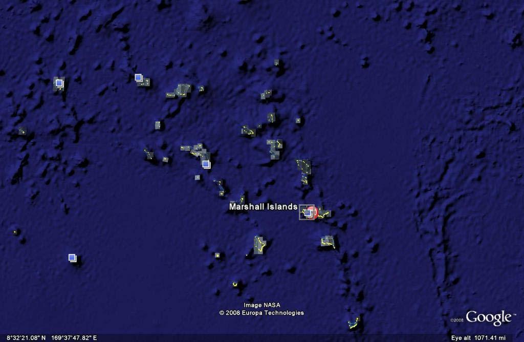
1 Page 1, archipelago, republic, central North Pacific Ocean. It consists of 34 islands in two groups: the southeastern Ratak Chain and the northwestern Ralik Chain. The chief industries are agriculture and fishing; the major export is copra. The islands are atolls and coral reefs, and the inhabitants are Micronesian. Kwajalein is the largest atoll; Majuro is the capital island. The islands were sighted by the Spanish in 1526 but remained essentially uncolonized until the late 19th century. They were a German protectorate from 1885 to 1914, when they fell to Japan. In 1920 the archipelago was mandated to Japan. In February 1944 American forces took Majuro, the first Japanese possession captured in World War II. Other islands were subsequently occupied. The archipelago remained under American military control for the duration of the war. In 1946 an American task force used Bikini atoll as a nuclear testing ground. The Marshalls became a trusteeship of the United States in 1947 and self-governing in 1979, with a locally drafted constitution, a popularly elected legislature, and a president. A Compact of Free Association, delegating to the U.S. the responsibility for defense, was approved by plebiscite in 1983 and came into effect in The trusteeship was formally dissolved by the UN Security Council in 1990, and the country was admitted to the United Nations in Area, 181 sq km (70 sq mi); population (2001 estimate) 70,822. Microsoft Encarta Encyclopedia Microsoft Corporation. All rights reserved.
2 Facts and Figures Page 1 Facts and Figures BASIC FACTS Official name Capital Area Republic of the Majuro 181 sq km 70 sq mi PEOPLE Population Population growth Population growth rate Projected population in 2025 Projected population in 2050 Population density Urban/rural distribution Share urban Share rural Largest cities, with population Majuro 70,822 (2001 estimate) 3.88 percent (2001 estimate) 171,134 (2000 estimate) 347,893 (2000 estimate) 391 persons per sq km (2001 estimate) 1,013 persons per sq mi (2001 estimate) 73 percent (1999 estimate) 29 percent (1999 estimate) Ethnic groups Micronesian, German, Japanese, American, Filipino Languages English (official and universally spoken), Ratak and Ralik (Marshallese dialects from the Malayo-Polynesian family), Japanese Religious affiliations Christian (mostly Protestant) HEALTH AND EDUCATION Life expectancy Total Female Male 65.8 years (2001 estimate) 67.7 years (2001 estimate) 64 years (2001 estimate) Infant mortality rate 40 deaths per 1,000 live births (2001 estimate) Population per physician Population per hospital bed 440 people (1990) Literacy rate Total 93 percent (1980) Female 88 percent (1980) Male 100 percent (1980) Education expenditure as a share of gross national product (GNP) Number of years of compulsory schooling Number of students per teacher, primary school
3 Facts and Figures Page 2 GOVERNMENT Form of government Republic Voting qualifications Universal at age 18 Constitution 1 May 1979 Armed forces Total number of military personnel Military expenditures as a share of gross domestic product (GDP) ECONOMY Gross domestic product (GDP, in U.S.$) $97 million (1999) GDP per capita (U.S.$) $1,910 (1999) GDP by economic sector Agriculture, forestry, fishing 14.9 percent (1998) Industry 15 percent (1998) Services 70.1 percent (1998) Employment Number of workers Workforce share of economic sector Agriculture, forestry, fishing Industry Services Unemployment rate National budget (U.S.$) Total revenue Total expenditure Monetary unit 1 United States dollar (U.S.$), consisting of 100 cents Major trade partners for exports United States, Japan, Australia Major trade partners for imports United States, Japan, Australia, New Zealand ENERGY, COMMUNICATIONS, AND TRANSPORTATION Electricity production Electricity from thermal sources Electricity from hydroelectric sources Electricity from nuclear sources Electricity from geothermal, solar, and wind sources Number of radios per 1,000 people Number of telephones per 1,000 people 62 (1998) Number of televisions per 1,000 people Number of Internet hosts per 10,000 people 0.39 (1999) Daily newspaper circulation per 1,000 people
4 Facts and Figures Page 3 Number of motor vehicles per 1,000 people Paved road as a share of total roads SOURCES Basic Facts and People sections Area data are from the statistical bureaus of individual countries. Population, population growth rate, and population projections are from the United States Census Bureau, International Programs Center, International Data Base (IDB) ( Urban and rural population data are from the Food and Agriculture Organization (FAO) of the United Nations (UN), FAOSTAT database ( Largest cities population data and political divisions data are from the statistical bureaus of individual countries. Ethnic divisions and religion data are largely from the latest Central Intelligence Agency (CIA) World Factbook and from various country censuses and reports. Language data are largely from the Ethnologue, Languages of the World, Summer Institute of Linguistics International ( Health and Education section Life expectancy and infant mortality data are from the United States Census Bureau, International Programs Center, International database (IDB) ( Population per physician and population per hospital bed data are from the World Health Organization (WHO) ( Education data are from the United Nations Educational, Scientific and Cultural Organization (UNESCO) database ( Government section Government, independence, legislature, constitution, highest court, and voting qualifications data are largely from various government Web sites, the latest Europa World Yearbook, and the latest Central Intelligence Agency (CIA) World Factbook. The armed forces data is from Military Balance. Economy section Gross domestic product (GDP), GDP per capita, GDP by economic sectors, employment, and national budget data are from the World Bank database ( Monetary unit, agriculture, mining, manufacturing, exports, imports, and major trade partner information is from the latest Europa World Yearbook and various International Monetary Fund (IMF) publications. Energy, Communication, and Transportation section Electricity information is from the Energy Information Administration (EIA) database ( Radio, telephone, television, and newspaper information is from the United Nations Educational, Scientific and Cultural Organization (UNESCO) database ( Internet hosts, motor vehicles, and road data are from the World Bank database ( Note Figures may not total 100 percent due to rounding. Microsoft Encarta Encyclopedia Microsoft Corporation. All rights reserved.
5
6

7 Detailed Map of Page 1 Microsoft Corporation. All Rights Reserved. Microsoft Encarta Encyclopedia Microsoft Corporation. All rights reserved.

8 Page 1 Bert Sagara/Tony Stone Images Consisting of 34 atolls and coral reefs, the are located in the central North Pacific Ocean. Its inhabitants are Micronesians. The republic had been under United States jurisdiction but in 1991 the arrangement was dissolved. Microsoft Encarta Encyclopedia Microsoft Corporation. All rights reserved.
9 limate information for - Climate Zone of 2 1/9/ :32 PM climate ZONE.com United States Alaska Great Plains Hawaii Mid-Atlantic Midwest Northeast Rocky Mountains South Southwest West World Map Continents Africa Asia Australia Europe Middle East North America Oceania South America Countries A-Z ABCDEF G H I J K L M N P R S T U V W Y Z World / Oceania / Average temperature, rainfall and snowfall information is available for the following climate stations in MAJURO WSO AP Official name: Capital: Area: Climate: Location: Geographic coordinates: Comparative Area: Land boundaries: Coastline: Terrain: Republic of the Majuro total: sq km note: includes the atolls of Bikini, Enewetak, Kwajalein, Majuro, Rongelap, and Utirik water: 0 sq km land: sq km wet season from May to November; hot and humid; islands border typhoon belt Oceania, group of atolls and reefs in the North Pacific Ocean, about one-half of the way from Hawaii to Australia 9 00 N, E about the size of Washington, DC 0 km km low coral limestone and sand islands Deals on Your Favorite Destinations travel.yahoo.com Majuro Find Deals, Read Reviews from Real People. Get the Truth. Then Go. Kwajalein Hotels Hotel Photos, Info & Virtual Tours Find the Hotel You Want at Expedia! Help Ebeye Children Charity to help Children to get an Education ebeyefund.com Weather Books Hurricane Books Meteorology Books Tornado Books Weather Books Weather Instruments Hygrometers Outdoor Thermometers Rain Gauges Weather Stations Elevation extremes: lowest point: Pacific Ocean 0 m highest point: unnamed location on Likiep 10 m Map of

10 Climate information for - Climate Zone 2 of 2 1/9/ :32 PM Portions of this site are based on the CIA World Fact Book, a public-domain work All original material copyright 2004 climate-zone.com. All Rights Reserved. Privacy Policy Contact Us
11 GeoHive 1 of 1 1/9/ :49 PM General info Entity: Capital: Majuro Population ( ): 63,174 (CIA) Area: 181 sq.km. Country code: MH Region: Micronesia Administrative units administrative units capital area (sq.km.) population 1980 census population census Ralik Chain ,684 17,502 Ailinginae (atoll) Ailinglaplap (atoll) ,385 1,959 Bikini (atoll) Ebon (atoll) Enewetak (atoll) Jabat (island) Jaluit (atoll) ,450 1,669 Kili (island) Kwajalein (atoll) ,624 10,902 Lae (atoll) Lib (island) Namorik (atoll) Namu (atoll) Rongedrik (atoll) Rongelap (atoll) Ujae (atoll) Ujelang (atoll) Wotho (atoll) Ratak Chain ,189 30,925 Ailuk (atoll) Arno (atoll) ,487 2,069 Aur (atoll) Bikar (atoll) Bokak (atoll) Erikub (atoll) Jemo (island) Likiep (atoll) Majuro (atoll) ,791 23,676 Maloelap (atoll) Mejit (island) Mili (atoll) ,032 Nadikdik (atoll) Toke (atoll) Utirik (atoll) Wotje (atoll) total ,873 50,840 source: Statistics. CSS XHTML 1.1 GeoHive,
Microsoft Encarta Encyclopedia 2002.
 Nauru Page 1 Nauru Nauru, also spelled Naoero, island and republic in the central Pacific Ocean, situated just south of the equator. It is a raised coral island, oval in shape, with an area of 21.2 sq
: Information from the CIA World Factbook INTRODUCTION GEOGRAPHY
 COUNTRY DATA: Tuvalu : Information from the CIA World Factbook INTRODUCTION In 1974, ethnic differences within the British colony of the Gilbert and Ellice Islands caused the Polynesians of the Ellice
Constitution of the Marshall Islands
 Constitution of the Marshall Islands Constitution of the Marshall Islands MIRC 2005 CONSTITUTION OF THE REPUBLIC OF THE MARSHALL ISLANDS PREAMBLE WE, THE PEOPLE OF THE REPUBLIC OF THE MARSHALL ISLANDS,
CONSTITUTION OF THE REPUBLIC OF THE MARSHALL ISLANDS PREAMBLE
 CONSTITUTION OF THE REPUBLIC OF THE MARSHALL ISLANDS PREAMBLE WE, THE PEOPLE OF THE REPUBLIC OF THE MARSHALL ISLANDS, trusting in God, the Giver of our life, liberty, identity and our inherent rights,
CHAPTER TWO DEMOGRAPHIC AND ECONOMIC TRENDS
 CHAPTER TWO DEMOGRAPHIC AND ECONOMIC TRENDS 2.1 GENERAL An evaluation of relevant demographic and economic trends represents an important element of the port master plan. Ever changing trends associated
Modeling Scenarios of Sea-level Rise and Human Migration: Rita Village, the Republic of the Marshall Islands
 University of Arkansas, Fayetteville ScholarWorks@UARK Theses and Dissertations 12-2014 Modeling Scenarios of Sea-level Rise and Human Migration: Rita Village, the Republic of the Marshall Islands Donna
Timeline of Marshallese Relocations
 Timeline of Marshallese Relocations What Happened to Whom, When, and Possibly Why 1945 to 1990 Collected from Day of Two Suns by Jane Dibblin and Marshall Islands Chronology at http://worf.eh.doe.gov/ihp/chron/
Marshall Islands. Total GDP: ,000, USD. Per Capita GDP: , USD
 Marshall Islands Overview: After almost four decades under US administration as the easternmost part of the UN Trust Territory of the Pacific Islands, the Marshall Islands attained independence in 1986
Location: Nearest Landmasses: Papua New Guinea (410 miles to the south) Philippines (550 miles to the west) Guam (815 miles to the northeast)
 Philippines (550 miles to the west) Guam (815 miles to the northeast)") Belau (Palau) Overview: The Republic of Belau is a sovereign nation in the westernmost part of Micronesia. Palau gained its independence October 1, 1994 with the entry into force of the Compact of Free
Belau (Palau) Overview: The Republic of Belau is a sovereign nation in the westernmost part of Micronesia. Palau gained its independence October 1, 1994 with the entry into force of the Compact of Free
Contents. Acknowledgements...xii Leading facts and indicators...xiv Acronyms and abbreviations...xvi Map: Pacific region, Marshall Islands...
 Contents Acknowledgements...xii Leading facts and indicators...xiv Acronyms and abbreviations...xvi Map: Pacific region, Marshall Islands... xii CHAPTER 1: CENSUS ORGANIZATION AND OPERATIONS...1 CHAPTER
COUNTRY DATA: Indonesia : Information from the CIA World Factbook INTRODUCTION GEOGRAPHY
 COUNTRY DATA: Indonesia : Information from the CIA World Factbook INTRODUCTION The Dutch began to colonize Indonesia in the early 17th century; Japan occupied the islands from 1942 to 1945. Indonesia declared
Center for Excellence in Disaster Management & Humanitarian Assistance
 Cover and section photo credits Cover Photo: Marshall Islands (Jaluit Atoll Lagoon, Marshall Islands) by Keith Polya is licensed under CC BY 2.0. https://www.flickr.com/photos/102182523@n07/9811274503
Chapter 4 North America
 Chapter 4 North America Identifying the Boundaries Figure 4.1 The geographic center of North America is located near Rugby, North Dakota. Notice the flags of Mexico, Canada, and the United States. Source:
COUNTRY DATA: UNITED KINGDOM: Information from the CIA World INTRODUCTION GEOGRAPHY
 COUNTRY DATA: UNITED KINGDOM: Information from the CIA World INTRODUCTION The United Kingdom has historically played a leading role in developing parliamentary democracy and in advancing literature and
Australia-Oceania :: Tuvalu page last updated on November 25, 2009
 Australia-Oceania :: Tuvalu page last updated on November 25, 2009 Background: In 1974, ethnic differences within the British colony of the Gilbert and Ellice Islands caused the Polynesians of the Ellice
Socio-Economic Profile
 LOCAL HEALTH AREA 7 - Socio-Economic Profile Powell River Comox Cumberland Denman Island Hornby Island Qualicum CENSUS POPULATION LAND AREA POPULATION DENSITY Number % of Region Sq. Km. % of Region Persons
Political Reviews. david w kupferman, kelly g marsh, donald r shuster, tyrone j taitano
 Political Reviews david w kupferman, kelly g marsh, donald r shuster, tyrone j taitano lorenz gonschor, hapakuke pierre leleivai, margaret mutu, forrest wade young 127 political reviews micronesia 135
Appendix C College of Micronesia FSM COURSE OUTLINE COVER PAGE. History of Micronesia SS 150
 Appendix C College of Micronesia FSM COURSE OUTLINE COVER PAGE History of Micronesia SS 150 Course Title Department and Number Course Description: This course will survey Micronesian history from prehistory
Central America and the Caribbean
 Chapter 11, Section World Geography Chapter 11 Central America and the Caribbean Copyright 2003 by Pearson Education, Inc., publishing as Prentice Hall, Upper Saddle River, NJ. All rights reserved. Chapter
Contents. Mini Almanac Primary Sources Library...988
 Contents.............................983 Primary Sources Library....................988 Honoring America: Flag Etiquette, The Star-Spangled Banner, The Pledge of Allegiance...................2 Glossary.................................3
Why Global Competence?
 Why Global Competence? Students want to know more about the world. Nine out of ten students want to know more about the rest of the world; they believe it will be important to their futures. Separate research
COUNTRY DATA: Belgium : Information from the CIA World Factbook
 COUNTRY DATA: Belgium : Information from the CIA World Factbook INTRODUCTION Belgium became independent from the Netherlands in 1830; it was occupied by Germany during World Wars I and II. The country
The U.S. affiliated Pacific Islands
 The U.S. affiliated Pacific Islands Narrated by: Ese Misiata (Am. Samoa: slides 1-3) Rose Castro (CNMI: slide 4) Clarissa Barcinas (Guam: slides 5-6) Margaret Weital (Pohnpei: slides7-9) Merly Nelson (Chuuk:
Human Resources. There are 500 children in my How many. My village has 1,000 people. school. people do you think, there are in the whole world?
 Human Resources Do you know? The Government of India has a Ministry of Human Resource Development. The Ministry was created in 1985 with an aim to improve people s skills. This just shows how important
Australia and Canada Unit Test-DO NOT WRITE ON THIS TEST
 Australia and Canada Unit Test-DO NOT WRITE ON THIS TEST 1. Which U-shaped rocky land covering is mineral rich and covers eastern and central Canada? A. Canadian Shield B. Rocky Mountains C. Lake Huron
Development in Migration and Remittance Flows Among FSM Migrants and their Socioeconomic Effects
 Development in Migration and Remittance Flows Among FSM Migrants and their Socioeconomic Effects 2016 Pacific Update Conference July 19, 2016 Michael J. Levin Independent Consultant Remittance Flows Differ
COUNTRY DATA: Lithuania : Information from the CIA World Factbook! INTRODUCTION
 ! COUNTRY DATA: Lithuania : Information from the CIA World Factbook! INTRODUCTION Lithuanian lands were united under MINDAUGAS in 1236; over the next century, through alliances and conquest, Lithuania
2016 Statistical Yearbook. Republic of Palau Bureau of Budget and Planning Ministry of Finance
 2016 Statistical Yearbook Republic of Palau Bureau of Budget and Planning Ministry of Finance REPUBLIC OF PALAU Office of the Minister ELBUCHEL SADANG Minister Message from the Minister of Finance I am
Unit Six: West African Nations in the 21 st Century Global Marketplace
 Unit Six: West African Nations in the 21 st Century Global Marketplace Grade Level: Grades 6-12 National History Standards: Era 9: Standard 2A The student understands how population explosion and environmental
Lanna Culture and Social Development:
 Lanna Culture and Social Development: A Case Study of Chiangmai Province in Northern Thailand 1. Introduction By Phaisal Lekuthai Thailand is situated in the Southeast Asian mainland, the latitude 6-21
COUNTRY DATA: Guatemala: Information from the CIA World Factbook INTRODUCTION GEOGRAPHY
 COUNTRY DATA: Guatemala: Information from the CIA World Factbook INTRODUCTION The Mayan civilization flourished in Guatemala and surrounding regions during the first millennium A.D. After almost three
(1) Overview of Japan 1-1) Land and Society
 Overview of Japan 1-1) Land and Society") (1) Overview of Japan 1-1) Land and Society a) Location and Physical Features Japan is an island nation situated off the eastern coast of the Asian continent. The nation s roughly 7,000 islands extend
(1) Overview of Japan 1-1) Land and Society a) Location and Physical Features Japan is an island nation situated off the eastern coast of the Asian continent. The nation s roughly 7,000 islands extend
Singapore Introduction Background: Geography Location: Geographic coordinates: Map references: Area: Area - comparative:
 Singapore Introduction Background: Founded as a British trading colony in 1819, Singapore joined Malaysia in 1963, but withdrew two years later and became independent. It subsequently became one of the
THE JUDICIARY OF THE REPUBLIC OF THE MARSHALL ISLANDS 2009 REPORT
 THE JUDICIARY OF THE REPUBLIC OF THE MARSHALL ISLANDS 2009 REPORT TABLE OF CONTENTS Message from the High Court Chief Justice........................................... 1 Mission and Vision Statements.....................................................
1. Economy. Economic Aggregates. Foreign Trade. Prices. Financial Statistics. Government Finance. Wages and Compensation. Foreign Investment
 1. Economy Economic Aggregates Foreign Trade Prices Financial Statistics Government Finance Wages and Compensation Foreign Investment GDP at Current Prices, Abu Dhabi Emirate, 2014* Non-oil GDP 952,676
Palestine in Figures 2011
 Palestine in Figures 2011 March, 2012 This document is prepared in accordance with the standard procedures stated in the Code of Practice for Palestine Official Statistics 2006. March, 2012 All rights
Republic of the Marshall Islands Economic Report
 April 2001 THE BANK OF THE PACIFIC Republic of the Marshall Islands Economic Report Available in Web Version Only www.boh.com PAGE 2 APRIL 2001 REPUBLIC OF THE MARSHALL ISLANDS ECONOMIC REPORT by Dr. Wali
LESSON 4 The Miracle on the Han: Economic Currents
 The Miracle on the Han: Economic Currents Like other countries, Korea has experienced vast social, economic and political changes as it moved from an agricultural society to an industrial one. As a traditionally
COUNTRY DATA: MALI : Information from the CIA World Factbook INTRODUCTION GEOGRAPHY
 COUNTRY DATA: MALI : Information from the CIA World Factbook INTRODUCTION The Sudanese Republic and Senegal became independent of France in 1960 as the Mali Federation. When Senegal withdrew after only
REPUBLIC OF THE MARSHALL ISLANDS. Leonard Mason. November 1988
 REPUBLIC OF THE MARSHALL ISLANDS Leonard Mason, November 1988 FOREWORD This paper on The Republic of the ~arshall Islands was prepared by Dr: Leonard Mason. Dr. Mason was involved in collecting basic data
Investing in Skills for Domestic Employment or Migration? Observations from the Pacific Region
 Skills for Inclusive and Sustainable Growth in Developing Asia-Pacific: An International Forum 2012 Investing in Skills for Domestic Employment or Migration? Observations from the Pacific Region Sunhwa
Dooly County Middle School. Social Studies Georgia Standards of Excellent. 6 th Grade (July 31, 2017-Oct. 2, 2017) First 9 Weeks
 First 9 Weeks") Unit 1: Connecting Themes Dooly County Middle School Social Studies Georgia Standards of Excellent 6 th Grade Social Studies GSE Pacing Guide 2017-2018 6 th Grade (July 31, 2017-Oct. 2, 2017) First 9 Weeks
Unit 1: Connecting Themes Dooly County Middle School Social Studies Georgia Standards of Excellent 6 th Grade Social Studies GSE Pacing Guide 2017-2018 6 th Grade (July 31, 2017-Oct. 2, 2017) First 9 Weeks
Cambridge International Examinations Cambridge International General Certificate of Secondary Education
 Cambridge International Examinations Cambridge International General Certificate of Secondary Education *1305303660* ENVIRONMENTAL MANAGEMENT 0680/23 Paper 2 October/November 2016 1 hour 45 minutes Candidates
Globetrotters of the Philippines. Carmen Ong Mitchell Todd Reed Bailey Gary Haack Grant Sander
 Globetrotters of the Philippines Carmen Ong Mitchell Todd Reed Bailey Gary Haack Grant Sander AGENDA 1. Introduction 2. Geographic Location 3. Economy 4. Socioeconomic Factors 5. Financial Markets 6. Currency
Ward profile information packs: Ryde North East
 % of Island population % of Island population Ward profile information packs: The information within this pack is designed to offer key data and information about this ward in a variety of subjects. It
COUNTRY DATA: Togo : Information from the CIA World Factbook INTRODUCTION GEOGRAPHY
 COUNTRY DATA: Togo : Information from the CIA World Factbook INTRODUCTION French Togoland became Togo in 1960. Gen. Gnassingbe EYADEMA, installed as military ruler in 1967, ruled Togo with a heavy hand
! Elements of Worldview
 Geography Identifying Through The Actions and Decisions Of Canadians Climate (weather, seasons, temperature): Geography - How do these factors impact the actions and decisions of Canadians? Canada is quite
2018 BAVARIA S ECONOMY FACTS AND FIGURES
 Bavarian Ministry of Economic Affairs, Energy and Technology 2018 BAVARIA S ECONOMY FACTS AND FIGURES wwwstmwibayernde As of August 2018 Area Population (3006) 1) females males age 0-14 (3112) 15-64 65+
Training on Making Governance Gender Responsive
 Organized by: Training on Making Governance Gender Responsive for local governments (city/municipality) and the government bureaucracy political parties, training institutes, human rights and other civil
Setting up in Denmark
 Setting up in Denmark 1. Denmark and the Danes Denmark is an attractive northern European country that offers many advantages to foreign investors. It is one of the 25 member states of the European Union
The Demographic Profile of Somalia
 UNITED NATIONS The Demographic Profile of Somalia Population Trends - Mortality - Fertility - Age Structure - Urbanization - International Migration - Education and Youth Unemployment Population Trends
Demography. Demography is the study of human population. Population is a dynamic open systems with inputs, processes and outputs.
 Population Demography Demography is the study of human population. Population is a dynamic open systems with inputs, processes and outputs. This means that change constantly occurs in population numbers,
Population. C.4. Research and development. In the Asian and Pacific region, China and Japan have the largest expenditures on R&D.
 Statistical Yearbook for Asia and the Pacific 2013 C. Education and knowledge C.4. (R&D) is a critical element in the transition towards a knowledgebased economy. It also contributes to increased productivity,
Goal 3: Promote Gender Equality and Empower Women
 98 Gender equality in primary school enrollment is high, with most economies having ratios of or more. This is also the case for gender equality in secondary school enrollment, but not so for tertiary
The Demographic Profile of the State of Palestine
 UNITED NATIONS The Demographic Profile of the State of Palestine Population Trends - Mortality - Fertility - Age Structure - Urbanization - International Migration - Education and Youth Unemployment Population
Southeast Asia and Oceania. Lands of Intrigue, Archipelagos, and the Outback
 Southeast Asia and Oceania Lands of Intrigue, Archipelagos, and the Outback Southeast Asia is also heavily volcanic The region is also prone to earthquakes, which can trigger tsunamis. Population Over
SUMMARY OF KEY FINDINGS RMI 2006 COMMUNITY AND SOCIO-ECONOMIC SURVEY
 SUMMARY OF KEY FINDINGS RMI 2006 COMMUNITY AND SOCIO-ECONOMIC SURVEY Republic of the Marshall Islands Economic Policy, Planning and Statistics Office Office of the President P.O. Box 7 Tel 625 3802/3803
MAPS. Environmental Issues. Economics Government History Pictures
 MAPS Environmental Issues Economics Government History Pictures 100 100 100 100 100 100 200 200 200 200 200 200 300 300 300 300 300 300 400 400 400 400 400 400 500 500 500 500 500 500 Q: 100 Which letter
ANNEX TO NEW ZEALAND NATIONAL REPORT SUBMITTED IN ACCORDANCE WITH PARAGRAPH 15(a) OF THE ANNEX TO HUMAN RIGHTS COUNCIL RESOLUTION 5/1 TOKELAU
 OF THE ANNEX TO HUMAN RIGHTS COUNCIL RESOLUTION 5/1 TOKELAU") ANNEX TO NEW ZEALAND NATIONAL REPORT SUBMITTED IN ACCORDANCE WITH PARAGRAPH 15(a) OF THE ANNEX TO HUMAN RIGHTS COUNCIL RESOLUTION 5/1 I. Methodology/Consultation Process TOKELAU 1. The first draft of this
ANNEX TO NEW ZEALAND NATIONAL REPORT SUBMITTED IN ACCORDANCE WITH PARAGRAPH 15(a) OF THE ANNEX TO HUMAN RIGHTS COUNCIL RESOLUTION 5/1 I. Methodology/Consultation Process TOKELAU 1. The first draft of this
Chapter 18: Development and Globalization Section 1
 Chapter 18: Development and Globalization Section 1 Objectives 1. Understand what is meant by developed nations and less developed countries. 2. Identify the tools used to measure levels of development.
Hessisches Statistisches Landesamt. Hesse in figures
 Hessisches Statistisches Landesamt Hesse in figures Edition 2013 Population and Area Population (31.12.) 2011 2012 TOTAL 5 993 771 6 016 481 100 Male 2 928 449 2 943 855 48.9 Female 3 065 322 3 072 626
The Demographic Profile of Qatar
 UNITED NATIONS The Demographic Profile of Qatar Population Trends - Mortality - Fertility - Age Structure - Urbanization - International Migration - Education and Youth Unemployment Population Trends Population
8. REGIONAL DISPARITIES IN GDP PER CAPITA
 8. REGIONAL DISPARITIES IN GDP PER CAPITA GDP per capita varies significantly among OECD countries (Figure 8.1). In 2003, GDP per capita in Luxembourg (USD 53 390) was more than double the OECD average
The Demographic Profile of Kuwait
 UNITED NATIONS The Demographic Profile of Kuwait Population Trends - Mortality - Fertility - Age Structure - Urbanization - International Migration - Education and Youth Unemployment Population Trends
Natural disasters, migration and education: an empirical analysis in developing countries
 Natural disasters, migration and education: an empirical analysis in developing countries Alassane DRABO Fondation pour les études et recherches sur le développement international (FERDI), Clermont-Ferrand,
World Map Title Name. Russia. United States. Japan. Mexico. Philippines Nigeria. Brazil. Indonesia. Germany United Kingdom. Canada
 214 P Gersmehl Teachers may copy for use in their classrooms. Contact pgersmehl@gmail.com regarding permission for any other use. World Map Title Name Canada United States Mexico Colombia Ecuador Haiti
IN THE UNITED STATES COURT OF FEDERAL CLAIMS
 IN THE UNITED STATES COURT OF FEDERAL CLAIMS ) THE PEOPLE OF BIKINI, BY AND ) THROUGH THE KILI/BIKINI/EJIT ) LOCAL GOVERNMENT COUNCIL, ) ELDON NOTE, ET AL. ) ) Plaintiffs, ) ) v. ) No. 06-288C ) (Judge
The Demographic Profile of Oman
 UNITED NATIONS The Demographic Profile of Oman Population Trends - Mortality - Fertility - Age Structure - Urbanization - International Migration - Education and Youth Unemployment Population Trends Population
The Demographic Profile of Saudi Arabia
 Infant mortality rate (per 1 live births) UNITED NATIONS The Demographic Profile of Saudi Arabia Population Trends - Mortality - Fertility - Age Structure - Urbanization - International Migration - Education
Population & Migration
 Population & Migration Population Distribution Humans are not distributed evenly across the earth. Geographers identify regions of Earth s surface where population is clustered and regions where it is
THE GLOBAL OCEAN. global ocean. huge, continuous body of salt water that surrounds the continents covers almost ¾ Earth s surface
 THE GLOBAL OCEAN Ø Ø global ocean Ø Ø huge, continuous body of salt water that surrounds the continents covers almost ¾ Earth s surface divided into 4 sections separated by continents 1. Pacific (largest:
Australian Aborigines (from Resolution on The Right of All Indigenous Peoples to Own and Control Both their Land(s) and their Lives.
 and their Lives.") WILPF RESOLUTIONS 23rd Congress Zeist, Netherlands July 23 29, 1986 Australian Aborigines (from Resolution on The Right of All Indigenous Peoples to Own and Control Both their Land(s) and their Lives.
WILPF RESOLUTIONS 23rd Congress Zeist, Netherlands July 23 29, 1986 Australian Aborigines (from Resolution on The Right of All Indigenous Peoples to Own and Control Both their Land(s) and their Lives.
Population & Migration
 Population & Migration Population Distribution Humans are not distributed evenly across the earth. Geographers identify regions of Earth s surface where population is clustered and regions where it is
MEXICAN AMERICAN YOUTH
 MEXICAN AMERICAN YOUTH DEMOGRAPHICS Total population: 111,211,789 (Ranked 11 th in the world by the US Census Bureau). Population density: 142 per square mile. Children 0-14: 29.1% (male 16,544,223/female
EARTHJUSTICE 350.ORG HUMAN RIGHTS ADVOCATES GREENPEACE INTERNATIONAL
 EARTHJUSTICE 350.ORG HUMAN RIGHTS ADVOCATES GREENPEACE INTERNATIONAL 1 November 2010 Office of the High Commissioner for Human Rights Palais Wilson, 52 rue des Pâquis, CH-1201 Geneva, Switzerland Re: Universal
The Demographic Profile of the United Arab Emirates
 UNITED NATIONS The Demographic Profile of the United Arab Emirates Population Trends - Mortality - Fertility - Age Structure - Urbanization - International Migration - Education and Youth Unemployment
Population and Migration. Chapters 2 and 3 Test Review
 Population and Migration Chapters 2 and 3 Test Review 1. What is land suited for agriculture? 1. Farm Land 2. Brain Drain 3. Arable Land 4. Crop Land 1. What is land suited for agriculture? 1. Farm Land
INTRODUCTION GEOGRAPHY
 COUNTRY DATA: JORDAN : Information from the CIA World Factbook INTRODUCTION Following world war 1 and the dissolution of the Ottoman Empire, the UK received a mandate to govern much of the Middle East.
Pakistan 2.5 Europe 11.5 Bangladesh 2.0 Japan 1.8 Philippines 1.3 Viet Nam 1.2 Thailand 1.0
 173 People Snapshots Asia and the Pacific accounts for nearly 55% of global population and 6 of the world s 10 most populous economies. The region s population is forecast to grow by almost 1 billion by
Station Directions 18. Gather Information About Nation-States. Follow these steps for each nation-state you visit:
 Station Directions 18 Visiting s in the Former Soviet Union Gather Information About s Follow these steps for each nation-state you visit: 1. With your group, go to a visitor center in this nation-state
c01.qxd 12/21/01 1:17 PM Page 3 The United States as a Nation
 c01.qxd 12/21/01 1:17 PM Page 3 P a r t I The United States as a Nation c01.qxd 12/21/01 1:17 PM Page 4 c01.qxd 12/21/01 1:17 PM Page 5 Where in the world is the United States of America? Where is the
ARAGON IN SPAIN AND THE EU.
 166 167 Population; Labour market. Population Total population as of January 1st* Persons 2016 1,318,738 46,445,828 510,284,430 Population density Inhab/Km2 2016 27.6 91.8 114.6 Annual population change
relocation story of the people of Bikini and Enewetak. University of California, conditions are discussed. Administrative insistence
 A STUDY OF THE RELOCATION in the OF TWO MARSHALLESE ATOLL COMMUNITES Anne Chambers University of California, Berkeley The effects of forced relocation on Bikini and Enewetak populations of the Marshall
Bringing the Census to schools
 Bringing the Census to schools 6 th Year Course In preparation for: 1 Table of Contents Introduction to Population Studies... 3 Lesson 1... 4 You will need... 4 Objectives... 4 Calculating Population Density...
Charting Singapore s Economy, 1Q 2016 Publication Date: December 8 th, 2015 Number of pages: 58
 Charting Singapore s Economy, 1Q 2016 Publication Date: December 8 th, 2015 Number of pages: 58 Attribution-NonCommercial-NoDerivatives 4.0 International (CC BY-NC-ND 4.0) You are free to: Share copy and
An Overview of the Chinese Economy Foundation Part: Macro-economy of the Mainland
 Core Module 15 An Overview of the Chinese Economy Foundation Part: Macro-economy of the Mainland The Chinese economy has been growing rapidly for years. Has it reached the level of the developed countries?
European Union : dynamics and development of the territories of Europe
 European Union : dynamics and development of the territories of Europe What are the features of the European space? Why is it said to be a specific territory? Europe, Europes? A continent between unity
Globalization s Challenges for South Asia: The Case of Sri Lanka
 Globalization s Challenges for South Asia: The Case of Sri Lanka Shreekant G. Joag St. John s University, New York 631-801-2211, drjoag@aol.com ABSTRACT South Asian countries are unique due to their shared
The Federated States of Micronesia
 The Federated States of Micronesia DIRK ANTHONY BALLENDORF 1 history and development of federalism Micronesia is a collection of island groups in the Pacific Ocean comprised of four major clusters: the
CANADA. Our big neighbor to the north.
 CANADA Our big neighbor to the north. CANADA VIDEO Geography made us neighbors, history made us friends, economics made us partners, and necessity made us allies. -JF Kennedy WELCOME TO CANADA Welcome
Southeast Asia and Oceania. Lands of Intrigue, Archipelagos, and the Outback
 Southeast Asia and Oceania Lands of Intrigue, Archipelagos, and the Outback Southeast Asia is also heavily volcanic The region is also prone to earthquakes, which can trigger tsunamis. Population Over
STOCKHOLM. Yearbook: Summary Results 232
 STOCKHOLM Stockholm is the capital city of Sweden, located on 15 islands where Lake Mälaren enters the Baltic Sea. Stockholm is the centre of an urban region with a population of approximately 1,760,000,
Guangxi Zhuang Autonomous Region 2013
 Guangxi Zhuang Autonomous Region 2013 By Sophie Lu LUP 011.8-3, Dec. 2013 Guangxi is the country s only area in the west which has a coastline and seaports. This region has the geographic advantage of
Chapter 7. Migration
 Chapter 7 Migration Chapter 7 Migration Americans have traditionally been highly higher levels of educational attainment than Figure 7-1. mobile, with nearly 1 in 7 people changing residence each year.
SPECIAL RELEASE. EMPLOYMENT SITUATION IN NATIONAL CAPITAL REGION January 2012 Final Results
 Republic of the Philippines NATIONAL STATISTICS OFFICE National Capital Region Number: 2013-07 SPECIAL RELEASE EMPLOYMENT SITUATION IN NATIONAL CAPITAL REGION January 2012 Final Results The Labor Force
Southeast Asia and Oceania. Lands of Intrigue, Archipelagos, and the Outback
 Southeast Asia and Oceania Lands of Intrigue, Archipelagos, and the Outback Southeast Asia is also heavily volcanic The region is also prone to earthquakes, which can trigger tsunamis. Population Over
ASEAN. Statistical Yearbook. The ASEAN Secretariat Jakarta
 ASEAN Statistical Yearbook The ASEAN Secretariat Jakarta The Association of Southeast Asian Nations (ASEAN) was established on 8 August 1967. The members of the Association are Brunei Darussalam, Cambodia,
INTRODUCTION GEOGRAPHY
 COUNTRY DATA: NICARAGUA : Information from the CIA World Factbook INTRODUCTION The Pacific coast of Nicaragua was settled as a Spanish colony from Panama in the early 16th century. Independence from Spain
IN THE UNITED STATES COURT OF FEDERAL CLAIMS
 IN THE UNITED STATES COURT OF FEDERAL CLAIMS ) THE PEOPLE OF BIKINI, BY AND ) THROUGH THE KILI/BIKINI/EJIT ) LOCAL GOVERNMENT COUNCIL, ) ) Plaintiffs, ) ) v. ) No. ) UNITED STATES OF AMERICA, ) ) Defendant.
THE JUDICIARY OF THE REPUBLIC OF THE MARSHALL ISLANDS 2011 REPORT
 THE JUDICIARY OF THE REPUBLIC OF THE MARSHALL ISLANDS 2011 REPORT TABLE OF CONTENTS Message from the High Court Chief Justice.......................................... 1 Mission and Vision Statements....................................................