Looking Beyond the Forest: Exploring the Significance of Alignment between Politics and Practices in Landscape Governance
|
|
|
- Georgina Brenda Bryan
- 6 years ago
- Views:
Transcription

1 Looking Beyond the Forest: Exploring the Significance of Alignment between Politics and Practices in Landscape Governance - A case study of the corridor in Gunung Halimun Salak National Park - in West Java, Indonesia - By Ilse Hennemann Wageningen University December 2012
.")
2 Looking Beyond the Forest: Exploring the Significance of Alignment between Politics and Practices in Landscape Governance - A case study of the corridor in Gunung Halimun Salak National Park in West Java, Indonesia - Managing a complex landscape for multiple functions is more like jazz, a constant process of learning, improvisation and adaptation (Sayer et al., 2004: 324). MSc thesis report, ENP MSc International Development Studies Environmental Policy group ENP Wageningen University Supervisor Environmental Policy: Dr. Peter Oosterveer Supervisor Forest and Nature Conservation Policy: MSc. Cora van Oosten Ilse Hennemann Wageningen, December P a g e
3 ABSTRACT Around the world, forested landscapes are changing. Untouched primary forests are rapidly decreasing and new mosaic landscapes have emerged. These landscapes have become increasingly multi-functional with diverse stakeholders holding different claims on the land. Gunung Halimun Salak National Park in Indonesia illustrates this case. In 2003, the park decided to expand the park area by almost two-third in 2003 due to on-going agricultural encroachment, mismanagement of forests and resulting severe land degradation. As the area is quite densely populated, the imposing new rules triggered social conflicts in the area. The introduction of collaborative management by the national park has not achieved its envisaged objectives. The problem lies in the misalignment of dynamics between the two arenas: the political institutional arena and the local practices arena, which limits sustainable landscape management. The main objective of this study is to get a better understanding of the bottlenecks that currently constrain alignment between both landscape arenas. Using a political ecology perspective, I examined how power relations between stakeholders influence the forest landscape and governance processes in the national park. Central concepts within the analytical framework of this research are rules & resources, agency and landscape governance. The results show that through a process of institutional bricolage new hybrid arrangements, based on existing formal and informal arrangements, have spontaneously been developed over time by diverse stakeholders. Resource users are (informally) allowed to use the park land for agriculture and forest exploitation, however based on some (formal) set conditions by the national park. These new arrangements provide opportunities to strengthen the link between spatial decision-making and the specific characteristics of a landscape. It is suggested that acknowledging this process of institutional bricolage can substantially improve sustainable landscape governance. 2 P a g e
4 PREFACE Three generations of my family have lived and worked in Indonesia and this has always made me curious to visit the country. This MSc research provided to be a perfect opportunity to get to know the history, culture and nature of Indonesia better. During my 6-month stay in Bogor and my fieldwork in Gunung Halimun Salak National Park, I am happy to have experienced Indonesian life and to have made new friends. Looking back, I can conclude it has been one of the most exciting yet challenging experiences in my life. I faced some challenges with regard to the Indonesian bureaucracy and cultural differences, but I have also learned much about myself and my capabilities. I am proud of my achievements, of carrying out a research independently in a very different environment and of writing my thesis in such a short time. With this MSc thesis report, I have made the final step towards my graduation. However, I could not have done this without the guidance, assistance and support of many people. First, I would like to thank all the respondents in Bogor, Jakarta and Gunung Halimun Salak National Park who dedicated their time to help me with my research. Particularly the Kan Dayat family in Cisarua, who hosted me for over 2 weeks and helped me enormously with my research. I am also grateful for the environmental NGO Tropenbos Indonesia to host me in Indonesia and to facilitate my research. Therefore a big thanks to Pak Petrus Gunarso, Tika, Hangga and the other colleagues for making me feel so welcome in Bogor. A very special thanks to my interpreter Nur Hasanah, not only for helping me with the translation in the field, but also for the fun discussions we had about the Indonesian culture and our future plans. Thank you for teaching me how to cook the best nasi goreng and krupuk together with Ibu Cica! I also would like to thank my two supervisors Peter Oosterveer and Cora van Oosten who have guided me throughout the entire thesis process and who have helped me finish this thesis on time. The last and most important people who I would like to thank are my family. Thank you so much for supporting me in so many ways not only during this thesis process, but throughout my entire study in Utrecht and Wageningen. You have always shown interest and encouraged me to reach my full potential. Terima Kasih Banyak 3 P a g e
5 TABLE OF CONTENTS TABLE OF CONTENTS... 4 LIST OF FIGURES... 6 LIST OF TABLES... 6 LIST OF ABBREVIATIONS INTRODUCTION Background Gunung Halimun Salak National Park Historical background Gunung Halimun Salak National Park Developments after National Park designation in Problem statement Research objectives and questions Research objectives Central question Organisation of the thesis CONCEPTUAL FRAMEWORK Political Ecology Landscape governance Landscape Landscape governance Rules and Resources Agency METHODOLOGY Research area Informants Research methods Observation Interviews Value ranking tool Landscape drawing Documentary sources and material artefacts Scope and Limitations Scope Limitations POLITICAL CONTEXT OF NATIONAL PARKS IN INDONESIA Decentralisation of forest management of post-suharto Indonesia Government policies and legislation regarding Halimun Salak National Park Conservation Law of No. 5/ Forestry Law of No. 41/ National Park management in Halimun Salak Institutional problems concerning National Park management National Park designation and gazettement processes Conclusion P a g e
6 5 CHANGING GOVERNANCE OF THE HALIMUN SALAK LANDSCAPE Changing landscape: Transition from production forest to conservation forest Profit sharing mechanism of Perum Perhutani Changing land (use) rights of local people in Halimun Salak New governance structures: stakeholders of Halimun Salak landscape Justification of the corridor as a multi-stakeholder landscape Stakeholder overview Implementation of national park policies and regulations Changing the rules of the game Conclusion DEVELOPMENTS AND PERSPECTIVES FROM THE POLITICAL INSTITUTIONAL ARENA Formal institutional arrangements Collaborative Management Model Kampung Konservasi (MKK) National Park zoning Resources within the political institutional arena Human resources in the political institutional arena Nonhuman resources in the political institutional arena Agency within the political institutional arena Manifestations of the political institutional arena in the in Halimun Salak landscape Conclusion DEVELOPMENTS AND PERSPECTIVES FROM THE LOCAL PRACTICES ARENA Local livelihoods practices Livelihood sources Livelihood alterations after Perspectives and environmental awareness of villagers Local environmental awareness Local perspectives on the future of their landscape Local conservation and development practices Local actor based initiatives Public-private partnership: The Green Corridor Initiative Informal institutional arrangements Resources within the local practices arena Human resources in the local practices arena Nonhuman resources in the local practices arena Agency within the local practices arena Institutional bricolage Manifestations of the local practices arena in the in Halimun Salak landscape Conclusion CONCLUSION REFERENCES APPENDIX 1: LIST OF INTERVIEWEES APPENDIX 2: QUESTIONNAIRE LOCAL COMMUNITIES APPENDIX 3: PHOTO IMPRESSION GHSNP P a g e
7 LIST OF FIGURES Figure 1: Research area Gunung Halimun Salak National Park, West Java Figure 2: Photo of the corridor connecting Mt. Halimun and Mt. Salak Figure 3: Dynamics within and between the two arenas Figure 4: Display of the landscape concept: A spatial unit which takes human-nature interaction on multiple levels over time into account. Figure 5: Fieldwork location Figure 6: Aerial photo of fieldwork area in the corridor of GHSNP Figure 7: A woman playing the value ranking game together with her children in Cisarua Figure 8: Ten value cards Figure 9: Participatory landscape drawing session Figure 10: Former production forest near Sukagalih Figure 11: Visualisation of Halimun Salak landscape Figure 12: Border corridor forest cover and tea plantations Figure 13: Agriculture inside the corridor Figure 14: Detailed map of GHSNP Figure 15: Demarcation point for the National Park boundary Figure 16: MoU signed by Sukagalih for receiving MKK status Figure 17: Special zone: planted trees and chillis Figure 18: Tapping resin from Damar trees inside the park Figure 19: Spatial zoning map of GHSNP Figure 20: Aerial photo of the special zone near Sukagalih Figure 21: Manifestations of the political institutional arena in the landscape Figure 22: Location of farm land Figure 23: Pie charts of the ranked first and second livelihood sources Figure 24: Best case scenario Garehong 2022 Figure 25: Best case scenario Sukagalih 2022 Figure 26: Planting young trees in the JARMASKOR nursery Figure 27: Infrastructure in the national park built by Chevron Figure 28: Manifestations of the local practices arena in the landscape Figure 29: Bottlenecks within and between the arenas of landscape governance in Halimun Salak List of TABLES Table 1: Number of interviews Table 2: Occurrence of stakeholders in corridor, Mount Halimun and Mount Salak All photos, unless stated otherwise, were taken by the author. 6 P a g e
8 LIST OF ABBREVIATIONS CIFOR CSR GHNP GHSNP ICRAF IPB JARMASKOR KDTK LIPI MKK MoF MoU NGO PHKA Center for International Forestry Research Corporate Social Responsibility Gunung Halimun National Park Gunung Halimun Salak National Park International Centre for Research in Agroforestry Institut Pertanian Bogor (Agricultural University of Bogor) Jaringan Masyarakat Koridor Kampung Dengan Tujuan Konservasi Lembaga Ilmu Pengetahuan Indonesia (Indonesian institute of Sciences) Model Kampung Konservasi Ministry of Forestry Memorandum of Understanding Non-Governmental Organisation Perlindungan Hutan dan Konservasi Alam 7 P a g e

9 1 INTRODUCTION All over the world, forests are changing. Externalities such as population pressure and demand for natural resources have contributed to the change from forests to multi-functional mosaic landscapes. There is a broad consensus that biodiversity is threatened by human activities and interventions are necessary to restrain these activities. A common policy is the establishment of protected areas such as national parks (Kubo & Supriyanto, 2010). This became also a dominant intervention in the 1980s in Indonesia whereby the management is still very centralised despite decentralisation policies in the 1990s. According to Kubo & Supriyanto (2010), scholars hold two different positions regarding conservation management: fence-and-fine approach or a participatory approach. The first one entails that human presence cannot be aligned with conservation activities and therefore restrictive regulations are imposed on the people. The second position aims for more collaboration whereby people are not seen as part of the problem, but are acknowledged as key elements for conservation strategies. Gunung Halimun Salak National Park (GHSNP) is an example of a national park that first followed the fence-and-fine approach and changed its policies in 2004 by introducing collaborative management which fits into the second approach. Gunung is the Bahasa Indonesian word for mountain and the national park consists of two mountains: Halimun in the west and Salak in the east. This park in West Java (see Figure 1), was established in 1992, but confined to mountain Halimun. For conservation purposes, the Indonesian government decided to expand the area in 2003 by including mountain Salak and the area connecting the two mountains which would function as an ecological corridor to support migration of animals (see Figure 2). The park increased two-thirds of its size with now many people residing in the national park boundaries. Around 100,000 people are now directly dependent on national park resources for their livelihood (Kubo, 2010). Figure 1: Research area Gunung Halimun Salak National Park, West Java Source: Wikipedia, P a g e

10 The landscape of GHSNP is not just a dense forest, but a mosaic of different land use patches such as farm land, tea plantations, infrastructure, settlements, mines etc. Collaborative management has been introduced to acknowledge this multi-functionality, but at the same time conserve the forest which is central in this landscape. The national park has been working together with local actors such as private sector, NGOs and local communities. Within this new management style, positive developments can be observed such as community based conservation activities and the creation of conservation villages where the national park works together with the local people. However, there are ways to make these governance processes more effective by aligning the perspectives of different actors. This thesis will explore the significance of alignment and the currently constraining bottlenecks. Figure 2: Photo of the corridor connecting Mt. Halimun and Mt. Salak Source: Krismantari, Background Gunung Halimun Salak National Park This section provides some background information of Gunung Halimun Salak National Park (GHSNP) with respect to the history and present-day conflicts. GHSNP, with its current boundaries, has a legal status, only since This forested area has known several titles and this first section will explain the developments preceding the national park designation in 2003, starting by the Dutch Colonial regime in the 1880s. The second paragraph will continue with the developments after receiving this new status in 2003 such as the change in forest bureaucracies Historical background Gunung Halimun Salak National Park The history of formal nature conservation in Indonesia started under the Dutch Colonial rule in the 1880s. Even though the first initiatives were undertaken by Dutch NGOs, they did not have much power because the Colonial Forestry Service refused to devolve authority. As a response, the Forestry Service issued the 1916 Staatsblad, which contained the legal framework for the Dutch Colonial regime to control and manage the nature reserves in Indonesia from then on. This also formed the foundations of forest management after independence (Peluso, 1992; Galudra et al, 2008). The Dutch, however, did not arrive in a country without any form of forest governance. For centuries, the Indonesians have 9 P a g e
11 practiced the customary adat institution 1. Adat can be seen as a cultural institution which contains beliefs, laws and rituals. With regard to forests, this concept is very important since it determines who has the right to access and own land based on ancestry. The Dutch tolerated the adat to a certain extent, but as soon as conflicts arose the government was the final decision-making authority (Contreras-Hermosilla & Fay, 2005). More attention to the Gunung Halimun Salak forest was given in the 1930s, when the government gazetted the area and declared it a state forest land. As the Colonial government was now the formal owner of the land, they controlled the villagers in terms of access to forest products and agricultural practices on forest land (Peluso, 1992, Galudra et al, 2008). However, justifications for this declaration were not based on biodiversity arguments, but rather on hydrological values as deforestation would further reduce water resources. It was only a decade later when the government started to consider Mount Halimun Salak as a nature reserve, but the actual designation was only realised after independence. This process was delayed due to two reasons. First and foremost was the political unrest in the 1950s and 1960s during the decolonisation which made preservation issues not a first priority. Secondly, after independence the ideas of protecting nature were still strongly associated with colonial values (Galudra et al, 2008; Jepson & Whittaker, 2002). Nevertheless, the preservation discourse still continued to play an important role after the political situation was tempered and a new political phase started ( ). As a result, all forest areas in Indonesia were declared national property under the Basic Forestry Law No. 5/1967 and managed by the State Forest Corporation (SFC). The exact categorisation of forest lands was determined by whether it was managed by the government, rather than the actual state of the area (Galudra, 2005). It was only in 1979, that the Mount Halimun area covering 40,000 ha, received the title of nature reserve. This time it was for habitat reasons to save certain endangered species, such as the silvery gibbon, grizzled leaf monkey and the panther, from extinction. The Javanese Rhino and Javanese Tiger were already found extinct in the Mount Halimun forests since 1974 (Galudra et al. 2008). A very important actor in this designation process is Perum Perhutani: the state forest logging concession on Java. They rejected the new status of Mount Halimun, because 1,000 ha of its teak forests would fall within the nature reserve boundaries. Eventually, the government decided to exclude this area from the designation. This decision was very much criticised by conservationists, because this excluded the possibilities of establishing a wildlife corridor between Mount Halimun and Mount Salak (ibid). Since the 1990s, conflicts regarding forest boundaries, access and overlapping tenure claims increased. In 1992, the government changed the status of the Mount Halimun area from a nature reserve to a national park 2 : Gunung Halimun National Park (GHNP). The exact reason behind this change is still 1 The adat system, based on cultural beliefs, rights, rituals and laws, has been shared by indigenous groups before the colonization. This form of local governance is location-specific and practices can also change over time. The system determines the relations between families, communities and outsider, but also between people and nature (Contreras-Hermosilla & Fay, 2005). 2 The corridor area between Mount Halimun and Mount Salak was still not included as part of the national park. As a result, logging and settling activities led to further encroachment of forest area in this wildlife migration corridor (Galudra et al. 2008). 10 P a g e
12 unclear, but according to Galudra et al (2008), two political considerations were very important. First, the international image of Indonesia concerning forest management has not been very positive and establishing a national park could be a reason to gain more international support. Besides GHSNP, eight other parks have been established in a relatively short period in the early 1990s. Secondly, the change in status could trigger economic growth as natural resources were perceived as economic resources by the government (ibid). On national level, laws were changing as another Forestry Law was adopted in This was part of the new legislation of the post-suharto (reformasi) period, where more tasks were decentralised (Contreras-Hermosilla & Fay, 2005). Kubo (2008) argues that the reformasi did not change much with respect to national forest management as it was still controlled in a top-down manner, however it did create political space for new actors to participate and negotiate in forest governance processes. More on this will be discussed in Section 4.2. In the meantime, logging activities and encroachment of local people in the corridor area, which was still not incorporated within the national park boundaries, were causing major degradation. Data shows that within an 11-year period ( ) the corridor area lost almost 50% of its forest cover from ha to ha (Galudra et al, 2008). The government did not do anything about this situation and seemed to be waiting for disaster to strike. This happened in 2001, when 102 villages in the western part of the Halimun Salak area were flooded and 60,000 people were compelled to flee. Another disaster took place in the same year in the form of landslides in the southern part of GHNP, where 94 people were killed and many others left homeless (ibid). These disasters became headlines in the national newspapers and provoked a lot of criticism. On top of that, conservationists expressed their concern regarding deforestation and the resulting water crisis. Ultimately, the government could no longer ignore this situation and therefore declared the entire area as a national park in Obviously, Perum Perhutani again rejected this large expansion from 40,000 ha to 113,357 ha. This time they were not proven right, because they had lost their legitimacy due to forest mismanagement in the past decades (ibid; Kubo, 2008) Developments after National Park designation in 2003 Perum Perhutani was not the only stakeholder refuting the new received status of the area, also the local communities opposed this decision (Galudra, 2008). What were the implications, of this change from a nature reserve or even production forest to a national park status, for these local people? The legal framework behind the national park status does not permit either agricultural land use or resource harvests within park areas, so that the conservation duty of natural biological resources implies strict protection from any resource exploitation (Kubo, 2008 p.84). According to Kubo (2010) as this was imposed, many local people were still heavily dependent on national park land for their livelihoods in terms of rice and vegetable cultivation and harvest from forest products. On top of this forest dependence, the government wanted to limit the involvement of local people in the whole of Indonesia to the implementation of conservation policies, rather than the extension to the decision-making process (Kubo, 2010). The people living within the boundaries of the national park were no longer allowed to use forest lands, lost their access rights and were also not included in the preliminary decision-making process. Together, this triggered land tenure conflicts between the locals, who claim the land based on customary rights (adat) and on informal arrangements with Perum Perhutani and on the other side the national park, supported by the government (Galudra, 2005; Galudra et al, 2008). 11 P a g e
13 After the disagreements in 2003, the government was struggling with the dilemma of nature conservation versus the securing of rural livelihoods. However, it became clear, that until then, the focus of the government has been on ecological integrity rather than human wellbeing. Kubo (2008, p.84) refers to it as: The principal duty of the state bureaucracy on forest resources management within the national park area is conservation of natural biological resources. Nevertheless, a policy shift in the legal framework of forest conservation became visible. Kubo & Supriyanto (2010:1785) describe this as a shift from fence-and-fine to participatory conservation. Two ministerial decisions in 2004 and 2006 were responsible for this shift. The first decision in 2004 was the introduction of collaborative management of nature reserves and protected areas. This entailed that all involved actors were being recognized as formal legitimate stakeholders of the conservation forest management. This meant that NGOs and local people received more influence in management processes (Mulyana et al. 2010; Kubo, 2008; Kubo & Supriyanto, 2010). The second regulation, implemented in 2006, is a spatial arrangement which addresses national park zoning. Within national parks, areas are allocated to different types of zones. These are categorised according to their function, the existing socio-economic activities and ecological conditions (Mulyana et al. 2010). One of these zones can be allocated to land use practices to sustain rural livelihoods. However, Kubo & Supriyanto (2010) stress that the definition of these land use practices are not further specified by the Ministry of Forestry and therefore argue that the actual interpretation of these land use activities might vary from park to park. An important question now remains, whether the shift in policy resulted in the decentralising of the national park management by including local actors in decision-making processes in the past nine years. 1.2 Problem statement The government of Indonesia declared the Halimun Salak area, including the corridor, a national park in The main rationale behind this decision was the conservation of nature and hydrological functions. Even though the intention was good, this new status triggered conflicts concerning land use, access and security. Local people disagreed with the designation and activities in the park continued degrading the land even further. An effort from the central government to overcome these issues was to introduce collaborative management and the zoning system (Kubo, 2008). Several documents from ICRAF (World Agroforestry Centre) show that after 2003 various steps have been taken in multi-stakeholder and multi-level negotiation processes. These have been organized by ICRAF and other NGOs (Galudra, 2008; Galudra et al, 2008). Whether these stakeholder platforms have already contributed to collaborative management and what the successes or failures are, is not clear from the literature. This shows that actors both at central and local level have undertaken several initiatives to overcome the dilemma of conservation versus development. The question then arises, why do I find very little literature about the results of these created arrangements? I argue that the problem can be found in the disconnection between these levels, because they belong to different arenas. Figure 3 displays these two arenas. The political institutional arena includes formal decision-making processes. Policy makers are for example mainly active in the political arena. The local practices arena describes the practices in reality, so how are these formal rules and policies translated in the Halimun Salak landscape. This process is influenced by socially embedded local practices which again are influenced by the knowledge 12 P a g e
14 and perception of local actors. The processes are more informal and less visible to outsiders. An important aspect are the differences in interests as actors in the local arena are more occupied with economic, social and cultural interests rather than purely political. It is also important to note that some actors find themselves moving between the two arenas. For example, local NGOs which are perhaps involved in formal decision-making processes, but at the same time present in the field and influencing local practices. This implies that the dynamics within each arena influence the arena itself, but also each other (see Figure 3). Figure 3: Dynamics within and between the two arenas Political Institutional Arena Local Practices Arena The main problem concerning the landscape governance of GHSNP is the mismatch of these two arenas. For some reason the emerging initiatives from both arenas do not align properly with the result that no efficient governance has been found yet. Alignment would mean that shared objectives would be achieved to eventually result in a win-win situation for all concerned stakeholders. Ideally this would imply securing local livelihoods and simultaneously protect the environment. In order to contribute to sustainable landscape governance, a better insight is needed on these complex dynamics between local and political landscape arrangements. Therefore, I will focus on the various types of existing dynamics and initiatives and their prospects for a better integration between these two arenas. 1.3 Research objectives and questions Research objectives It is my main hypothesis that in Gunung Halimun Salak National Park, political and local networks and arrangements are not properly aligned and three aspects play a significant role in this: 1. Different perceptions and use of landscape 2. Uneven power relations among the actors 3. Lack of involvement and participation of local stakeholders in national park management Based on this hypothesis, the general objective of my study is to gain insight as to why there is no proper alignment between the political institutional arena and the local practices arena in the landscape of GHSNP. I want to observe the landscape physically, but also in less tangible terms such as networks and formal & informal arrangements between stakeholders. The reason for this focus is that a better understanding can contribute to good landscape governance which is essential for an environmentally and socially sustainable landscape. 13 P a g e
15 1.3.2 Central question The central question of this research is: What are the bottlenecks for better alignment of the political institutional arena and the local practices arena in governing the Halimun Salak landscape in West Java, Indonesia? The sub-questions are: 1. What is the political context of the GHSNP corridor in terms of administration, legal framework and gazettement processes? 2. How has the Halimun Salak landscape changed in physical and political sense and how has that influenced landscape governance? 3. What are the bottlenecks within the political institutional arena and within the local practices arena and how are these manifested in the landscape? 4. What is the bottleneck for constraining better alignment between the political institutional arena and the local practices arena and why is this of significance? 1.4 Organisation of the thesis The following chapters will discuss the conceptual framework, methodology and Chapter 4 until 7 will present the empirical data collected during the fieldwork in Indonesia. To start with Chapter 2, in which the conceptual framework will be discussed. I will explain how the theory of political ecology helps to understand the power struggles between the stakeholders and how this affects the landscape. Central concepts which can help this process are rules & resources and agency which interpreted based on the ideas of Giddens. Another concept is landscape governance which suggests taking a broader perspective when looking at, in this case, forests. Chapter 3 will elaborate on the methodology of this study. The research area is described and the selected informants who were interviewed in Bogor, Jakarta as well in the national park. Thereafter, the various methods are explained which have been used in this research, followed by the scope and limitations. In this chapter, I have tried to critically reflect on the methodology and my role as a researcher in the field. I have provided arguments why certain methods have been selected and how these have contributed to the quality of my research. Chapter 4 and 5 can be considered as background chapters, however the data from these chapters have been collected during the fieldwork and are essential for understanding landscape governance in Gunung Halimun Salak National Park. Chapter 4 describes the political developments preceding the national park designation in 1992 and extension in 2003 and the legal framework behind the national park. Chapter 5 will explain how these political developments have influenced the physical landscape by extending the national park. The implications of this change are discussed in relation to changes in land use and the emergence of new governance structures. It will become clear why the focus on landscape governance helps us to capture the connection of spatial decision-making process and the spatial unit: the forest. Chapter 6 presents the dynamics within the political institutional arena. This is where formal decisionmaking takes place and where the traditionally powerful stakeholders such as Ministries are mainly active. It becomes clear that the rules and resources that can be found in this arena are different than in the local practices arena, discussed in chapter 7. These rules and resources enhance the agency of the 14 P a g e
16 some actors, but limit the agency of for example local communities. This results in a dominant reflection of these more powerful stakeholders perspectives in the national park policies. Chapter 7 has a similar structure as the previous chapter, except that it presents the dynamics in the local practices arena. I will go deeper into the socially embedded practices of local actors and explain their agency by looking at the informal rules and resources in this arena. Findings from Cleaver (2001) support my results and have helped me to understand the dynamics between the two arenas by using the concept of institutional bricolage. He suggests that new hybrid arrangements are developed from formal and informal existing arrangements. This chapter will illustrate how this process in also visible in GHSNP. Finally, the last chapter will provide a conclusion of the collected data collected and its analysis. I argue that there are three bottlenecks to be recognised in landscape governance of Halimun Salak which constrain alignment. I will explain why it is significant that alignment between the two landscape arenas takes place. Furthermore, I will discuss what role the process of institutional bricolage can play in alignment. 15 P a g e
17 2 Conceptual Framework To understand the environmental and political changes in Gunung Halimun Salak National Park, it is helpful to adopt political ecology as a theoretical framework. Central to this theory is to see environmental change as a political process as this theory allows one to analyse how power struggles over natural resources are manifested in the landscape. In order to further asses these issues of power and landscape, three concepts are used as building blocks for this research. To maintain the spatial perspective, the innovative concept of landscape governance is central in the study and power will be analysed by looking at rules & resources and agency. This chapter will elaborate on this conceptual framework. 2.1 Political Ecology The theoretical approach central in this research is political ecology 3, which emerged in the 1970s and has its roots in geography. It can be used as an analytical approach for studies on environmental change and conflicts (Bryant & Bailey, 1997). In academic sense, political ecology moves between human ecology and political economy as it combines both the material and the discursive struggles within a spatial unit. This means that the focus is on material issues such as land degradation and at the same time focuses on the way actors talk and frame ideas about the environment. Conflicts are not just present, but they are there because people give a particular meaning to it (Blaikie & Brookfield, 1987). Although, this approach has its basis in the 1970s, it expanded rapidly in 1980s and 1990s. According to Bryant & Bailey (1997:3) political ecology is about the politics of environmental change. At the core of this approach is the idea of a politicised environment (Idem, p. 27) which implies that environmental issues cannot be understood without looking at the political and economic context. Hence, if we want to deal with environmental issues we have to pay attention to the interconnection between politics and environment. Harvey describes this as follows (1996:182): All ecological projects (and arguments) are simultaneously political-economic projects (and arguments) and vice versa. Ecological arguments are never socially neutral any more than socio-political arguments are ecological neutral. Looking more closely at the way ecology and politics interrelate then becomes imperative if we are to get a better handle on how to approach environmental/ecological questions. However, the relationship between politics and environment is not equal. Political dynamics are changing the environment in a much greater way than a century ago due to social and technical changes (Bryant & Bailey, 1997). Within politics, relations among political actors are also not equal. This refers to one of the central concepts of political ecology: power. Typical for this approach is the recognition that unequal power relations between actors influence the human-environment interaction and the associated problems. In the 1970s and 1980s the focus was still more structural, which shows its neo- Marxist roots. Environmental and social conflicts were the result of global production processes, whereas in the 1990s the focus shifted to a more actor-oriented approach that explained these same issues by the unequal power relations (ibid). Bryant & Bailey (1997) encourage this move away from 3 Bryant & Bailey refer in their book (1997) to this theory as Third World political ecology. 16 P a g e
18 structuralism and stress the importance of agency (see 6.3 and 7.6). Rather than seeing human behavior as externally determined, Giddens (1979:6) argues that: Power relations are always two-way; that is to say, however subordinate an actor may be in a social relationship, the very fact of involvement in that relationship gives him or her a certain amount of power over the other. Those in subordinate positions in social systems are frequently adept at converting whatever resources they possess into some degree of control over the conditions of reproduction of those social systems. I have selected this theoretical approach for my research, because I believe that, with regard to the situation in the GHSNP, the governance processes very much shape the wider landscape. This concerns the level of power people hold over access and use of the natural resources, but also the level of involvement in decision-making processes. This theory can help me to identify which stakeholders and networks hold more power and which are much weaker and vulnerable and how these unequal relationships change the landscape in terms of degradation or conservation. During my research I have analysed the complexity of these power struggles and how these have shaped and still shape the landscape. Within the theoretical approach of political ecology, three concepts have been very useful for my research: Landscape governance, rules & resources and agency. 2.2 Landscape governance Landscape First I will explain the idea of landscape, followed by governance. Landscape has been defined in various ways and is probably one of the most complex concepts in human geography (Penker, 2008). For my research, I will not use the Anglophone definition, which focuses more on the aesthetic aspects of landscape, but lean more towards the broader German interpretation where landscape is seen as the outcome of human-environment interaction (ibid). Landscape can therefore be defined as a Geographical construct that includes not only the biophysical components of an area but also social, political, psychological and other components of that system (Sayer et al, 2007:2679). Görg argues that besides a geographical construct, landscape is a unification of societal production and natural-spatial conditions (2007:959) (see Figure 4). Governance is a typical umbrella concept that draws on the notion of steering. A very broad definition is any kind of coordination between organisations, parts of organisations, groups and individuals ranging from hierarchical command and control systems to decentralised forms of interaction (Gregory et al., 2009: 312). This shift from government to governance is often discussed in relation to decentralisation or the rescaling of politics. New and various actors on local as well as global level such as NGOs and civil society organisations have emerged and gained power through decentralisation processes (Wollenberg et al., 2005; Görg, 2007). Also in Indonesia, decentralisation processes have taken place in many fields, including forestry. Local actors have gained more formal influence and especially at district levels, control over forests has increased (Wollenberg et al., 2005). These processes have been going on since the 1980s, but with regard to the research site of GHSNP, the centralized power of the government is still very much 17 P a g e

19 present. Initiatives of devolving power to local actors have only taken place since 2004 when local actors became formal stakeholders in decision-making processes. These developments have changed the landscape governance of GHSNP. Figure 4: Display of the landscape concept: A spatial unit which takes human-nature interaction on multiple levels over time into account. Source: Pfund, 2010: Landscape governance According to the authors Görg (2007) and Penker (2008), landscape governance links the political processes to the natural spatial conditions. Spatial decision-making should thus be connected to and reflected by the dynamics in a landscape. A national park is a good example of how a landscape based institution can influence spatial decision-making processes. According to Görg (2007) governance is not always happening as such, because there can be gap between the socio-ecological landscape and the political administrative units which almost never overlap. So what does landscape governance mean with respect to Gunung Halimun Salak National Park? First of all, the park in itself is a spatial unit as well as a social construct. The park boundaries are not just there, maybe not even physically in terms of a gate, but they have been allocated or constructed by the Ministry of Forestry. This makes the landscape of GHSNP a politicised environment, because the park is an outcome of the political process of nature conservation. As a result of the human-nature interaction in Halimun Salak area, the government has decided to protect this area by giving it the political status of a National Park. Governance processes which then occur within this landscape are for example decisionmaking processes, platforms, formal and informal arrangements between stakeholders. 2.3 Rules and Resources Rules and resources are two concepts addressed by British sociologist Anthony Giddens structuration theory. Within this theory he explains the dualistic relationship between structure and agency. This section will focus on this first notion of structures which can be understood as institutionalized and 18 P a g e
20 embedded features of social systems (Giddens, 1984). Simply said, these can be traditions, customs, institutions etc. Structures consist of two modalities, namely rules and resources. Rules are the formal and informal codes of social systems which constrain the behavior of people and their ability to act. One can think of written and documented rules such as laws as well as unwritten rules such as customs, moral codes and traditions. These rules are produced and reproduced by people, because they live life according to certain social, set rules. The fact that these rules are locked into social systems does not mean that they are static and cannot change over time (ibid). Think for example of laws. Under constant pressure or collective repetition from society, laws and thus rules can change. As rules limit the behavior of society, resources can facilitate people s actions. They are the tools people have to exercise power: Resources are anything that can serve as a source of power in social interactions (Sewell, 1992:18) I perceive these properties as something people might possess or have access to such as money, social networks, natural resources etc. Therefore, the more control over resources, the more power one has. That is why Giddens believes that resources are the vehicles of power (1979:69). He also makes a distinction between human and nonhuman resources or sometimes also referred to as authoritative and allocative resources. The first one is described as capabilities which generate command over persons and allocation as those capabilities which generate command over objects or other material phenomena (Sewell, 1992:20). Simply said, nonhuman resources are objects such as money and natural resources and human resources are intangible objects such as networks, knowledge and control. Both types of resources can thus enhance or maintain one s power, however these are often unevenly distributed among actors. However, Giddens (1979) argues that structures are not externally determining peoples behavior but that there is a duality of structure. This duality refers to the interplay of structure and agency (capability to act) which makes these concepts inseparable. Structures are produced and reproduced by actors and simultaneously do structures limit or enhance the agency of actors (ibid; Gregory et al, 2009). With regard to my research, it would be interesting to look at the social system in GHSNP. According to Giddens (1979), social systems are situated in time and space, therefore GHSNP can be seen as a spatial unit. Rules and resources can be recognized in the landscape of GHSNP such as forestry laws, unequal power relations and access to networks. However, I agree with Giddens that these structures do not simply influence the landscape and the actors living in it. I believe in the idea that actors have the ability to act upon these structures. This notion of agency will be addressed in the following section. 2.4 Agency The concept of agency emphasizes the ability people have to act. Intrinsic to agency is the notion of power. The amount of freedom and the capabilities people have to resist or to take action is a form of exerting power. Even though, power increases the possibilities of actors, it is certain that at least all actors have agency (Giddens, 1984; Gregory et al., 2009). In the form of resistance, it can creates room for manoeuvre and thereby a certain autonomy from structures (van der Ploeg, 2007). When applying this concept to my research, structures of unequal power relations are visible in GHSNP. People who hold less power over rules and resources are some stakeholders at the local level. I my analysis I look at how different actors use their agency to resist central imposed policies and thereby change the landscape governance. What actions do people take in order to deal with natural park policies and what is their level of involvement is in decision-making processes. 19 P a g e


21 3 Methodology From July until September 2012 I joined Tropenbos Indonesia in Bogor to conduct my fieldwork. A broad range of stakeholders have been interviewed and therefore I collected my data on several locations. Office-based stakeholders have been interviewed in Bogor and Jakarta. Field observations and interviews with local communities have been carried out during a three-week stay in three villages in the corridor landscape of Halimun Salak National Park: Sukagalih, Cisarua and Garehong. During these weeks I was accompanied by an interpreter who translated all the interviews in the field. In this chapter, I will introduce my research area in Indonesia and more specially my three fieldwork villages and the informants. After that I will present the methodological choices I made before and during my fieldwork and I will conclude with the scope and limitations of this study. 3.1 Research area Gunung Halimun Salak National Park (GHSNP) is located on Java, about 4 hours drive from Jakarta (see Figure 5 and 6). Over 300 settlements are located within the national park boundaries and around 100,000 people depend on park land for their daily livelihoods (Kubo, 2010). The park is located in the provinces of West Java and Banten and covers three districts: Lebak, Bogor and Sukabumi (Galudra et al, 2008). Figure 5: Field work location The focus within GHSNP is on the corridor area connecting Mount Halimun (west) and Mount Salak (east). The corridor is indicated by the blue circle in Figure 5 and is shown on the Google Earth image Figure 6. This image very clearly shows the forested corridor with an elevation of around 1000m and the agricultural encroachment north and south of the corridor. Two of my research villages are located south of the corridor, in Sukabumi district and one village is located on the north side among the many tea plantations in Bogor Source: GHSNP website 2012 district. It is also important to note that these last two villages are located just outside the national park Figure 6: Aerial photo of fieldwork area in the corridor of GHSNP Source: Google Earth, P a g e
22 boundaries, but most people have land for farming inside the park. Garehong is the only village in this research which is located inside the national park boundaries, as well as its surrounding agricultural land. The red line represents the road crossing the corridor and connecting Cisarua with Garehong. These villages (kampungs) have been selected partly before and partly during my fieldwork visit. Beforehand I knew I wanted to visit around three villages with different characteristics in terms of location in/outside National Park boundaries, land use activities, relation with the National Park and size. During my preparation in Bogor, the name of Sukagalih village popped up a lot and was often presented or referred to as the example village due to its collaboration with the National Park management and their conservation activities. After selecting this first village, the second village Cisarua was chosen because of the host family I could stay with and who also happens to be the head of the corridor community network and therefore could be a potential gatekeeper: those people who control access to the site and the people within it (Green & Thorogood, 2010: 161). This was proven right as Mr. Kan Dayat helped me enormously in arranging interviews with villagers, which otherwise could have been quite time-consuming. During my stay in the field, I decided to select Garehong as a third village as this village was located inside the National Park and in Bogor district as opposed to Sukabumi district where the other two villages are located. It was never my intention to conduct an in-debt village study, but rather to get a clear impression of the corridor landscape including the villages in and surrounding the National Park boundaries. Doing research in these three diverse villages provided me with some interesting information and simultaneously made me think about the homogeneity of the stakeholder group local communities. 3.2 Informants When taking on a landscape perspective, obviously you should take the many diverse stakeholder groups into account who directly or indirectly influence the corridor landscape. The table below shows the number of interviews conducted within each stakeholder group. In total I have conducted 47 interviews and the detailed list of interviewees can be viewed in Appendix 1. Table 1: Number of interviews Stakeholder group Number of interviews 1. Ministry of Forestry 2 2. NGOs 4 3. Research institutions 5 4. National Park management 2 5. Local government 0 6. Private sector 1 7. Local communities Community Networks 1 9. Other (independent consultant) 1 Total 47 In July and September, before and after my field visit I interviewed 16 people in Bogor and Jakarta. Some of them working for obvious institutions, such as the Ministry of Forestry and the private company Chevron. Others such as local NGOs took a little bit more time to find as there are so many and not all are active in the corridor area. Thanks to my prior internship in June in Bogor, I was able to establish some initial contact with some of these stakeholders and to arrange interviews for in July. Some of the 21 P a g e
23 informants recommended me to other people or institutions to talk to, which is known as the snowball sampling method. This method has also been used during my field visit, which will be discussed below. In August I travelled to the Halimun Salak corridor for 3 weeks. First I had to register at the National Park office and pay a research fee for entering the park. There I conducted interviews with National Park staff and afterwards we drove to the first village: Sukagalih. In each village, my interpreter and I were always first introduced to the head of the village who gave us permission to do research in his village. During my field visit, I conducted 31 interviews: 6 in Sukagalih, 18 in Cisarua and 7 in Garehong. The reason for interviewing more people in Cisarua is twofold. First of all Cisarua is a bigger village then the other two and the second reason is more practical, namely that my host family was located in Cisarua and the other two villages were more remote and were visited during day trips. My host father Mr. Kan Dayat, who is head of the corridor community network, is a well-known man who is very much involved in community activities. He kindly helped me in my research by recruiting informants. In some cases, people were very interested in what I was doing; they visited me and offered themselves for an interview. On the one hand they helped me a lot, but the problem arising here was that my sample of the village was turning to become a bit biased as most informants were all from the same social network for example the corridor community network in Cisarua. Another limitation was that in the villages of Sukagalih and Garehong it was assumed that I was only interested in talking to men. When replying that I also liked to talk to women, they often looked very surprised. To solve this gender and bias issue, I often walked through the village during the day and approached women for an interview, as men were often off to work on their land. In the end I succeeded in interviewing around the same amount of men and women: 16 men and 15 women. 3.3 Research methods The adopted methods for this study are mainly qualitative as I want to understand the perspectives and meanings various stakeholders give to national park resources and the related governance processes. The focus is thus on understanding rather than measuring (Green & Thorogood, 2010). In order to increase the validity of my research, I have selected multiple methods. This is often referred to as triangulation (Green & Thorogood, 2010). I have selected five methods which are presented below, each with their advantages and disadvantages Observation The method of observation has been used in my research and can provide direct access to what people do, as well as what they say they do (Green & Thorogood, 2010: 148). I have named it observation on purpose and not participatory observation, because I was not always part of the processes I observed and I also did not have enough time to fully participate in every day village life. However, observing the landscape and the people allowed me to gain extra information I would not have gotten from solely interviews. I always tried to take notes whether in the form of written, jotted, mental notes or pictures. An advantage of observation is that it gives information which informants might not directly be aware of. This taken for granted knowledge can be linguistic and non-linguistic such a body language. You do not just write down what people say, but also what they do not say, how they move, interact etc (Green & Thorogood, 2010). An example from my field visit shows this wonderfully. I asked each informant whether they collect fuel wood from the National Park and almost everyone stated not to collect fuel 22 P a g e
24 wood; however during my stay I saw several people carrying fuel wood from the National Park to their houses. This was a typical example of where observations provided me more information than interviews Interviews Interviews were the main method used for this study, however various types of interviews have been conducted. For all my interviews, when approved, I used a voice recorder which allowed me to take some jotted notes but for the rest to fully concentrate on the interview. I tried to transcribe each interview preferably on the same or the following day. In Bogor and Jakarta I used semi-structured interviews which contained different questions for each interviewee, so I did not have one standard topic list as I spoke to so many different people. All the interviews took place in a formal setting and lasted around 1 hour. Because the interviews were semistructured, this allowed me to probe and ask questions I had not thought of before the interview. In the field, my interview list consisted of two parts (see Appendix 2): first a small questionnaire where I asked the people about their cultural backgrounds, their family structure and their livelihood sources. The reason for including some quantitative questions was not to conduct a statistical analysis, but rather to quantify some answers which makes it easier to compare between and within villages or to draw conclusions. I therefore used the results as descriptive statistics which can strengthen my qualitative data. An example is the question whether or not having agricultural land inside the National Park s boundaries. By quantifying this, it shows that 74% of the respondents has land inside the National Park, so even though a village can be located outside the Park, most agricultural land is still inside the Park boundaries. The second part of the interview consisted of a semi-structured interview where I tried to gain a deeper insight of the perception of the respondent, but also to find out what their level of knowledge and awareness was regarding National Park policies and community networks. After the first interviews, I reflected upon my questions and realised that I had to change or rephrase certain questions in order to get more information. The setting of these interviews was always a bit formal, as they were arranged and often conducted in someone s living room or porch. This formality was necessary, because I needed my interpreter for each interview, however there was always the opportunity to ask new questions during an interview. The interviews took about 1 hour, because of translation and this also included the value mapping game that I ended each interview with - see the next section for an explanation of this method. As observation allows me to look at one s actions and behavior, interviews allow me to listen to what people say. I believe that interviewing has several advantages; such as that it offers me a better insight in what kind of perspective respondents have. From all of these interviews I obtained much information which has resulted in data in the form of transcripts. A second advantage of the more formal setting was that I was always very well prepared; I brought my voice recorder, questionnaires, topic list and the value mapping game. Obviously this formal setting also had a very important disadvantage, namely that you miss the spontaneous moments for doing interviews. I remember there were some moments walking through the village or in a kitchen where my lips were burning and I wanted to have a small informal interview, but because of lack of time for translation it was not possible. Another disadvantage in my case was that when having to deal with an interpreter you also have to deal with a third person in terms of time, translation issues and presence. I realise very much that the results in this study may 23 P a g e


25 have been influenced by the perceptions and interpretation of the interpreter and my own perceptions and interpretations Value ranking tool There are different ways of ranking or measuring values. I have adopted a very simple method which helped me to get a better understanding of the priorities local people have. First, it is important to understand what is meant by values. They can be defined as preferred ways of being or end states of existence (Maio et al., 1996: 171). I have developed a simple card game which contained 10 cards, each with a value specific for this research area. I ended every interview in the villages with this game and asked the participant to rank the cards; one being the most important in your life and ten the least important. The values are illustrated in Figure 7 and 8. The ten values are: 1. Family and friends 2. Religion 3. Money / income security 4. Protecting nature 5. Water security 6. Land for agriculture 7. Health 8. Good relationship with the national park staff 9. Education 10. Livelihoods future generations Figure 7: A woman playing the value ranking game together with her children in Cisarua I selected these ten values after discussing the area and livelihoods with my interpreter who knew the area already. Together we felt that these ten values would provide a good reflection of important values in their lives. After the game I noted the ranking scores and this allowed me to analyse the importance of values for example per village or gender based. The interviewees very much enjoyed this game. This method has been selected just to further increase my understanding of what their values are Figure 8: Ten value cards and also to control whether this ranking reflected with what they have said during the rest of the interview. The results can be quantified to a certain extent and provided some interesting results which backed up some of my earlier observations. However, this method did not play a big role in my research, it was a fun way to end interviews and at the same time strengthen my data. 24 P a g e

26 3.3.4 Landscape drawing My research is about landscapes and the perceptions of people have of their landscape which can hamper current governance processes. In order to gain more insight into this, I wanted to apply another method which provides extra and new information besides my interviews. Therefore, I selected a method used by IUCN called landscape drawing which is a participatory visualisation technique where you ask a focus group to draw the landscape they live in (Boedhihartono, 2012). The exercise went as follows: In each village, I organised one focus group session in Figure 9: Participatory landscape drawing session the evening which lasted about 3 hours. I asked one informant, often head of the village or community network, to organise around 8-10 people from the village who were willing to help me with this exercise. Subsequently, I asked them to draw three drawings and at the end present each drawing: 1. Current landscape Best case scenario landscape Worst case scenario landscape 2022 I conducted this exercise in three villages and in total I now have 9 drawings. As an outsider I noticed that it can be very difficult to fully understand the complexity of the corridor landscape and I believe that an advantage of this method is that you are able to get a better insight in how local people think about their landscape and what they perceive as important. To add, not only the drawings provided me with new information, also the discussion among the participants during the exercise was useful. Another aspect which I liked about this exercise was that besides helping me as a researcher, this method also helped the participants, because it forced them to think about their future landscape; what do they want and more importantly what do they not want for their villages? A disadvantage of this method is that you do not really have a big say in the composition of the focus group. In my case this resulted into mainly men who joined the group. Some women were sitting on the side, but were not participating. Also the dominant men were often the ones leading the discussions and drawing their landscape Documentary sources and material artefacts A last, but not unimportant method is the documentary sources and material artefacts. One can think of articles (scientific and others), newspapers, websites, reports, but also photos and maps. During my fieldwork I have collected a few maps and have taken many photo s which I have used for this thesis. Other artefacts are gifts, which I brought from Holland, to give to some informants or people who have helped me during my field work. 3.4 Scope and Limitations Scope The scope of this research is the governance of the Halimun Salak landscape. This landscape, which is the research unit, extends beyond the boundaries of the administrative unit of the national park. It is actually very difficult to demarcate the exact boundaries of this landscape, because in today s world 25 P a g e
27 boundaries are in constant flux. The boundaries are shaped by the biophysical components of an area such as the forest habitat of animals and at the same time social and political components of an area such as local practices and invisible networks connected to the national or even global level. A landscape can thus change according to the type of stakeholders involved and their accompanied networks and power. For example, in Halimun Salak, there are private companies involved in mining and geothermal energy which obviously influences the landscape; however one should also take into account how these companies are connected to the national and international markets that influence their practices on the ground. In order to make my research manageable in three months of fieldwork, I have chosen to focus on the corridor area in the Halimun Salak landscape. This is such a crucial area in ecological terms as it allows the two ecosystems of Halimun and Salak to be connected and secondly, this is also the area where the governance processes are more visible. The corridor has become a symbol for the spatialisation of the national park management and after the extension the area became a landscape instead of fragmented ecosystems. More on this in Chapter 5. When looking at Figure 4, the corridor is exactly the place where political and local networks and arrangements intersect Limitations The shape and context of my research has several limitations. First and foremost is the language barrier. In Indonesia people speak Bahasa Indonesia and besides this often another local language. The second limitation is related to the fact that I carried out my field research during the Ramadan and lastly the sensitive topic of my research turned out to be another limitation. All my interviews in Bogor and Jakarta could be conducted in English. However during my three-week stay in Halimun Salak I worked with an interpreter. In Halimun Salak people originally speak the local language Sundanese, but fortunately most people also spoke Bahasa Indonesia. Obviously, working with an interpreter imposes limitations on the type of interview due to the interpretation of the answers. Spontaneous and informal interviews were not very common as I was not able to communicate on my own with local people. So most interviews were arranged and took place in a more formal setting. The level of English and academic background of my interpreter was good and therefore it was easy to communicate with her about my research objective and questions. However, the interpretation of the answers is indirect as they were first being translated into English by a third person. A third limitation concerned the time of my research which happened to fall in the Ramadan fasting month. As the majority of the people in Indonesia are Muslim, so are the people in Halimun Salak. I did not really take this into account before planning my research, but during my field visit it turned out to be quite a tough experience since I was the only person in the area not fasting. My host family accepted that I was not fasting, but it meant that I had to bring my own breakfast and lunch to my research area and eat and drink where no one could see me out of respect. For my informants it meant that during the day people were quite tired and not in the mood for an interview because they were saving all their energy for working on the farm. The men were thus often only available for an interview after the evening prayer of 8pm, but were often tired as they had to get up at 5am again. A last limitation turned out to be the sensitive topic of my research. Forestry, combined with a critical analysis of governance processes is a sensitive issue in Indonesia. I already expected this before going to 26 P a g e
28 Indonesia and unfortunately it turned out to be true as I waited almost four months for a research visa. Again in Indonesia there were troubles with the visa, but thanks to the great help of my host organisation Tropenbos International I was able to solve this within the first month. 27 P a g e
29 4 POLITICAL CONTEXT OF NATIONAL PARKS IN INDONESIA National Park policy in Indonesia is one of the issues that is not being processed well in general. The focus is on conservation like wildlife and habitat, but they did not see the opportunity to work together with the communities and the local government. I am not blaming the national park staff, because they are also being limited by the policy, because it is not progressive and currently, the responsibilities, the benefits and the authorities are clear as mud. 4 For 32 years, (1966 until 1998), Indonesia was governed by President Suharto in what he called the New Order and which is known for its repressive and authoritarian regime. With the fall of Suharto in 1998, the country entered the Reformasi period which changed politics in Indonesia drastically. Decentralisation was implemented and this meant that more responsibilities and power was being transferred to government authorities at lower levels (Contreras-Hermosilla & Fay, 2005). This chapter will elaborate on the political context of Halimun Salak National Park in terms of state policies and legislation. One cannot understand today s landscape of the Park without taking into account the political changes preceding the national park designation and the remaining importance of state power within national park management (Peluso et al., 2008). Section 4.1 will explain why national park management is still centrally managed even though other portfolios in forest management have been decentralised after The following section will list the laws that provide a relevant legal framework for GHSNP and have shaped the formal institutional arrangements addressed in Chapter 6. Section 4.3 focuses on the spatial aspect of national park management, namely the designation and gazettement procedures which have already been executed by the Dutch during the Colonial Rule. Together these sections will explain the political context of national parks in Indonesia and more specific of GHSNP. The assessment of this legal framework of national parks is necessary for understanding the changing landscape addressed in Chapter 5 and the dynamics in the political institutional arena and the local practices arena discussed in Chapter 6 and Decentralisation of forest management of post-suharto Indonesia Forest management during the New Order grew rapidly in importance and became characterised as procapitalistic where forest exploitation, mining and state and private plantations were being prioritised. These practices were supported by changing legislation resulting in a centralised resource management of forest reserves and industrial agriculture. Around 70% of Indonesia s territory received the status of political forest and came under direct control of the central government (Peluso et al., 2008). This was also the case in Halimun Salak where Perum Perhutani, the state forest logging concession, developed a big production teak forest in the 1970, but whom were eventually forced to leave because of major degradation. However, it was only in 2003, post-suharto time when Perhutani had to hand in their production forest for extension of the National Park (Galudra et al., 2008). Developments that led up to a forced departure of Perum Perhutani, was the collapse of Suharto s regime. This meant the start of the Reformasi period in 1998, which is mainly known for its decentralisation policies which should contribute to more democratic and transparent governance 4 Interview with Mr. Galudra on 11 September P a g e
30 systems. Even though these years are generally known for its decentralisation politics, the degree of devolving tasks and power differed strongly per sector as the Ministry of Forestry (MoF) kept control over forested lands, which still covers over two thirds of Indonesia s total territory. According to Peluso et al. (2008), the Ministry is required to negotiate with local government bodies, however it retained jurisdiction of forest lands. In an interview with the MoF, it was indeed claimed that local governments have an increased role in decision-making with regard to forest management, but this is a slow process and has to happen step by step by giving training to prevent misuse of power. As there is a difference in the degree of decentralisation between sectors, it also shows that there is such a difference, even within a sector. This is the case for the MoF, where a distinction is made between different forest lands: production forests, protected forests and conservation forests. Regarding the latter one, there has hardly been any decentralisation, because conservation forests are still managed in a very centralistic manner. As this case study concerns a national park, which falls in the category conservation forest, we can conclude that decentralisation with regard to Halimun Salak has been very limited. According to Mr. Haryanto from Bogor Agricultural University: National parks still fall under the central government authority and what is actually making the interface between the central and local government are the communities living in or close to Halimun Salak. 5 Within a national park, the central government has no mandate to manage the people, only the management of the conservation area, but as in many parks thousands of people live in or around Halimun Salak. To clarify, the land that falls within the national park boundaries is under the control of the central government (MoF), while the land outside park falls under the authority of the district government, but there is currently not much collaboration between these government levels with regard GHSNP management. According to the GHSNP management, the three districts (Bogor, Sukabumi and Lebak) organise regular meetings, but it depends on whether the national park is seen as a priority agenda point and is thus invited to those meetings or not. Another aspect of the Reformasi is the changing role of civil society. Opportunities for new forests debates emerged with more space for the grassroot-level (Contreras-Hermosilla & Fay, 2005). This has indeed happened in Halimun Salak, but gradually after 2003 when local NGOs came in to organise and educate the local people. As a result, the national park rangers confidence declined, as they first had to deal with more people and second who also felt more empowered. This is also one of the reasons why conflicts emerged in 2003, because people were no longer afraid to speak up, supported by the NGOs. More on these new and changing governance structures in Section Government policies and legislation regarding Halimun Salak National Park In terms of land administration, Indonesia is divided into two different land administrations. Non-forest estates fall under the control of the National Land Agency and the Ministry of Forestry (MoF) handles the forest estates (Kawasan Hutan) which can be divided into three zones: production forests, protected forests and conservation forests. In the 1980s the term National Park was introduced in Indonesia and national parks were at that time managed by the Ministry of Agriculture. In 1983 MoF was established and took over the control of forest estates. Today, the MoF consists of six departments which are called Directorate Generals (DG): 1. Planning and foresty 5 Interview with Mr. Haryanto on 24 July P a g e
31 2. PHKA: Forest protection and nature conservation 3. The agency of watershed management and social forestry 4. Forestry bussiness unit (BUK) 5. Human resources (BP2) 6. FORDA: Forestry research and rdevelopment agency The Directorate General PHKA is thus responsible for conservation areas, including the management of National Parks. Indonesia now counts 50 national parks which are all centrally managed by the PHKA, but each have their own management unit. According to Mrs. Setywati from FORDA, the reason for keeping this central authority and not decentralising has to do with ecotourism and the involvement of international partners and funding. The MoF wants to maintain control over these aspects of national park management. However, the Indonesian law does not provide a basis for the MoF to own Forest estate land, but only to control and manage natural resources (Contreras-Hermosilla & Fay, 2005). Therefore we should not speak in terms of ownership, but rather in right to manage Conservation Law of No. 5/1990 A national park in terms of legality is based on two laws, namely the Conservation Law of 1990 and the Forestry Law of The first Law provides a legal basis for national park management policy. Some important aspects of the Conservation Law include (Haryanto et al, 2012:18): National parks as nature conservation areas serve to protect life supporting systems and preserve a diversity of flora and fauna. Activities allowed in national parks include research, education, supporting benefits and cultural and natural tourism. National parks are managed by a zoning system This shows that the focus is clearly on ecological integrity and the sustainability of livelihoods is not prioritized. The Conservation Law does include a traditional use zone which implies that local communities can use certain areas within a national park for collecting fuel wood, fodder, herbs etc. However, the Conservation Law as well as the Forestry Law forbid local communities to use land inside a park. This means that although people seem allowed to collect forest resources, they are very limited to the type of resources and the location of those resources (Forest Law No. 41/article 50; Galudra, 2005). These areas are classified as zones and will be discussed more in depth in Chapter Forestry Law of No. 41/1999 The Forestry Law of 1999 was one of the outcomes of the Post-Suharto period with regard to legalisation, and most decrees and regulations of GHSNP were the result of this Law. The Forestry Law also gives legitimacy and legality to the MoF for managing forest estates in Indonesia. The Ministry has the authority to assign areas as forest areas and to regulate and organise all aspects of these forest areas (Forestry Law No. 41/article 4, 1999; Galudra et al, 2008). This shows that the management unit of a specific national park (e.g. Halimun Salak National Park staff) or local actors play no role in the policy design or decision-making processes. But when zooming out again and taking on a landscape perspective, we have to look at legislation beyond the national park boundaries as well and there one sees the contradiction of the Forestry Law with the Regional Autonomy Law No. 22/1999. Based on this latter law, authority over natural resources management decisions is assigned to local governments. This attempt to decentralise decision-making, clashes with the very centralistic Forestry Law. It shows that legislation is very fixed to the administrative boundaries of National Parks. However, animals do not know these boundaries and the boundaries are not always clear. On top of that there are these 30 P a g e
32 contradictions which make the governance of such a national park landscape very difficult. According to Contreras-Hermosilla & Fay (2005), these legal inconsistencies are a fertile ground for corruption and abuse of these regulations. The aspect of forest boundaries demarcating and gazettement which is also stated in the Forestry Law, will be further discussed in Section National Park management in Halimun Salak National park is actually a management system for conservation areas and each national park in Indonesia has its own management unit. This unit is often referred to as national park management or staff. The structure in the national park management in Halimun Salak is as follows: besides the head of the national park there are 100 employees who work in three different divisions. First there are the forest technicians who do research on the biodiversity of the park and who work closely together with other researchers. They provide recommendations from the field to the head of the national park. The second group are the forest extension workers who work with the local communities in and close to the park and inform them about park policies. The last group consists of 65 rangers who patrol in the park. These last two groups are considered the front liners as they are the ones in the field who have to communicate with the local people. As mentioned before, the staff is not involved in policy designing and decision-making processes. They are the implementers and law enforcers in the field. The staff can give recommendations to the PHKA, however there is no guarantee that this will be reflected in the policy. GSHNP does have their own management plan which is context specific for Halimun Salak and has started in This plan contains the activities for the next 20 years; however it is based on the legal framework designed by the MoF. Each national park in Indonesia receives a different budget from the MoF according to their size and activities within the park. The national park management is also not allowed to keep the money that comes in, ranging from private CSR funds to entrance fees. All funds go to the MoF that allocates the budget to different parks. So there are no incentives for national park staff to lobby or to keep proper control over their tickets. As a reaction, several parks have now set up a special fund which allows them to raise money for indirect national park purposes such as community development and environmental education. Thus, those activities such as patrolling, do not belong to the core national park tasks and are not budgeted under the Ministry. GHSNP has also set up such a fund where it receives money from Chevron and Yayasan Kehati: a national grant making institute which allocates budgets for biodiversity conservation. The park uses this money for collaboration with the private sector and NGOs to educate people or to set up networks Institutional problems concerning National Park management The previous sections show that the institutional network of which GHSNP is part of and imposes some restrictions on the way Halimun Salak is managed. To start at the central level, a problem in Indonesia is the separation of budgets of each Ministry. It is very rare that two or three Ministries share their budgets for a programme. This is called ego-sectorial: egoism of a sector. For the Halimun Salak case, it is relevant for the MoF to work more closely together with other ministries which is currently not happening. According to Mrs. Setywati from FORDA a possibility for collaboration could be with the Ministry of Health and its Department of Family Planning: Population pressure is a big problem in Indonesia and people need to understand that by expanding their families, they will need more land which has a big impact on national parks. People need to be educated and this environmental awareness 31 P a g e
33 raising is a responsibility of the government. 6 Besides land pressure, she argues that if families have 5 or 6 children, the education quality will decrease as elementary school is free. A large family, decreasing education qualities and no environmental awareness are all interrelated. Therefore it is crucial for ministries to collaborate on those fields where they can tackle problems together. Another institutional problem is the lack of collaboration between national park management and local governments. GSHNP is a large park and covers three districts but still the role of the local government within Halimun Salak is unclear. According to Mr. Galudra, it is important to encourage collaboration between different authorities in one landscape, but the roles of each (rights and duties) of these should be very clear which is currently not the case. He is not blaming the national park staff, because they are also being limited by the centralistic policy. Mrs. Moeliono from CIFOR agrees and states that the local government and national park management should both have a greater say in national park decisionmaking processes. Despite being very open-minded, the park management is tied in the system of the bureaucracy, so there are a lot of things they cannot do. She and others therefore argue that the MoF should create more room for these local actors to adapt the central policies to the site-specificness of their national parks, so they should allow different parks to do it differently. Moeliono further stated that of course you need some general rules applying to everyone, but there should be some guidelines for discretionary power and local adjustments. 4.3 National Park designation and gazettement processes Forest gazettement is the process to determine forest boundaries between forest estates and nonforest estates. This process needs to be executed before an area can receive the status of national park. Based on the Forestry Law no.41/1999, the formal procedure of gazettement consists of four steps: 1. Designation 2. Boundary setting 3. Mapping 4. Gazettement The designation of a forest area is done by the MoF which is often advised by a consortium of scientists. The main lines are drawn on the map and as the second step the staff really goes into the field to see where the boundaries can be demarcated. This process is led by the Bupati, head of a district. Mapping of the exact boundaries is undertaken by the Forestry Agency and after consultation based on social and bio-physical criteria in both steps 2 and 3, the size of the gazetted area can be changed. The last step is the formal recognition of a forest estate, which then eventually can become a national park. The difficulty in Halimun Salak is that the area has already been gazetted by the Dutch in the beginning of the 20 th century and once an area has been gazetted as forest it is legally very complex to change this. Between 1906 and 1939 around 80,000ha of forest in the Halimun Salak area has been gazetted. This historical process very much influenced the future boundary setting of the national park in 1992 and the extension in For example, the tea plantations located in the centre of the current day Halimun Salak corridor were excluded from the gazettement by the Dutch and therefore, once the national park was established, the plantations were never included and received an enclave status. Another implication of this historical gazettement has to do with the involvement of local actors. According to Moeliono, gazetting a forest area should be a process of negotiating the boundaries and all 6 Interview with Mrs. Setywati on 20 September P a g e
34 stakeholders should sign a process verbal. Unfortunately this almost never happens in reality. The reason for this is twofold, first it is a complicated and time consuming process if you have to involve all stakeholders and agree on the boundaries. Secondly, as is the case in Halimun Salak, the area has already been gazetted in the past, so nothing can be changed in a later stage. That it is difficult to change gazetted boundaries is exemplified in the Lebak district within GHSNP. In 2003, when the national park was extended, based on the colonial forest gazettement, mining sites in Lebak district were included in the park with the obvious disagreement of the Lebak. As districts were given more power in the Regional Autonomy Law No. 22/1999, the Bupati of the Lebak district requested in 2008 to exclude 15,000ha of land from the national park for mining. The MoF turned the request down and legitimized its action by saying that the area had already been gazetted by the Dutch (Galudra et al., 2008). As a result, Lebak district is the only district which, until today, has not signed the Memorandum of Understanding (MoU) of the national park. Conclusion This chapter has provided background information on the political and legal frameworks of GHSNP which is necessary first to understand how the landscape has changed by the implementation of formal rules such as laws (Chapter 5). Second, for understanding the dynamics and frictions of the two arenas addressed in Chapter 6 and 7. Two aspects of this chapter are important for the assessment of the rest of this study. First, despite decentralisation policies in the post-suharto period, forestry and more specifically national park management has remained very centralistic. As a result, the management units of national parks play a very limited role in policy design and decision-making processes and are mainly perceived as implementers and law enforcers in the field. A critique is that there is very little room for the national park staff to influence national policies and to adapt these to the local context, because they are tied in a bureaucratic centralistic system. This is an institutional problem, where the rules are too fixed and thereby freezing the governance of the Halimun Salak landscape. This means that even though GHSNP staff might be willing and capable of increasing their role in policy making process, they are locked in a system which does not allow them to do this. Another institutional problem which becomes clear when looking at the legal framework of GHSNP, is the limited role of the local government especially the district government. The problems in the Halimun Salak landscape are broader than just the national park boundaries and that is why the district government can play such an important role in the landscape governance. The different laws stipulate where the authority of the district government ends and of the MoF begins, but this should not imply that communication and collaboration between the two government levels should not happen. 33 P a g e

35 5 CHANGING GOVERNANCE OF THE HALIMUN SALAK LANDSCAPE Before 2003, the national park was still small and far away from Sukagalih, said Mr. Soma when I asked him about the extension of the national park to the corridor and Salak area. From other villages we heard that the park would become bigger, so we were very scared. Every time when we heard the motorcycles of the national park staff coming to our village, we went inside our houses and closed the doors. We were afraid that they would take our village and make it a national park and then we did not know what would happen to us. Then in 2003, the national park staff and the local NGO PEKA informed us that our village would not become part of the new park so we were really happy and not scared anymore. Only some part of our agricultural land is now inside the park, but we made good agreements about that with the park staff and we are not afraid of them anymore. We are happy now. 7 This chapter will explain the changes followed by the 2003 extension of Gunung Halimun National Park to Gunung Halimun Salak National Park. The quote above illustrates the fear and insecurity felt by local communities living near or in the extended area. As of 2003 the landscape became bigger and more diverse in terms of land, biodiversity, but also in terms of stakeholders and their networks. The system of a national park is already a form of landscape governance as governance is based on the forest landscape rather than on administrative boundaries. The extension of the park in 2003 has even increased this spatialisation of governance as the rationale was to protect the Halimun Salak forest habitat whereby the development of an ecological corridor was necessary. In this chapter, not only the effects of this extension on the physical environment will be assessed, but also its effect on the humannatural relations. Section 5.1 and 5.2 will start by explaining the physical changes in the landscape which resulted in the emergence of new governance structures. As a result of the extension, policies have been implemented to the new areas which has not been an easy process as will be explained in 5.3. These struggles and tensions have resulted into the changing rules of the game which is explained in the last section of this chapter. 5.1 Changing landscape: Transition from production forest to conservation forest Since the 1970s the corridor area between Mount Halimun and Salak was designated a teak production forest, managed by the state logging concession Perum Perhutani. They cut the forest and replanted the area with pines and teak. Obviously this change had the necessary consequences for the soil, wildlife and people who used to farm in this area. Regarding this latter aspect, Perhutani decided to introduce a profit sharing mechanism with the local people (see 7 Interview with Mr. Soma on 6 August 2012 Figure 10: Former production forest near Sukagalih 34 P a g e
 who advised the government to extend the national park to Mount Salak by the creation of a")

36 Section 5.1.1). Almost 30 years later, the area was in such a bad state due to mismanagement that floodings and landslides have occurred. The MoF set up a consortium of experts from universities and LIPI (Indonesian institute of Sciences) who advised the government to extend the national park to Mount Salak by the creation of a corridor. According to Mr. Haryanto, member of this consortium, the intention of connecting Halimun and Salak at the time was to make sure that important species can migrate. The corridor has thus an important function in terms of biodiversity and conservation issues. Halimun and Salak still have some of the primary ecosystem inhabited by endangered species such as the Javanese gibbon and the Javanese Leopard which needed a larger protected area to migrate. As the MoF accepted the advice of the consortium, they forced Perhutani to leave the site in In the weeks of their departure, Perhutani cut the trees and took all the wood they were able to take with them. As a result, the area was in an even worse state than before. Sukagalih was one village in the corridor area, which defended its trees from Perhutani and until today it uses these Damar trees for their resin, which is allowed by the park staff (see Figure 11). Figure 11 Visualisation of Halimun Salak landscape 35 P a g e

37 From ha, the park increased enormously in size to ha in The MoF has the formal right to convert a forest zone to a national park, as the area including the production forest was already gazetted as forest estate and therefore under the authority of the Ministry. Figure 11 visualises the changes and the current state of the national park landscape. The first image shows the entire national park and the second image zooms in on the corridor area. To start with the first image, the two circles display the two mountains: Halimun and Salak. The dark green color shows the initial national park designated in 1992 which was based around Mount Halimun. Mount Salak and the area in between were part of the extension in Of this connecting area between the two mountains (7km), the south part is referred to as the corridor where the dense forest cover can still be found, even though encroachment of agricultural activities is very visible (see Figure 13). The area north of the corridor is also included in the national park, but is quite fragmented due to the presence of many tea plantations. As mentioned in Section 4.3, the tea plantations were planted by the Dutch in the 19 th century and have always been excluded from forest gazettement so that tea cultivation could continue. Until today, the tea plantations have the enclave status, meaning that they do not belong to the national park, even though they are located in the middle of the park, and thus fall under the authority of the Ministry of Agriculture. However, the plantations wind through the landscape and the patches in between dó belong to the national park. Obviously, this creates confusion among local actors about the exact location of the park boundaries. Chapter 6 will go deeper into this aspect. Figure 12 shows the physical border between the forest cover of the corridor and the tea plantations north of the corridor. It is also important to look at the location of the villages. Not only those villages inside the park boundaries have to be taken into account, also those just outside the boundaries such as Sukagalih and Cisarua (A and B in Figure 11). Even though these are outside the park, many people have agricultural land inside the park boundaries (see Figure 13) and therefore influence the landscape. Figure 12: Border corridor forest cover and tea plantations Figure 13: Agriculture inside corridor The second visual image in Figure 11 reflects the corridor which consists of three zones: core zone, rehabilitation zones and the special zone. The core zone has a dense forest cover and which is used by animals to migrate from east to west. The width of the forest cover has decreased from 1.4km to only 0.7km at present. This indicates the relatively fast degradation that has taken place in this ecological critical area. Since it has become national park, the law dictates that no human activity can take place in this zone. However, the image also shows that the geothermal energy plant Chevron is located in the core zone. Similarly to the tea plantations, Chevron also has an enclave status which allows it to carry out small-scale surface mining activities and therefore falls under the authority of the Ministry of Energy 36 P a g e

38 and Mineral Resources. It is striking that activities carried out in the Halimun Salak landscape are under the authority of three different Ministries, between which there is no collaboration. The second zone in the corridor are the rehabilitation zones which are located north and south of the core zone and concern mainly highly degraded land and again, no human activity can take place in these zones, only forest restoration activities, except if the area is a special zone. However, Figures 11 and 13 show that agricultural activities still take place, even after 10 years of being part of the national park. A last striking aspect is the fact that a road is crossing straight through the national park and more importantly through the core zone of the corridor. This creates a lot of noise pollution as many motorcycles cross the road, but on the other hand it does allow local people to move from Bogor district (north) to Sukabumi district (south). Besides that, it is the fastest road for motorcycles to Bogor and Jakarta. What this extension of GHSNP shows, is that the MoF decided to increase the size of the park, based on an ecological rationale, namely the conservation and protection of the Salak ecosystem and the ecological corridor in between which is necessary to sustain both ecosystems. They took into account the broader landscape and realised that in order to sustain that landscape, the MoF had to extend and thereby spatialise their management. This means that they had to rearrange their management so that decision-making and implementation would reflect the extension of national park: larger area and more affected stakeholder on which the MoF and the park management had to anticipate. What they would soon find out after the extension in 2003, were the social and political aspects of this spatialisation. The local institutions were disrupted by the changing legal framework of their landscape which will be elaborated in Section 7.1. The park staff together with the MoF soon realised that by spatialising their management, they also had to take into account the social side as they now had to deal with new and more governance structures. Figure 14: Detailed map of GHSNP ` Protected forest Forest reserve research and tourism Production forest Limited production forest Land for other purposes Sea/water Adat society Customary land's rights of Baduy people New boundaries of national park (after 2003) Old boundaries of national park (before 2003) Regency boundaries District boundaries Village/settlement boundaries Coast line Source: GHSNP website, P a g e
39 5.1.1 Profit sharing mechanism of Perum Perhutani Under the Colonial rule, the corridor area was already gazetted as forest estate, but after the Dutch were defeated by the Japanese this land was left unmanaged and the local people reclaimed the area for the use of agricultural practices. In the 1970s, the government took back the land and turned it into a production forest under the authority of Perum Perhutani. They saw the effect it had on the local communities and therefore introduced a profit sharing mechanism in the form of an agroforestry model. This entailed that local people were asked to plant the trees and were paid for this or in return were allowed to farm on the land of the young trees. This land that is currently not used because the trees are still small is referred to as sleeping land. About 25% of the harvest had to be given to Perhutani as a tribute. Another arrangement was that people could tap resin from the Damar trees and in return would guard the forest boundaries. All these arrangements between Perhutani and local communities were informal and never written down on paper. According Mr. Galudra from ICRAF, formalisations of these arrangements would have been impossible as they would conflict with the Forestry Law. The arrangements, even though informal, gave local people some sense of security and some villagers even indicated that life was better during Perhutani time than now with the National Park: They succeeded to replant the trees and they gave the local people access to farm their crops. They also provided jobs, because they paid people to bring the timber to the road. They also they gave rewards to those persons who managed the trees well. But now it has changed and the national park staff pushes us to restore, but they still don t give us livelihood alternatives. 8 Not all villages surrounding the corridor had these types of arrangements with Perhutani. Sukagalih never collaborated with them and the local people were not permitted to enter the production forest. They are more negative about the management of Perhutani and argued that many local people from other villages cut trees, pretending to be Perhutani staff, but were in fact illegal loggers. So before 2003, people from Sukagalih were never allowed in the forest and now, by agreeing on a special zone within the national park, they have more access than before. It is interesting to see, that it is only this village near the corridor which has an MKK status (see Chapter 6) and obviously also has a good relationship with the park staff. This shows why it is it important to look at the informal arrangements made years ago. Those agreements still influence the current day practices and relationships between stakeholders. Sukagalih has never collaborated with Perhutani, but does so now with the national park. On the other hand, Cisarua and Garehong used to collaborate with Perhutani, but do not (yet) so with the national park. They still continue farming in the corridor and claim their rights based on the arrangement with Perhutani Changing land (use) rights of local people in Halimun Salak I inherited my land outside the park and I pay rp tax per year to the local government for this land and get a letter from them. Actually it is not an akte (land certificate for land ownership), because it is 8 Interview with Mr. Dayat on 10 August P a g e
40 too expensive and complicated for us to buy the land, so that is why we ask the local government for a new letter every year so we can continue farming. 9 This quote shows that villagers do not formally own the land outside the national park and certainly do not own any land ownership certificates. Currently they have a right to manage, rather than a right of ownership. In the case of Sukagalih their land security lasts only one year as they have to renew their right to manage every year. Two things are important here, first of all we have to make a clear distinction whether it concerns land inside or outside the national park and secondly, what kind of rights we are talking about. In the Halimun Salak case, we talk about four different types of rights: right to live in the national park, right of ownership, right to manage and access rights. First of all, the rights within the national park. As mentioned before, the park falls under the authority of the Ministry of Forestry and according to Mrs Moeliono from CIFOR, people have no formal rights in the park. During Perhutani time, people also did not have formal rights, but informal user rights Karapan, based on the profit sharing mechanism. For almost 30 years people were allowed to farm on this land and started to perceive it as their own land. Since 2003, this has situation changed, because legally people can no longer live or farm in, or collect forest resources from the national park. 10 This national park policy has affected many people living inside ánd outside the park as well, because even though they lived outside, their land was perhaps inside the park and also their rights to the collection of forest resources changed. Therefore it is crucial to take on the landscape perspective again and to look at those villages outside the park as well, as the changing landscape affects their livelihoods very much. What happens now is that people claim their rights based on the informal rights set up during Perhutani time. People have just continued with what they were doing before; living and farming inside the national park. The park staff realises that in practice it is unrealistic to strictly implement the law and to resettle these people, so they have accepted that people should have a right to manage (though only in certain designated areas) and a right to live in the park. Something that already happened which the government accepts that what should now be accommodated is called Keterlanjuran : If something wrong happened, it has already happened so you cannot do anything about it. It has become clear that even though local communities struggle to regain rights in Halimun Salak, they have no formal rights over their land. Therefore, the national park staff feels no urgency to include these people in the decision-making processes. According to Mrs. Moeliono from CIFOR, one cannot talk about rights, without also talking about responsibilities. The MoF and the national park management came up with a solution in 2006, i.e.: spatial zoning. Communities can continue farming in the park, but only in a so-called special zone, where people are supposed to have some kind of user rights. However, Mr Galudra from ICRAF states that you cannot talk of rights, because that means that someone has a private title over land, which is not the case. He sees the special zone more as a management system, of which local communities can be part, if they accept their responsibilities such as planting trees and no use of pesticides. 9 Interview with Mr. Soma on 6 August There are some adat communities who claim rights based on customary law and in the last years these have been recognized and have given their own zone. However, these were not included in this research as these communities do not live in the corridor. 39 P a g e
41 Box 1: The Ministry of Forestry has the final say In the 1960s before the establishment of the New Order, there was much agrarian reform and quite some forest land was formally given to local communities. This was also the case with some communities in Halimun Salak who obtained a letter stating that their agricultural land was given to them during the agrarian reform in the 1960s. The letter was signed by the National Land Agency. However the Ministry of Forestry, which was not established yet at the time of the agrarian reform, does not acknowledge the letter and argues that that was a long time ago and now the rules of the national park apply. The legal system is quite expensive, so the local people could not afford to challenge Ministry. The National Land Agency knows they issued some letters in the 1960s, but they feel unable to oppose the quite dominant Ministry of Forestry. So, in terms of power, the Ministry of Forestry has the final say in this case. 5.2 New governance structures: stakeholders of Halimun Salak landscape Justification of the corridor as a multi-stakeholder landscape Gunung Halimun National Park was already a quite densely populated national park, but with the extension to ha of land, the park became even more populated in According to a 2006 report of JICA (Japan International Cooperation Agency), 314 hamlets (kampungs) are located near or within the boundaries of the park (Galudra et al., 2008) and around 100,000 people are dependent on the national park resources for their livelihoods (Kubo & Supriyanto, 2010). Due to the relatively close proximity to cities as Jakarta and Bogor, the area is also subject to urban pressures. Besides the people living within the park boundaries, there are many stakeholders residing outside the park, but still strongly influencing the landscape. This shows that with the extension of the park, new stakeholders emerged on the scene as well, each with their own local practices networks such as community networks and links to NGOs etc. The landscape of Halimun Salak has thus become more complex since 2003 as each stakeholder has his own interests with regard to the landscape, and is often competing with other claims to the land. To understand the governance dynamics of a landscape, it is crucial to look at the existing and new governance structures in the form of stakeholder, their interests, and the networks they are entangled in. As was mentioned in Chapter 3, it was impossible to carry out fieldwork in the whole landscape of Halimun Salak due to time limitations. Therefore, only the corridor area was selected as this part embodies the spatialisation of landscape governance in Halimun Salak. First in physical terms of connecting Halimun and Salak ecosystems and second, in socio-political terms of taking into account more governance structures. The following arguments justify why the corridor is an adequate basis for understanding the landscape as a whole: 1. The stakeholder landscape of the corridor seems to coincide to those of Mount Halimun and Mount Salak. The stakeholders listed in Section are all present in the other two areas with the exception of Chevron and the tea plantations, as Figure 11 illustrates. This indicates that 40 P a g e
42 there is a high degree of resemblance in the occurrence of stakeholders in the corridor, Halimun and Salak and a high probability of similar dynamics which echoes through the entire landscape. 2. The corridor is key for understanding the landscape due to its intense dynamics. The corridor is part of the extended area of Therefore, this area can reflect how people dealt and still deal with this change and also what difficulties park staff is facing with the implementation of these rules in this new area. Secondly, the corridor is a very densely populated area. This means that problems related to population pressure are more visible here. 3. The corridor is a critical ecological area. The quality and sustainability of national park management increases when the corridor is protected and therefore can bridge the two mountain ecosystems. So when the benefits of protecting the corridor become clearer, one may understand the added value of the corridor to the fullest extent. 4. The corridor is a critical political area. In the institutional landscape, this area is a symbol for spatialisation and unifying the Halimun Salak landscape in a political sense. It is necessary to manage the entire Halimun Salak landscape, instead of the two mountain ecosystems. So in order to make it manageable for the park staff the corridor is indispensable Stakeholder overview The list below provides an overview of the stakeholders within the GHSNP governance processes and their interests regarding the landscape. The stakeholders are grouped in: administrative, nongovernmental and civil society organisations, private sector and research institutions. Please note that this overview is not a stakeholder analysis, but rather a short overview of who is involved. It is also important to take into account that this is a list of stakeholders present in the corridor and perhaps not in the rest of the park. In order to show the occurrence of each stakeholder role for the Mount Halimun and Mount Salak, Table 2 has been set up. This Table shows, for each stakeholder, whether they are present in the other two areas of the park as well and thus whether their roles are likely to be the same. In this way we can, to a certain extent, make generalisations about stakeholders for the entire Halimun Salak landscape. Administrative: The Ministry of Forestry (MoF) (Kementerian Kehutan): This Ministry has the taks to gazette and manage forest estates in terms of production and conservation in Indonesia. Within the MoF, the PHKA department provides the policy design and legal framework for national parks. Over the years, its role has not changed a lot as national parks are still under the central authority and the MoF is still perceived as a very powerful stakeholder. After designing the policies, the park staff are asked to implement the regulations in the field. It was the MoF that decided to extend the national park, based on a consortium of experts. Within the Ministry, there has also been a policy shift as were aiming for a more collaborative approach in national park management is aimed for since 2004 (see Section 6.1.1). Other Ministries: Within the national park management, there is currently no collaboration with other Ministries which is strange as some stakeholders are under the authority of those Ministries. An example is the geothermal company Chevron which is located in the centre of the park and falls under the Ministry of Energy and Mineral Resources. Other relevant Ministries are the Ministry of Agriculture and perhaps of Health. Even though these stakeholders are not involved in formal decision-making processes, they do influence the landscape through other stakeholders such as Chevron. 41 P a g e
43 Gunung Halimun Salak National Park management (GHSNP): The park has over 100 staff members who either work in the park or in office administration. They are the ones who actually implement and enforce the imposed rules from the Ministry of Forestry in the spatial unit of the national park. This stakeholder group is a good example of one that works on multi-scales; they communicate with the central level, they work on a landscape level and have to collaborate with local stakeholders who are present in or near the park. In horizontal terms, their management area has also increased as the park became larger in size. This has had obvious consequences for the work of the park staff who suddenly had a larger area to manage and had to deal with new stakeholders. The staff themselves stated that the role of rangers has changed in the last years from patrolling to facilitating, where they have to inform people about the rules (in the field this was referred to as socialisation of the rules ) and maintain good relationships with local stakeholders. Local government offices: Java has six provinces which can be subdivided into regencies and again into districts. GHSNP covers three districts (see Figure 14) (Galudra et al, 2008): Bogor Sukabumi Lebak The role of the local government within GHSNP is very limited. Many stakeholders answered that the role of the local government is very unclear. It is important to state that land inside the park is under control of park staff and MoF, the land outside the park under control of the local government. So in terms of the landscape, these stakeholders should be very much linked, however in reality their activities are based on the administrative area (district). The local government is involved in their constituencies such as schooling, capacity building for livelihood diversification in the villages in the three districts and thus also those very near the park border such as Sukagalih and Cisuarua. This makes it crucial for both of them to collaborate and coordinate their programs with those of the national park. Local communities: There are over 300 hamlets near or in GHSNP. Historically, people in the Halimun Salak region belong to the Sundanese ethnic group and are Muslim, which is also the case for all the interviewees of this study. Many people are engaged in rice and vegetable farming and collect forest resources such as fuelwood and fodder (Kubo & Supriyanto, 2010). For the purpose of this research, a distinction has been made between villages in the Halimun Salak landscape, based on a social institutional aspect; having a conservation village title or not. This MKK (Model Kampung Konservasi) status will be further discussed in Section The reason for this distinction is that it helps to explain the complex relationships between local communities and park staff and explains their involvement and willingness to collaborate in park policies. o MKK villages: There are now 28 MKK villages in or near the park and only one in the corridor which is Sukagalih. These villages have had environmental education and signed an agreement drawn up by the national park staff which states that the village will manage its agricultural land inside the park in a sustainable way. These villages are known to have a fairly good relationship with the national park. o Non-MKK villages: These are the majority of the villages which refused to sign such an agreement or which are still in a negotiation processes with the national park staff. These villages are known to be more critical towards the park management. In this research the villages Garehong and Cisarua belong to this group. However, I am a bit hesitant to state that 42 P a g e
44 the problems in all these non-mkk villages are similar to those in the rest of the park. Therefore, we should be careful in generalising problems related to non-mkk villages for the Salak and Halimun area as well. Non-governmental and civil society organisations: Non-governmental organisations (NGOs): There are several NGOs active in the area, all with their own focus. Their goal is to facilitate discussions between local communities and park staff, to provide environmental education and to create a platform where local voices can be heard. Some of these organisations which are active in the corridor as well as in the rest of the park are: RMI, BCI, PILI and PEKA. These are all small local NGOs and no large NGOs are currently active in the corridor, perhaps in other areas in Halimun Salak. These local NGOs work together with many stakeholders such as community networks, universities, private sector and national park staff. The problem these organisations are facing ares their unreliable budgets. They have problems finding donors who want to give them long-term support which makes them unreliable in the eyes of local communities. This creates trust issues between the local people and these small NGOs. Some of these NGOs currently do not have any large donors anymore and are therefore not very active in the area. Corridor Community network: Jaringan Masyarakat Koridor (JARMASKOR). This community network of the corridor of Halimun Salak has been established in 2003 with the help of the NGO PEKA. In response to the 2003 extension, PEKA supported the villages to organise themselves in order to represent the corridor communities and to be taken seriously by the national park staff. The network consists of farmer groups from different villages in and around the corridor with one community leader. This voluntarily network has established itself as a serious stakeholder, although not everyone agrees that this network should really be acknowledged as such. They collaborate with NGOs, national park staff, private sector, local government and are involved in forest restoration projects and now have even set up a micro-finance institution (Kooperasi). Current member villages are: Cisalimar, Leliwalum, Cipeteuy and Cisarua. Private sector Tea plantations: The northern part of the corridor is covered with hectares of tea plantations. These plantations can also be found in the Halimun and Salak area. Even though they are located within the park boundaries, they have an enclave status, meaning that they are not part of the park and different regulations apply to them. So the boundary of the national park follows the boundaries of the plantations, which is a bit confusing in reality as there are forest patches in between which do belong to the national park. The plantations are owned by private and state-owned companies. No collaboration takes place between the plantation holders and the park management, but from a landscape perspective this stakeholder is crucial. For example, they create job opportunities for people living near the tea plantations and some plantation holders allow local farmers to grow some crops on their land so that they do not have to farm on national park land. Chevron: Is an international energy company which develops geothermal energy development in Idonesia. One of its operating locations is on the slopes of the core zone between the corridor and Mount Salak where it has been active since This geothermal plant generates electricity for the islands of Java and Bali by drilling up steam from a depth of 3000m. This activity is considered smallscale surface mining and therefore falls under the authority of the Ministry of Energy and Mineral 43 P a g e
45 Resources (Chevron, 2012). When Chevron received a mining permit, the area did not belong to the national park yet. Although this changed in 2003, it has had minimal impact on the activities of Chevron. The current permit expires in 2016, but everything suggests that an extension will be granted. Chevron s Corporate Social Responsibility policy (CSR) has a good reputation and in GHSNP, it has set up a Halimun Salak Green Corridor Initiative which aims at restoring the degraded corridor in collaboration with park staff and local communities. Even though their mining activities affect the entire landscape, the CSR policy is only focussed on the corridor area and thus will not affect the Halimun area as much as the Salak. Yayasan Kehati: Is a national and independent grant making institution which has been working with partners on biodiversity conservation. It allocates programme budgets towards the promotion of sustainable development and biodiversity conservation across Indonesia. It has been active in GHSNP by collaborating on funding programmes of Chevron, local NGOs and GSHNP staff and also plays a key role in the Green Corridor Initiative set up by Chevron. Research institutions There are several research institutions active in the corridor as well as in the rest of the park. Their overall aim is to provide knowledge and technical assistance to help policy makers and practitioners to design sound policies and practice sustainable management. Below are the four research institutions; experts from the first two institutions were part of the consortium that advised the MoF to extend the park in order to protect the broader Halimun Salak landscape. LIPI (Lembaga Ilmu Pengetahuan Indonesia): This is the government-based Indonesian institute of Sciences. They work together with the MoF and IPB. IPB (Institut Pertanian Bogor): This is the Agricultural University of Bogor, which is often involved in research-related work of GHSNP, probably also due to its close proximity to the area. ICRAF (International Centre for Research in Agroforestry): Is an international research center that focuses on the diverse roles of trees within agriculture. CIFOR (Center for International Forestry Research): Is an international non-profit institution which conducts research on use and management of forests in developing countries. The international headquarters are located in Bogor. Table 2: Occurrence of stakeholders in corridor, Mount Halimun and Mount Salak Stakeholders in corridor In Mt. Halimun In Mt. Salak Ministry of Forestry Yes Yes Other Ministries Yes Yes National Park management Yes Yes Local government Yes Yes MKK villages Yes Yes NON-MKK villages Yes Yes NGOs Yes Yes Corridor community network No No Tea plantations Yes Yes Chevron No Yes Yayasan Kehati Yes Yes Research institutions Yes Yes 44 P a g e

46 Even though the stakeholder focus in the corridor can be justified, obviously there are stakeholders present in Halimun Salak which are not in the corridor and thus have not been included in this research. Some of them include private companies such as Pocari Sweat, Aqua Danone, electricity companies and mining companies. All these companies depend on natural resources present on that location such as fresh water resources in Salak or mines in Halimun. Another important stakeholder present in the park but not in the corridor are the adat communities Kasepuhan. There are several of these adat communities near Mount Halimun and Salak and they made certain agreements with the national park that they can migrate in the area and access forest resources in their traditional zone. These stakeholders influence the landscape and take part in landscape governance processes; however, they are beyond the scope of this research. It remains to be seen whether these stakeholders will change the situation to such an extent that one can speak of a total different dynamic. However, in order to be sure, similar research needs to be carried out around Mount Halimun as well as Mount Salak. To conclude, this section shows that even though the fieldwork was confined to the corridor, the vast majority of the stakeholders are similar to the other two areas and therefore resembling situations and problems might emerge in the rest of the landscape. 5.3 Implementation of National Park policies and regulations In the run up to the national park extension in 2003, local stakeholders were not involved in decisionmaking processes. Besides involvement, there was also no question of prior informed consent. This meant that people living in what was formerly known as outside the park, was now all of a sudden part of GHSNP, without people knowing it. Mr Ardhian who is an independent consultant and was in the corridor at that time helping the local NGO PEKA, explains the situation: The people did not know anything, so we informed them and discussed the policy change and the implications for them. People got really scared and the rumours about the park extensions spread through the area. That same night, we organised a meeting and more than 100 communities came to us to express their concern, because their livelihoods depended on the land. If PEKA would not have been there at that moment, the situation would have gotten out of hand and very bad. This was because the atmosphere in Indonesia after 1998 until 2002 was one of euphoria of reformation from Suharto to democracy. They wanted to organise a demonstration to the national park, but we intervened and we tried to bridge the conflict. 11 Not only the local communities were unaware of this change, even Perum Perhutani was informed in a very late stage. According to several local NGOs, the local staff of the Halimun Salak park management was not even informed, only the higher level knew about this change. When the field staff was eventually informed, there were even some internal disagreements as they knew that this expansion would generate conflicts and they would be the front-liners dealing with these issues. The year that followed can be seen as a 11 Interview with Mr. Ardhian on 31 July 2012 Figure 15: Demarcation point for the National Park boundary 45 P a g e
47 transition year when Perhutani was forced to leave the area, but the national park management did not start managing the corridor yet. This unmanaged area was obviously very attractive for illegal loggers or for people to continue farming with degradation as a result. For a short period there was a governance gap where no rules were implemented and people were given free rein to use the corridor area. Later in that year, the park staff became more present in the corridor and started implementing the 2003 decree, for example with poles demarcating the national park boundaries (see Figure 15). Other activities concerned socialising the decree, which means informing local communities and explaining the implications to them with regard to their agricultural land and use of forest resources. However, this decree stated that unless the areas are otherwise designated as a special zone, productive land use and resource harvest are illegal and subject to fine and penalty (Kubo & Supriyanto, 2010: 1789). As people became more aware of the implications for their livelihoods, tensions started to rise. Some local communities near the corridor were represented by the community network JARMASKOR and were able, together with NGOs, to protest against the national park management. 5.4 Changing the rules of the game In 2004 the government of Indonesia issued a decree which addresses the collaborative management in natural reserves and nature conservation areas. This was a milestone for national park management and is perceived as a policy shift from command and control to a more participatory way of managing national parks and thus taking social and political aspects more into account rather than solely focussing on conservation. The rising tensions in Halimun Salak at that time have probably contributed only a little to this change, because this decree is the result of a global discussion on the political involvement of communities in conservation management. At the 5 th World National Parks Congress in Durban in 2003, the political involvement of local stakeholders gained more legitimacy (Haryanto et al., 2012). At the same time, local stakeholders increased their bargaining positions in Indonesia which was also visible in GHSNP. The government recognised that current law and policies were quite rigid and did not include any involvement of communities in park management. Therefore, the government issued Forestry Regulation No.19/Menhut II/2004 on Natural Reserves and Nature Conservation Areas Collaborative Management which aims at more space for participation of various stakeholders in conservation management. In 2006, the MoF issued another decree on spatial zoning which complements the decree of With this policy shift, the rules of the game have been changed, that is to say, in this case the formal rules, as set by the Ministry of Forestry regarding national park management These changes have been formalised and institutionalised and therefore are part of the political institutional arena. However, the implementation showed to be more difficult and critics argue that only the perspective of the National Park management was reflected in these collaborative management and zoning policies. During the transition years of GHNP to GHSNP, the frictions between the two arenas started to become clearer. The perspectives on the use of Halimun Salak landscape and how to implement the rules differ in the political institutional arena compared to the local practices arena. Conclusion Halimun Salak is an example of landscape governance in Indonesia where the government has decided to spatialise the management of the national park by including an ecological corridor. Landscape governance, as introduced in the conceptual framework in Chapter 2, aims for governance based on spatial units rather than on solely political-administrational units. The system of a national park is 46 P a g e
48 therefore an example of landscape governance, because a management unit has been set up based on a forest landscape covering several administrative units. Even though a national park is landscape based, it has also become an administrative unit under the authority of the MoF. As Chapter 4 explained, this implies that the national park management is part of a bureaucratic system which distances the decision-making processes from affected stakeholders in the landscape. In 2003, the MoF and the GHSNP staff have even more spatialised its management as they recognised the need to protect the larger landscape ecosystem in which the inclusion of the corridor would be indispensable. As a result, the landscape has become more politicised as a larger part is included in the national park and can no longer be understood in isolation from the political context; more and new rules, policies and stakeholders affect the landscape. The MoF realised that besides the physical spatialisation of its management, they should also spatialise the socio-political aspects of its policies. This change reflects a priority shift of purely conservation to a more social form of national park management. It is important to understand these changes in the Halimun Salak landscape as the next two chapters will assess how these have influences the dynamics in the political institutional arena and in the local practices arena. 47 P a g e
49 6 DEVELOPMENTS AND PERSPECTIVES FROM THE POLITICAL INSTITUTIONAL ARENA In 2004 the government issued the new decree on collaborative management in conservation areas, so maybe that is the answer of the Ministry of Forestry to the demonstrations. In 2006 they issued another decree on zoning in the national park and that was the turning point: the communities were acknowledged more by having a special zone for them. But we are still debating: what does the special zone mean? The situation is better compared to a few years ago, but we have to push and increase community power. 12 Within governance processes, actors can move between the political institutional arena and the local practices arena. When dealing with formal rules and decision-making processes, one find themselves in the first arena, when one developing informal rules based on local practices they are in the second arena. In order to assess the dynamics within each arena, three central concepts of this study are analysed: the rules, resources and agency of actors. So as one moves from one to the other arena, the rules, resources and agency also change. This chapter goes deeper into these dynamics within the political institutional arena where formal decision-making takes place. The next chapter will analyse the same concepts in the local practices arena. First, the formal rules are discussed in Section 6.1 in the form three formal institutional arrangements which are based on the legal framework addressed in Chapter 4. The MoF, together with the national park management, is figuring out what role local actors can play in these new collaborative arrangements. Moreover, this analysis contributes to the understanding of how the traditionally powerful actors such as the government and the park management exert control over the landscape and other stakeholders. This done by first looking at the resources actors possess or have access to (6.2). The following section will discuss whether these rules and resources have enhanced or limited the agency of actors in this arena. Section 6.4 illustrates how these rules, resources and agency become visible in the Halimun Salak landscape by using photos. 6.1 Formal institutional arrangements Three types of rules designed and developed in the political institutional arena are discussed in this section. These are called formal institutional arrangements and have been established through formal decision-making processes at central government level. Rules are not static as the case in GHSNP has shown, because more attention was given to the social-political and spatial aspects of national park management. Regarding the latter, a shift has taken place within national park management from the single area to the landscape: Previously a national park was seen as a castle. Nowadays, national parks are viewed as a system, part of a network of protected areas, including the broader economic and social context as well as a component of an ecosystem or landscape. (Haryanto et al., 2012: 92). Three formal institutional arrangements, designed by the MoF and currently implemented by the national park staff, are assessed below. All three: Collaborative management, Model Kampung Konservasi and spatial 12 Interview with NGO RMI on 2 August P a g e
50 zoning, aim for more collaboration with local stakeholders like local communities, community networks and local NGOs Collaborative Management Even though collaborative management has already been introduced in previous chapters, this paragraph will elaborate on this formal arrangement and the emerging problems that occurred during the implementation in GHSNP. The introduction of collaborative management in national parks in Indonesia received a legal basis in 2004 with the forestry decree: In the institutional arena, collaborative management can be viewed as an instrument to develop partnerships through the fair sharing of roles, costs and benefits among the various stakeholders concerning the management of national parks. (Haryanto et al., 2012:59). The concept partnership is key in this new management style. It is a form of participation in which stakeholders can share power. Overall, stakeholders are very positive regarding the 2004 decree and together with the strong legal basis for more participation in GSHSNP it is a good starting point. However, reality shows that there is a discrepancy between what is stated in the decree and what is happening in reality. Every national park management in Indonesia has some freedom to adapt the decree to the context of their national park. The GHSNP staff has therefore drawn up a management plan for which several stakeholders were invited: Universities, NGOs and the private sector. They therefore argue that the management plan is not just theirs, but set up in a collaborative way. The plan s goal is to promote biodiversity conservation and sustainable use of GHSNP. This 20-year plan, developed in 2007, identifies the main problems of national park management such as illegal logging and mining, encroachment and poverty. In order to overcome these, the strategy is to provide training, environmental education, support in ecotourism and contribute to economic development. However, with the implementation of the collaborative management activities, several problems occurred: 1. The agenda of collaborative management is dominated by a conservation perspective. The national park management feels that it represents the central government in GHSNP which has a perspective with a dominant focus on biodiversity conservation. A point of critique is the reflection of this dominant focus on the entire collaborative management which limits the opportunities for other stakeholders such as the local government or local communities to participate in the initiative. Sometimes the national park is open to dialogue, but only to discussions based on their perspective. They are not willing to change, so what happens is not a dialogue, but a socialisation of their policy The precise role of local stakeholders in collaborative management is unclear. The park staff has difficulties in finding out what roles local actors should have in the process. One problem is that local communities are often perceived as a threat rather than being collaborative partners which is a wrong starting point for collaborative management. Moreover, it is also unclear in which part of the process the local stakeholders have participatory role. The decree stated that various actors should be involved in decision-making processes, but reality shows that the level of participation is not actual participation, rather mobilisation and implementation. Secondly, which actors have actually been invited to join the collaborative management? Park staff decides who is invited, sometimes representatives of communities or NGOs are not really 13 Interview with Mr. Ardhian on 31 July P a g e
 The process of developing collaborative management no longer debates the status of the conservation area. In other words, all stakeholders recognise all the conservation area.")

51 representing the grassroot level, often only larger NGOs are involved. The community network also claims not to have been invited to these meetings. According to Mr. Haryanto (2012: 63) The process of developing collaborative management no longer debates the status of the conservation area. In other words, all stakeholders recognise all the conservation area. The problem here is that not all local communities recognise the national park status, some still see it as Perhutani land or even as their own land. These communities are excluded and not invited to join in the collaborative process. 3. Clashing interests of stakeholders. The park staff themselves state that the biggest problem in GHSNP are the competing interests of stakeholders inside and outside the park. Obviously stakeholders have different interests regarding the landscape, but this should not mean that the one dominant and stronger stakeholder can determine the focus areas, especially not when the policy aim is collaboration. According to Mrs Setywati who works for the forest research department of the MoF, The underlying problem here is that if you want to collaborate with local people, you have to understand their level of education and understanding. The government has a responsibility to teach these people and make them understand the importance of the area. We have to tell them which benefits they can get if they treat the area in a sustainable way. So it is not only about changing the behavior of people, but also changing their mind set, more on this in Section 7.2. Besides making them aware of the importance of protecting nature, their livelihoods should also not be forgotten, as environmental and developmental concerns are inseparable. A changing physical and political landscape alters livelihoods and focus on this could be reflected more in the collaborative management of GHSNP. Critics argue that the space for local stakeholders to participate in park management needs further elaboration in order to contribute to a true collaborative management. Sustainable management is challenging if stakeholders have different perspectives, but change works both ways: the exact duties and benefits need to be clear to local stakeholders, so that they understand the importance of collaboration and are willing and at the same time, park staff should be more open to other perspectives regarding national park management. By adopting a landscape approach these perspectives and interests can be synergized, because one does not solely look at conservation issues, but also at livelihoods, development, water and infrastructure Model Kampung Konservasi (MKK) The development of a conservation village: Model Kampung Konservasi (MKK) is an example of a collaborative management programme in GHSNP. This national park based initiative is built on the Figure 16: MoU signed by Sukagalih for receiving MKK status 50 P a g e


52 idea that villages (kampungs) can carry out conservation activities independently and simultaneously provide prosperity to the community. Three activities are central to MKK: 1. Joint patrolling of the area between the community and the park rangers 2. Community involvement in forest restoration of degraded areas 3. Collaboration with local governments to improve community welfare To obtain this MKK status is a very time consuming and cumbersome process that can take about 4-5 years. First park staff approach villages and ask whether they are willing to join. If so, a community conservation group will be established Kelompok Pelestaran Linguagan (KOPEL) and they will receive environmental education to increase their understanding of nature conservation. After an assessment by the national park, both parties set up a Memorandum of Understanding (MoU) which lays out the rules a village has to comply with (see Figure 16). The MoU is signed by park staff, the village and the district government. The MKK status is valid for 5 years, after which the MoU has to be renewed. MKK village Sukagalih In GHSNP a total of 28 MKK villages have been established, with only one in the corridor namely Sukagalih. They have received the MKK status in 2007 and are currently renewing the MoU for another five years. Sukagalih is located just 100m outside the national park boundary, but much of their agricultural land lies inside the national park. A benefit of MKK is that the village has received a designated special zone (see 6.1.3) which gives people a right to legally farm inside the park, based on certain conditions. The community of Sukagalih Figure17: Special zone: planted trees and chillis acknowledges the importance of forest protection and therefore has engaged in the MKK programme. Some of the conditions in the MoU are: Figure 18: Tapping resin from Damar trees inside the park Farm size, cannot be increased when located in the national park Trees have to planted on farm land Villagers have to help with patrolling and forest restoration activities No use of pesticides No collection of forest resources (wildlife, trees, plants etc.) However, villagers from Sukagalih stated that some small-scale collection of forest resources is allowed as long as it is for consumption purposes. For example they are permitted to tap resin from the Damar trees to collect some forest fruits in the park and other non-timber resources of the trees they planted themselves. An interesting aspect is that Sukagalih is one of the few villages that did not collaborate with Perhutani in the past and thus was not allowed to enter the forest. Now, it is the only village in the corridor with an MKK status which allows them to enter and farm in the forest on a legal basis. This could be an important factor explaining why Sukagalih was willing to collaborate with the park staff as they would benefit from it. The other villages however have more to 51 P a g e
53 lose as they had more informal rights under Perhutani management than under national park management. Another reason why Sukagalih is collaborating with the MKK project is related to the social structure of the village. According to park staff, Sukagalih is a small village of only 39 households and is very family-like. There are no newcomers and the villagers still obey the village head. This implies that if the head of the village was willing to cooperate, the entire village would be. Problems with the MKK implementation In general terms, the introduction of MKK is a very positive development and is received favourably by many people. This village model is also often presented as the show case of GHSNP. It shows that there is actual collaboration between the national park management, the communities and the local government. However, some aspects of MKK can be improved. Three problems regarding the MKK implementation are listed below: 1. The MoU is not drafted by both parties: In order to become a MKK village and obtain a special zone, the village head has to sign a MoU. The national park management argues that drafting the MoU is done together with the village head. However, the exact conditions of MKK are already set by park staff. According to the Mr. Dayat, the community leader of JARMASKOR the draft that is made by a community will not be used and is just a formality to give them the idea that they are involved. 14 In the end, they will not give feedback and will not change their own MoU draft. In the final stage of becoming a MKK village, the park staff will give the MoU to the village head and the district government to sign. According to Mr. Dayat, this is the reason why other villages in the corridor have not signed yet. They have been in a negotiating process with the park for years, because they do not agree with the current MKK conditions; however adaptations are not accepted. This situation hampers the development of MKK villages in the corridor, because local people want to have a bigger input. 2. The MKK status does not give communities legal user rights: In Indonesia rights mean having a private title, but in terms of legality the MKK status does not give local communities more formal rights. Rather, MKK should be seen as a management instrument, because the area is still controlled by the national park and the MoF. In addition, the status of MKK is only valid for five years and the years after that are insecure. The GHSNP management stated in a presentation in 2009 (p.16) that In the 5th year, the special zone with local people and agricultural activities will be terminated, with the assumption that the community already has an alternative income in the buffer zone area. This shows that the park management assumes that local people are able to diversify their livelihoods within five years and will no longer be dependent on park land. Reality shows that for the case of Sukagalih this is far from achievable as almost every household still farm on land inside the special zone and agriculture is still their main livelihood income. 3. Limited capacities of the national park and the communities: The process prior to MKK is very timeconsuming and asks for many and capable staff from the side of the national park to educate and communicate with the villages. Secondly, the motivation, willingness and commitment eventually needs to come from the village. The GHSNP staff argues that in order to create willing communities they need to be educated about the potential of their environment. So this capacity gap needs to be addressed first, before a successful MKK village can be developed. 14 Interview with Mr. Dayat on 10 August P a g e
.")
54 6.1.3 National Park zoning The last formal institutional arrangement is national park zoning which has its legal basis in the Ministerial Decree P.56/Menhut-II/2006. It is a spatial arrangement whereby a national park is categorised into seven different zones according to function, socio-economic activities and ecological conditions (Mulyana et al., 2010). GHSNP knows seven zones as depicted in Figure 19: 1. Core zone Zona Inti 2. Wilderness zone Zona Rimba 3. Utilisation zone Zona Pemanfaatan 4. Special zone Zona Khusus 5. Rehabilitation zone Zona Rehabilitasi 6. Traditional zone Zona Tradisional 7. Cultural zone Zona Religi, Budaya dan Sosial In the corridor there are only four zones: core zone, wilderness zone, rehabilitation zone and special zone. Some primary forests can still be found in the core zone, which makes it a very protected area with strict zoning regulations. The core zone in the corridor has been heavily degraded and fragmented and has become a focus point in terms of restoration after the extension in The wilderness zone contains secondary forest and can often be found surrounding the core zone creating a buffer function. The rehabilitation zone is assigned to those areas, mostly on the fringes, which need forest restoration. Figure 19: Spatial zoning map of GHSNP Source: JICA report, 2008: P a g e

55 It is currently mainly in these areas inside the park where agriculture still takes place. The park staff can decide to turn a small part of such a rehabilitation zone into a special zone. This fourth category is the special zone, where local communities are allowed to farm based on some pre-set conditions. In theory, there is also an eighth zone which is called the buffer zone. This is located just outside the park and therefore not displayed in Figure 19, but it should offer available land for farmers who would otherwise farm inside the park. However, the exact definition of a buffer zone is still unclear. Park staff define it as some sort of community forest land, but located outside the park boundaries and therefore not their responsibility. Spatial zoning has been implemented in only a few national parks in Indonesia, including GHSNP. It is perceived as a very positive development, especially the design of a special zone, because it can help overcome conflicts between local communities and the national park. The regulations behind this special zone finally acknowledge the fact that people live and farm inside the park boundaries and should receive some role in national park management. The GHSNP staff has decided to combine their MKK programme with that of zoning. So when a community is willing to obtain a MKK Figure 20: Aerial photo of the special zone near Sukagalih status, has signed the MoU and perform well, they will receive a special zone. In the corridor there is only one special zone, belonging to the only corridor MKK village: Sukagalih. Figure 20 shows an aerial photo of this village and their agricultural land inside the park which used to be in the rehabilitation zone, but is now in the special zone. Problems with the spatial zoning implementation There are two main problems with regard to spatial zoning in national parks. First, the definitions and allocation of the zones have been determined by the Ministry of Forestry. So besides collaborative management, there is also zoning which is dominated by the perspective of the Ministry. Critics argue that the implementation of zoning is collaborative, but so should the designing and designation of the zones be. They would argue for a more bottom up approach of zoning where local communities have a say in the locations of the special zones. A second problem is related to the poor definition of zones. CIFOR states that seven categories are already too much, but the unclear definitions of each of those zones, make efficient implementation even more difficult. This confusion about zones creates opportunities for wide and incorrect interpretation. This became also clear in the corridor villages, where local people haphazardly referred to certain areas as zones which were in fact no zones at all. 6.2 Resources within the political institutional arena There are several actors who are clearly only active in the political institutional arena such as the Ministry of Forestry. But most actors find themselves moving between the political institutional arena 54 P a g e
56 and the local practices arena such as the GSHNP management. They are involved in formal decisionmaking processes and at the same time implementing policies in the local arena. This study focuses on the roles of diverse actors within these arenas. The roles can be clarified by not only looking at the rules (6.1), but also at the resources. As stated in the conceptual framework, rules and resources can help to explain what actors can and cannot do, so whether these limit or enhance agency. This section will discuss these resources of which people can have control over or access to, and thus can serve as a source of power. A distinction can be made between human and nonhuman resources. The first being intangible objects such as networks and authority and the nonhuman resources intangible objects such as control over natural resources. Each resource for a specific stakeholder will be discussed. Whether these resources are also being used, depends on their level of agency which will be discussed in the following section Human resources in the political institutional arena Ministry of Forestry: the authority to design and decide on policy processes concerning all national parks in Indonesia. Thereby, they have the resources in terms of authority, labor supply and knowledge to change the formal rules when necessary. Secondly, they have control over the Ministry budget and can allocate money to national park management. National park staff: the authority to implement national park policies and enforce the law by means of patrolling and sanctioning. However, due to the resources of the MoF, it is very difficult for national park staff to exercise influence on decision-making processes and budget allocation. Chevron: in the case of GHSNP, their resource is that they fall under the authority of the Ministry of Energy and Mineral Resources which excludes them from national park regulations. Secondly, they receive a budget and permit from this Ministry which allows them to expand geothermal activities. Tea plantation holders: the resource for this actor is that they fall under the authority of the Ministry of Agriculture which also excludes them from national park regulations. Therefore they can continue tea cultivation without breaking the law. Research institutions: use their knowledge to influence policy makers and practitioners by presenting scientific arguments. In GHSNP the consortium of experts have convinced the MoF with their research to expand the national park and to develop an ecological corridor. NGOs: they lack budget resources of donors which obviously influences their agency. They might be able to reduce this problem by using another resource namely access to powerful political networks present in this arena, addressed in the bullet below. For all actors: the fact that these actors are present in this arena is a resource itself. This arena can give access to powerful stakeholders or networks by which they can enhance their agency. For example a smart NGO should not only be active in the local practices arena, but also in the political institutional arena where they can network with potential donors or policy makers and create wider support for their goals. Local people have much more problems with this resource as they often lack knowledge, capacities and an institutional mechanism to deal with these powerful political networks. 55 P a g e
57 6.2.2 Nonhuman resources in the political institutional arena Ministry of Forestry: receives a budget from the Central Government for the execution of their ministerial responsibilities among others PHKA (Department of Forest Protection and Nature Conservation). With this resource and the human resource of authority, the MoF is a very powerful stakeholder and can influence the formal rules. The above analysis shows the many human resources in terms of networks and authorities, but the limited nonhuman resources in this arena. Chapter 7 will show that this is not the case for the local practices arena where the actors have also more access to nonhuman resources. The formal political power can thus be found mainly in the human resources in this arena. 6.3 Agency within the political institutional arena The previous two paragraphs show that actors have access to resources which allow them to develop or change the rules listed in 6.1. As mentioned in Chapter 2, these rules and resources together are referred to as structures and can limit or enhance the agency of stakeholders. This concept of agency allows us to analyse the capabilities of actors to exert power over the landscape as well as over other actors. I argue that in the case of GSHNP, structures in this arena do indeed increase the level of agency for most stakeholders. The most important cases are listed below. Ministry of Forestry: the MoF is a very powerful actor as they can use their agency to change the formal rules of the game by using their resources. The Ministry has the ability to design policies which are to be implemented in practice. So their agency in this arena is very high, because it is enhanced by their use and access to resources. However, their agency in the local practices arena, discussed in Chapter 7, is rather limited. National park staff: they use their agency to implement the policies designed by the MoF, but their role in other policy processes is limited because they do not have the resources to be involved in decisionmaking processes. This shows that their agency allows them to exert control over local actors, but not over the MoF who shapes the formal rules. Chevron and tea plantation holders: both actors have a similar way of using their agency in the political institutional arena. Not only the resources, but also the formal rules enhance their agency as they are being excluded from limitations imposed by the national park policies. They can continue with their local practices, because the Ministries they fall under recognise the economic importance of it. NGOs: their agency in the political institutional arena as well as in the local arena is limited by the lack of budget resources. They can improve their agency by using the resources they have more effectively. In this arena there are possibilities for lobbying and advocating local problems in this broader arena. Local communities: their agency in the political institutional arena is very limited, because they lack the resources. Their potential way of showing agency would be through representative institutions such as NGOs who do have the resources to manoeuvre in the political institutional arena. The level of agency of actors in this arena can be quite different from their agency in the field of GHSNP. Chapter 7 will elaborate on the fact that non-mkk villages can continue farming in forbidden 56 P a g e


58 parts of the national park without any negative consequences. The park staff hás the agency to fine people, but is not using it as they are afraid that that might trigger conflict in the area. So negotiation processes continue, but with no outcomes so far, thereby putting more power in the hands of the local people of the non-mkk villages. 6.4 Manifestations of the political institutional arena in the in Halimun Salak landscape Obviously, the rules, resources and agency within this arena influence the Halimun Salak landscape. By reading the physical landscape, these power manifestations become visible. First of all, the power of authority of conservation policies becomes visible when looking at the GHSNP signs and logos as depicted in Figure 21a and b. These signs demarcate the boundaries of the national park and even specific zones and the rules that need to be complied when entering the park. So the MoF and the park staff together determine who has access to natural resources within the park. New local institutions have also been set up by the park management as a result of the introduction of the MKK programme. Figure 21c shows the structure of the community conservation group (KOPEL) of the MKK village Sukagalih who now work closely with the national park. The ultimate goal of the GSHNP is of course to protect the forest ecosystem. The first results of this goal are also visible in the landscape, like establishments of tree adoption programs and forest restoration sites (see Figure 21d and e). Even though the restoration of the degraded areas is a slow process, the results so far are encouraging. In addition, the GSHNP have managed to reduce illegal logging due to strict patrolling on popular sites in the park. The results have already been noticeable for the local communities as the majority of the interviewees has stated that the status of the forest and water has improved in the last 10 years. Figure 21 Manifestations of the political institutional arena in the landscape 21a: Entrance gate of GSHNP (South border near Cisarua) 21b: Sign of rehabilitation zone in corridor 21c: Structure KOPEL Sukagalih 21d: Sign of tree adoption programme and results 21e: Young trees in the rehabilitation zone 57 P a g e
59 Conclusion The rules, resources and agency shape the dynamics visible in the political institutional arena of governance processes. The rules, as formal institutional arrangements, have been developed to overcome the social problems with the local communities. These three arrangements can be seen as practical examples of the spatialisation of national park management, discussed in Chapter 5, whereby the park area is more and more perceived as a broader landscape with different functions. However, the implementation of these arrangements has shown several problems such as unclear definitions, dominant conservation perspectives and the rather top down management by the national park staff. The interplay between structures and the agency within the political institutional arena show an interesting outcome, namely that structures have enhanced the level of agency of most actors. They can access powerful networks and therefore policy making. The MoF seems to be the most powerful actor in this arena as they have and use the resources to shape the formal rules. This allows them to indirectly exert control over the Halimun Salak landscape as well as over the people through the national park staff. This exertion of both actors is manifested in the environment by the signs, the national park borders, zones, restoration sites etc. The main problem in the political institutional arena seems to be the dominant MoF and park staff perspectives reflected in the collaborative management policies. Obviously there should be some general guidelines and rules, but the current focus is still too unilateral despite the term collaborative management. The national park decides who can join the collaboration and who not. NGOs claim that especially local communities have not been involved enough in this new management style. So, powerful actors have not sufficiently recognised local and informal institutions which could serve as a potential synergy for effective landscape governance. The following chapter will analyse this further by discussing the local practices in the Halimun Salak landscape. 58 P a g e
60 7 DEVELOPMENTS AND PERSPECTIVES FROM THE LOCAL PRACTICES ARENA There are so many prevention issues, because we are prevented from taking timber from the park and we can also not increase our farm size. But the patrollers allow it, because villagers do not know where else to get forest resources now and they also know we had a deal with Perhutani. So we can just continue with farming and our access to resources has not changed a lot. 15 There are warning signs, but when the rangers come they feel bad for the local people. They know the people were already there before the national park. That is why they allow people to get non-timber forest resources for consumption. If you do it commercially then they will put you in jail. I know someone from a nearby village who got jailed because he sold wood. 16 The local practices and institutions contribute to the uniqueness of the Halimun Salak landscape and therefore cannot be ignored in governance processes. Local practices are reproduced activities which take place locally, for example agriculture, logging, reforestation etc. This last chapter will discuss these practices and perspectives of actors active inside and outside the park boundaries. First the livelihood practices of local people, which are diverse but still very dependent on agriculture, are described 7.1. Section 7.2 will address the perspectives of local people on conservation issues and their future expectations about the landscape and how that might influence their current behavior. The following section describes the conservation initiatives developed by local actors and which have been acknowledged by the national park. The remaining chapter is organized very similarly as Chapter 6, describing the rules & resources and agency in the local practices arena. The Sections 7.4 and 7.5 will go deeper into informal arrangements or rules that can be observed in GHSNP, followed by the resources which actors have in this arena. After that, the agency of these actors is discussed and thus to what extent they use the resources to exert their power over the more powerful counterparts. After this analysis, the new concept of institutional bricolage will be introduced. This helps explaining those governance processes encountered in GHSNP. This institutional bricolage refers to the way various actors shape new institutions by blending different aspects of existing institutions. The last section of this chapter will explain how the local practices and this institutional bricolage is manifested in the Halimun Salak landscape by the illustration of photos. 7.1 Local livelihoods practices Livelihood sources Over 30 households from the villages Sukagalih, Cisarua and Garehong have been interviewed about their livelihoods. Often do rural households not just have one livelihood source they depend on, but multiple because livelihood diversification increases income security. Figure 22 shows the first and most important source of livelihoods and it reveals that agriculture is by far the most important source of income. From the 31 interviewees, only 3 answered not to own land at all, as is illustrated in Figure Interview with Mr. Mulyadi on 27 August Interview with Mr. Dayat on 10 August P a g e


61 More than half of the interviewees are very depended on the park land as they only own land inside the park. Around 30% own land inside as well as outside the park and only 10% only has land outside the park. The main crops that farmers grow in the area are: rice, chilli, beans, cabbage, cassava and fruit trees such as banana and coconut. Shifting cultivation, which is harmful for the environment, used to take place Figure 22: Location of farm land in the area, but not anymore due to restrictions of the national park. Some adat communities in the Halimun area are however still allowed to do this, because of their cultural traditions. But in general a trend of more permanent agriculture is visible. For example by the types of crops like the construction of paddy fields (sawah) for rice cultivation that indicate that farmers are not like to move anytime soon. Farming is mainly for subsistence purposes, except chilli and rice are also grown as cash crops. Other important sources of livelihood are livestock (goats and sheep), petty shops (warung) and wage labour. This last category includes working in construction, as a teacher, working as an agricultural labourer on the tea plantations or someone else s paddy field and some men of the Garehong village have diverse jobs in Jakarta and Bogor. The other category includes more informal jobs such as motor taxi (ojek), making krupuk and ice. What becomes clear from Figure 23 is the difference between first and second sources of livelihood. Agriculture as being the most important first livelihood source and the second livelihood sources are much more diverse. In addition, forestry was never mentioned as a first source, but ís an important second source of income and should not be overlooked. One can think of collecting timber, fuelwood, fodder for cattle, vegetables, mushrooms and medicines. Figure 23: Pie charts of the ranked first and second livelihood sources 60 P a g e
62 So for the livelihood sources of farming and forestry, people are depended on national park land. The other livelihood practices can be done outside the park, or inside in the case of Garehong but not needing for too many land or forest resources. If the national park management aims for diversifying people s livelihoods, they should focus on these livelihood sources that do not depend on national park land. Mrs. Moeiliono from CIFOR advises the national park to invest in livelihood diversification programs. She claims that people will stay working and living in the park if they are not supported in the development of other employment opportunities. IPB lecturer Mr. Haryanto agrees and sees this as one of the challenges for the park staff and the local government: To move the people outside the national park will be a challenging policy for the local government. Particularly, the consistency to improve the livelihoods based on the services like tourism and jobs outside the national park. I think ecotourism is very prospective, in some part of Gunung Salak there is already massive tourism, but for the corridor it is important to help them to develop ecotourism. Agriculture livelihood threats Farming on the land of what is now a national park contains some threats. Not only in terms of the imposed restrictions by the park staff, but other threats related to the physical conditions of the area. Many interviewees have pointed that the wild pig is a very big problem in the area. They come in the night and eat the roots of vegetables, thereby destroying the expensive agricultural plastic which prevents weeds to grow between the crops. Other threats are viruses which kill their sheep and chicken and pests destroying their harvest. Fertilizers and pesticides are very expensive and the latter are even forbidden now in the national park. However, people still buy this material and complain that agriculture becomes very expensive Livelihood alterations after 2003 The national park extension in 2003 obviously has had its restrictions on the livelihoods of people. However, the alterations are different for the MKK villages and the non-mkk villages. Mr. Soma from the MKK village Sukagalih mentioned that their livelihoods have improved as they did not have access to the park land during the presence of state logging company Perhutani. Our lives have changed and it is better, because we have more access to the national park. Also our incomes increased, because we can harvest in the forest and learn how to use resources from forest. Before 2003 we didn t even know the function of forest resources, but the park staff taught us that. 17 With the creation of the special zone, Sukagalih has received quite some attention from researchers and also from donors, such as private companies and the Sukabumi district, who provide funding for MKK related activities. However, some people from other non-mkk villages have a different opinion concerning the national park and argue that their livelihoods have changed not for the better: I realised that the access to the forest resources is limited now, because the national park staff controls the park. The people are instructed by them to plant the resources themselves around the house or on the farm. 18 This last aspect, of the park staff asking the people to plant trees on their farm land, was mentioned by 17 Interview with Mr. Soma on 6 August Interview with Mr. Atmawijaya on 10 August P a g e
63 quite a number of villagers. The people have to buy the seeds themselves and the number of trees depends on the size of the land, but one man answered that every six meters a tree should be planted. When asked if they are not afraid what will happen if the trees grow bigger, most people did not seem to care ór be aware of the fact that it will make farming in the future impossible. This could be a serious threat to their livelihoods in the near future. Overall, the majority of the people indicated to be afraid in the 2003 period, but now almost 10 years later state that not a lot has changed as they can still continue farming inside the park. It is striking that even though the formal rules imply that the collection of forest resources as well as farming on park land is forbidden, in reality people can still farm and collect forest resources for consumption purposes. 7.2 Perspectives and environmental awareness of villagers Local environmental awareness The inclusion of the corridor to the national park has attracted many NGOs who contributed through capacity building activities for local communities. In the last years, villagers have received training not only from NGOs but also from the national park staff, Chevron and the local government. The trainings can roughly be divided into conservation based and livelihood based. Below some examples: Conservation based training: Vegetation analysis: what plants and grasses can be picked and which not (NP, NGOs) Organic farming: how to farm without the use of pesticides (NGO) Forest rehabilitation: how to restore the area by using which trees and how to plant them (NGO) Forest training (only for MKK villages in special zone): how to use the forest optimally in a sustainable way and what are the consequences of local practices (NP, CIFOR, NGO) Community forest training on Sulawesi (only for MKK villages): How to develop a community forest (NP and JICA) Livelihood diversification training: Making krupuk from cassava and banana (NGO, local government) Gender training (NGO) Entrepreneurship training (Chevron) According to the villagers, the trainings were very efficient and educative. Mr. Soma from Sukagalih explained that: The training helped them to understand the things around them. For example, the trainer explained that the water resources here are important and influence the water quality for all people around me up to Jakarta. A problem concerning these trainings is the exclusion of some villagers. Some women in the non-mkk villages complained that they have never been invited even though they wanted to join. According to them, it is always the same people who participate in training. Another striking aspect is that the national park staff only facilitates training on conservation based topics and not on livelihood diversification. It is important that the national park staff collaborates with other partners providing livelihood trainings such as districts governments, NGOs and Chevron. This training has clearly contributed to the environmental awareness of local communities. Almost each interviewee could explain the ecological importance of the corridor for the Halimun Salak landscape. 62 P a g e


64 They referred to issues as: deforestation and the consequences for water supply, importance of erosion prevention, protecting animals and connecting Halimun and Salak so animals can migrate and breed etc. Not everyone was aware of what is and what is not allowed to collect from the forest. Especially in the non-mkk villages there was confusion about what area belongs to what zone and what the exact rules for that zone are. This resulted in people applying their own interpretation of the rules such as collecting fuelwood from the ground is allowed. The MKK villagers from Sukagalih were more aware of the formal rules, probably because they have worked more closely with the national park and have received more training with regard to conservation practices Local perspectives on the future of their landscape Long term commitment from all stakeholders is essential in collaborative management of a national park. However, interviews revealed that local people often have a different perception of the future. Mr. Ardhian who has worked for over 10 years in the area said: A long term perspective in Holland is maybe 5-10 years, in Indonesia maybe 1 year, but of the rural local communities it is next week! They live day by day, so we need to open up their perspective. The national park management together with the MoF have a long term perspective and have therefore developed the 20-year management plan. Also Chevron has developed a 5-year forest restoration programme for the corridor. According to Mr. Ardhian, local people should be involved in the setting of a long term goal. The park staff, together with other partners, should make a plan with the local people on how to diversify their livelihoods and in what time frame this should happen. The landscape drawing sessions in the villages also helped to understand the future livelihood perspectives and revealed an interesting difference. The drawings and discussions of the non-mkk villages Cisarua and Garehong showed that people are very open to diversifying their incomes in the future and even hope to make a living from something else than agriculture (see Figure 24 and 25). They drew the forest in very good condition and did not draw any agricultural land, instead they drew more space for livestock, a market, shops, a clinic and schools. Meanwhile, Sukagalih hopes to increase their agricultural activities such as chilli and also to increase their livestock of sheep. Figure 24: Best case scenario Garehong 2022 Figure 25: Best case scenario Sukagalih 2022 These different perspectives on the future could be explained by their (non) MKK status. A MKK village can currently farm and use the land in the national park on a legal basis thereby creating more livelihood and land security compared to the other villages. As they feel safer, the villagers in the MKK villages 63 P a g e
65 might therefore assume that these activities can continue in the future. The non-mkk villages, even though they are still farming in the national park, could perhaps be more scared of future park management and therefore already focus more on livelihood alternatives in case agriculture in the park is no longer allowed. Although the villagers made these drawings, they had difficulties with developing a best case scenario for their village. It showed that they do not think about the future in these terms of 10 years. This short term perspective of the future has some implications for the collaboration with other stakeholders. First, their aim is to gain direct benefits on the short term. Long term restoration plans for example, do not benefit the people directly which might decrease the willingness from the people to participate. Secondly, due to these short term benefits, local people lack commitment to follow up agreements and to be part of multiannual programmes. This shows that it not just a case of changing the behaviour of the local people, but also changing their mind set. Mr. Ardhian believes that this change can take quite some time: Maybe this generation will not change, but perhaps the next generation will understand the function of the forest. Our challenge is based on that and is the commitment of the local people to conserve and support the corridor is still in progress, because now they want to conserve because they still have benefits from it like cultivation. 7.3 Local conservation and development practices Many of the respondents are in some way involved in conservation activities in their village or in the corridor of GHSNP. However, it would be wrong to assume that all conservation activities have been initiated within the political institutional arena and implemented in a top down manner. Besides the conservation programmes discussed in Chapter 6, this section will discuss three initiatives which have been set up by local actors, meaning stakeholders who carry out activities in or close to the national park. It is important to look at these initiatives as well, because it shows that some local actors are also involved and willing to protect the forest by developing their own institutions and structures rather than being told what to do. For the national park staff, it is important to see which local institutions are already there, what they want with regard to conservation activities. Then the park staff can discuss the possibilities for collaboration Local actor based initiatives JARMASKOR Jaringan Masyarakat Koridor (JARMASKOR) is the corridor community network in GHSNP. This local institution has been established with the help of the NGO PEKA in 2003 as a local response to the national park extension. It is a voluntarily based network with currently four member villages: Cisalimar, Leliwalum, Cipeteuy and Cisarua. Sukagalih and Garehong used to be members, but Sukagalih left as soon as it became a MKK village and Garehong left, because the number of activities declined and thereby communication between the villages also decreased. Especially in the first years, the member villages have received environmental education and training on organic farming from local NGOs. Mr. Sahari who has worked for the NGO PEKA at that time, explains why it is important to train the local people: We helped local people to develop their livelihoods and develop organic farming, because they use many pesticides which have a bad impact of ecosystem. So then they will become smarter, smarter, smarter 64 P a g e

66 and then they know what is right and wrong. If they know what they want and need, then they can communicate with the higher authority levels. It is very important for them that they can identify what they actually need. Since 2003, JARMASKOR has been involved in many projects. Their main activities are related to forest restoration. Figure 26 shows the moment where JARMASKOR had just received plants from a local NGO which are first being planted in the JARMASKOR nursery and later will be planted throughout the corridor. JARMASKOR also collaborates with Chevron in the Green Corridor initiative which will be explained in Section Within the JARMASKOR initiative another institution has recently been created: a micro-finance Figure 26: Planting young trees in the JARMASKOR nursery cooperative (Koperasi). The communities raise money for example by setting up a small petty shop (Koperasi warung) or by keeping some community goats and that money is invested in the cooperative. People can then borrow some money to invest in their livelihoods and to become less dependent on the forest. The organisation is still very small and in their initial phase, but again it shows the communities willingness to improve and more importantly to diversify their livelihoods. The main problem the network is facing is related to the continuation and sustainability of the organisation. JARMASKOR is already declining in member villages and the head of the network is also worried about his successors: A big problem is the next generation doesn t seem to care about JARMASKOR. It is difficult to get young leaders who are motivated. He further argues that it is important for the national park staff to invest more time in the involvement of young people in the park management as they will be the next generation of community leaders. This section has described the development and activities of the corridor community network and the importance for the national park to recognize these local institutions for potential cooperation. The institutions can be seen as representatives of several villages and can therefore clearly convey the needs of the local people. Not only in terms of interests, but also indicate their capacity gaps and type of assistance needed. Kampung dengan Tujuan Konservasi (KDTK) Kampung dengan Tujuan Konservasi literally means village with conservation designation. KDTK is actually very similar to the MKK programme except that it is a community based initiative rather than a national park based initiative. The NGO RMI has introduced this programme in 2003 and has worked together with the community of Nyungcung to establish the first KDTK village in 2010 recognized by the national park management. The incentive for this village to collaborate with RMI was the fear from being evicted from the park land. The aim of this programme is that communities can benefit from the national park ecologically and economically in a sustainable way and thereby also protecting the environment (Haryanto et al., 2012). Within a KDTK village, the area is divided into three categories (Galudra, 2005:14): 65 P a g e

67 1. Forbidden forest : no activity can take here, this is only for conservation purposes 2. Fruits and trees land : this is a kind of community forest surrounding the forbidden forest 3. Utilized land : this area can be used for daily livelihood activities such as dwellings and agriculture The KDTK programme is seen as a good example of collaborative management where the initiative comes from the local communities. Some of the accomplishments of this initiative are participatory mapping, reforestation activities and capacity building through discussions with RMI. The main problem, however, is that the process of receiving a KDTK status is time consuming as it lasted 7 years for Nyungcung to become a KDTK village. First, it takes time to win trust and convince the national park that the village is ready to manage their area themselves, secondly the village internal structures hampered the process, because of impatience, different perceptions of the implementation and the conflict about land (Haryanto et al., 2012) Public-private partnership: The Green Corridor Initiative Geothermal activities in the core zone The geothermal company Chevron has been operating in the Halimun Salak corridor since the 1980s, thus before the area became part of the national park. However, since 2003 the plant is located in the core zone of the national park corridor and they have a contract until at least 2016, but this is very likely to be extended as will be discussed later. They have drilled around holes of which they generate electricity from hot steam at a 3000m depth. This technique is perceived as a relative clean form of generating electricity as only small scale surface mining is needed. Secondly, the generated steam is reinjected again which makes it a closed system with almost no emission. However, the presence of this plant in the core area of the protected forest obviously, has a great impact on the communities and the environment. Some of these problems are listed below: 1. Land clearing for mining and infrastructure: in order to reach the plant, roads have been built in the north and south side of the corridor which is depicted in Figure 27. Besides the roads, pipes have been built throughout the entire corridor to transport the steam from the geothermal plant to other electricity plants. Forest land has also been cleared for the drilling of the holes. 2. Light and noise pollution: this is related to Figure 27: Infrastructure in the national park built by Chevron the previous problem, because the vehicles crossing the roads create noise pollution in the national park which makes animal migration more difficult. Secondly, the geothermal plant is running 24/7 and generates much light during the night which scares some animals, but attracts others such as insects and has created a new market of beetle hunting. 3. Beetle hunting: the environmental NGO PEKA has done research on the declining beetle population in the last 10 years. They argue that this is the result of the light pollution by Chevron. During the night, the beetles are attracted by the light and this has attracted beetle catchers who sell the beetles to middlemen to eventually sell them to Japan for medicines or museums. 4. Decline of water quality of nearby village: the village of Garehong is close to the Chevron plant and some villagers have claimed to observe declining water quantities and qualities. They argue 66 P a g e
68 that the drilling has recently expanded at a 3km distance of the village and has affected the surface water of the area. Chevron claims that this cannot be true as they drill much deeper than the surface water. Mr. Loran from ITC argues that drilling for geothermal purposes, if done correctly, should not influence the surface water. However, if the wrong techniques are used and there is bad monitoring of these processes, then it could very well be that the drilling can influence the water qualities and quantities in the area. Currently, Chevron has a contractual area of 10,000 ha which they can use for geothermal activities, up to know they have only used 250 ha. Thus only 3% has been used, which indicates the environmental impact the future activities of Chevron might have if their permit is extended and they decide to expand their activities. The Green Corridor Initiative As a compensation for their actions, Chevron has adopted a corporate social responsibility (SCR) policy in which they want to serve society and sustain local ecology (Chevron, 2011:5) in what is known as the Halimun Salak Green Corridor Initiative. In the government regulations it is stated that the role of the private sector in national parks in Indonesia is limited to forest restoration activities. That is exactly what Chevron did when they launched this initiative in 2011 in which they aim to restore a critical priority area of 500 hectare within five years. They collaborate with many partners: GHSNP staff, the MoF, Kehati, NGOs, JARMASKOR and local communities. Even though, their main focus is on forest restoration, they have included other social development activities as well. The three core activities are (Chevron, 2012): 1. Rehabilitation of the forest: planting trees, especially favourite ones of endangered species 2. Community participation & empowerment: collaborative planting, training and stimulating economic activities outside the corridor. 3. Integrated communication: they have developed social media, website, flyers and organise regular media meetings in which they are being updated about this initiative or can come and visit tree planting activities. It is still very difficult to talk in terms of results, because the green corridor initiative has only been implemented a year ago. But the initiative looks promising, because so many stakeholders have been involved in the designing process of the project as well as in the implementation process. The forest restoration sites in the corridor are also visible and other initiatives such as the funding of public toilets and building of a Muslim primary school. This also shows the important role Chevron has, not only as a power plant, but also in terms of funding. They have become an important donor in the area which is vital now as many NGOs are struggling with funding. This could be one of the explaining factors why the contract of Chevron in the area is likely to be extended, besides their important role of geothermal energy supplier. Many people in the area indeed expect Chevron to stay longer than their current permit of 2016 allows. The fact that Indonesia wants to increase geothermal activities in Indonesia and the recent investments of Chevron in roads, other infrastructure and new drilling holes in GHSNP also indicate that their permit will be extended. 7.4 Informal institutional arrangements Chapter 6 describes the rules in terms of formal institutional arrangements such as collaborative management, MKK and zoning. Together with the legal framework described in Chapter 4, these can be categorised as the formal rules. However, when analysing the local practices arena, less visible and 67 P a g e
69 unwritten rules can be discovered within the informal arrangements. These arrangements have been developed over time as a local response to the formal rules which prevent certain activities such as agriculture and allow others such as tea cultivation. Local actors have found a way to circumvent these formal rules by making informal arrangements which favours their interests. There are probably many of these arrangements in the landscape of Halimun Salak, which are invisible for outsiders, but at least two important informal arrangements have been recognised: 1. Farming and harvesting forest resources in the rehabilitation zones: The begin quotes of this chapter already revealed that farming continues in the corridor in areas where it is legally forbidden. Figure 11 in Chapter 5 explained the existence of three zones in the corridor: core zone, rehabilitation zone and a possible special zone based on a MoU. According to the national park regulations, farming inside the national park, with the exception of the special zone, is not allowed. It is not the national park which was there before the agricultural encroachment; the agricultural land was already there for decades, only the status of the land changed. So farming and harvesting forest resources has always been legal, until the change of the status of the land which turned such practices into illegal activities. Despite this, people still continue farming and collect forest resources in what is now the rehabilitation zone. In an interview with the national park staff, they answered the following regarding these practices: It is not about legal, illegal. According to the law this is illegal, but the reality is different. The patrolling is not black and white, so if they catch someone stealing fuelwood or fodder for their own they will not jail them, but just tell them not to do it. So subsistence is allowed, only commercial is not ok. 19 The national park staff find themselves struggling with their different role in the political and the local arena. This means that they know the formal rules and their task to implement these in GHSNP, but on the ground they realise that this becomes difficult. The rangers who patrol in the park do not strictly enforce the formal rules as this would mean they have to fine all the people farming and harvesting forest resources in the park. In order to avoid conflict and maintain peace, they have agreed on informal arrangements with the local people whereby these activities for subsistence purposes are allowed. It is not sure whether the rangers are originally from the Halimun Salak area, but it is very likely that they are familiar with the local culture as they can also speak the local language Sundanese. Because of this and their regular visits to the villages, people have built a trust relationship with the ranger which enhances the creation of informal arrangements, but clashes with the formal rules. This only applies for the non- MKK villages, because the MKK villages have a special zone which legalises their activities. The interesting aspect here is that both MKK and non-mkk villages are currently allowed to farm and collect forest resources in the park, however one based on formal rules and the other based on informal rules. The MKK villages even have to comply with more conditions set by the park. The questions then arise, what are the benefits of becoming a MKK village if you can do the same and more if you belong to a non-mkk village? What are the incentives for villages to join the MKK programme, if they can do the same now anyway? Only when the national park staff will strictly enforce the formal rules, then this pattern will be broken and the benefits of MKK over non-mkk will become clearer, however tensions will rise and conflict might occur. 19 Interview with Mr. Faizin on 27 August P a g e
70 2. Farming on tea plantations: The tea plantations are located north side as well as in area of Mount Halimun and Mount Salak. Chapter 4 already addressed that the plantations, which were planted by the Dutch, were obviously also gazetted by them as non-forest land so that conservation would not interfere with cultivation. As gazettement is a very complicated process and cannot be redone very easily, it has consequences for today s landscape. The plantations have been given an enclave status and are therefore excluded from the national park, even though they are located within the boundaries of the park. Since the development of the plantations, many people have migrated to this area to work on the plantations. So the villages surrounding the plantations are (former) plantation villages, of which Garehong is an example. Many people in the village work on the tea plantations, but they often also have their own farming business as well. As this village is located in the middle of the national park, it becomes legally forbidden for them to farm there. What has happened is that arrangements between plantation holders and farmers have developed whereby farmers are allowed to grow some crops on the edges of the plantation. A villager who wanted to stay anonymous said the following: Someone from the tea plantation gave me this secret land to grow my crops, so I cannot tell anyone about this. It is surrounding the tea plantation and not in the national park. In return I keep an eye on the tea plantation. This shows that different rules apply to different stakeholders in GHSNP. Local people cannot farm in the area, while the land of the tea plantation holders has received a different status, thereby giving that stakeholder different rights. The people in Garehong are aware of the formal rules and have been finding a way to continue farming on a legal basis, by making an arrangement with other stakeholders. 7.5 Resources within the local practices arena The resources that actors have in the local practices arena are different than in the political institutional area described in Section 6.2. The focus here is on media which can enhance the power of actors when active in GHSNP. Again the division is made between human and nonhuman resources of the actors. Each resource for a specific stakeholder will be discussed and how this can influence their power in the field. Whether these resources are also being used, depends on their level of agency which will be discussed in the next Section Human resources in the local practices arena National park staff & local communities: a trust relationship between the national park staff and the local communities which is a potential synergy. This is especially true for the frontliners of the park staff, thus the rangers and the extension workers who visit the villages on a regular basis. Most people in the village often know that person and have built a trust relationship in the last 10 years. Probably the relationship is closer with MKK villages that collaborate more with the national park staff, but in general the relationship can potentially benefit both stakeholders. Local people can for example inform the staff about the local context and ask for assistance in certain activities. It also works the other way around as the park staff, who claim to have problems of labor shortages, could ask local communities to collaborate with them on a voluntarily basis. This process of trust building can create a peaceful environment with many opportunities for collaboration, however these are not always recognised and used as such. Local communities: when generations have been living in an area, much local knowledge has been gained and passed on. This includes knowledge about the physical environment: plants, 69 P a g e
71 species, trees etc., but also about the local culture in terms of traditions, customs and language. This is valuable resource is used for securing their livelihoods and exercising control over the area they live in. This also means that people have become emotionally attached to the land. NGOs: the NGOs active in GHSNP are local NGOs who work closely with the local communities. They have become very aware of the local context in terms of activities, customs, but also struggles and this information can give them power in propagating the problems of local communities in national parks in the political institutional arena (see Section 6.2.2). This does not mean that the NGOs are actually advocating these struggles at the higher institutional levels, but the resources are there. Furthermore, they have the knowledge to inform local communities about political developments and at the same time represent the interests and needs of these communities to other stakeholders Nonhuman resources in the local practices arena National park staff: they possess material objects which are used for the implementation of national park policies in the field of GHSNP. First of all, they have a budget to spend on their management which gives them the ability to buy material and pay the park staff. Related to this are the material resources they have such as cars, uniforms and guns which are used to exercise power over other actors active in the park. Chevron: receives a budget from the Ministry of Energy and Mineral Resources to operate geothermal activities. With this money they can execute drilling as well as building infrastructure, but also develop a CSR policy which can contribute to the development and environmental activities in the Halimun Salak landscape. Another human resource Chevron has, is of course the access to natural resources: geothermal sources in the soil. Without this resource and the regulations allowing them to produce electricity, their geothermal activities could not be realised. Tea plantation holders: the resource of this actor in the political institutional arena, namely an enclave status which states that they fall outside the national park, allows them to have access to the natural resources in this arena. The plantation holders can therefore cultivate tea on the land allocated as an enclave. Local communities: whether farming and collecting forest resources in the park are done on a legal basis (MKK villages) or illegal basis (non-mkk villages), the majority can still access the national park for these activities. The national park staff allows them to do so if it is done for subsistence purposes. So the informal rules in this case enhance their access to resources. There are more nonhuman resources in this arena compared to the political institutional arena. This can be explained by the fact that the practices in this arena are dependent on the physical landscape, whereas the political institutional arena is more abstract and shaped by intangible governance processes. This also explains why the agency of the MoF in this arena is much more limited, because of the lack of resources. This provides more room for the development of informal arrangements. 7.6 Agency within the local practices arena After explaining the rules and resources in the local practices arena, this section will analyse how the actors use these rules and resources to influence the governance processes in the Halimun Salak 70 P a g e
72 landscape. By adopting the concept of agency, we can explain to what extent they use their agency to exert power over the landscape as well as over other actors. Local communities: their control over natural resources has become limited with the extension of the national park in But they are still able to continue practices within the park boundaries. So their agency has on the one hand been limited by the formal rules as they legally cannot be farm or live in the park, but thanks to the mobilisation of their resources, these actors have been able to create informal arrangements which do allow them to do this. This points out that their agency within the political institutional arena is very limited, but in the local practice arena, thanks to the informal rules and resources have more agency. National park staff: they have access to use material resources for the management and law enforcement, however these are only used to a certain extent. The staff does not strictly enforce the law, because they know this will fuel conflict in the villages. This is related to the nonhuman resource of a trust relationship with these communities. Initiated by them, the national park staff has agreed on the informal arrangement of letting them continue their activities for subsistence purposes. However, these actions clash with the formal rules which they should implement and enforce. There is thus a gap visible between what they should do according to the formal rules and what they are actually doing in reality to create a peaceful environment. Chevron: they use the rules and resources which allows them to carry out drilling activities and built the necessary infrastructure. At the same time they also have developed a CSR policy which they actually do not have to do according to the formal rules. So their agency within the political institutional arena as well as in the local practices arena is quite high. Tea plantation holders: just like Chevron, the plantation holders have different rules applying to them, which makes them excluded from park management. They have rights to manage the natural resource land and this makes it easier for them to create informal arrangements with local people such as allowing agriculture on their land. NGOs: their agency in the field has been limited by the lack of budget resources addressed in Chapter 6. The result is that they are not able to set up long term projects or not able to finish projects due to budget problems. Over time, this has created trust issues between the NGOs and the local communities and has hampered projects. Nevertheless, some NGOs have been very effective in informing local communities about national park developments and have assisted in institutionalizing their communities for example by setting up JARMASKOR. They thus have a bridging function of communicating the policies of the political arena to the local arena. 7.7 Institutional bricolage This chapter so far has analysed how people living in GHSNP respond to the changing physical and political landscape. It has become clear that they do not easily comply with the imposed rules of the national park and not simply dispatch culture and their livelihoods for the more static rules which have been designed and set at the central government level. Instead, people draw upon the existing arrangements to shape new mixed institutions both formal and informal. This process whereby various stakeholders consciously or unconsciously shape these hybrid institutions is called institutional 71 P a g e
73 bricolage. Cleaver (2001) argues that we have to look beyond solely the formal institutional arrangements and this concept of institutional bricolage allows us to do that: the concept of bricolage implies an active assembly of parts and the adaptation of norms, values and arrangements to suit a new purpose (p. 31). There are probably several forms of institutional bricolage to be recognised in the Halimun Salak landscape, but the two examples addressed in this study are: the process of creating informal arrangements between the national park staff and the local people and the tea plantation holders and the local people. The following example illustrates the concept of institutional bricolage, as being practiced in the GHSNP between national park staff and local communities. In this example, the bricoleurs have together shaped a new institutional arrangement over time. This has not happened overnight, but gradually and spontaneously evolved by the reproduction of practices. Farmers have thus been growing crops in the corridor based on previous agreements with Perum Perhutani. When the national park management emerged as a new player in the landscape in 2003, new formal arrangements have been imposed. However, the local practises, networks and norms are socially embedded as opposed to the new rules of the game which make change difficult. Gradually the local practices and the new rules merged where a new bricolaged institution developed. The local people as well as the park staff have accepted certain conditions, but criticised others and after a process of bricolage the result is an arrangement intersecting the formal and informal domain. People can continue farming and collect forest resources in the corridor (informal arrangements) on certain conditions (based on formal rules): Farming inside park (temporarily) allowed based on the conditions: o Trees are planted on agricultural land o No use of pesticides o Agricultural land cannot increase Collection of forest resources (temporarily) allowed based on the conditions: o Only non-timber forest resources o Only for consumption purposes This example shows that the concept of institutional bricolage allows us to analyse more precisely how institutional arrangement are constructed: not only in the political institutional arena, not only in the local practices arena, but somewhere in the middle. Local people have felt excluded from the formal arrangements and have therefore used their agency to advocate their interests. Cleaver also perceives agency as an essential aspect of the shaping and reshaping of institutions (2001:29): Different bricoleurs are thus likely to apply their knowledge, power and agency in respect of social relations, collective action and resource management in differing ways. The result is a rich diversity of pliable institutional arrangements. The introduction of this concept helps explaining the complex realities of governance processes in GHSNP. This, because imposing new formal rules of the game may not be the most efficient way of dealing competing claims on natural resources, since these fail to acknowledge the local embedded practices and the informal collaboration of stakeholders which are crucial to effective landscape governance. 72 P a g e

 and geothermal company Chevron (Figure 28b).")


74 7.8 Manifestations of the local practices arena in the in Halimun Salak landscape This last section of Chapter 7 will illustrate how the rules, resources, agency of the local practices arena and this concept of institutional bricolage have become visible in the Halimun Salak landscape. The photos which are used to read the landscape show the patterns of resistance of local actors which eventually have resulted into the bricolaged arrangements shaped over time by multiple actors. The first two photos illustrate the manifestation of two powerful stakeholders in the landscape: the tea plantation holders (Figure 28a) and geothermal company Chevron (Figure 28b). The reasons that they are powerful is shown by their ability to use their resources to legally circumvent the formal rules by obtaining an enclave status. Both actors fall under the authority of other Ministries and this has been acknowledged by the MoF who excluded them from the national park policies. The result is that both stakeholders are able to have control over the natural resources (land and geothermal sources) within the national park boundaries. Their impact on the landscape is quite big, because of the construction of infrastructure and many hectares of plantations north of the corridor which obviously influences the ecosystem and livelihoods of people in Halimun Salak. Thus, the way these actors have wanted to use the landscape s resources has been approved in the political institutional arena. Figure 28: Manifestations of the local practices arena in the landscape 28a: tea plantations in the corridor, 28b: Chevron geothermal company located in the core zone 28c*: woman collecting fodder for livestock, 28d*: collected fuelwood, d: small path into the forest of the corridor - Hoe willen ze dat dit uitwerkt op het landschap en hoe werkt het zich uit (zie manifestations) * It is not sure whether these resources depicted have actually been taken from the national park. The local communities, however, have not been as fortunate as the imposed rules do apply to them. By using their agency to resist those rules, patterns of resistance can be recognised in the landscape. Figure 73 P a g e
75 28a,b and c illustrate locally embedded practices vital for their livelihoods such as collecting fodder for sheep and collecting fuelwood for cooking. Figure 28c, shows a small path made by local people to enter the dense forest in the corridor for the collection of forest resources. Such paths are visible on several places along the road crossing the corridor. First these were clearly patterns of resistance, but by repetitive action these practices have become informally allowed by the national park staff which has now turned them into patterns of institutional bricolage. However, according to the formal arrangements these practices are still not allowed. The interesting aspect here is that these patterns of bricolage are able to fulfil, to a certain extent, the shared objectives of different stakeholders. This should encourage us to take into account these new bricolaged institutional arrangements when looking at landscape governance. Conclusion Local people in and around GHSNP still very much depend on the national park for agriculture and forest resources to secure their livelihoods. These socially embedded practices shape the landscape just as the formal arrangements set by the central government do. Therefore, it is important to take into account these local actors and their daily activities which are not just local communities, but also NGOs and private companies. The last ten years a trend has become visible where both conservation and development based initiatives have emerged from within the local practices arena. More and diverse forms of collaboration are observable such as public-private partnerships. Some have only started recently but look promising. The main problem in the local practices arena is the inclination of local communities to have a relatively short term perspective. People have been living there for decades and are dependent on the natural resources for their livelihoods, but this has been threatened by the changing rules and changing landscape whereby the corridor became part of the national park. The long term planning of the national park clashes with the short term benefits perspective of local communities. People did not realise the consequences of their actions such as deforestation and declining water supply due to agricultural encroachment. However, this situation has improved over the last 10 years thanks to the growing role of other stakeholders such as private sector and NGOs. They have provided environmental education and training to these local communities and offered alternative livelihood options. People gained more insight to the relations between their practises, the impact on the landscape and eventually the impact it might have on their own livelihoods. It is not in their system to apply this long term thinking into their livelihood strategies and for this to happen, takes time perhaps even generations. However, the community based conservation initiatives show that their level of understanding sustainable natural resource management has improved. Results of this study have also indicated that people have been focussing more on alternative livelihood sources other than agriculture and are also open to livelihood diversification training. However they lack the capacities and resources to carry this out. This could be a potential aspect of collaboration with the national park. This problem of the local arena together with the narrow focus of collaborative management of the park staff addressed in the previous chapter, has created a misalignment between the two arenas which has hampered effective landscape governance. Results of this study have suggested that a process of institutional bricolage can be observed which connects two arenas in terms blending the rules from both arenas. The landscape governance in Halimun Salak is thus a more complex mix of modern and traditional, formal and informal. The problem here is that these new shaped institutions are not 74 P a g e
76 acknowledged or perhaps overlooked by the MoF and the national park management, which is a missed opportunity as they might be a potential answer to more sustainable governance. 75 P a g e
77 CONCLUSION When exploring landscape governance in Gunung Halimun Salak National Park in Indonesia, it becomes clear that the boundaries of this landscape are not as fixed as national park s legal boundaries. Where the precise boundaries of this broader landscape begin and end is difficult to say as today s realities are in a constant flux with changing rules and emerging of disappearing stakeholders. It is important to take such changing realities into account when analysing landscapes, which are marked by constantly changing actors, networks and circumstances. These changes are products of power struggles and dynamics, as illustrated by the Indonesian case of Halimun Salak National Park. The results of this study suggest that landscape governance of GHSNP is characterised by the existence of two arenas: the political institutional arena and the local practices arena. Both arenas influence each other constantly and one cannot function without the other. However, for effective and well institutionalised landscape governance, it is important that those dynamics between the arenas are aligned. Alignment would mean that a synergy is created to achieve shared objectives to eventually result in a win-win situation for all concerned stakeholders. Ideally this would imply securing local livelihoods and simultaneously protect the environment. The case in GSHNP shows that these dynamics have not been properly aligned yet. Chapter 7 illustrates that communication can be key as local interests are not being heard or not being expressed clear enough. Despite the fact that many people are dependent on farming for their livelihoods, they are open to livelihood diversification, but they lack the means and knowledge to do this. This is a potential shared objective where the national park would benefit, because people would stop farming in the park and at the same time, local livelihoods are secured by other sources of income. The national park could provide assistance in terms of capacity building and material support, but this opportunity for alignment is not sufficiently recognised. This case shows that even though stakeholders have different interests, this does not per se imply that there can be no cooperation to fulfil both needs. In order to investigate these bottlenecks for alignment between the arenas, the following central question needs to be answered: What are the bottlenecks for better alignment of the political institutional arena and the local practices arena in governing the Halimun Salak landscape in West Java, Indonesia? The analysis covers three parts, first the dynamics in the political institutional arena, second the dynamics in the local practices arena and third, the dynamics between the two. Bottlenecks within and between the arenas have been discovered and analysed, which are illustrated in Figure 29. To start with the first bottleneck. Results in Chapter 6 revealed that collaborative management policies, designed in the political institutional arena, are predominantly shaped by conservation objectives. The national park staff has difficulties figuring out what the role of local stakeholders should be in this new management style. The data shows that the national park staff organises meetings where stakeholders collaboratively draw the outline of the GHSNP long term management plan. However, they are the ones deciding who is invited to these meetings and more importantly who is not. In addition, the park staff determines which agenda topics are covered and which are not. This forms a bottleneck for true collaborative management in which all stakeholders feel included. NGOs have argued that local communities are not well represented in drawing this long term management plan. The problem arises that local people have not become part of collaborative management, only of collaborative implementation. Chapter 7 has 76 P a g e

78 shown that people in non-mkk villages have not taken ownership as they have not been involved in designing the rules. It is thus crucial that the national park staff increases the role of local communities in collaborative management. Figure 29: Bottlenecks within and between the arenas of landscape governance in Halimun Salak Related to this, is the bottleneck observed in the local practices arena. The majority of the local people are farmers and they are quite pragmatic with regard to their livelihood strategy. Their first priority is to secure their livelihoods and protecting the environment is less important. This is not per se a bad thing, but it does influence their perspective and interests in landscape governance. Local communities are inclined to have a relatively short term perspective and aim for direct livelihood benefits. The result is that people continue these socially embedded practices such as farming and collecting forest resources in the national park, despite formal regulations prohibiting any human activities inside the park boundaries (with the exception of the special zones). On the other hand, results in Chapter 7 explain that the situation has improved over the years. Three developments illustrate this change: o A transition from shifting cultivation to permanent agriculture: before 2003 there were more shifting cultivators in the area, but activities in the corridor show that this has more and more been replaced by permanent agriculture which is less damaging for the environment. o Environmental education is given to the local communities by non-governmental actors who have increased their role in the last ten years. o Development of community based and public-private based initiatives concerning conservation. For example, local communities have set up a corridor community network in which they organise conservation activities. This has partly been a result of the extension services provided by the NGOs. Chapter 7 has shown that even though local actors might have different priorities and perspectives, it does not mean that there are no shared objectives to be identified in which they can collaborate with the national park. There has been a trend visible where local actors have become more aware of the importance of protecting the environment and the long term consequences of their actions. The solution to this aspect is two-sided, one the one hand the environmental education of resource users 77 P a g e
79 should continue and on the other hand, the national park should take into account that they deal with a stakeholder group who has a different perspective of time. It is evident that intra-arena problems have contributed to the main bottleneck constraining proper alignment between the arenas. Figure 29 shows the problem of misalignment between formal political decision-making processes on the one hand and the socially embedded practices on the other hand. Some positive consequences of misalignment for local people is the fact that non-mkk villagers can continue farming inside the park, without any repercussions. For the national park, the positive aspect is that they can design and implement their policy without fully taking into account other interests. The negative consequences of misalignment are: first of all, conservation villages (MKK) who follow with the formal rules, see no incentive to comply with this programme if they can continue farming anyway. This would discourage the collaborative management and zoning programmes of the national park. Second, the main goal of the national park to protect the national park cannot sufficiently be achieved if local people continue farming in an unsustainable manner. Therefore, if landscape management wants to be sustainable and the needs of most stakeholders have to be fulfilled, then alignment is necessary. My findings suggest that this can be achieved by sufficiently acknowledging new hybrid arrangements. Cleaver (2001) argues new arrangements are shaped by diverse stakeholders who consciously and unconsciously draw on existing arrangements. The process in which this happens is called institutional bricolage. This is also visible in the Halimun Salak landscape where new arrangements have been made by local communities, national park staff and tea plantation holders. Local people, traditionally less powerful actors, have consolidated their power by using resources in the local arena to shape arrangements with national park staff, the traditionally more powerful counterpart. The outcome of this negotiating and bargaining is a new arrangement which is partly informal and partly formal. Local people are informally allowed to continue farming and collecting forest resources, based on some formal conditions set by the park staff. This hybrid arrangement is illustrated below: Farming inside park (temporarily) allowed based on the conditions: o Trees are planted on agricultural land o No use of pesticides o Agricultural land cannot increase Collection of forest resources (temporarily) allowed based on the conditions: o Only non-timber forest resources o Only for consumption purposes I argue that this process of bricolage is typical for landscape governance whereby decision-making processes are reconnected to the spatial unit in question. This case in GHSNP exemplifies that spatial decision-making is thus not only carried out by the Ministry of Forestry (political institutional arena), but also by other actors who have closer relationships with the landscape. Traditionally less powerful stakeholders can certainly influence the landscape by using different resources which other actors might not have access to, such as local knowledge. A national park policy is thus not implemented in a vacuum, but in a socio-political context with socially embedded practices and institutions. It is a shame that they are overlooked at, rather than being built upon as they could provide sustainable solutions. Therefore, I agree with the argument of Cleaver of (2001:34): 78 P a g e
80 how the introduction of 'formal' modern institutions or organisational arrangements may not be the most effective strategy for dealing with conflicts over resource management, relying, as they do, on principles derived from abstracted and universalised 'design principles. The new hybrid institutions or arrangements as an outcome of institutional bricolage should therefore not be seen as a problem, rather as a potential solution to misalignment. Unlike formal arrangements, these new arrangements in GHSNP provide opportunities to strengthen the link between spatial decision-making and the specific characteristics of a landscape; between governance and place. From experience of over 10 years now, some basic rules for a hybrid arrangement have been established and have proven itself in the local arena to contribute to a fairly sustainability of landscape management. This seems like a right time to make this arrangement also sustainable in institutional sense. But these arrangements have so far insufficiently been recognised and built upon by policy makers. Once formalised such arrangements would provide security and transparency for the involved stakeholders. It was not the intention of this study to provide recommendations concerning landscape governance processes. However, I have argued that the key to responding to the environmental, political and social problems in GHSNP lies in understanding the area as a landscape which is shaped by dynamics in the political institutional arena as well as the local practices arena. Institutional bricolage is thus an iterative process between arenas during which it is shaped by rules, resources and agency of actors. Local people, institutions and arrangements should therefore not be seen as the source of the problem, but rather as a potential for cooperation to solve the problem. 79 P a g e
81 REFERENCES Blaikie, P. and H. Brookfield (1987) Land Degradation and society. London: Methuen & Co. Ltd Boedhihartono, A. K. (2012) Visualizing Sustainable Landscapes: Understanding and Negotiating Conservation and Development Trade-offs Using Visual Techniques. Gland, Switzerland: IUCN. Bryant, R. L., and S. Bailey (1997) Third World Political Ecology. London: Routledge Chevron (2011) Forest for the Future: Halimun Salak Green Corridor. Information booklet. Cleaver, F. (2001) Institutional Bricolage, Conflict and Cooperation in Usanga, Tanzania. Institute of Development Studies Bulletin 32(4):26-53 Forestry Law of 1999 (1999) The Law of the Republic of Indonesia. Number 41 Year 1999 on Forestry Galudra, G. (2008) What Lies Ahead? Between Climate Change, Avoided Deforestation and Indonesia. Bogor, Indonesia: World Agroforestry Centre (ICRAF) Galudra, G., R. Nurhawan, A. Aprianto and Y. Sunarya Engkus (2008) The Last Remnants of Mega Biodiversity in West Java and Banten: An In-Depth Exploration of RaTA (Rapid Land Tenure Assessment) in Mount Halimun-Salak National Park, Indonesia. ICRAF Working Paper nr 69. Bogor, Indonesia: World Agroforestry Centre Galudra, G. (2005) Land Tenure Conflicts in Halimun Area: What are the Alternative Resolutions for Land Tenure Conflicts? This study is based on collaborative work between World Agroforestry Centre (ICRAF) and RMI (The Indonesian Institute for Forest and Environment) Giddens, A. (1984) The Constitution of Society. United States: University of California Press. Giddens, A. (1979) Central Problems in Social Theory. Action, Structure and Contradiction Analysis. Berkely and Los Angeles: University of California Press. Google Earth ( ) Google Earth Image: Gunung Halimun Salak Corridor. [Accessed ]. Görg, C. (2007). Landscape governance: the politics of scale and the natural conditions of places. Geoforum 38: Green, J. and N. Thorogood (2009) Qualitative Methods for Health Research. Second Edition. Gregory, D., R. Johnston, G. Pratt, M.J. Watts and S. Whatmore (2009) The Dictionary of Human Geography. Oxford: Blackwell Publising. 5th editon. Gunung Halimun-Salak National Park (GHSNP) [online]. (2012) Available from: < [Accessed ]. Harvey,D. (1996) Justice, Nature and the Geography of difference. Oxford: Blackwell Publishing Ltd. Haryanto, R.P., S.A. Sunkar, D. Rossanda and E.R. Prihatini (2012) Collaborative Management of National Park in Indonesia. Jakarta: Percetakan IPB. Jepson, P. and R.J. Whittaker (2002) Histories of Protected Areas: Internationalization of Conservationist Values and their Adoption in the Netherlands Indies (Indonesia). Environment and History, 8(2): JICA (2008) Rencana Pengeldaan Taman Nasional Gunung Halimun Salak. Gunung Halimun- Salak National Park Management Project in Bahasa Indonesia. Krismantari, I (2012) Saving 'the Corridor'. Jakarta Post, 8 May Kubo, H., and B. Supriyanto (2010) From fence-and-fine to participatory conservation: mechanisms of transformation in conservation governance at the Gunung Halimun-Salak National Park, Indonesia. Biodivers Conserv, 19: Kubo, H. (2010) Understanding Discretionary Decision-making of Frontline Bureaucrats in State 80 P a g e
82 Forestland Management: A Case from Java, Indonesia. Society & Natural Resources, 23(3): Kubo, H. (2008) Diffusion of Policy Discourse into Rural Spheres Through Co-Management of State Forestlands: Two Cases from West Java, Indonesia. Environmental Management 42: Maio, R., N.J. Roese, C. Seligman and A. Katz (1996). Rankings, Ratings, and the Measurement of Values: Evidence for the Superior Validity of Ratings. Basic and Applied Social Psychology 18(2): Mulyana, A., M. Moeliono, P. Minnigh, Y. Indriatmoko, G. Limberg, N. Adi Utomo and R. Iwan (2010) Establishing special use zones in national parks. Can it break the conservation deadlock in Contreras-Hermosilla, A., and C. Fay (2005). Strengthening forest management in Indonesia Peluso, N.L., S. Afif, and N.F.Rachman (2008) Claiming the Grounds for Reform: Agrarian and Environmental Movements in Indonesia. Journal of Agrarian Change 8(2 and 3): Peluso, N.L. (1992) Rich Forests, Poor People: Resource Control and Resistance in Java. Berkeley: University of California Press. Penker, M. (2008) Landscape governance for or by the local population? A property rights analysis in Austria. Land Use Policy, 26: Pfund, J. (2010). Landscape-scale research for conservation and development in the tropics: fighting persisting challenges. Current Opinion in Environmental Sustainability 2: Ploeg, van der J.W. (2007) Resistance Of The Third Kind And The Construction Of Sustainability. Paper presented to the ESRS conference, 23rd of august 2007, Wageningen (plenary session on sustainability) Sayer,J.M., G. Bull and C. Elliott (2008) Mediating Forest Transitions: Grand Design or Muddling Through. Conservation and Society 6(4): Sayer, J., M. Stewart, L. Buck, S. Scherr (2008) Learning from Landscapes. Arborvitae: joint initiative of IUCN, Ecoagriculture Partners/Cornell University. Sayer, J.M., B. Campbell, L. Petheram, M. Aldrich, M. Ruiz Perez, D. Endamana, Z. -L Nzooh Dongmo L. Defo, S. Mariki, N. Doggart and N. Burgess (2007) Assessing environment and development outcomes in conservation landscapes. Biodivers Conserv (2007) 16: Sewell, W.H. (1992) A Theory of Structure: Duality, Agency, and Transformation. American Journal of Sociology 98 (1): 1-29 Supriyanto, B. (2009) Challenges and Opportunities on Establishment and Rehabilitation of Corridor Halimun-Salak. Powerpoint presentation by director of Gunung Halimun Salak National Park. Wikipedia [online] (2012) File:Java Locator Topography [online]. Available from: < [Accessed ] Wollenberg, E., Moeliono, M., Limberg, G., Iwan, R., Rhee, S. and M. Sudana. (2006). Between state and society: local governance of forests in Malinau, Indonesia. Forest Policy and Economics 8(4): P a g e
83 APPENDIX 1: LIST OF INTERVIEWEES Interviewee Organisation Profession Date Location Bandung Sahari PEKA Conservation expert Bogor Moira Moeliono CIFOR Research forest governance Bogor Petrus Gunarso Tropenbos Director Bogor R.P. Haryanto IPB Conservation expert IPB, Bogor Mr. Gatot Subiantoro PHKA Sub head administration PHKA Jakarta David Ardhian Consultant Independent consultant Bogor Nur Hasanah PEKA Researcher Bogor Nani Saptariani RMI Employee Bogor Mrs. Ramdhaniaty RMI Program director Bogor Mrs. Ratnasari RMI Project coordinator GHSNP Bogor Mr. Herwadi GHSNP staff Forest technician Bogor Mr. Soma Villager Sukagalih Mrs. Tini Villager Sukagalih Mrs Hadijah Villager Sukagalih Mr. Rokip Villager Sukagalih Mr Yanto Villager Sukagalih Mrs. Aci Villager Sukagalih Mr. Hudri Villager Cisarua Mr. Sahputra Villager Cisarua Mrs. Kaya Villager Cisarua Mrs. Masri Villager Cisarua Mr. Atmawijaya Villager Garehong Mr. Hi Dayat Villager Cisarua Mr.Nang Villager Cisarua Mr. Mis Villager Garehong Mr. Urgi Villager Garehong Mrs. Maya Villager Cisarua Mrs. Ida Villager Cisarua Mrs.Mulyani Villager Cisarua Mrs. Yoyoh Villager Cisarua Mrs. Didah Villager Cisarua Mrs. Yujulia Villager Cisarua Mr. Mulyadi Villager Cisarua Mrs. Fitria Villager Cisarua Mr. Endi Villager Cisarua Mr. Ajub Villager Cisarua Mr. Agus. Villager Cisarua Mr. Haman Villager Garehong Mrs. Yayan Villager Garehong Mrs. Rika Villager Garehong Mrs. Halima Villager Garehong Mr. Parja Villager Cisarua Mr. Dayat Chairman Jarmaskor Cisarua Mr Faizin GHSNP Field technician Kabandungan Mr. Loran ITC NRM expert Jakarta Mr. Mulia Chevron Project Manager GCI Jakarta Mr. Galudra ICRAF Land tenure specialist Bogor Ms. Damayanti IPB Research Bogor Mrs. Setywati MOF / Forda Senior researcher Bogor 82 P a g e
84 APPENDIX 2: QUESTIONNAIRE LOCAL COMMUNITIES Questionnaire 5 Local communities Interview no. Introduce myself, Nur and research Ask permission to record Encourage to interrupt for questions 1. Respondent s name: 2. Date:. 3. Time of interview:. 4. Village:.. (City, village, district) 5. Location village: Within the NP boundaries Outside the NP boundaries A. Respondent s Profile 6. Age: years; 7. Sex: Female Male 8.Position in household: Profession. 10 Stakeholder group: 1. Forest department 2. NGO 3. Research 4. Park management 5. Local government 6. Private sector 7. Local community 8. Other. 11. Ethnic background: Religion:. 13. When did you start living here?..( = year of settlement in village) * 14. Household total size 15.Adult members: (a.female);.. (b.male) 16. Children: (a. Girls); (b. Boys) ; 17. Number of HH members > 60 yrs. 18. Educational Level: 1. No formal education 2. Some Elementary Education 3. Completed Elementary 4. Some Secondary Education 5. High School Graduate 6. Other education (specify) *Since when have they been living here, why have they moved there? 83 P a g e
85 B. Livelihood Sources 1. What are you doing for living? (Multiple sources possible) a. Agriculture Specify crops:. Subsistence Semi-commercial Commercial Size of farm (ha/ m 2 ). b. Livestock/poultry ii.. Livestock ii. Poultry c. Forestry i. Fuel wood collection ii. Herbs. iii. Medicines iv. Fodder vi. Timber vii. Fruits/vegetables viii. Others (specify) d. Petty shops (warung) e. Wage labour f. Tourism g. Others (specify) : 2. Which activity (sources of livelihood) generates the most income? (Rank in order of importance) a. Farming d. Livestock g. Wage labour b. Forestry e. Petty Shops h. Others c. Poultry f. Tourism 3. What are the major problems you face in agriculture? (Water, soils, limited land, drought, pests) 4. How did you obtain the land you are farming / living on? a. Inherited b. Bought c. Communal land d. Others (Specify): 5. In what way do you want to improve on your livelihood in the coming 5 to 10 years? C. Experiences of living in / near Halimun Salak National Park 1. You live in / near the corridor of Halimun Salak NP. Can you explain why this is such an important area in terms of protecting the nature? 2. In 2003 the corridor became part of the NP. a) How did you know it became NP? (how were you informed and by whom) b) Were your part of decision-making processes? c) What was your reaction and opinion about this change? (resistance, conflict) 3. How has your life and means of living changed after 2003? a) What has changed (rights, access to resources, income, harvest land size) b) How have you adapted to these changes? (move out of NP, livelihood diversification, involved in restoration/networks) 4. Are you prevented from extracting forest products or increase farm size on land from the NP? a) If yes, what products and are there certain areas more prevented than others? b) Who controls this and how often? c) What are the sanctions? (are communities aware) d) Are there also possibilities for making agreements about this with the NP staff? 5. What natural resource conflicts occur (or have occurred) in your village? a) Who were involved? b) How do (did) these conflicts affect your means of livelihood? c) How do you think these conflicts can be (could have been) solved? 84 P a g e
86 Family and friends Religion and god Income security / money Protecting nature Water security Land for agriculture Health Good relation with NP Education Future next generation 6. In 2004, the government and the NP implemented the regulation Collaborative Management a) Can you explain what this means? b) What kind of training / services do you receive from extension workers? (are they from the NP, NGOs, how often, your opinion about effectiveness) c) Have you become part of decision-making processes, if yes how so? (give examples) 7. In 2006, the government and the NP implemented the regulation of Zoning systems. a) Can you explain what this means? b) In what kind of zone do you live? c) What is your opinion about these zones? 8. What can be changed about the NP management? (what is good, what should be changed?) 9. What is your opinion of the current state or natural resources in your community? (Good, fair, declining, misused etc.) Resource State Forest Agricultural Land Water 10. Are you involved in conservation activities in the NP? If so what kind of activities and how do you benefit (restoration, training, revenue sharing) 11. What do you know about community networks/initiatives set up for the conservation of the corridor? 12. What kind of possible assistance would you like to receive for the future? (training, revenue sharing, options for livelihood diversification, etc) GAME: Value ranking What is most important to you in your life? Value nr A B C D E F G H I J Rank nr Thank the respondent for his/her time. 85 P a g e

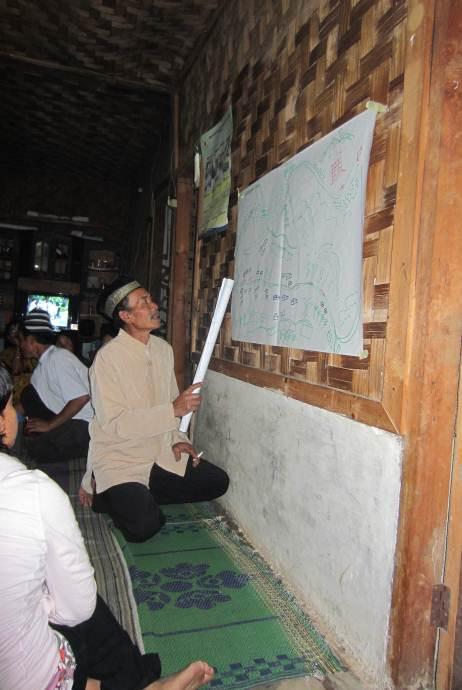
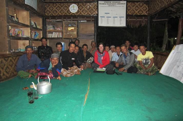

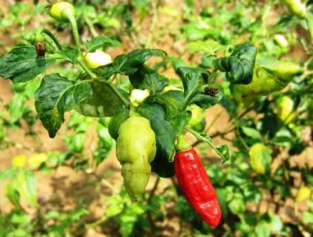
87 APPENDIX 3: PHOTO IMPRESSION GHSNP 86 P a g e
Chapter Ten Concluding Remarks on the Future of Natural Resource Management in Borneo
 Part IV. Conclusion Chapter Ten Concluding Remarks on the Future of Natural Resource Management in Borneo Cristina Eghenter The strength of this volume, as mentioned in the Introduction, is in its comprehensive
EXERCISING CUSTOMARY FOREST POLICIES: INSIGHTS AND THE WAY FORWARD
 EXERCISING CUSTOMARY FOREST POLICIES: INSIGHTS AND THE WAY FORWARD ASIA PACIFIC FORESTRY WEEK 2016 Sisilia Nurmala Dewi Head of Advocacy and Campaign Division ROAD MAP OF FOREST TENURE REFORM 2011 SYNERGIC
Leading glocal security challenges
 Leading glocal security challenges Comparing local leaders addressing security challenges in Europe Dr. Ruth Prins Leiden University The Netherlands r.s.prins@fgga.leidenuniv.nl Contemporary security challenges
Evaluating Integrated Conservation & Development at Bwindi Impenetrable National Park, Uganda. Julia Baker 29 th November 2012 Oxford Brookes
 Evaluating Integrated Conservation & Development at Bwindi Impenetrable National Park, Uganda Julia Baker 29 th November 2012 Oxford Brookes Conservation Policy Priorities for managing protected areas
Further key insights from the Indigenous Community Governance Project, 2006
 Further key insights from the Indigenous Community Governance Project, 2006 J. Hunt 1 and D.E. Smith 2 1. Fellow, Centre for Aboriginal Economic Policy Research, The Australian National University, Canberra;
THE HILL TRIBES OF NORTHERN THAILAND: DEVELOPMENT IN CONFLICT WITH HUMAN RIGHTS - REPORT OF A VISIT IN SEPTEMBER 1996
 THE HILL TRIBES OF NORTHERN THAILAND: DEVELOPMENT IN CONFLICT WITH HUMAN RIGHTS - REPORT OF A VISIT IN SEPTEMBER 1996 Contents Summary A background Perceptions, prejudice and policy Cards and identity
Democracy Building Globally
 Vidar Helgesen, Secretary-General, International IDEA Key-note speech Democracy Building Globally: How can Europe contribute? Society for International Development, The Hague 13 September 2007 The conference
Summary Report: Lessons learned and best practices for CBNRM policy and legislation in Botswana, Malawi, Mozambique, Namibia, Zambia and Zimbabwe
 Summary Report: Lessons learned and best practices for CBNRM policy and legislation in Botswana, Malawi, Mozambique, Namibia, Zambia and Zimbabwe By Brian T. B. Jones 30 March, 2004 For WWF SARPO Regional
Graduate School of Political Economy Dongseo University Master Degree Course List and Course Descriptions
 Graduate School of Political Economy Dongseo University Master Degree Course List and Course Descriptions Category Sem Course No. Course Name Credits Remarks Thesis Research Required 1, 1 Pass/Fail Elective
Governance Vs Accountability: A case of Protected Area Management with People's Participation in Nepal
 Governance Vs Accountability: A case of Protected Area Management with People's Participation in Nepal Bishnu Chandra Poudel University of Joensuu, Bishnu.poudel@forestrynepal.org IUFRO Division VI Symposium
Peace Palace, the Hague 15 March 2007 Dewan Adat Papua
 Peace and sustainability Sessions: Forces for Sustainability Mining the forests, the Military and the Communities: From Plunder to Protection in Papua Peace Palace, the Hague 15 March 2007 Dewan Adat Papua
Review and Update of the World Bank s Environmental and Social Safeguard Policies Phase 2 Consultations Feedback Summary
 Review and Update of the World Bank s Environmental and Social Safeguard Policies Phase 2 Consultations Feedback Summary Date: 15 December 2014 Location: Jakarta, Indonesia Audience: Multi-stakeholder
unfavourable climatic conditions and the mobilization of local labour which is crucial during the farming seasons. The studies on the pre-colonial
 SUMMARY This study has focused on the historical development of local co-operative credit unions, their organizational structure and management dynamics and the ways in which they assist local development
Academic Research In a Small Country: Called to Serve!
 International Environmental Agreements (2005) 5:387 393 Ó Springer 2005 DOI 10.1007/s10784-005-8330-2 Academic Research In a Small Country: Called to Serve! Wageningen University, Netherlands and Catholic
Evaluation of the European Commission-European Youth Forum Operating Grant Agreements /12
 Evaluation of the European Commission-European Youth Forum Operating Grant Agreements 2007-2011/12 Final report Client: DG EAC Rotterdam, 6 November 2013 Evaluation of the European Commission-European
ADVANCE UNEDITED Distr. LIMITED
 ADVANCE UNEDITED Distr. LIMITED 29 November 2018 CBD ORIGINAL: ENGLISH CONFERENCE OF THE PARTIES TO THE CONVENTION ON BIOLOGICAL DIVERSITY Fourteenth meeting Sharm-El-Sheikh, Egypt, 17-29 November 2018
Policy Dynamics of IDPs Resettlement and Peace Building in Kenya: An Evaluation of the Draft National IDP Policy
 Policy Dynamics of IDPs Resettlement and Peace Building in Kenya: An Evaluation of the Draft National IDP Policy Introduction Joshua Kivuva, PhD- UoN Displacement in Kenya is an old phenomenon that dates
Table of Contents. Executive Summary...1
 Table of Contents Executive Summary...1 1.0 Introduction...2 2.0 Strategic Environmental Assessment Methodology...3 2.1 Reference Databases... 3 2.2 Regulatory Framework... 3 2.3 SEA Methodology... 3 3.0
Living Together in a Sustainable Europe. Museums Working for Social Cohesion
 NEMO 22 nd Annual Conference Living Together in a Sustainable Europe. Museums Working for Social Cohesion The Political Dimension Panel Introduction The aim of this panel is to discuss how the cohesive,
Economic and Social Council
 United Nations E/C.19/2010/12/Add.5 Economic and Social Council Distr.: General 16 February 2010 Original: English Permanent Forum on Indigenous Issues Ninth session New York, 19-30 April 2010 Items 3
Summary Report: Lessons Learned and Best Practices For CBNRM Policy and Legislation in Botswana, Malawi, Mozambique, Namibia, Zambia and Zimbabwe
 Summary Report: Lessons Learned and Best Practices For CBNRM Policy and Legislation in Botswana, Malawi, Mozambique, Namibia, Zambia and Zimbabwe Brian T. B. Jones WWF - SARPO Occasional Paper Number 15
HUMAN RIGHTS IN CONSERVATION: PROGRESS SINCE DURBAN CONSERVATION INITIATIVE ON HUMAN RIGHTS
 HUMAN RIGHTS IN CONSERVATION: PROGRESS SINCE DURBAN CONSERVATION INITIATIVE ON HUMAN RIGHTS WHITE PAPER NOVEMBER 2014 HUMAN RIGHTS IN CONSERVATION: PROGRESS SINCE DURBAN CONSERVATION INITIATIVE ON HUMAN
EVERY VOICE COUNTS. Inclusive Governance in Fragile Settings. III.2 Theory of Change
 EVERY VOICE COUNTS Inclusive Governance in Fragile Settings III.2 Theory of Change 1 Theory of Change Inclusive Governance in Fragile Settings 1. Introduction Some 1.5 billion people, half of the world
THE SYSTEM OF PROVIDING INFORMATION ON SAFEGUARDS (SIS) SHOULD BE BASED ON RIGHTS-BASED INDICATORS TO ASSESS, AMONG OTHERS:
 SHOULD BE BASED ON RIGHTS-BASED INDICATORS TO ASSESS, AMONG OTHERS:") Forest Peoples Programme Submission to the SBSTA regarding a System of Information for Safeguards in REDD+ 17 th September 2011 KEY RECOMMENDATIONS: THE SYSTEM OF PROVIDING INFORMATION ON SAFEGUARDS (SIS)
Forest Peoples Programme Submission to the SBSTA regarding a System of Information for Safeguards in REDD+ 17 th September 2011 KEY RECOMMENDATIONS: THE SYSTEM OF PROVIDING INFORMATION ON SAFEGUARDS (SIS)
Information Note Civil Society and Indigenous Peoples Organizations Role in REDD+
 Information Note Civil Society and Indigenous Peoples Organizations Role in REDD+ Introduction One of the seven safeguards adopted by the UNFCCC (the Cancun Safeguards ) is the full and effective participation
We the Stakeholders: The Power of Representation beyond Borders? Clara Brandi
 REVIEW Clara Brandi We the Stakeholders: The Power of Representation beyond Borders? Terry Macdonald, Global Stakeholder Democracy. Power and Representation Beyond Liberal States, Oxford, Oxford University
PRETORIA DECLARATION FOR HABITAT III. Informal Settlements
 PRETORIA DECLARATION FOR HABITAT III Informal Settlements PRETORIA 7-8 APRIL 2016 Host Partner Republic of South Africa Context Informal settlements are a global urban phenomenon. They exist in urban contexts
April 2013 final. CARE Danmark Programme Policy
 April 2013 final CARE Danmark Programme Policy April 2013 Contents 1. Introduction... 3 2. Background and rationale... 3 3. Programme objectives... 4 4. Priority themes... 5 5. Impact group... 6 6. Civil
Equality. Democracy. Rule of Law Responsibility. Education DEMOCRACY. Position of women. Montenegro Professionalism Media. Autonomy of judiciary
 DEMOCRACY Montenegro 2016 INDEX Professionalism Media Transparency of authorities Position of women Rule of Law Responsibility Democracy Availability of legal protection Education Equality Protection of
EMES Position Paper on The Social Business Initiative Communication
 EMES Position Paper on The Social Business Initiative Communication Liege, November 17 th, 2011 Contact: info@emes.net Rationale: The present document has been drafted by the Board of Directors of EMES
Summary of the Results of the 2015 Integrity Survey of the State Audit Office of Hungary
 Summary of the Results of the 2015 Integrity Survey of the State Audit Office of Hungary Table of contents Foreword... 3 1. Objectives and Methodology of the Integrity Surveys of the State Audit Office
Area based community profile : Kabul, Afghanistan December 2017
 Area based community profile : Kabul, Afghanistan December 207 Funded by In collaboration with Implemented by Overview This area-based city profile details the main results and findings from an assessment
Rights to land, fisheries and forests and Human Rights
 Fold-out User Guide to the analysis of governance, situations of human rights violations and the role of stakeholders in relation to land tenure, fisheries and forests, based on the Guidelines The Tenure
TEWS Governance in Indonesia:
 TEWS Governance in Indonesia: The Role of Risk Governance, Multi Institutional Arrangements and Polycentric Frameworks for a Resilient Tsunami Early Warning System in Indonesia Dr. Denis Chang Seng United
Statement of. Prof. Dr. Balthasar Kambuaya, MA. The State Minister of Environment. for
 The following is a non-official translation by UNORCID for the benefit of the stakeholders. UNORCID does not guarantee the accuracy of the translation. The official version is the original Bahasa Indonesia
The Expert Mechanism on the Rights of Indigenous People - Access to Justice. Cambodia Indigenous Youth Association (CIYA)
") The Expert Mechanism on the Rights of Indigenous People - Access to Justice Cambodia Indigenous Youth Association (CIYA) Case Study: Prame Commune, TbengMeanchey District, PreahVihear Province March 10,
The Expert Mechanism on the Rights of Indigenous People - Access to Justice Cambodia Indigenous Youth Association (CIYA) Case Study: Prame Commune, TbengMeanchey District, PreahVihear Province March 10,
 Agreement between the Swedish Government, national idea-based organisations in the social sphere and the Swedish Association of Local Authorities and Regions www.overenskommelsen.se Contents 3 Agreement
This section outlines Chinese law governing domestic dam building, Chinese policies. Policies Guiding Chinese Dam Building
 Policies Guiding Chinese Dam Building This section outlines Chinese law governing domestic dam building, Chinese policies on overseas dams, and international guidelines that can be applied to Chinese overseas
TaLkingPoiNts. Photo by: Judy Pasimio. Shifting Feminisms: From Intersectionality to Political Ecology. By Sunila Abeysekera.
 TaLkingPoiNts Photo by: Judy Pasimio Shifting Feminisms: From Intersectionality to Political Ecology By Sunila Abeysekera 6 Talking Points No.2 2007 WOMEN IN ACTION I thought ecology was about the ecosystem!
Translating Youth, Peace & Security Policy into Practice:
 Translating Youth, Peace & Security Policy into Practice: Guide to kick-starting UNSCR 2250 Locally and Nationally Developed by: United Network of Young Peacebuilders and Search for Common Ground On behalf
SUBMISSION TO THE REVIEW OF THE FLORA AND FAUNA GUARANTEE ACT, 1988 (Vic).
.") SUBMISSION TO THE REVIEW OF THE FLORA AND FAUNA GUARANTEE ACT, 1988 (Vic). INTRODUCTION 1. This submission is made by Lawyers for Forests Incorporated (LFF). 2. LFF is a not for profit voluntary association
SUBMISSION TO THE REVIEW OF THE FLORA AND FAUNA GUARANTEE ACT, 1988 (Vic). INTRODUCTION 1. This submission is made by Lawyers for Forests Incorporated (LFF). 2. LFF is a not for profit voluntary association
Legal Principles and Mechanisms for Safeguarding Biodiversity
 27.11.2003, Kai Kokko (LL.D.), researcher, Institute of International Economic Law, University of Helsinki Legal Principles and Mechanisms for Safeguarding Biodiversity A presentation for the, 15.- 16.1.2004,
THE TANZANIAN LAND ACTS, 1999: AN ANALYSIS OF THE ANALYSES. Robin Palmer Land Policy Adviser, Africa Oxfam GB. March 1999
 THE TANZANIAN LAND ACTS, 1999: AN ANALYSIS OF THE ANALYSES Robin Palmer Land Policy Adviser, Africa Oxfam GB March 1999 Introduction On 11 February 1999 the Tanzanian Parliament passed The Land Act, 1999
Master of Arts in Social Science (International Program) Faculty of Social Sciences, Chiang Mai University. Course Descriptions
 Faculty of Social Sciences, Chiang Mai University. Course Descriptions") Master of Arts in Social Science (International Program) Faculty of Social Sciences, Chiang Mai University Course Descriptions Core Courses SS 169701 Social Sciences Theories This course studies how various
Master of Arts in Social Science (International Program) Faculty of Social Sciences, Chiang Mai University Course Descriptions Core Courses SS 169701 Social Sciences Theories This course studies how various
Compliance with Wildlife Laws: Acknowledging Social Principles. Jannie Vos
 Compliance with Wildlife Laws: Acknowledging Social Principles of Law Jannie Vos MSc-Thesis Forest and Nature Conservation Policy Group Wageningen University & Research Centre, The Netherlands August 2011
Original language: English CoP17 Inf. 94 (English only / Únicamente en inglés / Seulement en anglais)
") Original language: English CoP17 Inf. 94 (English only / Únicamente en inglés / Seulement en anglais) CONVENTION ON INTERNATIONAL TRADE IN ENDANGERED SPECIES OF WILD FAUNA AND FLORA Seventeenth meeting
Original language: English CoP17 Inf. 94 (English only / Únicamente en inglés / Seulement en anglais) CONVENTION ON INTERNATIONAL TRADE IN ENDANGERED SPECIES OF WILD FAUNA AND FLORA Seventeenth meeting
Experiences of Uganda s PPA in implementing and monitoring poverty reduction
 ch7_uganda3.qxd 20/4/05 7:14 pm Page 47 7 Experiences of Uganda s PPA in implementing and monitoring poverty reduction by RICHARD SSEWAKIRYANGA The first Poverty Eradication Action Plan (PEAP) Although
NHEK SARIN, SK ADVISOR MARCH 27, 2014 SK OFFICE
 LAND GRAB CASE: A RESETTLMENT BY AN ECOMIC LAND CONCESSION (ELC) IN BOTUM SAKOR AND KIRI SAKOR DISTRICT, KOH KONG PROVINCE NHEK SARIN, SK ADVISOR MARCH 27, 2014 SK OFFICE 1 TABLE OF CONTENTS I. Background
NATIONAL ENVIRONMENTAL MANAGEMENT: PROTECTED AREAS ACT 57 OF 2003
 NATIONAL ENVIRONMENTAL MANAGEMENT: PROTECTED AREAS ACT 57 OF 2003 (English text signed by the President) [Assented To: 11 February 2004] [Commencement Date: 1 November 2004] [Proc. 52 / GG 26960 / 20041102]
Community Agreements on Conservation in Central Sulawesi: A Coase Solution to Externalities or a Case of Empowered Deliberative Democracy?
 Community Agreements on Conservation in Central Sulawesi: A Coase Solution to Externalities or a Case of Empowered Deliberative Democracy? Regina Birner and Marhawati Mappatoba STORMA Discussion Paper
SUBJECT : MANAGEMENT OF OVERLAPPING PROTECTED AREAS AND/OR THEIR BUFFER ZONES AND ANCESTRAL DOMAINS/ LANDS
 JOINT DENR-NCIP MEMORANDUM CIRCULAR No. 2007 01 May 09, 2007 SUBJECT : MANAGEMENT OF OVERLAPPING PROTECTED AREAS AND/OR THEIR BUFFER ZONES AND ANCESTRAL DOMAINS/ LANDS Pursuant to Section 13 of RA No.
UNDERSTANDING AND WORKING WITH POWER. Effective Advising in Statebuilding and Peacebuilding Contexts How 2015, Geneva- Interpeace
 UNDERSTANDING AND WORKING WITH POWER. Effective Advising in Statebuilding and Peacebuilding Contexts How 2015, Geneva- Interpeace 1. WHY IS IT IMPORTANT TO ANALYSE AND UNDERSTAND POWER? Anyone interested
An informal aid. for reading the Voluntary Guidelines. on the Responsible Governance of Tenure. of Land, Fisheries and Forests
 An informal aid for reading the Voluntary Guidelines on the Responsible Governance of Tenure of Land, Fisheries and Forests An informal aid for reading the Voluntary Guidelines on the Responsible Governance
THE WORLD BANK OPERATIONAL MANUAL. Indigenous Peoples
 THE WORLD BANK OPERATIONAL MANUAL Indigenous Peoples (Draft OP 4.10, March 09, 2000) INTRODUCTION. 1. The Bank's policy 1 towards indigenous peoples contributes to its wider objectives of poverty reduction
REPUBLIC OF SOUTH AFRICA NATIONAL FORESTS AMENDMENT BILL
 REPUBLIC OF SOUTH AFRICA NATIONAL FORESTS AMENDMENT BILL (As introduced in the National Assembly (proposed section 75)) (The English text is the official text of the Bill) (MINISTER OF AGRICULTURE, FORESTRY
Analysis of REDD+ policy networks in Peru
 CIFOR briefs provide concise, accurate, scientific information on current topics in forest research. No. 86, cifor.org Analysis of REDD+ policy networks in Peru Mary Menton, Javier Perla, Juan Sotes and
2.1 Mandate for the Commission on Environmental, Economic and Social Policy (CEESP)
") RESOLUTIONS A. Governance-related 2.1 Mandate for the Commission on Environmental, Economic and Social Policy (CEESP) GRATEFUL for the past work of the Commission on Environmental Planning, most recently
RESOLUTIONS A. Governance-related 2.1 Mandate for the Commission on Environmental, Economic and Social Policy (CEESP) GRATEFUL for the past work of the Commission on Environmental Planning, most recently
The Global State of Democracy
 First edition The Global State of Democracy Exploring Democracy s Resilience iii 2017 International Institute for Democracy and Electoral Assistance This is an extract from: The Global State of Democracy:
COUNTRY PERSPECTIVES ON GOVERNANCE FOR REDD+ INDONESIA. Brazzaville, Republic of Congo 23 October 2012
 COUNTRY PERSPECTIVES ON GOVERNANCE FOR REDD+ INDONESIA Brazzaville, Republic of Congo 23 October 2012 MAS ACHMAD SANTOSA Head of Working Group Legal Review and Law Enforcement REDD+ Task Force, Indonesia
RRI ER-PIN Assessment Mexico Date of ER-PIN: April 2014; Date of R-Package: April 2016
 Grading for ER-PIN Assessments: Color Qualification Analysis Green The indicator is clearly addressed and supported by country stakeholders and other sources of evidence; Reasons for attributed grade should
Globalisation and Poverty: Human Insecurity of Schedule Caste in India
 Globalisation and Poverty: Human Insecurity of Schedule Caste in India Rajni Kant Pandey ICSSR Doctoral Fellow, Giri Institute of Development Studies Aliganj, Lucknow. Abstract Human Security is dominating
National Environmental Management: Protected Areas Act (Act No 57 of 2003
 National Environmental Management: Protected Areas Act (Act No 57 of 2003 (English text signed by the President.) (Assented to 11 February 2004.) (Into force 01 November 2004) as amended by the National
Centre for United States and Asia Policy Studies
 Centre for United States and Asia Policy Studies flinders.edu.au/cusaps 2013 EDITION Contents 01 02 03 04 06 08 10 11 12 13 Introduction Welcome Co-directors message Flinders University Our research Our
Comments on Suriname RPP (23 February 2013)
") Comments on Suriname RPP (23 February 2013) For addressing grievances and conflicts a temporary three-tier approach will be set up, starting with the REDD+ Steering Committee. If issues cannot be resolved
Comments on Suriname RPP (23 February 2013) For addressing grievances and conflicts a temporary three-tier approach will be set up, starting with the REDD+ Steering Committee. If issues cannot be resolved
Involuntary Resettlement Due Diligence Report
 Involuntary Resettlement Due Diligence Report # Report May 2016 VIE: Second Lower Secondary Education for the Most Disadvantaged Areas Project (LSEMDAP2) Nghe An Province Prepared by the Ministry of Education
Civil society responses to large-scale land acquisitions in Tanzania and Indonesia. E. Mwangi, H. Komarudin, E. Luoga, M. Toxede
 Civil society responses to large-scale land acquisitions in Tanzania and Indonesia E. Mwangi, H. Komarudin, E. Luoga, M. Toxede Partners Research Sokoine University of Ag Sciences, Faculty of Forestry
4 PHD POSITIONS PRACTICAL INFORMATION. Faculty of Law and Criminology Human Rights Center
 4 PHD POSITIONS Deadline for applications Jan 14, 2019 PRACTICAL INFORMATION Foreseen starting date September 1, 2019 Department Contract Degree requirements Faculty of Law and Criminology Human Rights
information on safeguards (SIS): Inclusion of data relevant for indigenous peoples
: Inclusion of data relevant for indigenous peoples") Fore Peoples Programme ForestPeoplesProgramme REDD+ systems on providing information on safeguards (SIS): Inclusion of data relevant for indigenous peoples EXECUTIVESUMMARY: Developingcountries remainingforestsarespacesinhabitedby
Fore Peoples Programme ForestPeoplesProgramme REDD+ systems on providing information on safeguards (SIS): Inclusion of data relevant for indigenous peoples EXECUTIVESUMMARY: Developingcountries remainingforestsarespacesinhabitedby
1/24/2018 Prime Minister s address at Asian Ministerial Conference on Disaster Risk Reduction
 Press Information Bureau Government of India Prime Minister's Office 03-November-2016 11:47 IST Prime Minister s address at Asian Ministerial Conference on Disaster Risk Reduction Distinguished dignitaries
I n t e r v i e w w i t h A p s a r a C h a p a g a i n C h a i r p e r s o n, F E C O F U N
 I n t e r v i e w w i t h A p s a r a C h a p a g a i n C h a i r p e r s o n, F E C O F U N July 2012 Background The Federation of Community Forestry Users, Nepal (FECOFUN) is a formal network of Community
Civil Society Partnership
 CARE Civil Partnership CIVIL ACTION FOR SOCIO-ECONOMIC INCLUSION (CASI) Civil Society Partnership Civil Action for Socio-economic Inclusion(CASI) GOAL: Sustainable improvements in livelihood security for
Mongolian Law on Special Protected Areas and Law on Buffer Zones Review, comments and recommendations
 Mongolian Law on Special and Law on Buffer Zones Review, comments and recommendations Report Table of Contents I. INTRODUCTION... 1 II. CONSISTENCY WITH INTERNATIONAL OBLIGATIONS... 1 2.1 LEGALLY BINDING
Empowering Communities and Facilitating Good Governance during Economic and Political Transition
 Empowering Communities and Facilitating Good Governance during Economic and Political Transition Agus Purnomo, WWF-Indonesia & TI-Indonesia Presented for the Forest Law Enforcement and Governance (FLEG):
To the President of the House of Representatives of the States General Binnenhof 4 Den Haag
 To the President of the House of Representatives of the States General Binnenhof 4 Den Haag Sub-Saharan Africa Department Central and East Africa Division Bezuidenhoutseweg 67 2594 AC Den Haag Date 1 September
Lubuk Jering and PT. RAPP Resolve their Land Conflict
 Tour 1 Lubuk Jering Lubuk Jering and PT. RAPP Resolve their Land Conflict Lubuk Jering is community in Siak district, 125 kilometers to the north of Pekanbaru. A conflict over land developed between Lubuk
ROLE DESCRIPTION & PERSON SPECIFICATION
 ROLE DESCRIPTION & PERSON SPECIFICATION Job Title: Research and writer consultants: human rights accountability in the extractives sector in Kenya and Tanzania and the role of national human rights institutions
Clarifications to this call for applications are presented at the end of this document
 Clarifications to this call for applications are presented at the end of this document Call for Applications to Conduct Mapping Studies of Trade Unions and Professional Associations as Civil Society Actors
Methodological note on the CIVICUS Civil Society Enabling Environment Index (EE Index)
") Methodological note on the CIVICUS Civil Society Enabling Environment Index (EE Index) Introduction Lorenzo Fioramonti University of Pretoria With the support of Olga Kononykhina For CIVICUS: World Alliance
Methodological note on the CIVICUS Civil Society Enabling Environment Index (EE Index) Introduction Lorenzo Fioramonti University of Pretoria With the support of Olga Kononykhina For CIVICUS: World Alliance
2. Good governance the concept
 2. Good governance the concept In the last twenty years, the concepts of governance and good governance have become widely used in both the academic and donor communities. These two traditions have dissimilar
The Way Forward: Pathways toward Transformative Change
 CHAPTER 8 We will need to see beyond disciplinary and policy silos to achieve the integrated 2030 Agenda. The Way Forward: Pathways toward Transformative Change The research in this report points to one
Global Politics and Peace Parks Dr. Rosaleen Duffy Centre for International Politics, Manchester University
 Global Politics and Peace Parks Dr. Rosaleen Duffy Centre for International Politics, Manchester University Nowhere is the need for transnational forms of management more apparent than in the realm of
Summary. The Politics of Innovation in Public Transport Issues, Settings and Displacements
 Summary The Politics of Innovation in Public Transport Issues, Settings and Displacements There is an important political dimension of innovation processes. On the one hand, technological innovations can
Law, Justice and Development Program
 Law, Justice and Development Program ADB Regional Capacity Development Technical Assistance Strengthening Capacity for Environmental Law in the Asia-Pacific: Developing Environmental Law Champions Train-the-Trainers
1. About Eastern Partnership Civil Society Facility project:
 Call for Applications to Conduct Mapping Studies of Trade Unions and Professional Associations as Civil Society Actors Working on the Issues of Labour Rights and Social Dialogue in six EaP Countries The
Gramalote, Colombia: A displaced community in transition
 Gramalote, Colombia: A displaced community in transition The newly built town of Gramalote, Norte de Santander, Colombia. Photo by Carlos Arenas Carlos Arenas and Anthony Oliver-Smith October 2017 1 Background
Human Rights and Climate Change
 Human Rights and Climate Change Briefing Paper drafted for the purpose of informing the Climate Justice Dialogue on 7 February 2015, co-hosted by the OHCHR and the Mary Robinson Foundation in Geneva Embedding
This document relates to item 4.5 of the provisional agenda
 This document relates to item 4.5 of the provisional agenda Sixth Session of the Conference of the Parties to the WHO Framework Convention on Tobacco Control, 13-18 October 2014, Moscow FCA Policy Briefing
Terms of Reference 1. INTRODUCTION
 Terms of Reference Description of the assignment (Title of consultancy): National Consultant to assess the Regional Technical Office (RTO) operating under the mandate of the Union of Municipalities of
ASYLUM SEEKERS AND REFUGEES EXPERIENCES OF LIFE IN NORTHERN IRELAND. Dr Fiona Murphy Dr Ulrike M. Vieten. a Policy Brief
 ASYLUM SEEKERS AND REFUGEES EXPERIENCES OF LIFE IN NORTHERN IRELAND a Policy Brief Dr Fiona Murphy Dr Ulrike M. Vieten rir This policy brief examines the challenges of integration processes. The research
Proposals for the 2016 Intermediate Review of Progress on the Doha Work Program
 YOUNGO Submission for SBI-44 Proposals for the 2016 Intermediate Review of Progress on the Doha Work Program Executive Summary The official Youth Constituency to the UNFCCC (known as YOUNGO ) is pleased
Marxism and the State
 Marxism and the State Also by Paul Wetherly Marx s Theory of History: The Contemporary Debate (editor, 1992) Marxism and the State An Analytical Approach Paul Wetherly Principal Lecturer in Politics Leeds
Strategic Issues for World Heritage: some IUCN and personal perspectives
 INTERNATIONAL PERSPECTIVES ON THE CONVENTION Strategic Issues for World Heritage: some IUCN and personal perspectives Peter Shadie This brief chapter aims to highlight a number of strategic issues for
A Methodology for Policy Process Analysis
 A Methodology for Policy Process Analysis Livelihood-Policy Relationships in South Asia Working Paper 9 Oliver Springate-Baginski and John Soussan The UK Department for International Development (DFID)
Thank you David (Johnstone) for your warm introduction and for inviting me to talk to your spring Conference on managing land in the public interest.
 for your warm introduction and for inviting me to talk to your spring Conference on managing land in the public interest.") ! 1 of 22 Introduction Thank you David (Johnstone) for your warm introduction and for inviting me to talk to your spring Conference on managing land in the public interest. I m delighted to be able to
! 1 of 22 Introduction Thank you David (Johnstone) for your warm introduction and for inviting me to talk to your spring Conference on managing land in the public interest. I m delighted to be able to
THE CONVENTION ON THE PROHIBITION 9 October 2008 OF THE USE, STOCKPILING, PRODUCTION AND TRANSFER OF ANTI-PERSONNEL
 MEETING OF THE STATES PARTIES TO THE CONVENTION ON THE PROHIBITION 9 October 2008 OF THE USE, STOCKPILING, PRODUCTION AND TRANSFER OF ANTI-PERSONNEL MINES AND ON THEIR DESTRUCTION Original: ENGLISH Ninth
CONVENTION ON MIGRATORY SPECIES
 CONVENTION ON MIGRATORY SPECIES CMS Distribution: General UNEP/CMS/Resolution 11.16 Original: English THE PREVENTION OF ILLEGAL KILLING, TAKING AND TRADE OF MIGRATORY BIRDS Adopted by the Conference of
ARRANGEMENT OF SECTIONS
 LAND USE Land AND Use SPATIAL and Spatial PLANNING Planning Act, ACT, 2016 2016 Act 925 ARRANGEMENT OF SECTIONS Section Application 1. Application The Planning System Planning at National Level 2. Establishment
GUIDANCE NOTE: AMENDEMENT OF UGANDA WILDLIFE ACT NOVEMBER 2014 GUIDANCE NOTE
 GUIDANCE NOTE Amendment of the Uganda Wildlife Act (2000) and Opportunities for Incorporating Issues Concerning Management of Human-Wildlife Conflict, and Sharing of Revenue and Other Benefits with Communities
POLICY MAKING PROCESS
 POLICY MAKING PROCESS Hon. Dr. Kojo Appiah-Kubi DRUSSA-ISSER Executive Training on Influencing Policy 10 Dec 2015 1.0 Introduction Policy a statement of intent for achieving an objective. Deliberate statement
CONTENTS 20 YEARS OF ILC 4 OUR MANIFESTO 8 OUR GOAL 16 OUR THEORY OF CHANGE 22 STRATEGIC OBJECTIVE 1: CONNECT 28 STRATEGIC OBJECTIVE 2: MOBILISE 32
 EN 2016 2021 2016 2021 CONTENTS 20 YEARS OF ILC 4 OUR MANIFESTO 8 Our core values 12 Our mission 14 Our vision 15 OUR GOAL 16 The contents of this work may be freely reproduced, translated, and distributed