Resettlement Action Plan (RAP) For Ajalli Gully Erosion Site, Nsude-Enugu
|
|
|
- Vivian O’Brien’
- 5 years ago
- Views:
Transcription
1 Public Disclosure Authorized Public Disclosure Authorized Public Disclosure Authorized Final Report Public Disclosure Authorized Resettlement Action Plan (RAP) For Ajalli Gully Erosion Site, Nsude-Enugu
2 TABLE OF CONTENTS LIST OF TABLES... V ABBREVIATIONS AND ACRONYMS... IX EXECUTIVE SUMMARY... XI RESTORATION MEASURES FOR THE VULNERABLE GROUP... XV CHAPTER ONE INTRODUCTION PROJECT BACKGROUND OBJECTIVES AND BENEFITS OF NEWMAP PROJECT COMPONENTS JUSTIFICATION FOR THE PREPARATION OF RAP AIMS AND OBJECTIVES OF THE RAP SCOPE OF WORK RAP METHODOLOGY FORMAT OF THE RAP CHAPTER TWO DESCRIPTION OF THE PROJECT AND PROJECT INTERVENTION AREA BACKGROUND GEO-PHYSICAL DESCRIPTION GEOLOGY, RELIEF AND DRAINAGE CLIMATIC CONDITION VEGETATION SOILS AND SOIL EROSION ENUGU DEMOGRAPHICS AND ECONOMY EDUCATIONAL INSTITUTIONS OVERVIEW OF PROJECT SITE CHAPTER THREE POLICY AND REGULATORY FRAMEWORK POLICY AND REGULATORY FRAMEWORK THE ENVIRONMENTAL AND SOCIAL MANAGEMENT FRAMEWORK (ESMF) THE RESETTLEMENT POLICY FRAMEWORK (RPF) INTERIM GUIDELINES FOR ADDRESSING LEGACY ISSUES IN WORLD BANK PROJECTS,
3 3.4 POLICY ON DISCLOSURE AND ACCESS TO INFORMATION (DAI) NIGERIA LAW/LAND USE ACT OF 1978 AND RESETTLEMENT PROCEDURES REQUIREMENTS OF THE LAND USE ACT FORESTRY ACT COMPARISON BETWEEN LAND USE ACT AND THE WORLD BANK S (OP4.12) POLICY CHAPTER FOUR SOCIAL ORGANIZATION AND BASELINE STUDY OF THE PROJECT COMMUNITY COMMUNITY PROFILE ADMINISTRATION CULTURAL FESTIVALS AMENITIES AND INFRASTRUCTURE MAJOR MEANS OF LIVELIHOOD MAJOR INDUSTRIES LAND TENURE SYSTEM IN NSUDE COMMUNITY LAND USE WITHIN THE INTEGRATED WATERSHED AREA DISPUTE RESOLUTION GENDER PARTICIPATION IN COMMUNITY AFFAIRS SOCIOECONOMICS SAMPLE DETERMINATION FOR DEMOGRAPHIC SURVEY IN NSUDE GENDER AND AGE OF RESPONDENTS EDUCATION AND FAMILY SIZE LIVELIHOOD AND INCOME SOURCE OF DRINKING WATER AND EXPENDITURE ON WATER OCCUPANCY STATUS OF DWELLING CONCERNS ON EROSION MENACE PERCEIVED IMPACTS OF EROSION SUGGESTIONS TO EROSION CONTROL COMMUNITY EXPECTATION FROM THE PROJECT HEALTH IMPACT ANALYSIS PLACE WHERE HOUSEHOLDS GO FOR HEALTHCARE NATURE OF SICKNESS COMMONLY SUFFERED BY HOUSEHOLDS CHAPTER FIVE IDENTIFICATION OF PROJECT IMPACTS AND PROJECT AFFECTED PERSONS APPROACH TO IMPACTS IDENTIFICATION AND INVENTORY OF IMPACTS TYPE OF ACTIVITIES AND LAND ACQUISITION REQUIREMENT FIELD VISIT OF THE EROSION SITE FOR INVENTORY COMMUNITY PERCEPTIONS ON SOCIO-ECONOMIC AND CULTURAL PROPERTIES AND LIVELIHOODS THAT MAY BE LOST MATRIX PRESENTATION OF PROJECT IMPACTS FROM COMMUNITY PERCEPTION LINKING POTENTIAL AND ASSOCIATED PROJECT IMPACTS TO THE APPLICABLE WORLD BANK iii
4 OPERATIONAL POLICIES LINKAGE OF IMPACTS WITH THE ESMF (OP 4.01) LINKAGE OF IMPACTS WITH THE RPF (OP 4.12) VULNERABILITY IN THE PROJECT AREA ENTITLEMENT OR COMPENSATION FOR COMMUNITY LAND RESTORATION MEASURES FOR THE VULNERABLE GROUP VALUATION METHODOLOGY REPLACEMENT COST METHOD LAND RESETTLEMENT THE ENTITLEMENT MATRIX FOR VARIOUS CATEGORIES OF PAPS CENSUS CUT-OFF DATE PERFORMANCE INDICATORS FOR ASSESSING COMMUNITY LIVELIHOOD ENHANCEMENT CHAPTER SIX PUBLIC AND STAKEHOLDER CONSULTATIONS INTRODUCTION APPROACH FOR IDENTIFICATION AND PARTICIPATION OF STAKEHOLDERS SUMMARY OF PROCEEDINGS OF CONSULTATIONS MEETING WITH STAKEHOLDER MDAS AND COMMUNITY PUBLIC CONSULTATION WITH THE NSUDE (AJALLI WORKS) COMMUNITY PICTURES OF MEETINGS WITH STAKEHOLDERS CHAPTER SEVEN GRIEVANCE REDRESS MECHANISM INTRODUCTION TO GRIEVANCE REDRESS MECHANISM GRIEVANCES AND APPEALS PROCEDURE GRIEVANCE REDRESS COMMITTEE (GRC) THE FUNCTIONS OF THE GRIEVANCE REDRESS COMMITTEE COURT RESOLUTION OF GRIEVANCE MATTERS PROCEDURE FOR EFFECTIVE LOCAL RESOLUTION OF GRIEVANCE CHAPTER EIGHT INSTITUTIONAL ARRANGEMENT AND RESPONSIBILITIES INTRODUCTION TO INSTITUTIONAL ARRANGEMENT INSTITUTIONAL ARRANGEMENT CHAPTER NINE MONITORING AND EVALUATION OVERVIEW ON MONITORING INTERNAL MONITORING EXTERNAL /INDEPENDENT MONITORING TASKS OF THE MONITORING AND EVALUATION OFFICER IMPLEMENTATION SCHEDULE MONITORING INDICATORS CHAPTER TEN: FUNDING ARRANGEMENT AND SCHEDULE iv
5 10.1 INTRODUCTION TIMETABLE FOR THE ABBREVIATED RESETTLEMENT ACTION PLAN TRAINING AND CAPACITY NEEDS REFERENCES ANNEX 1: INVENTORY AND CENSUS FOR PROJECT AFFECTED PERSONS (PAPS) ANNEX 2: LAND ACQUISITION DOCUMENTATION ANNEX 3: PICTURES OF OTHER LAND AREAS UNDER GULLY EROSION THREAT IN NSUDE ANNEX 4: ATTENDANCE OF PUBLIC CONSULTATIONS AT NSUDE HEALTH CENTRE, ENUGU ANNEX 4 B: STAKEHOLDERS PUBLIC CONSULTATION FORUM FOR THE PREPARATION OF ESMP AND RAP FOR THE AJALLI GULLY EROSION SITE LIST OF figures Figure 2.1: Map of Enugu State in Nigeria showing the Project Site Figure 2.2: Ajalli Erosion Site Plan View Figure 4.1: Age Categories of Respondents Figure 4.2: Trend in Education and Family Size over the Project Community Figure 4.3a: Intersection of Income and Livelihood Data Figure 4. 3b: Sources of Livelihood and Representation in the Project Area Figure 4.4: Sources of Drinking Water by Season of the Year Figure 4.5: Concern Response to Erosion in the Area Figure 4.6: Frequency for where households go for medical attention Figure 4.7: Common Health Problems Suffered in the Past 2 Years Figure 5.1: Twin reservoir Tanks (left top)at risk by gully menace Figure 5.2; Water works - transmission pipelines destroyed by erosion Figure 5.3: Bursted Water Pipeline at the Ajalli Gully Head Figure 5.4: Bursted Water Pipeline at the Ajalli Gully Head LIST OF TABLES Table 3.1: Comparison of Nigerian Land Use Act (1978) and World Bank s Operational Policy (OP 4.12) Table 5.2: Entitlement Matrix for the PAPs... Error! Bookmark not defined. Table 7.1: Institutional Arrangement and Responsibilities for ARAP Implementation Table 8.1: Summary of Responsibility for Implementation of Resettlement Action Plan Table 9.1: Timetable for RAP implementation shown in Gant Chart Table 9.2: Recommended Training and Education v
6 vi
7 DEFINITIONS Children: all persons under the age of 18 years according to international regulatory standard (convention on the rights of Child 2002). Community: a group of individuals broader than households, who identify themselves as a common unit due to recognized social, religious, economic and traditional government ties or shared locality. Compensation: project. payment in cash or in kind for an asset or resource acquired or affected by the Cut-off-Date: the date of completion of inventory of losses and census of project affected persons Economic Displacement: a loss of productive assets or usage rights or livelihood capacities because such assets / rights / capacities are located in the project area. Entitlement: the compensation offered by RAP, including: financial compensation; the right to participate in livelihood enhancement programs; housing sites and infrastructure; transport and temporary housing allowance; and, other short term provisions required to move from one site to another. Head of the Household: the eldest member of the core family in the household, for the purpose of the project. Household: a group of persons living together who share the same cooking and eating facilities, and form a basic socio-economic and decision making unit. One or more households often occupy a homestead. Involuntary Resettlement: resettlement without the informed consent of the displaced persons or if they give their consent, it is without having the power to refuse resettlement. Lost Income Opportunities: lost income opportunities refers to compensation to project affected persons for loss of business income, business hours/time due to project Operational Policy 4.12: Describes the basic principles and procedures for resettling, compensating or at least assisting involuntary displace persons to improve or at least restore their standards of living after alternatives for avoiding displacement is not feasible Physical Displacement: a loss of residential structures and related non-residential structures and physical assets because such structures / assets are located in the project area. Private property owners: persons who have legal title to structures, land or other assets and are accordingly entitled to compensation under the Land Act. Project-Affected Community: a community that is adversely affected by the project. Project-Affected Person: any person who, as a result of the project, loses the right to own, use or otherwise benefit from a built structure, land (residential, agricultural, or pasture), annual or perennial crops and trees, or any other fixed or moveable asset, either in full or in part, permanently or temporarily. Rehabilitation: the restoration of the PAPs resource capacity to continue with productive activities or lifestyles at a level higher or at least equal to that before the project. Relocation: a compensation process through which physically displaced households are provided with a one-time lump-sum compensation payment for their existing residential structures and move from the area. Replacement Cost: the amount of cash compensation and/or assistance suffices to replace lost assets and cover transaction costs, without taking into account depreciation or salvage value. Resettlement Action Plan (RAP): documented procedures and the actions a project proponent will take to mitigate adverse effects, compensate losses, and provide development benefits to persons and communities affected by a project.
8 Resettlement Assistance: support provided to people who are physically displaced by a project. This may include transportation, food, shelter, and social services that are provided to affected people during their resettlement. Assistance may also include cash allowances that compensate affected people for the inconvenience associated with resettlement and defray the expenses of a transition to a new locale, such as moving expenses and lost work days. Resettlement: a compensation process through which physically displaced households are provided with replacement plots and residential structures at one of two designated resettlement villages in the district. Resettlement includes initiatives to restore and improve the living standards of those being resettled. Squatters: squatters are landless household squatting within the public / private land for residential and business purposes. Vulnerable group: People who by their mental or physical disadvantage conditions.will be economically worse impacted by project activities than others such as female headed households, persons with disability, at-risk children, persons with HIV-AIDS and elderly household heads of 60 years and above. viii
9 ABBREVIATIONS AND ACRONYMS CDC - Community Development Council DP - Displaced Persons ESIA - Environmental and Social Impact Assessment ESMF - Environmental and Social Management Framework ESMP - Environmental and Social Management Plan FGN - Federal Government of Nigeria FGD - Focus Group Discussion FMWR - Federal Ministry of Water Resources GEF - Global Environmental Facility GRASS - Gully Rapid Action and Slope Stabilization GRC - Grievance Redress Committee IDA - International Development Association LAP - Land Acquisition Plan LGA - Local Government Authority MWRRD NEWMAP Ministry of Water Resources & Rural Development Nigerian Erosion and Watershed Management Project NGO - Non-Governmental Organization NIHSA - National Hydrological Services Agency NIWRMC - NUWSRP - National Integrated Water Resources Management Commission National Urban Water Sector Reform Project NWRI - National Water Resource Institute PAD - Project Appraisal Document PAP - Project Affected Person PRA - Participatory Rural Appraisal ix
10 PIM - Project Implementation Manual PMU - Project Management Unit RAP - Resettlement Action Plan ROW - Right of Way RPF - Resettlement Policy Framework SPIU - State Project Implementation Unit SRMC - Sector Reform Management Committee SCCF - Special Climate Change Fund SEMA - State Emergency Management Agency SSI - Semi Structured Interview UNFCCC - United Nation Framework Convention on Climate Change WB - World Bank x
11 EXECUTIVE SUMMARY Project Background The Government of Nigeria is implementing the multi-sectorial Nigeria Erosion and Watershed Management Project (NEWMAP), which is financed by the World Bank, Global Environment Facility, the special climate change fund, and the Government of Nigeria. NEWMAP Finances activities implemented by states and activities implemented by the Federal Government. The project currently includes 7 states, namely Anambra, Abia, Cross River, Edo, Enugu, Ebonyi, and Imo. The lead agency at the Federal level is the Federal Ministry of Environment (FME), Department of Erosion, Flood and Coastal Zone Management. State and local governments, local communities and CSOs are or will be involved in the project, given that the project is a multi-sector operation involving MDAs concerned with water resources management, public works, agriculture, regional and town planning, earth and natural resources information, and disaster risk management. The development objective of NEWMAP is: to rehabilitate degraded lands and reduce longer-term erosion vulnerability in targeted areas. At state level, NEWMAP activities involve medium-sized civil works such as construction of infrastructure and/or stabilization or rehabilitation in and around the gullies themselves, as well as small works in the small watershed where gullies form and expand. These works trigger the World Bank s Safeguard policies including Environmental Assessment (OP4.01) and Involuntary Resettlement (OP 4.12). It is also likely that other safeguard policies such as Natural Habitats (OP 4.04), Physical Cultural Property (OP 4.11); Safety of Dams (OP 4.37); Pest Management (OP 4.09) and Projects on International Waterways (OP 7.50) may be triggered by the project in some other sites. Overview of the Ajalli Gully Erosion Site The site is located at Ugwuto Nsude, Udi Local Government Area of Enugu State. It is within geographical co-ordinates of N and E. It has two fingers with a confluence at a point about 300meters downstream. The gully head at finger 1 is about 6m away from the fence of Ajalli Water Works and about 37meter to the Twin Water Tanks. The distance of the gully head at finger 1 to the Imezi-Owa community road (home of Seminary School in the area) is about 89 meters while from finger 2 gully head to the access road is only about 10.5 meters. Other features of the site include: Length of the gully is about 800m Width of the gully (degraded area) is about 10 m xi
12 The depth of the gully varies from about 8m from the gully head to about 12m at the middle of the gully Total width required for erosion work is 15m Area of land affected/degraded by erosion for the two fingers is about 0.8 hectare Areas of land to be acquired for erosion control work including the degraded area is about 1.2 hectares Justification for the Preparation of RAP The scoping of the intervention site revealed that over 10% of the total land holding of the community is either degraded by the gully erosion spread or will be acquired for the purpose of the erosion intervention project. In line with the World Bank Involuntary Resettlement Policy, OP 4.12, the RAP is precautionarily the right safeguard instrument to manage the potential impacts/displacement. The RAP identified the potential Project Affected community and engaged them in participatory discussions regarding the plan in order to adequately compensate them for their losses. The core requirement of the OP 4.12 Involuntary Resettlement is as follows: Avoid or minimize involuntary resettlement where feasible, exploring all viable alternative project designs. Assist project affected persons in improving their former living standards, income earning capacity, and production levels, or at least in restoring them back to the former status Encourage community participation in planning and implementing resettlement. Provide assistance to affected people regardless of the legality of land tenure. Aim and Objectives of the RAP The main aim of preparing this RAP is to design methods and schemes for resettling or compensating the Project Affected Community in the erosion devastated/prone area. The goal is to improve decision-making as regards the resettlement and compensation of persons that would be affected by the proposed project. The specific objectives of the RAP are to: Conduct a census survey of impacted persons and valuation of assets; C o n s u l t with the would be impacted Persons (PAPs) or community; Ascertain the number of vulnerable persons among PAPs and design livelihood restoration measures suitable to addressing their economic sustenance. Describe compensation and other resettlement assistance to be provided; and Prepare a budget and time table for resettlement action. xii
13 This Policy (OP 4.12) covers direct economic and social impacts that both result from both Banks -assisted projects, and are caused by: (a) The involuntary taking of land resulting in (i) Relocation or loss of shelter; (ii) Loss of assets or access to assets, or (iii) Loss of income sources or means of livelihood, whether or not the affected persons must move to another location; or not (b) The involuntary restriction of access to legally designated parks and protected areas resulting in adverse impacts on the livelihoods of the displaced persons. RAP Methodology This RAP involves review of previous studies done by NEWMAP (including project implementation manual, Project appraisal document, Environmental and Social Management Framework and Resettlement Policy Framework), site visit and verification of impacts on the community. It involves consultation with stakeholders including the host community. Legal and Regulatory Framework This RAP was prepared in consistence with the applicable National Laws and the World Bank Operational Policies. Specifically, the RAP preparation was in line with the provisions of the Resettlement Policy Framework (RPF) of NEWMAP and the country system guidance drawn from the Land Use Act 1978 and the national agricultural policy Findings of the RAP Key findings of the RAP are: That the Ajalli erosion control work will require minor land acquisition along the gully stretch. No individual or household PAP was identified, No business or private assets will be affected by the project, The land constitutes an insignificant portion of landholding in the community and would not substantially contribute to depletion of land for agriculture or other uses in the area. The land is wholly owned by the Nsude community and they are willing to have NEWMAP intervene in the project and commits to voluntarily ceding the needed portion of land for the temporal civil works as required. xiii
14 Other findings of the project include: 1) those collected from survey and community consultations underpinning the baseline situation and, 2) the envisaged impacts from the proposed erosion control works. Baseline adverse social impacts/conditions are as follows: The project community is predominantly agrarian with majority of the farmers earning low income; Devastation and fragmentation of community land has occurred; Depletion of land and alteration of land use has occurred; Destruction of public utility such as water conveyance pipes and its attendant untold water hardship; Threat to life and community fragmentation due to the erosion menace; Leaching of soil nutrients and low productivity of crops and, Potential adverse social impacts from Erosion Control Works will include: Social crises over land take; Land depletion and possible cause of erosion in other areas from where sands will be excavated and, Destruction of public utilities such as water pipelines Nature of Resettlement to be implemented and Budget The degraded land area for intervention belongs to the Ugwuto Nsude (public ) and has never been allocated to any household prior to this period. No productive activity is put to the land under consideration. Categorically also, there are no economic trees to be affected by the project. Since the land under consideration belongs to the public, Ugwuto Nsude community by customary land ownership right, resettlement is not foreseeable, particularly, because the community has made its intent clear not to be compensated for land but wants the government to intervene in the renovation of 4 public primary schools in the community. NEWMAP has accepted to renovate the primary schools as part of its social responsibility to the host community. The necessary requirement is therefore, for Enugu-NEWMAP to complete the land documentation agreement (attached as annex 2) with the community. Budget for the schools renovation is to the sum of Ten Million Naira (N10,000,000) or $62,150. Therefore, budget for the entire implementation of this RAP is Eighty Two Thousand One Hundred and Fifteen Dollars ($82,115) made up of: xiv
15 Item Amount (USD) A Renovation/Refurbishment of 4 Primary Schools 62,500 B Capacity Building & Awareness 12,150 C Monitoring and Operation (10%) of A+B 7,465 D Total $82,115 Restoration Measures for the Vulnerable Group As a result of the low income status of the affected community in which about 26% of the Ugwuto agricultural-based population are economically vulnerable due partly to low productivity of their land degraded by the erosion, Enugu SPMU will include Ugwuto-Nsude community in the priority list during the implementation of NEWMAP component 1C: Livelihood Restoration Programme. Budget for livelihood support will be as provided for the component 1C. Enugu NEWMAP will identify the economically vulnerable group through the Livelihood Needs Assessment survey. The SPMU shall encourage the identified group to embrace livelihood support alternatives provided by NEWMAP especially those that enhance erosion control stabilization such as Gabion Box making, Rain water harvesting, Vetiva Grass cultivation and Moringa Production. Other livelihood measures likely to pull through based on the economic activity value chain of Nsude community may include: Welding, Tailoring, Small retail shops, Food Production, Motor Mechanic skill and Computer skill. Key Activities and Responsibilities for Implementation of RAP PROJECT CYCLE PLANNING DESIGN PHASE ACTIVITIES RESPONSIBILITIES Scoping and Screening Preparation of RAP consultations Initial site visit & Consultant; Supervision by consultations. Social & Livelihood Officer at NEWMAP Identification of Resettlement and Social issues Application of safeguard policies Categorization Action plan Screening Report WB RAP /AfDB inception No-Objection report Consultant; Supervision by Draft RAP Social & Livelihood Officer at NEWMAP Consultations WB No-Objection Disclosure Disclosure of RAP locally & to WB Info Shop NEWMAP PC in collaboration with Ministry of Environment xv
16 Finalization and Incorporation Final version of RAP document and harmonization with social recommendations of the ESMP into contract documents Consultant; procurement officer Supervision by PC, World Bank EXECUTION OPERATIONS (POST- Implementation and monitoring Operations and maintenance Implementation Contractors Supervision by Social & Monitoring & reporting Livelihood Officer at NEWMAP, M&E on environmental and social officer mitigation measures Monitoring and reporting of resettlement and livelihood issues Maintenance Contractors Supervision by Social & Monitoring and reportinglivelihood Officer at NEWMAP, M&E of Resettlement and social officer livelihood issues Implementation Timetable for the Resettlement Action Plan The timetable and schedules for the completion of the RAP Plan program is as follows: No Activities Completion Time 1 Submission of Draft RAP Report 2 Field Verification and comments 3 Update of comments 4 Submission of final RAP Document Public Display & Advertisement in the 5 Country 6 Posted in the World Bank Info Shop 7 RAP capacity Building 8 Commencement of RAP 9 Completion of RAP Implementation 10 Commencement of Civil work April 2014 May 2014 June 2014 July 2014 xvi
17 CHAPTER ONE INTRODUCTION 1.1 Project Background The Government of Nigeria is implementing the multi-sectorial Nigeria Erosion and Watershed Management Project (NEWMAP), which is financed by the World Bank, Global Environment Facility, the special climate change fund, and the Government of Nigeria. NEWMAP Finances activities implemented by states and activities implemented by the Federal Government. The project currently includes 7 states, namely Anambra, Abia, Cross River, Edo, Enugu, Ebonyi, and Imo 1. The lead agency at the Federal level is the Federal Ministry of Environment (FME), Department of Erosion, Flood and Coastal Zone Management. State and local governments, local communities and CSOs are or will be involved in the project, given that the project is a multi-sector operation involving MDAs concerned with water resources management, public works, agriculture, regional and town planning, earth and natural resources information, and disaster risk management. The development objective of NEWMAP is: to rehabilitate degraded lands and reduce longer-term erosion vulnerability in targeted areas. At state level, NEWMAP activities involve medium-sized civil works such as construction of infrastructure and/or stabilization or rehabilitation in and around the gullies themselves, as well as small works in the small watershed where gullies form and expand. These works trigger the World Bank s Safeguard policies including Environmental Assessment (OP4.01) and Involuntary Resettlement (OP 4.12). It is also likely that other safeguard policies such as Natural Habitats (OP 4.04), Cultural Property (OP 4.11); Safety of Dams (OP 4.37); Pest Management (OP 4.09) and Projects on International Waterways (OP 7.50) may be triggered by the project in some other sites. 1.2 Objectives and Benefits of NEWMAP NEWMAP supports the country s transformation agenda to achieve greater environmental and economic security. It will primarily support State investments to enhance resilience to soil erosion and climate change in specific sub-catchments. The Project Development Objective (PDO) is to reduce vulnerability to soil erosion in targeted sub-catchments. NEWMAP will take an integrated catchment management approach to erosion that will be informed by lessons learned on the interlinked challenges of poverty, ecosystem services, climate change, disaster risk management, biodiversity, institutional 17
18 performance and governance. In doing so, the project will raise awareness and capacity to promote long-term climate resilient, low carbon development. GEF and SCCF supportwill be fully blended with IDA resources to fund locally driven planning and replicable, innovative investment actions for protective tree cover and biodiversity, urban storm-water management, and water harvesting.newmap s major benefits will occur in the form of: 1. Improved erosion management and gully rehabilitation which will provide for: Reduced loss of infrastructure including roads, houses, markets, etc. Reduced loss of agricultural land and productivity from soil loss caused by surface erosion. Reduced siltation in rivers leading to less flooding (particularly in urban areas) and the preservation of some of the water systems for improved access to domestic water supply. Reduced risks of floods (due to reduced siltation) in rural areas and reduced impacts on villages and agricultural areas. Reduced sedimentation in rivers and in water infrastructure such as canals and dam reservoirs, improving their life and productivity. Reduced lowering of the water table from the ravines caused by gullies. improved access to economic activities, social services, communication and road network Progressively restored vegetative cover, improved environmental conditions and more humid local microclimates. This results in increased vegetation cover for wildlife and carbon sequestration. Environmental improvements due to land stabilization measures which preserve 2. the landscape and biodiversity. Increased incomes for rural households from improved agricultural and forest practices through the use of conservation agriculture, agro forestry, natural regeneration, etc. Livelihood Enhancement Activities (LEA) will also add to household activities. Farming households may also diversify their livelihoods by introducing new crops such as cashew, which can help stabilize land and also provide increased revenue. 3. Efficiency gains in public administration and public spending through improved knowledge base, analytical tools, multi-sectoral coordination and stakeholder dialogue. 18
19 1.3 Project Components The Project has four components as summarized below: Component 1: Erosion and Watershed Management Infrastructure Investments The objective of this component is to support on-the-ground interventions to help reduce vulnerability to land degradation. Key outcomes are achieved through a strategic approach that: (i) stabilizes severe erosion sites, and/or (ii) prevents emerging erosion problems early while intervention costs are relatively low, while also (iii) improving preparedness for landslides and floods. Physical interventions will include a range of engineering/structural and vegetative measures, supported by participatory sub-watershed planning and extensive communications and outreach. In addition, communities will benefit from livelihood support. These interventions will generate important local, national, and global public goods related to disaster and climate risk reduction, ecosystem function, biodiversity, terrestrial carbon, soil health, and siltation reduction. Interventions will be at the sub-watershed level, in three stages: (i) creating conditions for gully and watershed rehabilitation and livelihood development, including community sensitization, social mobilization, communications, and capacity building to ensure ownership and a strong foundation for subsequent interventions; (ii) implementation of sub-watershed management plans including disaster response, and livelihoods development; and (iii) continuing financial and technical support for gully and sub-watershed rehabilitation and livelihood activities as well as monitoring, while phasing out civil engineering activities. Activities. This component will finance works, goods, equipment, and consultant services for the following activities organized into three sub-components: Sub-component 1A. Gully Rapid Action and Slope Stabilization (GRASS): This sub-component supports actions to stabilize and rehabilitate major erosionrelated sites and underlying causes of gully erosion using both structural and vegetative measures. GRASS can be used in emergency situations as a palliative to help limit damage and address immediate threats to houses and critical infrastructure. At the same time, it plays the role of entry point into the local communities, to help secure their participation and ownership of the larger erosion and watershed management planning and implementation activities that will bring a more permanent solution. Activities include: (i) emergency and temporary halting of gullies and landslide management; (ii) complementary structural erosion and water management works; and (iii) preventive erosion control works, as well as associated community monitoring. Sub-component 1B. Integrated watershed management: This subcomponent supports the participatory development of integrated watershed management plans and local investments for the wider sub-watershed surrounding the gully systems (or other erosion- affected areas) targeted by sub- component 1.A. By taking an integrated approach, the sub-component addresses degradation of natural resources and biodiversity, erosion, landslide 19
20 and flood risks, low agricultural productivity, water quantity and quality, as well as access to land and related resources. The following activities are supported: (i) sensitization, mobilization and organization of communities to manage erosion and prevent disasters; (ii) preparation and implementation of integrated sub-watershed management plans and related technical guidelines and manuals including land and water management and disaster risk preparedness measures; and (iii) carrying out of specific subprojects for the identification, establishment and management of soil and water conservation zones, including implementation of associated land and water management practices, through the provision of sub-grants to eligible community organizations. The major structural works included in the sub-watershed management plans will be financed in subcomponent 1.A. Sub-component 1C. Livelihoods: The targeted intervention sites will include support for livelihood activities including: (i) sub-grants for community subprojects on livelihood enhancements including natural-resource based enterprises such as local community geo- textile and gabion box manufacture; alternative income generating activities such as small livestock, mushroom, snail and honey production; and service provision/trading such as small shops and bicycle repair; (ii) sub-grants for community sub-projects on employment and skills acquisition opportunities, for instance maximizing labor-intensive public works; and (iii) provision of community and household water harvesting for eligible communities to help reduce runoff expected from increased rainfall intensity as well as storing water for use during the prolonged dry season. The SCCF will co-finance water harvesting. Component 2: Erosion and Watershed Management Institutions and Information Services The objective is to strengthen the enabling environment for effective implementation of erosion and watershed management. Effective investment and implementation of Nigeria s transformation agenda requires better institutional performance and information modernization. The component supports all three tiers of government and the private sector, but with a special focus on improving the effectiveness of states in investment design and supervision, with the federal level serving primarily as facilitator, regulator, monitor, bench marker, information broker, and aggregator. The component will contribute to a number of outcomes centered on enhanced capacities, modernization and coordination of relevant federal, state, and local institutions involved in investment planning, management, assessment, enforcement, and monitoring of watershed and erosion related activities and disaster risk management. To reinforce good design and prioritization of investments under component 1, this component will help improve engineering and watershed and basin planning among states and federal actors, enhance the regulatory environment, data modernization and openness, information sharing, design and construction standards, development and application of analytical and monitoring tools, and watershed diagnostics. In particular, because states have primary responsibility for land allocation and management, they have primary responsibility in NEWMAP for site interventions 20
21 financed under Component 1 and land-use planning. It is critical that states participate in a continual process of institutional strengthening and investment-oriented learning across states and stakeholders. The activities below help address this need, thereby underpinning the sustainability of NEWMAP s investment approach and setting the stage for further investment action. Activities. This component will finance goods, equipment, services, operating costs, and small works, for the following activities, organized into four sub-components: Subcomponent 2A. Federal MDA Effectiveness and Investment Services for States: (i) Providing investment design support and quality assurance for federal and state MDAs through diverse expertise in relevant disciplines such as geotechnical engineering and watershed planning; (ii) Carrying out an institutional assessment of and providing training for participating implementing agencies and the Ecological Fund Office, to help the government in its efforts to streamline the functions of the numerous agencies and institutions in the erosion and watershed sector of the country, to make them more effective and enhance service delivery; (iii) Strengthening regulatory capacity of key environmental and disaster response institutions; (iv) Strengthening information and monitoring services and tools including a HydroMet system in the project area, integrated in a state-of-the-art erosion monitoring and landslide risk early warning system; (v) Building a Spatial Knowledge Management Information System (MIS) as part of an erosion and watershed management knowledge resource network; (vi) Developing tools for basin and watershed planning and inter-state coordination; and (vii) Providing engineering guidelines and tools that could, for example, help the government make changes in the way drainage structures and roads are regulated, designed, approved, budgeted, constructed and maintained, with a view to reduce gully formation (linked with state efforts below). Subcomponent 2B. State MDA Effectiveness and Services: (i) Providing investment design support for states through environmental engineering and planning expertise, (ii) Urban and rural land use and watershed planning tools; (ii) Providing tools and a platform that could help the government improve state roads cross drainage, with a view to reduce gully formation (linked with federal efforts above), and (iii) Strengthening state emergency management agencies (SEMAs) to anticipate, ameliorate, and respond to natural disaster related emergencies. An additional SCCF grant will finance the development of 1-2 comprehensive urban stormwater plans, starting in Onitsha, Anambra state, to help stem gully formation, better manage flood and landslide risk, adapt to higher rainfall intensities and run-off, and identify priority investment options that can be scaled up and replicated with IDA and other resources. Subcomponent 2C. Effectiveness and Services of Local Government Areas: Strengthening Local Government Areas (LGAs) in intervention sites to sustain operation and maintenance project works and disaster risk reduction and response capacities. Subcomponent 2D. Private and Non-Government Sector Institutions and 21
22 Services: Training contractors and other non-government entities that can be engaged as needed to deliver professional services. Such needs include: (i) labor intensive works; (ii) manufacture and installation of geo-textiles and gabion boxes; (iii) water harvesting and storage; and (iv) natural resource based enterprises such as seedling nurseries. Component 3: Climate Change Response This component will include actions that contribute to strengthening Nigeria s strategic framework for climate action. As such, the component objective is to enhance Nigeria s capacity to promote low carbon, climate resilient development. The contribution that this support will make to Nigeria s strategic framework for climate action is important because climate variability and change threaten to exacerbate Nigeria s erosion challenges, and more broadly might undermine the country s efforts to reach its longer-run development aspirations. For example, climate variability and change are affecting critical sectors such as agriculture, livestock, forest, water resource management, and coastal zone development. At the same time, Nigeria has a significant potential to contribute to global efforts to reduce the emission of greenhouse gases (GHGs). With the right combination of better knowledge, enhanced governance of climate- related policies, and international funding for climate action, Nigeria could make its development more climate-resilient, and pursue a range of win-win options to reduce emissions while at the same time spurring growth. For these reasons, to help the country put in place a strategic framework for reducing the longer-term climate-related challenges, the government requested that NEWMAP includes a dedicated component aimed at assisting the country to address the broader climate change agenda. Outcomes focus on providing tools and approaches for government to become better equipped to respond to climate change; and on supporting demonstration projects on the ground to test the viability and scaling-up potential of low-carbon development options. Activities to be financed under this component will consist primarily of technical assistance, to be delivered through consulting services, procurement of goods (e.g. IT equipment, software), workshops/consultations, and knowledge sharing via publications, web-sites, etc; and small civil works/ goods for the implementation of demonstration activities. Eligibility and priority criteria for financing demonstration sub-projects, acceptable to the Bank, will be included in the project implementation manual (PIM). Sub-component 3A. Strengthening the strategic policy and institutional framework: Activities include institutional development and capacity building in support of the FGN and its framework for climate action, including institutional development and capacity building in support of the FGN, including the National Climate Change Commission (once established), to manage and act upon data and information on climate change, integrate climate risk and low carbon into policies and planning, and facilitate the mobilization of international and national resources for climate action. 22
23 In addition, the project will strengthen the capacity of federal institutions in key climate- vulnerable sectors to design and implement climate-resilient development activities, including planning and climate-screening of water infrastructures, identification and design of triple wins agriculture management options (higher productivity, higher climate resilience, reduced carbon emissions), development of financial instruments to manage climate risks. Sub-component 3B. Promoting low carbon development. The project will support the development of an enabling framework for renewable energy, including incentive frameworks for private sector investments, feed-in agreements for small and medium scale renewable energy production; upgrading the knowledge base on on-shore and off- shore wind potential; feasibility studies for large-scale renewable plants (for example wind and concentrated solar), and demonstration projects of off-grid, low-carbon technologies to provide access to energy in rural areas (e.g., hybrid systems: solar/wind/diesel). Component 4: Project Management This component aims to ensure efficient delivery of project resources and document results, the objective of this component will finance goods, equipment, staff, travel, and consultant services for the following activities: (a) project management and coordination at federal and state levels, including procurement and financial management; (b) social and environmental safeguards management and oversight; (c) strategic project communications and outreach; (d) project M&E, including two Mid-Term Reviews; and (e) an impact evaluation fully integrated into M&E arrangements that will help build replicable intervention models early during implementation. The M&E system will address input-output, process and outcome monitoring. Impact evaluation will examine the causal impact of the project and its interventions on key outcomes. M&E and impact evaluation will be used to reinforce and help build a multi-state learning platform on erosion and watersheds and inform adaptive project management and improvement of next- generation site intervention designs that can be replicated inside and outside the project. Credit proceeds cannot be used to fund salaries or bonuses of civil servants. 1.4 Justification for the Preparation of RAP The scoping of the intervention site revealed that over 10% of the total land holding of the community is either degraded by the gully erosion spread or will be acquired for the purpose of the erosion intervention project. In line with the World Bank Involuntary Resettlement Policy, OP 4.12, the RAP is precautionarily the right safeguard instrument to manage the potential impacts/displacement. The RAP identified the potential Project Affected community and engaged them in participatory discussions regarding the plan in order to adequately compensate them for their losses. The core requirement of the OP 4.12 Involuntary Resettlement is as follows: 23
24 Avoid or minimize involuntary resettlement where feasible, exploring all viable alternative project designs. Assist project affected persons in improving their former living standards, income earning capacity, and production levels, or at least in restoring them back to the former status Encourage community participation in planning and implementing resettlement. Provide assistance to affected people regardless of the legality of land tenure. 1.5 Aims and Objectives of the RAP The aim of the RAP is to identify and assess the human impact of the proposed works at the Ajalli fixed/gully erosion site and to prepare an Action Plan to be implemented in coordination with the civil works in line with World Bank Policy and Nigeria Polices and Laws. This will entail to design methods and schemes for resettling or compensating the Project Affected Persons (PAPs)/community in the erosion devastated/prone area. The goal is to improve decision-making as regards the resettlement and compensation of persons that would be affected by the proposed project. The specific objectives of the RAP are to: Conduct a census survey of impacted persons and valuation of assets; C o n s u l t with the affected community and agencies; Ascertain the number of vulnerable persons among PAPs and design livelihood restoration measures suitable to addressing their economic sustenance. Describe compensation and other resettlement assistance to be provided; and Prepare a budget and time table for resettlement action. This Policy (OP 4.12) covers direct economic and social impacts that both result from both Banks -assisted projects, and are caused by: (a) The involuntary taking of land resulting in: (i) Relocation or loss of shelter; (ii) Loss of assets or access to assets, or (iii) Loss of income sources or means of livelihood, whether or not the affected persons must move to another location; or not (b) The involuntary restriction of access to legally designated parks and protected areas resulting in adverse impacts on the livelihoods of the displaced persons. 24
25 1.6 Scope of Work The scope of work underlying this RAP is the identification of project impacts and affected population through the following: Thematic maps; Engineering Drawings Census that enumerates project affected community and public utilities affected by the planned work Analysis of surveys and studies to establish compensation parameters, to design appropriate income restoration and sustainable development initiatives; Identify baseline monitoring indicators Consultation with affected populations regarding mitigation of impacts and development opportunities Establish a cut-off date after which any new structures or arrivals within the project area will be barred from benefitting from the re-planning or resettlement exercises Provide a definition of displaced persons and compensation eligibility criteria Valuation of and compensation for losses Provide a description of resettlement assistance and restoration of livelihood activities Provide a detailed budget and implementation schedule Provide description of provisions for redress of grievances Provide a description of organizational responsibilities and, Provide a framework for monitoring, evaluation and reporting. 1.7 RAP Methodology This RAP study involves a number of coordinated approaches and action plans tailored to addressing the scope of work and objectives set out in the TOR. The RAP team took the following steps and approaches: 1) Initial meetings with the SPMU This meeting offered the opportunity to clarify relevant issues in the terms of reference and to agree on deliverables and timelines. The outcome of this meeting culminated in the collection of relevant documents from the PMU and other relevant bodies. These documents include Engineering Drawings and feasibility report, NEWMAP Resettlement Policy Framework (RPF), NEWMAP ESMF, PAD and PIM. 25
26 2) Literature Review The consultants duly reviewed all the relevant documents. The review exercise was helpful in understanding the relationship and gaps in the policy frameworks of the World Bank and the country laws and policies on involuntary resettlement. From the review of the policy documents stated above, the necessary requirements for this RAP were ascertained. 3) Initial/Reconnaissance Site Visit and Stakeholder Consultation This step was apt to determine the magnitude and nature of the anticipated impacts, identify the affected persons and community in which potential PAPs belong. It was also used to consult with the stakeholder line ministries. Among the MDAs/stakeholders consulted are the State Ministry of Environment, Ministry of Works, Ministry of Agriculture, Ministry of Lands and Survey, Ministry of Physical and Urban Planning and Enugu State Water Corporation. 4) Identification of PAPS and Affected Assets Identification of project-affected persons (PAPs) was facilitated by the SPMU in cooperation with the community association members in the project area. The existence of the community association and the setting up of site committee following the guideline in the PAD was quite helpful in the overall success achieved in the course of the preparation of this RAP. 5) Consultation of Affected PAPs, Community and Stakeholders Consultations were carried out at different levels. These include consultation with the host community where Ajalli Water Work erosion site is located and the consultation involving relevant Ministries, Department and Agencies. 1.8 Format of the RAP The RAP is made up of the following sections: Cover page Table of contents List of acronyms and their definition Executive Summary Introduction Description of the proposed project Description of the area of influence and social baseline conditions; Summary of consultations with relevant stakeholders and affected persons 26
27 Summary of relevant local and federal policy, legal, regulatory, and administrative frameworks; Discussion of the social impacts of the proposed project The Proposed RAP: o Entitlements o Eligibility Matrix Budget and Financing Plan Institutional Matrix Timetable of events coordinated with the construction project Monitoring plan including suitable indicators for the proposed project; 27

28 CHAPTER TWO DESCRIPTION OF THE PROJECT AND PROJECT INTERVENTION AREA 2.1 Background Enugu State is a mainland state in southeastern Nigeria created from the old Anambra state in 1991 with Enugu as its capital. The principal cities in the state are Enugu, Agbani, Awgu, Udi, Oji-River and Nsukka. The state with a land mass of 7,161km 2 is located on geographical coordinates of 6 o 30 N 7 o 30 N and 6.5 o N 7.5 o E. It shares borders with Benue State to the northeast, Kogi State to the northwest, Anambra State to the west and Ebonyi State to the East respectively. Figure 2.1: Map of Enugu State in Nigeria showing the Project Site 2.2 Geo-Physical Description Geology, Relief and Drainage Enugu State occupies much of the highlands of Awgu, Udi and Nsukka. The hills are flanked 28
29 by the rolling lowlands of Oji River, Adada and Anambra Basins to the west, and the Ebonyi (Aboine) River Basin to the east. The area contains about nine geological formations. From east to west, and in terms of age and sequence of exposure, the formations are the Asu River Group of the Albian (Lower Cretaceous) Age, made up of shales, sandstones and siltstones. The sediments later became folded, giving rise to the Abakaliki anticlinoria and the related Afikpo synclinorium both within the present Ebonyi State, as well as the syclinal basin lying between the Niger and Ezeagu shales formation of the Turonian age which contains shales, siltstones of sandstones and limestones. Enugu urban area where Ajalli erosion site is located is dominated by a western highland, a dissected cuesta, traditionally called the Udi hill. The geological structure of the area is made up of mainly the cretaceous rocks, a sedimentary material formed some million years ago. The major mineral found in the area is coal. The main streams which drain the area include: The Ajali River, Ekulu River, Asata River, Nguege River and the Aria River flowing more or less south east. These together with their tributaries drain the Enugu urban area Climatic condition Climate: The climate is comparatively congenial, and particularly equable in the hilly and ecologically transitional region of Nsukka. The mean monthly highest temperature in the hottest period of February to April is about 34 C while the temperatures occur in the month of November, reaching about C and the annual rain fall ranges between 152 to 203cm. The rain is almost entirely seasonal, most of it falling between May and October. Temperature: The mean temperature in Enugu State in the hottest month of February is about C, while the lowest temperatures occur in the month of November, reaching about C. Rainfall: The lowest rainfall of about 0.16 cubic centimeters ( cu ) is normal in February, while the highest is about 35.7 cubic centimeters (2.18 cu in) in July Vegetation The vegetation on the highlands of Awgu and stretching through its rocky promonto ries to link with the undulating hills of Udi, is of the semitropical rainforest type. It is characteristically green and is complemented in the Nsukka area by typical grassy vegetation. Fresh water swamp forests occur in the NigerAnambra Basin Soils and Soil Erosion The soils are made up of shallow and stony lithosols found on the steep slopes of the cuesta and often left uncultivated, the ferrallitic soils, also called Red Earth or Acid Sands, found on 29
30 the plateau, and the hydromorphic soils of the flood plains. Soil erosion, both from physical and manmade causes, is rampant in several parts of the state. It shows in rills along roadside embankments, in sheet wash across compounds and farmlands, and in gullying, sometimes very dramatic, along definitive channels and zones. 2.3 Enugu Demographics and Economy Based on the 2006 population census, Enugu State has a population of over 3,267,837 people made up of 1,596,042 males and 1,671,795 females. The estimated population for 2013 is 5,590,513. The state is predominantly rural and agrarian, with a substantial proportion of its working population engaged in farming, although trading (18.8%) and services (12.9%) are also important. It is also the home of coal mines with several coal mines that are unfortunately inoperative due to managerial neglect. In the urban areas trading is the dominant occupation, followed by services. A small proportion of the population is also engaged in manufacturing activities, with the most pronounced among them located in Enugu, Oji, and Nsukka Educational Institutions Enugu state is branded as the home of education as every community in the State has at least one public Primary and Secondary Schools with a pool of private nursery, primary and secondary schools across the State. Nigeria's First Indigenous University, University of Nigeria, Nsukka (UNN), the Enugu State University of Science & Technology (ESUT), Institute of Management and Technology (IMT), Enugu State College of Education Technical, Enugu, Caritas University, Amorji-Nike, Renaissance University, Ugbawka; Federal Government College, Federal School of Dental Technology & Therapy College of Immaculate Conception are all located in Enugu state. 30

31 2.4 Overview of Project Site The site is located at Ugwuto Nsude, Udi Local Government Area of Enugu State. It is within geographical co-ordinates of N and E. It has two fingers with a confluence at a point about 300meters downstream. The finger 1 gully erosion is principally caused by unchecked/ uncontrolled wash-out discharge from the public water storage (twin tanks) reservoirs. The second finger is primarily caused by unchecked local gutter offshoot. Both of the gully fingers are active, and the gully heads are rapidly approaching two public utilities the water storage reservoir, and an access road leading to Imezi-Owa community. The gully head at finger 1 is about 6m away from the fence of Ajalli Water Works and about 37meter to the Twin Water Tanks. The distance of the gully head at finger 1 to the Imezi- Owa community road (home of Seminary School in the area) is about 89 meters while from finger 2 gully head to the access road is only about 10.5 meters. The land degraded for the 2 fingers is about 0.8 hectares while the total land area to be acquired including the degraded area is about 1.2 hectares. Figure 2.2: Ajalli Erosion Site Plan View 31
32 CHAPTER THREE POLICY AND REGULATORY FRAMEWORK 3.0 Policy and Regulatory Framework The review of the following policy and regulatory frameworks guided the preparation of this RAP. 3.1 The Environmental and Social Management Framework (ESMF) At the time of project preparation, the specific sites that the project would be implemented in were not known in sufficient details. Therefore, an environment and social management framework (ESMF) was prepared to outline the principles and procedures that would be followed to ensure that implementation of NEWMAP meets with the existing EIA law in Nigeria and World Bank Safeguards policies. Key highlights of the ESMF included: Detailed and comprehensive environmental and social management process with key baseline in formation when identifying adverse impacts; Administrative, policy, legislative and regulatory framework in Nigeria for environmental management; A review of the World Bank Safeguards Policies and identification of probable triggered policies in the project which included: o OP 4.01 Environmental Assessment; o OP 4.04 Natural Habitats; o OP 4.11 Physical Cultural Property o OP 4.12 Involuntary Resettlement (which is being addressed at this level); o OP 4.09 Pest Management Policy o OP 4.37 Safety of Dams; and Identification of generic adverse impacts of the project and mitigation measures The need for sub-project site screening and scoping and, The need to carry out a detailed ESMP and RAP in the applicable sub-project sites when sub-projects design and sites would have been fully determined. 3.2 The Resettlement Policy Framework (RPF) The Resettlement Policy Framework (RPF) was prepared as a guide to set out the general terms under which involuntary displacement of persons from the land or right of way of the intervention sites can take place, to comply with the World Bank Operational Policy (OP Involuntary Resettlement). 32
33 The main objective of the RPF is to describe and clarify the policies, principles and procedures to be followed in minimizing and mitigating adverse social and economic impacts that will be caused by NEWMAP in the course of implementation. The RPF is formulated to establish and clarify the resettlement principles, organizational arrangements and design criteria to be applied to subprojects which will be prepared during project implementation. It stated that sub-project resettlement plans consistent with the RPF will subsequently be prepared and submitted to the World Bank for approval when relevant and specific information on the sub-project s activities becomes available. The RPF was prepared to serve as a practical guide during the preparation of RAPs for sub-projects during the implementation of the NEWMAP programme. The RPF specified that during implementation stage and following the identification of sub-projects and sites for the developments, individual resettlement action plans should be prepared that must be consistent with the provisions of the RPF. It also provided a generic process for the preparation of resettlement plans. The RPF specified that in addressing impacts, resettlement plans must include measures to ensure that the displaced persons are: informed about their options and rights pertaining to resettlement; consulted on, offered choices among, and provided with technically and economically feasible resettlement alternatives; provided prompt and effective compensation at full replacement cost for losses of assets and access attributable to the project. The RPF specified that occupants who must be displaced will be moved at minimum cost and at short distance as possible. It also states that occupants who must be moved will be assisted physically by inclusion of preparatory site work in the works programme of the contractor and/or by payments to move items of livelihoods to alternative locations. It also recommended the setting up of a dispute resolution mechanism that will address complaints and grievances that may emanate from the resettlement or compensation process. The World Bank policy on Involuntary Resettlement (OP/BP 4.12) states that all occupants of an area who must be displaced are eligible for assistance that permits them to replace lost assets, recover their living standards and incomes to at least the pre-project state. This is irrespective of whether they are formal occupants (those with land titles) or not. The policy did not cover occupants who would come to occupy after the cut of date. This means that the Bank policy (OP/BP 4.12) did not cover those who would later come to a 33
34 land or an area around the project corridor or ROW to take advantage of compensatory assistances being offered to those who have been living/using the place, up to the period of PAPs census/inventory. In the overall, a major objective of the RPF was to ensure that PAPs are meaningfully consulted, participated in the planning process and are adequately compensated to the extent that at least their pre-displacement incomes have been restored and in a fair and transparent process. Therefore, the preparation of this ARAP is largely premised on the outcome, guidelines and recommendations of the RPF of NEWMAP. 3.3 Interim Guidelines for Addressing Legacy Issues in World Bank Projects, 2009 The interim guideline aims to provide Bank project teams and Management with guidance on how to address legacy issues related to Safeguards documents when: The Bank restarts engagement in a project after a significant passage of time, or The Bank becomes engaged significantly late in a project or in a component of a project that is already well underway. Legacy issues in the context of social impacts are also commonly understood as impacts that remain after a development project, factory, business, mine, or similar project enterprise has ceased operations. Although, there are no predetermined legacy issues in NEWMAP implementation in Nsude, the ESMF specifies or acknowledges that the interim guidance note of the World Bank may not be sufficient to cover all legacy issues that may occur in the NEWMAP project because some legacy issues may require situation-specific approaches or other approaches not well addressed through the use of the Bank s Safeguards work. In order words, there is need to complement the interim guideline with local legacy system. 3.4 Policy on Disclosure and Access to Information (DAI) The objective of the Policy on Disclosure and Access to Information (DAI) is to provide a clear framework for ensuring greater awareness and understanding of the Bank s development function and mission through public outreach, and providing better access to information, particularly on the Bank s operations. 3.5 Nigeria Law/Land Use Act of 1978 and Resettlement Procedures The Land Use Act, Cap 202, 1990 Laws of the Federation of Nigeria is the applicable law 34
35 regarding ownership, transfer, acquisition and all such dealings on Land. The provisions of the Act vest every Parcel of Land in every State of the Federation in the Executive Governor of the State. The Governor holds such parcel of land in trust for the people and government of the State. The Act categorized the land in a state to urban and non-urban or local areas. The administration of the urban land is vested in the Governor, while the latter is vested in the Local Government Councils. At any rate, all lands irrespective of the category belongs to the State while individuals only enjoy a right of occupancy as contained in the certificate of occupancy, or where the grants are deemed. Thus, the Land Use Act is the key legislation that has direct relevance to resettlement and compensation in Nigeria. Relevant Sections of these laws with respect to land ownership and property rights, resettlement and compensation are summarized in this section. The concept of ownership of land as known in the western context is varied by the Act. The Governor administers the land for the overriding common good and benefits of the citizens of the State. The law makes it lawful for the Governor to grant statutory rights of occupancy for all purposes; the a g r i c u l t u r a l (including g razing and ancillary activities), residential and other purposes, grant easements appurtenant to statutory rights of occupancy and to demand rent. But the limit of such grant is 500 hectares for agricultural purpose and 5,000 for grazing. The Statutory rights of Occupancy are for a definite time (the limit is 99 years) and may be granted subject to the terms of any contract made between the state Governor and the Holder. The local Government, under the Act is allowed to enter, use and occupy for public purposes any land within its jurisdiction that does not fall within an area compulsorily acquired by the Government of the Federation or of relevant State; or subject to any laws relating to minerals or mineral oils Requirements of the Land Use Act The State is required to establish an administrative system for the revocation of the rights of occupancy, and payment of compensation for the affected parties. So, the Land Use Act provides for the establishment of a Land Use and Allocation Committee in each State that determines disputes as to compensation payable for improvements on the land. (Section 2 (2) (c). In addition, each State is required to set up a Land Allocation Advisory Committee, to advise the Local Government on matters related to the management of land. The holder or occupier of such revoked land is to be entitled to the value of the unexhausted development as at the date of revocation. (Section 6) (5). Where land subject to customary right of Occupancy and used for agricultural purposes is revoked under the Land Use Act, the local government can allocate alternative land for the same purpose (section 6) (6). 35
36 If local government refuses or neglects within a reasonable time to pay compensation to a holder or occupier, the Governor may proceed to effect assessment under section 29 and direct the Local Government to pay the amount of such compensation to the holder or occupier. (Section 6) (7). Where a right of occupancy is revoked on the ground either that the land is required by the Local, State or Federal Government for public purpose or for the extraction of building materials, the holder and the occupier shall be entitled to compensation for the value at the date of revocation of their unexhausted improvements. Unexhausted improvement has been defined by the Act as: anything of any quality permanently attached to the land directly resulting from the expenditure of capital or labour by any occupier or any person acting on his behalf, and increasing the productive capacity o f the utility or the amenity thereof and includes buildings, plantations of long-lived crops or trees, fencing walls, roads and irrigation or reclamation works, but does not include the result of ordinary cultivation other than growing produce. Developed Land is also defined in the generous manner under Section 50(1) as follows: land where there exists any physical improvement in the nature of road development services, water, electricity, drainage, building, structure or such improvements that may enhance the value of the land for industrial, agricultural or residential purposes. It follows from the foregoing that compensation is not payable on vacant land on which there exist no physical improvements resulting from the expenditure of capital or labour. The compensation payable is the estimated value of the unexhausted improvements at the date of revocation. Payment of such compensation to the holder and the occupier as suggested by the Act is confusing. Does it refer to holder in physical occupation of the land or two different persons entitled to compensation perhaps in equal shares? The correct view appears to follow from the general tenor of the Act. First, the presumption is more likely to be the owner of such unexhausted improvements. Secondly, the provision of section 6(5) of the Act, which makes compensation payable to the holder and the occupier according to their respective interests, gives a pre-emptory directive as to who shall be entitled to what. Again the Act provides in section 30 that where there arises any dispute as to the amount of compensation calculated in accordance with the provisions of section 29, such dispute shall be referred to the appropriate Land Use and Allocation Committee. It is clear from section 47 (2) of the Act that no further appeal will lie from the decision of such a committee. If this is so, then the provision is not only retrospective but also conflicts with the fundamental principle of natural justice, which requires that a person shall not be a judge in his own cause. The Act must, in making this provision, have proceeded on the basis that the committee is a distinct body quite different from the Governor or the Local Government. It is submitted, however, that it will be difficult to persuade the public that 36
37 this is so since the members of the committee are all appointees of the Governor. Where a right of occupancy is revoked for public purposes within the state of the federation; or on the ground of requirement of the land for the extraction of building materials, the quantum of compensation shall be as follows: In respect of the land, an amount equal to the rent, if any, paid by the occupier during the year in which the right of occupancy was revoked. In respect of the building, installation or improvements therein, for the amount of the replacement cost of the building, installation or improvements to be assessed on t h e b a s i s of prescribed method of assessment as d e t e r m i n e d by t h e appropriate officer less any depreciation, together with interest at the bank rate for delayed payment of compensation. With regards to reclamation works, the quantum of compensation is such cost as may be substantiated by documentary evidence and proof to the satisfaction of the appropriate officer. In respect of crops on land, the quantum of compensation is an amount equal to the value as prescribed and determined by the appropriate officer. Where the right of occupancy revoked is in respect of a part of a larger portion of land, compensation shall be computed in respect of the whole land for an amount equal in rent, if any, paid by the occupier during the year in which the right of occupancy was revoked less a proportionate amount calculated in relation to the area not affected by the revocation; and any interest payable shall be assessed and computed in the like manner. Where there is any building installation or improvement or crops on the portion revoked, the quantum of compensation shall follow as outlined above and any interest payable shall be computed in like manner. 3.6 Forestry Act This Act of 1958 provides for the preservation of forests and the setting up of forest reserves. It is an offence, punishable with up to 6 months imprisonment, to cut down trees over 2ft in girth or to set fire to the forest except under special circumstances. Nigeria is at present a wood deficit nation. In order to ameliorate the situation, the policy on forest resources management and sustainable use is aimed at achieving self-sufficiency in all aspects of forest production through the use of sound forest management techniques as well as the mobilization of human and material resources. The overall objectives of forest policy are to prevent further deforestation and to recreate forest cover, either for productive or for protective purposes, on already deforested fragile land. 37
38 Specifically, the National Agricultural Policy of 1988 in which the Forestry Policy is subsumed, provides for: Consolidation and expansion of the forest estate in Nigeria and its management for sustained yield. Regeneration of the forests at rates higher than exploitation. Conservation and protection of the environment viz: forest, soil, water, flora, fauna and the protection of the forest resources from fires, cattle grazers and illegal encroachment. Development of Forestry industry through the harvesting and utilization of timber, its derivatives and the reduction of wastes. Wildlife conservation, management and development through the creation and effective management of national parks, game reserves, tourist and recreational facilities, etc. 3.7 Comparison between Land Use Act and the World Bank s (OP4.12) Policy In this section a comparison is made between the Nigerian Land Use Act and the World Bank s operational policy on involuntary resettlement. Table 3.1: Comparison of Nigerian Land Use Act (1978) and World Bank s Operational Policy (OP 4.12). CATEGORY NIGERIAN LAW OP 4.12 of World Bank Land Owners: statutory Rights Land Owners: customary rights Cash compensation based upon market value Cash compensation for land improvements; compensation in kind with other village/district land Recommends land-for-land compensation, or cash compensation at replacement cost. Equivalent value. If not, cash at full replacement value, including transfer costs. Land Tenants Entitled to compensation based on the amount of rights they hold upon land. Entitled to some form of compensation subject to the legal recognition of their occupancy. Land Users Owners of Non permanent Buildings Land users without title rights be it customary, C of O or R of O are not entitled to any form of compensation or assistance Cash compensation based on prevailing market value Entitled for compensation for crops and entitled for land replacement and income loss compensation for minimal of the pre- project level. Entitled to in-kind compensation or cash compensation at full replacement cost including labour and relocation expenses, prior to displacement. 38
39 Owners of permanent Buildings Cash compensation based on prevailing market value Entitled to in-kind compensation or cash compensation at full replacement cost including labour and relocation expenses, prior to displacement. Following the apparent gap in the country laws on involuntary policy and that of the World Bank, this RAP will be aligned with the World Bank Operational Policy which indicates best practices for rehabilitation of livelihoods of people affected by the implementation of the project. The Bank s policy will be applicable because: 1) they are involved in the funding of the project and, 2) its policy best fulfill the pro-poor objectives of the project, ensuring that the conditions of PAPs are preferably improved or at least restored to pre-displacement levels as well as offers special considerations for vulnerable and landless PAPs. 39
40 CHAPTER FOUR SOCIAL ORGANIZATION AND BASELINE STUDY OF THE PROJECT COMMUNITY 4.1 Community Profile The Ajalli gully erosion site is found in Ugwuto village in Nsude community in Udi LGA of Enugu State. Nsude community is the eldest clan in Udi local government area with a population of about 21,000 people (projected from 2006 population census) and constitutes of 10 villages Administration There are two types of administration in Nsude, namely the traditional or cultural governance structure and the community development union administration. The traditional or cultural administration commands a great influence within the community and State. The Igwe is the head of the traditional council and adjudicates on issues of culture, civil disputes and inter-village relations. Each of the 10 villages in Nsude has heads who are members of the Igwe palace council. On the other hand, the Nsude Development Union is the community organization responsible for day to day operation and development of the community. It s headed by an elected President General who also supervises and coordinates the local village heads of the 10 villages in Nsude Cultural Festivals Two main cultural festivals are celebrated. They are the Aju festival that parades masquerade dance and celebration. It is celebrated annually and symbolizes the celebration of the community gods. The second one is a bi-annual festival called Nkwa. It is a gallery for the celebration of progress made in the community and by the people of the community. There is however, no interlink/effects of the project on historical/archaeological sites, heritage/artifacts, native religious or harvest sites of the affected community. 40
41 4.1.3 Amenities and infrastructure Schools: there are 4 public primary schools and one public secondary school in the community. Other schools in Nsude include one unit Missionary School and one Seminary school. The public primary schools are in deplorable conditions and lack adequate desks for pupils and students learning comfort. Despite the inadequacy of educational facilities, the enrolment of girls and boys into the primary and secondary schools is encouraging in the community. Healthcare Facilities: there exist one functional primary health centre, a maternity and private hospitals in the community. However, a secondary healthcare facility has been constructed by the government which has not been commissioned. Electricity: the Nsude community is connected to the national grid but often without power supply which accounts for the use of generator sets and lamp tan for many who cannot afford generators. Transportation: Prevalence in the area is the use of motor cycle (bike), cabs and buses as means of road transport Major means of livelihood The people of Nsude home of Ajalli erosion site are predominantly farmers. However, the surge in urbanization has modified livelihood practices in the area as survey indicates that presently about 40% of the population are farmers, 45% traders, 10% artisans and 5% are shared into government and company employments Major Industries The major industries found within the project area are: 1) Coca-Cola Bottling Company located at Ngwo, about 3km from Nsude community and 2) Pepsi Bottling Company located about 1.8km from Ajalli Water Works Erosion site and about 1km from Nsude community settlement and, 3) East Chase Aluminum Company located at Ugwuto-Nsude. The presence of these companies is linked to the employment of about 10 percent of the working population of Nsude community. 41
42 4.2 Land Tenure System in Nsude Community Two types of land tenure, customary right (for rural areas) and statutory right of occupancy (for urban areas) exist in Enugu state as provided in the Land Use Act revised in Nsude community is a rural area, therefore customary right of land ownership is being practiced in which land belongs to the community but administered by the leadership of each of the 10 constituent villages. The affected land in Ajalli erosion control site belongs to or administered by the Ugwuto village Nsude. The land under consideration has never been allocated to any individual, household or entity prior to this period Land Use within the Integrated Watershed Area There are no socio-economic activities in the planned intervention site. The intervention site used to be a community farm land prior to the gully erosion encroachment. The Nsude community have for long deserted farming activities in the area due to the gully erosion encroachment. 4.3 Dispute resolution Disputes that are non-criminal are resolved by the community via the village heads and/or Igwe s cabinet. Depending on the magnitude and type of grievance, disputes involving households and village members are handled by the village heads, but where parties are not satisfied with the resolution; the matter is referred to the Igwe for hearing and settlement. However, criminal matters are not entertained by the community leadership but are handed over to the government law enforcement agencies. It is also possible for community members to pursue other claims in court, though most prefer to resolve conflicts at the village level. 4.4 Gender Participation in Community Affairs Nsude community practices a culture that gives freedom to women as well as men to engage in all aspects of community decision making, politics and livelihoods measures. Women are 42
43 only excluded in the Aju cultural festival which has cultural origin and significance for men s participation. 4.5 Socioeconomics Sample Determination for Demographic Survey in Nsude The project area has an estimated population of 21,000 (community based census 2010) and using a scientific based Decision Analyst STAT 2.0 the sample population was established at 96. A stratified random sampling method was used in which villages in Nsude that have erosion menace are strata groups and questionnaires were randomly administered to one person per household. Strata group as used here simply refers to targeted sections or divisions of the larger population that must be included in a sampling for it not to lose validity. The following section shows analysis of data collected from the sample population in the community Gender and Age of Respondents The survey covered a total of 67 male and 29 female respondents representing 70% and 30% respectively. The age distribution of the respondents shows that only adults were targeted in the household survey. This is evidenced in figure 4.1 which shows zero (0) frequency for age bracket below 20 years. Females featured in every age range between 25 years to 54 years while the presence of males was seen across age ranges between 25 to 60 years and above. 43

44 Male female Figure 4.1: Age Categories of Respondents Education and Family Size Information from the survey shows that primary education is the highest attainment for the majority of the people of the project area (about 45%), followed by secondary education in which about 32% of the respondents fall in. Only about 10% of the sample population is without any form of formal education while the proportion of those that went to higher school/tertiary institution is least (about 8%). The project community can be generally classified as being literate with about 90% of the sample population having the ability to read and write. This has been a major advantage for the community in socio-economic interaction with visitors, investors and development partners who visit the area. Average household size in the area ranges from 3 to 8; but what is of most interest in the result is that there appears to be a positive correlation between academic level of households and the household size for the distribution. It appears from figure 4.2 that the higher the level of education/training the lesser the number of children parents are willing to have and vice versa. 44

45 Edu level frequency Av Family size No edu Pry Edu Sec Edu Tertiary Edu Figure 4.2: Trend in Education and Family Size over the Project Community Livelihood and Income Figure 4.3a and figure 4.3b are complementary graphs showing income earning distribution and livelihood sources for the people of the project area. One of the significant aspects of figure 4.3a is that it showcases partially the intersections between income distribution and the occupation/livelihood of the people. Those that earn between N20,000 and N49,000 per month are 50 in number or 52% of the sample population; an indication that majority of the respondents belong to this class. Other prominent class are those whose earning per month is between N 0 and N19,000 who are 25 in number or 26% of the sample population. An aggregation of these two classes brings to a conclusion that about 78% of the people in the project area earn less than N50,000 or about $300 per month. Analysis of the partial relationship among variables of the distribution shows that: 25 persons or 62.5% of income earners on N 0 N19,000 are farmers while 15 other farmers fall within income outside this range; All the 8 civil servants in the sample earn between N20,000 and N49,000; The 10 company employees within the project area constitute about 83% of the proportion of persons on income between N50,000 and N79,000 in the project area; Whereas 30 respondents or about 31% of the respondents are traders, only 10% of them are associated with maximum monthly income of between N80,000 and N119,


46 ,000 20,000-49,000 50,000-79,000 80, , , Farming Civil service Company employment Artisan Trading Figure 4.3a: Intersection of Income and Livelihood Data Livelihood Figure 4.3b: Sources of Livelihood and Representation in the Project Area 46

47 4.5.5 Source of Drinking Water and Expenditure on Water Evidence from the survey strongly shows difficult experience for the people of the project area over water for domestic use. It was informed that the Nsude people whose land has been engulfed by erosion had given their land to the Water Corporation in the 1970 s with high expectation that their water demand would be met. Years later, the people are still in acute need of drinking water. The survey reveals that during dry season all community members buy water from commercial vendors but during rainy season about 58% of the respondents state that they depend on rain fed while 36% of them buy from commercial vendors all year round Rainy Season Dry Season Rain Water Commercial Tanker Private Borehole River Figure 4.4: Sources of Drinking Water by Season of the Year Expenditure on water in the project area varies with season. During rainy season a 50 liters or 12 gallon of water sales for N20 while the price goes for N50 or more during dry season. Depending on the household size, respondents expenditure on water consumption per month varied between N1000 to N2,500 during wet season and N4000 and N6000 during dry season Occupancy Status of Dwelling The survey shows that all the respondents dwell in their private/household residences. The reason for this common trend is that the project area is in semi-rural area where dwellers are all indigenes that live in their family compounds and houses Concerns on Erosion Menace When asked about their concern towards the gully erosion in the community, all the 47


48 respondents stated that they are worried about the menace. But on whether the gully erosion has affected sources of livelihood the responses varied as shown in figure 4.5. Frequency yes no Figure 4.5: Concern Response to Erosion in the Area Perceived Impacts of Erosion The impacts enumerated by members of the community that attributed to the gully erosion include: Devastation and fragmentation of community land; Depletion of land and alteration of land use; Destruction of public utility such as water conveyance pipes and its attendant untold water hardship; Threat to life and community fragmentation Leaching of soil nutrients and low productivity of crops Suggestions to Erosion Control The community reiterated that previous measures for handling erosion in the Ajalli water work land had failed because of the peculiar fragile nature of the area. As a result of the fragile nature of the soil any little run-off creates gully. They advised that in addition to creating embankment and drainage, NEWMAP should consider finding bio-natural measures for combating erosion (such as a forestation) that will help soil stabilization of the area. The community also frowned at the activities of migrant herdsmen in the area, whose 48
49 grazing activities are also linked to soil fragmentation. The herdsmen according to them sometimes break public water conveyance pipes to provide drinking water for their cattle. They want the government to take a strong stand/policy that will prohibit migrant cattle grazing in the community lands Community expectation from the Project Renovation of public primary schools in the area Rehabilitation of the abandoned water reservoir at Amagu-Nsude; Engagement of community persons in the supply of sand to the contractor; Employment/empowerment of youths and women in the area. Future expectations of the community from NEWMAP and the government of the State are: Construction of the 25km stretch Native Authority road from Owa to Enugu Ngwo; Erosion control at Ekpe Okpulor, Amagu and Umuaka Nsude. 4.6 Health Impact Analysis Approach to health impact in the community was based on questionnaire and interview of the households. It was generally observed that an average household in the project area has had one or more members of their households sick in the past two years. Was the sickness/disease diagnosed? About 83% of the respondents stated that the causes of the sicknesses were diagnosed while 17% stated that they did not know the cause of the sicknesses Place where Households go for healthcare The community survey on healthcare indicates that about 50% of the community members go to private hospital for medical attention while 18 visit general hospital which is located in a different community. Other results for where and how community people handle their medical needs are 6% for pharmacy and self medications and 5% for native herbal and prayer houses respectively (figure 4.6). 49

50 Frequency Figure 4.6: Frequency for where households go for medical attention Nature of Sickness Commonly Suffered by Households The survey identified Malaria and Typhoid as most common sickness that find re-occurrence in most of the households. Figure7 shows that as many as 75% of households have suffered from malaria in the past two years. Similarly, about 65 % of households have suffered from the occurrence of typhoid fever in the same period while other diseases common to households and frequency of distribution amongst households in the past two (2) years are: dysentery (35%), high blood pressure or hypertension (15%), low blood pressure or hypotension (10%). It was however, not intended in this study to establish the root causes of these diseases. However, mitigation measures in the ESMP report prepared by NEWMAP for the site will take cognizance of these baseline situations and proffer measures that will ensure that the project is not linked to causal effect or exacerbating of the adverse conditions prevailing before the intervention. 50

51 Responses Responses Figure 4.7: Common Health Problems Suffered in the Past 2 Years 51
52 CHAPTER FIVE IDENTIFICATION OF PROJECT IMPACTS AND PROJECT AFFECTED PERSONS 5.1 Approach to Impacts Identification and Inventory of Impacts To identify impacts of the planned erosion control intervention, it was necessary to carry out the following scientific procedures: 1) investigating the type of activities and the extent of land acquisition required during project implementation 2) undertake field visit of the site for actual site verification and inventory of potential affected assets 3) Ascertaining perception of the community on socio-economic and cultural properties and livelihoods that may be lost Type of Activities and Land Acquisition Requirement A review of the engineering design and feasibility report carried out by Nest Engineering for the proponent shows that hydrological studies were undertaken to determine the design - discharge expected at the gully heads (i.e. finger 1 and finger 2). The maximum total inflow into the 2 tanks was found to be 1.75 m3/s. The approximate dimension of each reservoir is 18 m diameter by 10 m height. The overflow discharges from these tanks emptied into a manhole before entering into a 0.9 m diameter concrete transmission pipe which was laid to a slope of approximately towards the gully head. Maximum transmission capacity of the concrete pipe was estimated to be 1.95 m3/s while a washout pipe of 0.45 m diameter with control gate valve also emptied into the same manhole. Based on the result of the hydrological study it was determined that a maximum discharge of 1.34 m3/s will flow into the manhole assuming the tanks were at full capacity (head of water at 8 m), hence; a discharge of 2 m3/s was recommended for the design of hydraulic control structures downstream of the transmission pipe. Similarly, a hydraulic study was undertaken which evaluated the flood flow kinetics and kinematics for the site. From the above studies, optimal solution option recommended for erosion work in order stabilize gully bed, and to responsibly transmit the discharges to the outfall safe zone approximately 800 m downstream in both fingers is the Controlled flood routing through the existing gully using hydraulic control structures/check dams, starting from gully head to outfall watershed. This option entails the following activities: Total of 1 number 15 m drop height reinforced concrete chute channel complete with stilling basin, and 15 numbers 2 m drop height check dams (hydraulic control structures) for finger 1. 1 number 3 m drop height reinforced concrete chute channel with stilling basin and 2 numbers 2 m drop height dam for finger 2. Based on the above descriptions, we deduce that some typical activities that may trigger involuntary resettlement and impacts are structural land management measures and civil 52


53 works such as cross-drainage, gabions dam check with rip rap, terracing and other slope stabilization works, geo-textiles and a forestation. Land requirement of 800m length and about m 2 width would be needed because of the heavy vibration machines and trucks that will be used during civil works. However, this land take will only be necessary during construction and therefore, temporal Field visit of the Erosion Site for Inventory Scope and inventory visit of the project area shows that: no farm land is located within the erosion site, no settlement is found around the site; no market, social institution or economic activities takes place within the area, the gully erosion is fast spreading towards the fence of the Ajalli water works facility and the access road, some transmission pipelines have been destroyed by the erosion. Figure 5.1: Twin reservoir Tanks (left top)at risk by gully menace Figure 5.2; Water works - transmission pipelines destroyed by erosion 53

54 Figure 5.3: Bursted Water Pipeline at the Ajalli Gully Head Figure 5.4: Bursted Water Pipeline at the Ajalli Gully Head 54
55 5.1.3 Community Perceptions on socio-economic and cultural properties and livelihoods that may be lost Public discussions held with stakeholder groups particularly the Nsude community shows that the land presently under erosion threat is owned by Ugwuto village in Nsude community. The land area is presently empty/fallow due to the menace of the gully erosion. The erosion site was formally used for farming while a part of it was ceded to the Enugu government in the 1970 s for the Ajalli Water Works project. The community perceives the erosion work intervention as a welcome development and a demonstration of government responsiveness to their prayer concerning critical community needs. They expressed some concerns which are detailed in the section on Public Consultation. However, the concerns include impacts suffered by the community before the conception of this project and therefore, not necessarily caused by the planned erosion site control work. This fact, relative to the provisions of the involuntary policy of the World Bank was made clear to the project community. That is to say that OP 4.12 takes cognizance of persons and assets that will be affected physically or economically as a result of the activities of the project which the Bank is funding and not those that had occurred prior to project conception and/or implementation. The nature of social impacts therefore, is classified into two; namely, those associated with the planned intervention and those related to a no intervention or delayed intervention scenario. These are discussed in section 5.2 below. 5.2 Matrix presentation of Project Impacts from community perception Source of Impact Impacts Fragmentation of community land and alteration of land use; Existing and no intervention scenario X Planned erosion control works Depletion of available land X X Destruction of public utility such as water conveyance pipes Threat to live and community fragmentation due to activeness/spread of the gully X X X 55
56 Leaching of soil nutrients and low productivity of crops Increased cost of domestic water Fragmentation of community social structure including access road and interactions X X X Social crises may trail the land take for the project X 5.3 Linking Potential and Associated Project Impacts to the Applicable World Bank Operational Policies Linkage of Impacts with the ESMF (OP 4.01) The ESMF proffers that adverse impacts should be as reasonably as practicable avoided and that where avoidance is not possible there should be mitigation measures that meet sustainable development tenets. Since the erosion incidence in the project area is a natural disaster that has already occurred and expanding, it is inconceivable to avoid all the adverse impacts closely associated with the erosion control and land reclamation work. Therefore, the mitigation measures outlined below should be linked to the recommendations of the ESMP prepared for the site by NEWMAP to strengthen safeguards decision making prior to civil works in the site. Mitigation Measures include: Early involvement and participation of affected community and stakeholders on project alternatives, design and implementation. Preferential consideration of community members in employment and subcontracting activities (supply of sands) during construction Carry out need assessment in the project community Implementation of livelihood program and social corporate responsibilities based on the need assessment findings Actual implementation of mitigation measures and monitoring of performance. Setting up of site committee that will involve in project implementation and supervision 56
57 5.3.2 Linkage of Impacts with the RPF (OP 4.12) It is important at this juncture to align or link the findings and impacts of the RAP study with the principles and guidelines of the Bank. First, OP 4.12 requires that upon scoping or inventory of potential and associated impacts that the RAP study identifies the eligible category of affected persons/groups and their entitlements. The RPF provides the description of eligibility Criteria for Defining Categories of PAPs. It recognizes the following as eligibility criteria: a. Those who have formal rights to land (including customary, traditional and religious rights recognized under the Federal and/or State Laws of Nigeria). b. Those who do not have formal legal rights to land at the time of the census begins but have a claim to such land or assets provided that such claims are recognized through a process identified in this resettlement plan c. Those who have no recognizable legal right or claim to the land they are occupying, using or getting their livelihood. d. Those enumerated as tenants in the various compounds/houses affected. The above summarized eligibility criteria pre-supposed that individuals, households or business entities are affected by project activities. This is however at variance with the case in Ajalli gully erosion site where only community owned land is affected Vulnerability in the Project Area Although section concludes that only community land is affected in the Ajalli erosion control site, however, given that households are entitled to natural resources which have been degraded by the gully erosion in the community land, it is indicative that the over 26% of the PAPs identified by the survey as earning monthly income of less than N19,000 or about less than N600 per day may have been made worse off by the occurrence of the gully erosion and therefore, considerably vulnerable. 5.4 Entitlement or Compensation for Community Land It has been specified in this RAP that minor land acquisition will be required for setbacks for vibration machines and trucks that will operate in the site. While the gully stretch is about 800m, the required width for land take is about 10-15m. Using the upper limit, the total land area likely to be acquired (temporarily) for the work is estimated at 12000m 2 or 1.2 hectares. OP 4.12 clearly indicates that land for land compensation is paid to the community especially where the affected land contributes significantly to the land resource livelihood of the 57
58 community. But in this case where the land acquisition is insignificant to the total land holding of the community and does not affect the livelihood of the community, the nature of compensation that best satisfies the pro-poor livelihood enhancement of the community is prevails being in consultation and agreement with the host community. It was established however, through community consultation that the community is willing to voluntarily offer the land for use of the project and that this voluntary donation will not severely affect the living standards of the community. The land acquisition document authorized by the host community is attached as annex 3. The community however, presented the renovation of its 4 number community primary school as a critical project that NEWMAP could support. Although not applicable to the Ajalli gully site, Enugu NEWMAP is aware that OP 4.12 states that where a community asset other than land is affected compensation in-kind should be paid to the community as a whole in the form of reconstruction of the facility to at least the same standard before the project. Examples of community compensation include; School Building (public or religious), Public Toilets, Well or Pump, Market Place, Road, Storage warehouse, etc Restoration Measures for the Vulnerable Group As a result of the low income status of the affected community described above, it is envisaged from the survey result that about 26% of the Ugwuto population are economically vulnerable due partly to their land degradation caused by the erosion. Therefore, Enugu SPMU will include Ugwuto-Nsude community in the priority list during the implementation of NEWMAP component 1C: Livelihood Restoration Programme. Budget for livelihood support will be as provided for the component 1C. Enugu NEWMAP will identify the economically vulnerable group during the Livelihood Needs Assessment survey. The SPMU shall encourage the identified group to embrace livelihood support alternatives provided by NEWMAP especially those that enhance erosion control stabilization such as Gabion Box making, Rain water harvesting, Vetiva Grass cultivation and Moringa Production. Other livelihood measures likely to pull through based on the economic activity value chain of Nsude community may include: Welding, Tailoring, Small retail shops, Food Production, Motor Mechanic skill and Computer skill. 58
59 5.5 Valuation Methodology The methodology used is outlined below: Replacement Cost Method OP 4.12 requires that current market value of asset within the project area be used to determine the compensation rate for land, building and other assets. This entails carrying out market survey of land per square meter and the market prices of the affected assets. DaLA method is used to determine compensation for economic trees because of its robustness and advantage over the traditional method of assessing the cost of an economic tree. DaLA method states that market value of yield per tree for the current season (agricultural season) and cost of re-planting and nursery should be used to determine the compensation rate for the economic tree while the Traditional Method equates the capital of the existing structure/ tree to the cost of reinstating the structure/ tree on the same type of plot at the current labour, material and other incident costs. It is however, noteworthy that no loss of building, economic trees or any other asset except land will be affected in the RAP for Ajalli Erosion Site. Therefore, the DaLA method described above is not applicable to this sub-project Land Resettlement The World Bank OP 4.12 requires that displaced owners of land be provided with an area of land equivalent to their displaced land. It states that land restoration should be in a location that has similar value as the one displaced to the project. However, land resettlement will not occur since affected land under consideration belongs to the public (Ugwuto Nsude community) who are willing to part with it in the overriding interest of securing their land from erosion menace by the state government. To reinforce this, a land documentation form agreement between the community and NEWMAP attached in the annex is expected to be signed by the parties and documented. No farming or economic activity is being undertaken at the affected land area. Further to the above, the renovation of 4 community schools in Nsude by NEWMAP is presented by the community to NEWMAP. The cost of this renovation has been estimated and captured in this report. 5.6 The Entitlement Matrix for Various Categories of PAPs The matrix below underpins the potential types of losses, entitled persons and description of entitlement as applicable across the NEWMAP projects. For this particular RAP, as 59
60 explained above, the community has agreed to let go of the affected land and not seek replacement land at this time. Type of Loss Entitled Person Description of Entitlement 1. Permanent loss of land 1.1 Cultivable/residential /commercial land 2. Damage to land (such as abutting sub-project site) 2.1. By excavation etc. from borrows for earth for construction. 2.2 By severance of agricultural holding 3. Loss of income and livelihood 3.1. Temporary loss of access to land for cultivation 3.2. Loss of agricultural crops, and fruit and wood trees. 3.3 Loss of income by agricultural tenants because of loss of land they were cultivating 1.1 (a)legal owners of land (b)occupancy/heredit ary tenant 2.1. (a)legal owner/s (b) Village/s or clan/s with customary ownership 2.2. (a)legal owner/s (b) Village/s or clan/s with customary ownership 3.1.Cultivator occupying land 3.2. (a) Owner/s of crops or trees. Includes crops trees owned by encroachers/squatters (b) /tenant 3.3 Persons working on the affected lands 1.1 (a) Land for land compensation is preferred priority, or Cash compensation at replacement value based on market rate plus 10% compulsory acquisition surcharge as second option (b) & (c) Compensation will be paid as plus a one- time lump sum grant for restoration of livelihood and assistance for relocation (a) & (b) Restoration of land to preconstruction condition or cash compensation at prevailing rates for necessary bulldozer/ tractor hours to restoring level and/or truckloads of earth for fill 2.2 Provision of water course to connect severed segment with source of water 3.1. Estimated net income for each lost cropping season, based on land record averages of crops and area planted in the previous four years 3.2. (a) Cash compensation for loss of agricultural crops at current market value of mature crops, based on average production. Compensation for loss of fruit trees for average fruit production years to be computed at current market value. Compensation for loss of wood-trees at current market value of wood (timber or firewood, as the case may be) (b) Partial compensation to tenants for loss of their crops/trees as per due share or 60
61 Type of Loss Entitled Person Description of Entitlement agreement (verbal or written) 3.3 One-time lump sum grant to agricultural tenants (permanent, short-term or longterm agricultural labor (this will be in addition to their shares in crop/tree compensation) a) Tree/perennial crops: Harvesting of the crops will be given a first priority but where harvesting is not possible, counting of the affected crops will be done in the presence of the owner. Computation of the costs will be done according to market rates b) Annual crops: Crops will be harvested by the owner and therefore no compensation will be paid for crops. Where crops cannot be harvested, compensation at the market rate will be paid 4. Permanent loss of Structures 4.1 Residential and commercial structures 4.2. Cultural, Religious, and community structures /facilities School, church, water channels, pathways, and other community 4.1. (a)owners of the structures whether or not the land on which the structure stands is legally occupied (b) Renters 4.2. Community 4.1. (a) Cash compensation for loss of builtup structures at full replacement costs Owners of affected structures will be allowed to take/reuse their salvageable materials for rebuilding/rehabilitation of structure. In case of relocation, transfer allowance to cover cost of Shifting (transport plus loading/unloading) the effects and materials will be paid on actual cost basis or on current market rates. (b) One-time cash assistance equivalent to 4 months rent moving to alternate premise. Transfer allowance to cover cost of shifting (transport plus loading/unloading) personal effects paid on actual cost basis or on current market rates Complete rehabilitation/restoration by the Project; or, Cash compensation for restoring affected cultural/community structures and installations, to the 61
62 Type of Loss Entitled Person Description of Entitlement structures/installations 5. Special provision for vulnerable PAPs 5.1.Restablishing and/or enhancing livelihood 5.2 Change in Livelihood for women and other vulnerable PAPs that need to substitute their income because of adverse impact 5.1 Women headed households, disabled or elderly persons and the landless 5.2. (a) Vulnerable APs, particularly Women enrolled in a vocational training facility 5.2. (b) owner/s whose landholding has been reduced to less than 5 acres recognized patron/custodian. 5. Needs based special assistance to be provided either in cash or in kind. 5.2 (a) &(b).restoration of livelihood (vocational training) and subsistence agreed rate per day for a total of 6 months while enrolled in a vocational training facility Unanticipated adverse impact due to project intervention or associated activity The Project team will deal with any unanticipated consequences of the Project during and after project implementation in the light and spirit of the principle of the entitlement matrix. 5.7 Census Cut-Off Date Cut-off date refers to the date announced for completion of census of the affected persons in the project area. Usually, any persons or persons that install themselves in the project site for any form of improvement such as to build, settle, trade or farm after the cut-off date would not be entitled to any form of compensation. The WB OP 4.12 sets a caveat for nullifying new claims as follows provided that there has been an effective public dissemination of information on the area delineated, and systematic and continuous dissemination subsequent to the delineation to prevent further population influx. The cut-off-date for this project was March 11, Although there is no individual PAP in connection with the planned intervention, it was announced through the community consultation so that no person goes to the site for improvement under any guise. 5.8 Performance Indicators for Assessing Community Livelihood Enhancement Performance indicators and monitoring are important in evaluating the progress and effectiveness of the livelihood restoration measures. 62
63 Events Indicators Next line of action taken Meetings held with Date, attendance, topics discussed community No and description of No of priority needs identified community needs identified Sub-community needs and approved for support approved for support No of sub-grants and implementation for community sub-projects on livelihood enhancement No of people trained for skill acquisition and empowerment RAP committee RAP orientation implementation implementation Composition of the committee, Representation of women, site committee, community association, etc Training and date on RAP implementation, place of training and report of training Date, number and attendance of community interest groups Fliers/communication manual distributed, questions asked and answered Progress with implementation of community projects Community Livelihood Restoration Deliverables and percentage of completion No of persons per livelihood program, No of persons trained/empowered Income relative to pre-project condition/data Grievance Committee Redress Composition of the committee Training and date given to the 63
64 members of the committee 64
65 CHAPTER SIX PUBLIC AND STAKEHOLDER CONSULTATIONS 6.1 Introduction In line with the requirements for social impact assessment by World Bank, public consultation was a major driver of this social safeguard assignment. Public consultation was used amongst other things to identify the population affected by the project. It also served the purpose of creating an enabling environment for PAPs and stakeholder participation and inclusion in project implementation. The principal outcome of the public consultation process was: Communication of the planned project and its objective to the concerned communities, PAPs and stakeholders; The identification of the likelihood and nature of impacts, Identification of ownership of land for the project area Perception of the community regarding the planned intervention; expression of concerns of the affected community; community commitment and responsibilities towards project successful implementation and, Identification of indicators for measuring performance of the RAP 6.2 Approach for Identification and Participation of Stakeholders The existing documents prepared by NEWMAP such as the project appraisal document (PAD), Project Implementation Manual (PIM) and the Resettlement Policy Framework (RPF) clearly stated the stakeholders to be identified in the project stakeholders including the MDAs at the Steering Technical Committee. The PIM and RPF expressly underpinned the need to constitute a site committee and of the essence of working in collaboration with community association and NGOs. Therefore, with facilitation support from NEWMAP-PMU the RAP and ESMP consultants for the site came together in identification and engagement of the stakeholders in consultations. The consultants in collaboration with the PMU prepared letters of invitation and the follow up approach to the participating MDAs and the project community. 65
66 6.3 Summary of Proceedings of Consultations Consultation was done at two-levels as follows: At Stakeholder Level: The forum was used to engage the various MDAs on the project, shared thoughts on their participations and capacity to implement their tasks. It helped to evaluate capacity strengths and weaknesses with a view to ensuring that gaps are filled within the context of NEWMAP project implementation and supervision responsibilities. At Community Level: The essence of the community consultation which was held in the project community was amongst other things to accord the people of the area the right due them as primary beneficiaries of the project. It served as a platform to identify the various social strata in the community, elicit information, questions and concerns relevant to the project, ascertain the nature of impacts of the project from the community perspective and livelihood based issues that might be supported by the present project or other future development projects. An account of the proceedings of the two for a is given in the subsequent sections below: Meeting with Stakeholder MDAs and Community Venue of Meeting Enugu NEWMAP office, NO. 73, Coal City Garden Estate, GRA Date of Meeting March 14, 2014 Participation Introduction Ministry of Environment, Min.of Land &Urban Devt, Enugu State Water Corporation, Ministry of Agriculture, ESEPC, PROVINA NGO, NEWMAP PMU, Consultants, Ameke Ngwo Community and Nsude Community The Project Coordinator NEWMAP gave an overview of the agenda and led the introduction of Consultants and stakeholders present at the meeting. The Consultant preparing RAP and ESMP took their turns to explain the objective of the project and the individual policy plans (ESMP & RAP) to the stakeholders. They admonished stakeholders to ask questions, express their concerns, perceptions about the project and inputs they would want project sponsors to factor in for project implementation The importance of having desk officers from the MDAs was reiterated by the RAP consultant and was corroborated by the representative of the Perm. Sec Min of Agric who said that bureaucracy could kill the pace or success of the project if specifications for persons needed as 66
67 desk officers for the project is not given. Questions and Concerns How questions and concerns were resolved 1. Engr. Calistus and Christian Ukwuani from Ngwo community asked about the choice of the sites at Ajalli in Nsude and Ngwo in Ameke for remediation since they are not the only sites threatened by the erosion. They advocated for site inspections to be carried out to unravel more threatening sites. 2. They observed that the cattle rearers have over time been a continuous menace, vandalising the pipelines carrying effluents from the Coca-Cola Bottling Company in order to provide drinking water for their cattle 3. Concern was also raised about overgrazing by the herdsmen in the farms and green areas that had been reserved to check erosion. It was mentioned that the influx of cattle and the rearers from the neighbouring Benue and Nassarawa States as a result of the deadly clashes between the herdsmen and farmers had increased the number of erosion sites. 4. Representative of the Water Corporation said that Nsude is not enjoying water supply from the Corporation because of the threats their facilities are under. He said that the effluents from Coca-Cola is washing off the sand fast, exposing their underground pipes and fast approaching the twin tanks, making distribution of water to other parts of Enugu impossible. He also said that efforts in the past to repair the pipes with concrete conveyance method and PVC have proved abortive because of the soil structure which is loose. 5. The ESMP consultant asked the ministry of agriculture about species to be planted since the engineering and vegetation must go hand in hand during this Project. He further asked if he could suggest that non-edible (non-graze able) species be planted in order to check the problem of overgrazing? 6. He also asked the Water Corporation about what contingency plans are in place in the advent of emergency? 7. The RAP consultant asked the Min of environment if there is a state law to ensure compliance with pollution abatement by industries The concerns and questions were addressed in the following manner: 1. Inventory of erosion threatened sites in the state are known. The number of sites for intervention is constrained by funding. The two sites approved for intervention are big active sites and therefore accorded high priority. 2&3. The issues of activities of herdsmen and overgrazing will be brought to the fore of government to enforce existing laws on overgrazing and vandalization of public facilities. Community 67
68 members should be watch wards by reporting cases to government through their community heads. 4. A multiple-approach response to gully erosion check including cutting & filling, bio-engineering and gabion construction have been developed to ensure sustainability of the project The Project Coordinator responded by assuring the stakeholders that the World Bank is a very reputable organisation that does not compromise on standards and is very familiar with jobs of this nature having handled similar jobs in Brazil, etc., and that issues of soil stabilisation will be taken into consideration while undertaking any intervention. 5. The Perm Sec Min of Agric admitted the need to plant species such as chrysopogon zizanioides (vetiver grass) but also stated that there are edicts concerning overgrazing and grazing limits and that there was a need for a meeting between the Ministry and the cattle rearers in order to educate them on those laws. 6. Emergency shut-down and repairs are carried out by the Water Corporation immediately in the advent of emergencies. 7. The drafted laws available were yet to be passed into law by the Enugu State House of Assembly. The Ministry of Environment currently depended on existing Federal laws. Commitment and recommendations Ministry of agric promised that his Ministry will recommend and encourage planting soil stabilizing plant species and that these species could be given to farmers to be spread along erosion prone sites. He also stressed that the forestry division of the Ministry works hand in hand with the Ministry of Environment. Other MDAs present promised to be responsive to their functions to NEWMAP The Consultants informed the stakeholders that further awareness on ESMP& RAP including training will be recommended for effective project implementation It was informed that their inputs are highly regarded and will be mainstreamed into the reports, while stating that the reports (ESMP/RAP) will be disclosed/displayed in the public domain for their view and comments. 68
69 6.3.2 Public Consultation with the Nsude (Ajalli Works) Community Meeting Date 15 th March, 2014 Meeting Venue Attendance Preamble Primary Health Centre Field, Nsude The meeting was attended by the traditional ruler, Community leaders, Women, Youths, Site Committee Members, Community Association Members and the RAP Consultant The President General of Nsude Development Union welcomed the participants and thanked them for responding to the call for the community forum. He said that the meeting was a continuation of the stakeholder meeting held in Enugu involving stakeholder MDAs, Enugu NEWMAP and the host communities of the erosion devastating communities, particularly those from sites selected for intervention. He informed the community of the outcome of the meeting held in Enugu, stating that the Nsude community made a presentation in the meeting which informed the need for the Consultant s planned visit to have a closer meeting with the community. He asked the community to receive the consultant in their means and use the opportunity to interact with him on issues that affect them. The Consultant told the community that the State government in partnership with international funding partners is concerned with the plight of the community who has experienced gully erosion that had ravaged the area and depleted the available land. The essence of the intervention is to rehabilitate degraded lands and reduce long term erosion vulnerability in the area. Although the planned intervention does not involve displacement of persons, or significant land take, the project sponsors are mindful of the impact of expropriation and wants to ensure that where land take is required the right process that recognizes the right of land owners and users is followed. Overview of Ajalli site land ownership and effect of project on sociocultural ordinance of the community An elder of the community, Chief (Hon) E. O. Nweze stated that the Ajalli erosion site is located in Ugwuto Nsude and that the Ajalli water work is sited in a community land acquired by state government in 1974 for Ajalli water work project. He regretted that despite the promise of portable water from government, the community still suffers from acute lack of portable water while facing gully erosion devastation caused by poor management of washout water from the storage reservoir. There is however, no effect of the project on any historical/archaeological sites, heritage/artifacts, native religious sites of the Nsude community. Perception of Community about Many speakers from the community stated their delight for the planned intervention and hoped that this is not another dream chase promise based on 69
70 the project their previous experiences. Concerns and questions raised The community were surprised that only the Ajalli site was listed for intervention in Nsude living out other sites which are also of high priority to them They want NEWMAP to come to their aid in the rehabilitation of their primary schools in deplorable conditions They want NEWMAP to also intervene in other erosion threatened sites in the community They observed that the cattle rearers have over time been a continuous menace, vandalising the pipelines carrying effluents from the Coca-Cola Bottling Company in order to provide drinking water for their cattle The community complained about lack of drinking water and the high cost of buying water for domestic use. They want the abandoned reservoir in Amagu Nsude to be put to use. They stated that government had made many unfulfilled promises in the past about solving erosion problem in the area, and wanted to be assured that it will not be like the previous promises. They want all issues discussed to be documented and copied to them, The community wants their youths and women to be assisted by the project through employment and other livelihood support programs. How Concerns were addressed 1. The community was informed that the number of sites for intervention is constrained by funding. The two sites approved for intervention in the State are big active sites and therefore accorded high priority. They were however, asked to bring an imagery of the concerned sites for presentation to the government for their consideration in future interventions. 2. Concerning the rehabilitation of community primary schools, NEWMAP will render its social responsibility support in lieu of the land ceded to it by the community; 3. The issue of activities of herdsmen and overgrazing will be brought to the fore of government for appropriate rapid intervention; 4. As concerning lack of drinking water, NEWMAP will present the request to the State government; 5. The community was informed that World Bank is an organisation that does not compromise on standards and its reputation hence, will not identify with unfulfilled project promises 6. The Consultant assured them that the entire document (RAP/ESMP Reports) will be disclosed at strategic places including within their domain for their assessment, 7. The NEWMAP informed the community that their youth and women 70
71 will be given consideration in job engagement and training during construction Commitment of the Community to Project Sustainability The community promised to be part of the project implementation by undertaking the following: Ceding the required land for erosion control to NEWMAP; Providing security for the contractor personnel and equipment, Ensuring compliance with the prohibition of disposal of solid waste into the drain ways Providing information at any point about the community that may aid the consultants/contractors in carrying out their works. 71


72 6.4 Pictures of Meetings with Stakeholders A stakeholder making contributions during consultations with MDAs and community A view of women seated during consultation in Nsude community 72


73 A community leader in Nsude delivering speech during community consultation A stakeholder asking question during public consultation 73
74 CHAPTER SEVEN GRIEVANCE REDRESS MECHANISM 7.1 Introduction to Grievance Redress Mechanism Based on the absence of individual/household PAPs in this sub-project and the consultation/right procedure observed in the land acquisition, there may not be grievances in this project, however, Enugu State PMU will establish a grievance redress mechanisms (GRM) as a proactive measure that will allow general public in the project area who feel aggrieved to file complaints and to receive responses in a timely manner. The system will also record and consolidate complaints and their follow-up. This system will be designed for handling complaints perceived to be generated by the project or its personnel including disagreements about compensation, livelihood program participation and other related matters. However, in order to effectively implement a grievance redress mechanism, it is important to explore the existing cultural medium and approach to grievance redress mechanism in the project community and integrating or taking lessons from it going forward. In Nsude community grievances and civil cases are resolved by a local grievance redress system. The existing local system is tied to the traditional administrative authority and requires that aggrieved persons in the community report their complaints to the local village head. The village head and his executives have the responsibility to invite the parties in dispute, and/or hear the issue under summon and find a resolution. Where a matter is not satisfactorily resolved at the level of the village head, the matter is taken to the Igwe cabinet (the traditional ruler of Nsude community) who resolves the matter with the members of his cabinet. However, criminal matters are not entertained by the traditional system but referred to the appropriate government security agencies. The major areas of grievances may include: Persons dissatisfied with the community agreement to cede land for the erosion work; Those who may have come into the land for improvement after the cutoff date; Dispute about ownership of land; Dispute regarding livelihood support benefits offered by NEWMAP The grievance redress mechanism for this NEWMAP will benefit from the positive advantage of the traditional grievance redress system while aligning with the ESMF/RPF guideline. 74
75 7.2 Grievances and Appeals Procedure The need to provide a forum locally to receive, hear and resolve disputes is in the best interest of all parties to forestall the lengthy process of litigation, which could affect the progress of project. Therefore, the setting of grievance redress committee early during RAP implementation is desirable Grievance Redress Committee (GRC) The Grievance Redress Committees, GRC, will be mandated to deal with all types of grievances arising at the community level due to the NEWMAP and its sub-projects. The GRC members will comprise of qualified, experienced, and competent personnel who will be able to interact and gain the trust of the PAP s in their communities. The GRC should consist of both male and female representatives. They should be able to accept complaints, provide relevant information on the process, discuss the complainants situations with PAP s, and explore possible approaches for resolution. The committee will include the following members: Social & Livelihood officer of the PMU; A representative of women residing in the affected Project study area; A representative from the Private sector (if a private company is located within the affected area); A representative of a voluntary organization, NGOs; A representative of the community association A representative appointed by the Community head. A representative of the site committee The functions of the Grievance Redress Committee The Grievance Redress Committee will be responsible for: acknowledging appeals from persons, households or groups on matters relating to the sub-project works determine the seriousness of the complaints and recommend to the PMU whether such persons should be recognized as PAP s, and to communicate back the decisions to the Claimants. recommend to the project coordinator at the PMU solutions to such grievances from affected persons; ensure timely determination of matters and logical conclusion of grievance redress including implementation of adequate compensation if necessary. Aggrieved persons shall have the option of contacting the GRC directly or indirectly to register their grievance by themselves or through their local chief or leader 75
76 There will be no fees or charges required of those wishing to have a grievance or complaint heard. The timeline for implementation of the grievance resolutions shall be at most 15 days from the last day allowable for grievance and complaints submission following the end of RAP disclosure. The grievance procedure should be simple, administered as far as possible at the local and state levels to facilitate access, flexible and open to various proofs taking into consideration the fact that PAPs require a speedy, just and fair resolution of their grievances. However, when matters could not be resolved at this level, there is need for the grieved to seek redress in the court Court Resolution of Grievance Matters The possibility of seeking for grievance resolution in the court may be a last resort and should be expected, especially, where the complainant felt dissatisfied with resolution of the GRC. The provision of the RPF is that grievances concerning non-fulfillment of contracts, levels of compensation, or seizure of assets without compensation shall be addressed to the state local courts system of administration of justice. The court hierarchy would in ascending order hear the matter. The high court of the state is being designated as the highest appellate court to settle grievances. 7.3 Procedure for Effective Local Resolution of Grievance The following steps and procedures will apply in this project to ensure that grievances are settled by the Grievance Redress Committee as much as possible: An accessible and affordable complaints mechanism will be in place as soon as RAP report is disclosed, and will enable people with claims against the process to make their complaints At the first stage, PAPs will register their complaints and grievances to the designated officers of the GRC. Verification of the matter should be done with the resettlement committee or its secretary (social and livelihood officer) to be followed by a written response to the complainant within two weeks The written response is to convey to the complainant explanations regarding his/her complains including measures, requirements and timeline to address the matter. Where a matter is not satisfactorily resolved at this level, PAPs have the right to seek 76
77 redress through the court of justice. It is expected that the members of the grievance redress committee shall undergo training/sensitization workshop recommended in this report. While the setting of grievance mechanism is necessary it is expected that RAP implementations should be thorough and in line with the provisions of this RAP which is consistent with the OP4.12 policies. It is however, very important that lessons learnt and complaints received at any given time be properly documented for future reference and intervention in other projects. 77
78 CHAPTER EIGHT INSTITUTIONAL ARRANGEMENTS AND RESPONSIBILITIES 8.1 Introduction to Institutional Arrangement The major institutions and stakeholders that are involved in this RAP implementation process are the PMU-Enugu NEWMAP, Ministry of Environment, World Bank, Grievance Redress Committee, Site Committee and Community Association. It is instructive to note that except for the special role of the grievance committee, the implementation of programs stipulated in this RAP should be in coordination with the social recommendations of the ESMP. This is with a view to forestalling duplication of roles and expenditure. 8.2 Institutional Arrangement The roles and responsibilities of the institutions regarding RAP Implementation are as per table 8.1. Table 8.1: Institutional Arrangement and Responsibilities for RAP Implementation S/No Stakeholders/Institution Responsibilities 1 PMU-Enugu NEWMAP Co-ordinate all policies, programmes and actions of all related agencies in the States; Ensure the smooth and efficient implementation of the project s various technical programmes; Cooperate through a Steering Committee that provides guidance to the technical aspects of all project activities; Maintain and manage all funds effectively and efficiently for the sub-projects; Plan, coordinate, manage and develop NEWMAP projects to ensure success; Organize the necessary orientation and training for officials, community and other stakeholders Ensuring that the project conforms to World Bank safeguard policies, including implementation of the Action Plan as required. Submission of Reports to World Bank for review. Release of funds for implementing programs; Ensuring that programs are monitored and corrections effected in a timely manner 78
79 2 Word Bank Responsible for the final review, clearance and approval of the RAP. Monitor project performance 3 Ministry of Environment 4 Social and Livelihood Officer 5 Grievance Redress Committee Approves RAP budget and funding; Supervises RAP compensation implementation; Ensures that RAP report is displayed for public view Advice on World Bank policies on OP 4.12; Ensures coordination between the implementing committees and NEWMAP, Write periodic reports on RAP implementation for submission to the PC and WB; Monitors and reports RAP implementation including livelihood restoration of PAPs Record the grievance of the PAPs, categorize and prioritize the grievances that need to be resolved by the committee; Report to the aggrieved parties about the developments regarding their grievances and the decision of the project authorities and, Ensure that grievances are settled locally and in time as much as possible 79
80 CHAPTER NINE MONITORING AND EVALUATION 9.1. Overview on Monitoring Monitoring and Evaluation are integral components of the programme/project management cycle used at all stages of the cycle, monitoring and evaluation can help to strengthen project design, enrich quality of interventions, improve decision-making, and enhance learning. The key objectives of monitoring the RAP implementation would be as follows: Transparency and accountability in terms of use of project resources Providing constant feedback on the extent to which the RAP implementation are achieving their goals Identifying potential problems at an early stage and proposing possible solutions Providing guidelines for the planning of future projects and, Improving project design There will be two levels of monitoring; namely internal monitoring and external monitoring. Internal monitoring will involve an M&E resident staff at PMU-NEWMAP while an external M&E expert will be engaged periodically by NEWMAP Internal Monitoring The internal monitoring and evaluation officer will report to the Project Coordinator at the PMU. Implementation of the RAP will be regularly supervised and monitored by the Monitoring and Evaluation/ Social &Livelihood Officer. The findings will be recorded in quarterly reports to be furnished to the PMU and the World Bank. Lessons learnt during implementation will be documented and disseminated so that gaps identified can serve as valuable information for subsequent projects External /Independent Monitoring The PMU will engage an independent firm or organization to conduct periodic external assessments of resettlement progress. The PMU will develop a detailed monitoring work plan for the terms of reference, based on this resettlement plan. The selected firm/consultant should have extensive experience in social survey and resettlement monitoring for this work. The PMU will review and approve the questionnaires and inventory forms developed by the firm/consultant, as well as the proposed research methods, analytic techniques, and reporting formats. 80
81 The aim of this independent monitoring is to provide verification of key concerns in resettlement, such as compliance with resettlement policies, implementation progress, the extent of effective consultation and participation of local populations, and the direction and extent of changes of income and livelihood among displaced persons. Careful attention to monitoring matters such as these will help ensure equitable benefits for every displaced person. In addition to verifying the information furnished in the internal supervision and monitoring reports, the independent monitoring consultant will visit a sample of 10% of the Project affected Population six months after the R A P has been implemented to: Determine whether the procedures for PAPs/community participation and delivery of compensation and livelihood enhancements have been done in accordance with the provisions of this RAP. Assess if the R A P objective of enhancement or at least restoration of living standards and income levels of PAPs have been met. Gather qualitative indications of the social and economic impact of project implementation on the PAPs/community. Suggest modification in the implementation procedures of the RAP, as the case may be, to achieve the principles and objectives of this RAP. The terms of reference for this task and selection of qualified agency will be prepared by the PMU-NEWMAP in collaboration with World Bank at the beginning of project implementation stage Tasks of the Monitoring and Evaluation Officer Verify that the baseline information of all PAP/community have been carried out; Oversee that the RAPs are implemented as designed and approved; Verify that funds for implementing the RAPs are provided to the sub-implementing agencies/stakeholders in a timely manner in amounts sufficient for their purposes and that such funds are used in accordance with the provisions of the RAP. 9.2.Implementation Schedule Table 9.1 below summarizes the implementation schedule of the R A P by phase, responsibilities and completion time for the Project. 81
82 Table 9.1: Summary of Responsibility for Implementation of Resettlement Action Plan PROJECT CYCLE PHASE ACTIVITIES RESPONSIBILITIES PLANNING DESIGN Scoping and Screening Preparation of RAP consultations Initial site visit & Consultant; Supervision by consultations. Social & Livelihood Officer at NEWMAP Identification of Resettlement and Social issues Application of safeguard policies Categorization Action plan Screening Report WB RAP /AfDB inception No-Objection report Consultant; Supervision by Draft RAP Social & Livelihood Officer at NEWMAP Consultations WB No-Objection Disclosure Disclosure of R A P locallynewmap PC in collaboration with & to WB Info Shop Ministry of Environment Finalization and Incorporation Final version of RAP document and harmonization with social recommendations of the ESMP into contract documents Consultant; procurement officer Supervision by PC, World Bank EXECUTION OPERATIONS (POST- Implementation and monitoring Operations and maintenance Implementation Contractors Supervision by Social & Monitoring & reporting Livelihood Officer at NEWMAP, M&E on environmental and social officer mitigation measures Monitoring and reporting of resettlement and livelihood issues Maintenance Contractors Supervision by Social & Monitoring and reportinglivelihood Officer at NEWMAP, M&E of Resettlement and social officer livelihood issues 9.3 Monitoring Indicators The M&E indicators include but not limited to the following: delivery and usage of compensation and resettlement entitlements (if applicable); reported grievances and action taken; problems encountered and action taken; general issues related to the success of compensation and resettlement measures. implementation progress; number and types of trainings, enlightenment programs;; changes in livelihoods and incomes among community groups and, meetings and outcome of consultation with community and other Stakeholders. 82
83 CHAPTER TEN: FUNDING ARRANGEMENT AND SCHEDULE 10.1 Introduction Responsibility for RAP funding will be that of the State Government through its counterpart fund. It will be financed through the projects administrative and financial management rules and manuals like any other sub-activity of the project eligible for payment under this project. The budget for the renovation of all the primary school is estimated for sum not more than Ten Million Naira (N10m) or USD 62,500. It is expected that implementation function will rest on the State PMU, but the budget will however be subject to the finalization of disclosure and clearance/approval by World Bank before disbursement or implementation can commence. Therefore, budget for the entire implementation of this RAP is Eighty Two Thousand One Hundred and Fifteen Dollars ($82,115) made up of: Item Amount (USD) A Renovation/Refurbishment of 4 Primary Schools 62,500 B Capacity Building & Awareness 12,150 C Monitoring and Operation (10%) of A+B 7,465 D Total 82, Timetable for the Abbreviated Resettlement Action Plan The timetable and schedules for the completion of the Abbreviated Resettlement Action Plan program can be seen in Table 10.1 below. This plan has to be completed before commencement of work on the site. 83
84 Table 10.1: Timetable for RAP implementation shown in Gant Chart No Activities Completion Time 1 Submission of Draft RAP Report 2 Field Verification and comments 3 Update of comments 4 Submission of final RAP Document Public Display & Advertisement in the 5 Country 6 Posted in the World Bank Info Shop 7 RAP capacity Building 8 Commencement of RAP 9 Completion of RAP Implementation 10 Commencement of Civil work April 2014 May 2014 June 2014 July Training and Capacity Needs Aware of the fact that Enugu NEWMAP is implementing RAP in other sites beside the Ajalli gully erosion site, extensive assessment of the institutional capacities of the State NEWMAP and other implementing agencies in the understanding and implementation of RAP was carried out. Following its outcome, it is recommended that some form of capacity building and enlightenment be provided to the implementers, site committee and other supporting agencies. The various categories of training needs/education and target designates are identified in Table Table 10.2: Recommended Training and Education Item Module Course Content Who to Train Estimated Amount(USD) 3 Days Involuntary Resettlement and Training Rehabilitation Protocol Plan 1. Principles of Resettlement Action 2. Monitoring & Evaluation of RAPImplementation PMU Social & Livelihood 4,000 Officer, M&E Officer, Site committee, Grievance redress committee Grievance Redress Mechanism Conflict Management and Resolution in RAP PMU Social & Livelihood 4,000 Officer, M&E Officer, Site committee, 84
85 Basics of Livelihood Restoration 1. Cash Management and Monitoring Record Management& Book keeping 3. Making livelihood Decisions TOTAL: USD 12,150 Representatives of community livelihood interest groups 4,150 85
86 REFERENCES Nigeria Erosion & Watershed Management Project ( 2012), Environmental and Social Management Framework Nigeria Erosion & Watershed Management Project (2012), Project Appraisal Document Nigeria Erosion & Watershed Management Project (2012), Project Implementation Manual Nigeria Erosion & Watershed Management Project ( 2012), Resettlement Policy Framework (RPF) World Bank (2001), Operational Policies: Involuntary Resettlement OP.4.12 and Annex. World Bank (2000), Resettlement and Rehabilitation Guidebook, Washington DC World Bank (2004), The Little Green Data Book, from the World Development Indicators 86
87 Annex 1: Inventory and Census for Project Affected Persons (PAPS) Name of Community.Identity of Enumerator Photograph Number of PAP Brief Introduction of project by the Enumerator SECTION A. IDENTIFICATION IDENTITY OF RESPONDENT/PAP Options (Tick the applicable) 1 Name of Respondent/PAP 2 Name of Next of kin 3 Gender (Tick) Male Female 4 Age 5 Marital status (Tick) Married Single Separated/Divorced 6 Your Religion 7 Are you the household Yes No head (Tick) 8 Office/House Address 9 Phone No 10 Highest level of Education Non Primary Secondary Tertiary LIVELIHOOD INDICATORS 11 Occupation (main) Occupation (support) 12 Income/Week Income/Month 13 Other Household Members Options (Tick the applicable) Surname First Gender Age Relationship to Name /HH Wife / Husband Member 1 Member 2 Member 3 Member 4 Member 5 Member 6 Member 7 Member 8 Member 9 14 HOUSEHOLD VULNERABILITY STATUS FHH with under aged children Aged Person (65+) on low income Present Educat Status No of PDP No of MDP No of CHH 87
88 Key: FHH: Female headed household PDP: Physically disadvantaged person MDP: Mentally disadvantaged person CHH: Child headed household SECTION B: FOR AFFECTED BUILDING/STRUCTURES Photograph and Reference Number of affected building/structure 15) Description of Affected Building/Structure (a.) Residential Building b) Shop C) Kiosk D) Iron Container E) Church F) Mosque, 16). How many rooms are in the Affected House?... 17). What type (s) of roofing materials were used for the affected structure? (a) Bamboo /palm/grass (b) Wood /planks & Corrugated iron sheets (c) Wood & Asbestos/Aluminum (d) iron roof &Corrugated iron sheets (e) Aluminum (f) others (Pls state) 18) What is the material of the floor and wall of the Affected Structure? (Please Tick One) a.) Cement (b) Mud (c) Tiles.. (d) Wood (e) others, pls state) SECTION C: FOR AFFECTED LAND 19) State the size of land affected in meter 20) State the present use of the land: a) Farming b) Fallow/empty c) Building d) others (specify) 21) State the type of Ownership Status a) Personal hereditary Land b) Lease/Bought from an indigene c)family/clan Land d) Community Land SECTION D: FOR FARMS/CROPS/ ECONOMIC TREES 22) State the type of crops in the farm ) State the number count of each type of crop/tree in the farm ) State the type of economic tree in the land ) State the number count of each type of economic tree in the land SECTION E: FOR BUSINESS PREMISES LOSS OF MAN HOUR 26) What type of business would be affected?... 27) What is your average daily income /sale? 28). How many days in the week do you operate your business?... 29). How many staff/workers has the business employed? 88
89 30) What implication will relocating have on your business? (i) (ii). 31) How do you think this impact can be minimized? (i) (ii). SECTION F: FOR CULTURAL AND SACRED PROPERTY 32) Is there any shrine/family altar to be affected in your household land?... 33) Is there any burial ground in this place? 34) What will be the effect of relocation on this/these sacred property? ) What should be done to pacify or mitigate the effect identified?..... SECTION G: FOR TENANTS 36) Full Name of Tenant. 37) Name of your landlord. 38) Tenancy identity: a) residential house b) Store. C) others (specify). 39) How many rooms do you occupy?. 40) How much do you pay per month or annum?... 41) Indicate if you pay monthly or annually?... 89
90 Annex 2: Land Acquisition Documentation This documentation is undertaken and witnessed on this. Day of between two parties: Ugwuto Nsude Community in Udi LGA of Enugu State and the Nigerian Erosion and Watershed Management Project (NEWMAP), Enugu State. Whereas, NEWMAP is desirous of implementing an Erosion Control and Watershed Management in Ajalli Water Works site and wants to acquire some portion of land along the 800 meter gully stretch for its civil works activities, the Ugwuto-Nsude community welcomes the development and commits to voluntarily ceding its land to meet the NEWMAP request in the overall good of the community. The said land will be acquired temporarily for the period of civil works, and parties described above have shared understanding as follows: 1. That the portion of land required for the work is insignificant to the total land holding of the community and thus, will not significantly affect land resource livelihood of the community; 2. That no formal compensation for land is demanded or required by the Nsude community; 3. That NEWMAP however, accepts to renovate 4 number community primary schools in Nsude as part of its social responsibilities in lieu of land ceded to it. This documentation is authorized and witnessed on behalf of the parties as follows: For Ugwuto-Nsude Community: Signed.. Name. Title For NEWMAP: Signed.. Name. Title For Ugwuto-Nsude Community: Signed.. Name. Title For NEWMAP: Signed.. Name. Title 90


91 Annex 3: Pictures of other Land Areas Under Gully Erosion Threat in Nsude 91
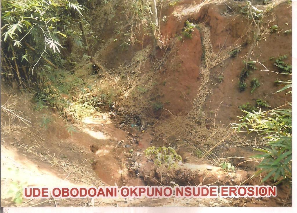
92 92


93 Annex 4: Attendance of Public Consultations at Nsude Health Centre, Enugu 93
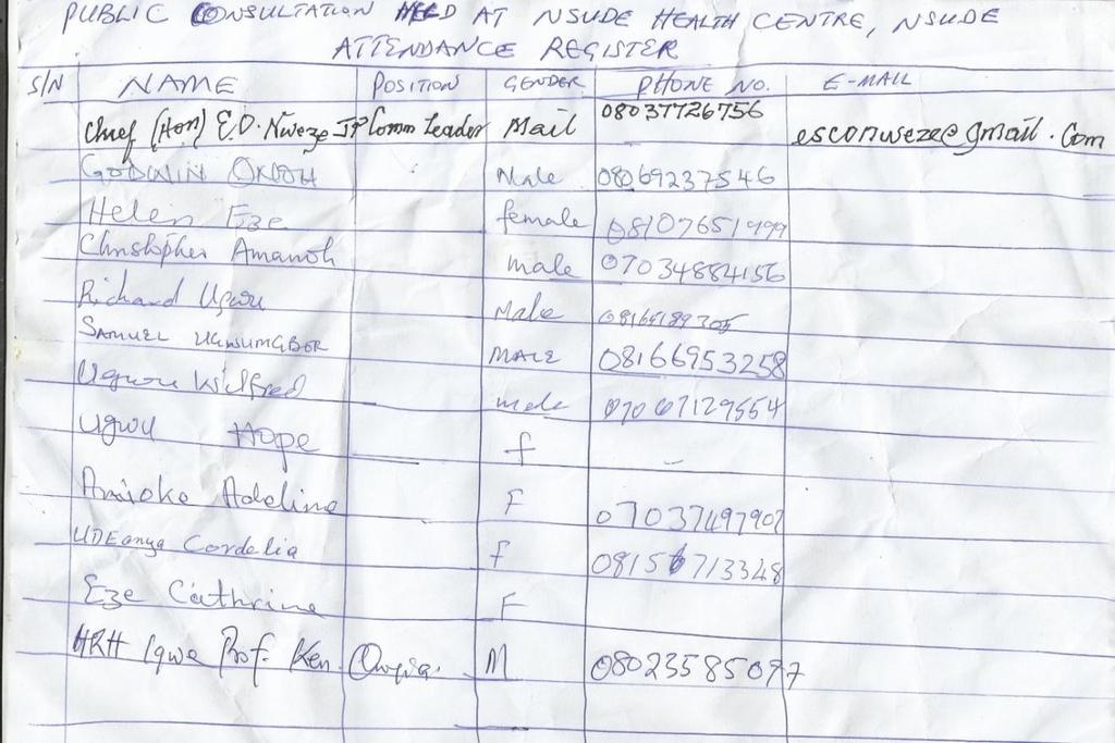
94 94

95 Annex 4 B: Stakeholders Public Consultation Forum for the Preparation of ESMP and RAP for the Ajalli Gully Erosion Site 95
RESETTLEMENT ACTION PLAN (RAP)
") Public Disclosure Authorized Public Disclosure Authorized Public Disclosure Authorized Public Disclosure Authorized RESETTLEMENT ACTION PLAN (RAP) ENUGU STATE NIGERIA EROSION AND WATERSHED MAGEMENT PROJECT
Public Disclosure Authorized Public Disclosure Authorized Public Disclosure Authorized Public Disclosure Authorized RESETTLEMENT ACTION PLAN (RAP) ENUGU STATE NIGERIA EROSION AND WATERSHED MAGEMENT PROJECT
A. Involuntary resettlement should be avoided where feasible, or minimized, exploring all viable alternative project designs. B.
 Module 8 - Involuntary Resettlement- Policy Principles & Requirements (World bank OP 4.12 and 4.12 Annex A) Key principles and objectives of an involuntary Resettlement Policy Resettlement planning instruments
Lao People s Democratic Republic Peace Independence Democracy Unity Prosperity. Prime Minister s Office Date: 7 July, 2005
 Lao People s Democratic Republic Peace Independence Democracy Unity Prosperity Prime Minister s Office No 192/PM Date: 7 July, 2005 DECREE on the Compensation and Resettlement of the Development Project
ASCO CONSULTING ENGINEERS PROJECT MANAGERS URBAN AND REGIONAL PLANNERS TRAINING
 Road Development Agency 1 5 6 2 3 4 RESETTLEMENT POLICY FRAMEWORK FINAL REPORT Consultancy Services for the Design and Preparation of Bidding Documents for a Countrywide Roll-out of the Output and Performance
Annex 2: Does the Xayaburi resettlement comply with Lao law?
 Annex 2: Does the Xayaburi resettlement comply with Lao law? The Xayaburi project s resettlement scheme has not complied with Lao laws and policies on involuntary resettlement and compensation. As the
SUMMARY EQUIVALENCE ASSESSMENT BY POLICY PRINCIPLE AND KEY ELEMENTS
 SUMMARY EQUIVALENCE ASSESSMENT BY POLICY PRINCIPLE AND KEY ELEMENTS ENVIRONMENTAL SAFEGUARDS Objectives To ensure the environmental soundness and sustainability of projects and to support the integration
The Resettlement Policy Framework for the Smallholder Agriculture Development Project. Papua New Guinea
 Public Disclosure Authorized Public Disclosure Authorized Public Disclosure Authorized Public Disclosure Authorized The Resettlement Policy Framework for the Smallholder Agriculture Development Project
FEDERAL REPUBLIC OF ETHIOPIAN MINISTRY OF MINES
 Public Disclosure Authorized Public Disclosure Authorized Public Disclosure Authorized Public Disclosure Authorized FEDERAL REPUBLIC OF ETHIOPIAN MINISTRY OF MINES Volume II: Resettlement Policy Framework
Guidance Note 5 Land Acquisition and Involuntary Resettlement
 This Guidance Note 5 corresponds to Performance Standard 5. Please also refer to the Performance Standards 1-4 and 6-8 as well as the corresponding Guidance Notes for additional information. Bibliographical
Involuntary Resettlement - Overview. Transport Forum Washington, D.C. March 30, 2007
 Involuntary Resettlement - Overview Transport Forum Washington, D.C. March 30, 2007 OP 4.12 - Triggers Trigger: acquisition of land which displaces people physically and / or economically. Policy applies
RESETTLEMENT ACTION PLAN (RAP)
") Public Disclosure Authorized Public Disclosure Authorized Public Disclosure Authorized Public Disclosure Authorized RESETTLEMENT ACTION PLAN (RAP) Final Report For IYIUZO IHIOMA OGBERURU GULLY EROSION
Public Disclosure Authorized Public Disclosure Authorized Public Disclosure Authorized Public Disclosure Authorized RESETTLEMENT ACTION PLAN (RAP) Final Report For IYIUZO IHIOMA OGBERURU GULLY EROSION
The. Nigeria Erosion and Watershed Management Project (NEWMAP) (WORLD BANK ASSISTED) ABIA STATE REPORT RESETTLEMENT ACTION PLAN.
 (WORLD BANK ASSISTED) ABIA STATE REPORT RESETTLEMENT ACTION PLAN.") Public Disclosure Authorized The Public Disclosure Authorized Nigeria Erosion and Watershed Management Project (NEWMAP) (WORLD BANK ASSISTED) Public Disclosure Authorized ABIA STATE REPORT Public Disclosure
Public Disclosure Authorized The Public Disclosure Authorized Nigeria Erosion and Watershed Management Project (NEWMAP) (WORLD BANK ASSISTED) Public Disclosure Authorized ABIA STATE REPORT Public Disclosure
THE WORLD BANK OPERATIONAL MANUAL OP 4.12 December Involuntary Resettlement. Policy Objectives
 Page 1 of 9 Involuntary Resettlement 1. Bank 1 experience indicates that involuntary resettlement under development projects, if unmitigated, often gives rise to severe economic, social, and environmental
EBRD Performance Requirement 5
 EBRD Performance Requirement 5 Land Acquisition, Involuntary Resettlement and Economic Displacement Introduction 1. Involuntary resettlement refers both to physical displacement (relocation or loss of
Indonesia: Enhanced Water Security Investment Project
 Initial Poverty and Social Analysis March 2018 Indonesia: Enhanced Water Security Investment Project This document is being disclosed to the public in accordance with ADB s Public Communications Policy
RESETTLEMENT FRAMEWORK. Supplementary Appendix to the Report and Recommendation of the President to the Board of Directors. on the
 RESETTLEMENT FRAMEWORK Supplementary Appendix to the Report and Recommendation of the President to the Board of Directors on the Secondary Education Modernization Project II in Sri Lanka Ministry of Education
RP297. Resettlement and Rehabilitation (R&R) Entitlement Framework
 Entitlement Framework") Public Disclosure Authorized Public Disclosure Authorized Public Disclosure Authorized Public Disclosure Authorized FINAL REPORT Resettlement and Rehabilitation (R&R) Entitlement Framework RP297 Under
Public Disclosure Authorized Public Disclosure Authorized Public Disclosure Authorized Public Disclosure Authorized FINAL REPORT Resettlement and Rehabilitation (R&R) Entitlement Framework RP297 Under
THE WORLD BANK OPERATIONAL MANUAL. Indigenous Peoples
 THE WORLD BANK OPERATIONAL MANUAL Indigenous Peoples (Draft OP 4.10, March 09, 2000) INTRODUCTION. 1. The Bank's policy 1 towards indigenous peoples contributes to its wider objectives of poverty reduction
SECOND DRAFT FOR CONSULTATION JULY Environmental and Social Standard 5 Land Acquisition, Restrictions on Land Use and Involuntary Resettlement
 This document should be read in conjunction with the proposed World Bank Policy to understand the proposed responsibilities of the World Bank (in the Policy) and the Borrowing Country (in the Standards).
ASIAN DEVELOPMENT BANK
 ASIAN DEVELOPMENT BANK TAR: VIE 34055 TECHNICAL ASSISTANCE TO THE SOCIALIST REPUBLIC OF VIET NAM FOR ENHANCING THE RESETTLEMENT LEGAL FRAMEWORK AND INSTITUTIONAL CAPACITY September 2001 CURRENCY EQUIVALENTS
FEDERAL GOVERNMENT OF NIGERIA
 Public Disclosure Authorized Public Disclosure Authorized Public Disclosure Authorized Public Disclosure Authorized FEDERAL GOVERNMENT OF NIGERIA FEDERAL MINISTRY OF WATER RESOURCES Third National Urban
FRAMEWORK FOR LAND ACQUISTION AND INVOLUNTARY RESETTLEMENT AND THE ASIAN DEVELOPMENT BANK SAFEGUARD FOR INVOLUNTARY RESETTLMENT
 DRAFT COMPARATIVE ANALYSIS OF NEPAL s LEGAL FRAMEWORK FOR LAND ACQUISTION AND INVOLUNTARY RESETTLEMENT AND THE ASIAN DEVELOPMENT BANK SAFEGUARD FOR INVOLUNTARY RESETTLMENT Note: The following is based
RESETTLEMENT POLICY FRAMEWORK. NATURAL GAS CONNECTION PROJECT IN 11 GOVERNORATES IN EGYPT (March 2014)
") Public Disclosure Authorized Public Disclosure Authorized Public Disclosure Authorized Public Disclosure Authorized Submitted to : Egyptian Natural Gas Holding Company Prepared by: EcoConServ Environmental
Public Disclosure Authorized Public Disclosure Authorized Public Disclosure Authorized Public Disclosure Authorized Submitted to : Egyptian Natural Gas Holding Company Prepared by: EcoConServ Environmental
MINISTRY OF COMMERCE, TRADE AND INDUSTRY
 Public Disclosure Authorized Public Disclosure Authorized Public Disclosure Authorized Public Disclosure Authorized Republic of Zambia SFG2542 MINISTRY OF COMMERCE, TRADE AND INDUSTRY Project ID: No. P156492
Gender Equality and Development
 Overview Gender Equality and Development Welcome to Topic 3 of the e-module on Gender and Energy. We have already discussed how increased access to electricity improves men s and women s lives. Topic Three
isimangaliso Resettlement Policy Framework and Process Framework April 2009
 Public Disclosure Authorized Public Disclosure Authorized Public Disclosure Authorized Public Disclosure Authorized isimangaliso Resettlement Policy Framework and Process Framework April 2009 Resettlement
RESETTLEMENT ACTION PLAN (RAP)
") TERMS OF REFERENCE SFG1801 RESETTLEMENT ACTION PLAN (RAP) FOR SAVING OF GIZA NORTH PROJECTS Public Disclosure Authorized Public Disclosure Authorized Public Disclosure Authorized Public Disclosure Authorized
TERMS OF REFERENCE SFG1801 RESETTLEMENT ACTION PLAN (RAP) FOR SAVING OF GIZA NORTH PROJECTS Public Disclosure Authorized Public Disclosure Authorized Public Disclosure Authorized Public Disclosure Authorized
Bangladesh: Urban Public and Environmental Health Sector Development Program
 Resettlement Planning Document Draft Resettlement Framework Document Stage: Draft for Consultation Project Number: 39305 May 2009 Bangladesh: Urban Public and Environmental Health Sector Development Program
SUMMARY RESETTLEMENT PLAN OF WATER SUPPLY AND SOLID WASTE MANAGEMENT TRANCHE-2 SUB PROJECT OF GANGTOK UNDER ADB ASSISTED NERCCDIP PROJECT
 SUMMARY RESETTLEMENT PLAN OF WATER SUPPLY AND SOLID WASTE MANAGEMENT TRANCHE-2 SUB PROJECT OF GANGTOK UNDER ADB ASSISTED NERCCDIP PROJECT A. Introduction and Subprojects Components 1. Tranche 2 of the
Tenke Fungurume Mining An affiliate of Freeport-McMoRan Copper & Gold
 Tenke Fungurume Mining An affiliate of Freeport-McMoRan Copper & Gold Tenke Fungurume Mining (TFM), an affiliate of Freeport-McMoRan Copper & Gold, is the largest private foreign investment in the DRC,
Government of the Republic of Malawi MINISTRY OF FINANCE. Malawi Social Action Fund MASAF 4- Strengthening Safety Net Systems in Malawi
 Public Disclosure Authorized Public Disclosure Authorized Public Disclosure Authorized Public Disclosure Authorized Government of the Republic of Malawi MINISTRY OF FINANCE Malawi Social Action Fund MASAF
Resettlement Policy Framework
 Urban Transport Improvement Project of Tianjin by Using the World Bank Loan Resettlement Policy Framework Public Disclosure Authorized Public Disclosure Authorized Public Disclosure Authorized Public Disclosure
2. PLAN ADMINISTRATION
 2. PLAN ADMINISTRATION 2.1 SECTION INTRODUCTION 2.1.1 This section gives an overview of District Plan administration. It discusses the sections of the Act that directly relate to the planning and resource
VOLUME 4 CHAPTER 1 PROJECT DESCRIPTION
 VOLUME 4 CHAPTER 1 PROJECT DESCRIPTION Table of Content Volume 4 Chapter 1: Project Description 1 PROJECT DESCRIPTION...1 1.1 THE NT2 PROJECT...1 1.2 THE NEED FOR RESETTLEMENT AND DEVELOPMENT...1 1.3 THE
EG-Giza North Power Project (P116194)
") Public Disclosure Authorized The Egyptian Natural Gas Company SFG1796 Public Disclosure Authorized Public Disclosure Authorized EG-Giza North Power Project (P116194) Utilization of Project Savings for
Public Disclosure Authorized The Egyptian Natural Gas Company SFG1796 Public Disclosure Authorized Public Disclosure Authorized EG-Giza North Power Project (P116194) Utilization of Project Savings for
FILE COPY. RP222 February Water Supply and Sanitation Project. Resettlement Policy Framework. Final. The World Bank
 Public Disclosure Authorized Public Disclosure Authorized Public Disclosure Authorized Public Disclosure Authorized Federal Democratic Republic of Ethiopia Ministry of Water Resources Prepared for: Prepared
RP622 FEDERAL GOVERNMENT OF NIGERIA. Federal Ministry of Agriculture and Water Resources (FMAWR)
") Public Disclosure Authorized Public Disclosure Authorized Public Disclosure Authorized Public Disclosure Authorized CADP Resettlement Policy Framework (RPF) Draft Final Report RP622 FEDERAL GOVERNMENT
Public Disclosure Authorized Public Disclosure Authorized Public Disclosure Authorized Public Disclosure Authorized CADP Resettlement Policy Framework (RPF) Draft Final Report RP622 FEDERAL GOVERNMENT
Social Management Policy Framework
 Appendix 1-2 SFG1851 GEF Mainstreaming Integrated Water and Environment Management Project Social Management Policy Framework (Amended) Public Disclosure Authorized Public Disclosure Authorized Public
The Republic of Sakha (Yakutia) of the. Russian Federation. Innovative Development of Preschool Education in the Republic of Sakha (Yakutia)
 of the. Russian Federation. Innovative Development of Preschool Education in the Republic of Sakha (Yakutia)") Public Disclosure Authorized Public Disclosure Authorized Public Disclosure Authorized Public Disclosure Authorized The Republic of Sakha (Yakutia) of the Russian Federation Innovative Development of Preschool
Public Disclosure Authorized Public Disclosure Authorized Public Disclosure Authorized Public Disclosure Authorized The Republic of Sakha (Yakutia) of the Russian Federation Innovative Development of Preschool
Performance Standard 5 Land Acquisition and Involuntary Resettlement
 Introduction Performance Standard 5 1. Involuntary resettlement refers both to physical displacement (relocation or loss of shelter) and to economic displacement (loss of assets or access to assets that
PROJECT INFORMATION DOCUMENT (PID) ADDITIONAL FINANCING Report No.: PIDA Project Name Parent Project Name. Region Country Sector(s) Theme(s)
 ADDITIONAL FINANCING Report No.: PIDA Project Name Parent Project Name. Region Country Sector(s) Theme(s)") Public Disclosure Authorized Public Disclosure Authorized Public Disclosure Authorized Public Disclosure Authorized Project Name Parent Project Name Region Country Sector(s) Theme(s) Lending Instrument
Public Disclosure Authorized Public Disclosure Authorized Public Disclosure Authorized Public Disclosure Authorized Project Name Parent Project Name Region Country Sector(s) Theme(s) Lending Instrument
RESTRUCTURING PAPER ON A PROPOSED PROJECT RESTRUCTURING ZIMBABWE NATIONAL WATER PROJECT APPROVED ON JANUARY 29, 2016 REPUBLIC OF ZIMBABWE
 Public Disclosure Authorized The World Bank REPORT NO.: RES30298 Public Disclosure Authorized RESTRUCTURING PAPER ON A PROPOSED PROJECT RESTRUCTURING OF ZIMBABWE NATIONAL WATER PROJECT APPROVED ON JANUARY
Table of Contents. Executive Summary...1
 Table of Contents Executive Summary...1 1.0 Introduction...2 2.0 Strategic Environmental Assessment Methodology...3 2.1 Reference Databases... 3 2.2 Regulatory Framework... 3 2.3 SEA Methodology... 3 3.0
World Bank-financed Gansu Revitalization and Innovation Project Resettlement Policy Framework (RPF)
") World Bank-financed Project World Bank-financed Gansu Revitalization and Innovation Project Resettlement Policy Framework (RPF) Public Disclosure Authorized Public Disclosure Authorized Public Disclosure
World Bank-financed Project World Bank-financed Gansu Revitalization and Innovation Project Resettlement Policy Framework (RPF) Public Disclosure Authorized Public Disclosure Authorized Public Disclosure
H 7904 SUBSTITUTE A ======== LC005025/SUB A ======== S T A T E O F R H O D E I S L A N D
 01 -- H 0 SUBSTITUTE A LC000/SUB A S T A T E O F R H O D E I S L A N D IN GENERAL ASSEMBLY JANUARY SESSION, A.D. 01 A N A C T RELATING TO STATE AFFAIRS AND GOVERNMENT - CLIMATE CHANGE - RESILIENT RHODE
RESETTLEMENT POLICY FRAMEWORK (RPF) ZAMBIA RENEWABLE ENERGY FINANCING FRAMEWORK
 ZAMBIA RENEWABLE ENERGY FINANCING FRAMEWORK") RESETTLEMENT POLICY FRAMEWORK (RPF) ZAMBIA RENEWABLE ENERGY FINANCING FRAMEWORK i TABLE OF CONTENTS LIST OF ACRONYMS AND ABBREVIATIONS... iv DEFINITIONS... v 1.0 INTRODUCTION... 1 1.1 Background... 1 1.2
RESETTLEMENT POLICY FRAMEWORK (RPF) ZAMBIA RENEWABLE ENERGY FINANCING FRAMEWORK i TABLE OF CONTENTS LIST OF ACRONYMS AND ABBREVIATIONS... iv DEFINITIONS... v 1.0 INTRODUCTION... 1 1.1 Background... 1 1.2
Managing Social Risks and Impacts in Geothermal Projects Turkey Geothermal Development Project
 BURCU ERGIN SOCIAL SAFEGUARDS SPECIALIST WORLD BANK RSM LAUNCH WORKSHOP IZMIR, 5 JULY 2018 Managing Social Risks and Impacts in Geothermal Projects Turkey Geothermal Development Project Why is it critical
Ethiopia : the Gilgel Gibe Resettlement Project
 No. 141 August 1999 Findings occasionally reports on development initiatives not assisted by the World Bank. This article is one such effort. The views expressed here do not necessarily reflect the views
Guidance Note UNDP Social and Environmental Standards. Standard 5: Displacement and Resettlement
 Guidance Note UNDP Social and Environmental Standards Standard 5: Displacement and Resettlement December 2016 UNDP Guidance Notes on the Social and Environmental Standards (SES) This Guidance Note is part
Ministry of Energy and Mining. Development Bank of Jamaica. Energy Security and Efficiency Enhancement Project
 Public Disclosure Authorized Public Disclosure Authorized Public Disclosure Authorized Public Disclosure Authorized Ministry of Energy and Mining Development Bank of Jamaica FINAL (JANUARY 21, 2011) Energy
SRI: Local Government Enhancement Project
 Draft Resettlement Framework July 2011 SRI: Local Government Enhancement Project Prepared by the Ministry of Local Government and Provincial Councils for the Asian Development Bank. CURRENCY EQUIVALENTS
Summer School November Beng Hong Socheat Khemro Ph.D. (UCL, London, England, UK)
") Housing Policy and Circular No. 3 on Squatter Settlement Resolution Summer School 12-13 November 2014 Beng Hong Socheat Khemro Ph.D. (UCL, London, England, UK) bhskhemro@yahoo.com Content Housing Policy
Housing Policy and Circular No. 3 on Squatter Settlement Resolution Summer School 12-13 November 2014 Beng Hong Socheat Khemro Ph.D. (UCL, London, England, UK) bhskhemro@yahoo.com Content Housing Policy
FAO MIGRATION FRAMEWORK IN BRIEF
 FAO MIGRATION FRAMEWORK IN BRIEF MIGRATION AS A CHOICE AND AN OPPORTUNITY FOR RURAL DEVELOPMENT Migration can be an engine of economic growth and innovation, and it can greatly contribute to sustainable
UNITED NATIONS CONVENTION TO COMBAT DESERTIFICATION IN THOSE COUNTRIES EXPERIENCING SERIOUS DROUGHT AND/OR DESERTIFICATION, PARTICULARLY IN AFRICA
 UNITED NATIONS CONVENTION TO COMBAT DESERTIFICATION IN THOSE COUNTRIES EXPERIENCING SERIOUS DROUGHT AND/OR DESERTIFICATION, PARTICULARLY IN AFRICA The Parties to this Convention, Affirming that human beings
Ethnic Minorities Development Framework. PRC: Guiyang Integrated Water Resources Management Sector Project
 Ethnic Minorities Development Framework Ethnic Minorities Development Framework Document Stage: Draft Project Number: P38594 September 2006 PRC: Guiyang Integrated Water Resources Management Sector Project
FEDERAL MINISTRY OF FINANCE PROJECT COORDINATING UNIT Business District Area, Ahmadu Bello Way, Abuja, Nigeria
 Public Disclosure Authorized Public Disclosure Authorized Public Disclosure Authorized Public Disclosure Authorized Resettlement Policy Framework (RPF) RP1375 (FINAL) FOR YOUTH EMPLOYMENT AND SOCIAL SUPPORT
THE WORLD BANK INSPECTION PANEL S EARLY SOLUTIONS PILOT APPROACH: THE CASE OF BADIA EAST, NIGERIA
 THE WORLD BANK INSPECTION PANEL S EARLY SOLUTIONS PILOT APPROACH: THE CASE OF BADIA EAST, NIGERIA In July 2014 the World Bank Inspection Panel, the Bank s complaints mechanism for people who believe that
COVER NOTE Tanzania Energy Development and Access Project (TEDAP) Safeguard Documents
 Safeguard Documents") Public Disclosure Authorized Public Disclosure Authorized Public Disclosure Authorized Public Disclosure Authorized 7+(81,7('5(38%/,&2)7$1=$1,$ COVER NOTE Tanzania Energy Development and Access Project
Public Disclosure Authorized Public Disclosure Authorized Public Disclosure Authorized Public Disclosure Authorized 7+(81,7('5(38%/,&2)7$1=$1,$ COVER NOTE Tanzania Energy Development and Access Project
VIET NAM: MEDIUM CITES DEVELOPMENT PROJECT (MCDP) PHU LY CITY SUBPROJECT HA NAM PROVINCE. (Final Draft)
 PHU LY CITY SUBPROJECT HA NAM PROVINCE. (Final Draft)") Public Disclosure Authorized VIET NAM: MEDIUM CITES DEVELOPMENT PROJECT (MCDP) PHU LY CITY SUBPROJECT HA NAM PROVINCE COMPENSATION, ASSISTANCE AND RESETTLEMENT POLICY FRAMEWORK (Final Draft) Table of Contents
Public Disclosure Authorized VIET NAM: MEDIUM CITES DEVELOPMENT PROJECT (MCDP) PHU LY CITY SUBPROJECT HA NAM PROVINCE COMPENSATION, ASSISTANCE AND RESETTLEMENT POLICY FRAMEWORK (Final Draft) Table of Contents
Country programme for Thailand ( )
") Country programme for Thailand (2012-2016) Contents Page I. Situation analysis 2 II. Past cooperation and lessons learned.. 2 III. Proposed programme.. 3 IV. Programme management, monitoring and evaluation....
Country programme for Thailand (2012-2016) Contents Page I. Situation analysis 2 II. Past cooperation and lessons learned.. 2 III. Proposed programme.. 3 IV. Programme management, monitoring and evaluation....
VIE: Comprehensive Socioeconomic Urban Development Project Viet Tri, Hung Yen, and Dong Dang (Dong Dang)
") Resettlement Plan August 2011 VIE: Comprehensive Socioeconomic Urban Development Project Viet Tri, Hung Yen, and Dong Dang (Dong Dang) Prepared by the Lang Son Provincial People s Committee for the Asian
Resettlement Plan August 2011 VIE: Comprehensive Socioeconomic Urban Development Project Viet Tri, Hung Yen, and Dong Dang (Dong Dang) Prepared by the Lang Son Provincial People s Committee for the Asian
Technical Assistance Consultant s Report. TA 7566-REG: Strengthening and Use of Country Safeguard Systems
 Technical Assistance Consultant s Report Project Number: 44140 Date: April 2013 TA 7566-REG: Strengthening and Use of Country Safeguard Systems Subproject: Strengthening Involuntary Resettlement Safeguard
Resettlement and Income Restoration in Thilawa SEZ
 Resettlement and Income Restoration in Thilawa SEZ Lessons from the first & second phases and emerging good practices Thilawa SEZ Management Committee (TSMC) Yangon Region Government (YRG) 20 February
MINISTRY OF FINANCE CLIMATE CHANGE SECRETARIAT RESETTLEMENT POLICY FRAMEWORK
 SFG1934 REV MINISTRY OF FINANCE CLIMATE CHANGE SECRETARIAT RESETTLEMENT POLICY FRAMEWORK Great Lakes Region: Displaced Persons and Border Communities Project - Zambia Component (P152821) March 2016 i EXECUTIVE
Environmental and Social Management Framework
 Public Disclosure Authorized Public Disclosure Authorized Public Disclosure Authorized Public Disclosure Authorized Pacific Aviation Investment Program Environmental and Social Management Framework Technical
PROJECT INFORMATION DOCUMENT (PID) CONCEPT STAGE Report No.: AB4547 Project Name
 CONCEPT STAGE Report No.: AB4547 Project Name") PROJECT INFORMATION DOCUMENT (PID) CONCEPT STAGE Report.: AB4547 Project Name Kenya Slum Upgrading Program Region AFRICA Sector General water, sanitation and flood protection (40%); general transportation
PROJECT INFORMATION DOCUMENT (PID) CONCEPT STAGE Report.: AB4547 Project Name Kenya Slum Upgrading Program Region AFRICA Sector General water, sanitation and flood protection (40%); general transportation
Involuntary Resettlement Due Diligence Report
 Involuntary Resettlement Due Diligence Report # Report May 2016 VIE: Second Lower Secondary Education for the Most Disadvantaged Areas Project (LSEMDAP2) Quang Binh Province Prepared by the Ministry of
Subproject: Hai Lang Province: Quang Tri
 Public Disclosure Authorized Public Disclosure Authorized Public Disclosure Authorized Public Disclosure Authorized RP299 vol. 4 Ministry of Agriculture and Rural Development The World Bank Natural Disaster
Indigenous Peoples Development Planning Document. IND: Assam Integrated Flood and Riverbank Erosion Risk Management Investment Program
 Indigenous Peoples Development Planning Document Indigenous Peoples Development Framework Document Stage: Draft for Consultation Project Number: 38412 June 2009 IND: Assam Integrated Flood and Riverbank
GUIDELINE 8: Build capacity and learn lessons for emergency response and post-crisis action
 GUIDELINE 8: Build capacity and learn lessons for emergency response and post-crisis action Limited resources, funding, and technical skills can all affect the robustness of emergency and post-crisis responses.
BANQUE AFRICAINE DE DEVELOPPEMENT
 BANQUE AFRICAINE DE DEVELOPPEMENT Publication autorisée Publication autorisée KENYA: PROPOSAL FOR AN EMERGENCY HUMANITARIAN ASSISTANCE TO POPULATION AFFECTED BY DROUGHT AND FAMINE* LIST OF ACRONYMS AND
TRANSPORT ECONOMICS, POLICY AND POVERTY THEMATIC GROUP
 Public Disclosure Authorized Public Disclosure Authorized Public Disclosure Authorized Public Disclosure Authorized TRANSPORT NOTES TRANSPORT ECONOMICS, POLICY AND POVERTY THEMATIC GROUP THE WORLD BANK,
Involuntary Resettlement Safeguards. A Planning and Implementation Good Practice Sourcebook Draft Working Document
 Involuntary Resettlement Safeguards A Planning and Implementation Good Practice Sourcebook Draft Working Document November 2012 This working document was prepared by staff of Asian Development Bank. It
SFG3481 V1 REPUBLIC OF RWANDA. Final Report
 Public Disclosure Authorized REPUBLIC OF RWANDA SFG3481 V1 Public Disclosure Authorized LOCAL ADMINISTRATIVE ENTITIES DEVELOPMENT AGENCY (LODA) IKIGO GISHINZWE GUTEZA IMBERE IBIKORWA BY ITERAMBERE MU NZEGO
SRI: Local Government Enhancement Project
 Appendix 13 Resettlement Framework Dec 2011 SRI: Local Government Enhancement Project CURRENCY EQUIVALENTS (as of 27 June 2011) Currency Unit = Sri Lankan Rupee/s (SLR/Rs) Rs1.00 = $0.0091 $1.0 = Rs 109.8700
RESETTLEMENT ACTION PLAN
 Public Disclosure Authorized Public Disclosure Authorized PEOPLE S COMMITTEE OF PHU YEN PROVINCE PHU YEN PROJECT MANAGEMENT UNIT OF CONSTRUCTION INVESTMENT WORKS FOR AGRICULTURE AND RURAL DEVELOPMENT ----------------o0oo---------------
PROJECT INFORMATION DOCUMENT (PID) APPRAISAL STAGE. Sri Lanka: Puttalam Housing Project
 APPRAISAL STAGE. Sri Lanka: Puttalam Housing Project") Project Name Region Sector Project ID Borrower(s) Implementing Agency PROJECT INFORMATION DOCUMENT (PID) APPRAISAL STAGE Sri Lanka: Puttalam Housing Project Report No.: AB2595 SOUTH ASIA Housing Reconstruction
Project Name Region Sector Project ID Borrower(s) Implementing Agency PROJECT INFORMATION DOCUMENT (PID) APPRAISAL STAGE Sri Lanka: Puttalam Housing Project Report No.: AB2595 SOUTH ASIA Housing Reconstruction
Resettlement Policy Framework
 SFG3184 Public Disclosure Authorized GOVERNMENT OF TAMIL NADU PUBLIC WORKS DEPARTMENT WATER RESOURCES ORGANISATION Environmental & Social Assessment and Preparation of Environmental & Social Management
Resettlement Policy Framework
 Public Disclosure Authorized The World Bank SFG3873 REV Public Disclosure Authorized Hezhou Urban Water Infrastructure and Environment Improvement Project Public Disclosure Authorized Resettlement Policy
CENTER STAGING GRASSROOTS WOMEN S LEADERSHIP IN SECURING SUSTAINABLE, INCLUSIVE URBANIZATION
 CENTER STAGING GRASSROOTS WOMEN S LEADERSHIP IN SECURING SUSTAINABLE, INCLUSIVE URBANIZATION THE HUAIROU COMMISSION NETWORK: TWO DECADES OF CONTRIBUTIONS TO POLICY- MAKING AND DEVELOPMENT INITIATIVES TO
FOR IYIOKWU-INTERNATIONAL MARKET FLOOD INTERVENTION SITE IN ABAKALIKI L.G.A OF EBONYI STATE
 RESETTLEMENT ACTION PLAN (RAP) FINAL REPORT FOR Public Disclosure Authorized SFG1691 V8 IYIOKWU-INTERNATIONAL MARKET FLOOD INTERVENTION SITE IN ABAKALIKI L.G.A OF EBONYI STATE Public Disclosure Authorized
The World Bank FOR OFFICIAL USE ONLY
 Public Disclosure Authorized Public Disclosure Authorized Public Disclosure Authorized Public Disclosure Authorized Document of The World Bank FOR OFFICIAL USE ONLY RESTRUCTURING PAPER ON A PROPOSED PROJECT
RESETTLEMENT FRAMEWORK HA TINH, QUANG NAM, QUANG NGAI, QUANG TRI, THANH HOA, THUA THIEN HUE
 RESETTLEMENT FRAMEWORK HA TINH, QUANG NAM, QUANG NGAI, QUANG TRI, THANH HOA, THUA THIEN HUE Supplementary Appendix to the Report and Recommendation of the President to the Board of Directors on the CENTRAL
RESETTLEMENT ACTION PLAN (RAP) FINAL REPORT
 FINAL REPORT") SFG1691 V4 GOVERNMENT OF ANAMBRA STATE, NIGERIA ANAMBRA STATE NIGERIA EROSION AND WATERSHED MANAGEMENT PROJECT (NEWMAP) RESETTLEMENT ACTION PLAN (RAP) FOR: UMUDUNU ABAGANA GULLY EROSION PROJECT ABAGANA,
SFG1691 V4 GOVERNMENT OF ANAMBRA STATE, NIGERIA ANAMBRA STATE NIGERIA EROSION AND WATERSHED MANAGEMENT PROJECT (NEWMAP) RESETTLEMENT ACTION PLAN (RAP) FOR: UMUDUNU ABAGANA GULLY EROSION PROJECT ABAGANA,
Involuntary Resettlement Due Diligence Report
 Involuntary Resettlement Due Diligence Report # Report May 2016 VIE: Second Lower Secondary Education for the Most Disadvantaged Areas Project (LSEMDAP2) Binh Thuan Province Prepared by the Ministry of
Hamilton City Council BYLAWS HAMILTON STORMWATER BYLAW 2015
 Approved By: Hamilton City Council Date Adopted : 28 May 2015 Date In Force: 28 September 2015 Clause 7.1(e) - 12 months from enforcement date Clause7.1(f) 6 months from enforcement date Review Date: To
RESETTLEMENT ACTION PLAN
 RESETTLEMENT ACTION PLAN SHALA NEIGHBOURHOOD HADE PROJECT KOSOVO Prepared for: Kosovo Energy Corporation Prepared by: Project Hade Office, Ministry of Environment and Spatial Planning replan Inc. 2011
Involuntary Resettlement Due Diligence Report
 Involuntary Resettlement Due Diligence Report # Report May 2016 VIE: Second Lower Secondary Education for the Most Disadvantaged Areas Project (LSEMDAP2) Nghe An Province Prepared by the Ministry of Education
Resettlement Policy Framework
 Public Disclosure Authorized Public Disclosure Authorized Public Disclosure Authorized Public Disclosure Authorized Republic of Tajikistan Ministry of Transport Central Asia Road Links Project Republic
DRAFT RESETTLEMENT POLICY FRAMEWORK. Public Disclosure Authorized. Public Disclosure Authorized. Public Disclosure Authorized
 Public Disclosure Authorized Public Disclosure Authorized Public Disclosure Authorized Public Disclosure Authorized Ministry of Finance P 0 Box 30049 DRAFT RESETTLEMENT POLICY FRAMEWORK... -3ey* b4 -I
Lake Turkana Wind Power Project - Kenya Resettlement Policy Framework
 Public Disclosure Authorized Public Disclosure Authorized Public Disclosure Authorized Public Disclosure Authorized Lake Turkana Wind Power Project - Kenya Resettlement Policy Framework November 2011 Prepared
Resettlement Action Plan Update for the Rehabilitation and Upgrading of Bukoba Airport
 Public Disclosure Authorized UNITED REPUBLIC OF TANZANIA SFG2612 Public Disclosure Authorized MINISTRY OF WORKS, TRANSPORT AND COMMUNICATION TANZANIA AIRPORTS AUTHORITY Public Disclosure Authorized Resettlement
Framework Resettlement Action Plan
 Nimba Western Range Iron Ore Project, Liberia Environmental and Social Studies, 2008-2015 Project Phase 2: Concentrator Environmental and Social Impact Assessment Volume 6, Part 1: Framework Resettlement
TREATY SERIES 1997 Nº 13
 TREATY SERIES 1997 Nº 13 United Nations Convention to Combat Desertification in Countries Experiencing Serious Drought and/or Desertification, Particularly in Africa Done at Paris on 14 October 1994 Signed
Draft Resettlement Policy Framework
 Republic of Tajikistan Ministry of Transport Central Asia Road Links Project Republic of Tajikistan Draft Resettlement Policy Framework Date: July 5, 2014 Draft Resettlement Policy Framework for Central
TERMS OF REFERENCE. Overview:
 TERMS OF REFERENCE Position Title: Research Consultant Duty Station: Kathmandu, Nepal international travel and field visits as required Type of Appointment: Consultancy, 15 months part time Estimated start
RESETTLEMENT ACTION PLAN SHALA NEIGHBOURHOOD HADE PROJECT KOSOVO MONITORING REPORT 1
 RESETTLEMENT ACTION PLAN SHALA NEIGHBOURHOOD HADE PROJECT KOSOVO MONITORING REPORT 1 Prepared for: CLRP-AF Project Monitoring Unit, Ministry of Environment and Spatial Planning Prepared by: replan Inc.
2622-BAN: Natural Gas Access Improvement Project, Part B: Safety and Supply Efficiency Improvement in Titas Gas Field
 Draft Safeguards Monitoring Report Project No. 38164-013 Draft Semi Annual Report December 2015 2622-BAN: Natural Gas Access Improvement Project, Part B: Safety and Supply Efficiency Improvement in Titas
Work plan of Independent Agency and Implementation of IFC Performance Standards. Green Goal Ltd., 17 February 2014
 Work plan of Independent Agency and Implementation of IFC Performance Standards Green Goal Ltd., 17 February 2014 Content IFC performance standards Legal grounds of Cambodia Resettlement planning process
Involuntary Resettlement Due Diligence Report
 Involuntary Resettlement Due Diligence Report # Report May 2016 VIE: Second Lower Secondary Education for the Most Disadvantaged Areas Project (LSEMDAP2) Soc Trang Province Prepared by the Ministry of