Contesting Knowledge of Land Access Claims in Jambi, Indonesia
|
|
|
- Paulina Gallagher
- 6 years ago
- Views:
Transcription

1
2 ii
3 Contesting Knowledge of Land Access Claims in Jambi, Indonesia Dissertation zur Erlangung des mathematisch-naturwissenschaftlichen Doktorgrades "Doctor rerum naturalium" der Georg-August-Universität Göttingen im Promotionsprogramm Geowissenschaften / Geographie der Georg-August University School of Science (GAUSS) vorgelegt von Rina Mardiana Aus Bandung, Indonesien Göttingen 2017
4 Betreuungsausschuss: Prof. Dr. Heiko Faust Georg-August-Universität Göttingen, Fakultät für Geowissenschaften und Geographie, Geographisches Institut, Abteilung Humangeographie Prof. Dr. Christoph Dittrich Georg-August-Universität Göttingen, Fakultät für Geowissenschaften und Geographie, Geographisches Institut, Abteilung Humangeographie Mitglieder der Prüfungskommission Referent: Prof. Dr. Heiko Faust, Georg-August-Universität Göttingen, Fakultät für Geowissenschaften und Geographie, Geographisches Institut, Abteilung Humangeographie Korreferent: Prof. Dr. Christoph Dittrich, Georg-August-Universität Göttingen, Fakultät für Geowissenschaften und Geographie, Geographisches Institut, Abteilung Humangeographie Weitere Mitglieder der Prüfungskommission Prof. Dr. Endriatmo Soetarto Bogor Agricultural University, the Faculty of Human Ecology, Department of Communication and Community Development Sciences Prof. Dr. Daniela Sauer Georg-August-Universität Göttingen, Abteilung Physische Geographie Dr. Soeryo Adiwibowo Bogor Agricultural University, the Faculty of Human Ecology, Department of Communication and Community Development Sciences Dr. Stefanie Steinebach Georg-August-Universität Göttingen, Centre of Biodiversity and Sustainable Land Use Tag der mündlichen Prüfung: Montag, ii
5 Abstract Land constitutes productive space, as well as a commodity. For this reason, land has become a contestation arena for various interested actors of all scales. The strategists of knowledge construct a wide variety of knowledge frameworks relating to land access claims. This research identifies particular forms of knowledge on land access and examines how knowledge of land access claims is contested. This research will contribute to the debates on knowledge of land access, which have been shaped by historical contexts, political and economic interests, as well as access relations; while land has been contested in the name of livelihoods, economic growth, and power. This research used the multi-sited ethnography approach by following the actors, events, policies and stories within the dimensions of space and time. This research was conducted in the former Asialog forestry concession; specifically, in two places: Bungku Village in Batanghari District and Tanjung Lebar Village in Muaro Jambi District. I have used the term community to specify geographical and population units in my research location. The communities covered were Bungku Indah, Johor Baru, SAD 113, Ujung Aspal, Rantau Rasau, Kunangan Jaya 1, Kunangan Jaya 2, Tanjung Lebar, Portal, Pangkalan Ranjau, Pinang Merah, Alam Sakti, Tanjung Mandiri, Sei Jerat and Ulu Badak. In other words, I researched and analyzed all communities existing in southern Jambi to ensure a holistic, whole and complete coverage of the formation process of the Bungku and Tanjung Lebar villages. Throughout , I interviewed a total of 187 community scale actors. I also carried out repeated structured interviews of 170 academics and scientists, government bureaucrats, and representatives of NGOs/mass organizations. In general, I conclude that knowledge constructions relating to land access claims can be classified into four categories: development knowledge, open access regime knowledge, adat land knowledge, and agrarian reform knowledge. Knowledge of access claims to land is meant to result in the establishment of territories of various scales. Development knowledge from the state will result in the form of state territorialization of various kinds, such as concession territories and conservation/restoration territories. Whereas other knowledge can be utilized to form local territories that are constructed by communities accessing land. This formation of territories is dynamic, and determined by knowledge and access relation dynamics. Finally, the answer to the question of who will come out as the most powerful party in defending territorial claims, whether for forest territorialization or village territorialization, is very dependent on the knowledge being employed by the access relation actors Contesting Knowledge of Land Access Claims in Jambi, Indonesia iii
6 . iv
7 Table of Contents Abstract... iii Table of Contents...v List of Figures... vii List of Tables... viii List of Appendices... viii Acknowledgements... ix Map of Research Location... xi CHAPTER 1- Introduction Background Theoretical Consideration The Strategists of Knowledge Access Relations Knowledge Contestation A Note on Methods The Dissertation Chapters in Brief...17 CHAPTER 2 - Jambi Context The Ecology of Jambi and Batanghari River Territory and Authority Expansion Commodities Ethnic Heterogeneity, Agrarian Matters and Demography...32 CHAPTER 3 - Reformation and the Culmination of Open Access Regime: Power and Authority Formation Endless Concessions in Southern Jambi PT Asialog Forest Concession Land Cultivation Rights Palm Oil Industrial Timber Estate PT Wanakasita Nusantara and PT Agronusa Alam Sejahtera Ecosystem Restoration Concession - PT Restorasi Ekosistem Indonesia Batin Sembilan Adat Community and Their Land Reformation: State Withdrawal versus Grass Roots Emergence Construction of Adat Identity and Authority...72 CHAPTER 4 - Village Expansion and Its Forms of Knowledge: The Dynamics of Power and Authority Bungku Case: From Resettlement to Settlement Expansion Johor Baru: Growth Center and Pioneer of Bungku Expansion Bungku Indah: Community Forest and Land Transfer in Tahura Rantau Rasau Community: Land Opening Pioneer Community Camp Gunung Community: Kunangan Jaya 2 and the Golden Triangle Concession Camp Gunung Community: Kunangan Jaya 1 and the Trans Swakarsa Mandiri - Initiative SAD 113 Community: Adat Land Reclaiming Ujung Aspal Community: Adat Land Claim, To Whom is it for? Tanjung Lebar Case: From Resettlement to Settlement Expansion Contesting Knowledge of Land Access Claims in Jambi, Indonesia v
8 Pangkalan Ranjau Community: Forest Fire, Land Transfer and Oil Palms Pinang Merah Community: Farmer Group and Elites as Land Brokers Sei Beruang Community: Adat Land Reclaiming Alam Sakti Community: Kerinci People and Kerinci Seblat National Park Tanjung Mandiri Community: Lesson Learned from Camp Gunung Sei Jerat Community: Cut, Plant, and Wait Ulu Badak Community: This Land is Ours CHAPTER 5 - Power: Agrarian Regime and Knowledge of Land Access Claims Agrarian Regime and Policy Period Milestones Access and Recognition in Expanding Settlements and Agricultural Activities Decentralization: Separating Sisters from Brothers Democrat Party and SBY s 2004 Campaign Promise Heading toward Agrarian Reform Knowledge Formation and Land Claim Access Knowledge Regarding Open Access Regime Knowledge Regarding Adat Land Knowledge Regarding Agrarian Reform Knowledge Regarding Open Access Regime and Adat Land Knowledge Regarding Open Access Regime and Agrarian Reform Knowledge Regarding Adat Land and Agrarian Reform Contesting Knowledge of Land Access Claims and Land Use Change CHAPTER 6 - Conclusion ENDNOTE Endnote Chapter Endnote Chapter Endnote Chapter Endnote Chapter Endnote Chapter REFERENCES Abbreviations, Acronyms and Glossaries CURRICULUM VITAE vi
9 List of Figures Map of Research Location, Jambi-Indonesia...1 People Harvesting Paddy in Muara Sabak, East Tanjung Jabung District: Paddy Transforms into Rubber and Oil Palm Plantations...32 The First Transmigration Pilot Project in Jambi:...34 Dusun Pembangunan-Desa Rantau Rasau (Development Hamlet-Rantau Rasau Village), East Tanjung Jabung District...34 NGOs Support Adat Community Capacity Building...64 VCDs Record Form Forkala-SAD Institution in The Coronation of Temenggung Sembilan Bilah...76 The Former Bungku Resettlement or Bungku Indah Hamlet:Notice-boards from Forestry Department in Tahura Senami...81 Social Mapping of Bungku Village, own illustration (2013)...82 Bulian Wood Stumps and Processing in Tahura Senami...89 The Gate of Rantau Rasau Hamlet in Bungku Village...93 Bungku Unites for GNP33 and Land Title...94 The Gate to Enter Kunangan Jaya 2 Hamlet...97 The Gate to Enter Kunangan Jaya 1 Hamlet Left to Right: STN-PRD s Banner on SAD 113, Kunangan Jaya 2, and GNP33; House of SAD 113 s leader in the HGU of Asiatic GNP33 s Flags Legitimized to Harvest Palm Fruit of Asiatic Company Trench Impeding Access SAD to Settlement (left), and SAD Cross the River as to Avoid the Trench (right) Asiatic Oil Palm Company Evicted SAD People around Its Concession Left to Right: Catur s Campaign Poster for Election to Post of Village Head for the Period; PRD Activist Candidate List for Legislative Election in SAD Houses in Ujung Aspal Community Land Claim for 1,000 Ha; 2,150 Ha; and 5,000 Ha The Gate to Enter Tanjung Lebar Village Sketch of Pangkalan Ranjau Hamlet, own illustration Adat Territory of SAD Pangkalan Ranjau (Source: AGRA) Signs of Pangkalan Ranjau Adat Territory Pangkalan Ranjau Adat Territory and SPI Claim AGRA Sketch of Pinang Merah Community, own illustration The Gate to Enter Sei Beruang Hamlet Sketch of Alam Sakti Community, own illustration Settlement of Alam Sakti Community Sketch of Tanjung Mandiri Community, own illustration SPI Occupied Shrub and Secondary Forest of the Former Asialog Concession Settlement and Agricultural Crops of Sei Jerat Community Sketch of Sei Jerat Community, own illustration left to right: REKI Poisons Rubber Trees Belonging to the Community, and Rubber Seedling Cultivation Area Belonging to the Community REKI Evicts Sei Jerat Community with Heavy Equipment and SPORC Burning of Sei Jerat Community s Homes by REKI The left photo was taken when the incident was underway SPI The right photo was taken after the incident occured Contesting Knowledge of Land Access Claims in Jambi, Indonesia vii
10 37. Oil Palm Seedling and Plantation in Sei Jerat area (above), and SPI Member Card (below) Portal Borders REKI and Ulu Badak Community Sketch of Ulu Badak Community, own illustration A House in the Block E of Ulu Badak Community Clockwise Ulu Badak Community Do Gotong Royong Agrarian Regime in Jambi, Indonesia The Relationship among Data, Information, and Knowledge The Relationship among Knowledge, Access Relation and Territorialization List of Tables Communities and the Number and Types of Interviews Done Area Topography of Jambi Province Jambi Sultanate Territory Separation of Provinces in Sumatra Separation of Districts/Municipalities in Jambi Province in Decentralization Era PTPN 6 Nucleus Estate Smallholders-Transmigration Terminology for Adat Communities in Regulations Issued in Batin Sembilan Adat Community and Administrative Areas Laws Inclusive of Adat Community in Hamlets and Agrarian Status of Bungku in Access and Recognition in Bungku and Tanjung Lebar Villages Land Access Claims Constructed by Land Opening Pioneers Land Access Claims, Community, Pioneer and Access Relation Land Access Claims and Commodities List of Appendices Appendix 1: Appendix 2: Appendix 3: Appendix 4: viii IMF Intervention in 1998 Related to Policies and Regulations List of Regulation Related to Agrarian Resources to Promote MP3EI Regulation under the Amendment and Process Resettlement Program in Jambi Province, Land Allocation for Palm Oil Estate in
11 Acknowledgements I am deeply indebted to my dissertation committee. I cannot do justice here to write what I got from them individually and collectively. I would like to thank Prof. Heiko Faust, my committee chair, for all his relentless support. I have benefited greatly from his wideranging knowledge on power in political ecology. He contributed greatly to the design of this dissertation, and also showed great patience and forbearance. Prof. Christoph Dittrich carefully read every concepts of the dissertation and helped me not only with detailed substantive comments, constructive critiques, and useful suggestions, but also with his genuine encouragement, which made my confidence stronger. Dr. Soeryo Adiwibowo provided important input at different stages of the project, comments on each draft, and also for his understanding during very difficult personal circumstances which disrupted my study halfway through. This study would not have been possible without the financial support from the ERASMUS MUNDUS scholarship of the EXPERT program. For that I am extremely grateful. Besides, I want especially to thank the Collaborative Research Centre (CRC) 990 project for all support and collaboration in the implementation of my research efforts. I could not have been able to carry out this research and finish writing this dissertation without receiving help from numerous people and institutions who have contributed to the various stages. Particularly in Jambi, I need to thanks hundreds of remarkable people who made my stay there so enjoyable and productive. I can never fully repay the debt of gratitude I owe all my informants, friends and colleagues there, but can only hope that good time will come soon for our next discussions. I wish to convey my heartfelt thanks to Prof. Endriatmo Soetarto, Bogor Agricultural University, who provided me critical input, and encouraged me consistently to complete this doctoral program. Special thanks also go to marvelous colleagues at Human Geography Institute, Göttingen University, Yvonne Kunz, Barbara Beckert, Michael Fink, Marcus Keck, Helena Grenzebach, Michael Mießner, Hendrik Kohl, Jennifer Martin, Thomas Wieland, Doni Yusri, Helga Jackson, Fenna Otten, Tobias Behnen, Tobias Reeh, and Jonas Hein, who made my life in Germany as comfortable as my home country. Of no less important was the invaluable support I received from all empirical work assistants, Rai, Arfin, Widya, Ade, Edi, Hesti, Hilda, Anom, Astri, Ayu, Risna, Risma, and Mat Dedi. We could continue our scientific journey in the future. I feel really lucky to have Mama Margaret Agusta and Nick Traynor who assisted in editing this whole manuscript. I would also like to express my thanks to Dian Ekowati who assisted in reading and fixing the English language text that I wrote. Special thank to unforgettable roommates, Oyudary Vova and Rajius Idzalika for sharing everything what we have. There are still many whom I have not mentioned for the sake of keeping this acknowledgement short. For those, I deeply appreciate and thank you all. Contesting Knowledge of Land Access Claims in Jambi, Indonesia ix
12 Finally, without the love and support of my beautiful family, none of this would have been possible. My parents, Abunawan Zuhdi and Kiki Sukini, who always make the best dua for me; my brothers, Fakhmi Zainal Hidayat and Dicky Kurniawan, who always encourage my pathways; my soulmate, Nur Rohmat Fadlil, who brings me to the wonderful life; and my beloved sons, Muhammad Rifki Ramadhan and Muhammad Nuril Hakim, who inspire me to be a better mom. I love you all. x

13 Figure 1. Map of Research Location, Jambi-Indonesia Contesting Knowledge of Land Access Claims in Jambi, Indonesia xi
14 xii
15 CHAPTER 1 Introduction 1.1. Background As a space for production, land often becomes a political-economic battlefield of contestation between investors who accumulate capital and poor farmers who till the soil. This contestation leads to endless vertical and horizontal conflicts among actors; the state, corporate/private sectors, non-government organizations (NGOs), political parties, and local communities. Land conflicts are basically battles over access to land resources, using legal or illegal rights-based access (Ribot and Peluso 2003: ). Land conflict has a very wide dimension that covers socio-economic aspects, politics and ecology. Each contesting actor exercises different land access patterns with different bases of knowledge. The construction of strategic knowledge by each actor is applied in several ways, such as regulations, policy discourse, capital assets, force, consensus, and authority (both formal and informal). Actors exercise their land access relations by developing power relations and similar interests. They later establish government-corporate or community-ngo coalitions. Land access affects the ecological landscape by changing land-use. In Indonesia, landuse has transformed gradually since the Dutch colonial era, New Order regime, and into the decentralization era. The paradigm of land access for development and its economic growth goal has been promoted continuously by a series of regulations, laws, and policies. Land access oriented toward economic growth has greatly supported large-scale corporate investments, which exert huge power in the processes of land exploitation. While on the other side, the poor, whose lives depends on land resources, have undergone massive exclusion processes (Hall et al. 2011). The initiation of the reform drive ( ) embraced underground movements, such as agrarian and adat (customary) community movements. Along with this, community awareness and courage to fight for their rights as citizens rapidly escalated. During the reform era, land previously under government control was accessed by communities and converted into settlements and agricultural land. The communities access and control of the land, which previously had been designated as state forestland, soon changed the ecological landscape. This land accesses by the communities has become extremely problematic with the emergence of complicated contestation arenas, which remain to be solved even in the post decentralization era. Contesting Knowledge of Land Access Claims in Jambi, Indonesia 1
16 This research identifies the particular forms of knowledge of land access and examines how knowledge of the land access claim process is leveraged and contested. Knowledge is a dynamic issue controlled by various local-global actors with diverse interests. Jambi s case will elucidate the social-economic and political contingencies through which knowledge of land access is constructed and utilized by communities in different ways. Furthermore, the research will explore how the communities, which are often perceived as the weakest actors, manage to develop strategies and power in confronting more powerful opponents. This research will contribute to the debates on knowledge of land access, which have been shaped by historical contexts, political-economic interests, and access relations; as land has been contested in the name of livelihoods, economic growth, and power. Foucault s perception of power everywhere and in everything which leads us into mysterious areas within the unlimited power possibilities of Foucault s power-knowledge hypothesis, has a huge influence on the use of power in many scientific fields. Haugaard (2003) identified seven ways embarked upon in the creation of power. Haugaard (2010) declared the family resemblance of power, which was later elaborated by Dean (2012, 2013) in his notion of the signature of power. However, in this dissertation I argue that power is a prerequisite element and that it is embedded in the strategists understanding of how to employ knowledge in creating arguments and exercising their access relations, through which knowledge contestation takes place. Therefore, the land-use changes serve as a subsequent output from knowledge contestation over land access claims Theoretical Consideration The Strategists of Knowledge Who are the strategists? A strategist is someone who has a lot of skill and experience in planning 1 or a person with responsibility for the formulation and implementation of a strategy.2 In other words, the strategist is an actor - such as a development planner, important decision maker, thinker, pioneer, leader, creator, or founder - who always invents, formulates and develops strategies. The strategic knowledge utilized may be launched by an individual strategist, interest groups, mass organizations or institutions. The most important point is that this commonly relies upon who the strategist is and the extent of the strategist s expertise. Van den Steen (2013a; 2013b) defines strategy as the smallest set of (core) choices to optimally guide the other choices.3 This definition captures the idea of strategy as a potentially flexible and adaptive core, which informs an intended course of action.4 Strategy generally involves setting goals, determining actions to achieve the goals, and mobilizing resources to execute the actions.5 2 Introduction
17 From this, it is obvious that strategists will employ certain basics of knowledge depending on the particular kinds of data and information, which they have collected, selected and assembled. The strategists, therefore, have formed and framed strategic knowledge as a means to pursue their ends. Strategy is the choice of winning solutions (Foucault 1982: 793). Both data and information are fundamental to creating strategic knowledge. A large number of conceptual approaches in defining data, information, and knowledge (D-I-K hereafter) were mapped by Zins (2007). His review portrays various conceptions of D-I-K that are rooted in diverse theoretical grounds. The D-I-K concepts are interrelated, but the nature of the relationship among them is debatable, as are their definitions. Many scholars claim that D-I-K are a part of a sequential order (p.479), or rather a package of a way of thought. Data are symbols that represent the properties of objects and events (Ackoff 1989), a set of discrete elements (Davenport & Prusak 1998: 2); it describes only a part of what happened; it provides no judgment or interpretation and no sustainable basis of action (p.3). Data is meaningless, and requires further processing to be transformed into information.6 Therefore, information is a bunch of processed and modified data; with meaning and value. It is contained in descriptions, answers to questions that begin with such words as who, what, when, where, and how many (Ackoff 1989). To explain how information works, Davenport and Prusak use messages, senders and receivers as an illustration. The message is something that one (sender) wants to convey to another person (receiver). Information is meant to shape the person who gets it, to make some difference in his outlook or insight. Strictly speaking, then, it follows that the receiver, not the sender, decides whether the message he gets is really information - that is, if it truly informs him. A memo full of unconnected ramblings may be considered information by the writer, but judged to be disjointed input by the recipient. The only message it may communicate successfully is an unintended one about the quality of the sender's intelligence or judgment (Davenport & Prusak 1998: 3). While we find data in records or archives7, and information in messages, we obtain knowledge from individuals or groups of knowledgeable persons, or sometimes in organizational routines. It is delivered through structured media, e.g. books and documents; through information technology like the internet, short message texts, or various kinds of social media; or it may even flow from word-of-mouth contacts ranging from conversations to apprenticeships.8 Information, in the end, will become a source of knowledge. This shows the interrelationship amongst data, information and knowledge. Data is transformed into information and vice-versa, as well as information being converted to knowledge and vice-versa.9 for this, Davenport and Prusak (1998) stated that: Contesting Knowledge of Land Access Claims in Jambi, Indonesia 3
18 Knowledge is neither data nor information, though it is related to both, and the differences between these terms are often a matter of degree (p.1). [ ] Knowledge is a fluid mix of framed experience, values, contextual information, and expert insight that provides a framework for evaluating and incorporating new experiences and information. It originates and is applied in the minds of knowers (p.5). Knowledge reflects some key components e.g. truth, belief, value, perspective, concept, judgment, expectation, methodology, experience, contextual information, know-how, expert insight, rules of thumb, complexity, and actions (Davenport & Prusak 1998: 4; Sveiby 1997; Nonaka & Takeuchi 1995: 58; Wiig 1993: 73). Nonaka and Takeuchi (1995) have explored the distinction between tacit and explicit knowledge, and later explicated different dimensions of the knowledge-creation process. However, Long and Long (1992) argue that knowledge processes are embedded in social processes that imply aspects of power, authority and legitimization. Knowledge in relation to power; therefore, must be seen relationally (p.27-28). This view refers to the power-knowledge of Foucault s concept, as observed: The exercise of power itself creates and causes to emerge new objects of knowledge and accumulates new bodies of information... the exercise of power perpetually creates knowledge and, conversely, knowledge constantly induces effects of power... It is not possible for power to be exercised without knowledge, it is impossible for knowledge not to engender power (1980: 52). Knowledge is integral to the operation of power through which knowledge creating activities take place within and between humans. As Dutton and Jackson stated: Strategic issues do not come in prepackaged form; rather decision makers (one type of strategists -- addition by the author) selectively choose some emerging developments while ignoring others. Those selected elements are subsequently interpreted and infused with meanings (1987: 77). Knowledge is an understanding of the relationship between information and experience as an individual or as a group. The process of knowledge transfer from individual/community to other(s) is highly determined by the extent of data and the role of information in the process of knowledge making. Here, knowledge is active and always interacts with updated data and information; this is in line with the actor(s) as recipient(s) who continuously maintain dialectics with knowledge from the outside. This allows the strategist to set up specific knowledge that forms a new recognition space concerning land access claims. The strategists use historical and political contingencies as an arena to create new arguments. That makes sense in the way that power-knowledge is integral, productive, and linked to the context from which it is created. As Foucault (1977: 194) wrote: 4 Introduction
19 In fact, power produces; it produces reality; it produces domains of objects and rituals of truth. The individual and the knowledge that may be gained of him belong to this production. Foucault's work traces the formation of knowledge and power structures. By analyzing the processes involved in the construction of knowledge - processes of classification, codification, categorization, precise calibration, providing tables and taxonomies, providing nomenclatures or the process of naming - he showed how discourses on sanity, health, knowledge, and punishment have been developed and the implications that this has had for the individual (the criminal, the madman) who becomes an object of knowledge.10 This shows that knowledge of land access claims is something that is not only created, adopted or forced; it works through access relations, which in certain conditions are able to promote a wide transformation process and social change. It is basically a selection, reconstruction and re-articulation of structure elements through previous involvement, in line with specific exiting conjunctures. This articulation is only temporary as a result of prolonged competition among history, culture, socio-economic occurrences, and dynamics of power and authority (politics). As a temporary product of reconstruction, they also fall under contestation, uncertainty, risk, and openness to be re-articulated within the different conjunctures that follow. Thus, knowledge of land access or an argument to make land claims is seen more as a strategy; by employing these things, knowledge is made explicit and becomes a base for negotiation in the context of interaction between on-going knowledge. The arguments of knowledge on land access are intricately bound up with the data, information, actors and factual situations through which they are produced, reproduced, and transformed. All these processes are always connected within a local-global context. Foucauldian-inspired political ecologists (Valdivia 2015: 470; Rocheleau 2008: 718; Bryant 1998: 86) examined the multi-scale analysis of local-global nexus, as well as policies, practices, and effects, to recognize the multiple locations of power. Foucault s insistence on power-knowledge as a unit is not lost to political ecology either.11 Given the discussion above, the depiction of knowledge as closely linked to power, not only assumes the authority of 'the truth' but has the power to make it true. All knowledge, once applied in the real world, has effects, and in that sense at least, 'becomes true'. Knowledge, once used to regulate the conduct of others, entails constraints, regulations and the disciplining of practices.12 This refers to what Davenport and Prusak discussed about knowledge not being a rigid structure that excludes what does not fit; that it can deal with complexity in a complex way. This is one essential source of its value. Although it is tempting to look for simple answers to complex problems and deal with uncertainties by pretending they do not exist, knowing more usually leads to better decisions than knowing less, even if the less seems clearer and more definite (1998: 7). It is clear that the strategy of knowledge always Contesting Knowledge of Land Access Claims in Jambi, Indonesia 5
20 encompass actors, data, information, and power. Whereas access relations, as discussed in the next section, provide fundamental steps toward manifesting and making knowledge work strategically Access Relations Access theory (Ribot and Peluso 2003) is about the ability to derive benefits from things (material objects, persons, institutions, and symbols). It explores a range of powers which is implemented through various kinds of mechanisms, processes and social relations. Institutions, communities, and different actors have bundles of power in their power relations. Power relations form games or wars in which each participant and group of participants develops strategies to gain advantage.13 For Foucault there is "no power relation without the correlative constitution of a field of knowledge, nor any knowledge that does not presuppose and constitute at the same time power relations. 14 Haugaard (2010) built the idea of power relations as a set of resemblances, and examines singular cases and examples as exemplars and paradigms of the kinds of power. Power relations are seen through their signatures that mark these substances (Dean 2012: 113). This is in line with Foucault s notion that power is relational, apparent when it is exercised, and employed at all scales, as well as working through many dimensions. Therefore, access analysis will aid toward understanding why several actors/ communities/institutions have been able to gain benefit from land resources, despite the existence (or not) of rights over the resources. Access mechanisms, which are formed through right-based access, refer to agreed access through law, adat, and convention; including illegal access when benefit is obtained through illegal mechanisms.15 Access always changes depending on an individual s or a group s position and power within various social relationships and political-economic circumstances. Further, Sikor and Lund (2009) state that access to natural resources is intimately bound up with the exercise of power and authority. These dynamics and interactions of power and authority are defined by the actors involved, their interests and strategies, the power resources they have access to, and the alliances they can utilize. In third-world countries, such as Indonesia, Bryant (1998: 85) analyzes historical developments in unequal power relations, which were linked with conflicts over access. The influences of European and American colonial powers shaped the patterns of human-environmental interaction and associated power relations, such as the first world-dominated capitalist global system to produce commodities (Rush 1991; Watts 1983). Robbins (2004: 12) explains the linkages between social/environmental systems and change, with explicit consideration of relations of power. Slightly different, Foucault considers social practices as transitory and intellectual formations as connected with power and social relation (Valdivia 2015: 467). 6 Introduction
21 My dissertation, the Jambi case in Indonesia, illustrates communities, which are often perceived as the weakest actors; but able to develop strategies and power in land struggle in which they confront more powerful opponents (government and private companies, for instance). To analyze this case, I have utilized the thoughts of Adas (1981) on the potential power of grassroots actors, such as poor farmers and shifting cultivators, in environmental conflicts, with emphasis on the concepts of avoidance behavior and everyday resistance (Scott 1985) as part of an attempt to link political ecology with developments in social movement theories (Rachman 2011; Peluso 1992; Guha 1989). Most political ecologists use power relation terms (e.g., Robbins 2004; Paulson, Gezon & Watts 2004; Peet & Watts 2004; Neumann & Schroeder 1995; Neumann 1992; Peluso 1992) to address land access relations. Therefore; I intend to argue that access relations serve as vehicles for bundles of power, social relations, and strategic knowledge, which are utilized to gain access Knowledge Contestation Foucault s idea pointed out that the mechanisms of power affect everyday lives; that power is exercised to produce structures of domination and resistance in society. Power diffuses everywhere in everything, and is exercised by everyone; it forms a complex mosaic in which every single piece plays its relatively autonomous role.16 In doing so, it can be said that contesting knowledge of land access claims constitutes power contestation, which is shaped by the reciprocal productivity of power-knowledge; therefore, becoming a mode of action.17 This research assumes that land-use change is one of the excesses of power contestation in the field where political, economic and ecological processes are interconnected (Bryant & Bailey 1997). Harvey (1993: 25) observes all ecological projects (and arguments) as being simultaneously -- political-economic aspects; thus as never socially neutral. Among the products or effects of power, according to Foucault, none is more important than knowledge.18 In sum, knowledge is a key factor in power, in which power lies at the heart in the realm of political ecology. Knowledge comes from the accuracy and synthesis of data and information; it emerges as a product of interaction, dialogue, reflexivity and contest of meaning, and involves aspects of control, authority and power (Adiwibowo 2005: 15). Power is seen in different ways, resistance, force, and regulations. This is in line with the thinking of Bryant (1992: 18) that state policies are not developed in a political and economic vacuum. Rather, they result from a struggle between competing actors seeking to influence policy formulations. The processes of land policy-making are complex sites of power struggle, contestation, and negotiation (Watts & Peet 1996: 266). Power is not simply the power of one actor (individual, institution, etc.) over another, or others; but is fundamentally the capacity to achieve some desired end (Dean 2012: 102). Contesting Knowledge of Land Access Claims in Jambi, Indonesia 7
22 The signature of power implies both power to and power over as capacity (Dean 2012: 106); for instance, in economic arenas (Dean 2013), class dynamics (Bernstein 2010; Foucault 1980), the role of the state (e.g., Arnscheidt 2009; Sikor & Lund 2009; Li 2007; West 2005; Sundberg 2004; Schroeder 1999; Rangan 1997; Carney 1993; Peluso 1992; Hecht & Cockburn 1989; Bunker 1985; Watts 1983), everyday resistance (Neumann 1998; Sahlins 1994; Scott 1985), and social movements (Rahman 2011; Earle & Simonelli 2005; Peet & Watts 2004; Escobar 1999, 1998, 1995; Bebbington 1997; Schmink & Wood 1987). All of the above are political ecologist fields that explore how political struggles; economic interests and ecological changes come together in human-environment interaction (Bryant 1998: 85). The political ecology perspective uses history, change, knowledge and power (Bryant 1998; Valdivia 2015). It is produced in a variety of sites and through diverse actors, and bears the premise that various social groups have the potential to act politically not just the state, nor the NGOs, nor the proletariat (Valdivia 2015: 468). In addition, Bryant s work (1998: 82) explored the intertwined link between knowledge and power in the third-world political ecology. One highly engaged work on this topic is that of Bernard S Cohn (1996): Colonialism and Its Forms of Knowledge. Cohn s pioneering role was in the tracking of the colonial production of knowledge and insisting on the connection between knowledge and power (Knight 1998: 435). This thought framework is similar to that of Bryant et al. (1993), who studied and explored the idea that the colonial legacy is still alive and hitherto working well in many parts of the law, policy and regulations in the third-world, where political and economic elites accumulate wealth and power based on tenure arrangements and management practices inherited from the colonial authorities (Bryant & Bailey 1997; Bryant 1997; Jewitt 1995; Peluso 1992; Rush 1991; Guha 1989; Blaikie 1985). Recent research by Peluso and Vandergeest (2011: 589), which jointly considered the political ecologies of war and forests through the analysis of specific moments and spaces of global conflict: the Cold War era in three nation-states of Southeast Asia Indonesia, Malaysia, and Thailand. They stated (p.603): Forestry for development was generally preceded by enclosure and reservation of forests and the dispossession of rural people from huge tracts of forest lands, except as forest labor. Like forest enclosures and reservation, counterinsurgency operations also aimed to evict people from jungles to facilitate permanent conversion of the land to industrial agriculture. Further, Peluso and Vandergeest (2011: 604) show that the remaining debris of imperialism are not only those created through the imperial projects of the traditional colonial powers. Other effects arose from the reinvention or extension of colonial-era imperial practices by newly formed nation-states trying to make their control of territorial formations within the nation-state seem normal and natural. Thus, it is important to 8 Introduction
23 understand the ecological and political existence of contemporary forests in connection with the Cold War-era insurgencies and counterinsurgencies. In Indonesia, massive agrarian transformations occurred during then President Suharto s New Order regime. In response to the international backdrop of the Cold War and its fight against communism, the New Order constructed a political economy based on foreign investment, large-scale development, and centralized state control over all natural resources. The strategy reintegrated Indonesia into the world capitalist system (Rahman 2011: 7) in the name of development. However, the moment of reform, served as an entry point for the agrarian movements resurgence to campaign for agrarian justice through agrarian reform and indigenous peoples rights discourses (Rahman 2011; Afiff 2004). This is the arena of contesting knowledge of land access claims. This research study report argues that the resemblances of knowledge and power are in their capacity, production, action, contestation, and dynamics. Knowledge as capacity is the ability to interpret data and information into strategic knowledge, while power capacity is the ability to exercise knowledge as power in addressing the signature of power (Dean 2013; 2012). Power-knowledge should be the capacity to do one s will, reflected in the ability of one actor to occupy and control land resource under the jurisdiction of other regimes. In this way, the situated knowledge, as unleased by the strategists, provides new recognition space to contest their knowledge of land access claims; a product of their time and place A Note on Methods When I first visited Jambi in 2006, it was for a study on the impact of oil palm plantations and transmigration programs in relation to social changes within the Anak Dalam Ethnic Group (Suku Anak Dalam, or SAD). That research was done under the auspices of the Agriculture and Rural Development Study Center (Pusat Studi Pembangunan Pertanian dan Pedesaan, or PSP3) of the Bogor Agricultural University (Institut Pertanian Bogor, or IPB). I undertook this research study after I had earned my Master s Degree in Anthropological Policy. I did another policy study in 2007 concerning adat land policy within the Land Management and Policy Development Project (LMPDP) under the coordination of the National Development Planning Agency (Badan Perencanaan Pembangunan Nasional, or BAPPENAS) with funding from World Bank. Simultaneously, I was involved in a research team analyzing sectoral policy on agrarian matters sponsored by the Ministry of the Environment (Kementerian Lingkungan Hidup, or KLH). Parallel with that research, I served on a team researching regional government issuance of agrarian resource permits in the decentralization era under the Coordinating Minister of Economy, Finance, and Industry (Menteri Koordinator Bidang Ekonomi, Keuangan dan Industri or Menko Ekuin). In 2008, I undertook a research project in forestry resource management within Contesting Knowledge of Land Access Claims in Jambi, Indonesia 9
24 a fundamental research scheme supported by the Directorate of Higher Education (Direktorat Pendidikan Tinggi, or DIKTI). In 2009, I did research on state land in collaboration with the Sayogyo Institute (SAINS) and the National Agrarian Institute (Sekolah Tinggi Pertanahan Nasional, or STPN). In 2010, I joined a research team from the Ministry of Agriculture (Kementerian Pertanian) to analyze income vulnerability (ebb-and-flow agriculture and oil palm plantations) on peat land in South Sumatra and Riau. Also in that year, I researched the implementation of the National Agrarian Reform Program with a team from the National Research and Development Center (Pusat Penelitian dan Pengembangan, or Puslitbang) of the National Land Agency (NLA). I intensified this research further in 2011, with a team from the Indonesian Institute of Sciences (Lembaga Ilmu Pengetahuan Indonesia, or LIPI), focusing on reform strategies for agrarian renewal to reduce poverty. In 2012, with the formal inception of the Collaborative Research Centre (CRC) by Georg-August-Universität Göttingen and IPB, I returned to my study of Jambi with start-up funds from CRC for an interdisciplinary research project on Ecological and Socio-economic Functions of Tropical Lowland Rainforest Transformation Systems. From 2012 to 2016, I was engaged with research on Jambi in connection with finishing my PhD study program. At this time, I also had a contract with the Sayogyo Institute and the Asia Foundation as an expert reviewer for Sumatra Island, with the responsibility of reviewing 2016/2017 research results from grantee researchers at the Agrarian and Women s Empowerment Study Program (Studi Agraria dan Pemberdayaan Perempuan, or SAPP). Certainly, I have much more extensive research experience. What I have listed here is research that falls into the context of this dissertation, which covers history, state policy, indigenous peoples, population dynamics, agrarian regimes, changes to the ecology and natural environment, knowledge, authority/power, and ethnography. As an individual, I am part of a generation that reflects Indonesia s plurality within the context of the ethnic identity I carry, and within my experiences; having spent years on Indonesia s three largest islands: Sumatra, Java, and Sulawesi. I have studied the anthropology of Indonesia fully. For this reason, I am able to understand the ethnic heterogeneity of Jambi s population, with its wide-ranging ethnic mix of Jambi Malay, Palembang ethnic, Minangkabau, Javanese, Sundanese, Batak, and others. This enables me to quickly absorb information from the various ethnic groups; especially in southern Jambi, where my study of the SAD adat community, whose culture and history are closely linked to the Palembang ethnic people. This was of benefit to me in my research because my father is from Palembang, and we lived there for several years. I was primarily raised in Sumatra, mostly in Lampung. My mother is Sundanese and I was born in Bandung, West Java. I also have no difficulty interacting with the Javanese trans-migrants because I have lived in Malang (East Java) and Pati (Central Java). I am not fluent in the languages of those 10 Introduction
25 regions, but I can understand them, and I can adapt my speech patterns and cultural focus quickly from one ethnic group informant encounter to another. This enables me to deftly reposition myself from being an outsider to being accepted as an insider, or a part of the communities I am researching. In May 2012, I began collecting as much data, information, and knowledge of Jambi as I could. The topics I collected covered information in the categories of decentralization, agrarian resource management policy, forestry and agrarian business concessions, indigenous peoples, and population dynamics. The data collected was primarily sourced from the internet. Besides that, I gathered research results from a number of journals and research study reports from various institutes of higher education (IPB, University of Indonesia, STPN, Padjajaran University, and University of North Sumatra), government bodies (Ministry of Forestry, NLA, Social Welfare Ministry, and LIPI), as well as from NGOs and mass organizations (Sayogyo Institute, KPA, HuMa, AMAN, SPI, STN, AGRA, and Burung Indonesia). The secondary data I collected was sourced by directly contacting authoritative parties having data and research reports. This data collection process brought me into contact and discussion with people to whom I explained that my data collection was integrally tied to CRC research. This clarification was very relevant considering that I had yet to enroll as a doctoral student at the University of Göttingen. Besides the networking I have mentioned above, the data collection process also brought me into contact with a wider network of scholars, which snowballed into meetings and discussions with intellectuals who recommended me to other more expert people experienced in researching the topic I was exploring. I was able to accomplish all of this due to my position and experience as an academic, and as a professor teaching in the laboratory of demography, agrarian and political ecology at the Human Ecology Faculty of IPB. In Indonesia, academics have access to various bodies, ranging from higher learning institutes, government bodies, businesses, and grassroots movement organizations. This means that the context of my knowledge goes beyond Jambi to also encompass actors and institutions related to Jambi on a national scale. Once I had built this capacity, I returned to the forests of Jambi. I arrived in Jambi in December 2012, where I began my research at the provincial scale. My first stop was the University of Jambi (Unja) because I was carrying out the CRC with Unja. After that, I went to the Jambi Provincial Office of the NLA and provincial scale NGOs and mass organizations, such as SETARA, CAPPA, SPI, STN, AGRA, WARSI, WALHI, Perhimpunan Hijau (Green Association), and AMAN. I also interviewed representatives of the People s Democratic Party (PRD). After that, I went to a number of districts: Sarolangun (Bukit Duabelas National Park, or TNBD), Batanghari (REKI s ecosystem restoration concession), and Muaro Jambi. I interviewed representatives of TNBD and PT REKI, which were located in the CRC research project Contesting Knowledge of Land Access Claims in Jambi, Indonesia 11
26 area. While there, I visited a number of villages and other areas in an effort to determine the most suitable location for my research, in line with my intentions and field of research expertise. I then discussed the results of my observations in Jambi, Bogor and Jakarta. This enabled me to further analyze the data collected in order to establish connections among that data. This was important because Jambi is closely linked to national politics and actors at the national scale. I then met and held discussions with a number of NGOs/mass organizations, such as the Association for Society and Ecologically Based Law Reform (Perkumpulan untuk Pembaharuan Hukum Berbasis Masyarakat dan Ekologis, or HuMa), the Participative Mapping Work Network (Jaringan Kerja Pemetaan Partisipatif, or JKPP), and Sawit Watch to further enrich my earlier observations at the national scale, before I returned to Jambi. I then decided that I would research the southern Jambi region, in particular the former PT Asialog forest concession area. Throughout the data collection process, I made notes and undertook coding before reviewing and comparing the data collected to determine categories. From there, I formulated a number of questions related to causality for profile and structured interviews. My next step was to minimize the differences among the categories already identified to achieve a more basic category framework. At district scale, I interviewed government officials from the Development Welfare and Social Protection Office (Kesejahteraan Pembangunan dan Perlindungan Masyarakat, or Kesbanglinmas), integrated teams of Batanghari District, NLA, and forestry offices, as well as representatives of district scale adat institutions. At the district scale, I interviewed district heads. The NGOs and mass organizations representatives and former members I held interviews with were from Yamabu, Yayasan Peduli Bangsa, LMR-RI, SPI, STN, and AGRA. I consistently prepared myself for any possibilities arising in the research process. Throughout 2013, I involved myself in concentrated full research from the local to regional to national scale. I stated my research location as southern Jambi; in particular the former Asialog forestry concession. I describe the region researched as southern Jambi because this terminology is most neutral within the context of the presence of Asialog and the ensuing forestry and agrarian concession divisions, along with decentralization, which resulted in the expansion of districts, making it difficult to positively identify specific locations. If I mentioned specific villages or districts for all of my research locations, I would run the risk of certain kinds of claims or criticism from various parties reading my dissertation, and drawing the conclusion that I had supported specific territorial claims. To maintain strict neutrality, I have used the more generic term of southern Jambi in reference to the geographical region that I researched. Specifically, based on state administrative geography, this research was conducted in two places: Bungku Village in Batanghari District and Tanjung Lebar Village in Muaro Jambi District. 12 Introduction
27 I have used the term community to specify geographical and population units in my research location. In this context, the communities are social units based on location, the solidarity and interdependence of the people living in those units, and their community sentiment that the place in which they lived provides them with supportive livelihoods. Community sentiment comprises the elements of emotional attachment, responsibility and need. The communities covered were Bungku Indah, Johor Baru, SAD 113, Ujung Aspal, Rantau Rasau, Kunangan Jaya 1, Kunangan Jaya 2, Tanjung Lebar, Portal, Pangkalan Ranjau, Pinang Merah, Alam Sakti, Tanjung Mandiri, Sei Jerat and Ulu Badak. In other words, I researched and analyzed all communities existing in southern Jambi, to ensure a holistic, whole and complete coverage of the formation process of the Bungku and Tanjung Lebar villages. Throughout , I interviewed a total of 187 community scale actors. I also carried out repeated structured interviews of 170 academics and scientists, government bureaucrats, and representatives of NGOs/mass organizations. In order to facilitate a proper validation and confirmation of developments in the field within the national and global contexts, I not only carried out face-to-face interviews, but also interviews by telephone and through social media and . I used the multi-sited ethnography (Marcus 1995) method for this research, paying particular attention to the larger national and global scopes of history and politics. I linked the ethnography of the southern Jambi region with its history and political-economic contexts. According to Marcus, the multi-sited ethnography methodology, which encompasses a number of sites, provides leeway for the researcher to find answers to various research questions of different modalities and techniques. Multi-sited ethnography is not only multi-community in that it encompasses a specific geographical area, it also enables the collection of data and information through a variety of approaches, such as following the mobilization of peoples, events, metamorphoses, plots, stories, biographies and conflicts. Besides that, this approach helps define the positon of researchers of varied individual backgrounds. In my case, this definition of position would be my extensive background experience in the fields of population, agrarian matters, and political ecology. This research also involved delving into data in such way as to follow policies, series of events, and stories (personal narratives) within the dimensions of place and time. The policy research traces policies on agrarian resources; national agendas, which result in permits and concessions (territorial control); and administrative decentralization. Coverage of key events has been done to pinpoint the steps, incidents, and important processes effecting agrarian changes in the field within the contexts of both topography and time periods. I have included certain key events in connection with community mobilization, capital transformation, and government policy, including events like political momentums, conflicts, ecological disasters, and planting seasons. Contesting Knowledge of Land Access Claims in Jambi, Indonesia 13
28 As a political ecology study, this research was done not only at the grassroots scale, but includes the dynamics of national and global policy. In order to take a look at knowledge contestation relating to access claims at the local scale, I collected primary data through personal narratives, which were analyzed within the context of life history interviews of pioneers, and structured interviews of their followers. I took careful consideration of history and social changes from the bottom up. This focus strengthened the view of the ethnographic and social history that colors the local reality reflected in this research study (Marcus & Fischer 1999). I carefully and critically applied this ethnographic approach because the viewpoints of the local (native) people are highly dynamic. I delved into their perceptions as thoroughly as possible by linking their way of thinking to the issues of authority, knowledge, political-economic matters, policy, and historical changes. I did this to achieve as encompassing a picture as possible of the reality of the situation. I also applied the ethnographic method on a micro scale, although this meant navigating the dynamics of the actions of and among the various actors, their access relations, and the rapidity of circulation of information as a result of inexpensive communication technology from the local to national scales. As was the case with the actions of the actors themselves, their knowledge flow fluctuated dynamically. The social media technology of text messaging, WhatsApp, Facebook, Skype, Blackberry, and Line were no longer unfamiliar. Even though the populace concerned in this study is generally illiterate, they know how to use mobile telephones, and can save information using the icons they understand. These communication technology developments have affected their social interaction (circumstantial constraints). This technology also facilitated my research and analysis processes involving data from Germany, as well as my communication with my informants, as I carried out this study. Through the multi-sited ethnographic approach, I was able to penetrate the traditions practiced by the villagers as if their immediate environments were islands unto themselves; free of outside influence. In this era of globalization, social reality must be understood on the basis of historical aspects and materials relating to current environments and social realities, which influence the development of the thinking patterns of the people. Sensitivity to pluralism is an important element in ethnography and history. Knowledge of locality (native environment) will always depend on a wide spectrum of general knowledge. Marcus and Fischer (1999) explained the necessity for methodological research relating interpretive studies with economics and politics within the context of multi-location societies. The sociologist, Norman Long (1997), held a similar view. He emphasized the need for linking actor-oriented methodology to history, and advised the undertaking of middle-range regional studies to bridge the gap between larger theory and village ethnography (Agusta 2013). This bridges the relationship between local context as an 14 Introduction
29 analysis unit linked to outside authority/power and global influences determining social changes at the local scale. This research identifies constructions and contestations concerning land access claims that result in the formation of territories. Knowledge of government development policies and the regulations issued were analyzed and documented. The knowledge of development and local community claims to adat land are social constructions that have emerged over an extensive period of time. The overlapping of state and adat land has been going on since Suharto imposed the State Rights Control (Hak Menguasai Negara, or HMN). Knowledge of development and territorialization must be considered within the context of the point of view of the politics of state concessions that were biased toward the benefit of large corporations. Whereas other knowledge (open access regime, adat land, and agrarian reform) was covered not only within the policy context, but also in relation to the momentum, events, actors and local conditions, in which knowledge had been constructed within the realms of specific history and geography. Community level territorialization by the various pioneers was done on the basis of differing access claims. The research questions applied in this context delved into the way of life of the pioneer community, access relations and land access claims as constructed by the pioneers, as well as access mechanisms used by individual pioneers to bring in followers, the commodities planted in the community areas, and the efforts of the pioneers to get the recognition of the closest authority; the village head. Once the community had achieved this recognition, their community territory became one with the village territory. I researched every ethnographic site critically. The questions asked in the life history study segment basically focused on how human beings (respondents) gave meaning to their existence, in particular in relation to what they perceived as important events within their community. Within this framework, I was then better able to analyze the specific life profiles of individuals (community figures). From this individualized questioning, I was able to develop individual profiles of all community pioneers, or in the case the pioneers had died, the profiles of the actors closest to them within the context of their personal interactions. I also developed life profiles of the village heads. This was important because both the village heads and pioneers played important roles in the scale of the community. I also carried out structured interviews of members of the community to synchronize and validate the verity, relevance, and consistency of what the pioneers had said, in particular concerning the aspects of information gleaned by the pioneer on the availability of land for clearing, the community land access claim, the land access mechanisms, the roles of officials and NGOs/mass organizations, and commodity production and income systems, as well as the recognition of land title rights by the authorities. Table 1 shows the number of respondents/informants at community scale. Contesting Knowledge of Land Access Claims in Jambi, Indonesia 15
30 Table 1 Communities and the Number and Types of Interviews Done No Total Community Bungku Village Bungku Indah Johor Baru SAD 113 Ujung Aspal Rantau Rasau Kunangan Jaya 1 Kunangan Jaya 2 Tanjung Lebar Village Portal Pangkalan Ranjau Pinang Merah Sungai Beruang Alam Sakti Tanjung Mandiri Sei Jerat Ulu Badak Life Profile Village Pioneers Heads Structured Interview Followers I also interviewed the heads of all hamlets in all of the researched villages. The hamlet heads were generally people who had pioneered the community access to land, and were interviewed in the hamlets themselves. During each trip to the community scale, I would stay for 7 to 14 days, depending on the situation and the extent of data I needed to collect. I made a point to move from community to community dynamically to enable optimal critical verification within the multi-location ethnographic methodology. I also made a point to repeatedly cross back and forth and from top to bottom within my research, which was based on the multi-location ethnographic approach. I found this to be effective in achieving the critical perspective I wanted, which enabled me to find a strong linkage among local, regional, national and global contexts. This study encompassed all communities formed in southern Jambi from the former Asialog concession; with all primary and secondary data being carefully analyzed. Primary data originated from interviews in combination with data gleaned from observation of physical and ecological conditions, as well as maps I sketched of the territorial areas of the communities. Secondary analysis was done in relation to knowledge constructions concerning land access claims. This resulted in the formulation of ethnographic data on all communities that could be compared and evaluated. The local context of the communities was then integrated into the regional-national context. This enabled the tracing, identification and the creation of understanding of the pattern and function of power-knowledge. 16 Introduction
31 I undertook this process in three qualitative data analysis phases: data reduction, data presentation, and drawing of conclusion (Sitorus 1998). Data reduction involves selection, formulation of focus and simplification, abstraction, and transformation of raw data originating from field notes. Data reduction is a long process, particularly in connection with the abstraction and transformation of raw data into the framework of thought and theoretical approach I developed. This process resulted in the sharpening and clarifying of data, its classification, and the discarding of irrelevant information. Triangulation was then undertaken toward the advanced process of extrapolation to achieve theoretical conclusions The Dissertation Chapters in Brief Land constitutes productive space, as well as a commodity. For that reason, land has become a contestation arena for various interested actors of all scales. The strategists of knowledge construct a wide variety of knowledge frameworks relating to land access claims. This research identifies particular forms of knowledge on land access and examines how knowledge of land access claims is contested. This research will contribute to the debates on knowledge of land access, which have been shaped by historical contexts, political and economic interests, as well as access relations; while land has been contested in the name of livelihoods, economic growth, and power. This research used the multi-sited ethnography approach by following the actors, events, policies and stories within the dimensions of space and time. The ecological context of Jambi s forests, land, rivers, and its indigenous peoples has been set out in Chapter 2. This chapter also deals with Jambi s history from the point of view of territorial dynamics and reterritorialization contestation and negotiation, from the Jambi Sultanate era, through Dutch colonial rule, the Japanese occupation, and the regimes of presidents Sukarno and Suharto, into the reformation period and the current decentralization era; all of which are integrally entwined with the dynamics of power and authority. Chapter 2 also sets out information about the various prima-donna commodities emerging from era to era, which constituted the triggers for the transformation of land use patterns in Jambi. In addition, this chapter points out that the drive to hold authority over commodities resulted in periodic influxes of outsiders into the Jambi region that contributed to the ethnic heterogeneity of the region s population today. Chapter 3 deals with the various policies that paved the way for political concessions in forest and agrarian areas during the Suharto presidency. The issuance of policies, regulations and permits created a governance culture that provided authoritative space for the state to formulate and apply development knowledge that the citizens of Indonesia were forced to accept whether they wanted to or not. This development knowledge was disseminated to form and introduce a specific economic growth Contesting Knowledge of Land Access Claims in Jambi, Indonesia 17
32 paradigm. This resulted in an unending onslaught of concessions. From the point of view of access, corporations excluded adat communities from their traditionally held forest and agrarian land; forcing poverty-stricken forest communities to struggle for even the opportunity to try to survive on the adat land that had been their ancestral home and heritage since before Indonesia became a state. The shift in the political constellation triggered by reformation is also described in this chapter. New policies relating to agrarian resources and knowledge of land access claims emerged from grassroots pressure for people-friendly policies for the benefit of adat community and povertystricken communities and fed a new set of socio-political and economic dynamics. Chapter 4 discusses the process of settlement expansion from below set in motion by visionary pioneers, who were responding to the shifts in the socio-political constellation during the reformation era, or open access regime. These pioneers invited newcomers to join them in occupying land previously designated as forest and agrarian concessions in southern Jambi for the purpose of developing agricultural areas and villages. These pioneers leveraged strategic knowledge of land access claims to undertake land clearance and expand community agricultural territory by putting pressure on the weakened state property regime of state forests. This has resulted in the broad expansion of village areas. Chapter 4 also points out how access relations functioned within this village expansion in tandem with the emergence of various forms of knowledge about land access claims. As many as 12 communities originating from two villages, which accessed forest lands were researched. This chapter details the pioneers (profiles) who initiated these settlements, how access relations were developed, what types of land access claims were used, as well as the mechanisms for bringing in settlers for their communities, and which commodities were planted, along with how recognition of these communities by the authorities was achieved. Chapter 5 sets out a detailed analysis of the information presented in Chapters 3 and 4. This chapter begins with a listing of agrarian regimes and policy milestones. It then continues with details of processes, events and political momentum related to recognition of the communities accessing forest land as village administrative areas within the political territorialization of villages. This segment/sub-chapter of the discussion primarily concerns how knowledge of land access claims was constructed by the pioneers (the strategists of knowledge). This particular sub-chapter also discusses how the actors obtained data, compiled information, and constructed knowledge. Chapter 5 then closes with the contestation of knowledge of land access claims and the impact on land designation and utilization patterns. Chapter 6 sets out conclusions offering a theoretical framework at a higher, more abstract level as a reflection of the practices and phenomena emerging from the construction of various forms of knowledge concerning land access claims and the ensuing contestation of this knowledge and claims. It can be concluded here that power-knowledge is the capacity to take action to achieve/get something through access relations to achieve the 18 Introduction
33 goal of constructing certain geographical territories within the scope of various scales of interests. Contesting Knowledge of Land Access Claims in Jambi, Indonesia 19
34 20 Introduction
35 CHAPTER 2 Jambi Context 2.1. The Ecology of Jambi and Batanghari River JAMBI, is a province located on the Island of Sumatra. This island in the western part of the Indonesian archipelago is also known as Gold Island, Andalas, Andaleb, Pulo Percha, Swarnadwipa, and Bumi Melayu. Sumatra is the world s sixth biggest island; it comprises ,8 km2. There are three national parks in Sumatra; all established by UNESCO as The Tropical Rainforest Heritage of Sumatra in 2004: South Bukit Barisan, Gunung Leuser, and Kerinci Seblat National Parks. Sumatra s western regions constitute a mountainous ecosystem that spreads from north to south, with rivers running from upstream in the western reaches. The area is known as the Bukit Barisan mountain range. The downstream of the river system spreads along the eastern regions, where the ecosystem is dominated by swampland and large rivers. Batanghari River1, the longest in Sumatra, is 1,740 km long and 200 to 600 meters wide. From its upstream in Bukit Barisan, this river flows into the downstream eastern waters region of Sumatra through the Muara Sabak area (East Tanjung Jabung District) and eventually into the South China Sea. The ecology and culture of Sumatra are integrally intertwined with the Batanghari River, which has evolved as a famous Malayan civilization center since the 7th century. At that time, this Malayan center of culture ruled all of Sumatra Island and the Malayan Peninsula. The people of Sumatra migrated along the river and established living spaces along the river basin. The Batanghari River has laid a strong basis for the shaping of the Sumatran culture system, as can be seen from the way the cultural community is geographically structured: west east and north south in an upstream-downstream pattern (uluan iliran in the local language). A holistic interrelationship exists between the downstream regions and the forest/mountain region upstream. In the Malay language, batang means river, and that term encompasses the area stretching from the Batanghari River estuary to its upstream origins. This Batanghari territory is Jambi Province today. Contesting Knowledge of Land Access Claims in Jambi, Indonesia 21
36 Further, the term uluan iliran (upstream-downstream) not only serves as a symbol of territory, it also contains a sociocultural meaning, which relates to lines of descent and the beginning of civilization. The upstream (ulu) often refers to forest and is associated with under-developed areas, while downstream (ilir) is associated with developed areas, where knowledge, development and change is initiated. The Batanghari River has long provided space for economic, socio-cultural, and political transactions; aside from its main role for transportation. In Batanghari s downstream regions, the Chinese, Arabic, Indian and European cultures came into contact with the peoples of Sumatra, and exerted various scales of influence. The Batanghari Watershed covers four provinces. Most of it (76 percent) is located in Jambi Province (in nine districts). The rest consists of four districts in West Sumatra (19 percent), Musi Rawas District in South Sumatra Province (4 percent), and Indragiri Hulu District in Riau Province (1 percent). Jambi has a total area of 5,100,000 ha or 53,436 km2. Of this total area, 43 percent or 2,179,440 ha, is designated as state forest. Geographically, Jambi s northern part is adjacent to Riau Province and Riau Islands; its southern part is adjacent to South Sumatra Province; its western part is adjacent to West Sumatra and Bengkulu provinces; and its eastern part is adjacent to the South China Sea. Jambi s topography is mostly low land, which covers 3,431,165 ha (67 percent) of the entire area (see Table 2). Its ecological characteristic is appropriate for plantations (46 percent) and forestry (43 percent). Jambi s agricultural region accounts for 9 percent, while settlements and other uses account for 1 percent (Jambi Provincial Development Planning Agency - Badan Perencanaan Pembangunan Daerah Provinsi Jambi, or BAPPEDA; 2013). Village Potential (Potensi Desa, or Podes) Data of 2011 shows that 91.6 percent of the Jambi community s livelihood depends on commodity plantations for rubber, palm oil, cocoa, cloves, etc. Forest constitutes the second biggest area in Jambi s ecology. There are villages located inside and around forest areas. Village Potential Data of 2011 shows that there are 19 villages inside the forest area, 207 villages located adjacent to/around the forest, and 1,146 villages located outside the forest. Based on forest function, 108 villages are adjacent to protected/conservation forest, and 118 villages are adjacent to production forest. 22 Jambi Context
37 Table 2 Area Topography of Jambi Province Topography (mdpl) Low Land (0 100 ) Mid Land ( ) High Land (> 500) Total Area Districts Ha % 3,431, Jambi City, West Tanjung Jabung, East Tanjung Jabung, Muaro Jambi, Merangin, Batanghari 903, Part of Sarolangun, Tebo, part of Batanghari, Sungai Penuh City, Merangin, part of West Tanjung Jabung 765, Kerinci, Sungai Penuh City, part of Merangin, part of Sarolangun, part of Bungo 5, Source: BAPPEDA Jambi Province, Historically, Batanghari River s borders have defined the area of Jambi Province. Therefore, when Jambi was established as an autonomous region, Batanghari District directly became the oldest district in Jambi Province. Batanghari District is located in the southern part of Jambi, adjacent to South Sumatra Province. In its development, Batanghari District has been divided twice. The first division was in 1965 (Law 7/1965), the resulting districts were Batanghari District, with Kenali Asam as its capital, and Tanjung Jabung District, with Kuala Tungkal as its capital. In 1999 (Law 54/1999), Batanghari District came into being, with Muara Bulian as its capital, and Muaro Jambi was formed, with Sengeti as its capital. At the same time, Tanjung Jabung District was separated into West Tanjung Jabung District, with Kuala Tungkal as its capital; and East Tanjung Jabung District, with Muara Sabak as its capital. Today, Batanghari District consists of 8 sub-districts, and 113 villages. Geographically, the southern part of Jambi is low land (92.67 percent). Jambi s low lands are connected with the northern part of South Sumatra Province (generally called Palembang in reference to its ethnic identification and the name of the capital city). Thus, the low land tropical rainforest of Sumatra spreads over Batanghari, Muaro Jambi, and the West and East Tanjung Jabung areas, as well as the northern part of Palembang opposite to Batanghari s downstream region. Jambi s southern parts and Palembang s northern parts have been economically and politically important places since Dutch Colonialization. This has remained the case in this era of decentralization. In 2004, the Indonesian Government responded to stronger global interest in reducing emissions from deforestation and forest degradation and carbon trade by issuing its Ecosystem Restoration Policy for Production Forest (Decision Letter No. 159/MenhutII/2004). PT Restorasi Ekosistem Indonesia (REKI) is the first ecosystem restoration concessionaire in Indonesia. It manages 98,555 hectares of Harapan Rainforest in the Sumatra low lands in the northern part of Palembang (South Sumatra Province) based on Decision Letter No. 293/Menhut-II/2007, and in the southern part of Batanghari (Jambi Province) based on Decision Letter No. 327/Menhut-II/2010. Contesting Knowledge of Land Access Claims in Jambi, Indonesia 23
38 2.2. Territory and Authority Expansion Every territory has its own history, with a golden age and eras of decline, expansion and resistance; the dynamics of territorial restructuring. These dynamics can be identified by pinpointing who has been in control and who has been controlled at any given time; specifically in relation to how each actor gains power to establish and even restructure a territory. And finally, by determining what made this power work. Jambi history portrays the process and dynamics of creating and recreating territories: establishment, negotiation, and contestation. In the Jambi context, the periods discussed here are: Jambi Sultanate ( ), Dutch Colonialism ( ), Japanese Military Occupation ( ), Sukarno Presidential Administration ( ), Suharto Presidential Administration ( ), Reform Era (mid ), ands Decentralization Era2 (2001 until now). The Jambi Sultanate area encompassed the Batanghari River s upstream downstream regions (Table 3). The Jambi Sultanate s authority weakened after a series of agreements were made with the Dutch Colonial government (hereinafter the Dutch). The first agreement was made in 1833, during the Muhammad Fachruddin sultanate era ( ). This agreement was for Dutch aid to expel pirates from Batanghari River s downstream area. A series of other agreements by him and the following Jambi sultans followed. However, in 1855, Thaha Saifuddin, the ruling sultan ( ) decided not to continue the agreements. He negated the points of agreement that had been established by previous sultans. Sultan Thaha s action was taken as a threat by the Dutch, who were developing their authority in Jambi (Locher-Scholten 2004). The Dutch subsequently took several actions to bring Sultan Thaha down. The climax was on September 25, 1858, when the Dutch declared that they no longer recognized the Thaha Saifuddin Sultanate. The decline of the sultanate s authority motivated Sultan Thaha to move into the forest interior (upstream area) and continue the struggle with guerrilla strategies.3 Soon after that, the Dutch designated a new sultan, who was fully under their control to continue previous agreements and make new ones. The new agreements strengthened Dutch authority over Jambi. In August 1903, the Dutch took over the Jambi Sultanate entirely and handed it over to the Palembang Resident.4 To cope with Sultan Thaha s resistance, the Dutch employed a military force in Jambi on December 29, Jambi Context
39 Table 3 Jambi Sultanate Territory No Uluan (Upstream) Batanghari Tungkal Ulu Watershed Jujuhan Watershed Batang Tebo Watershed Batang Tabir Watershed Batang Merangin Watershed Pangkalan Jambi West Sumatra Hinterland (Langsat River in Sawah Lunto, Siguntur in Pulau Punjung, Rambahan in Dharmasraya) Iliran (Downstream) Batanghari Tungkal Ilir Rantau Benar Danau Ambat Batang Tembesi Palembang Borders Source: A.M. Nasruddin 1990: The Jambi Residency5 was established on July 2, 1906; its territory comprising the former Jambi Sultanate area, and its capital was on the bank of the Batanghari River. The first Jambi Resident was O.L. Helfrich. This marked the rise of Dutch imperialist and colonial authority in Jambi ( ). From that point, Jambi adopted European systems; the Dutch eradicated the sultanate system, including titles, positions and privileges.6 Furthermore, they divided the former Jambi sultanate into several smaller social units called marga, whose territorial areas and authority were limited.7 The Dutch control over Jambi s territory strengthened their authority in Sumatra. The history of territorial conquest always culminated in a revamping of territorial dimensions as a consequence of accumulation and expansion of territory. From this point, Jambi s political and socio-economic systems experienced significant transformation. The Dutch succeeded in controlling all Sumatran territory in 1929, and divided Sumatra into ten residencies: Aceh, East Sumatra, Tapanuli, West Sumatra, Riau, Jambi, Palembang, Bangka-Belitung, Bengkulu, and Lampung.8 The capital of the Dutch controlled region was in Medan. When the Indonesian independence era began in 1945, the archipelagic territory of the fledgling nation was divided into eight provinces (Sumatra, West Java, Central Java, East Java, Lesser Sunda, Kalimantan, Sulawesi and Maluku). Territory is a political-economic matter. The Indonesian National Committee in Sumatra meeting in Bukittinggi in 1946 decided to divide Sumatra into three sub-provinces, i.e. North Sumatra (consisting of the former Aceh, East Sumatra [Medan], and Tapanuli residencies), Central Sumatra (consisting of the West Sumatra [Bukittinggi], Riau, and Jambi residencies), and South Sumatra (consisting of Palembang, Lampung, Bengkulu, and Bangka-Belitung residencies). The Jambi authorities were disappointed with this division. The interests of the political elite of Jambi provoked conflicts over the geographical division of Jambi territory. The elite in the upstream area (northern part) of the Batanghari Contesting Knowledge of Land Access Claims in Jambi, Indonesia 25
40 River region agreed that Jambi should be part of the Central Sumatra sub-province; while the elite in the downstream area (southern part) of the Batanghari Region considered Jambi more socio-culturally and economically and politically suited to fit the into South Sumatra sub-province. The process of revamping Jambi s territory at the beginning of the independence era was full of intrigue, conflict, and contestation of political power. The Jambi Youth Front (Front Pemuda Jambi, or Fropeja) was initiated as a movement to resolve the conflicts of revamping Jambi s territory. Fropeja offered the option of establishing Jambi as an autonomous province on April 18, Fropeja s alternative was agreed to by both sides in the conflict, which united them and motivated the establishment of the Jambi People Congress Body (Badan Kongres Rakyat Jambi, or BKRJ). In 1956, the BKRJ demanded autonomy for Jambi due to unfair financial and authority arrangements (Purnomo 2009). However, the central government (Sukarno) did not respond to their demand, and BKRJ conducted a second congress in The second congress decided to declare the Jambi Residency as an autonomous territory de facto. The BKRJ also established the Jambi Province Defender Movement (Gerakan Pembela Provinsi Jambi) in anticipation of action by the political parties elites. The political constellation in Jambi then became dominated by two issues: First, who would serve as Jambi Governor, and Second, how to obtain recognition. Eventually, the struggle of the Jambi people reached a milestone when the central government issued Emergency Law 19/1957, which established Jambi as an autonomous territory. The Law divided Jambi into two districts: Batanghari (downstream Jambi to Muara Sabak) and Merangin (upstream Jambi to West Sumatra Province). Officially, Jambi Province was established by Law 61/1958. The establishment of provinces brought an end to the residency system. Temporarily, the Jambi autonomy issue was resolved, while the autonomy dynamics throughout Sumatra continued on into 2002, as shown in Table 4 below. 26 Jambi Context
41 Table 4 Separation of Provinces in Sumatra Government Regime Early Independence Centralization Year Parent Province 1945 Sumatra (Result of Indonesian Independence Preparation Committee Congress on August 19, 1945) 1948 Sumatra (Law 10/1948) 1956 North Sumatra 1958 Central Sumatra (Law 61/1958) 1964 South Sumatra 1967 South Sumatra 2000 South Sumatra 2002 Riau Decentralization Separated Province (s) Total Number of Provinces 8 1. North Sumatra 2. Central Sumatra 3. South Sumatra Aceh (Law 24/1956) 1. Riau 2. Jambi 3. West Sumatra Lampung (Law 3/1964) Bengkulu (Law 9/1967) Bangka Belitung (Law 27/2000) Riau Islands (Law 25/2002) Source: Primary Research Data 2013, own illustration. In 1999, with the onset of the Reform Era, the issue of autonomy emerged once again in Jambi Province. Table 5 shows that separations occurred in all parts of Jambi. Decentralization resulted not only in the revamping of territorial borders and division of authority, but also in the restructuring of domiciles and residential status, and conflicts over resources, as well as contestation of power over the determination of district borders. Expansion of authority was leveraged to control territory. Table 5 Separation of Districts/Municipalities in Jambi Province in Decentralization Era Year Parent District Batanghari Sarolangun Bangko 1999 Tanjung Jabung Bungo Tebo 2008 Kerinci Separated District/Municipality Muaro Jambi 1. Merangin 2. Sarolangun 1. East Tanjung Jabung 2. West Tanjung Jabung 1. Bungo 2. Tebo Sungai Penuh City Source: Research Primary Data 2014, own data. Contesting Knowledge of Land Access Claims in Jambi, Indonesia 27
42 2.3. Commodities Land constitutes space for production. People have a huge interest in agrarian resources, which include underground resources, the land surface, and the area above. Underground resources consist of water and minerals. The land surface contains biodiversity habitats, and provides people with space to conduct agricultural activities, as well as to develop communities. The area above the land surface contains oxygen and other elements that define and sustain ecosystems. The resource-based livelihoods of the people living in the Batanghari River upstream and downstream regions differ in line with the commodities existing in them. The upstream forest region provides people living there with jernang sap, resin, jelutung, balam, and rattan for trade with the people living in the downstream stretches of the river basin. Traders in the downstream region take the upstream commodities from the upstream region in exchange for cloth, salt, cigars/cigarettes, and other items brought in by international trade vessels. Commodities mean local, regional and international trade. Commodities, which have been in high demand on the international market, have remained economically important over time. The great demand and high prices for herbs and spices (clove, pepper, nutmeg, and cinnamon), gold, oil, camphor, and aromatic woods (aloes and sandalwood) motivated people to explore the world, expand their territories and claim areas that were not yet on the world map.9 People from European countries (e.g. the Netherlands, England, Portugal, Spain, and America), other Asian countries (e.g. Japan, China, Thailand, Bengal, Malabar and Ceylon) arrived in Jambi to explore commodities and agrarian resources. The most sought after commodities have changed over time, but the politico-economic motive remains the same. Expansion of control over territory is basically the establishment of authority over strategic commodities. Human points of view and interests always change; therefore the value of each commodity constantly changes, fluctuating dynamically, and facilitating the sporadic emergence of particularly profitable commodities, such as coffee, tea, rubber, and palm oil, from time to time. During the Jambi Sultanate era (17th century), pepper was the main export commodity. The Sultan s family and elite elements of society served as the agents for collecting pepper. They established posts along Batanghari River to collect pepper from the hinterland (upstream area). Jambi Harbour at the side of the Batanghari River had long been an important trading post for exports and imports, because the Batanghari was the main means for transporting agricultural and other products to and from upstream areas. During the Jambi colonial residency era, gold, coal and oil were strategic commodities. The northern part of Jambi was the main gold mining site, while the southern part -Jambi-Palembang -- was a source of natural oil. Oilfields were found in Bajubang, Kenali Asam, and Tempino in the 1880s. Next, Jambi experienced an oil boom in the 1890s. 28 Jambi Context
43 Fifteen foreign companies requested oil exploration permits for areas in Jambi from the Dutch in In August 1902, exploration for oil began in Jambi s southern regions. The first pipeline to channel Jambi oil to Palembang was installed in Large-scale oil explorations occurred during the period of , with oil distillation done in Plaju, Palembang. The Jambi economy shifted to a more people-based production mode when then resident O.L. Helfrich introduced Havea brasiliensis (rubber), which originated from Brazil, into Jambi. The first rubber tree was imported from Singapore into Jambi in The Dutch encouraged people to plant rubber to pay their taxes. By 1907, 5,796 rubber trees had been planted in Jambi, with numbers increasing rapidly to reach 2,000,000 trees in During the period of 1924/1925, the rubber plantations in Jambi held as many as 21,109, 353 trees.11 At this point, land conversion from paddy fields into rubber plantations started. The high price of rubber and its comparative ease of cultivation motivated communities to abandon rice production. This impacted food supplies in the Jambi Residency, causing the Dutch to import rice from Singapore.12 Even though the amount of rice imports increased steadily from 2,166 tons in 1911 to 7,845 tons in , a rise of more than 35 percent, this did not stop the conversion of agricultural land and forests into rubber plantations. This golden age for rubber in Jambi was known as the coupon era because the Dutch sold coupons, which functioned as permits to harvest the rubber cultivated by local smallholders, who managed small tracts of rubber tree plantations individually or in family units. Larger-scale plantations, which used workers from Java and Sulawesi, were mostly owned and managed professionally by local landlords of Chinese descent (Hidayat 2012). Rubber was the main source of livelihood in Jambi in The monetary and economic benefit of rubber as a commodity, particularly during the peak of the golden era for rubber in the period of , shifted the traditional nature-based mind set of the Jambi people toward a more pragmatic capitalist viewpoint. Jambi rubber was the Netherland s colonial administration s top export commodity from the Dutch East Indies, as the Indonesian archipelago was known at the time. Rubber continued to rule as a top commodity through 1941, and Jambi s indigenous people preferred planting rubber to the exploitation of oil or gold mining.15 In 1942, the Dutch lost their authority in Jambi, when Dai Nippon, or Japan, invaded the archipelago. Prior to the Japanese occupation of Jambi, the Dutch destroyed oilfields in Kenali Asam, Tempino, and Bajubang, and destroyed three of four rubber factories.16 During the Indonesian independence era, Sukarno (then president) nationalized all foreign companies and established them as state owned enterprises. Mining companies in Jambi were managed under the State Oil and Natural Gas Company (Perusahaan Pertambangan Minyak dan Gas Bumi Negara, or Pertamina). The Kayu Aro tea plantation in Kerinci was managed under the State Plantation Company (Perseroan Contesting Knowledge of Land Access Claims in Jambi, Indonesia 29
44 Terbatas Perkebunan Nusantara PTPN 6). Sukarno managed the nation s resources in a populist manner, as can be seen in the issuance of Government Regulation No. 64/1957 on Fishery, Marine matters, Forestry and People s Rubber Plantations (Perikanan Laut, Kehutanan dan Karet Rakyat); and Law No. 5/1960 on Basic Agrarian Law (Peraturan Dasar Pokok-pokok Agraria). Agrarian resources also played a central role during the Suharto presidency ( ), which leveraged concession politics. This forest exploitation orientation was supported by Law 5/1967. In particular, exploitation of natural forest timber commodities was legitimized by Government Regulation No. 21/1970 on Forest Concessionary Rights (Hak Penguasaan Hutan, or HPH). From that point onwards, the southern part of Jambi functioned as a timber resource for the Suharto regime. The largest HPH permit for natural forests, covering 99, ha, was issued to PT Asialog, which had a timber processing plant in Palembang. The forest concessions caused severe deforestation of Jambi s southern forests. In 1990, the government issued a new policy, as set out in Government Regulation No. 7/1990 on Industrial Timber Estates (Hutan Tanaman Industri, or HTI), which was expected to cope with the ecological and environmental degradation. However, this regulatory move resulted in worsened forest timber exploitation the forested areas not yet logged during the forest concession period were denuded in the name of developing production forests, worsening the deforestation and degradation of natural forests. In response, the government issued a new policy to convert damaged production forest development areas into plantations through Land Cultivation Rights (Hak Guna Usaha, or HGU) licensing. This further policy shift (Law 12/1992) was triggered in part by the push to develop plantations, in particular oil palm plantations due to high export demand for palm oil. Suharto s policies on forest conversion and land use, and accelerated investment increased the expansion of oil palm plantations in Indonesia. This opening up of plantations areas triggered the need for workers, which was met through the transmigration program designed to relocate people from the most heavily populated regions, primarily from Java Island, to the less populated regions in which plantations were being developed. To accomplish this, the Suharto administration established its Nucleus Estate Smallholders - Transmigration scheme (Perkebunan Inti RakyatTransmigrasi, or PIR-Trans). Some see this as a mechanism to multiply corporate profits, because it set up the opportunity for companies to act as contractors in smallholder plantation development, with the additional benefits of being able to log timber when clearing areas for oil palm cultivation, and the right to obtain additional fees for managing smallholders credit (Kartodihardjo and Supriono 2000). From the beginning of the decentralization policy in 2001, the Jambi Provincial Government accelerated their palm oil plantation concession development to cover one million hectares in the name of economic development, but also to gain more Region Own-Source Revenue (Pendapatan Asli Daerah). In 2004, the Central Government 30 Jambi Context
45 established its Palm Oil Plantation Revitalization Program by amending Law 12/1992 into replacement Law 18/2004. As noted in a policy document, this program was intended to expand the palm oil plantation area to 1.5 million hectares through private sector investment and bank credit facilitation (Directorate General of Plantations - Direktorat Jenderal Perkebunan 2007). During the Susilo Bambang Yudoyono administration ( ), agrarian concession politics and the exploitation of economically superior commodities were significantly expanding and gaining strategic positions. This administration issued the Masterplan for Acceleration and Expansion of Indonesia's Economic Development (Master Plan Percepatan dan Perluasan Pembangunan Ekonomi Indonesia, or MP3EI) for the period of The MP3EI is meant to promote economic growth centers with agrarian resource commodities. Its particular focus for the Jambi economic corridor is on palm oil, rubber, and coal. The decentralized Jambi government was quick to jump on the masterplan bandwagon. In 1990, there were only 45,528 ha of palm oil plantations. The number rose significantly to 625,974 hectares by 2011 (1990 and 2011 data from Indonesian Agriculture Department Departemen Pertanian). During , about 72,000 hectares of Jambi agricultural land was converted into palm oil plantations (SETARA Foundation Database 2010). Today, East Tanjung Jabung, which was previously famous as the Jambi food belt (rice, chili, soybeans, and perennial crops) has transformed into rubber and palm oil plantations. In addition, the number of coal mining permits issued for the Jambi region reached 301 in 2011 (Hidayat 2012). Contesting Knowledge of Land Access Claims in Jambi, Indonesia 31

46 Figure 2 People Harvesting Paddy in Muara Sabak, East Tanjung Jabung District: Paddy Transforms into Rubber and Oil Palm Plantations R. Mardiana This transformation of land utilization in the southern part of Jambi occurred so systematically, massively, and dramatically that it seemed inevitable. There have been three distinct transformational processes during the various rubber, natural timber, and palm oil exploitation periods. Over time, these commodities transformed not only the agrarian practices of the region, but also changed the face of its infrastructure. During the Dutch colonial era, roads were built to transport gold, coal and oil. Today, the MP3EI policy has placed infrastructure development into the national development agenda. From this, it can be concluded that the transformation of land utilization in the southern part of Jambi is a logical consequence of politico-economic interests in commodities, which in turn spur greater infrastructure development Ethnic Heterogeneity, Agrarian Matters and Demography The economic emphasis on and production of commodities is a double-edged sword as it involves a vast need for manpower both as employers and workers. The exploitation of commodities, ranging from gold, oil, coal, pepper, cinnamon, cloves, forest products, tea, coffee, and rubber, to palm oil, constitutes the main factor in the migration of populations from other regions to Jambi (Tideman 1938; Otten 1986; Locher-Scholten 2008; Hidayat 2012). 32 Jambi Context
47 The Pamalayu expedition in 1257 resulted in the establishment of the Malayan Empire in Jambi, including the Sriwijaya Empire in Palembang, as a vassal region under the Majapahit Empire in Java. Later, the Majapahit Empire relocated its Malayan capital to Dharmasraya in the upstream region of Batanghari River17, a place known for its gold mining. Today, Dhamasraya is part of the Minangkabau homeland (West Sumatra Province). The golden era of the Malayan Empire occurred under the leadership of Adityawarman ( ) who established himself as the Kanakamedinindra or Golden State Ruler.18 The migration of the Minangkabau people, who were attracted to Jambi by gold mining in the upstream regions of the Batanghari River basin, began in the 17th century. From that time and into the 18th century, the gold mining operations in Jambi fell fully under the control of the Minangkabau.19 With the onset of the Dutch era, the influx of migrants20 (e.g. from West Sumatra, South Sumatra, Java, Kalimantan and Sulawesi) into Jambi increased as a consequence of the Dutch colonial need for workers in their large- scale tea, coffee, and rubber plantations. Tideman (1938: 74) reported that from 1934, the Jambi community consisted of a diverse ethnic mix of Jambi Malay, and Riau peoples (Kampar, Indragiri, Siak, and Kuantan), Palembang, Eastern Archipelago, Banjar, Bugis, Javanese, Singkep, and Bajau), as well as Chinese, Arabians, and Indians, along with Europeans (Netherlands, England). They came to Jambi for trade and/or to develop plantations and mining endeavours. The native Jambi ethnic communities were very open to the immigrants and marriage among the various ethnicities were common. The Suharto era transmigration program was similar to the Dutch program designed to meet the need for manpower in Jambi s mining and plantation industries. The first transmigration pilot project was conducted in 1967 in the Rantau Rasau area, Tanjung Jabung District (today East Tanjung Jabung) with rice as the main commodity. Later, the PT Asialog forest concession brought workers from Java, Sunda (West Java) and Palembang to cut timber. In the period of , as many as 10,551 households from Java were brought into Batanghari District as palm oil sector labour by PIR-Trans for the PTPN 6 plantations; units 1 to Considering that each household had at least 3 members, the population growth caused by these and other trans-migrants and the generations born to them have brought more complexity to the population and ethnicity dynamics of Jambi. Contesting Knowledge of Land Access Claims in Jambi, Indonesia 33

48 Figure 3 The First Transmigration Pilot Project in Jambi: Dusun Pembangunan-Desa Rantau Rasau (Development Hamlet-Rantau Rasau Village), East Tanjung Jabung District R. Mardiana In light of the above: Who, then, are the Jambi natives? This discourse will detail Jambi s geographical and ecological positions in the Batanghari upstream and downstream areas. The northern Batanghari River upstream region (especially Bukit Duabelas National Park), is an exploration arena for the Orang Rimba (Forest People), while the people of Talang Mamak ethnicity live in Bukit Tigapuluh National Park on the Jambi-Riau border. The ethnic grouping of descendants of the Minangkabau migrants from West Sumatra primarily occupies the upstream to middle sections of the Batanghari River basin. They mostly live in Bungo, Tebo, and Batanghari districts. The Batanghari upstream area is also home to the Orang Dalam (Interior People) who are descendants of people who migrated to Jambi from Palembang. They control Batanghari s tributaries, which the local people call batin. In the southern part of Jambi, the Orang Dalam primarily live along and among the hinterland upstream reaches and 34 Jambi Context
49 tributaries in the region around the Batanghari River basin. The downstream estuary regions are primarily populated by Melayu people (Malayan descent). There are nine tributaries: Bahar, Jebak, Jangga, Bulian, Telisak, Sekamis, Pemusiran, Burung Antu, and Singoan. The estuaries of eight of these are in Batanghari and Batang Tembesi in Jambi Province. Only the Batin Bahar has its estuary in the Lalan River, South Sumatra Province. The Orang Dalam, who predominantly populate the nine tributaries, are known as the Batin Sembilan. The Kubu Lalan ethnic people control the Lalan River basin along the Jambi-Palembang border (Hagen 1908). According to the Batin Sembilan adat (customary) community, when the forest of southern Jambi was still pristine, there had been long trails that appeared to have been pathways for elephants because the trees growing alongside them were crooked. The area in which these pathways existed is called Bakal Petas or Batas, and forms a natural border between the Kubu Lalan and Batin Bahar ethnic territories. The Indonesian government has named the native groupings of people Suku Anak Dalam (SAD) or the Anak Dalam Ethnic Group.22 The SAD term refers to the Orang Rimba, Talang Mamak, Orang Dalam, Orang Batin, and Kubu Lalan peoples. Today, Orang Dalam is often referred to by the acronym SAD, or as SAD Batin Sembilan, Batin Sembilan or Orang Batin Sembilan. The SAD designation constructed by the government refers to all minority ethnic communities in Jambi and its surrounding area. In connection with Jambi s ethnic groupings, the term minority does not refer to numbers, but rather to the extent of a given group s influence on the dominant culture, which is perceived as more developed and civilized. Thus, the Melayu Jambi people are considered more developed and civilized. On the other hand, the Orang Rimba and Batin Sembilan adat communities are perceived as marginal groups, or less developed, and living in the hinterland or along the riversides. The government s designation or construction of the SAD term has caused the public to perceive SAD as a homogenous entity, while in fact, the SAD is a highly heterogeneous entity. The disparity between the upstream and downstream, the ecology, livelihoods, commodities, and the various levels of assimilation among the ethnic communities has caused their cultures to be highly diverse. The population of Jambi is not a homogenous entity; rather, it is a highly heterogeneous entity. As mentioned above, change and development are generally initiated from downstream. Therefore, the Batin Sembilan are perceived to be more civilized (more Malayan) and developed than the Orang Rimba. Some anthropologists have even categorized the Batin Sembilan as elder Malaya or Malayan.23 Culturally, the Batin Sembilan adat community are Muslims, similar to the Malayan peoples. The Orang Rimba believe in animism. When anyone from the Orang Rimba adat community coverts to Islam, that person becomes Malayan without changing their existing family relationships or their losing right to explore the forest. Contesting Knowledge of Land Access Claims in Jambi, Indonesia 35
50 Whereas the Batin Sembilan people prefer to settle in hamlets, the Orang Rimba adhere to the Melangun tradition of moving to new habitats24 in which they may leave a location, but may come back to it again in the future. The Batin Sembilan people also visit the forest for brief periods to hunt and gather forest products (jernang sap, jelutung, balam, rattan, etc.), but never go very far and always return to their settlements quickly. They also cultivate gardens located around the outer reaches of their hamlets. There is no readily discernible physical difference between the Batin Sembilan and Melayu Jambi ethnic groupings; however, there are differences in their cultures and adat social structures. One of the core differences is that Batin Sembilan people practice besale, a traditional approach to healing that is unique to them. For the Batin Sembilan adat community, the river is their front yard and the forest is their back yard. This can be seen from their settlement pattern, in which they build their houses closely together along the riverside. This kind of settlement pattern emerged in downstream areas around the 8th century, and in the upstream region in the 13th century.25 The settlements were located along the riverside, and therefore their houses were built on stilts, made from big timber such as Bulian wood (also called Kalimantan wood), which is known for being waterproof and resilient for hundreds of years. Bulian wood was obtained from the Senami Conservation Forest Park 26 (Taman Hutan Raya, or Tahura) in Muara Bulian Sub-district, Batanghari District. The adat communities used the lower part of the house, from which a small ditch connected to the Batanghari River, for mooring boats or for domesticated animals. As noted above, the Orang Rimba and Batin Sembilan adat communities are highly vulnerable to exclusion; primarily in the name of development. Suharto s authoritarian administration often used violence, repression, military force, and intimidation to push ahead with the regime s development policies. The result was the structural marginalization of adat communities by the forestry and agrarian concessions initiated during Suharto s presidency. In connection with this development drive, the SAD often became the target of poverty alleviation programs, with the poverty alleviation concept becoming dualistic, contradictive, and a façade for authoritarian tyranny. The concessions granted in the southern part of Jambi excluded the Batin Sembilan adat community from their territory. They were relocated through the Resettlement of the Isolated Community program (Pemukiman Kembali Masyarakat Terasing, or PKMT), which was launched for the SAD in This and the implementation of Law No. 5/1979 on Village Administration (Pemerintahan Desa) have led to the destruction of the Batin Sembilan adat community structure and authority. Their territory has been integrated into village social units, comprising hamlets. However, the river basin landscape cannot be manipulated and lines of descent remain connected to the river s channel. Therefore, although villages are now distributed into different districts and sub- 36 Jambi Context
51 districts, Batanghari River remains as a holistic system beyond the state administrative system. Today, the Batin Sembilan adat community is distributed in three districts, i.e. Batanghari, Muaro Jambi, and Sarolangun. The concept of the legal construction of adat, or customary/traditional law, from van Vollenhoven27 inspired the Dutch to recognize the Batin Bahar adat community area. A document issued by the Dutch in 1940 designated an area between the Merkandang/Kandang and Merkanding rivers as the border for the Kubu Lalan and Batin Bahar communities. The Batin Bahar adat community was centred in Pinang Tinggi hamlet, which was an important place in the coupon era. The Dutch colonial administration s recognition of this adat community was strongly related to their interest in commodities, and in developing oil pipeline infrastructure from Betung (Bajubang) to the Plaju refinery, which sat across from the Batin Bahar territory. Traces of the oil pipelines can still be seen in Pinang Tinggi Hamlet (Bungku Village, Batanghari District), as well as in the Sei Beruang and Pangkalan Ranjau hamlets (Tanjung Lebar Village, Muaro Jambi District). The pipeline trail is called horse road by the community, because many horses used to pass that way. The later post-independence implementation of forest and agrarian concessions, as well as conservation policies, and the village governance system, extended the impact of outside influences; destroying the Batin Sembilan adat system. Access (Ribot and Peluso 2003) and exclusion (Hall et al 2011) are two sides of a coin. When the license holders accessed the southern part of Jambi land, they excluded the Batin Sembilan territory (settlement and cultivation area). Hall et al (2011) stated that the exclusion process proceeded through development policies, market control (neoliberalism), violence and intimidation, and several forms of legitimation. In 1970, the Batin Sembilan adat community was expelled by military force. Most of this adat population scattered into forested areas, while a few chose to stay and abide by the government s decision to relocate them. In their new area, they chose to use their old hamlet s name, which was later changed. The reterritorialization process and change in the ecological landscape have destroyed the historical memory of the Batin Sembilan adat territory, triggered conflicts, and led to contestation of land access claims. The forest concessions (HPH, HTI, and Ecosystem Restoration), agrarian concession (HGU), transmigration program, PIR-Trans, resettlement program (PKMT), and the village administration system have basically operated simultaneously since the 1970s. As a result, the ecology, economic value of commodities and demography have become linked to a highly complicated power system a political constellation with authority dynamics. Contesting Knowledge of Land Access Claims in Jambi, Indonesia 37
52 38 Jambi Context
53 CHAPTER 3 Reformation and the Culmination of Open Access Regime: Power and Authority Formation On May 16, 2013, The Indonesian Constitutional Court1 (Mahkamah Konstitusi, or MK) stated that adat forest is part of adat community territory.2 This decision was handed down in connection with the request for a review of Law No. 35/PUU-X/2012 (hereinafter referred to as MK 35) filed by the Indigenous Peoples Alliance of the Archipelago (Aliansi Masyarakat Adat Nusantara, or AMAN). One member of the team of judges of the Constitutional Court Achmad Sodiki (2012) stated that the use of agrarian resources in an equal and fair manner as mandated by Article 33 of the 1945 Constitution of the Republic of Indonesia3 cannot be accomplished by legal acts because the current law on agrarian resources is biased and its forced implementation will lead to social injustice. The MK 35 case aimed to obtain the state s recognition of the existence of adat communities and their agrarian sovereignty. Adat land was unconditionally recognized by the Dutch colonial administration and the Republic of Indonesia s founding fathers. However, from the onset of the Suharto regime, adat community rights were neglected and manipulated by the greediness of the development paradigm which aimed for economic growth. The regulations and policies served only as tools to legitimate the state s ideology and hegemony. The authoritarian nature of this regime automatically curtailed the involvement of citizens in policy and decision making, which eventually resulted in uprisings that culminated in the reform era. 3.1 Endless Concessions in Southern Jambi The Dutch colonial government was the initial executor of agrarian concession politics. The Domein Verklaring4 (domain statement) of 1870, which stipulates that all parcels of land not documented with individual land titles constitutes as state land. Their agrarian act (Agrarische Wet); therefore, granted agrarian concessions (erpacht right) to private sector entities for up to 75 years for the production of commodities for global trade, e.g. tea, coffee, sugar cane, tobacco, rubber, palm oil, quinine. Contesting Knowledge of Land Access Claims in Jambi, Indonesia 39
54 President Sukarno, through the Basic Agrarian Law (BAL) of 19605, aimed to radically reform the agrarian structure inherited from the colonial era. He viewed that the agrarian structure ran counter to Indonesia s vision of independence. The Indonesian BAL of 1960 replaced the Domein Verklaring principle with the State Rights Control (Hak Menguasai Negara, or HMN) concept6. The following step was to redistribute lands for community farms through the Agrarian Reform Program ( ).7 The program served as a stepping stone to achieve an Indonesian Socialist Community, as stated in the 1960 Politic Manifesto. However, Sukarno compromised this vision of Dutch estates converted to state land from the land designated for agrarian reform.8 These estates were nationalized by converting erpacht right into Land Cultivation Rights (HGU). Besides this, Sukarno also excluded state land under forestry institutions from the Agrarian Reform Program. He did not retract Forest Laws 1865, 1927, and 1932 and Forestry Regulations 1874, 1875, 1897, and Instead, Sukarno issued Government Regulation 64/1957. He allowed forestry institutions to operate precisely as they had under the Colonial government. This was the start of divergent pathways for agrarian and forestry policies. In addition, foresters and forestry institutions did not perceive the BAL of 1960 as including the land within forested areas; although the BAL mentioned clearly that it covered all types of Indonesian land, agro ecology, and natural resources.9 With the advent of the 30th of September 1965 Movement, General Suharto, supported by the United States Central Intelligence Agency, conducted a coup d état on Sukarno s presidential regime.10 From then onwards, agrarian reform was halted. Under the authoritarian Suharto regime ( ), HMN was literally interpreted as Domein Verklaring, which referred to state property rights. Through its regulations and policies, the Suharto regime divided agrarian resources into forests, plantations, mining concessions and conservation areas; which excluded indigenous peoples. None of Suharto s agrarian resource policies referred to the BAL of Moreover, a greater gap emerged to separate forestry from agrarian control and jurisdiction, as reflected in the 1967 Basic Forestry Law.11 The extractive politics of the economic sector s concessions was strongly seen in Law No. 1/1967 on Foreign Direct Investment (Penanaman Modal Asing), Law No. 6/1968 on Domestic Direct Investment (Penanaman Modal Dalam Negeri), and Law No. 11/1967 on Mining (Pertambangan). The first foreign investor in the Suharto era was PT Freeport McMorran Indonesia an American gold mining company. The regulatory bias toward large-scale companies was clearly seen in the natural forest timber logging policy set out in Government Regulation No. 21/1970 on HPH. Concessions were granted for 20 years and were renewable. This concession policy intended to maximize profit from the export of logs. Article 6 (1) on forest concession stipulated: adat communities and their members rights to harvest forest products based on adat law still exist; however implementation needs to be governed so this will not 40 Reformation and the Culmination of Open Access Regime
55 hinder concession rights implementation, (3): for the sake of public security, community rights to harvest forest products are eliminated within the forest area where concessions are currently working. Obviously, the forest concession was the harbinger of adat community exclusion from their adat forest and the beginning of natural forest degradation. All of the southern Jambi forest came under the domain of PT Asialog and its subsidiaries concessions: PT Tanjung Asa, PT Tanjung Johor, PT Suka Rimba Jaya, and PT Tanjung Jati. Asialog s total concession (excluding its subsidiaries holdings) was 99, hectares. However, PT Asialog had started the operation before the permit was issued, and eventually logged more than 100,000 hectares. The company also excluded the Batin Sembilan adat community from their adat land, which was the community s sole source of livelihood. The exclusion of adat communities from their land was motivated by the need for land for the Surharto regime s transmigration program (Law 3/1972 and Government Regulation 42/1973). However, in 1967 Suharto s administration had already placed the first trans-migrants in Jambi at Rantau Rasau; representative of the fact that many state projects were implemented before related legal matters were resolved. The production of commodities, land allocation, and provision of workers initiated by the World Bank-funded Nucleus Estate Smallholders (Perkebunan Inti Rakyat, or PIR) scheme in Sumatra in Since PIR was synergized with the transmigration program, its name was changed to PIR-Trans based on Indonesian President Instruction No. 1/1986 on Plantation Development using Nucleus Estate Smallholders linked to the Transmigration Program (Pengembangan Perkebunan dengan Pola Perusahaan Inti Rakyat yang dikaitkan dengan Program Transmigrasi). The commodities produced under PIR-Trans were palm oil, rubber, hybrid coconuts, tea, sugarcane, cotton, and cocoa. In southern Jambi, implementation of palm oil production through the PIR-Trans program for PTPN 6 lasted from 1984 until The PIR-Trans project was a development package consisting of nucleus and plasma estates, settlements, plots of land, and public facilities. Each PIR-Trans farmer received a 2 hectare plasma plantation, a 0.5 hectare plot of land (including housing), and annuity for two years. Government Regulation 42/1973 stated that this government assistance for the trans-migrants constituted a loan to be repaid. Twenty years after the HPH concessions began, the forest ecology had dramatically changed, and the Industrial Timber Estates (HTI) program was introduced under a new policy framework on former concession land areas.12 The government argued that this policy should be able to cope with the ecological and environmental damage. Nevertheless, Kartodihardjo and Supriono (2000) perceived the HTI policy as being motivated by potential private sector interest in unproductive forest; as evidenced by incentives. Contesting Knowledge of Land Access Claims in Jambi, Indonesia 41
56 Although demand for logs and plywood continued, world demand for plantation commodities was increasing significantly, especially for palm oil. In response, the government issued Law No. 12/1992 on Plantations (Perkebunan) as policy shifted to agribusiness systems to attract new investors into Indonesia. The focus on plantations has continued into the decentralization era, with the revision of the 1992 Plantation Law into Law 18/2004. The golden era of concessions culminated at the end of the 1990s. The forest concession policies shifted to a focus on timber (HTI) and/or oil palm estates (HGU). Many parties perceived these concessions as a cover up for natural timber exploitation. Facing a worsened ecosystem situation, the Suharto government issued Law No. 5/1990 on Biodiversity and Ecosystem Conservation (Konservasi Sumberdaya Alam Hayati dan Ekosistemnya) in the name of sustainability. This policy carried on the bias of concession politics, and denied the public access to conservation forests. The long saga of complicated shifts in forest land classification had begun in the Dutch colonial period, when the Dutch became interested in Bulian (Eusideroxylon zwageri T et. B) timber, which grew endemically in southern Jambi.13 To exploit this treasure, Dutch Colonial government established 20,000 hectares of Senami Bulian production forest based on Panglongreglement The Senami Bulian area was designated as protected and production forest (hodroologi of product) based on Nederland Indie Governor s Act of 18/1933. Much later, in 1987, the Indonesian government designated the Senami Bulian forest tracts as limited production forest.15 During the decentralization era, the 15,830 hectares of land changed status again, with designation as Forest Park Conservation (Tahura), which was then named for Sultan Thaha Syaifuddin.16 The local population calls this area Tahura Senami. As previously discussed, forestry and agrarian policies have different trajectories and jurisdictions. The designations of conservation forest (Tahura) and concessions (HPH and HTI) are under the authority of the Ministry of Forestry (Kementerian Kehutanan), whilst land administration and HGU are under the authority of the National Land Agency (Badan Pertanahan Nasional, or BPN/NLA).17 The initial HGU period is 35 years and can be extended for 25 years. After 60 years, holders are given the opportunity to renew their rights by using a new permit number. This implies that a company can continuously renew their new rights almost indefinitely; thus controlling hundreds to tens of thousands of hectares of land for 100 years or more (unlimited rights).18 Land constitutes a vital production resource from the economic perspective. This view has shifted the social function of land into that of a strategic commodity, which means it became crucial to establish the efficient land market mechanism. The commodification of land has been apparent since the NLA implemented the Land Administration Project with the support of the World Bank in the 1990s. The National Development Planning Agency (Badan Perencanaan Pembangunan Nasional, or BAPPENAS) and NLA study 42 Reformation and the Culmination of Open Access Regime
57 on land policy reform as part of the Land Administration Project in 2000 shows that land legalization opened access for the land market; increasing land prices, and at the same time, assuring investment. This followed along the lines of the De Soto theory about the transforming land from dead capital into living capital assets or property (Soto 2003: 15).19 The Suharto regime operated concession politics in the name of economic development, but it ignored local communities and the socio-economic aspects of communities. Further, the concessions reflected systematic land use transformation, which was constructed by the state through the legitimation of regulations and policies. Thus, the socio-ecology crises caused by agrarian resource policies, with their inherent agrarian inequalities, has resulted in structural impoverishment for adat communities who live in or around forests. Mose (2010), on the basis of his relational perspective, stated that poverty is a consequence of power relations that impoverish certain community groups. After the Suharto era, concession politics continued with an updated point of view. In 2004, forest concession politics for ecosystem restoration emerged through the issuance of Forest Minister Regulation, Forestry Ministerial Decree 159/Menhut-II/2004. The ecosystem restoration period permit was 60 years, with a 35 year extension.20 The ecosystem restoration initiative was perceived as a solution in revitalizing the function of forest ecology through rehabilitation and conservation activities. Ecosystem restoration is one of the elements included in the REDD+ National Strategy Document to overcome deforestation and forest degradation. The economic politics of concessions for agrarian resources have changed the use of land. These concessions, which affected hundreds of thousands hectares of land, became key elements in the changes occurring in southern Jambi s ecological landscape. The largest concessionaire in southern Jambi was PT Asialog ( ) PT Asialog Forest Concession PT Asialog (Asialog hereafter) obtained access to the southern part of Jambi based on Forest Agreement No. FA/S/023/X/1969, October 30, Asialog operated there, along with several of its subsidiaries. Asialog s direct foreign investment concession, covering 99, hectares of land, was based on Agriculture Minister Decree No. 408/KPTS/Um/9/1971, dated September 23, The concession was for 20 years until Asialog s status then changed from foreign to domestic direct investment based on Decision Letter Addendum on Forest Concession No. FA/N.AD/004/II/1983, dated February 24, In the 1980s Asialog started to return some areas to the state, particularly areas where the trees were considered unproductive according to the concession s standards. The Forestry Ministry employed two approaches to the former Asialog land. First, the land was assigned for other concessions (for example for HTI), or second, the land was released Contesting Knowledge of Land Access Claims in Jambi, Indonesia 43
58 from forest area status to become Area for Other Uses (Area Penggunaan Lain, or APL). The APL land is administered by NLA and it can be used for HGU concessions, transmigration settlements, or adat community resettlement programs. The second extension of Asialog s concession was legalized through Forestry Minister Decree No. 116/Kpts-II/93, dated February 25, 1993; meaning that the second period of Asialog s concession rights started from 1991/1992 and lasted until 2011/ Asialog s concession extension decision was amended several times, i.e. Agriculture Minister Decree No. 408/KPTS/UM/9/1997, dated September 23, 1997, in reference to (juncto) Forestry Minister Decree No. 674/Kpts-II/1997, October , in reference to Forestry Minister Decree No. 155/Kpts-II/1998, February 26, The final decision on the extent of Asialog s concession area for the second period was 61,239 hectares. There was a long dry season and huge forest fires in 1997 in Asialog s concession areas, spreading across Sumatra, Kalimantan and other islands. Many parties were of the opinion that the fires were caused primarily by the political situation most particularly the political and economic interests of profit hunters and free riders. The company s losses have been estimated at more than IDR 66 trillion22 in the 11.6 million hectare area. The widest spread fires were in Kalimantan (8.12 million hectares) and Sumatra (2.01 million hectares).23 Forestry Ministry data shows that during , the Indonesian deforestation rate was 1.8 million ha/year. The forest fires, occurring in (reform era), increased the rate to 2.8 million ha/year.24 The forest fires, monetary crisis, and political turmoil that brought down President Suharto on May 21, 1998 caused political chaos and became the culmination point for uncertainty in Indonesian law. Communities that lived around Asialog s concessions and around Batanghari collectively accessed and claimed Asialog s land. In this case, open access resource rights usurped state property rights. From 1999, Asialog was no longer able to prevent people from occupying their concession area land. Asialog had to tolerate the public s access to the unproductive forest or brush, but it retained its operations in areas with productive timber (according to HPH standards). In the eyes of the local community, Asialog has no longer been operating since There were two main claims relating to this; first, Asialog was in the process of voluntarily returning its concession permits to the state through the Ministry of Forestry, and second, Asialog s concession permit was withdrawn by the state due to the logging of 4,000 cubic meters of Bulian trees (endemic forest) from 1997 to Asialog had used the distraction of the forest fires and the chaos of the reformation era to log protected natural forest. According to informants25, Bulian timber had been ordered by a high level official in the Palembang Provincial Government. Moreover, informants26 had been told that it was unfortunate that Bulian timber was protected by forestry institutions because it was the best quality timber. Another issue was that the Batin Sembilan adat community perceives Bulian trees as sacred. This resulted in Asialog leaving some of the Bulian timber within the forest of Soboring in the Lalan River area. At first, nobody from the 44 Reformation and the Culmination of Open Access Regime
59 local communities or forestry institutions dared to touch the logs, half of which remain there even now. In the past few years, some timber cartels backed up by military, bureaucrats and the private sector, have been plundering the logs there. On April 24, 2007, Asialog submitted a proposal to return the concessions area to the Ministry of Forestry before the permit s expiry date.27 This proposal was agreed to by the Forestry Minister through Decree No. 272/Menhut-II/2007, dated August 7, The Ministry then conducted a tender for those areas for other companies.28 From 1987 to 2010, the former Asialog concession area was divided up and designated to eight companies. Five concessions went to oil palm oil estate operators (PTPN 6, PT Asiatic, PT SBP, PT MPS and PT JT); which means that those areas were released from state forest status. Two of the new concessions were for industrial timber estates (PT WN and PT AAS), and the last one was for PT REKI s ecosystem restoration concession Land Cultivation Rights Palm Oil The golden age of timber began to subside in the 1980s, and land-based economic development changed direction toward large scale plantations (foreign and domestic direct investments) oil palm estates in particular. Hundreds of thousands of hectares were reserved for plantations through converting or releasing forest areas. Forest land status conversion increased significantly within the decade between 1988 and The forest area released for palm oil estate in was 159, hectares; the number increased to 319, hectares in and during the reform era in 1998 it increased to 409, hectares31. The Jambi Provincial Government allocated ex-concession areas in southern Jambi32 for palm oil estate expansion, e.g. the state plantation company of PTPN 6 (PTPN hereafter) and PT Bangun Desa Utama (BDU hereafter), a foreign investor s palm oil estate. A. PT Bangun Desa Utama and PT Asiatic Persada PT Bangun Desa Utama (BDU) was a foreign direct investment, which obtained location permission for an oil palm HGU in in the former Asialog concession area. However, before starting operations, BDU had to obtain a decision letter confirming its right to the land and an HGU certificate. In that same year, the Jambi Provincial Government reserved 40,000 hectares34 for processing into APL status for the BDU plantation. In follow up to the Jambi Provincial Governor s directions, BDU submitted Letter No. 04/XII/BDU/SB/85, dated December 6, 1985, to the Ministry of Forestry, proposing that ± 30,000 hectares of forest in area of the Bahar and Temidai rivers be released. In the following year, the BDU HGU decree was issued, based on Internal Affairs Minister s Decree Copy No. SK 46/HGU/DA/86, September 1, 1986; and in 1987, the HGU certificate for BDU was issued by the NLA for 20,000 hectares35, and was valid for Contesting Knowledge of Land Access Claims in Jambi, Indonesia 45
60 35 years (until December 31, 2021). This shows that BDU s HGU was only based on the Minister of Internal Affair s Decree, without legitimation from the Ministry of Forestry concerning forest area release (pelepasan kawasan hutan). After the HGU issuance to BDU, the local community complained that BDU did not plant commodities; but, instead, exploited timber that was left by the previous concession holder. BDU did not start to plant palm oil trees until the 1990s. On July 11, 1987, the Ministry of Forestry issued Forest Inventory and Use (Inventarisasi dan Tata Guna Hutan) No. 993/VII-4/1987 in line with an in principle agreement to release 27,150 hectares of forest area for the BDU oil palm estate.36 The area originated from three former forest concessions: 1,485 hectares from Tanjung Asa; 10,550 hectares from Suka Rimba Jaya; and 15,115 hectares from Asialog. A clause in the Forest Inventory and Use stated that within the HGU issued to BDU, there was bush (1,400 hectares), farm land (2,100 hectares) and housing (50 hectares) which belonged to the local community for which no compensation of steps toward possible relocation had been taken. Therefore BDU had the obligation to resolve this issue with the community. The clause also stipulated that if BDU could not resolve those issues, the HGU certificate would be automatically terminated. The legalization of the release of the former forest concession land was not issued by the Forestry Ministry until 7 years after BDU started its operation. This release was based on Forestry Minister Decree No. 667/Kpts-II/1992, and encompassed a 27,675 hectare area.37 This forest land which was now under APL status was then handed over to the NLA, which had the authority to issue an HGU certificate for BDU. However, concerns relating to the above process began emerging as early as 1987, when the NLA issued the HGU certificate for 20,000 hectares to BDU. In the same year, Forest Inventory and Use issued the agreement to release 27,150 hectares forest land for BDU s oil palm estate, meaning that there were 7,150 excess hectares compared to the stipulated amount of land in the NLA decree. Another issue that emerged later was the fact that the forest conversion issued in 1992 was for 27,675 ha, meaning an excess of 525 ha. The overlap of land allocations from the NLA and the Ministry of Forestry showed that there was no connection and coordination within the government itself. To be precise, there appeared to also be no coordination among the forestry institutions. Each institution created its own policies based on political and economic interests. Policy was BDU s source of legal authority. BDU s capital power was accumulated by this authority. In the implementation, however, BDU s efficiency report performance was bad. It was also apparent that BDU and military forces were excluding the local adat community from their forest allocation area through intimidation, violence, and eviction. BDU ignored the rights of the adat community that it was legally obligated to address under the Forest Inventory and Use agreement. BDU s actions occurred partially because the issuance of the HGU happened prior to the Decision on Forest Inventory and Use, 46 Reformation and the Culmination of Open Access Regime
61 and the issuance of the Decision Letter on forest area release. These policy issues have caused huge problems for the Batin Sembilan indigenous people who live in southern Jambi s forests. Impropriety was not only apparent in BDU s performance, but also in the content of the decree on forest area release. The decree stated that BDU should complete its HGU within one year after the forest conversion area allocation decision was issued stipulating that if the required conditions were not attained, the forest conversion would be invalidated automatically and the land returned to the Ministry of Forestry. Some parties perceive as suspicious the fact that the Ministry of Forestry did not acknowledge the timeframe of the issuance of the BDU s HGU in relation to the NLA s release of forest land. In 1992, BDU s name was changed to PT Asiatic Persada 38 (hereinafter referred to as Asiatic). The name was changed because BDU was registered as an HPH private company, while plantation sector activities fall under HGU concession status. However, the HGU used by Asiatic remains in the name of BDU until now. Asiatic is a member of the Asiatic Mas Corporation (AMC) Group, owned by Andi Senangsyah, a Palembang native in South Sumatra. He has a close relationship with the military. Asiatic has developed its oil palm operations in Batin Sembilan adat community territory, particularly in the Batin Bahar areas in the Pinang Tinggi, Padang Salak, Tanah Menang, and Markanding hamlets. As mandated to BDU, the responsibility for the adat community s settlements, gardens, farms and crops, should have followed on similar obligations Asiatic had held previously. However, it turned out that Asiatic had not taken responsibility for the Batin Bahar territory, but had excluded the local community instead. AMC s network power was the reason that AMC obtained another additional 7,150 hectares of reserve land (from former Asialog concession) for Asiatic plantations. The land was used to develop the Asiatic subsidiaries PT Maju Perkasa Sawit and PT Jammer Tulen. In 2000, Asiatic was sold to Commonwealth Development Corporation and Pacific Rim (CDC-PacRim), a British company. AMC only holds a 49 percent stake in the new company.39 The local community noted that it was not until 2000, that Asiatic seriously started to plant oil palm trees. Before that year, their activities were basically focused on exploiting the natural forest timber left by the BDU and Asialog concessions. In 2006, Asiatic experienced two shareholder changes. First, in relation to Cargill from the USA, and second to Wilmar Group, which was based in Singapore. Eventually, the company s shareholders changed again in early 2013 to PT Agro Mandiri Semesta (AMS, a member of Ganda Group). The AMS owner has a family relationship the Wilmar Group s owner. The changes in shareholders and managements aborted resolution of conflict; particularly in connection with the obligations to the adat community. Contesting Knowledge of Land Access Claims in Jambi, Indonesia 47
62 B. PT Maju Perkasa Sawit and PT Jammer Tulen PT Maju Perkasa Sawit (MPS hereafter) and PT Jammer Tulen (JT hereafter), both subsidiaries of Asiatic with plantation reserve status, are referred to as MPS-JT by the local people. Governor s Letter No /10475/Bapedda, dated December 3, 1991, recommended a principal permit for a 7,150 hectare area. Of that total, 3,650 hectares were allocated for JT and the remaining 3,500 hectares were for MPS. In 1993, JT conducted land clearing, followed by small-scale planting of oil palm trees. Massive planting did not start until JT claimed that it planted oil palm trees on only 2,000 hectares; however, the local community complained that JT planted oil palm trees illegally over 2,150 hectares. MPS, on the other hand, has yet to clear land in its reserve area because most of it has been accessed and is being managed by immigrants in Bungku Village. JT s location permit for 3,871 hectares was not issued by the Batanghari District Government until May 20, , so no HGU certificate had been issued yet. The area assigned by the Batanghari District Government was 221 hectares in excess compared to the land allocated by the Jambi Governor in JT s location permit expired in May However, JT continued to conduct land clearing, planting and harvesting activities after Furthermore, since 2006, MPS-JT have planted oil palm trees in a 525 hectare area which is close to REKI s concession. Geographically, JT s concession borders were adjacent to MPS and Asiatic on the north, while REKI was on the south and west. MPS was adjacent to Tahura Senami and REKI on the north, and to REKI on the south and west. The Batanghari Regent (Bupati), Syahirsyah issued Letter No /1332/Eko, dated April 27, 2007, on the Moratorium on Land Clearing and Planting in the MPS-JT area. He issued a similar letter in 2008 and However, in 2011, under the new Regent, Abdul Fattah, MPS-JT obtained a permit for Plantation Business for Cultivation (Izin Usaha Perkebunan untuk Budidaya) through Regent s Decree 14/2011 for MPS42 and 15/2011 for JT.43 The decisions enabled the MPS-JT plantation operations to be continued. However, the land conflict issue had become deeply rooted in the community. C. PT Perkebunan Transmigration Nusantara 6 Nucleus Estate Smallholders PTPN is a state owned oil palm estate, which was developed in 1982/1983 through the PIR-Trans arrangement. Land allocation for PTPN was designated through Jambi Governor Decree No. 274/1983 on the provision of 50,000 hectares of former forest concession located in Markanding and Tanjung Lebar villages.44 The obligation to build a palm oil mill in connection with the use of the land was based on Agriculture Minister Letter No. 918/Mentan/XI/1981, dated November 25, Reformation and the Culmination of Open Access Regime
63 In 1990, PTPN built the Pinang Tinggi, Bunut, and Tanjung Lebar palm oil mills, funded by the World Bank.45 Pinang Tinggi mill in Suka Makmur Village was the first mill in Jambi Province. Bunut mill was built in Markanding Village and Tanjung Lebar mill in Tanjung Lebar Village. The nucleus estates of Pinang Tinggi, Bunut, and Tanjung Lebar were developed respectively on 2,025; 3,883.2; and 1,793 hectare land tracts. All three mills operate under the Sungai Bahar PTPN estate unit. PTPN also has the Durian Luncuk estates located in Batin XXIV Sub-district, Batanghari District, and in Mandiangin Sub-district, Sarolangun District. These plantations cover 2,307.3 ha and 2,216.7 ha respectively. These Durian Luncuk plantations sites were formerly Tanjung Asa s forest concession area.46 In 1987, PTPN Durian Luncuk obtained an additional 20, ha of Asialog s former concession area in Batanghari.47 In 1990, PTPN Durian Luncuk obtained another additional 3,601 ha of Asialog concession land in Sarolangun Bangko.48 In 1988, PTPN Sungai Bahar obtained 17, ha of Asialog s former concession in the Batanghari forest area.49 Furthermore, in 1990, another 32, hectares of the former Asialog concession was granted to PTPN Sungai Bahar.50 Table 6 below shows the development of the PTPN PIR Trans in southern Jambi PTPN reported on April that Sungai Bahar nucleus estate had established a 10, ha area within a 30, ha plasma estate, which means that they had exceeded the rule of 20 percent nucleus and 80 percent plasma. PTPN Sungai Bahar still has a ± 4,000 ha reserve area from Asialog s concession area in Tanjung Lebar Village. 52 Considering the situation, on October 9, 1999, the Jambi Provincial Development Planning Agency (BAPPEDA) sent a letter to the PTPN director53 referring to Jambi Governor Policy No /576/VI/Bappeda, dated February 4, 1998 and Batanghari District Decree No /5717/Pem, dated September 27, 1999, and stating that PTPN Sungai Bahar could not expand its plantations any further. Therefore, some of the remaining segment of ± 3,700 ha54 from the former Asialog concession that had previously been reserved for PTPN was granted to PT Sungai Bahar Pasifik (SBP hereafter) for the development of an oil palm Nucleus Estate-Smallholders (PIR) site. SBP s location permit was issued for ± 3,000 ha through the NLA decision of Batanghari District No. 14/1997, dated June 30, Contesting Knowledge of Land Access Claims in Jambi, Indonesia 49
64 Table 6 PTPN 6 Nucleus Estate Smallholders-Transmigration Unit Village Unit 1 Suka Makmur Mekar Sari Makmur Unit 2 Marga Mulya Unit 3 Panca Mulya Unit 4 Marga Unit 5 Unit 6 Unit 7 Unit 8 Rantau Harapan Bakti Mulya Panca Bakti Talang Bukit Talang Datar Bukit Subur Tri Jaya Mekar Jaya Unit 9 Tanjung Harapan Unit 10 Berkah Unit 13 Unit 14 Ujung Tanjung Tanjung Baru Sumber Mulya Mulya Jaya Matra Manunggal Bukit Mulya Unit 15 Bukit Makmur Unit 16 Unit 17 Bahar Mulya Tanjung Mulya Unit 18 Bukit Mas Unit 19 Unit 20 Unit 21 Unit 22 Sumber Jaya Adi Pura Kencana Bukit Jaya Tanjung Sari Unit 11 Unit 12 Period (Years) Number of Households 1984/ / / / Bahar Tengah (Sungai Bahar) 1989/ Bahar Utara 1989/ Bahar Selatan 1990/ Bahar Selatan 1990/ / / Bahar Selatan 1991/ Bahar Utara 1993/ Bahar Utara Bahar Utara Bahar Tengah (Sungai Bahar) Bahar Utara Bahar Selatan Bahar Tengah (Sungai Bahar) Bahar Utara Bahar Selatan Bahar Selatan Bahar Selatan 1993/ / / / / / / / / / Sub-district Bahar Tengah (Sungai Bahar) Bahar Tengah (Sungai Bahar) Bahar Tengah (Sungai Bahar) Bahar Tengah (Sungai Bahar) Bahar Tengah (Sungai Bahar) Bahar Tengah (Sungai Bahar) Source: Research Primary Data 2015, own data Industrial Timber Estate PT Wanakasita Nusantara and PT Agronusa Alam Sejahtera In 1995, the Ministry of Forestry issued a 9,030 ha concession permit to PT Wanakasita Nusantara (WN hereafter), before it became Asialog, under the status of Industrial 50 Reformation and the Culmination of Open Access Regime
65 Timber Estate (HTI) through Ministry of Forestry Decree No. 672/KPTS-II/1995, dated December 18, WN s HTI was designated for limited forest production in the Ketalo and Lalan rivers, or Senami Bahar, forest region. WN s HTI was a company with a PIR-Trans scheme. However, the Forestry Service of Jambi Province (Dinas Kehutanan Provinsi Jambi) states that it has not been active since The local community has observed that WN has not planted trees in their concession area or taken any other action to manage it, after exploiting the logs left by Asialog s concession. This situation motivated the community to occupy WN s concession area and convert it into settlement and oil palm plantations. PT Agronusa Alam Sejahtera (AAS hereafter) was an HTI that obtained its concession rights in 2009 through Forestry Minister Decree No. 464/Menhut-II/2009, dated August 5, AAS concession area was from the former Asialog concession 22,525 ha located in Batanghari and Sarolangun districts. Long before AAS obtained its legal permit, there were communities cultivating land in this segment of the defunct Asialog concession area. The HTIs of WN-AAS were located in two districts; Batanghari and Sarolangun; their concessions areas were adjacent to each other. In 2009, WN s assets and concession permit were taken over by AAS under PT Barito Group. However, they still used the WN name Ecosystem Restoration Concession PT Restorasi Ekosistem Indonesia The ecosystem restoration policy concessions were the latest issued by forestry institutions55 in The first ecosystem restoration license holder was PT Restorasi Ekosistem Indonesia (REKI hereafter). In 2007, 46,385 ha of Asialog s former concession area was obtained by REKI through a tender. This last parcel of Asialog s former concession land was located in Batanghari District (38,604 ha), and Sarolangun District (the remainder). Although, REKI was chosen as the tender winner, their legal permit was not issued until That means there was a vacuum of power in the area in the period of By the time REKI obtained concession legality, the area had been occupied by community settlements, farms, and plantations. Burung Indonesia is a Non-governmental Organization (NGO) whose mission is to sustain wild birds in Indonesia through the wildlife habitat and forest ecosystem approach. Based on its mission, Burung Indonesia works with the Royal Society for Protection of Birds (RSPB) and Birdlife International (partnership organization with headquarters in England) to initiate and develop a program to save the only Sumatran lowland forest which has been degraded through an ecosystem restoration program. To achieve their goal, the Burung Indonesia Consortium, RSPB and Birdlife International Contesting Knowledge of Land Access Claims in Jambi, Indonesia 51
66 established the Indonesian Forest Ecosystem Conservation (Konservasi Ekosistem Hutan Indonesia, or KEHI) Foundation. Due to the requirement that every concessionaire must be a company, they established PT REKI. Prince Charles from England visited the REKI concession area in November REKI is funded by aid from British, Danish, and German members of bird conservation organizations. REKI works with KEHI Foundation in ecosystem restoration management. They formulated a Joint Agreement on an Operational Unit for restoration area management operations, which later came to be known as the Harapan Rainforest Management Unit. The unit was expected to conduct sustainable development, and use and manage forest production to achieve a balance in the ecosystem and the livelihoods of local communities. 3.2 Batin Sembilan Adat Community and Their Land Look at my land, full of concessions There are palm oil, industrial timber, and restoration concessions. Every day there is agrarian conflict. Every concessionaire operates with an iron hand. The question remains as to whether concessions fall within the peoples agrarian rights areas, or whether the peoples farm lands fall within concessions? Does adat land under adat community territorial control really exist or is it just a myth? Is it true that the Batin Sembilan adat community57 is the native owner of southern Jambi? When did they start to occupy this area and why are they now demanding that their adat land be returned? What has caused them to lose their identity and their adat territory? These questions concerning the Batin Sembilan adat community s identity and territory are often asked by various parties. The Batin Sembilan adat community has been living in southern Jambi since before the Malayan and Jambi sultanates and Dutch imperialism; this means that they existed before the Unitary State of the Republic of Indonesia (Negara Kesatuan Republik Indonesia, or NKRI) was established. They are the indigenous people of the region. The Republic of Indonesia s founders recognized adat communities in the archipelago, and they incorporated them into the 1945 Constitution, which is the basis for the founding and legality of the state. Furthermore, the Dutch colonial adminisraters unconditionally recognized Batin Sembilan. In addition, adat community militants were indispensable in 52 Reformation and the Culmination of Open Access Regime
67 the struggle for Indonesian independence.58 Who is negating the origin of Batin Sembilan s rights? Why are agrarian conflicts in southern Jambi nuanced with the struggle for recognition and the return of adat land/forest sovereignty? People cannot survive without water. Therefore, great civilizations are always born, centered and developed around water sources. For example, Arab civilization was developed around the Zamzam Well, Egypt around the Nile River, India around the Ganges, Sriwijaya around the Musi, and Malaya59 around the Batanghari River. Every big river has its tributaries and every tributary has sub-tributaries. River basins mark the borders of territorial territory which cannot be manipulated, since the nature of streams is to connect one to another and gather in one estuary, flowing through bigger water channels to the ocean. That is how the SAD Batin Sembilan constructed their adat territory borderlines. Every river has its name and master. The origin of descent that controls every river s stream can be detected. Batin is the local name for tributary. Batin Sembilan means nine groups of descendants, who have control over nine Batanghari River tributaries. Every batin developed a central hamlet surrounded by smaller hamlets located at each sub-tributary. Each small hamlet consists of 5 to 10 households, which were divided into several smaller groups to control the smaller rivers at each branch of a sub-tributary. This smaller group is a big family that lives along a small river or stream. Batin Sembilan territorial concepts have made the descent lines easily recognizable; by tracing the river s channel up to batin/tributary as the center of the hamlet. Every batin was led by a patih or depati60 with the upstream of the river as the batin territorial borderline. The nine tributaries under the Batin Sembilan adat community territory are Batin Bahar, Jebak, Jangga, Bulian, Telisak, Sekamis, Pemusiran, Burung Antu, and Singoan. The adat governance of the Batin Selisak and Batin Sekamis were conjoined in Batin Selisak Sekamis. This was similar to the Batin Pemusiran and Batin Burung Antu, which fell under the Batin Pemusiran Burung Antu adat governance. Batin Bulian is the adat community controlling the largest territory, which spreads the Batanghari region upstream to its downstream stretches. While other batin only control the middle part of Batanghari into the upstream. Batin Singoan is the only batin located in the northern part of Batanghari River. Other batin are located in southern part of Batanghari River. Eight of the batin tributaries are in Batanghari and Batang Tembesi, Jambi Province, and only one batin (Batin Bahar) estuary is located in Lalan River; tributary of Musi River, South Sumatra. According to the Batin Sembilan adat community, back to the time when forests in the southern part of Jambi were still pristine, there was a long trail believed to be an elephant pathway because the trees beside the pathways were bent or crooked. The area was named Bakal Petas or Batas. This natural landmark became the borderline to divide the Kubu Lalan and Batin Bahar territories. Tambo Adat Batin Sembilan explained their adat territory as follows61: Contesting Knowledge of Land Access Claims in Jambi, Indonesia 53
68 Mulai dari muaro batin semak ilir batang sampe ke olak gedong melako intan, menuju ulu penerokan, melintas di lesung batu menitih pematang beliung patah sampai ke batas palembang menuju batin bahar. Melintas ke lubuk udang tegantung menuju ke bakal petas menitih pematang tulung batin sekamis turun sampai batin pemusiran. Melintas menuju batin jangga turun lalu ke batin jebak laju ke ilir batang melintas ulu sungai ringin menuju batas rambahan ilir tibo ke muaro batin semak. Batin singoan sebrang batang batin singoan dari sungai rambutan lalu ke jalan babat menuju ke bukit bucu melintas pematang ulu sungai rengas sampai ke batu tetedeng ilir menuju ulu sangkilan sampai ke sungai merante eler sampai batin singoan. Starting from the estuary of Batin Semak Batang River s upstream to the Olak Gedong Melako Intan, towards Penerokan s headwaters, across the Lesung Batu through Pematang Beliung Patah to the Palembang borders towards Batin Bahar. Across the Lubuk Udang Tergantung towards Bakal Petas through Pematang Tulung Batin Sekamis and down to Batin Pemusiran. Across Batin Jangga down to Batin Jebak straight to the downstream crossing of the Ringin River upstream, to the border of Tibo s downstream to Batin Semak estuary. Batin Singoan across the Batin Singoan from the Rambutan River to Babat Street towards Bukit Bucu, crossing the Pematang s upstream Rengas River to Batu Tetedeng downstream to Sangkilan upstream until Merante Eler River to Batin Singoan. The existence of Batin Sembilan settlements have been recognized since the Dutch Colonial era. This is known from the Endorsement Letter of November 20, 1940 issued by Mantri Police Moeara Tembesi. The letter explained the territory of Depati Kelele of Pinang Tinggi and Padang Salak hamlets, Sungai Bahar as: Batas-batas wilayah dusun ulu Sungai Bahar berbatasan dengan Sungai Jentik wilayah dusun Depati Jentik. Ilirnya Sungai Bahar berbatasan dengan muara Sungai Markanding dan Markandang. Kiri mudik Sungai Bahar berbatasan dengan Sungai Bungin-Sungai Kandang, Sumatra Selatan. Kanan mudik Sungai Bahar berbatasan dengan Sungai BulianSungai Jernih Bangkai Tigo. The borderlines of the upstream of Bahar River hamlets adjacent to the Jentik River; the territory of Depati Jentik hamlet. The Bahar River s downstream is adjacent to the upstream areas of the Markanding and Markandang rivers. The left part of the upstream of Bahar River is adjacent to the Bungin-Kandang rivers, South Sumatra. The right side of the upstream of Bahar River is adjacent to Bulian- Jernih Bangkai Tigo rivers. The letter was acknowledged by the penghulu (chief) of Singkawang Hamlet and pasirah (head) of Pemayung Ulu Hamlet. Bahar River s upstream region was defined as adjacent 54 Reformation and the Culmination of Open Access Regime
69 to the Jentikan River that is located outside Asiatic s HGU; inside Tahura Senami, which is now part of Depati Jentikan territory. Depati Jentikan descendents lived in Bungku Village with one of its adat leader named Datuk Tampit. Next to Bahar River were the upsteam areas of the Merkanding and Merkandang rivers. On the left side of the Bahar River were the Bungin and Markandang Rivers in South Sumatra. A document in 1940 issued by the Dutch Government stated that Bungin River and Kandang/Merkandang River were located in South Sumatra. Today, the provincial territories locate them all within Jambi Province. The right side of the upstream region of Bahar River is adjacent to Jernih Bangkai Tigo River. Today, the river is under the administration of Nyogan Village, located close to the gate of the PTPN palm oil estate in Ladang Peris Village. Recognition letters prior to the previously mentioned letter had been issued by Palembang Resident: Letter No. 233, October 25, 1927 and No. 211, September 4, The Dutch letter stated that the center of SAD in the Bahar River area is in the Padang Salak and Pinang Tinggi hamlets. Other hamlets, including Tanah Menang Hamlet, are branches of the main hamlet. Similar to Batin Bahar, another group of batin also have their own main hamlet. Among them, the Merkanding and Merkandang (Kandang) rivers have Merkanding Hamlet and Tanjung Lebar Hamlet on the Kandang River. Several communities of Tanjung Lebar Hamlet separated from the main hamlet and established new hamlets along the Kandang River s stream; e.g. Penyerukan Hamlet in Penyerukan River. From the several main hamlets mentioned before, only Padang Salak, Pinang Tinggi and Tanah Menang hamlets are located within Asiatic s HGU. Others have parts of the area within Asiatic, such as the Merkanding and Tanjung Lebar area within PTPN s HGU, but part of it (upstream of Merkanding -Mat Ukup group- and Penyerukan hamlets) are under Asiatic s HGU. The old hamlet of Laman Sumpit and the Jentikan Hamlet area have been placed within Tahura Senami, far away from HGU area. Bungku Village today was previously the old Laman Sumpit hamlet that was relocated during the 1972 resettlement program. Historically, the old Laman Sumpit hamlet is a faction of pasirah Agus Cik from Tiang Tunggang Hamlet. Today, the hamlet is located within Pompa Air Village. Adat territory and the recognition of its borderlines have become crucial since adat territory is a living space for Batin Sembilan, which has abundant agrarian resources, as well as timber, gold, coal, and oil. It was important for the Dutch Colonial Government to provide recognition for adat territory. Political moves, such as this, served the two aims for the Dutch imperial regime: first, the party who provides recognition over another party s existence has more power having the authority to recognize or not. On the other side, the party which received the recognition automatically recognizes the other party s power and authority. Second, the Dutch imperial faced a lot of resistance from many adat communities across the archipelago, while the Dutch had a huge interest in exploiting the commodities of each of the adat community territories. One example was the issuance Contesting Knowledge of Land Access Claims in Jambi, Indonesia 55
70 of letters from the Palembang Resident in 1927 and 1930 on the development of oil pipelines across Batin Bahar adat territory to the southern part of Jambi to Plaju, Palembang. The recognition became a strategy to facilitate the Dutch capitalist interests. The Batin Bahar adat community was assured that forests and their source of livelihood would not be disturbed; and the Dutch secured the community s commitment to not damage the pipeline. In 1940, just as the Japanese Nippon forces were entering the archipelago for their Great East Asia drive in World War II, the Dutch issued another recognition letter. To deal with this situation, the Dutch needed to decrease the resistance of the people of the archipelago to their colonial rule and to try to secure their support. From the time when the Dutch colonial government controlled Jambi in 1906, the dissolution of the Jambi Sultanate had been marked by the dissolution of former sultanate area into 12 new territories, called marga (onderdistrict62) based on adat law. Each marga was led by a pasirah. The 12 marga were; Ondendistrict Sarolangun (Sarolangun, Pelawan, Batin VIII), Ondendistrict Limun (Cermin nan Gedang, Datuk nan Tigo, and Bukit Bulan), Ondendistrict Batangasai (Batangasai, Batang Hungemban, and Sungai Pinang), and Ondendistrict Pauh (Batin VI, Simpang III, and Air Hitam).63 The Dutch affirmed the Batin Sembilan adat territory to some extent and recognized their adat rights. Adat community territory in the form of local authority units were outside the authority of the Dutch colonial government and not included within that structure. President Sukarno took different steps. He wanted adat communities to be civil village communities. His effort was reflected in Law No. 1/1957 on Local Administration (Pokok-pokok Pemerintahan Daerah) and Law No. 19/1965 on Civil Villages as a transition to achieving a third level locale in all parts of Indonesian territory. However, Suharto s coup d état ruined Sukarno s plan. During his 32-year tenure as president, Suharto never issued policies, regulations or laws on adat communities. To the contrary, Suharto s concession politics policies from the 1970s onwards provided access for large scale companies to exploit Indonesia s agrarian resources and exclude adat communities from their adat forest territories. The brutal exclusion mechanism employed included military force, repression, intimidation, and terror. Suharto covered this over with a thin veneer of prudence and the elegant logic that this exclusion had to be done in the name of economic development and community modernization. Vandergeest and Peluso (1995) noted that territorialization was established, mapped and determined by the more powerful actors. Territorialization was established by the state based only on concessions, conservation and administrative authority division. Whereas, the Batin Sembilan adat community was strongly linked with the river that not only served as territorial borderlines, but also had a socio-cultural function. In order to facilitate this territorialization, it was important for the state to establish a dichotomy of perception; civilized versus uncivilized, modern versus traditional, rich versus poor, intelligent versus shortsighted, religious or not, etc. The categories implied 56 Reformation and the Culmination of Open Access Regime
71 one as superior and the other as inferior. To achieve a condition in which all people are civilized, modern, and educated, the migration of people from the forest would be required. This became the argument underlining the Batin Sembilan resettlement policies. The Suharto government started its resettlement program in 1969 (the first of several five year development plans) under the authority of the Social Welfare Department. The adat community resettlement projects used different names from time to time throughout implementation, such as Resettlement of Isolated Community (Pemukiman Kembali Masyarakat Terasing), Isolated Community Social Welfare Program (Program Kesejahteraan Sosial Masyarakat Terasing), and Social Settlement System (Sistem Pemukiman Sosial). The argument for resettlement was the stigmatizing construction of Batin Sembilan as isolated, minority, indigenous, nomadic, native, retarded, etc. The point was this community needed to be modernized. The actual reason for the relocation of the Batin Sembilan adat community was that their hamlets fell under concession areas. Small groups, hamlets and the main hamlet of Batin Sembilan were relocated through mechanisms such as development policies, violence and intimidation, market power, and various types of legitimation, as noted by Hall et al (2011). The resettlement program in southern Jambi was implemented for 40 years ( ). Based on linguistic terminology, the AMAN designation included Batin Sembilan into the adat community (masyarakat adat) or adat law community (masyarakat hukum adat). The term was in line with the terminology related to indigenous people used by the International Labor Organization (ILO). Different terms were used by the Social Welfare Department; which referred to the Batin Sembilan community group as Isolated Tribe (Suku Terasing), Isolated Community (Masyarakat Terasing) or Remote Adat Community (Komunitas Adat Terpencil). In this dissertation, I will consistently use the term adat community to refer to community groups similar to Batin Sembilan. The state s authority formed and familiarized the public with development knowledge through the language of policy and regulation. Therefore, the changes in and development of terms and definitions relating to adat communities based on state policy can be traced from several regulations issued by the state (Table 7) below. In the state s perception, resettlement was the base for the creation of what Suharto called Desa Penerangan or enlightened villages referring to people who had received information or enlightenment concerning development programs. Within this context, it was deemed necessary to move and resettle the communities living within the forest to chosen concentrated sites to facilitate the enlightenment process and ease the efforts to expose them to the various development programs. The Directorate for Isolated Community Empowerment (Direktorat Bina Masyarakat Terasing) of the Social Welfare Department (1996: 21) described isolated communities as: (1) living nomadic lives; (2) highly dependent on nature for their livelihoods (hunting, gathering, fishing, and swidden agriculture); (3) low level of health; (4) very simple Contesting Knowledge of Land Access Claims in Jambi, Indonesia 57
72 clothing or not wearing clothes at all; (5) poor housing; (6) low level of knowledge and technology; (7) animism and dynamism beliefs; and (8) not open to new people. In addition, three types of isolated communities are identified: nomadic, partly nomadic and temporarily settled. In the development paradigm, all terms for the characteristics of adat community were more stereotypical than factual reflections of existing conditions. Relocation of the Batin Sembilan community through the resettlement program was the initial mechanism utilized toward destroying the community s historical roots and territorial bonds. Table 7 Terminology for Adat Communities in Regulations Issued in No. Type of Regulation Definition First Phase term: SUKU TERASING (ISOLATED TRIBE) 1. Technical Guideline 1969 Refers to communities/tribes whose life and livelihoods are separated (from other citizens), attached to their situation and time. 2. Technical Guideline 1974 Refers to community groups whose social-cultural systems have their own development processes; having limitations to communicate, modest livelihoods and lives, living remotely and scattered, and thus not able to carry out normal social functions. 3. Technical Guideline 1981 Refers to community groups who live remotely and in isolated regions, who have limited communication with and services from the government; therefore being retarded in their livelihood, and in accessing information, politics, economics, social-culture and religion. 4. Technical Guideline 1981 Refers to communities whose lives and livelihood are modest and retarded, and who are isolated physically and social-culturally, and have not been reached by developmental services. Second Phase term: MASYARAKAT TERASING (ISOLATED COMMUNITY) 5. Social Minister Decision No. 5/HUK/1994 on the Development of Isolated Community Social Welfare Refers to community groups, who are nomadic or settle in areas, which are geographically remote, and are thus isolated both physically and socio-culturally, and developmentally retarded compared to other Indonesian citizens. 6. Social Minister Decision No. 60/HUK/1998 on the Development of Isolated Community Social Welfare Refers to group of people who live in scattered local socio-cultural units, and are minimally or not at all involved with the networks and services for social, economic or political matters on a national scale. 58 Reformation and the Culmination of Open Access Regime
73 No. Type of Regulation Definition Third Phase term: KOMUNITAS ADAT TERPENCIL (REMOTE ADAT COMMUNITY) Presidential Decision No. 111/1999 on the Development of Remote Adat Community Social Welfare Social Minister Decision No. 06/PEGHUK/2002 on the Implementation Guideline to Empower Remote Adat Community Social Minister Regulation No. 09/2012 on the Empowerment of Remote Adat Communities Presidential Regulation No. 186/2014 on the Social Empowerment of Remote Adat Communities Social Minister Regulation No. 12/2015 on the Implementation of President Regulation No. 186/2014 on Social Empowerment of Remote Adat Communities Refers to local socio-cultural groups which are scattered and not optimally involved with the networks and services for social, economic or political matters on a national scale. Refers to groups of people in certain numbers who are attached to geographic, economic, and/or sociocultural units, which are poor, isolated, and/or socio-economically vulnerable. Source: Social Welfare Ministry (Kementerian Sosial) 2015, own illustration. The next step was to destroy traditional leadership institutions using the state s structural power, through Law No. 5/1974 on Principles of Local Administration (Pokok-pokok Pemerintahan di Daerah) and Law No. 5/1979 on Village Administration. Through these two laws, the lowest government administrative units were the villages, which were formed and designated uniformly by the central government all across the archipelago. This policy has caused adat law and adat community institutions to no longer have official power and authority. From that time forward, the adat institutions of the Batin Sembilan have been merged into hamlet units under village administration. From the 1980s, starting with mapping of the southern Jambi area to develop village territorialization, hamlets were merged to fulfill the population numbers required to form villages. Southern Jambi is a huge area with a small population. People live in small groups far away from one populated place to another. Those populations of groups, or batin peoples, are concentrated along the river basin. In Batin Sembilan adat structure, the leader of several mangku is called pasirah. The adat leader of temenggung was never established in southern Jambi, it is only found in the Orang Rimba adat community in Bukit Duabelas. Pasirah Pelempang was the leader in southern Jambi. Suharto s policy was to develop a uniform governance administration system all across Indonesia. It was expected that it would take 10 years to alter adat system into a system that could be perceived as modern. To implement the village system, the state converted Contesting Knowledge of Land Access Claims in Jambi, Indonesia 59
74 adat positions such as mangku and pasirah, which were the leadership titles for Batin Sembilan to Kepala Desa/Kades (Village Head). A similar administrative approach had been taken by the Dutch after the fall of Jambi Sultanate. The Dutch dismantled the existing adat system by classifying batin groups into a marga (clan) system. The marga system had been adopted by the Dutch from Palembang, which had been conquered previously. Nevertheless, the marga system still accommodated the adat system; whereas during the New Order regime, Suharto completely destroyed the adat system by introducing the village administration system. Resettlement has uprooted the batin people from their river-based territory and mixed them in among batin from different river streams or hamlets. Later, resettlement became the basis for developing village centers. The resettlement villages were Mandi Angin, Simpang Karmio, Jebak, Bungku, Kampung Baru, Bungin, Paku Aji, Nyogan, Pelempang, Tanjung Pauh, Sungai Landai, Ladang Peris, Lubuk Kayu Aro, Nebang Para, Penyerokan, Markanding, and Tanjung Lebar, etc. The name of the hamlets designated for the Batin Sembilan people were not the same as those of their places of origin. However; only a few people were willing to follow the state rules and join the resettlement program. Most batin people who used to live inside the forest chose to go deeper into the forest. They avoid concessionaires guns and state rules which oppose their adat. Batin Bahar people adhere to what they call Sumpah Bokor, meaning that they cannot take other people s rights or territory, which are not their inheritance rights. At the relocations sites, the Batin Sembilan people were allowed to choose their own village name. In general, they named their resettlement villages after rivers, which is typical of batin people. An example: In 1972, the batin people of the old hamlet of Laman Sumpit in Tahura Senami, next to the Bungkul River, named their new area Bungku, taken from Bungkul. Another example is the batin people from the old hamlet of Tanjung Lebar, who, after joining the resettlement program in 1974, decided to name their new area with their previous location s name, Tanjung Lebar. Bungku was definitely established as a village in 1982, while Tanjung Lebar was established in In southern Jambi, the population of Batin Sembilan people from pasirah Pelempang were relocated to the Bungku, Pompa Air-Kilangan, Markanding and Tanjung Lebar villages. These four villages were located in Batanghari District. Since the decentralization era, the Bungku and Pompa Air villages have been included into Batanghari District, while Markanding and Tanjung Lebar villages are included in Muaro Jambi District. Specifically, state territorialization has divided Markanding Village into two areas based on the upstream-downstream range of the river. Markanding s upstream consists of 10 original hamlets (Sai Markanding Tuo, Sai Kilat, Biawak Air, Sai Ngapar, Empan Manyan, Sewalan, Pangan Manyan, Temedak Bawah, Mantilingan, and Malengan Mato Minyak) and is administered under Johor Baru Hamlet, Bungku Village, Batanghari District. The rest, in Markanding s downstream region, were established as 60 Reformation and the Culmination of Open Access Regime
75 one autonomous village Markanding Village which is administered under Muaro Jambi District. Table 8 Batin Sembilan Adat Community and Administrative Areas 1. Bulian Hamlet of Origin (Dusun Lamo) Singkawang Jebak Jangga Jebak Jangga Aur 4. Bahar Pinang Tinggi, Padang Salak, Tanah Menang, Merkanding 5. Singoan Pemusiran Burung Antu Telisak Semeguk, Sialang Pungguk Pemusiran Burung Antu Telisak 9. Sekamis Sekamis No. Batin Current Village Bulian, Sridadi, Pasar baru, Rengas Condong, Bajubang, Kilangan, Singkawang, Sungkai, Petajin, Batin Tanjung Merwo, Jebak Jangga Baru, Jangga Aur, Meranti Baru, Buntang Baru, Terentang Baru Pelempang, Nyogan, Tanjung lebar, Tanjung Pauh, Ladang Peris, Sungai Landai, Kampung Baru, Bungku, Markanding, transmigration villages in Muaro Jambi District Sialang Pungguk, Tidar Kerangi, Bulian Jaya Pemusiran, Kampung Baru The villages of Trans Ketalo Lamban Sigatal, Lubuk Napal, Sepintun, Trans Mandiri Teladan Batin Sembilan Taman Bandung, some part of Trans Ketalo villages District Batanghari Batanghari Batanghari Batanghari, Muaro Jambi Batanghari Sarolangun Sarolangun Sarolangun Sarolangun Source: Hidayat (2012: 32) and revised based on Primary Research Data of Based on the history, the widest forest area in southern Jambi was the former Asialog (and subsidiaries) concession areas, along with the Tahura Senami area. Asialog s concession also extended into the southern regions of South Sumatra Province. While Tahura Senami extended to the north. The Batin Sembilan adat community built their settlements and undertook the establishment of swidden farms in these areas. Asialog s concession area was so wide, and with such few staff, that the company could not watch over all parts of the concession. This has enabled the Batin Sembilan people to live in forested areas nomadically. This means that when it came time for Asialog s staff to operate in the area occupied by batin settlements and farms; the batin people would simply move away, going further into the forest to find a place where there was nobody else except people of their ethnicity. Tahura Senami was a relatively safe place for some of the Batin Bahar adat community to escape from the threat of the concessionaire. The villages where adat territory was closely linked to or overlapping concessions and conservation areas in southern Jambi were Bungku, Pompa Air, Markanding, and Contesting Knowledge of Land Access Claims in Jambi, Indonesia 61
76 Tanjung Lebar. Among the Batin Sembilan adat communities in southern Jambi, the Batin Bahar community was the one which experienced the strongest threat from the agrarian concession political practices of the Suharto era. Based on current government administration, the Batin Sembilan have been relocated to the areas shown in Table 8 above. Pasirah Ibrahim Tarab, the Head of Marga Batin V Karmio, issued an endorsement letter of origin, Letter No. 174/SK/3/1978, dated March 4, 1978 on the Anak Dalam Ethnic Group s territory settled in Jangga, Jebak, Bahar, Temidai, Cerobongbesi Sekapur, throughout the upstream-downstream region from Pinang Tinggi Padang Salak to the Burung Antu Pemusiran forests. A similar letter was issued by Kades Markanding on March 3, 1984, concerning land tenure rights and the origin of adat community land. The letter explained that concession companies had claimed and logged the adat forest of the old hamlets in Padang Salak and Pinang Tinggi, which were located under Markanding Village. Explicitly, the letter stated that since 1984, BDU had started their palm oil and cocoa estate by claiming every parcel of land in both hamlets. In detail, the letter listed the origins and names of each descendant line and the river basins providing their livelihoods. On September 7, 1986, the elders (ninik mamak tuo-tuo) of Batin Bahar issued an explanation letter on their inheritance, e.g. housing, farm, brush land, durian orchards, trees used to cultivate honey bees, and cemeteries. They stated that the concession companies - PT BDU, PT Gunung Pamelah, PT Danai Belidang, PT Sari Asih, PT Tripa Abadi, SP Sumber Jaya Asih, and SP Sejahtera - had destroyed SAD s roots in their traditional living space, their livelihoods, and their adat system by converting SAD s adat forest into cocoa and oil palm plantations. The letter also detailed 30 points concerning the locations and evidence of their adat territory. They stipulated that the adat land of Suku Dalam was adjacent to the Bulian River (old hamlet Bungku Laman Sumpit), Bakal Petas Ulu Bahar Bukit Tembesu, stretching to the Merkanding Merkandang downstream estuary. The letter also reports that after the concession logging -- era their land was soon occupied by cocoa and oil palm estates. In the HGU plantation documents, there was no clarification of crops; however, in implementation, a plantation company that was supposed to plant cocoa planted oil palms instead. Comparatively, the plantation era has proven to be more destructive, with its total replacement of natural forests with estates, than the concession era which still left some forested area or brush behind. The connection between human beings and the land is genuine within social, cultural and religious dimensions. The Batin Sembilan adat community once had their own belief in the forest as the lungs of the world, long before the Suharto regime destroyed the forests and the people with his extractive concession system. Yet, in the public s mind, the question remains as to who the real illegal loggers were, and who actually destroyed the forests? In light of the endless concessions in southern Jambi, it seems clear that 62 Reformation and the Culmination of Open Access Regime
77 development projects have destroyed the forests, and the Batin Sembilan adat community has become a scapegoat and, at the same time, victim of this development. Where can the Batin Sembilan search for livelihoods now; and where can they go? Their forest area has been wiped out by concessions. And now, another pressure comes from the descendants of transmigrants who live in the original homeland of the Batin Sembilan people and compete with them for livelihoods. Do the Batin Sembilan blame the trans-migrants? In fact, the trans-migrants, many of them Javanese who believe that large families bring blessings, were transported to the region by the government, which provided them with only small pieces of land. The many descendants of trans-migrants are also poor and cannot rely on inheritance. Within the context of human connections, the Batin Sembilan people of today continue to accept the presence of the outsiders. Within this context, The Batin Sembilan adat community of Bungku Village came under the most pressure from state concession and conservation territorialization. In 1989, the members of the Batin Sembilan adat community that originated from the hamlets of Bungku, Pompa Air, Markanding, and Tanjung Lebar, led by pasirah Pelempang, themselves under Bungku Community Forum (Forum Masyarakat Bungku, or FORMASKU) wanted to fight together for their rights. Bungku was designated as the center of the struggle since most of the concessions had been located there. Indonesia s political situation changed in The pressures of injustice, criminalization and discrimination against the adat community over their adat territory become the driving force of their movement. Collectively, the adat community demands their ancestral land be returned to them. Activists and grassroots NGOs have supported their struggle with capacity building so they can all strive together to achieve the same goal; land for the tiller, particularly the poor tillers. Contesting Knowledge of Land Access Claims in Jambi, Indonesia 63

78 Figure 4 NGOs Support Adat Community Capacity Building R. Mardiana The existence of the SAD64 community depends on forest and agricultural products. The livelihood patterns of the SAD people are often cited as the cause of environmental degradation, and the destruction of rare flora and fauna.65 However; the history of agrarian concessions and development programs in the name of economic growth reflects these activities as the root of environmental degradation and ecological landscape change. The SAD Batin Sembilan community and their adat land have been going through different types of political conjunctures. Every win is the beginning of yet another battle Reformation: State Withdrawal versus Grassroots Emergence The initiation of reform led to an overlapping of the issues of capitalism, with the state and adat communities in the center of agrarian conflicts. The state property regime as the interpretation of the HMN concept under Suharto s agrarian politics had reached its culmination point. Reform triggered momentum for an open access regime through which state land and forests were accessed collectively by the community. Reform became an arena of contestation, negotiation, and establishment of new authority to control, own and use agrarian resources. The processes for establishing control and authority to access and expansion of control over agrarian resources were constructed from grassroots efforts to form a local-global nexus. The adat community and agrarian reform movements are one and the same. During the Suharto authoritarian regime grass roots movements worked underground. The reform era brought a climate in which the movement could emerge openly. 64 Reformation and the Culmination of Open Access Regime
79 In terms of Indonesia s agrarian history, the first milestone towards fulfilling farmer s rights was Indonesia s proclamation of independence on August 17, 1945, while the second was Suharto s fall from power in The state s credibility collapsed and reformation raced along at high momentum from 1998 into 2000; then continuing at a slower pace as an ongoing process; dynamically moving within the space and political conjunctures emerging from time to time. Within this context, it is worth noting that the 1945 Indonesian Constitution was amended four times during the period of The state had come under extreme global-local pressure from the International Monetary Fund (IMF) and the World Bank, both of which tend to employ the market mechanism as an instrument to achieve uses of forests for economic efficiency. In 1998, IMF intervention produced 10 certification letters on trade liberalization, 7 regulations on forest use regulations and forest taxation, 2 ministerial regulations on forest assets redistribution, and 1 ministerial regulation on transparency in forest concession allocation (see details in Appendix 1). On the other hand, many state regulations and policies issued during the Suharto era were deemed invalid as the grass roots movement generated massive power in the name of the people to achieve agrarian sector justice. This aspect of reform ran counter to the forest policies of IMF, which demanded freedom for foreign investment. This shows that influential foreign entities, such as international financial institutions, have the power to alter Indonesia s development policies. However, grass roots movements have consistently maintained their resistance and struggle. The following shows how the grass root movements influence state policies. In this situation, the state is an interface between global and local contestation. The state s decisions on which party they will be supporting will be crucial to the directions taken by the movement. Asialog s concession areas had no legal security in the initial reform period of This uncertainty continued when Asialog accepted the parceling of the forest areas of its former concession into several HTI and HGU concessions During this period, the contestation over land access claims was unavoidable; with each interested party doing everything possible to legitimate their control over agrarian resources. Information on Asialog s concession status spread quickly in southern Jambi, to the region of the Kerinci Seblat National Park, and to immigrants in concentrated population areas like Jambi, Riau, Bengkulu, and North Sumatra. The poor peasant communities all had the same idea: to access the former Asialog concession and convert it into agricultural, plantation, and settlement land. Because there was no certainty over the control of agrarian resources during this period, it came to be known as the open access era. People came to the former Asialog concession area and converted the degraded forest into oil palm plantation for the production of palm oil, a primadonna commodity. In the process, forest degradation and deforestation became much more massive. Contesting Knowledge of Land Access Claims in Jambi, Indonesia 65
80 The state is regulatory in nature and is solidified through the law. Reformation weakened the state, as well as paralyzing the state s regulations. It was not long before the state yielded to the demands of reform. Meanwhile, the grass root movements resorted to political intervention and various maneuvers to influence the process of state policy formulation. The grass roots movements were and are aware that strong intervention is needed to influence policy formulation. The Agrarian Reform Consortium67 (Konsorsium Pembaruan Agraria, or KPA) took the role of influencing the state policy agenda toward implementing agrarian reform. AMAN took on the role of gaining the state s recognition of the existence of adat communities and acknowledgement of their rights within government programs. Suharto s leadership was replaced by that of Bacharuddin Jusuf Habibie (Suharto s vice president), who led a transition government until October The reform era continued with one demonstration after another. During the Suharto era, management of agrarian resources had created huge gaps in agrarian structure, with the economic surplus enjoyed only by the social and political elite and the rich, and the exclusion of adat communities from their adat land. State land previously under the forest and plantation concessions, was extensively occupied, accessed, and converted by the adat communities for settlements and agriculture. The state and its policies were paralyzed. The grass root movements fighting for the adat communities and their agrarian sovereignty emerged to dominate the discourse. Several new terms, such as reclaiming, land occupation, peasant movement, land reform, agrarian reform, became widely popular among agrarian activists. They employed the political transition period to network and establish local organizations, peasant organization federations, and to develop non-governmental organizations (Rachman 2012: 82). Hasan Basri Durin, Minister of Agrarian Issues/Head of NLA under then president Habibie, criticized the Suharto regime s policies saying: ( ) we got carried away by a political system that prioritized economic growth, and thus has left the social function and roles to achieve the people s welfare behind (Durin 1998: 32). At a grass roots level, the agrarian conflict escalated; the people expanded their occupation of state land more significantly and dramatically as the momentum of the open access regime culminated. Agrarian reform had found its moment and resonated with the issue of adat community rights. AMAN has kept on voicing the need for adat community rights protection and KPA continues to pinpoint the urgency of agrarian reform. KPA suggests that to mainstream the agrarian reform issue, it should be interlinked with other popular issues, i.e. adat community rights and food sovereignty.68 Thus, both AMAN and KPA have taken on the role of mediator and conveyer of the community s voice to make sure that the issues are heard and recognized by the general public. 66 Reformation and the Culmination of Open Access Regime
81 Habibie, the replacement president, responded to demands for reform by trying to curtail the open access trend through issuance of several policies and regulations. In the beginning of the reform era, there were three important legal products; Agrarian Minister/NLA Head Regulation No. 5/1999 on Guidelines to Resolve Issues of Adat Community Customary Rights (Pedoman Penyelesaian Masalah Hak Ulayat Masyarakat Hukum Adat), Law No. 39/1999 on Basic Human Rights (Hak Asasi Manusia), and Law No. 41/1999 on Forestry (Kehutanan). Different from Forestry Law 1967, which made no reference to BAL 1960, the Forestry Law of 1999 referred to the BAL. Another important part of this current law is the recognition of adat forest under state ownership. This was the first time the state s forestry policies brought the adat communities and the BAL into joint consideration. Other than that, Government Regulation No. 6/1999 on forest concessions and forest product harvest rights also rectified previous legislation, which excluded adat communities from their traditional forest land. Article 27, clause 1 of this regulation stipulated that adat communities, as long as their existence is recognized by government regulation, are given the right to harvest forest products to fulfill their daily needs. Habibie took a further step by issuing Presidential Decree 48/1999 that mandated the Judiciary Ministry and Agrarian State Ministry (Menteri Kehakiman dan Menteri Negara Agraria) the authority to review the agrarian reform policies and legal aspects based on the BAL of His willingness to implement agrarian reform also was reflected in the People's Consultative Assembly (Majelis Permusyawaratan Rakyat, or MPR) Ordinance no. IV/MPR/1999 on State Policy Guidelines (Garis-garis Besar Haluan Negara) that stated develop land policies to improve its use in a fair, transparent and productive way and to prioritize local peoples rights, including adat community s customary rights, based on a balanced spatial plan. Habibie was not re-elected, so clearly the drive toward reform was not completed. The people chose Abdurrahman Wahid/Gus Dur as Indonesia s fourth president (October 1999 July 2001). Gus Dur then issued a controversial statement saying that 40 percent of all plantation areas had been obtained by stealing the community s land; therefore, those lands should be redistributed to the people.69 During his period70, the campaign demanding agrarian reform got stronger, and open access escalated. Megawati Sukarnoputri (July 2001 October 2004) was chosen as Indonesia s fifth president. She was from Indonesian Democratic Party of Struggle (Partai Demokrasi Indonesia Perjuangan, or PDIP). Agrarian activists in KPA, who had been trying to influence the Indonesian Peoples Consultative Assembly s policies since 1999 obtained new and wider space in voicing their initiative during the Megawati era. The first milestone occurred in November 2001 during the General Meeting of Peoples Consultative Assembly, when Ordinance No. IX/2001 on Agrarian Reform and Natural Resource Management (Pembaruan Agraria dan Pengelolaan Sumberdaya Alam) was issued. KPA leaders see the ordinance as serving as an entry point for the state Contesting Knowledge of Land Access Claims in Jambi, Indonesia 67
82 implementation of agrarian reform. Further, the ordinance influenced policy processes in the NLA and Human Rights Commission (Komisi Nasional Hak Asasi Manusia, or Komnas HAM). The Indonesian Peoples Consultative Assembly s ordinance became a strong tool in the reform process to improve Indonesian agrarian regulations. Demands from agrarian movement activists, critical academicians-researchers, reformist government officials, and the people s need to implement agrarian reform had become a mandate for each Indonesian president coming into office. Susilo Bambang Yudoyono (SBY) included the agrarian reform agenda into his political campaign and put it in SBYJK s book of vision, mission and government programs for One of SBY s political pledges was his commitment to implement agrarian reform as part of Improving and Establishing Work Opportunities and Revitalizing Agricultural and Rural Areas. In other words, the moment SBY was elected as president in 2004, was the moment when the agrarian reform issues went mainstream at the state level. On January 31, 2007, SBY delivered his speech on Agrarian Reform as Constitutional, Law and Political Mandate. At the state level, Law 17/2007 included agrarian reform policies as part of Long Term Development Plan (Rencana Pembangunan Jangka Panjang) SBY s agrarian reform concept was new, he introduced new formula Agrarian Reform = Asset Reform + Access Reform wrapped in a program called the National Agrarian Reform Program (Program Pembaruan Agraria Nasional, or PPAN) This was meant to be a cross-sectoral program, to redistribute land and provide legal assurance on land rights. Its cross-sectoral nature was derived from the fact that land, as the object of agrarian reform, referred not only to land under the NLA s jurisdiction, e.g. the land for which land cultivation rights had been ended, or abandoned land; but also included land under Forestry Department management, e.g. expired former concession areas (converted forest land). There were 1.1 million hectares of state land under NLA Jurisdiction to be redistributed; and 8.5 million hectares of state forest land stipulated under the converted forest production category, which fell under the Ministry of Forestry s jurisdiction; and more than 7 million hectares of abandoned land under NLA jurisdiction. Winoto (2008) stated that all converted production forest (22,140,199 hectares); more than 60 percent, or 13,411,025 hectares, could be managed by local communities.71 In implementation, the agrarian reform program did not receive the support needed from the Ministry of Forestry, which controlled about 70 percent of Indonesia s forest land. There the Ministry of Agriculture had a similarly negative attitude. Both institutions were poorly coordinated and synchronized. Each of them worked within their own paradigm and with sectoral interests. Trying to cope with the situation, the NLA issued Government Regulation No. 11/2010 on the Clearing and Utilization of Abandoned Land (Penertiban dan Pendayagunaan Tanah Terlantar). On the other side, the adat forest recognition in Law 41/1999 was a good opportunity for the adat community; even though the Forestry Law still included adat forest in the state 68 Reformation and the Culmination of Open Access Regime
83 forest category. According to grass roots movement activists, the recognition became an initial step toward achieving the genuine vision-mission of agrarian justice. The emergence of the adat community sovereignty recognition agenda, drove several rural and social movement organizations, such as AMAN, with the support of agrarian and environmental NGOs, to challenge the Ministry of Forestry s claim and to reject the inclusion of adat territory into state forest. This objection was driven by the fact that the Forestry Law did not recognize the adat community s rights over the land, forest and resources within their customary regions, even though their adat forest tradition had existed long before Indonesia was born as a state. This situation motivated AMAN to file a suit with the Indonesian Supreme Court. AMAN, an NGO, was established in March, AMAN has campaigned and popularized the slogan: If the state does not recognize us, we will not recognize the state. AMAN tries to develop its authority by making MoUs with several government institutions, e.g. (1) with the National Commission of Human Rights (March 17, 2009), on a mainstreaming approach based on adat community basic rights in Indonesia ; (2) with the Environmental Ministry (January 27, 2010), on the effort to improve adat community s roles to protect and manage their environment ; and (3) with the NLA (September 18, 2011) on improving the adat community s role to achieve legal justice and assurance for adat community. On the international level, the United Nations agreed on the Universal Declaration of Human Rights, which states their respect, protection, improvement and fulfillment of adat community rights worldwide. This adat community protection effort was also established in ILO Convention No. 169/1989 on Indigenous and Tribal Peoples in Independent Countries. The convention defends adat community rights over land, education, and health access. Adat community discourses also have emerged in environmental agreements, such as International Convention on Biological Diversity. The overall adat community discourse then gained wider international support with the issuance of United Nations Declaration on the Rights of Indigenous People on September 13, The Indonesian delegation also signed this declaration. The Decree of MK 35 in 2013 became an early milestone for all Indonesian adat communities and grass roots movements. The following step was to assure that adat communities were recognized as public legal entities as part of the Indonesian administrative system. This effort triggered the issuance of Law No. 6/2014 on Villages (Desa), which stipulates that an adat community entity can be established as desa adat (customary village) with origin rights, control and authority. This milestone was achieved after a long struggle beginning in the reform era. Village Law 2014 was then strengthened with Internal Affairs Minister Regulation No. 52/2014 on the Guidelines to Recognize and Protect Adat Community (Pedoman Pengakuan dan Perlindungan Masyarakat Hukum Adat). Further, the Jokowi regime issued Agrarian and Spatial Issues Minister Regulation No. 9/2015 on the recognition of adat communities rights over communal land. Contesting Knowledge of Land Access Claims in Jambi, Indonesia 69
84 After all the systematic criminalization, discrimination, oppression and exclusion of adat communities for more than 30 years under the Suharto regime; space for formal recognition of adat communities developed during the reform era. The State s ideology, hegemony, and authority are consistently legalized into policies and laws. Table 9 below shows that the laws issued by the state after the reform era, included acknowledgement of adat communities. In 2012, the draft Law on Adat Community Entity Rights Recognition and Protection (Pengakuan dan Perlindungan Hak Kesatuan Masyarakat Adat) was included under that year s National Legislation Program (Program Legislasi Nasional), but remains under revision until now. Reformation becomes the entry point into the decentralization era, a policy move that was elicited by the demand to reform Suharto s authoritarian regime which had centralized all economic and political strength. The main pillar of the Suharto government s economic development was agrarian resources, especially forestry sector products. Table 9 Laws Inclusive of Adat Community in No. 1. President Bacharuddin Jusuf Habibie Year Megawati Sukarnoputri Susilo Bambang Yudhoyono Type of policy Law No. 39 on Human Basic Rights (Hak Asasi Manusia) Law No. 41 on Forestry (Kehutanan) Law No. 22 on Natural Oil and Gas (Minyak dan Gas Bumi) Law No. 21 on Special Autonomy for Papua Province (Otonomi Khusus Bagi Provinsi Papua) Law No. 20 on National Education System (Sistem Pendidikan Nasional) Law No. 24 on Constitutional Court (Mahkamah Konstitusi) Law No. 27 on Geothermal Energy (Panas Bumi) Law No. 7 on Water Resources (Sumberdaya Air) Law No. 18 on Plantations (Perkebunan) Law No. 31 on Fisheries (Perikanan) Law No. 11 on Aceh Government (Pemerintahan Aceh) Law No. 26 on Spatial Planning (Penataan Ruang) Law No. 27 on Coastal and Small Islands Management (Pengelolaan Wilayah Pesisir dan Pulau-pulau Kecil) Law No. 30 on Electrical Energy (Ketenagalistrikan) Law No. 32 on Environmental Protection and Management (Perlindungan dan Pengelolaan Lingkungan Hidup) Law No. 13 on the Yogyakarta Special District Status (Keistimewaan Daerah Istimewa Yogyakarta) Law No. 18 on Forest Prevention and Eradication of Forest Destruction (Pencegahan dan Pemberantasan Perusakan Hutan) Law No. 1 on the change of Law No. 27/2007 on Coastal and Small Islands Management (Pengelolaan Wilayah Pesisir dan Pulau-pulau Kecil) Law No. 6 on Villages (Desa) Source: Research Primary Data 2015, own data. 70 Reformation and the Culmination of Open Access Regime
85 The beginning of Indonesia s new governance regime was marked by the creation of two laws: Law No. 22/1999 on Regional Autonomy (Otonomi Daerah) and Law No. 25/1999 on the Fiscal Balance between National and Regional Levels (Perimbangan Keuangan Pusat dan Daerah). The socio-political conditions stirred up by the rapid momentum of the reform moment, only provided a year s gap between the Suharto regime and the decentralization era; only a year to formulate the decentralization concept. Therefore, it is understandable if the decentralization policies have been undergoing correction, revision, contestation, and still contain much ambiguity concerning power and authority. De facto, decentralization was implemented on January 1, The pull and push between the national and regional governments over land authority has been lengthy. When Law 22/1999 was issued, authority over land was included as a mandate to regional governments; district/municipality governments in particular. However, this was then corrected with Law No. 32/2004 on Regional Government (Pemerintahan Daerah) which changed the term authority (kewenangan) to matter/issue (urusan), and also returned authority over land to the national government. Meanwhile, since 2001, many district/municipality governments have established their own Land Service (Dinas Pertanahan) to implement Law 22/1999 (Murhaini 2009). With the revision, the NLA remains the main handler of land matters, with its provincial and district offices as the executing agencies at a regional level.72 In addition, Law 32/2004 stipulates that the establishment of an adat community entity must be done under a District Regulation (Peraturan Daerah Kabupaten). With all these shifts and changes, another question arose as to how the state would respond to the agreement on economic liberalization, which was signed by Indonesia during the reform era, in 1998? This was one of the obstacles of SBY s agrarian reform. In 2011, SBY issued The Masterplan (MP3EI) policy, which stipulated Indonesia s policy on the development of global commodities production based on the Indonesian archipelagic economic corridor concept. This policy unavoidably demands the availability of large tracts of land availability to develop commodity production and infrastructure. The MP3EI s projects stand on the shaky ground of ecological-social crises within the agrarian conflicts in Indonesia. There were 44 regulations issued to support the masterplan (see Appendix 2), 25 among them were interlinked with agrarian economics and politics. MP3EI was perceived by the grass roots movement as an antithesis to rural and food sovereignty development. The movement believes that implementation of this masterplan will further grasp and exploit the land, damage the natural environment, exploit labor, while providing leeway for corruption, and widening the gap between urban and rural populations; all of which could trigger further violence for the people.73 Nowadays, SBY s presidential era has been replaced by the administration of Joko Jokowi Widodo ( ), in which he has announced and applied his Three Strengths of Independence (Trisakti Kemerdekaan) concept: economic and political Contesting Knowledge of Land Access Claims in Jambi, Indonesia 71
86 sovereignty and cultural identity. This concept is listed among the items in Jokowi s nine priorities agenda document (Nawa Cita). KPA has vowed to continue reminding Jokowi to keep his promise to implement agrarian reform. 3.4 Construction of Adat Identity and Authority Access to and the claiming of agrarian resources were achieved by several actors who effectively used the indigenous people s slogans of adat land, and adat community rights. The Anak Dalam Ethnic Group s leaders have their authority sourced from cultural identity and their detailed knowledge of forest territory in southern Jambi. Only SAD has detailed knowledge of tributaries names and sub-tributaries names; ranging to the smallest streams/branches of sub-tributaries. They also understand well the location of the upstream river region in relation to the downstream river channels and the joining points of river branches. They have knowledge of who the batin leaders were and are, of the origins of batin descendents, and the smallest groups of batin peoples. Another source of their power emerges from their knowledge of the number and location of sacred trees, Sialang trees (honey bee trees), and other trees they use for their livelihoods. They also have cemeteries located within the forest. In SAD s perception, their river-based territorialization cannot be usurped by state-based territorialization. Even if the river landscape has changed, due to natural disasters or people s intervention, the Batin Sembilan adat community is still knowledgeable of the lay of the land along the river basins. Even if the migrants gain knowledge of Jambi s geography and forest ecology, their knowledge could not reach the same depths as that of the autochthonous people, who spend their lives exploring the forest on a daily basis. Further, southern Jambi is a low land rainforest surrounded by hundreds of river trenches and swamps, each of them having their own names and masters. The construction of identity and adat authority in accessing and claiming agrarian resources was achieved through four mechanisms, (1) claim to Batin Sembilan indigenous identity and adat land; (2) collaboration between the local elite and Batin Sembilan adat leaders; (3) construction of SAD adat institutions; and (4) the name of the SAD Batin Sembilan adat community. 1. The claim to indigenousity and adat land Access to the land was initiated by actors who identify themselves as indigenous people. This indigenousity claim was used to attract migrants to join in establishing new communities within the forest and agrarian concession areas in southern Jambi. The pioneers, who identified themselves as indigenous people always became the community leaders. Their leadership authority was obtained from their SAD cultural identity and 72 Reformation and the Culmination of Open Access Regime
87 from their knowledge of the adat land of each batin group. Under these conditions, there were no double claims to adat territoriality. The territory of each group of one batin line of descent has a clear borderline in the upstream region. There were three communities: Sei Beruang, SAD 113, and Ulu Badak. 2. Elite actors collaborating with adat leaders The elite from mass organizations or community leaders from transmigrant or immigrant groups collaborated with Batin Sembilan adat leaders to gain access to Asialog s former concession. This collaboration was possible because the immigrants were aware and understood that the indigenous population had valid claims to the land. The evidence of that was the long-established farmland; trees, which were deemed sacred by the adat community and as a source of livelihood; cemeteries; and the physical territorial borders of adat community land based on river channels. The Batin Sembilan adat community has a deep knowledge of these things handed down from generation to generation. Historically, since the time of the Malayan Sultanate, the Batin Sembilan adat community has been open to newcomers. The Batin Sembilan have simple lives, they do not accumulate capital greedily. They are open for marriage with immigrants coming from different ethnicities, e.g. Minangkabau, Palembang, Javanese, Sundanese, Kerinci and Malay Jambi. The Batin Sembilan adat community legalized access to land in their area with some conditions as collectively agreed, as long as it did not oppose Batin Sembilan adat law. There are seven mixed communities of this type: Rantau Rasau, Camp Gunung, Pangkalan Ranjau, Pinang Merah, Alam Sakti, Tanjung Mandiri and Sei Jerat. The people of those mixed communities interact and develop understanding of each other under the adat leaders, who hold a great deal of power on a village scale. 3. Construction of adat institution As much as 1 billion rupiah was collected as our capital to fight for access to the former MPS-JT concession land in Ujung Aspal. Many NGOs and important figures at national, provincial, and district level have participated in our struggle. The establishment of an adat institution is only the beginning. The struggle is never cheap, and there are costs accrued due to adat ceremonies. (Panas, Elit Bungku, 2013) Panas74 (pseudonym), is an elite member of the Bungku Village community. Panas explained that there had been a series of huge and expensive festivals or ceremonies from 2004 up to the beginning of 2008, when a final ritual performance presentation was accomplished. These celebrations or ceremonies consisted of a series of activities, ranging from establishing the adat institution, forming affiliations with NGOs at the local level, and awarding adat titles to several national figures, to designating an SAD leader. The Contesting Knowledge of Land Access Claims in Jambi, Indonesia 73
88 activities involved figures close to SBY, government officials and Jambi Province and district staffs. These events gather all of the SAD members that live in Jambi. Some of them come to Bungku by truck and some on foot; the latter being most common for the Orang Rimba of Bukit Duabelas, Sarolangun District. In January 2008, the launching of the Anak Dalam Ethnic Group Adat Institution (Forum Komunitas Lintas Adat Suku Anak Dalam, or Forkala-SAD) was done in Bungku Village. The ceremony was attended by Jenderal TNI (Purn) Prof. Dr. Drs. GPH. Tjokrodiningrat, a professor on adat law and a former military secretary under president Sukarno, who had founded along with Sukarno75, the Lembaga Missi Reclasseering Republik Indonesia (LMR-RI) on August 18, This body is now known in Bungku Village as LMR-RI Intelligence Agency under the leadership of Sya ari. Since 2008, almost all of the Bungku villagers now carry a membership card for the LMR-RI, whose partner agency, KRIS (Keadilan Rakyat Indonesia) Legal Aid, which is headquartered in Bogor, West Java, was instrumental in establishing the SAD adat institution. The declaration of Forkala-SAD by Tjokrodiningrat was aimed to cover all provinces of Indonesia, not only Jambi Province. Further, Tjokrodiningrat inaugurated Ibusad (pseudonym) as the general head of the Forkala-SAD. Ibusad is Wongmalay s wife; Wongmalay (pseudonym) was the Bungku Village head during The launching ceremony legalized the establishment of LMR-RI at Bungku scale; with its core staffers being Wongmalay and Pak Mien. Both figures are the intellectual actors of the entire construction for the Forkala-SAD institution. Neither are of SAD descent. Wongmalay is of Malayan-Jambi ethnicity and is married to Ibusad, a woman of SAD descent. This is the reason why Ibusad was assigned as the Forkala-SAD head. Pak Mien is a former NGO activist of Javanese descent, who holds the position of treasurer for the struggle fund in Ujung Aspal. During the launching ceremony, Ibusad accepted a flag from Tjokrodiningrat as a symbol of the launching of the organization. The declaration speech was delivered by Wongmalay in his capacity as the head of the village. In his speech, Wongmalay stated: Forkala-SAD is an organization with different ethnicities. Among its staff, there are people of Anak Dalam Kubu, Javanese and Medan ethnic descent. This shows that the organization does not belong only to the Anak Dalam Ethnic Group. (Wongmalay, January 2008). The following ceremony, for the conferring of Semendo honorary titles on national figures and to inaugurate a leader for the SAD community, was held on September 27, The ceremony was attended by many actors from the national, regional, and local levels. At a national level, there were two President Advisory Board (Dewan Pertimbangan Presiden, or Wantimpres) members standing in for SBY. They were Prof. Dr. Subur Budhisantoso, for social-cultural matters, and Prof. Dr. Ir. Radi Andi Gani, for agricultural matters. 74 Reformation and the Culmination of Open Access Regime
 that was dissolved by the fourth amendment of Indonesia s 1945 Constitution.")
89 In 2007, SBY established the Wantimpres76 as a non-structural institution, with the task of providing advice to the president. The board was a replacement for the Supreme Advisory Board (Dewan Pertimbangan Agung) that was dissolved by the fourth amendment of Indonesia s 1945 Constitution. The Wantimpres has nine members, with one of them also serving as chairman.77 In particular, the highest level SAD Semendo title, Jenang Patih Balaraja was awarded to Budhisantoso. Before becoming a member of Wantimpres, Budhisantoto had been the chairman of SBY s Democrat Party (Partai Demokrat) for the period Budhisantoso was a member of the Wantimpres from April 10, 2007, to January 25, Gani was an academic and the rector of Hasanuddin University in Makassar ( ). Figure 5 VCDs Record Form Forkala-SAD Institution in 2008 R. Mardiana The dulur semendo title was given to Drs. Hengky Luntungan from the national leadership board of Trisula Nusantara and to Danang Sadewa from KRIS Legal Aid. Luntungan was one of the founders and declarers of the Democratic Party in The final item on the agenda was coronation of Herman Basyir as Temenggung Sembilan Bilah (the head of Sembilan Bilah). He is the grandson of Depati Maliki, a previous member of the Indonesian Consultative Assembly from the Anak Dalam Ethnic Group. This ceremonial event cost hundreds of millions of rupiah for the carrying out of the adat rituals and inviting government officials from the national, regional and local levels. The funds were obtained from several donors. The successful bid to get the Wantimpres figures to attend was the result of hard work by the Trisula Nusantara NGO, LMR-RI, and KRIS Legal Aid. Preparation at the local level was conducted by Bungku Community Forum (Forum Masyarakat Bungku, or FORMASKU) a local NGO led by Bangdani, which was established on June 16, This forum is a second-generation Contesting Knowledge of Land Access Claims in Jambi, Indonesia 75

90 body in the form of an NGO. This FORMASKU body is different with the one established in 1986, in that its intellectual actors are new and its goals have changed. The program conducted in 2008 was a result of preparations by Kades Wongmalay, Pak Mien and FORMASKU starting in They function as a solid team and have the same goals; i.e. to access the former MPS-JT concession in Ujung Aspal. They know for sure that the MPS-JT concession permit ended in Thus, Wongmalay s inauguration speech was understandable; the SAD referred to by Forkala-SAD does not refer to the native SAD. FORMASKU members and their donors are not SAD descendents. After the ceremony to establish the SAD adat institution, every elite actor involved was soon mobilizing their people to occupy the MPS-JT oil palm plantations and distribute them proportionally based on their individual contribution of material support and time during the process. The Ujung Aspal community then harvested the oil palm fruit from trees planted by MPS-JT on the oil palm estate. The ceremony reinforced their right to access the MPS-JT location from 2006 under FORMASKU s command. Figure 6 The Coronation of Temenggung Sembilan Bilah Picture Reproduction by R. Mardiana Forkala-SAD s role was to strengthen adat community identity and the bond among the claimants of MPS-JT concession area. Ibusad s cultural identity as a SAD descendent worked to obtain SAD community support. However, Ibusad has never participated actively, and does not have much understanding of the effort. Every activity in relation to Forkala-SAD and SAD community has been implemented by her husband, Wongmalay, the village leader. Forkala-SAD basically serves as an entry point to claim the land. Further, Forkala-SAD initiated the establishment of the adat community post of temenggung as legal in the eye of law. This is needed to reconstruct the SAD Batin Sembilan adat community in a formal way. 76 Reformation and the Culmination of Open Access Regime
91 Historically, since 1987, elements of the SAD community have scattered into and hidden in several districts of the forest hinterland. Wongmalay and other village actors see reconstructing the adat institution as a way to attract the SAD peoples that live in various places to come to Bungku and reclaim the land in the area as their ancestral land. Thus, since 2008, SAD peoples have come to Bungku to harvest the company s oil palm fruit. The formation of FORMASKU s membership changes dynamically, but it always has six members. Thus, FORMASKU is known as Team 6, and functions as the center of the struggle and coordination of the land claims movement and palm oil harvesting in MPSJT concession area. Team 6 is an organization established by village elites to legalize the actions of people from outside of the Batin Sembilan adat community who want to access the oil plam plantations in the MPS-JT area. They organize the harvesting of oil palm fruit and buy it from the MPS-JT area. Team 6 also works to collect donations, although basically all members of Team 6 are donors themselves. Beside donor from within the village, there are also donors from outside Bungku, even from different districts and provinces. Donors provide funds to fight for the success of land claims, and for this they are compensated with oil palm allotments. According to Kades Wongmalay, he has succeeded in bringing Bungku s battle to the Supreme Court (Mahkamah Agung) and has won recognition of legal rights. He cites the fact that this ruling is legally strong because it confirms the Muara Bulian High Court s Decision No K/PPT/2010 on a lawsuit brought against the Bungku village head by PT Maju Perkasa Sawit and PT Jammer Tulen. The matter started when Wongmalay, as the village head, sent a letter to Asiatic forbidding their harvesting of oil palm fruit at the MPS-JT location because the status of the plantation was in conflict with the community. Wongmalay s act led the company to file a counter claim, suing Wongmalay and demanding 45 billion rupiah in damages for his actions. The company stated that the damages equaled their losses from not being able to harvest oil palm fruit from their estate. However, with Wongmalay s knowledge of forestry and agrarian concessions in Bungku Village, Wongmalay successfully escaped the counter claim. Wongmalay then won in the final ruling and the damages were denied by the court. Thus, it can be concluded that a renewed sense of identity for the adat community and access to adat land was linked to Wongmalay s role as an advocate and pioneer. Wongmalay has the right to identify himself as part of the adat community due to his wife s indigenous identity. Through the Forkala-SAD adat institution, Wongmalay was integrated into the SAD Batin Sembilan structure and identity. Further, Wongmalay was more able to leverage control and mobilize the adat institution, than temenggung Herman Basyir. The construction of adat institutional framework keeps evolving. In 2014, the Batanghari District government set up the Batanghari Adat Institution (Lembaga Adat Batanghari), and appointed Fatahudin Abdi as its head. Certainly, the formation of the Batanghari adat Contesting Knowledge of Land Access Claims in Jambi, Indonesia 77
92 institution took a different route than that of the Forkala-SAD. However; basically they have similar goals, to solve the Batin Sembilan adat community s problem in the Ujung Aspal community. 4. In the name of adat community interests The pioneer of Camp Gunung community is the same person pioneering the Rantau Rasau community. He has great knowledge of the forests in southern Jambi. Camp Gunung community is located in the former Asialog concession area that now belongs to three concessions: the HGU of MPS-JT, the HTI of WN-AAS, and the REKI ecosystem restoration. Most of these areas have been occupied by the Batin Sembilan adat community. Meanwhile, another actor came to the Camp Gunung area. His parents were Singkut transmigrants in Jambi. Before accessing the Camp Gunung area, he had been a contractor conducting land clearing for transmigrants. He understood the transmigration procedures and had observed the SAD Batin Sembilan community around Camp Gunung, which inspired him to create Self-Initiated Migration (Trans Swakarsa Mandiri, or TSM). This was a resettlement program that facilitated the assimilation of the transmigrants into the Batin Sembilan adat community. The TSM was intended to create equality between the two groups and improve the prosperity of the Batin Sembilan adat community. The main indicator is perceived as being ownership of oil palm estates and decent housing. 78 Reformation and the Culmination of Open Access Regime
93 CHAPTER 4 Village Expansion and Its Forms of Knowledge: The Dynamics of Power and Authority Reformation resulted in the withdrawal of Law No. 5/1979 on Village Administration, which was replaced with Law No. 6/2014 on Villages. This law defines villages as village or desa adat (customary village); which are hereinafter referred to as desa. Law No. 6/2014 on Villages stipulates that the desa is a unit of legal community with its own area boundaries, having its own authority to regulate and manage its governance, its community s interest is based on community initiative, origin rights, and/or traditional rights recognized and respected by the Indonesian State.1 Village territory and its boundaries are established by the State based on the geospatial politics constructed by the State. Chapter 3 described the processes used to form villages in southern Jambi, which were closely linked to several policies issued by Suharto in , e.g.: Forestry 1967, Foreign Investment 1967, Domestic Investment 1968, Forest Agreement 1969, Resettlement Program 1969, Forest Concession 1970, Transmigration Program 1972, Principles of Local Administration 1974, Village Administration 1979, and Nucleus Estate Smallholders - Transmigration The analysis in Chapter 3 shows that the issuance of regulations and policies is part of the state s culture, through which the State exercises its power and authority to form and establish development knowledge and to force it upon all citizens. This development knowledge was disseminated to the public and carried on along with the economic growth paradigm. Batin Sembilan is an adat community that dwelt in and relied for their livelihood on the forests of southern Jambi, long before the desa terminology was created by the state. SAD Batin Sembilan s history is intertwined with Jambi and the Batanghari River ecological characteristics, as explained in Chapter 2. For the Batin Sembilan people, rivers have a socio-cultural meaning a river is a place where their ancestry began. Batin Sembilan and their land, as well as the process to form their identity and adat authority, have been described in detail in Chapter 3. Chapter 4 will explore the process of settlement expansion from below, which was pioneered by several actors as a result of change in the social-political configuration of Contesting Knowledge of Land Access Claims in Jambi, Indonesia 79

94 open access in the reform era. The pioneers invited migrants to access state forest in the former Asialog concession in southern Jambi that later was converted into settlement and agricultural land. The pioneers used various strategic knowledge on land access claims, and expanded their settlement and agricultural land areas by pushing the boundaries of state forest land within the state property regime. This is why Bungku and Tanjung Lebar could expand their territories. This section will explicate how power and authority dynamics in village territorial expansion are intertwined with Batin Sembilan adat community discourse. 4.1 Bungku Case: From Resettlement to Settlement Expansion In 1972, there were 50 households of people from the SAD Batin Sembilan adat community originating from the interior forests covering southern Jambi into Tahura Senami in the north. The government s argument to choose Tahura as the destination for the resettlement program was that in this area, there were already SAD Batin Sembilan hamlets and gardens. In fact, Batin Sembilan was not the only ethnicity that had settled in that area. There were transmigrants and migrants from different ethnicities; which due to several reasons, chose to live in the jungle.2 For this reason, the government also ordered that all of the migrants also be relocated into a 27 hectare or 5 Km2 area in Tahura Senami. Thus, the total population of the resettlement area including the SAD people who had been settling there was 320 households. This area was later called Bungku. Figure 7 The Former Bungku Resettlement or Bungku Indah Hamlet:Notice-boards from Forestry Department in Tahura Senami R. Mardiana 80 Village Expansion and Its Forms of Knowledge
95 At that time, the traditional governance systems of the SAD Batin Sembilan in southern Jambi were the pasirah, penghulu and mangku systems. Their main livelihood was rubber plantation cultivation and the harvesting of forest products. In the name of development, the government let the Bungku community transform socially, economically and politically. In the socio-economic sector, the government provided rubber seedlings and paid them to develop their own rubber estates. In the socio-political sector, the government provided political education to the traditional leaders of SAD so that they would be willing to adopt the modern governmental system (Law 4/1974 and Law 5/1979). Ten years later, in 1982, the Bungku resettlement was stipulated definitively as a village, with Hasyim3 ( period) serving as the first Village Head (Kades). To support the transformation of the Bungku resettlement into a village, Asialog funded the construction of a village office and a mosque. Both buildings were the first formal facilities in Bungku. The main village road was a dirt road, which also served as Asialog s transportation access into the area. Therefore, this road only stretched across Bungku to specific Asialog destinations. Most other ways had footpaths that could not be passed by vehicles. In 1986, the government resettled more Batin Sembilan people (65 households) from the forests in southern Jambi. The second resettlement was located in Tanjung Johor, where an HPH company affiliated with Asialog had formerly held a concession. The new resettlement area was named Johor Baru. Similar to the selection of the Bungku resettlement location, the selection of the Johor Baru resettlement site was due to the many hamlets and plantations of Batin Sembilan along the Bahar tributary, which were known by the SAD Batin Sembilan adat community as Batin Bahar. Among the Batin Bahar hamlets are Pinang Tinggi, Tanah Menang, and Padang Salak. In 1985, before the implementation of the resettlement, the Asiatic plantation estate destroyed the fields, rubber plantations, and settlements of the three Batin Bahar hamlets because they were located inside its HGU concession.4 The Johor Baru population grew even more rapidly when the government launched the third resettlement program (65 Batin Sembilan households) in Johor Baru in The reason for the third resettlement was similar to the reasons for the second Johor Baru resettlement by the government, which was to provide land access for the Asiatic company. In 1991, Jambi s Governor recommended two oil palm plantation permits for two Asiatic subsidiaries, i.e. PT Maju Perkasa Sawit (MPS) and PT Jamer Tulen (JT) in Johor Baru. Contesting Knowledge of Land Access Claims in Jambi, Indonesia 81
 and plantation companies (Asiatic and MPSJT) lived in the area.")
96 Figure 8 Social Mapping of Bungku Village, own illustration (2013) We can see that since Bungku s stipulation as a village, its population has increased steadily; mainly concentrating in Johor Baru. This was because many employees of the subsidiaries (including Asialog concession) and plantation companies (Asiatic and MPSJT) lived in the area. The dynamics and developments in Johor Baru were viewed as strategic to developing the Bungku area by Kades Hasyim. The village head and village officials asked employees or former employees of the companies, who were usually from Java, to live in Bungku to increase its population density. There was no administrative fee or land opening fee for those interested in living in Bungku. For the village head, an applicant only had to meet him and state their commitment to become residents and to live in Bungku. With that commitment, the village head would give permission, which was followed up by designation of the land, which could be opened for building a house and 82 Village Expansion and Its Forms of Knowledge
97 developing a plantation. The land provided by the Kades was in the Tahura Senami area and/or the former Asialog concession. Bungku territory has expanded from the Bungku resettlement in Tahura Senami (in the north) to the Johor Baru resettlement close to southern Jambi. To separate the Bungku resettlement from Bungku as a village, the Bungku resettlement was renamed Bungku Indah, which is led by a Hamlet Head (Kepala Dusun/Kadus).5 The first hamlet head of Bungku Indah was a Sundanese migrant who was a part of the Bungku resettlement Johor Baru: Growth Center and Pioneer of Bungku Expansion From Johor Baru, the Bungku region expanded into an explosive situation that eventually became news of global proportions. In the Suharto era, corporations had accessed agrarian regions and resources in southern Jambi by excluding the SAD Batin Sembilan people. These companies expelled the SAD using intimidation, land eviction, military force, and destruction of settlements. Meanwhile, the government excluded the SAD on the basis of development policies, such as the resettlement program. The forestry company Asialog s access to the region in 1971 was followed by the Bungku resettlement in Similarly, access for the plantation company Asiatic (1985) was followed by the Johor Baru resettlement in 1986 (see Appendix 3). The processes for excluding the SAD and expelling them from their adat forests started in the 1970s when Asialog s HPH concession was issued by the government as the controller of the southern Jambi forests. Following that, in 1989, all SAD Batin Sembilan people in southern Jambi demanded that their adat forests be returned to them. They joined an institution called FORMASKU (Bungku Community Forum) led by SAD figures. The resistance of the SAD, who then presented themselves in open conflict with the state, was driven by international developments on land rights for indigenous people as stipulated in ILO Convention 169/1989. However, FORMASKU s struggle didn t last long. Suharto s authoritarian regime quickly suppressed the FORMASKU movement, triggering a retreat by most of the SAD people into deep-forest areas; which made their communities very difficult to identify. Before the Johor Baru resettlement was implemented by the government, there had been Asialog employee housing in the area. The employees built houses in a row along the main road. This concentrating and centered settlement pattern was adopted by the government to build a settlement for the resettlement of SAD people in Johor Baru. On the other hand, the estates of SAD who joined the resettlement process ended up in areas distant from the settlement, with some even located inside company plantations. When Asialog released its concessions in several forest areas, some employees were laid off. The former employees then worked for plantation companies in Bungku or managed their own plantations. There were two ways for former employees to get land; i.e. getting Contesting Knowledge of Land Access Claims in Jambi, Indonesia 83
98 it for free using their social relations with village officials, and paying land compensation to the SAD or to transmigrants/migrants. The population of Johor Baru has steadily increased since the 1990s. As a result, economic activities and infrastructure development, such as health, education, religious, and trade facilities, have also increased. Furthermore, Johor Baru also became a social, economic, and political center. In Johor Baru, various data, information and knowledge about various agrarian conditions and the land status of forestry and plantation companies in southern Jambi were exchanged among the SDA Batin Sembilan community, the local community, and the current/former employees of companies. The government elites of Bungku Village Kades Hasyim, village secretary (Sekretaris Desa/Sekdes), and Kadus Bungku Indah were the most strategic actors with agrarian knowledge on the southern Jambi forest. Johor Baru is a former Asialog concession area, whose land status changed from forest to APL (Other Land Uses). Administratively, APL lands were under the NLA, which means that the NLA may allocate the land for HGU concessions, infrastructure development, or settlements. In this case, NLA gave the APL land over to the oil palm plantation concessions of Asiatic and its subsidiaries (MPS-JT). According to Bungku village officials, not all APL land was given over to oil palm company concessions, meaning there was free state land not controlled by any party. The problem was that no village official knew for certain the locations of that land. To track those free stateland tracts, those elite actors had to seek information from the government, especially the Forestry Department, the land office (NLA), and the Social Welfare Department. Getting the data and formulating information from it proved to be a massive undertaking. Later, various social relations and profit share agreements concerning the data were developed, negotiated, agreed upon, and kept secret among the actors. In 1997, a long drought triggered forest fires which destroyed most of Asialog s forest area. The barren forests became a socio-economic threat for people who depended on forest products for a living. The multiplier effect of the degraded forest was the massive flood in 1998, which hit the downstream regions of the Batanghari River, particularly Rantau Rasau (Rasau hereafter), Berbak, and Muara Sabak in East Tanjung Jabung District (Tanjabtim). Since then, floods have happened regularly in Tanjabtim. The Tanjabtim ecology is dominated by peatland. This condition only allows land to be cultivated using tidal patterns. The floods have made the peatland ecosystem more fragile. Population-wise, Tanjabtim District is dominated by transmigrants. In fact, Rasau6 is the oldest transmigration settlement in Jambi. After 1998, in the midst of the fallout from the economic and monetary crises impacting Asia, including Indonesia, the economic conditions in Tanjabtim worsened drastically. Therefore, the Tanjabtim people started to sporadically spread into various regions 84 Village Expansion and Its Forms of Knowledge
99 around Jambi to find viable living space and livelihoods. Finally, they arrived in Johor Baru. Here, they worked as construction workers, plantation workers, or foraged for forest products. Transmigrants from Tanjabtim only lived in Bungku to work, while their families stayed in Tanjabtim. The nationwide ecological, socio-economic, and political crises of affected the dynamics of local politics in Bungku. The problems in Bungku required sub-district officials to take over and become temporary officials (pejabat sementara) until a new legitimate village head was elected. Bangdani was the sub-district official to lead Bungku for around a year (1997). In 1998, a new village head of Bungku Village was elected. His name was Wongmalay7 and he was the son in-law of Kades Hasyim. Economic instability due to the monetary crisis became one of the triggers of reformation. For communities around forests in southern Jambi, the initiation of reformation in 1999 was the beginning of an open access era marked by the occupation of state forests: The Asialog production forest concession (HPH), the timber estate (HTI) of Wanakasita Nusantara, Tahura Senami, and the oil palm HGU estates of Asiatic and MPS-JT. The land was mainly accessed by immigrants descended from transmigrants, including from Tanjabtim District (Rasau, Muara Sabak, and Berbak transmigrants) and Sarolangun District (Singkut transmigrants). Their arrival in the open access era was legitimized by Kades Wongmalay and Kadus Bungku Indah. Since Bungku was headed by Kades Wongmalay, Bangdani8 no longer had any direct relationship with the Bungku government. However, personally, Bangdani became an important actor who played a key role in many events in Johor Baru. Bandani even collected illegal logs from Asialog, WN-AAS, Asiatic and MPS-JT forests, from trees, which had been cut down by immigrants to open the land and undertake further land clearing processes (imas tumbang) since the beginning of the open access regime. Open access to the former Asialog land made Bungku, particularly Johor Baru, a magnet for people seeking land. This segment of Johor Baru s agrarian history saw the arrival of migrants whose population concentrated in Johor Baru. As a result, the Bungku population increased fivefold compared to when the settlement was initially established. Bungku Indah Hamlet, which is located in Tahura Senami, has been difficult for new comers to access because it is surrounded by 11 villages with clear boundaries between them. Senami Baru Village is located exactly in the middle of the Tahura area. Unlike the Johor Baru, which stretches from the southern corner of Jambi to South Sumatra Province, Tahura Senami is partly under Asialog s former concession, thus land expansion in Johor Baru is more extensive than in Tahura. The open access era produced new pioneers who developed land accessor communities. Every pioneer has their own narration and argumentation based on their knowledge of the legal status of their lands, and the opportunities to legalize their access claims. Contesting Knowledge of Land Access Claims in Jambi, Indonesia 85
100 In Johor Baru, two main communities have played significant roles in the population growth and/or expansion of Bungku Village: the Rantau Rasau and Camp Gunung communities. As in Bungku Indah, land access legalization (settlement and farming) of migrants to the area was formalized by the release of land title documents by the Bungku Village government. In 2001, Johor Baru was officially established as a hamlet under the administration of Bungku Village. In other words, since the decentralization era, Bungku Village has grown into two hamlets: Bungku Indah Hamlet and Johor Baru Hamlet. A SAD Batin Sembilan adat leader ( periods) was appointed as Kadus Johor Baru. In the same year, the oil palm company Asiatic promised to provide 1,000 hectares of partnership land in Johor Baru to be managed by SAD. In Johor Baru, the power and authority dynamics continued to be intertwined with the economic and political interests of every actor. Knowledge on adat lands and the SAD Batin Sembilan people became inseparable parts of Bungku. In 2003, a community called SAD 113, based in the Johor Baru resettlement, reclaimed Batin Bahar adat territory in three hamlets (Pinang Tinggi, Tanah Menang, and Padang Salak). The formation of the SAD 113 community drew SAD descendants, who had been separated from their people in the 1980s, to return to the adat territory of their ancestors. On the other hand, an increasing number of migrants arrived to access state forests, with this influx peaking in That year, there was a transfer of leadership in Johor Baru from SAD figures to Pak Mien ( periods), a Javanese migrant. Although Pak Mien has no relation to the SAD, Pak Mien supports the SAD adat land struggle. Pak Mien first came to Bungku to find work. However, he was then appointed as Kadus Johor Baru due to his skills in making strategies and communicating, which he had gained from his experience as an NGO activist in Java. Pak Mien was a very influential actor in the development of Bungku, especially Johor Baru. In 2006, the Ujung Aspal community occupied and harvested MPS-JT s oil palm estates. The occupation was pioneered by the second generation of FORMASKU under the leadership of Bangdani. This occupation by the Ujung Aspal community deliberately invited hundreds of migrants from various regions, especially the SAD people who had been living in other areas. The peak of the oil palm harvesting by the Ujung Aspal community was in 2008 following the construction of various Forkala-SAD adat institutions. The area was reclaimed by the SAD 113 community and the MPS-JT land occupied by the Ujung Aspal community was administratively located in Johor Baru Hamlet. The agrarian dynamics in Johor Baru increased the power and authority dynamics of the Bungku elite actors. Every actor had influence based on different authority sources. At some point, these actors cooperated and joined forces. This cooperation was fluid, depending on the economic and political interests of every actor within the agrarian complexity of Bungku. The movements of each actor often benefited Bungku 86 Village Expansion and Its Forms of Knowledge
101 aggregately. However, they could also produce counter-productive activities or negate each other s struggles. In the next period of global and national political momentum, Johor Baru Hamlet produced new hamlets: Rantau Rasau, Kunangan Jaya 1, and Kunangan Jaya 2. Bungku has grown from 27 hectares of resettlement into a village with an unlimited and undefined area, especially in the southern area of Bungku. In Bungku Village Regulation No. 2/2014, it is stipulated that, in the south, Bungku is bordered by the Lilin River of South Sumatra Province; and in the north by Batanghari District (Pompa Air Village); in the east by Muaro Jambi District (Bunut Village and Pinang Tinggi Village); and in the west by Sarolangun District and Batanghari District (Sridadi Village) Bungku Indah: Community Forest and Land Transfer in Tahura The Ministry of Forestry quickly responded to the open access phenomenon by launching a new policy scheme called Community Forest (Hutan Kemasyarakatan, or HKm) scheme.9 The government assumed that the HKm policy would reduce the open access or land opening rate by the community. The HKm scheme was implemented from 1999 specifically in villages adjacent to protected forests, such as Bungku, Pompa Air, Sridadi, and Singkawang villages. However, the open access trend could not be stopped and spread across most of Indonesia. The HKm program was not a panacea. In fact, it further worsened the Bungku agrarian conflict. Further, in 2002, the HKm scheme of the Ministry of Forestry collaborated with the resettlement program of the Social Welfare Ministry. This collaboration was applied in Tahura Senami with the placing of 50 SAD households. Three hundred hectares of Tahura area was allocated for the HKm scheme. The program was targeted at the SAD adat community and people who had lived in Bungku for a long period. They were given 2.5 hectares of land to cultivate and were asked to plant forest trees, with the government providing the seeds. Additionally, the government paid compensation for the labor and time expended by the program participants during bush clearing and planting. The distribution of land, seeds, and provision of wages in the HKm system were similar to the resettlement program implemented by the government for the Bungku Indah people. The only difference was the types of seeds. While resettlement provided rubber seeds, the HKm provided forestry plant seeds, such as meranti, jabon and mahogany. Participants of the HKm program interpreted this as a land distribution program. As a result, land transfer from HKm participants to third parties became inevitable. Sadly, the results of the forestry seeds provided by the government were sold by the program participants. Contesting Knowledge of Land Access Claims in Jambi, Indonesia 87
102 This clearly indicated the failure of Community Forest policy in Bungku. The program didn t last long and HKm land was planted with the oil palm trees, which were demanded by the market. On the other hand, the land transfer process for the Tahura area from SAD to third parties had occurred for a long time, either through compensation or simple trading mechanisms, or through social relations between SAD and migrants so that the lands were given for free.10 The fact is that the implementation of HKm policy in the open access period increased land transfers in Tahura. The various dynamics following the reformation/open access era opened up a much wider world view for the SAD. In fact, the intensive relationship with the returning SAD migrants had introduced the SAD to monetary and power chains that could fulfill their desires instantly. Thus, land transaction between SAD and third parties became more common. People who own land in Tahura are generally from Bungku Indah and Johor Baru, although there are many Tahura land owners from outside of Bungku who do not live in Bungku. The land ownership transfers did not have formal legal recognition by the state, so they are not agrarian sources which are safe for use by the community. Therefore, the agrarian source control process of the community was followed by efforts to legitimize control through the power and authority of the village elites. In this case, the village published a Letter of Plant Ownership (Surat Keterangan Tanam Tumbuh, or SKTT) as a form of village recognition of the right to crops cultivated by the community, but not the land used. It is very clear that the land they use is protected forest. A small number of people in Tahura still plant rubber (like the SAD), while most of them have switched to oil palms. Thus, it is not surprising that the ecological condition of Tahura is more like an oil palm estate than a Bulian wood conservation area. Migrants were highly interested in purchasing Tahura land because they could get twice the benefit, i.e. besides making oil palm plantations, they could also exploit the Bulian wood stumps left from logging, which were worth up to IDR 3 million per m3. Bulian wood is rare and, according to the government, must not be cut down. In reality, the Bulian wood stumps left by HPH Company were the migrants main targets. 88 Village Expansion and Its Forms of Knowledge

103 Figure 9 Bulian Wood Stumps and Processing in Tahura Senami R. Mardiana Rantau Rasau Community: Land Opening Pioneer Community The flash flood that hit the downstream area of Batanghari River in 1998 drove the Rasau people into other regions to search for livelihoods. The pressure to find a better livelihood outside of Rasau was caused by damaged tidal farm areas and the difficulty of cultivating the peatlands after the flood. The Rasau migrants are descendants of transmigrants. They were born and/or grew up in Rasau. Interestingly, they still use the Javanese language in their daily lives although they have never been to Java Island, where their ancestors came from. Their parents stayed in Jambi until their passing. Some of them say the furthest regions they have gotten to are Jambi, Riau, and Palembang. A group of Rasau immigrants led by Sapari accidentally arrived in Bungku. They met Mangabah (pseudonym), a Bungku village official. They then often visited Bungku where Sapari and his friends stayed in Mangabah s house. Poor ecological conditions and the difficulty with cultivating land in Rasau forced the Rasau migrants to work in Bungku regularly. Sometimes they sold vegetables they had planted in Johor Baru. They also tried to get additional income by working as loggers, wood planers, or gatherers of sandalwood and other forest products in forests around Bungku. Contesting Knowledge of Land Access Claims in Jambi, Indonesia 89
104 The story of the Rasau migrants drew Mangabah s sympathy, especially because Mangabah was a transmigrant from Ciamis, West Java. In 1968, Mangabah joined a transmigration program to Jambi with his parents and relatives. The poor condition of the transmigration land forced Mangabah to leave and work as a logger and/or wood planer for timber merchants in Bungku. Mangabah is known as a senior resident in which means that he has gone through various events in the history of Bungku. Moreover, Mangabah was one of the migrants involved in the first resettlement of Bungku. Using the land from the resettlement program, Mangabah made a rubber plantation in Tahura. At the village government level, Mangabah was appointed as the Kadus of Bungku Indah, the first hamlet of Bungku Village. In his time there, Mangabah has witnessed the inauguration of the first Kades, Hasyim, and of Kades Catur ( periods). In the open access era, Mangabah offered Sapari the opportunity to open lands in the former Asialog location. That meant that Mangabah opened the way for the Rasau migrants seeking a place to live and farm to enter Bungku. Therefore, the area accessed by Rasau migrants was renamed to Rantau Rasau. The word rantau means wandering, while Rasau was their origin.11 Pioneers, Access Relations and Land Access Claims The authority Mangabah leveraged to give land access to Sapari was similar to the way in which Kades Hasyim provided access to the employees and former employees of companies in Johor Baru, under the condition that they became residents of Bungku. As a village officer, Mangabah reported this to Kades Wongmalay.12 This was important considering that the village would release rights for the utilization of the land for cultivating crops. The village authority released several types of land rights titles, which were (1) a stamped letter/document identifying land control/ownership; (2) SKTT or village sporadic (sporadic desa) or a village certificate of cultivation in a forest area, whatever the land status might be; and (3) a purchase deed or certificate of Bush Clearing Compensation (Ganti Rugi Imas Tumbang). There were administrative fees with varying amounts of commissions for every document released. According to Mangabah, the status of the land in Johor Baru was state-owned APL. So, it was not forest area (de jure) although the physical condition of the area at that time was secondary forest (de facto). Since Asialog s former concession area in the location was unclaimed, unused, and abandoned as brush by Asialog, Mangabah was of the opinion that it would be better if the land was cultivated and utilized. Mangabah explained that the location of the Asialog land referred to was quite far from Johor Baru, the economic center; in other words it was an inland area. Mangabah emphasized to Sapari that he should return with a group of at least twenty households to 90 Village Expansion and Its Forms of Knowledge
105 fulfill the criteria to make a community or, in village administration, a Neighborhood Association (Rukun Tetangga, or RT). Sapari, as the leader of the group, agreed. Finally, Sapari returned to Rasau. Sapari disseminated the information and data on abandoned land in Bungku from Mangabah to the people of Rasau and the surrounding areas, such as Berbak, Nipah Panjang, Muara Sabak, and other areas in Tanjabtim. According to Mangabah, the land opening access in the former Asialog forest was initiated by many actors. They were SAD/local community or former company employees who were experienced in exploring forests in southern Jambi and knew the land status of the region. When the village authorities welcomed migrants to access the unclaimed state forestland in Bungku, this became a pendulum swing driving the strategic actors to establish their own local territories. These pioneering actors used their own mechanisms and Bungku village officials were not directly involved. This was because the pioneering actors understood that every parcel of land in the NKRI system had to be registered or recognized by the smallest local authority unit, or village. Therefore, pioneering actors will always stay in touch with village officials, especially Kades to legitimize every land parcel accessed by members of their community. However, village officials have no authority over the community residents under the control of pioneering actors. This also explains the relationships between community members and village officials, which are mediated by the pioneers. This includes the processes related to the civil rights or villagers; which include the issuance of Resident Identity Cards (Kartu Tanda Penduduk, or KTP). Considering the size of forest in southern Jambi, the Bungku village officials could not control the overall land accessing activities of the communities in their area. Around the same time as the arrival of the Rasau migrants, there was another Rasau group led by SAD pioneers. These pioneers, known collectively as Yamin, were very popular and charismatic. Another example (simultaneous to the arrival of the Rasau migrants in Bungku) was a land-accessing group from Meranti, Sarolangun District led by former employees of Asialog. This Meranti group accessed the same area as the Rantau Rasau community. All of this happened in the same year, 1999, at the peak of the open access era. In 1999, Sapari arrived in Bungku with twenty heads of household as the first wave of arrivals in the open access era. Kades Wongmalay allowed them to open lands in the former Asialog concession area when the subsidiary of Asiatic (MPS-JT) was applying for a HGU license. The location at that time was a secondary forest. Land Access Mechanism, Crops and Recognition Everyone joining a Sapari s pioneer group paid a pioneering fee (uang rintisan) of 150 thousand to 250 thousand rupiah to open land. According to Sapari, some of the funds collected were given to Bungku village officials for the ruler of the area. Contesting Knowledge of Land Access Claims in Jambi, Indonesia 91
106 Some of the heads of households who followed Sapari brought their families. Because Sapari s group was the first organized group, the group could be called a pioneering community. Neither Bungku village officials nor Sapari had any idea of the regulations or development mechanisms for settlement that might apply to this community. As a result, each individual had their own plan on land opening. Some people decided to immediately live permanently in the land opening location; others temporarily stayed in the location and then returned to Tanjabtim. The access mechanism negotiated and agreed on by the Rantau Rasau pioneer community involved defining the initial size of the plot of land to be opened would be 75 square meters. Meanwhile, the area of the land eventually cultivated would depend on each individual s ability to open land to the boundary of a road or natural border (river) or someone else s land. This mechanism caused the plots of land opened to vary in size. The holding of the Rantau Rasau settlers range between 3.5 to 10 hectares and average land tenure is 5 hectares. The settler families just needed to obtain a stamped letter (surat segel) as evidence of their right to the opened land areas. Previously, the Meranti community from Sarolangun mentioned above had come to the location accessed by the Rantau Rasau community. However, the Meranti group could not bear indefinitely with the ecological conditions of the southern Jambi forest, which was inhabited by wild animals, such as tigers, bears, monkeys, gibbons, deer, boars, porcupines, snakes, etc. Opening the agricultural area made them vulnerable to animal attacks, so eventually they left it. The land which had been cleared by the Meranti community was transferred to the Rasau immigrants who compensated them the material and labor costs they had expended for land clearing. Thus, the land access mechanism for the Rantau Rasau community was based on a land transfer process from the Meranti group. The Rasau immigrants, although they also had to strive to conquer the wild forests in Bungku, were encouraged by the fact that Bungku had better soil conditions than the tidal lands in Tanjabtim. The news of the fertile land in the former Asialog concession area in Bungku spread across Rasau Tanjabtim, which was becoming overpopulated, making it almost impossible for the younger generations of transmigrants to get access to any land other than that which they would one day inherit from their parents. Moreover, the inherited land that would have to be shared or divided up with siblings was no longer very productive, and could not be farmed intensively. For those reasons, more and more Rasau migrants headed to Johor Baru and eventually to the Rantau Rasau community. They came individually based on word of mouth information. Once there, however, they found that they could not afford to pay the pioneering fund (uang rintisan), for land clearing and planting. These poor, land-hungry immigrants were forced to work hard to get access to arable land. 92 Village Expansion and Its Forms of Knowledge

107 These Rasau migrants resorted to working as laborers in land-based companies in Bungku, or as land clearance workers, oil palm harvesters, and wood planers, etc. They saved their earnings to invest in land to cultivate themselves. Once they had enough saved, they bought land from the SAD and other members of the local community, or paid compensation for land opened by earlier pioneers. Land transfer from one person to another was very common, especially in the beginning of Rantau Rasau community development. Sapari s follower, Pakrasso (Pseudonym), immediately decided to live there permanently and cultivate the land. Pakrasso came from Tanjabtim to Rantau Rasau with his family carrying a sack of rice and one jerry can of kerosene. Pakrasso s persistence in developing a plantation motivated others. He even drew the next migrants from Rasau Tanjabtim. Pakrasso s leadership made him a successor to Sapari as a pioneer who brought people to Bungku. Pakrasso became a respected figure in the Rantau Rasau community. Figure 10 The Gate of Rantau Rasau Hamlet in Bungku Village R. Mardiana In terms of ethnicity, most of the Rantau Rasau community is Javanese, although a few are Sundanese and from North Sumatra (Medan). The Medan people came to Rantau Rasau after they saw the success of first generation Rantau Rasau people s oil palm estates (1999). It drew the interest of the Medan migrants because they had backgrounds in managing oil palm estates. The Bungku village government recognized the Rantau Rasau community by including it as a part of Johor Baru Hamlet. In 2010, Kades Wongmalay decided to expand Johor Baru Hamlet so that the Rantau Rasau community became an autonomous hamlet. Contesting Knowledge of Land Access Claims in Jambi, Indonesia 93

108 Pakrasso was the first Kadus of Rantau Rasau Hamlet, and he still holds the position to this day. According to Rantau Rasau residents, Pakrasso is considered the right person for the Kadus because Pakrasso was the first to arrive and lives permanently in Rantau Rasau with his family. Pakrasso also showed how to open land quickly, so that others were motivated to develop oil palm plantations, and even attracted other immigrants to open land there as well. Thus Pakrasso is viewed as the pioneer of the Rantau Rasau community, while Sapari, who invited Pakrasso (and his group), is the mediator between Rasau immigrants and Bungku village officials. Regarding recognition of the agrarian resources controlled by the Rantau Rasau community, Pakrasso, the hamlet head, keeps trying to change the status of their property from the SKTT/sporadic rights category to the status ensured by land certificates released by the land office (NLA). This is possible because the land status of the Rantau Rasau area is APL, one step away from a certificate of ownership. Therefore, Pakrasso and the elite actors in Bungku Village have fought for it. Figure 11 Bungku Unites for GNP33 and Land Title R. Mardiana The year 2004 marked the peak of the arrival of migrants from Rasau Tanjabtim in Bungku. Most of them were relatives of the pioneers of the Rantau Rasau community. The 2004 wave of arrivals increased the area of opened land in the former Asialog concession area significantly. The migrants did not all follow the same pioneers, and the Bungku village officials did not intervene when migrants wanted to find livelihoods in 94 Village Expansion and Its Forms of Knowledge
109 Bungku. In the eyes of Kades Wongmalay, pioneers would always interact with the village elites and understand the rules established by the village, including the administrative aspects of land access. The commissions were not always direct price transactions per land access; the economic profit received by the village elites was related to the release of land control rights documents in various forms, or to the accumulation of power and influence they could leverage for lucrative political interests. Most of the immigrants in 2004 entered Bungku through Yamin. The Rantau Rasau community agreed to plant oil palms on the land they opened. When the oil palms were still under four years old (1999 to 2003), the residents intercropped the oil palms with vegetables, such as chilies and eggplants, as well as nuts, and so on. The year 2004 saw the first oil palm harvest in Rantau Rasau. According to the Rantau Rasau community, their standard of living has improved since they came to live in Bungku, because they have enough land area to cultivate oil palms. However, in achieving this, the Rantau Rasau community has changed the ecological condition of the initial secondary forest into oil palm plantation Camp Gunung Community: Kunangan Jaya 2 and the Golden Triangle Concession The flood that hit Tanjabtim District in 2003 had a bigger impact than the inundations of previous years. It caused a dramatic increase in the number of Tanjabtim people migrating to the Bungku region. Yamin and the former Asialog concession in Bungku had become well known across Tanjabtim. The year 2004 was the peak of the migrants arrival in the Bungku region. The successful oil palm plantations of the Rantau Rasau community attracted Tanjabtim migrants to look for livelihoods in the Bungku forests. When they returned to Tanjabtim, they talked about Tanjabtim migrants who had successfully established oil palm estates in Bungku. These stories, including information about the pioneers and the access mechanism, spread from mouth to mouth. The economic promise of the oil palm boom appealed to the Tanjabtim people. Some innovators tried to plant oil palms in their Tanjabtim tidal lands despite the large investment required to do this, with the hope that they could imitate the success of oil palm estates in peatlands in other regions. In particular, they looked at the experience of farmers from South Sumatra (Musi Banyuasin District, for instance) who were considered successful in cultivating oil palms in peatlands. Unfortunately, three years after they planted the palm oil trees, a big flood hit the area, rotting many of their oil palms. And even if the oil palms survived, their productivity was very low. This natural disaster was devastatingly frustrating for many of the Tanjabtim people, who chose to move to the more abundant location of Bungku. Yamin13 was the pioneer most often mentioned by the Tanjabtim migrants. Contesting Knowledge of Land Access Claims in Jambi, Indonesia 95
110 Yamin led a nomadic lifestyle because SAD people always move their hamlets. Since the open access era, Yamin had moved to a new frontier, a mountainous forest where he put up a tarpaulin tent to house his family. In the area where Yamin built the tent, there were SAD communities. Within a short time, the area where Yamin built the tarpaulin tent was filled with other tents. Those tents did not belong to SAD people, but rather to Yamin s followers from Tanjabtim who tried to open the land in the forest which used to belong to Asialog. The mountainous new frontier filled with tarpaulin tents became known as Camp Gunung. Another Camp Gunung pioneer, Pak Tesem (pseudonym), proposed synergizing SelfInitiated Transmigration (Trans Swakarsa Mandiri, or TSM) with the SAD. Pak Tesem held several discussions with Yamin about this concept in the hope of developing it further. Therefore, 2004 became the peak of the arrival of Tanjabtim immigrants to Camp Gunung, following Yamin s or Pak Tesem s path. Considering the level of development of Camp Gunung by 2007, Wongmalay, the village head, decided that Camp Gunung should be autonomous rather a part of Johor Baru Hamlet. Once stipulated as a hamlet, the Camp Gunung community was renamed to Kunangan Jaya, with Pak Jayya as the Hamlet Head. The dynamics between the people who accessed land in Kunangan Jaya Hamlet and the agrarian companies in the area drove village officials to think of effective strategies to encourage collective actions by the community to defend their access rights. Therefore, in 2011, Kunangan Jaya Hamlet separated into Kunangan Jaya 1 Hamlet and Kunangan Jaya 2 Hamlet. Thus, since 2011, the settlement, which started as the Camp Gunung tent grounds, has grown into two hamlets under Bungku Village. Pak Jayya (pseudonym), the former hamlet head of Kunangan Jaya now continues his position in Kunangan Jaya 1 Hamlet. Meanwhile, the elected hamlet head of Kunangan Jaya 2 Hamlet is Ngopoyo (pseudonym). Both hamlet heads in Camp Gunung are Tanjabtim migrants who arrived at Bungku on Yamin s pioneer track. Hereinafter, Camp Gunung will be used by the researcher to refer to Yamin s activities, position, and influence across the area which was initially known as Camp Gunung. Kunangan Jaya 2 Hamlet will be used by the researcher to refer to specific community activities in the location. 96 Village Expansion and Its Forms of Knowledge

111 Figure 12 The Gate to Enter Kunangan Jaya 2 Hamlet R. Mardiana Pioneer, Access Relation and Land Access Claim Yamin s role as a land pioneer started in To develop the Camp Gunung community, Yamin was assisted by two partners, Pardede and Pasaribu. They were loggers of Medan (North Sumatra) ethnicity who provided wood for the demands from wood processing companies. Yamin was a SAD community member from Sarolangun who had experience as a logger in forestry companies and as a land-clearing laborer for oil palm companies. As a SAD member, Yamin was popular among employees of forestry companies, such as Asialog. Yamin s nomadic lifestyle was known by Asialog. According to Yamin, Asialog and forestry police who were paid by the company once visited Yamin in Camp Gunung. At that time, Yamin stated firmly that he was an Indonesian citizen who had the right to earn a living on his own land. Yamin was stubborn, brave, smart, and was a great strategist. Therefore, the Forestry Department allowed the Camp Gunung community to stay, under the condition that Yamin must not move anymore. It has been implied that Yamin had a document concerning an agreement between him and the forestry department before the agrarian companies entered Bungku. The document was the basis of Yamin s knowledge about the land in Bungku. Yamin was determined to develop the Camp Gunung community into a prosperous region. Yamin carefully planned settlement construction procedures, estates, and infrastructure layout. He did this, especially driven by his experience with the development of the Rantau Rasau community, which he did not consider as well planned or properly structured. In terms of village structure, Yamin s authority as a SAD gave Yamin advantage of having knowledge of forests in southern Jambi. Yamin developed the Camp Gunung Contesting Knowledge of Land Access Claims in Jambi, Indonesia 97
112 community using his own local rules. In this case, Yamin s authority surpassed that of Mangabah as the head of Bungku Indah Hamlet or Pak Mien, the head of Johor Baru Hamlet. Yamin was considered by Wongmalay to provide protection to the Bungku area which continued expanding, against companies who owned concessions which tried to enter Bungku and claim it as their management areas. Yamin s courage in arguing and negotiating with the forestry agency and companies led Kades Wongmalay to appoint Yamin as a head of RT (Neighborhood Association) in Johor Baru Hamlet. Wongmalay and Kadus Johor Baru (Pak Mien) realized that claiming land in Bungku would be impossible without involving the SAD community. Over time, Yamin s influence in the community surpassed the popularity of Wongmalay. Yamin s SAD identity allowed him to approach SAD communities in Bungku Indah and Johor Baru. Kades Wongmalay tried to develop his own SAD identity, but it seemed that being a semendo was not enough to obtain complete SAD identity. After Yamin was appointed by Wongmalay to be a part of the village s official lineup (Head of RT in Johor Baru), Yamin and the Bungku Village government made an agreement. For every pioneering fee paid by migrants to Yamin, 70 percent should go to the village treasury, and the rest would be used to build public facilities in Camp Gunung. Yamin initially agreed, but later protested to Kades Wongmalay that he did not think it was a fair arrangement. From that point forward Yamin s relationship with Kades Wongmalay was strained. This eventually led to Yamin s arrest by the Forest Department at the end of For a few months Yamin was jailed for selling land. After being released from jail in 2008, Yamin s land expansion activities continued despite his continually worsening relationship with Wongmalay. On the other hand, Yamin became more influential and was considered very important by local politician, because he was viewed as a strategic actor who could gain votes during elections. In the 2009 General Election, Yamin received an award for the best voter from the local government because Yamin was a part of President SBY s campaign team. In 2009, Kunangan Jaya 2 Hamlet was claimed as a working area for the HTI concession of Agronusa Alam Sejahtera (AAS). At the same time, an HTI company, Wanakasita Nusantara (WN), which had not operated since 2003, started operating again and there was rumor that it had joined the same corporate group as AAS. Then in 2010, the REKI ecosystem restoration concession claimed to have a legal permit to access, utilize, and control the area. Those three agrarian corporations pressed in against Kunangan Jaya 2 Hamlet more than any of the other hamlets in Bungku. In 2010, the forestry companies started to intimidate the community with explosions, shootings, physical violence, arson, and evictions of people from their plantations and houses. Not long after, in 2011, Yamin died in a motorcycle accident. Many people suspected that it was a murder. Since Yamin s death, the Camp Gunung community has been like a ship without a captain. 98 Village Expansion and Its Forms of Knowledge
113 After Yamin s death, the pressure from people who claimed to have concession licenses from the government escalated. In 2011, hamlet officials asked for the assistance from the National Farmers Union14 (Serikat Tani Nasional, or STN) and the People s Democratic Party15 (Partai Rakyat Demokratik, or PRD). Both agreed to support the struggle of the people of Kunangan Jaya 2 for access rights, using the slogan Gerakan Nasional Pasal 33 (Article 33 National Movement) or GNP33. This STN-PRD agrarian movement slogan referred to the substance of Article 33 of the 1945 Constitution that forests and all natural resources within them shall be under the power of the state and shall be used to the greatest benefit of the people. The agrarian movement in Kunangan Jaya 2 Hamlet is strongly identified with that slogan. STN has assured the people that land for the tiller is the one agrarian reform stipulated by the GNP33 for the sake of the Indonesian people s welfare. The Kunangan Jaya 2 community later argued that they, as citizens, had the right over unoccupied state land such as Asialog s former concession area. This argument was strengthened by the fact that far before the government granted the concession to the company, the community had accessed the area and built their settlements Land Access Mechanism, Crops and Recognition Yamin stipulated that each family be granted the right to open a stake area (one stake is equal to five hectares). The families then cleared the granted land and planted it with oil palm trees. The land access mechanism for the Camp Gunung community worked directly through a connection with Yamin or through compensation for land from families who were unable to continue to cultivate the land. There were several factors causing residents to separate from the Camp Gunung community; e.g. insecurity due to intimidation from the company and uncertainty of land status. Inviting families and relatives was one of the strategies Yamin had used to establish Camp Gunung as a small village (perkampungan). Everybody could access land in Camp Gunung by getting permission from Yamin. At first, people could obtain a parcel of land in Camp Gunung area without charge, as long as they were willing to cooperate and brought along their family. However, after Yamin became the head of RT (Rukun Tetangga: a group of several families located in one neighborhood within one village. RT is part of an administrative village) in Johor Baru Hamlet, he initiated a new policy. In addition to be willing to work together and bringing along their families, anyone who intended to access land there had to pay a pioneering fee of between 750 thousand to 2.5 million rupiah. The fee could be paid in three installments within a year. The funds were used to construct public facilities and as village revenue. Contesting Knowledge of Land Access Claims in Jambi, Indonesia 99
114 Yamin decided that initially each family should have a 5 ha parcel of land at maximum. He based his decision on the assumption that a 5 ha area could fulfill a family s daily needs and educate their children. The families created gardens and built their houses on those 5 ha plots of land. If a family was considered capable of managing that portion of land well, then the family would be allowed to request an additional parcel of land from Yamin. Every family that accessed land at Camp Gunung had to obtain a land tenure letter from the village leader by paying an administration fee of 150 thousand rupiahs. Evidence of such authorization took the form of the SKTT and sporadic documents. Although not considered certificates, both types of document were accepted by banks as collateral to obtain loans. Transferal of land in the Camp Gunung area, or Kunangan Jaya 2, had to go through the pioneer. If a community member wanted to transfer their land to another user; the two parties had to meet with Yamin, who would witness the new owner hand over his/her compensation fee to the former owner. The total amount of compensation depended on the agreement between the former and the current owner. Usually, the amount of compensation was equal to the cost spent by the former owner to obtain their land. The dominant ethnicities in Kunangan Jaya 2 are Javanese and people of Medan origin. This research study determined that the proportion of both ethnic communities in the community were equal. Beside these ethnic groups, there were also Malayan Jambi, Palembang and Sundanese minorities. The Kunangan Jaya 2 community agreed to struggle for the land that they had accessed since 2004 they wanted land ownership rights. This was mainly due to the fact that they had already started harvesting oil palm fruit from their trees. They demanded that their land be excluded from forest area status and changed to APL status or that of an enclave Camp Gunung Community: Kunangan Jaya 1 and the Trans Swakarsa Mandiri - Initiative As discussed above, the community of Camp Gunung developed into two hamlets; Kunangan Jaya 1 and Kunangan Jaya 2. The area that was pioneered by Pak Tesem was administratively included under Kunangan Jaya 1 Hamlet. This means that there were two paths of land access mechanisms in Kunangan Jaya 1, under Yamin or Pak Tesem. Kadus Kunangan Jaya 1, Pak Jayya, was a follower of Yamin. In this case, both Pak Jayya and Pak Tesem were leaders of Kunangan Jaya 1. On a broader scale, Pak Jayya s authority as a hamlet head technically brought him greater power than that of Pak Tesem. However, the accessing of land in Kunangan Jaya 1 depended on who the pioneer was. The pioneer had the role of informal leader. In TSM for instance, Pak Tesem was the 100 Village Expansion and Its Forms of Knowledge

115 only person who had the right to grant land access. He also served as an informal leader among his followers. That meant that Pak Tesem had great power and authority over his followers. In 2010, the region of Kunangan Jaya 1 was claimed by the formal REKI ecosystem restoration concession. Pak Jayya, the hamlet head, and Pak Tesem had very different strategies to face this challenge. This split the Kunangan Jaya 1 community into two major groups, one under Pak Jayya and the other under Pak Tesem. Figure 13 The Gate to Enter Kunangan Jaya 1 Hamlet R. Mardiana Pioneers, Access Relations and Land Access Claims Pak Tesem is a descendant of a Singkut migrant, Sarolangun. From 1980 Pak Tesem has been exploring forests in southern Jambi as a logger, an artisan, and an Asiatic contractor. In his role as an Asiatic employee, Pak Tesem s responsibility was clearing forestland to develop employee housing. As a contractor, Pak Tesem had explored Jambi, Riau and Bengkulu. This is where Pak Tesem gained much experience and knowledge, as well as developing networks, including with the SAD community and with Asialog. In 2003, Pak Tesem received information from his colleagues who worked in Asialog that their forest area was in the process of being returned to the state. This information drove Pak Tesem to observe the situation in the region of Kunangan Jaya 1. His observations showed that there were many SAD groups who lived there although their houses were scattered. On the other hand, since Asialog would soon leave the area, the forest would soon be abandoned. Considering these two aspects, Pak Tesem thought of a way to access land in the region, not only to attract migrants, but to improve the lives of the SAD people. Contesting Knowledge of Land Access Claims in Jambi, Indonesia 101
116 In 2004, Pak Tesem initiated the TSM scheme. The initiative aimed to improve the way of life of the SAD people. To bring their prosperity levels up to those of transmigrants. These equal conditions could be measured by the possession of oil palm plantations and descent housing. According to Pak Tesem, educating the SAD had to be done through consciously assimilating them into the transmigrant communities. Pak Tesem fully understood that the SAD people could not learn through teachers as students would, but more by seeing and then imitating. Through TSM, Pak Tesem believed that the SAD people could learn how to develop palm oil estates, to create a healthier way of life, and other things as well. As a descendant of Javanese transmigrants; it was impossible for Pak Tesem to initiate TSM without involving SAD figures, especially since this initiative was for the sake of SAD. Therefore, Pak Tesem started approaching SAD figures in Kunangan Jaya 1. Later he found out that one of the leaders in the SAD region was the son of Bujang, a SAD leader who had once served as the village head of Tanjung Lebar (Muaro Jambi District). Pak Tesem had known him since Later, together with the SAD figures, Pak Tesem discussed the appropriate location to establish TSM. Also, there was an agreement between Pak Tesem and SAD leaders that the land division was based on the river, not on the village s borders. And most importantly, migrants did not interfere with the customary rules of SAD. These things were agreed by Pak Tesem. Furthermore, the SAD figures played a vital role in developing TSM, especially in collecting data on the SAD communities that were spread across the region. To gain greater support, Pak Tesem held a meeting on the development of TSM at Bungku village scale; with Wongmalay the village head, Johor Baru hamlet head (Pak Mien), Village Consultation Institution (Badan Permusyawaran Desa, or BPD), and the Institute for Community Empowerment (Lembaga Pemberdayaan Masyarakat, or LPM) of Bungku Village. They made a follow up plan up to develop a proposal for the SAD settlement area to be released from the Asialog area. They submitted the proposal to Asialog in The proposal was rejected by Asialog, they argued that this approval was not under their authority. Asialog then further directed Pak Tesem to submit the proposal to the Ministry of Forestry. Pak Tesem took the next step through the legal process. He presented the importance of developing TSM to the Batanghari government and the Department of Forestry. Pak Tesem submitted a proposal letter to the Ministry of Forestry on the land release area of 3,775 ha. However, Pak Tesem s letter has never obtained a response. Later, Pak Tesem learned that the land had been designated for the REKI concession. Pak Tesem was disappointed and protested this decision. He was especially concerned because, during the period of waiting for the government's response, the TSM initiative had been running. They had built the transmigrants settlement on a 101 ha area, and the oil palm trees planted had already begun producing fruit. 102 Village Expansion and Its Forms of Knowledge
117 In 2007, both Yamin and Pak Tesem were jailed. Pak Tesem received a longer sentence than Yamin. Yamin s arguments and his SAD identity seemed to be enough to limit his time in prison. After Pak Tesem was released, his influence in the TSM community decreased significantly. In 2010, the region of Kunangan Jaya 1, including the TSM locations, were designated by the government as a concession area for REKI s ecosystem restoration. Pak Tesem later encouraged the community to develop partnerships with REKI. This situation shocked the TSM community. Most of them rejected a partnership with REKI. This worsened Pak Tesem s reputation in the TSM community. They were disappointed because: (1) Pak Tesem s explanation on land status (when they first came to the area) was not in line with the current situation; and (2) The partnership solution seemed to be misleading. In essence, partnership would mean that the status of the land currently managed by the community will be fully recognized as being under REKI s concession. Meanwhile, the community of Kunangan Jaya 1, which was following Yamin s path, chose to struggle for their access rights under Kadus Pak Jayya s command. They did this by developing relationships with people outside of their community circles, such as NGOs. Some even expressed that they were willing to die for their land. Several others were actively seeking support from agrarian movements. They later received support from the GRA (Gerakan Reforma Agraria - Agrarian Reform Movement), SETARA Jambi Foundation, CAPPA, AMAN, Perhimpunan Hijau (Green Association), and AGRA (Aliansi Gerakan Reforma Agraria - Alliance of Agrarian Reform Movement). Since then, CAPPA has continuously supported the community. The community s interaction with NGOs became a key to facilitating the community s awareness of the need to struggle to retain their land. The discourse revolved around the stipulation about land for poor landless peasants in the constitution. Further, the agrarian reform narrative led the people to stand stronger to defend their land. Despite the fact that the community eventually came to perceive the NGOs assistance as too heavy handed and without meaningful results; it was through their working with NGOs, that community could be exposed to knowledge on the agrarian conflicts in their area and continue struggling. Land Access Mechanism, Crops and Recognition The process of clearing land and developing the TSM settlement began in There were 52 SAD households that needed houses. And for the 500 migrant households, Pak Tesem also prepared houses. The process to distribute land was conducted by Pak Tesem with help from the SAD leaders. They especially aided in measuring the plots and laying them out. Wongmalay, the village head, provided his support for Pak Tesem by issuing a SKTT letter, which stated that the plants in the area belonged to the community. Pak Tesem set an administrative fee of 5 million for one stake (0.25 ha for yard and 5 ha for estate). Later, Pak Tesem realized that the 101 cleared areas were not sufficient to Contesting Knowledge of Land Access Claims in Jambi, Indonesia 103
118 meet the 5 hectare allocation per migrant family. This was because at the beginning of land clearing, Pak Tesem focused only on providing 0.25 ha for yard and housing and did not pay much attention to the land for planting. It was later discovered that some migrant families had not received their 5 ha of land. Later, when Pak Tesem was not able to provide 5 ha of estate land as promised, the TSM followers started to buy land from SAD, while some others opened land that they considered to be abandoned. The latter mechanism was then imitated by the other migrants. All land considered master free was then accessed by the TSM followers. Pak Tesem could not control this, especially during his time in prison. This resulted in the unequal distribution of land ownership in the TSM community. As described above, Yamin was assisted by migrants from Medan to establish mechanisms for land access in Camp Gunung. Having relations with SAD encouraged the migrants from Medan to open 130 ha of forest area in Kunangan Jaya 1. This has triggered other migrants to further open forest lands considered to be abandoned. For example, those who initially only opened 1 ha of forest would follow the example of those who were opening more abandoned forest land. They argued that they did this for the sake of survival. The process of land transfer from the TSM community to others was left entirely to the parties conducting the transfer. Pak Tesem chose not to involve himself in it. Thus, Pak Tesem did not possess any data on land transfer and immigrants. Had he realized this earlier, he could have included the data in the memorandum. The TSM followers generally were children/ grandchildren of transmigrants from Singkut, Pak Tesem s hometown. Information about open access to Asialog s former concession area had quickly spread by word of mouth among the descendants of transmigrant children/grandchildren in Singkut. Therefore, the TSM area became dominated by people of Javanese ethnicity. Others were SAD, but in much smaller numbers, along with a few Sundanese and Batak (Medan) SAD 113 Community: Adat Land Reclaiming As discussed in Chapter 3: Batin Sembilan adat community and their land, since 1984 agrarian resources along the river upstream of Bahar had been accessed by two large corporations, the PIR-Trans PTPN and Asiatic. Plantation company access to the land occurred in conjunction with the exclusion of the SAD community from Batin Bahar. In earlier times, the area along Bahar s river channel was the heart of the community s economy and forest community transportation access. Now, the rise of oil palm plantations had resulted in the narrowing and decreasing of the rivers water flow. Bahar River s upstream is located in Jambi, while the downstream is in South Sumatra, or the Lalan River. The Lalan River is located in South Sumatra, and its indigenous peoples are 104 Village Expansion and Its Forms of Knowledge
119 called Kubu Lalan, as shown by the study of Bernhard Hagen (1908) in his work Die Orang Kubu Auf Sumatra. Most SAD Batin Bahar in PTPN locations had been relocated and compensated. While most SAD Batin Bahar in the Asiatic region claimed that they had not received any compensation, or any alternate location. This motivated the establishment of the SAD 113 community. The SAD 113 community and their descendants now live scattered in various locations. Some are located in Asiatic s HGU plantation, Tahura Senami, Ladang Peris Village and in the PTPN concession. Also, there are many SAD 113 people who have assimilated into transmigrant communities; e.g. Sungai Bahar, Mestong, Bajubang, Jebak and Durian Luncuk. In 2003, 113 Batin Bahar SAD figures declared their unity in the struggle for customary rights, in particular the struggle for adat land (that they had inherited from their ancestors) within the Asiatic concession. The name SAD 113 was chosen as way to distinguish their struggle from that of the SAD of Batin Bahar. SAD 113 is not the only community that struggles for their customary rights. There are others, like the SAD Batin Bahar16 who also struggle for their adat lands, e.g. Terawang, Bidin/Tergusur, and Sei Beruang, and KOPSAD/Tani Persada groups. The SAD 113 community activity was centered in the Johor Baru resettlement, at the old hamlet of Tanah Menang. This struggle was not newly emerged. They have been struggling since 1989 to defend their land from latent resistance and conflict. SAD exclusion from their adat lands has drawn attention from a number of local NGOs; both national and international. There have been several NGOs assisting the communities since 2003: Yamabu, AMPHAL, YLBHL, Hanura, Yayasan Peduli Bangsa, Perhimpunan Hijau, SETARA, Compliance Advisor Ombudsman-International Finance Corporation (IFC), and Forest Peoples Program. However, the SAD 113 elites consider the NGOs facilitation and mediation unsatisfactory. The SAD 113 community demands that the government return their adat land in three hamlets: Padang Salak (1,252 ha), Pinang Tinggi (1,071 ha), and Tanah Menang (1,291 ha).17 The community achieved much stronger evidence of their ownership after the government issued its micro survey maps in Since the SAD 113 community was established, they have been receiving mentoring, advocacy, and capacity building from STN. However, relations between SAD 113 and STN have seen ups and downs, following the decision of SAD 113 leaders to allow facilitation by local-national NGOs. Eventually, in 2011, the SAD 113 community decided in a legal-formal way to give the authority to handling their adat land cases to STN. Since the SAD 113 has become more closely related to the STN mass organization and the PRD party; the direction of their struggle has become more focused and stronger. Contesting Knowledge of Land Access Claims in Jambi, Indonesia 105

120 However, the SAD 113 community refuse to become part of a partnership mechanism, as they do not see that as the answer for their struggle. SAD 113 community believes that partnership would mean that they would never own their land. Figure 14 Left to Right: STN-PRD s Banner on SAD 113, Kunangan Jaya 2, and GNP33; House of SAD 113 s leader in the HGU of Asiatic R. Mardiana Similar to the advocacy of STN-PRD in Kunangan Jaya 2, the SAD 113 community also bases its arguments on the premises established by the National Movement of Article 33 of the 1945 Constitution (GNP33). They know that their movement must be conducted consistently and systematically from the district to provincial to the national level. From 2013 to 2016, they conducted a long march from Jambi to Jakarta; moving steadily along 1,000 km every year, consistently demanding that a 3,550 ha area to be enclaved for them from Asiatic s HGU concession. 106 Village Expansion and Its Forms of Knowledge

, and SAD Cross the River as to Avoid the Trench (right) R.")
121 Figure 15 GNP33 s Flags Legitimized to Harvest Palm Fruit of Asiatic Company R. Mardiana In 2013, there was a massive eviction of communities, including the SAD 113 community, living in Asiatic s designated area. Soon after the eviction, Asiatic constructed the Elephant Trench to prevent people from getting into their plantations. Figure 16 Trench Impeding Access SAD to Settlement (left), and SAD Cross the River as to Avoid the Trench (right) R. Mardiana Contesting Knowledge of Land Access Claims in Jambi, Indonesia 107

122 Figure 17 Asiatic Oil Palm Company Evicted SAD People around Its Concession R. Mardiana The eviction occurred at the end of 2013, not long after Catur was elected as the new Bungku village head. Catur is an STN activist who lives in Johor Baru resettlement. This eviction was assumed to have a connection with the legislative and presidential elections that took place in April Catur is a Palembang native, who migrated to Bungku in In Bungku, he stayed with a friend in the Bulian Baru area, a Johor Baru resettlement region. Later, Catur fell in love with a SAD woman and got married in They have lived in the Johor Baru resettlement since then. Catur started his interaction with STN in He was introduced to STN by his brother-in-law who is part of SAD 113. He had requested that Catur accompany him to Jambi to meet STN and denounce the land dispute between SAD 113 and Asiatic. Since 2005, Catur has started many discussions with STN activists and the National Student League for Democracy (Liga Mahasiswa Nasional untuk Demokrasi, or LMND) Jambi, a student organization affiliated politically with the PRD. In 2011, Catur was appointed as the temporary chairman of STN Jambi, and was officially appointed as the chairman of STN Jambi a year later. 108 Village Expansion and Its Forms of Knowledge

123 CATUR Figure 18 Left to Right: Catur s Campaign Poster for Election to Post of Village Head for the Period; PRD Activist Candidate List for Legislative Election in 2014 R. Mardiana Ujung Aspal Community: Adat Land Claim, To Whom is it for? The Ujung Aspal incident resulted in the climax of the SAD Batin Sembilan narrative and their adat land. It was a fact that when land based companies came to Bungku, the SAD Batin Sembilan were driven from their adat land. The question is, was it true that Ujung Aspal struggle had been intended for the SAD? Which party would benefit most from the adat land claims? The Ujung Aspal community was named for its location at the end of a paved road. Administratively, Ujung Aspal is under Johor Baru Hamlet. The Ujung Aspal community was different from the other communities, which accessed land in the area, because they did not open forest land, but, rather, occupied MPS-JT concession land and harvested the company s palm fruits. Similar with other communities, the Ujung Aspal community has invited hundreds of migrants from various regions to enter Bungku. They attract immigrants in two ways. First, physical support in which the immigrants came and could harvest the oil palm fruit along with the settled community. Second, non-physical support, which refers to donors (from different villages or districts) who provided funds for the promise of receiving oil palm fruit from the harvest in return. Contesting Knowledge of Land Access Claims in Jambi, Indonesia 109
124 The Ujung Aspal community s struggle was the SAD community s struggle over their adat land rights. Therefore, through Forkala-SAD, Wongmalay, the village head, called on all SAD people in Jambi to enter Bungku and harvest MPS-JT s palm fruits. Thus, it is understandable if an Orang Rimba from Bukit Duabelas National Park ended up with a parcel of land in Ujung Aspal. Through FORMASKU, Bangdani led a movement in Bungku to demand that the government release MPS-JT land to the community. Except Bungku Indah Hamlet, the residential expansion sites of all other hamlets (Johor Baru, Rantau Rasau, Kunangan Jaya 1, and Kunangan Jaya 2) are in the MPS-JT concession area (Table 10). Table 10 Hamlets and Agrarian Status of Bungku in 2015 Hamlets Bungku Indah Johor Baru Rantau Rasau Kunangan Jaya 1 Kunangan Jaya 2 RT Tahura Senami 1, 2, 3, 4, 5, 6, 32 7, 8, 9, 10, 11, 33, 34 6, 1, 2, 3, 4, 5 12, 13, 14, 15, 16, 35 17, 18, 19, 20, 21, 22, 23, 37, 38, 39, 40 24, 25, 26, 27, 28, 29, 30, 31, 36, 41 Agrarian Based Companies/Conservation HGU of HGU of HTI of HTI of MPSAsiatic WN AAS JT 5, 6, 32 33, RE of REKI all 12, 13, 14, 15, 35 18, 19, 39, , 29, 41 Tanjung Mandiri Alam Sakti 20, 21, 37, 38, 22, 23 24, 25, 26, 27 36, 31, 29 all Source: Research Primary Data 2015, own illustration. In 2004, Bangdani uncovered that MPS-JT had been working in the Bungku region on the basis of a legally flawed permit. Bangdani purchased these documents for tens of millions of rupiah from Asiatic s employees and government officials. Based on these documents, Bangdani encouraged every Bungku village elite and the entire community to struggle for the + 7,150 ha concession of MPS-JT. Of the area, 5,000 ha have been claimed by the people of Bungku, who had been developing farms and settlements on that land since the 1990s. They demanded that the government issued land certificates to them for this 5,000 ha area. The remaining + 2,150 ha area became the main focus for the Ujung Aspal community, with the understanding that it should be the right of the SAD community. This means that there are two claims in the Ujung Aspal community, a claim for 5,000 ha of abandoned land and another for + 2,150 ha of adat land. In practice, both FORMASKU and Forkala-SAD became institutions whose authority was 110 Village Expansion and Its Forms of Knowledge


125 only to legalize the community harvesting of the MPS-JT oil palm fruit on a 2,150 ha area. In 2005, Bupati Batanghari halted the MPS-JT permit, thus consolidating the Bungku village claim to land. In 2006, FORMASKU was established with the aim of organizing the community s struggle for the + 2,150 ha land area. FORMASKU, with Bangdani as the leader (Mangabah as a member), did not play a lengthy role. In 2007, Wongmalay, the village head, took over Ujung Aspal and acquired FORMASKU in Team 6, a village scale team to resolve the Ujung Aspal conflict. In this case, all members of FORMASKU (including Bangdani) merged into Team 6 led by Wongmalay the village head. Team 6 s struggle for Ujung Aspal requires a lot of funding. Therefore, they need donors. Each donor paying 10 million rupiahs would receive a two-hectare parcel of land in return. Using the donor funds, Team 6 could push forward its advocacy, hire assistance from legal aid agencies, and take official trips related to the struggle. In 2008, Team 6, the elites of Bungku Village (Pak Mien as hamlet head of Johor Baru, and Yamin as a SAD elder), and national NGOs (Trisula Nusantara, KRIS, and LMR RI), established Forkala-SAD, which was led by Ibusad, Wongmalay s wife. Forkala-SAD was established with the aim of raising the status of the SAD and as a vehicle for connecting SAD with other ethnicities. Further, the Trisula Nusantara NGO legitimized the Ujung Aspal + 2,150 ha area as adat land. Figure 19 SAD Houses in Ujung Aspal Community R. Mardiana Contesting Knowledge of Land Access Claims in Jambi, Indonesia 111
126 Team 6 and Forkala-SAD of Bungku Village are the elite institutions struggling at the same location, on the 2,150 ha land area at Ujung Aspal. These two institutions were created as part of the strategy. Team 6 acts to struggle for the land for the benefit of the Bungku community in general, including the donors who have join their cause. ForkalaSAD aims to build sympathy and supportive sentiment for the SAD identity and their adat land. Wongmalay, the village head, and the village officials of Bungku constructed the idea about who has the right to control, own and use the agrarian resources in the village of Bungku. The descendants of transmigrants, who were born in Jambi and the Jambi Malayan people, are considered local Jambi people, while the SAD Batin Sembilan are defined as the indigenous people of the southern Jambi forest. All of them are Indonesian citizens entitled to the land as a source of livelihood. However, the question remained as to who would obtain the most benefit from the struggles and claims over the land? In 2010, SAD and the donors began to build huts in Ujung Aspal and harvest the oil palm fruit of the abandoned MPS-JT concessions. The company did not provide any resistance to this, they even showed some respect to Team 6. These happenings at Ujung Aspal resonated within the SAD 113 community which began harvesting oil palm fruit from the Asiatic concession; legitimizing their access through the STN-PRD movements. The community s occupation and harvesting of the concession went on until Later, the company cooperated with government officials to criminalize the elite actors of Team 6 one by one. In this case, Bangdani was jailed for a second time. In 2013, Ujung Aspal was taken over by the Batanghari District government on behalf of the Batanghari Integrated Team (Tim Terpadu Batanghari), as part of the Ujung Aspal conflict resolution team.18 Adat land claims drove the integrated team to verify SAD. The result of this verification determined that SAD land was in Ujung Aspal. Later, Asiatic allocated 2,000 ha of land under partnership with SAD. This shows that Asiatic s promise to provide land partnership land in 2001 was not implemented until Later, the Batanghari Integrated Team offered to further verify the SAD 113 community s land area claim, because they were demanding 3,550 ha in Asiatic s concession. However, SAD 113 rejected this offer. Of course, this did not interfere with the SAD community process toward receiving the 2,000 ha of partnership land. 112 Village Expansion and Its Forms of Knowledge

127 Figure 20 Land Claim for 1,000 Ha; 2,150 Ha; and 5,000 Ha R. Mardiana The sequence of events resulting in the Ujung Aspal takeover by the Batanghari District government started after the eviction of the community at the Asiatic and MPS-JT concession sites, which was followed up with the construction of the elephant trench (parit gajah). In this case, Catur, the Bungku village head who had been selected, was not immediately appointed, and the government of Bungku Village was under temporary governance. While the local political officials of Bungku were being held, the SAD 113 community, in the spirit of the Ujung Aspal struggle, demonstrated in Jakarta at the national level. In the midst of this situation, the Adat Institution of Batanghari District (Lembaga Adat Batanghari) worked in Bungku in order to verify the status of SAD and its land access claim rights. In 2014, various local political happenings took place in Bungku, which were strongly influenced by the configuration of the local elite/regional actors striving for legislative level seats before the Indonesian presidential elections. In this case, the activist of the PRD party had registered as a candidate, as well as the former village leader, Wongmalay. Both hoped to obtain many votes from the Bungku community. STN s success in promoting Catur to the post of Bungku village head is a strong lesson to be learned. Catur s supporter base was in STN assisted communities and/or SAD communities. Thus, the issue of adat land and SAD in Bungku are inseparable. Catur was elected as village leader by almost 100 percent of the votes in the Bungku Indah, Johor Baru, Rantau Rasau, and Kunangan Jaya 2 hamlets. For the agrarian-based companies, Contesting Knowledge of Land Access Claims in Jambi, Indonesia 113
128 Catur and his power would be a great block for the companies operations. Catur s victory in the midst of this political situation foretold the possibility that the PRD could get a legislative seat. The PRD legislative candidate was championing recognition for the SAD community s land access rights. This constituted a major threat for the company. The company considered Wongmalay, the former village head, as easier to deal with compared to anyone from the agrarian movement by STN-PRD, which was perceived as being filled with leftists and hardliners. The Bungku people have witnessed several events in which Wongmalay did not take a clear position. Wongmalay presented himself as with the community; however, certain evictions by the company indicated that Wongmalay was backing them. Wongmalay s vague position drove doubts in the community about whether Wongmalay was struggling for their land access rights. Wongmalay responded to these allegations by saying that he was an expert, experienced, and had extensive data and documents, and that he was definitely a part of the SAD/local community. He further declared that his strategies were the best for finding a resolution for all of the conflicting parties. He also emphasized that his intention to register as a legislative candidate was part of his struggle to defend the Bungku community at the higher level. The result was that Wongmalay successfully collected more votes than PRD s candidate, even though Wongmalay also failed to win the coveted seat in the legislature. In 2014, the Integrated Team (Tim Terpadu) completed verifying SAD, and issued the result in Decision Letter No. 180/2014. Unfortunately, this document did not solve the problem, because the number of Bungku resident SAD people acquiring land in the scheme it set out was disproportionate. Most SAD actually came from another village called Markanding. Thus, another re-verification was conducted in 2015 by a team from Bungku village called the Sisik Siang Team with Wongmalay as the mastermind. Questions remain as to the Ujung Aspal donors. They clearly are not part of the Bungku community, nor of SAD ethnicity. Bangdani is currently trying to formulate a strategy to address this donor issue. 4.2 Tanjung Lebar Case: From Resettlement to Settlement Expansion The government has been gradually moving SAD Batin Sembilan adat community from Asialog s concessions through resettlement programs since The programs were not always initiated by the Social Welfare Ministry, but also by the Jambi Provincial Government. There were two types of resettlement processes. First, by assimilating the SAD into transmigrant communities. The government assumed and expected that there would be a process of accommodation and acculturation from this. Second, by relocating 114 Village Expansion and Its Forms of Knowledge
129 a specific SAD community to forest areas already occupied by other groups of SAD peoples. This was meant to concentrate the SAD settlements all in one location. For instance, in the old Tanjung Lebar hamlet, there were sub-hamlets named Sei Beruang and Pangkalan Ranjau. In 1974, the government relocated the SAD of Sei Beruang to another location, called the Tanjung Lebar resettlement. In the following years, 1975, 1980, 1985, 1993, 1995, and 1997, the government simultaneously carried out resettlement for a second, third, and more times in the Tanjung Lebar area. Gradually, the government gathered the SAD community into two resettlement areas: Tanjung Lebar and Pangkalan Ranjau. As described in Chapter 3, the PTPN oil palm plantation was developed through transmigration. It brought thousands of migrants from Java ( ) and formed 22 Transmigration Settlement Units (Unit Pemukiman Transmigrasi, or UPT) in the Sungai Bahar area. As a result, the distances between hamlets in Tanjung Lebar Village were far apart and interspersed with transmigration villages. Unfortunately, the expected cross-cultural adaptation between immigrants and SAD was not achieved. The characters/personalities of the transmigrants rarely matched with the characters/personalities of the SAD. For example, the SAD community in Pangkalan Ranjau resettlement was afraid to deal with immigrants from Sekayu Palembang. They considered the Sekayu people as abusive, loud, and troublesome; a view exacerbated by the Sekayu people s habit of carrying firearms with them at all times. This became the reason given by the SAD for moving out of the Pangkalan Ranjau resettlement area and returning to their adat land in Sei Beruang. Before the reform era, the Tanjung Lebar resettlement was under the Batanghari District administration area. This means that a similar line can be drawn for the Bungku and Tanjung Lebar resettlements. Both were similar in terms of the SAD Batin Bahar history, both were of the former Asialog concession area, or the Asiatic oil palm companies concessions, and had undergone the various processes of access and exclusion that accompanied, along with the process of the changing of resettlement location status to village status. Asialog company did not cut every tree in their entire forest concession. This means that the secondary forest left by Asialog could still provide a source of livelihood for the SAD people who were dependent on forest products. Even under Asialog s intimidation and violence, the SAD communities were still able to run, hide, and delve deeper into the forest. Soon after Asialog finished logging all of the trees that met their standard in any given area, they would leave for another area. Soon, the SAD community would return to the area to harvest honey from beehive trees or fruit from trees (such as durian, rambutan and jackfruit) that had been created or planted by them previously. The fruit trees were not logged by Asialog, and once they had finished logging in an area, they let the SAD return. Contesting Knowledge of Land Access Claims in Jambi, Indonesia 115
130 Drastic changes occurred when Asialog released forest areas deemed unproductive. Even more changes came about when the government later allocated these areas for oil palm plantation concessions. The plantation system requires land clearing for the planting of new crops. Eventually the invasion of oil palm estates left little or no natural forest for the SAD. How did the SAD survive? Is it true that, based on the development knowledge of the state, the SAD were deliberately forced to alter their culture? The state allocated the former Asialog concession land into two large-scale plantations, one to Asiatic (previously named Bangun Desa Utama), which involved private capital investment, and one to PTPN, the state-owned plantation company. In 1999, the Muaro Jambi District was separated from Batanghari District. Thus, the Asiatic oil palm estate fell under Batanghari District, while the PTPN oil palm estate fell into Muaro Jambi District. An issue then emerged, the Sei Beruang Hamlet, which was administratively under Tanjung Lebar Village in Muaro Jambi District, was now located within the Asiatic concession, which is in Batanghari District. The same problem occurred in Tanjung Mandiri Hamlet. Since 2010, this village has been recognized as an administrative hamlet under Tanjung Lebar Village. On the other hand, there were legal claims by REKI for the land on which Tanjung Mandiri is located administratively under Batanghari District. In 2015, after some political maneuvering by the Batanghari government, Tanjung Mandiri Hamlet was recognized as administratively under Bungku Village, and the name was changed to Tanjung Mandiri Alam Sakti Hamlet. This indicated that the socio-geopolitical government decentralization of Batanghari and Muaro Jambi had not been defined clearly. Tanjung Lebar resettlement was led by a mangku (functionary/manager) named Bujang. As a mangku, Bujang s power, authority and influence extended to the Jambi-Palembang border. It can be said that the SAD who live scattered within the forest of southern Jambi had family ties with mangku Bujang. This is possible because culturally, the traditional leaders of SAD, such as mangku Bujang, have many wives, thus, the children of that family line are connected to one another. In 1985 the Tanjung Lebar resettlement was determined to be a definitive village. Thus, mangku status was transformed into the modern government system post of village head. Bujang served as Tanjung Lebar village head from 1985 until his death in As village head, Bujang was assisted by his trusted assistant named Mugojava (pseudonym). Mugojava is a Javanese migrant who worked as a logger in Tanjung Asa s HPH concession, a company affiliated to Asialog, from Later, Mugojava moved to a plantation company, and additionally planted his own oil palm plantation in 1986 after acquiring PTPN land. Mugojava and Kades Bujang had been introduced to each other in Bayung Lencir market, the border area of Jambi-Palembang. From that, Mugojava was appointed as village leader assistant by Bujang. Mugojava later became semendo after 116 Village Expansion and Its Forms of Knowledge

131 marrying Bujang s daughter. Mugojava lived in Tanjung Lebar resettlement with Bujang s family. Before Bujang died, all Tanjung Lebar Village affairs had been transferred to Mugojava. After Bujang was gone, the Tanjung Lebar Village government was immediately taken over by Mugojava. Without any election and without any protest from residents, Mugojava had inherited the Tanjung Lebar village head position from Bujang, which he held until In 2005, Kades Mugojava, changed the status Tanjung Lebar resettlement, where he used to live, to Tanjung Lebar Hamlet, as well as establishing Pangkalan Ranjau resettlement as Pangkalan Ranjau Hamlet. That means that under the power and authority of Kades Mugojava, Tanjung Lebar Village had officially grown extensively. The Tanjung Lebar village election took place for the first time in Wongkito (pseudonym), an immigrant from Palembang who had become Semendo (married a woman of SAD), was elected decisively as Kades Tanjung Lebar Soon after his election as village head, Wongkito returned all the support he received from accessor communities in Former Asialog concession area. He soon established Sei Beruang and Tanjung Mandiri (including the Tanjung Mandiri and Alam Sakti communities) as hamlets under the Tanjung Lebar village administration. In addition, similar to Mugojava s decision to establish his hamlet as autonomous, Wongkito also established the Tanjung Lebar resettlement area in which he lived as a hamlet. The Tanjung Lebar resettlement occupied by Wongkito is located opposite to the entrance of the PTPN area. Therefore, the new hamlet was named Portal Hamlet. Portal refers to the border area between the village of Tanjung Lebar and PTPN; there is a physical portal or gateway that marks the border both areas. Figure 21 The Gate to Enter Tanjung Lebar Village R. Mardiana Contesting Knowledge of Land Access Claims in Jambi, Indonesia 117
132 4.2.1 Pangkalan Ranjau Community: Forest Fire, Land Transfer and Oil Palms Was the Asialog forest fire in 1997 a natural or political event? In the following section, the explanation of the land transfer mechanism used in Pangkalan Ranjau will show that the forest fire had begun as a necessary process of land clearing for the operation of the oil palm plantation concession. Pangkalan Ranjau is located in southern Jambi, which has made it a highly strategic area for the migration of people from Palembang and the Jambi-Palembang border areas: Bayung Lencir, Sungai Lilin, and Sekayu. Since the 1970s, the timber in the southern Jambi forest had been the target of Palembang migrants who are known as highly skilled loggers. The Palembang migrants began settling in Pangkalan Ranjau in the 1990s. Besides logging, the Palembang migrants worked in Asialog, or became land clearing workers for PTPN. Additionally, they cultivated one to two ha of land provided by Bujang, which they planted with rubber trees. The Lalan River s tributaries in Pangkalan Ranjau have been inhabited by SAD groups, such as along the Gajah Beranak, Mangkubangan, Rebo, and Badak rivers. Since 1993, Pangkalan Ranjau has become one of the locations for SAD resettlement. The last resettlement to Pangkalan Ranjau was in 1997 (75 households of SAD). These SAD people had scattered themselves deeply into the forest and were only willing to agree to resettlement because it had been ordered by Bujang. PT PT Figure 22 Sketch of Pangkalan Ranjau Hamlet, own illustration. 118 Village Expansion and Its Forms of Knowledge
133 In 1999, Bujang, the village head, demanded land from the government, he wanted to allocate the land for the Pinang Merah SAD farmers group (Kelompok Tani, or Poktan). Thus, there were two categories of land given by the government to the SAD at this location, the land for resettlement and land for the Pinang Merah farmers group. However, in 2002, the majority of the Pangkalan Ranjau SAD peoples decided to return to Sei Beruang, an area claimed as their ancestral adat lands. Only 26 SAD households in total continued to stay in Pangkalan Ranjau resettlement. It was not a forest fire in 1997 that burned their rubber estates, which became their main driver to move. Pioneer, Access Relations and Land Access Claims Many SAD figures joined the SAD Pangkalan Ranjau resettlement, including Matarus, Dulhadi, Sainudin, Seman, and Jupri. As typical for SAD, these SAD leaders were constantly moving out to other areas in the southern forest of Jambi. For example, Seman s group moved from the Mangkubangan River to Jerat River. The driving factors for SAD movement to other regions were usually natural disasters, poor soil conditions, disease, or avoidance of conflict with settlers. Some of the Palembang migrants who settled in Pangkalan Ranjau married SAD women. Among them were Suwardi and Ciori (nickname), who were Palembang natives, later acted as precursors, with the help of their semendo status for the influx of more migrants from Palembang. Pioneering actors became the informal leaders of their followers. Pioneers generally later became hamlet or village heads once political momentum integrates their land opening regions into the village administration system. This was experienced by Suwardi when the status of the Pangkalan Ranjau resettlement was changed to that of a hamlet of the same name. He was named the first hamlet head of Pangkalan Ranjau Hamlet. Thus, his power increased, because in addition to being semendo, he had earned formal authority as a hamlet head. To attract Palembang migrants to the Pangkalan Ranjau, Kadus Suwardi was assisted by Ciori. They worked together as land brokers that connected buyers with SAD who had land rights. The SAD lands which became the object of sales were the resettlement land, the Pinang Merah farmer group land, and the burned out SAD rubber estate land. All of that land could be easily transferred to migrants because the SAD had left it to settle in Sei Beruang. After Suwardi s death, the position of the Pangkalan Ranjau hamlet head was occupied by Jamil, a semendo, and the son-in-law of Ciori. Similarly, Kadus Jamil then continued the practice of brokering land handed down from the previous hamlet head. The process of transferring SAD land to other parties was carried out by village officials and also involved SAD figures. Who accumulated or took control over the SAD land; individuals Contesting Knowledge of Land Access Claims in Jambi, Indonesia 119
, an oil palm company.")
134 or companies? What was the purpose of the land control; survival, investment, or business? The SAD land in Pangkalan Ranjau was sold to Palembang migrants and to PT Sungai Bahar Pacific (SBP), an oil palm company. In this case, SBP had developed connections with government officials from the hamlet, village, and district to provincial levels. Additionally, in particular the SBP had built a relationship with a SAD leader named Seman. The SBP oil palm company began buying and accumulating SAD land in Figure 23 Adat Territory of SAD Pangkalan Ranjau (Source: AGRA) After building relationships with the SAD, hamlet elites, migrants, and farmers organizations developed Pangkalan Ranjau into the most dynamic region in Tanjung Lebar Village. In 2014, SAD elites received assistance from the Agrarian Reform Movement Alliance (Aliansi Gerakan Reforma Agraria, or AGRA) and the Indonesian Peasant Union (Serikat Petani Indonesia, or SPI) to plan the map of the community s claim over the forest/land of of SAD Kunangan Bawah-Pangkalan Ranjau area, which amounted to 14,951 ha. The highest leader of SAD Pangkalan Ranjau was Seman. The adat forest territory claims spread from the Gajah Beranak River in Pangkalan Ranjau to Lilin River in the Palembang border area. 120 Village Expansion and Its Forms of Knowledge


135 In particular, the adat territory of the SAD Pangkalan Ranjau was divided between two leadership powers: Seman (11,326 ha of land) and Nahodi (3,625 h). Within Seman s area, there was already a community, Sei Jerat, which was led by SPI. Within Nahodi s area, there was a community named Ulu Badak, which was led by SAD elites. Within this geographical and territorial context, two lawsuits were filed by the SAD Pangkalan Ranjau. First, they demanded that the government return SAD adat land, and second, demanded that REKI recognize Pangkalan Ranjau adat territory. Further, SAD Pangkalan Ranjau wanted clarity within the administrative system of Indonesia. They wanted to be located under either the Batanghari or Muaro Jambi districts. This was important in relation to the population s identity documents. Although, initially SAD had never required Resident Indentity Cards (KTP); the SAD community became exposed to various elections (district head, provincial head, legislative, or presidential) they were issued such cards. Then, because the SAD elites had taken other ethnicities under their adat territory, they felt responsible to handle the matter of identification cards for them as well. Figure 24 Signs of Pangkalan Ranjau Adat Territory R. Mardiana Customary rules that must be obeyed by all communities residing in Pangkalan Ranjau adat territory include: migrants who were allowed to settle in Pangkalan Ranjau adat territories are obliged to settle, cultivate the land, not sell the land, and to work together to develop the customary area optimally, as well as preserving the culture of the SAD. There were also sanctions for violating customs, for instance if a migrant opened a parcel of land but did not cultivate it, the land would be confiscated by the SAD leaders and placed under the status of SAD communal land. The same thing would happen if anyone Contesting Knowledge of Land Access Claims in Jambi, Indonesia 121
 claiming others rights without the knowledge of the owner(s); (2) cutting down beehive trees, fruit trees, and")
136 sold/purchased a parcel of land in adat land. The grace period for cultivating land after bush clearing was three months, while the period after forest clearing was six months. There were also customary rules regulating the social life of SAD and migrants: (1) claiming others rights without the knowledge of the owner(s); (2) cutting down beehive trees, fruit trees, and other tree species that serve for food would be penalized under customary law; (3) working on land with historical value, such as Suban kumbang aik, suban jantangan, suban besak, lubuk buek, sungai bengkua hitam ilir-ulu-tengah, or the cemeteries in pambatan sie, lubuk amet, samsemilai, puyang gebus, nenek seha, and suban sawung rupis; (4) not preserving the besale culture; (5) not preserving knowledge of medicines from ancestral tradition; and (5) not enhancing the knowledge of SAD, especially in reading, writing, and arithmetic for children, teenagers and parents, would be subject to customary sanctions to be determined by the traditional authorities. Figure 25 Pangkalan Ranjau Adat Territory and SPI Claim AGRA Land Access Mechanism, Crops and Recognition As previously discussed, small numbers of Palembang migrants had already settled in Pangkalan Ranjau. When Pangkalan Ranjau became a resettlement location, the road access was improved. This benefited people from Palembang who wanted to visit their relatives in Pangkalan Ranjau. From those visits, information about the Pangkalan Ranjau agrarian situation became a popular topic in the Palembang region. 122 Village Expansion and Its Forms of Knowledge
137 Because it was a resettlement area, the government did social development training and provided seedlings, as well as wages for the initial cultivation of individual property for the people in the location of Pangkalan Ranjau. The agrarian and population dynamic of Pangkalan Ranjau shifted when the local Social Welfare Department office stopped this facilitation process in From this year onward, the practice of land transfer from the SAD community to migrants became common. There were two reasons for the transfer of land from the SAD to Palembang migrants. First, the SAD were afraid to come into conflict with the Palembang people, whom they considered to be loud and rude. The fact that the Palembang migrants were in the habit of carrying firearms exacerbated that concern. Second, the SAD people tend to seek out instant solutions or gratification. For those reasons, the SAD sold their land and left Pangkalan Ranjau. In other words, land from the government s redistribution program was only in the hands of the SAD for a short period of time. The land was then obtained or grabbed up by Palembang migrants and PT SBP, an oil palms company. The area of land distributed for resettlement to members of the Pinang Merah farmers group ranged from two to three ha per every household. Later, the land was sold by the SAD to migrants at a very cheap price; with some of the plots even going for as little as a few hundred thousand rupiah, or in exchange for food, coffee, or cigarettes. On average, the Palembang migrants tended to purchase no more than 3 ha plots initially. Only a few migrants could afford to buy more than that outright. The area owned by any given migrant would depend on how much capital they had. The more capital, the larger the land area they could purchase. In addition to the cost of land compensation for the SAD, the migrants also had to cover the expense of clearing, planting, and cultivating the land. According to the settlers, planting oil palms is easier, it does not require daily work, and oil palms fruit goes for high prices. In addition, they could bide their time waiting for their own oil palm harvests by working as pickers on other people s estates, or as workers for company plantations. As discussed in Chapter 3, in April 1997, PTPN requested the government of Jambi Province to inventory the core plantation and smallholdings in Sungai Bahar region. It was later determined that PTPN still had land reserves from the former Asialog concession area of about + 4,000 ha in the Tanjung Lebar area. This motivated SBP to submit a request on March 13, 1997, for an initial permit to develop oil palm plantations. This letter was immediately responded to by the Batanghari District government on March 22, The district government agreed and suggested that SBP take care of the steps needed with the Batanghari District Land Agency (kantor pertanahan kabupaten). In a short time, on June 30, 1997, Batanghari District Land Agency issued a permit for oil palm plantation development by SBP on + 3,000 ha located in Pangkalan Ranjau. Soon, a vast forest fire swept across the Asialog concession area, which automatically degraded the quality of the forest and made it easier to shift the status of the land to APL (Other Use Area). Contesting Knowledge of Land Access Claims in Jambi, Indonesia 123
138 Basically the issuance of location permits in Pangkalan Ranjau was in the hands of the NLA. However, political lobbying at various government levels was necessary to procure policy documents to transfer rights of PTPN reserved plantation land to other parties. For that, the Jambi Governor issued a letter about principal permits for oil palm plantation development in the + 3,000 ha in connection with the PIR partnership scheme involving the SAD residents around the site in February Further, the Jambi Governor issued letter No /576/VIII/Bappeda on August 31, 1998, concerning the release of forest land for oil palm plantation partnerships with SBP. This policy document basically stated that PTPN could no longer expand its plantation area. Thus, the + 3,700 ha of reserved land previously allocated for PTPN would be transferred to SBP. Facing this government policy, in October 1998, PTPN sent an official letter to the Governor of Jambi to return an area of + 4,000 ha for other land uses. In 1999, the district in which the land - including the allocation of reserve land - under PTPN s concession was separated out and placed under the authority of Muaro Jambi District. In 2000, the Bupati of Muaro Jambi District issued a license for the SBP oil palm plantation covering an area of 3,000 ha. However, the government did not issue the HGU certificate for SBP until 2005; and it was for a 2,521 ha area. SBP also accumulated land by purchasing it from SAD. Our informants19 stated that SBP purchased a 365 ha area from SAD Pangkalan Ranjau. The SBP oil palm company also developed an oil palm plantation in Bungku Village, which was partially located in the Tahura Senami region. In this case, SBP accumulated land in the same way as in Pangkalan Ranjau, by purchasing land from SAD people. The most populated area in Pangkalan Ranjau Hamlet is Mangkubangan. The majority ethnic groups in this hamlet are Palembang and Batak (from North Sumatra). Also, there are a small number of SAD, Sundanese and Javanese. These migrants convert SAD forests or rubber plantations into oil palm estates. A small area of rubber plantations can still be found there Pinang Merah Community: Farmer Group and Elites as Land Brokers Asialog employees had leaked the news about the latest status of Asialog s forest concessions to Bujang the village head of Tanjung Lebar Village, and that the reserved area of PTPN would be allocated to the SBP oil palm company under a partnership system. SBP wanted to immediately establish plantations. It had obtained various officials permission from the district and provincial governments. After the forest fire in the former Asialog concession, the forest area release process was faster, especially if the argument that the forest land had been degraded was used. Armed with data and information from Asialog employees, Kades Bujang soon followed up the partnership offer on the grounds that he aimed to improve the livelihoods of the SAD. With the intention to alleviate the poverty, on November 10, 1999, Kades Bujang 124 Village Expansion and Its Forms of Knowledge
139 sent a letter to the Bupati of Batanghari proposing that 187 Tanjung Lebar SAD households be included as farmer groups for partnerships with SBP. After the letter was sent, Bujang described his initiatives to Asialog. Later, the Asialog manager provided more detailed data about the opportunity for SAD to manage more than 600 ha through farmer groups. As compensation for this confidential information, the manager asked Bujang to provide land for at least 54 households of Asialog employees. Further, the requested location had to be close to the Trans PTPN Unit 22, which was in the center of Sungai Bahar Sub-district. Information and requests from Asialog encouraged Kades Bujang to revise his proposal on the partnership pattern. To assure SBP of their readiness for partnerships, Bujang gave a collective name to the SAD farmer groups: Pinang Merah. He also listed the land area required, and attached a map of the proposed management area location. Later, the number of members had increased from 187 to 225. On October 23, 2000, the Pinang Merah farmers group, with a membership of 225 people, was officially formed. This farmers group was established on behalf of the SAD. On November 1, 2000, the Pinang Merah farmers group submitted an application to the Head of Mestong Sub-district (Camat) to open forest. Then Camat Mestong responded by issuing letter No. 593/267/Pem on March 27, 2001 for Principal Approval to open forest areas for the Pinang Merah farmers group in Tanjung Lebar Village. This was then followed by the approval of the Bupati of Muaro Jambi District who accepted the application of the Pinang Merah farmers group to utilize a ± 600 ha area for community oil palm estate or people s forest. As the next step, Kades Bujang established the management structure of the Pinang Merah farmers group. He appointed himself as the manager. The advisory board included Dulhadi and Samanudin. Sainudin was appointed as the chief executive, and the core members were Mugojava, Wongkito, Rongrong (pseudonym) and others. All of these actors later played major roles in controlling the direction and development of Tanjung Lebar Village. Furthermore, they all have family ties with Bujang, either blood relations or relationship by marriage. Dulhadi and Samanudin paved the way to establish Alam Sakti community; Sainudin then began pioneering action to reclaim Sei Beruang as adat land; Mugojava later served as the second head of Tanjung Lebar Village, while Wongkito became the third; Rongrong later became the head of Sei Beruang Hamlet. However, we cannot conclude that the SAD were incorporated into the Pinang Merah farmers group, nor that they have benefited from the oil palm fruits harvest on the Pinang Merah land. Other migrants from Palembang have taken over the area, and started clearing the land considered to be allotted to SAD through the Pinang Merah farmers group. Contesting Knowledge of Land Access Claims in Jambi, Indonesia 125
140 Figure 26 Sketch of Pinang Merah Community, own illustration. Pioneers, Access Relations and Land Access Claims Wakirul (pseudonym) came from Sungai Lilin, Palembang, to Unit 22 of Tanjung Sari Village (Trans PTPN). He was invited by his mother-in-law and relatives who were already there. Wakirul and his family moved to Jambi in 2000, soon after he received information that there was arable land available in the Trans PTPN area in Sungai Bahar. In 2001, Wakirul was pioneering the land behind Unit 20 of PIR-Trans PTPN, whose status, according to Wakirul, was under Asialog s HPH concession, which had been abandoned. Wakirul was motivated to convert the forest into agricultural land due to his family s poverty. He further emphasized that it was impossible for him to buy the parcel of land from PTPN transmigrants for the going price of 100 million rupiah per lot. His thinking was that if SAD may access the land freely, why couldn t he? He and SAD are the same, both are Indonesian citizens. In 2004, Wakirul formed a farmers groups called Bukit Bahar, with a total membership of 155 people and a land area of two ha per member. This meant that the total land area was 310 ha. In the location where Wakirul developed his estates, there was a sign written 126 Village Expansion and Its Forms of Knowledge
141 Forbidden to enter, Asialog area. However, Wakirul chose to ignore this. In a short period of time, the Bukit Bahar farmer group had completed the conversion of secondary forest into oil palm plantation. In 2008, when the oil palms of Bukit Bahar farmer group had produced fruit, Kades Tanjung Lebar, Mugojava, came to Wakirul and claimed that the land occupied by Wakirul and his followers actually belonged to the Pinang Merah farmers group. Wakirul was shocked and annoyed. He had never been told, nor had he ever acknowledged, that the land where he planted his oil palms trees had previously been allocated by the government for the SAD Pinang Merah farmers group. Wakirul emphasized that there were no signs/stakes to show that the site belonged to Pinang Merah farmers group. The only sign existing was from Asialog. Although Wakirul was known as fierce, having been jailed in 2004 due to firearms possession; he did not have enough power to face Mugojava s authority as Kades Tanjung Lebar. Later, Mugojava asked Wakirul and his group of followers to leave their cultivated land. Wakirul did not directly accept Mugojava s claim. He asked Mugojava to provide legal evidence showing that the land belonged to the Pinang Merah farmers group. Unfortunately, neither Mugojava nor Sainudin were willing to show any evidence. They only insisted that Wakirul and his group should move from the location. Wakirul then tried to think up another strategy. He considered the clarity of his land s status as crucial, for the sake of his own livelihood and that of the Bukit Bahar farmer group. Wakirul spent some money to gather the documents in question. Wakirul looked for people within Sainudin or Mugojava s circles who were willing to cooperate with him. To compensate them for their help, Wakirul promised money to anyone who could get him the documentation in question. Eventually, the documents, in the form of letters and maps, were obtained by Wakirul. The person who brought the documents to him said that he had stolen them from Sainudin. The documents showed that the land cultivated by Wakirul and his followers belonged to Pinang Merah farmers group. Wakirul discussed this with Mugojava and the entire committee whose names are listed in the Board of Pinang Merah farmers group. Later, Wakirul re-checked the names of SAD Pinang Merah members and visited each of them. Surprisingly, the members as listed in the letter, were not aware that they had the right over the parcel of land; more surprisingly, they did not even know that they were listed in the Pinang Merah farmers group. On March 5, 2012, several members of the Pinang Merah farmers group approached Wakirul with a letter of memorandum. The letter contained two demands: (1) some Pinang Merah members would reclaim their land, and (2) most of the other members asked for 30 million rupiah in compensation per household. The letter was written by the Pinang Merah farmer group investigation team. Wakirul resolved this matter through a friendly approach (musyawarah mufakat), and both parties agreed on a certain amount of compensation. After that, Wakirul resorted to a strategy that he called 'Picking up the Contesting Knowledge of Land Access Claims in Jambi, Indonesia 127
142 Ball (Sistem Jemput Bola)', which meant he would visit each person named as a Pinang Merah farmers group member. If the person had died or their whereabouts no longer known, Wakirul would seek the heir, and explain their land status and the Pinang Merah farmer group history. He would then persuade the registered members/heirs to sell their land to Wakirul. There were relatively no obstacles faced by Wakirul during this process. The prices paid by Wakirul for the plots of land varied. Actually, from 2008, Wakirul suggested this idea to Mugojava, the village head. However, Mugojava rejected it. Later, in 2012, after Wongkito had become village head, Wakiruk found it easy to discuss the matter with him, partially because they had similar ethnic backgrounds. Wongkito issued a sporadic letter to support Bukit Bahar farmers group led by Wakirul. Since 2013, several people have started the process of land certification with District Land Agency (NLA). Back when Wakirul and his followers (Bukit Bahar farmer group) were first claiming land in the area, they did not ask permission to the customary leaders of SAD or Tanjung Lebar village officials. Wakirul directly claimed the land because he considered it abandoned by Asialog. He said "It is true that the land belonged to Asialog, but Asialog never maintained/reforested their area. Thus, we thought that we could cultivate it." Administratively, the Pinang Merah farmer group area is located in Pangkalan Ranjau Hamlet. Word of Pinang Merah s demands of Wakirul and his groups, followed by the picking the ball system as Wakirul s initiative, quickly spread. Migrants who had accessed land in Pinang Merah s site, but were not included among Wakirul followers, rushed to Wakirul to gain knowledge. The security of the land owned by SAD was raised as an important issue. Wakirul then created a Letter of Land Purchase to be used by anyone who wanted it. The letter was aimed to assist in purchasing SAD land. Some people modified the letter, but still used Wakirul s format as the base. In essence, since the Bukit Bahar farmer group incident, anyone in the community who wanted Pinang Merah land began seeking out SAD or their heirs, whose names were listed as belonging to the Pinang Merah farmers group. In 2015, 130 SAD names had been replaced by Bukit Bahar community names through the compensation mechanism. People who accessed the land had then asked for Wakirul s assistance to trace the SAD to be compensated. Some others conducted the process themselves. One thing for sure is that every compensation process had to be reported to Wakirul to avoid overlapping and double claims from the SAD people. Land Access Mechanism, Crops and Recognition The Pinang Merah farmers group was formally founded in 2001 by the Bupati of Muaro Jambi. Ironically, most of the SAD community from Pangkalan Ranjau migrated to Sei Beruang. Sainudin, the chair of the Pinang Merah farmers group, then became the first actor to reclaim adat land and occupy Sei Beruang in Village Expansion and Its Forms of Knowledge
143 In this case, researchers argue, there were intellectual actors who took advantage of this momentum. Those actors knew that there were lands with formal legal status owned by SAD in Pangkalan Ranjau. The land was from land the resettlement program and the Pinang Merah farmers group. Therefore, certain issues were raised to create the sentiment among the SAD that they should return to their adat land in Sei Beruang. If the SAD could all be convinced to move to Sei Beruang and leave behind their land in Pangkalan Ranjau, the migrants would have easier picking when getting the SAD to transfer their land into the hands of the migrants. This argument will be further elaborated in the discussion about Sei Beruang community. The migrants were increasingly convinced to buy SAD land in the Pinang Merah farmers group; especially after Robfest (pseudonym), a lawyer of Palembang ethnicity bought land from the SAD of Pinang Merah. Robfest has a notary office and Land Deed Office (Pejabat Pembuat Akta Tanah, or PPAT) in Jambi. Later, Wakirul and Robfest served as witnesses for all land transactions in the Tanjung Lebar region. The cost of Pinang Merah land varied. Wakirul bought land for IDR 1,000,000 per plot (two ha), while the other migrants had to pay 2.5 million for an area of 1.8 ha. In addition to money compensation, migrants conducted a barter system, e.g land in exchange for food or motorcycles. In 2012, after many members of Pinang Merah had sold their land, Sainudin finally decided to sell his land to Robfest for IDR 1.8 million per two ha area. After the migrants obtained stamped letters of land transaction, the next step was to create a village sporadic document, with Wakirul as the intermediary. With a sporadic letter, the migrants could apply to NLA for land title ownership. Land certificate to NLA for an area of 2.5 ha costs three million rupiah. According to Mugojava and Sainudin, theft of the Pinang Merah farmer group land has occurred since the Bupati inaugurated and announced the farmers group. The SAD adat community has tried to survive, but the number of migrants has kept on increasing; putting more pressure on the SAD people. This became one of the driving factors for Sainudin s decision to return to their adat land in Sei Beruang. There were many mechanisms for migrants to enter the Pinang Merah and Pangkalan Ranjau areas. Around the same time, in 2001, exactly two months after Wakirul pioneered the opening of the Pinang Merah farmers group area, refugee groups (Aceh, Sambas, and Nias), led by Naceh, entered Jambi and came to that area to find new livelihoods. There were 96 households, or 267 people, mostly from Aceh. In 1997, the group of refugees arrived in Mersam Village, Muara Bulian Sub-district. However, the refugees felt that their presence was not accepted by the village officials, who gave little or no support for the refugees. Therefore, Naceh tried to obtain as much data and information as possible to find a way to be allowed to cultivate land and to be socially accepted. Contesting Knowledge of Land Access Claims in Jambi, Indonesia 129
144 As a refugee coordinator, Naceh met officials of the Social Welfare Affairs Department. Naceh asked about palaces to live for the refugees and sources of livelihood. Naceh, who had collected a lot of knowledge about Asialog s forest area, then applied to social affairs people; requesting that he be allowed to take the areas around the forest and make a living by farming. The social affairs office did respond; neither agreeing nor disagreeing. This was happening when Asialog was still operating. Economic pressure encouraged the refugees to divide up and scatter. Naceh and the rest of the refugees (less than half remained) then moved to the village of Tanjung Sari (Unit 22 of Trans PTPN). Here Naceh saw many migrants working on land abandoned by Asialog. This drove Naceh to ask permission of a SAD leader named Dulhadi who was on an advisory board of the Pinang Merah farmers group. Dulhadi agreed to assist them and even showed the areas that could be allocated for the refugees. The site was located in Pangkalan Ranjau; adjacent to the location opened by Wakirul. In this case, Naceh and his ten remaining households got farming lands from Dulhadi for free, without any compensation. Dulhadi is a nomad, as are most SAD people. He is currently living in Kunangan Jaya 1 Hamlet, Bungku Village. In terms of his role in the community of Camp Gunung-Bungku Village, he was one of the supporting actors for the TSM Pak Tesem initiative. Although Dulhadi has a home in Kunangan Jaya 1, Dulhadi spends most of his time living with his son in Sei Beruang. Through Dulhadi s actions, the group of refugees became one more factor in the increasingly dense population in Pangkalan Ranjau. Word of mouth information continued to circulate from one person to another outside Jambi, and knowledge that there was a piece of Asialog land available for farming became widespread. It then seemed to become a general agreement that everyone was entitled to open land and invite anyone else to open the land, as long as there was clear agreement that this was mutually beneficial, and there was communication among fellow pioneers. Wakirul also invited relatives and colleagues to work on the land in Pangkalan Ranjau. Some of the migrants managed to stay and some others left. Of the many followers of Wakirul, about 60 percent stayed and the rest returned to their hometowns, or migrated to other places. Wakirul formed the Bukit Bahar farmer group and its branches because he saw that more and more farmers were working at the site opened by Wakirul. He talked to the newcomers, whom he convinced to join farmer groups. Wakirul assured them that the land they were working on would be their future, to support their families; in particular the children. According to Wakirul, members of Bukit Bahar farmer group had bought and sold land to members of the Pinang Merah farmers group, which finally became inactive. Why did the Pinang Merah farmers group, which had been pioneered by Kades Bujang, become inactive? 130 Village Expansion and Its Forms of Knowledge
145 The answer can be found in the history of the Pinang Merah farmers group, which initially had 225 members, with each member having the right to a land area of 2.5 ha. Sainudin, as chair of Pinang Merah farmers group, told the members they were not allowed to work in the Pinang Merah forest location initially because there was, as yet, no division of the plots for each member. In addition, the condition of the land was still forest and the Pinang Merah members did not have the capital to cultivate the land. Therefore, Sainudin and Mugojava, assisted by the NLA, were assigned to find a Foster Father (Bapak Asuh) to help cultivate the land of the Pinang Merah farmers group. However, until all the areas were occupied by migrants, none of the ' fathers were willing to adopt them. Rongrong and some other members of Pinang Merah then expressed their intention to cultivate the land to Sainudin and Mugojava. However, both refused and did not allow them to do so as most members were not ready to cultivate their land. Rongrong and the other members agreed, especially since they were all basically one family. Mugojava s wife is Sainudin s sister, while Rongrong is Sainudin s nephew. Furthermore, according to Wongkito and Rongrong, all things relating to Pinang Merah were regulated and managed by Sainudin and Mugojava. "... I was not involved in any decision in Pinang Merah. Everything was taken care of by Sainudin and Mugojava, they were family, so everything was taken care of by them, said Rongrong. According to Sainudin, the Pinang Merah farmers group finally got permission to cultivate 600 ha. However, if after 6 months, they did not find any Foster Father, they would no longer have the right. Sainudin added, the permission period for land opening was stated clearly in the Decree of the District Head in If we could not open the area in accordance with the time specified in the Bupati Decree within six months, then the Pinang Merah farmers group would no longer have permission to use the land." said Sainudin. However, when the researcher examined the documents related to the establishment of Pinang Merah, especially District Head Decree 2001, the stipulation cited by Sainudin could not be found. There were two possibilities for this in the mind of the researcher: (1) The SAD were unable to fully understand the policy set out in the text due to their near illiteracy, and (2) Some actors intentionally spread misinformation to take advantage of the SAD people s limited knowledge. The lack of government assistance in disseminating information about the farmer groups management further hampered the SAD s efforts. A year after the Pinang Merah farmers group had been legally formed, Sainudin, as chairman, chose to return to Sei Beruang. Meanwhile, under the leadership of the Bukit Bahar farmer group, the migrants worked together to build the roads to transport oil palm fruits. Each farmer was obliged to provide 15,000 rupiah per one ton of fresh fruit harvested. The average member of the Bukit Bahar/Pinang Merah had a land area of 2.5 ha, but some had more, depending on each individual s ability to work and their capital. Wakirul himself had an area of 7-8 ha in the Pinang Merah allocation, and Robfest held the largest area of 40 ha. Later, Robfest would Contesting Knowledge of Land Access Claims in Jambi, Indonesia 131
146 become an important informant, who would reveal developments on the status of the Asialog forest concession. This is because Robfest was a lawyer with good relationships with Asialog, the police, and various government agencies. According to Wakirul, Robfest holds a total area of 100 ha in Pangkalan Ranjau Hamlet. The majority of migrants who worked on the Pinang Merah land were from Palembang and Medan, with only a small portion coming from Java, and there were almost no SAD people. The majority of migrants lived in the transmigration units of PTPN and only a small percentage lived in the Pinang Merah allocation area. Wakirul was registered as resident of the village of Tanjung Sari (Unit 22 of Trans PTPN), and Robfest was registered as a resident of Jambi City. Wakirul was seen as a leader and the elder of the Pinang Merah community in Tanjung Sari and Tanjung Lebar villages. If there were any issues, ranging from marriage problems, the making of a sporadic documents, certificates, or NLA documents, or even the handling of legal matters related to the police and the security of the companies, everyone (the people and/or village officials) would ask Wakirul for his opinions or assistance Sei Beruang Community: Adat Land Reclaiming Discussing Sei Beruang always brings us to the experiences of the SAD 113 community in Bungku Village. They have a similar ethnicity; both the SAD 113 and Sei Beruang are descendants of Batin Bahar. Moreover, their adat land claim is located in the area of the same company, i.e. the HGU of Asiatic. And they received assistance on conflict resolution between their communities and the company from the same NGOs. This section explains how the SAD Sei Beruang, who had been relocated to several locations in the Tanjung Lebar area, returned to the region claimed by the overall SAD people as their adat land. Why did they choose to return and stay in Sei Beruang? Even though living in Sei Beruang meant facing eviction, arson, and even violence from Asiatic. Pioneer, Access Relations and Land Access Claims Sainudin was a participant of the Mangkubangan resettlement in Pangkalan Ranjau Hamlet. He did not like his life in the resettlement location because the area had been inhabited by migrants from Sekayu Palembang. Sainudin always thought that the Sekayu Palembang people were stubborn, aggressive, and possessed firearms. Therefore, Sainudin told his father (Kades Bujang) and his brother in-law (Mugojava) that he wanted to return to their ancestors adat land in Sei Beruang. In 2002, Sainudin arrived in Sei Beruang. 132 Village Expansion and Its Forms of Knowledge
147 Soon, Sainudin was followed by Rongrong. Similar to his grandfather (Kades Bujang), Rongrong previously had a house and lived in Tanjung Lebar resettlement (Tanjung Lebar Hamlet). Before leaving to Sei Beruang, Sainudin and Rongrong heard that their ancestors adat land in Sei Beruang would be converted into an oil palm plantation. The news also said that if any SAD person did not return to Sei Beruang immediately, the land would be claimed by Asiatic. As a result, Rongrong invited 40 SAD and semendo households who lived in Tanjung Lebar resettlement with him to occupy the Sei Beruang land. When Rongrong and his followers arrived, the area was still secondary forest, although there were some Asiatic oil palm nursery plots. Most importantly, however, their ancestors graves in the location were still intact. According to the Sei Beruang community, the land they are currently accessing had been their ancestors land since 1913, before Indonesia s independence, when it was still occupied by the Netherlands. Their ancestors arrived in Jambi via Kandang River and first settled in Beruang River. In 2004, Rongrong established the Sungai Beruang farmers group. The regional and national level NGOs, which have facilitated and mediated in the problems of the Sei Beruang community are SETARA, HuMa, Sawit Watch, Forest Peoples Program, and CAO (World Bank). Rongrong20 states that Although Asiatic is a large-scale international corporation, which is a part of Wilmar group, we won t be intimidated because we are native people and descendants of indigenous people, while the owner of Wilmar is a Chinese-Singaporean. I won t move out from my ancestors land. SAD won t ever give in because we are native and indigenous people. Land Access Mechanism, Crops and Recognition Rongrong was quickly followed by SAD people who lived in the Mangkubangan and Pangkalan Ranjau resettlements. The SAD who went to Pangkalan Ranjau claimed that they did not like living with Palembang people. As Sainudin said, it seemed that the characteristics of the Palembang people were a common problem for the indigenous populace. As soon as the SAD arrived in Sei Beruang, Asiatic immediately took action. In , Asiatic worked with the police mobile brigade (BRIMOB) to intimidate and evict them. However, the people of the Sei Beruang community held out and demanded the removal of their region (enclave) from the HGU of Asiatic. The Sei Beruang community of 150 households had a total of ± 800 ha.21 Contesting Knowledge of Land Access Claims in Jambi, Indonesia 133

148 Figure 27 The Gate to Enter Sei Beruang Hamlet R. Mardiana Since 2004, other migrants, descended from the Sungai Bahar PTPN transmigrants, have opened land in Sei Beruang. The later migrants who followed Rongrong knew each other because they had been neighbors when they lived in Tanjung Lebar Hamlet, and in general they were related. As explained above, Tanjung Lebar Village was surrounded by transmigration villages. The migrants heard about the land in Sei Beruang from SAD/semendo people who had come to live there before them. According to Rongrong, the migrants weren t charged for establishing estates in Sei Beruang. The only requirement was that in addition to each estate they established, they would have to establish another oil palm estate for the SAD people. That means that oil palm estates owned by SAD people in the Sei Beruang community were actually from land the access fees paid in kind by the migrants who came to Sei Beruang. This means that the SAD culture has changed. They consciously decided not to plant rubber anymore. They chose oil palms because they considered this more profitable and requiring little maintenance (once every two weeks). The SAD Sei Beruang have learned how to maintain and harvest oil palms from the migrants. The ethnic majorities in Sei Beruang community are SAD and semendo, and there are a small number of Javanese and Sundanese. In 2010, Kades Wongkito recognized the Sei Beruang community as Sei Beruang Hamlet under Tanjung Lebar village administration. Rongrong became the first hamlet head of Sei Beruang and is still occupying the position today. Today, in Sei Beruang Hamlet, there is an elementary school constructed using the Regional Government Budget (Anggaran Pendapatan dan Belanja Daerah, APBD) of Muaro Jambi District. Teacher housing is currently being constructed by the Muaro Jambi District government. 134 Village Expansion and Its Forms of Knowledge
149 Kadus Rongrong has also defended the non-sad migrants in Sei Beruang, when Asiatic wanted to identify the SAD and non-sad in the Sei Beruang region. Rongrong and other SAD/semendo people refused to be verified and discriminated against. According to Kadus Rongrong, this would create social conflict between residents of the Sei Beruang community. Additionally, the hamlet area administration is the hamlet s internal affair. Kadus Rongrong demanded that Asiatic release the hamlet area in line with the map they had made together. The Sei Beruang community residents would not give up the land which was owned by non-sad residents to Asiatic. They preferred to face a conflict with Asiatic than with other hamlet residents Alam Sakti Community: Kerinci People and Kerinci Seblat National Park Various data and information on the agrarian status of Asialog s forests spread rapidly. Documents on policies which could validate the information were hunted by the strategists. On the other hand, land pioneers had to be able to involve the SAD people, because forests in southern Jambi are the living space of the SAD. In Tanjung Lebar Village, pioneering actors started to open lands in They did it after a statement by Robfest that Asialog would soon return the forest area to the government. Robfest s statement was the basis for Kerinci pioneers to open the land and build a community called Alam Sakti, a distinctive name of Kerinci ethnicity. Pioneer, Access Relations and Land Access Claims Ninety percent of Alam Sakti community residents are immigrants from Kerinci, specifically Kerinci Seblat National Park (Taman Nasional Kerinci Seblat, or TNKS). In the Alam Sakti community, there are the Alam Sakti 1 and Alam Sakti 2 settlements. These names refer to different access periods, pioneers, access mechanisms, and community development patterns. Contesting Knowledge of Land Access Claims in Jambi, Indonesia 135
. The pioneers of the second wave are senior pioneers.")
150 Figure 28 Sketch of Alam Sakti Community, own illustration. There were four pioneers of the first wave (Marsinci, Ijukci, Okanci, and Jowonci all pseudonyms). While there were only three pioneers of the second wave (Jowonci, Wakirul, and Dulmadi). The pioneers of the second wave are senior pioneers. Jowonci is a Kerinci pioneer who was involved in the first wave, while Wakirul was a pioneer in the Pinang Merah community. Under the second generation, particularly under Jowonci and Wakirul, their Alam Sakti settlement was managed well. The first wave pioneers started to access the Alam Sakti area in The peak of Kerinci immigration from TNKS was in 2004 under the pioneers of the first wave. The second wave of pioneers happened in 2007 when the arrival of Kerinci people was more organized. Community organizing in the second wave was much better conducted due to the realization that to make the government recognize Alam Sakti area, their settlement and plantations must be well organized. Furthermore, in 2007, the REKI company arrived and warned the Alam Sakti and Tanjung Mandiri communities not to farm and live in the area. People knew that REKI did not have an official ecosystem restoration license at that time. Therefore, the community immediately started a collective action, improved community cohesiveness, and planned strategies to protect the land they had accessed. They agreed that if REKI returned to evict them, they would say that they were there before REKI. In 2010, when REKI returned with the restoration license, the Alam Sakti area was already well organized with a transmigration settlement pattern, and with various public facilities, such as roads, schools, and places of worship. 136 Village Expansion and Its Forms of Knowledge
151 Marsinci had worked in PTPN Padang (West Sumatra) for 3 years ( ). In 1996, Marsinci and his family joined a transmigration program to Sungai Bahar Jambi. Marsinci agreed to join PIR-Trans PTPN because it was impossible to farm in the Kerinci region because TNKS had restricted farming areas there. In the beginning period of living in Sungai Bahar region, besides getting an allowance from the Department of Transmigration, Marsincci planted vegetables in his garden and hunted animals such as magpies, pigs, and deer in the southern forests of Jambi. Marsinci revealed that he had accessed land in Alam Sakti along with a SAD figure named Samanudin, who was an advisor in the Pinang Merah farmers group. Marsinci had known Samanudin since 1998/1999, when they were hunting pigs in a forested area. Samanudin offered land to Marsinci and other hunters. Samanudin claimed that the land belonged to him and if anyone wanted to open land in Alam Sakti, Samanudin would give it as long as the immigrants educated the SAD, especially on how to farm oil palms. Marsinci did not immediately accept. In 2000, after Marsinci saw many immigrants from Palembang come and open former Asialog concession land, he started to think of taking similar action. Marsinci discussed this plan with his community in the Kerinci Family Association (Himpunan Keluarga Kerinci, or HKK). This Kerinci community formed a pioneering team. They did not know for sure whether the area had been released or not. To them, the most important things were to connect with the SAD elite who definitely would build relations with Tanjung Lebar village officials. In this case, Asialog knew that the Kerinci community had started opening lands in Asialog forest area. Okanci and his family moved out of Kerinci to the Sungai Bahar PTPN transmigration area in He had three reasons to leave Kerinci: (1) it was impossible to intensify or expand agricultural activities in the TNKS area; (2) the price of cinnamon in Kerinci dropped significantly; and (3) a relative of Okanci s wife offered Okanci the opportunity to replace him to take a Transat portion of transmigration land allocated for police/army personnel. Okanci dared to open Asialog forest because the area was state land and not a National Park, and thus could be accessed by all Indonesians. Okanci started to live in the Alam Sakti community in 2007, when the second generation of Alam Sakti pioneers was intensively developing the area. Jowonci is a two-generation pioneer in the development of the Alam Sakti community. In a way, during the first generation, Jowonci can be considered an intern, while during the second generation, Jowonci was a leader. He lived in the Mangkubangan area (Pangkalan Ranjau Hamlet), where many Palembang immigrants live. He received a lot of information on the development of the agrarian situation in the area, such as the real status of Asialog, PTPN, and SBP, and the resettlement areas left behind by SAD. Kadus Pangkalan Ranjau was a key informant who mediated land transfer from SAD to immigrants. Here, he exchanged data and information with Wakirul. Therefore, in 2007, Jowonci and Wakirul encouraged the Kerinci people, who at that time kept moving Contesting Knowledge of Land Access Claims in Jambi, Indonesia 137
152 between Kerinci and Alam Sakti, to go to, stay, and live in Alam Sakti. Jowonci started to live in Alam Sakti in In 2011, after seeing the development of the Alam Sakti area which was managed by Jowonci, the other community in Alam Sakti, under Marsinci, reorganized their area following Jowonci pattern. Since the Alam Sakti and Tanjung Mandiri communities realized that they were facing a common enemy, REKI, they formed Team 12 to resolve all matters related to REKI. Since the formation of both communities (Alam Sakti and Tanjung Mandiri) was based on ethnic identity, Team 12 consisted of elite actors from the Kerinci, Batak (Medan), and Javanese ethnicities. The first action of this team was to report REKI to the Department of Forestry. On January 2008, the Head of the Department of Forestry of Jambi Province sent a letter to the Departments of Forestry of Batanghari and Sarolangun districts. The letter stated that REKI did not have a concession yet, so REKI should have not been allowed to perform any activity in the former Asialog concession area.22 According to the Alam Sakti community residents, to resolve the land conflict between Alam Sakti community and REKI, REKI said that Alam Sakti residents would be allowed to cultivate the land but only for 25 years or one lifecycle of oil palms. Afterward, Alam Sakti land would belong to REKI again. However, this was rejected by the residents, using the argument that they had lived and opened the land before REKI. At the end of 2014, around 10 people who claimed to be from the Department of Forestry of Batanghari arrived in Alam Sakti. They measured the plantations and residential areas of the Alam Sakti community and said that REKI would release the Alam Sakti area. After measuring, a boundary which separated the estates of Alam Sakti residents and REKI s concession was determined and set. This started a protest in the Tanjung Mandiri community. Furthermore, administratively, the Alam Sakti and Tanjung Mandiri communities are united under Tanjung Mandiri Hamlet. Therefore, the Tanjung Mandiri people did not accept the idea that Alam Sakti would be released by REKI, while Tanjung Mandiri community was not. According to Jowonci, this was a conflict management strategy on the part of REKI. The company tried to break community cohesion and disrupt their collective actions. Thus, the boundary in Alam Sakti was removed by the residents. Jowonci looked for confirmation from the institution beyond Tanjung Lebar Village, to Bahar Selatan Sub-district officials. The Head of Bahar Selatan Sub-district claimed that he did not hear anything from the Department of Forestry of Batanghari about the measuring activity. This led Jowonci and Team 12 to believe that this had all been part of a plan by REKI. Land Access Mechanism, Crops and Recognition Marsinci and Samanudin s SAD agreed that immigrants wishing to open the land in Alam Sakti must pay a fee of 100 thousand rupiah/per every three ha of land procures and teach the SAD how to cultivate. Naceh was an exception, as mentioned above. Naceh married a Kerinci woman and wanted to develop an estate in Alam Sakti. So Naceh traditionally 138 Village Expansion and Its Forms of Knowledge

153 asked for Dulhadi s permission and did not pay anything. Naceh only submitted a letter from the Social Department saying that he and his group were refugees from Aceh and should be given a place to live. Today, Naceh has 8 ha of plantation in Alam Sakti. According to Jowonci, migrants who had received information from their relatives or neighbors in TNKS came upon the region suddenly. Anyone could bring in migrants as long as the person who wanted to make a plantation and/or live in Alam Sakti reported to Jowonci first. The immigrants from Kerinci came in groups by trucks. Every group consisted of 10 to 15 people. These groups worked together to set up tents for temporary housing and to open up land access for planting. In this way, they were able to establish their estates in only one month. After planting, the groups returned to Kerinci and regularly visited Alam Sakti to maintain their plantations. The average size of each family estate is 3 ha. Only a few people had more than that, including Wakirul. The size difference in land area depended on how much capital they had. The people s strategy to fulfill their needs while waiting for harvest was to work outside of the village as PTPN laborers or loggers. There are two types of migrants based on where they chose to live, i.e.: people who permanently live in transmigration unit villages or in Tanjung Lebar Village; or people who stay in Kerinci and are Kerinci residents. The second type comes to Alam Sakti at certain times; especially when harvesting every two weeks. There is a local regulation in the Alam sakti community, under which every family is required to develop a three ha estate and a house plus a yard on 25m X 20m (in Alam Sakti 1) and 15m X 20m (in Alam Sakti 2). Jowonci and Wakirul implemented these rules as the second generation of Alam Sakti drafters and pioneers. Cooperation and kinship in Alam Sakti grew quickly because they had the same ethnicity and came from the same region. People collectively funds and worked to construct public facilities, such as mosques, roads, schools, and estates. According to Okanci, the people raised up to 65 million rupiah to build the community s main roads. The Kerinci people are resilient, hard-working, and cohesive. Figure 29 Settlement of Alam Sakti Community R. Mardiana Contesting Knowledge of Land Access Claims in Jambi, Indonesia 139
154 The division of Alam Sakti 1 and Alam Sakti 2 was based on settlement locations, not estates. Alam Sakti 1 is a settlement formed and conceptualized by the second-generation pioneers, while Alam Sakti 2 is a settlement formed and conceptualized by the first generation pioneers. At first, Alam Sakti 2 residents wanted the settlement to join Alam Sakti 1, but due to limited areas of land, they built a new settlement with a similar concept and pattern as the ones implemented by Jowonci and Wakirul. The land access process in Alam Sakti was first to develop an estate, then a settlement. This is the opposite of the method employed in the Tanjung Mandiri community, in which the settlement was developed before the estates. When people started accessing Alam Sakti land, the area was a forest of small trees. Today, the ecology of Alam Sakti is entirely oil palm plantations. They think oil palm cultivation is very promising economically and trees are easy to maintain. Until now, none of the residents of Alam Sakti community have SKTT or sporadic letter documents as a basis for land ownership rights. However, everyone in the region knows the plots and boundaries of their land, there are no land conflicts among the residents. If land is to be transferred from one migrant to another, the process is handled personally. The community said that they have tried to follow Samanudin s request to teach the SAD to cultivate oil palms. However, the SAD do not like the work, and chose to leave instead. Some of the migrants in Alam Sakti stay and others leave. Those who leave have stated that they could not manage the plantation work properly, and were scared of REKI. On the other hand, the people who have stayed stated that they do not have any land elsewhere and have been evicted from TNKS. Land transfer from one person to another is reported to Jowonci as the leader of Alam Sakti. In terms of land administration, Alam Sakti is a part of Batanghari, but in terms of population administration, Alam Sakti has joined the Tanjung Mandiri Hamlet, Tanjung Lebar Village, Muaro Jambi District. During village head, legislative, regional head, and presidential elections, Alam Sakti residents are considered permanent voters from the Muaro Jambi region. The Muaro Jambi District government has aided the Alam Sakti people by distributing rice and repairing the main road that connects to the Alam Sakti and Tanjung Mandiri communities Tanjung Mandiri Community: Lesson Learned from Camp Gunung Pioneer, Access Relations and Land Access Claims The Tanjung Mandiri community was formed in 2004 by three migrants led by Pak Marti (pseudonym), a Unit 22 Trans PTPN resident. When the area was first opened, Kerinci pioneers were involved in connecting the Tanjung Mandiri pioneers to SAD elite figures and Kades Bujang. Once the Tanjung Mandiri area was controlled by Matarus - Kades 140 Village Expansion and Its Forms of Knowledge
155 Bujang s brother, Kades Bujang delegated the authority over the area to Matarus. Matarus himself lived with the SAD community in Sei Beruang. Land access in Tanjung Mandiri involved the SAD elite figures Kades Bujang, Matarus, and Mugojava. They and the Tanjung Mandiri pioneers explored forests in Tanjung Lebar and measured the boundaries of villages. After agreeing on which areas were to be opened, they formed a team to manage and invite migrants. The team consisted of a Chairman (Matarus), Vice Chairman (Pak Marti), Treasurer and Secretary (Kohar pseudonym), and field coordinator (Selamat -pseudonym). According to these pioneers, the Tanjung Mandiri area was an abandoned forest. In 2006, Matarus led Tanjung Mandiri elite pioneers to meet the Bupati of Muaro Jambi. The purpose of this visit was to ask for legal permission to open the land and build a settlement in Tanjung Mandiri. The Bupati s response at that time was, I can neither approve nor forbid (any community) to open the former Asialog concession lands, as long as you build a complete settlement, especially with mosques, churches, schools, and a village hall. The statement was much the same as that of Bupati Muaro Jambi, as reported by Pak Marti.23 Although the response was ambiguous, it encouraged the community. From September 2006, the pioneer and his followers worked hard to open the land by cutting down trees, burning brush, making land parcels, and building roads. In 2007, people from REKI evicted the Alam Sakti and Tanjung Mandiri community residents and destroyed their houses and oil palm plantations. Further, REKI erected signage declaring Hutan Harapan REKI the land to be the REKI Hope Forest at KM 35 in Simpang Macam. In 2010, the Alam Sakti and Tanjung Mandiri community residents discovered that the area where they had built housing and oil palm estates was legally under REKI s ecosystem restoration concession. Since the incident in 2007, the Alam Sakti and Tanjung Mandiri communities have been working on the strategies and steps they must take to defend the land they have accessed and utilized. The NGOs which tried to resolve the conflict between Tanjung Mandiri and REKI were CAPPA and AMAN. However, the Tanjung Mandiri community residents refused the assistance and aid. In 2008, SPI offered Tanjung Mandiri the opportunity to join SPI. Matarus refused this offer, saying that the Tanjung Mandiri community wanted to struggle by themselves. On August 2007, Pak Marti was arrested and put in jail. The indirect reason for Pak Marti s arrest was land opening, but he was trapped by using another small matter regarding the misuse of a village stamp. Pak Marti was jailed for 9 months (August 2007 to May 2008). For the Tanjung Mandiri community residents, Pak Marti is a revered public figure. He is a pioneer with a genuine goal to develop the Tanjung Mandiri area. After Pak Marti s arrest, Tanjung Mandiri residents were anxious because they had lost a leader. Many residents decided to leave Tanjung Mandiri. Matarus could not replace Pak Marti immediately. Eventually, a figure of Batak (Medan) ethnicity, Galingging, was Contesting Knowledge of Land Access Claims in Jambi, Indonesia 141
156 appointed to replace Pak Marti. However, Galingging worsened Tanjung Mandiri s situation. Galingging s strategy was to proclaim himself and his followers from the Batak group in Tanjung Mandiri as residents of Bungku, Batanghari District. This created a conflict among Tanjung Mandiri community residents. During legislative, presidential, province head, and district head elections, Tanjung Mandiri had two voting stations: the Galingging group in Batanghari, while the other group voted in Muaro Jambi District. In this stressful and depressing condition, another Tanjung Mandiri pioneer, Selamat, looked for a resolution. Selamat met his friend, Pak Joyo (pseudonym), to ask his help to lead Tanjung Mandiri in 2008, when Pak Marti was jailed. Pak Joyo was a unit 14 Trans PTPN resident. He had lived in Camp Gunung with Yamin and had learned much from that experience. Pak Joyo said that he admired Yamin and is inspired by his struggles and processes to develop a forest village society. Pak Joyo is the brother of Pak Jayya, the hamlet head of Kunangan Jaya (2007). Through data, information and knowledge transfer on the agrarian status and matter of Asialog s former concession area, the land accessing communities in Bungku and Tanjung Lebar, interact, share information, and spy on other actors who are suspected of trying to break their cohesiveness or threaten the safety of their work. Therefore, while Pak Marti was jailed, Pak Joyo encouraged and even improved the layout of the Tanjung Mandiri settlement to concentrate along the main road. This made it easier to interact, communicate and develop strategies to struggle against REKI, which was considered a common enemy. In 2008, the members of the community built an elementary school and meeting hall collectively. Pak Joyo s involvement in Tanjung Mandiri continued until Pak Marti was released from jail. In 2010, the Tanjung Mandiri community was recognized by Kades Wongkito as a hamlet in Tanjung Lebar Village. Pak Joyo was then elected as the first hamlet head of Tanjung Mandiri. Kadus Pak Joyo was considered skillful in political negotiations and had power relations with Kades Wongkito and Camat of Bahar Selatan Sub-district. Previously, the Tanjung Mandiri administrative area was recognized by Kadus Suwardi as a part of Pangkalan Ranjau Hamlet. In 2011, Kadus Pak Joyo was replaced by Yusuf. In 2010, the Tanjung Mandiri community formed Committee 9, consisting of 9 elite actors of Tanjung Mandiri, such as the hamlet head (Kadus), heads of Neighborhood Associations (RT), and pioneers. The main mission of Committee 9 was to provide advocacy in solving problems in Tanjung Mandiri in connection with the district government, Department of Forestry, and House of Regional Representatives (Dewan Perwakilan Rakyat Daerah, or DPRD). In fact, in 2011, Bupati Muaro Jambi visited Tanjung Mandiri during the rice harvest and placed the first stone for construction of a mosque. Furthermore, the main road, which had been built collectively to connect the Alam Sakti and Tanjung Mandiri communities, was recompensed with aid from Bupati Muaro Jambi in In 2014, the main road was repaired again using financial aid from a legislative candidate from Jambi Province. Most Tanjung Mandiri residents have Muaro Jambi identity cards. 142 Village Expansion and Its Forms of Knowledge
157 Since then, aid from the Muaro Jambi District government has continued pouring in. Since 2012, Tanjung Mandiri has also received aid from the National Foster Parents Movement (Gerakan Nasional Orangtua Asuh) program, the Student Operational Support (Bantuan Operasional Siswa) fund, and the rice for the poor program, as well as the gift of gas stoves, etc. Hamlet officials actively build power relations with the Muaro Jambi government, the District Education Service (Dinas Pendidikan), and other agencies. In other words, nearly all government service agencies of Muaro Jambi District have visited Tanjung Mandiri. In 2013, Tanjung Mandiri hamlet officials, supported by SAD elites, including former Kades Mugojava, submitted a letter to the Ministry of Forestry.24 The letter stated that the residents of Tanjung Mandiri Hamlet asked that the status of the area they have accessed and manage be changed to Hutan Desa (Village Forest), consistent with Minister of Forestry Regulation No. P.49/Menhut-II/2008. Land Access Mechanism, Crops and Recognition Immigrants received information on open access land in Tanjung Mandiri from the pioneers of Tanjung Mandiri who spread this information from mouth to mouth. The land allocation opened for Tanjung Mandiri was around 2, 700 ha. Land division was managed by existing administrations. They provided information on the land location and how to organize the settlement. Matarus allocated one stake, or three ha of land per household, in addition to a 20 x 50 square meter house and yard area. Although every immigrant was entitled to only have 3 ha of land, some immigrants have larger estates, including Pardede, an immigrant from Medan (North Sumatra). According to some residents of Tanjung Mandiri, Pardede is a rich man who owns dozens of hectares of land. To manage his estates, Pardede hires employees and has built houses for them. This shows another way of accessing land in Tanjung Mandiri, which was resorted to by Batak migrants in the Tanjung Mandiri community who were not Matarus followers. As a result, overlapping land claims have become inevitable. Some of the land occupied by the Batak (Medan) immigrants overlap with the land claims of Matarus followers. Geographically, Camp Gunung and Tanjung Mandiri are located in the same region. Thus, Pardede, who opened land in the Camp Gunung area (Kunangan Jaya 1, Bungku Village) has done the same in Tanjung Mandiri. Similarly, the first hamlet head of Tanjung Mandiri (Pak Joyo) is related to Yamin from the Bungku area of Camp Gunung. The pioneering fee amounts in Tanjung Mandiri varied. It was cheaper for early generation immigrants - ranging from only 100 to 250 thousand rupiah per stake. Some immigrants have since had to pay a permission fee of 700 thousand rupiah to the SAD. Payment transactions, involving receipts, were handled by Matarus. The funds were used Contesting Knowledge of Land Access Claims in Jambi, Indonesia 143
158 to develop the hamlet and pay workers. After Matarus passed away in 2010, Pak Marti replaced him. Figure 30 Sketch of Tanjung Mandiri Community, own illustration. The community contribution fee ranged from 250 to 300 thousand rupiah per hectare, with an additional 400 to 600 thousand rupiah per hectare to be able to cut down the trees. The difference in the fees for cutting down trees and land clearing depended on the year. Furthermore, the tree-cutting fee is optional. If an immigrant can cut trees down himself, he does not have to pay for the process. The land transfer mechanism among migrants in Tanjung Mandiri involved reimbursing the fee allowing the cutting of trees paid by the person previously working the land. This was because Tanjung Mandiri could not release any certificate as proof of land ownership, so if anyone left their plot, they would not get their pioneering fee back. 144 Village Expansion and Its Forms of Knowledge
159 Every migrant was required to live permanently in Tanjung Mandiri, cultivate their land, and to have a Tanjung Mandiri resident identity card. Land opening was only allowed for migrants who really needed land to survive, rather than for investment. If a plot of land was opened, but not immediately cultivated, it would be transferred to people who were already living permanently in Tanjung Mandiri with their families, but did not yet have their own plantation. Tanjung Mandiri overall land area of 3,100 ha land area is divided into the block system, i.e. blocks A, B, C, D, and E. In 2015, the settlement itself covered 56 ha. The people using this land built a church, mosques, an integrated services and health center (Pos Pelayanan Terpadu, or Posyandu), a meeting hall, and schools, as well as developing a cemetery, and a volleyball field by themselves. The successful development of Tanjung Mandiri will be used as a reference for improving settlement patterns in the Alam Sakti community in the coming years. The Tanjung Mandiri community is dominated by two ethnicities: Javanese and Batak (Medan). The Javanese people in Tanjung Mandiri were formerly participants of transmigration to Lampung, Tanjabtim, and the PTPN transmigration units. The entire Tanjung Mandiri community lives there permanently and plants oil palms. On June 2013, Committee 9 sent a letter to REKI, signed by 280 residents of Tanjung Mandiri community. The letter conveyed their demand that REKI release their oil palm and bush forest area from REKI. The residents also indicated that they preferred to be facilitated by the Muaro Jambi government instead of the Batanghari government. This type of stance on the part of communities has brought a great deal of complexity to governance issues in the decentralization era Sei Jerat Community: Cut, Plant, and Wait Indonesian Peasant Union25 (SPI) is a national mass organization affiliated with an international organization called La Via Campesina. In 2007, the Jambi Peasant Association (Persatuan Petani Jambi, or Pertajam) held a congress on land access for poor farmers. As a follow up, this congress appointed Matjangkung (pseudonym) to survey the Asialog forest and collect data and information on that concession forest. Matjangkung managed to get an Asialog document from Wakirul, who claimed to get the document from Robfest, saying that Asialog had officially returned its forest area to the government. The next step was to find a forest area to be opened by SPI. Matjangkung discussed this with the hamlet head of Pangkalan Ranjau (Suwardi) and SAD figures named Seman and Jupri.26 SPI s 20th anniversary in 2008 was used as an opportunity to form the Branch Preparation Committee (Panitia Persiapan Cabang)27 of Muaro Jambi District. SPI also declared the occupation of former Asialog land. It was said that the former Asialog concession area was no longer under anyone s ownership or control. SPI invited poor farmers with no Contesting Knowledge of Land Access Claims in Jambi, Indonesia 145


160 land across Indonesia to come and join SPI to cultivate Asialog s former concession from the state. This declaration took place in the center of Sungai Bahar Sub-district and was attended by hundreds of farmers. Wakirul, the pioneer of Pinang Merah community, has even offered his house as an office to discuss and prepare the declaration. Figure 31 SPI Occupied Shrub and Secondary Forest of the Former Asialog Concession R. Mardiana 146 Village Expansion and Its Forms of Knowledge
161 Pioneer, Access Relations and Land Access Claims The Pangkalan Ranjau resettlement involved migrants who had stayed around the forest for a long time as program participants like those living in the Bungku resettlement area. In 1997, Matjangkung s Sundanese parents received a settlement and plantation land allocation from a resettlement program. Matjangkung and his family s history in Pangkalan Ranjau made a lot of people think that Matjangkung was a SAD. Especially because Matjangkung, although a descendant of migrants, was born in Jambi in In 2002, Matjangkung and his parents lived in the Pangkalan Ranjau resettlement. When many migrants opened land in the defunct Asialog forest, Matjangkung was motivated to pioneer land opening as well. Matjangkung felt that if newcomers could immediately open lands, he should be able to do the same because he had lived there longer. In 2006, he opened a parcel of land to cultivate, but eventually abandoned this land and sold it to someone else. Matjangkung was more interested in living in Mangkubangan, Pangkalan Ranjau. To get land in Mangkubangan, he exchanged his motorbike for a parcel of land owned by a member of the SAD community. That is where Matjangkung built a hut and started his estate. In 2008, SPI pioneers started to enter Asialog s former concession area. There were four pioneers who were also leaders of SPI. In this mission, Matjangkung acted as the land opening coordinator. The next year (2009) Matjangkung, as SPI coordinator of Tanjung Lebar, made a note of agreement on land access by SPI, which was signed by SAD figures, including Seman and Jupri, as well as Suwardi as the hamlet head of Pangkalan Ranjau. Matjangkung started the SPI location from the Rebo River, one of the tributaries of Lalan River. Slowly, SPI farmers concentrated along the Jerat River. Therefore, the SPI community is called Sei (river in local language) Jerat. The Sei Jerat area is passed through by two major rivers, Lalan River and Badak River, and branches of the Simpur, Jerat, and Plauan rivers. In those areas, SPI farmers converted former Asialog secondary forest into settlements and plantations. Contesting Knowledge of Land Access Claims in Jambi, Indonesia 147

162 Figure 32 Settlement and Agricultural Crops of Sei Jerat Community R. Mardiana In 2010, the Chairman of SPI for Jambi sent instruction letters to all bases and SPI farmers in the Sei Jerat community to immediately plant crops. This was the land access claim strategy in the location because SPI knew that in that year, the former Asialog forest would be officially turned over to the ecosystem restoration company, REKI. Another instruction from the Jambi Chairman of SPI Jambi for the settlers was to pay off all administrative obligations to SAD figures and to pay SPI membership dues to fund development costs in the area. The letter also stated that the financial administration officers in Sei Jerat were Juwono and Kepin.28 All did not go smoothly; however, because internal conflicts complicated the activities of SPI in the Sei Jerat community. Every base head believed that he was the leader and could make regulations and manage his territorial unit on his own. Within this context, Juwono and Kepin signed a cooperation contract with REKI without coordinating with the SPI leaders of Jambi Province. 148 Village Expansion and Its Forms of Knowledge
163 Figure 33 Sketch of Sei Jerat Community, own illustration In 2011, the central SPI office in Jakarta signed an agreement with the Ministry of Forestry not to plant oil palms. The implication of this agreement was that all SPI Contesting Knowledge of Land Access Claims in Jambi, Indonesia 149

164 members in the Sei Jerat community should plant rubber, including people who already had planted oil palms. Thus, the SPI members who wanted to keep their oil palms trees left SPI. Figure 34 left to right: REKI Poisons Rubber Trees Belonging to the Community, and Rubber Seedling Cultivation Area Belonging to the Community R. Mardiana Similar to the Alam Sakti and Tanjung Mandiri communities, the Sei Jerat community had land access claim conflicts with REKI. In 2010, the conflict started when the Department of Forestry of Batanghari posted signs forbidding logging. Then, REKI committed various acts of intimidation and violence so that the people would leave their opened land by poisoning the farmers crops, burning cottages and plantations, bulldozing structures and land area, arresting intellectual actors, and using the Rapid Reaction Forest Ranger Unit (Satuan Polisi Hutan Reaksi Cepat, or SPORC) and the Mobile Brigade to put down resistance from the farmers. This happened most in 2012 and During that period, three leaders of SPI of Sei Jerat (Matjangkung, Jhonbatak, and Satriobahar all pseudonyms) were arrested and jailed. The arrests scared some of the residents of the Sei Jerat community, and they left the land they had opened. 150 Village Expansion and Its Forms of Knowledge


165 Figure 35 REKI Evicts Sei Jerat Community with Heavy Equipment and SPORC SPI Figure 36 Burning of Sei Jerat Community s Homes by REKI The left photo was taken when the incident was underway SPI The right photo was taken after the incident occured R. Mardiana On 30 June 2012, there was a written agreement between SPI (Matjangkung) and SAD (Seman) where SAD acknowledged SPI s presence in SAD s territory. Moreover, there was a statement that SAD was ready to be a part of SPI, and conversely SPI was ready to be a part of SAD. Both parties agreed to implement SAD s traditional rules and SPI s rules side by side. However, somehow this agreement was not approved by many of the elite pioneers of SPI/base heads in Sei Jerat. There were a large number of base heads/spi elite, and they each had different interests. Some actors felt that the agreement threatened Contesting Knowledge of Land Access Claims in Jambi, Indonesia 151
166 their positions. Controversy over the relationship of SAD and SPI in the Sei Jerat community increased after the SAD decided on their Pangkalan Ranjau adat forest claim the SPI community area is a part of the SAD adat land territory. Another internal controversy within SPI in Sei Jerat concerned the steps to be taken in confronting REKI. Some of the elite leaders agreed on partnership to resolve the agrarian resources management conflict in Sei Jerat. However, most actors demanded land rights to cultivate as stipulated by SPI in the initial land access agreement. Land Access Mechanism, Crops and Recognition Not everyone who opened land in Sei Jerat was an SPI farmer who had accessed the land through the SPI mechanism. For example, Pak Bugis and 36 households accessed land there by developing access relations with a SAD figure (Seman). However, eventually the Pak Bugis group became SPI members. However, in 2011, the Pak Bugis group was removed from SPI because they kept planting oil palms. As mentioned above, the land pioneers in the Sei Jerat community consisted of several people who were heads of bases. For instance, the land opened by Matjangkung in Sei Jerat was 78 blocks or 4,680 ha. The SPI members arrived in the Sei Jerat community in the period of 2008 to The migrants came from Lampung, Jambi (PTPN, Tanjabtim, and Sungai Gelam transmigrants), Bengkulu, South Sumatra, North Sumatra, West Java, and Riau. They did not come individually, but were coordinated by branch heads and SPI bases. They came from the Bahar Selatan, Kumpe Ulu, Mestong, Sungai Bahar, and Sungai Gelam branches. 152 Village Expansion and Its Forms of Knowledge


167 Pak Bugis Figure 37 Oil Palm Seedling and Plantation in Sei Jerat area (above), and SPI Member Card (below) R. Mardiana The peak of the SPI farmers arrival in Sei Jerat was in The migrants knew about land opening in Sei Jerat from word of mouth information. Every group which entered Sei Jerat occupied a block under a base head. Before entering the location, the head of the base would contact Matjangkung to plot out land parcels. Then, the migrants would be asked to pay administrative fees and get receipts as proof of payment. Moreover, the migrants were also asked to sign an agreement to obey SPI regulations. The migrants were also told about the risks of opening land in Sei Jerat. SPI emphasized that to make a living in Sei Jerat, the migrants must immediately plant crops and live there permanently. The migrants paid a 500 thousand rupiah pioneering fee per lot/parcel to SPI, which SPI was to then pay to Seman and Kadus Suwardi. However, Seman claimed he never received the money. Furthermore, Seman said that Jupri, Seman s brother, knew about SPI better than he did. Besides being Seman s trusted man, Jupri was also the head of a Neighborhood Association (RT) in Pangkalan Ranjau Hamlet. Every group formed one or two blocks. One block covered 60 ha, which was divided into 50 ha for plantations, 8 ha for settlement, and 2 ha for community garden. One block consisted of 25 households; with every family having 2 ha of plantation. Meanwhile, the contribution fee for cutting trees and clearing the land was optional. The land clearing fee was 500 thousand rupiah per hectare and for cutting trees it was 1 million rupiah per hectare. If a migrant could do that himself, he did not have to pay the contribution for cutting trees. However, if he could not, Matjangkung had a team of paid workers to do that. In practice, the pioneering fees paid and the size of land opened by the SPI farmers Contesting Knowledge of Land Access Claims in Jambi, Indonesia 153
168 varied greatly. Every base had a different price standard, land ownership size, and policies. Every farmer who arrived through the SPI path was automatically registered as an SPI member. According to SPI, SPI members are poor farmers who do not own any land. To develop the Sei Jerat community, SPI promoted the 3T rule, which was Tebang, Tanam, and Tunggu or Cut, Plant, and Wait. Thus, every SPI farmer must immediately plant crops and live permanently in Sei Jerat after clearing the forest area they entered. Some SPI farmers decided to leave Sei Jerat, but most decided to stay. Community residents who stayed have said that they do not have any possessions elsewhere. Economic pressure is the main factor for staying. Furthermore, according to farmers, it was not cheap to go to Sei Jerat. To even be there, they had to sell all assets in their hometowns. Moreover, the soil in Sei Jerat is fertile so there is no cost to maintain plants. Compared with their places of origin, the migrants remaining in the settlements claim that they are better off economically in Sei Jerat. Tenant farmers were also attracted to joining the SPI program because the land access cost in Sei Jerat was relatively cheap. The settlement pattern of the Sei Jerat community consists of six blocks or bases: Simpur 1, Simpur 2, Plauan, Bukit Sinyal, Ronggurnihuta, and Ulu Jerat. The settlements are far from each other and some bases are even separated by rivers, so when the rainfall is high, it is difficult to contact other bases. Until now, the residency status of the residents of the Sei Jerat community remains unclear. Farmers in the Sei Jerat community wish to be residents of Tanjung Lebar under Pangkalan Ranjau Hamlet. However, the new hamlet head of Pangkalan Ranjau selectively accepts Sei Jerat community members as residents; accommodating only around ten percent of residents. The struggle for recognition as village residents was passed by the head of the SPI for Sei Jerat to Kades Wongkito, but Wongkito said that the land status of the Sei Jerat community was illegal. Actually, many residents of Tanjung Lebar Village had opened land in Sei Jerat. In a gesture of negotiation and compromise, Kades Wongkito essentially accepted residents of Sei Jerat as residents of Tanjung Lebar Village, but suggested not to apply the government administrative system in Sei Jerat too soon. Although their residency is unclear, residents of the Sei Jerat community had voting rights in the election of the Muaro Jambi District Head Ulu Badak Community: This Land is Ours It never crossed the minds of REKI s managers or any of the intellectual actors that in the Jambi-Palembang border Ulu Badak had actually been established by SAD elite s initiative. Moreover, this community was established in July 2013 on land, which was legally and formally known to be REKI s ecosystem restoration concession. Why was REKI unable to prevent this land opening? How does the land claim and adat forest 154 Village Expansion and Its Forms of Knowledge
169 knowledge controlled by the SAD elite work effectively against the more powerful actors above them? In 1997, SAD people from the Nahodi family were relocated by the Social Welfare Affairs Department from the southern forest of Jambi in the upstream of Badak River to Sako Suban Village, Musi Banyuasin District, South Sumatra Province. Harassment from villagers of Palembang ethnicity caused the SAD group to leave after several months in the Sako Suban resettlement. They returned to the upstream of Badak River. Pioneer, Access Relations and Land Access Claims The Ulu Badak community is located along Telang River. The pioneers of this community are SAD elite figures who claim that the community they formed is located in adat land/forest. The adat land claim of the Ulu Badak was combined with the indigenous forest claim of Pangkalan Ranjau. The adat forest territory of the Ulu Badak led by Nahodi covers 3,625 ha. To invite migrants, Nahodi was helped by his eldest son, Burhan. According to the SAD elite of Ulu Badak, their adat forest was claimed as REKI restoration forest. Not only was it located adjacent to REKI s concession; the Ulu Badak community is also bordering the HTI concession of PT Wira Karya Sakti (WKS) and the land held by oil palm company of PT Sentosa Bahagia Bersama (SBB). Since the end of 2014, Nahodi has been inviting migrants from the Jambi-Palembang border, specifically the Bayat and Bayung Lencir regions, to develop settlements and plantations in the Ulu Badak adat forest. Nahodi invited migrants to their adat land to improve the SAD community s level of education, knowledge, and way of life; aiming for a more developed and modern life. According to Nahodi, SAD must grow and develop with migrants under regulations stipulated by custom. Land Access Mechanism, Crops and Recognition Every migrant was required to follow SAD s rules, in term of cultivating land and the building of houses, as well as not cutting certain types of trees. The land access mechanism developed by Nahodi and Burhan is very simple. They used two paths: one for migrants of Balinese ethnicity and one for migrants of Javanese ethnicity. The Balinese and Javanese brokers then spread information into several districts in Lampung Province. The migrants responding were of the Balinese, Javanese, and Batak (Medan) ethnicities. Most of them were from Lampung Province and descendants of transmigrants. Every migrant received a 25 X 50 meter plot of land for housing in addition to 4 ha (one stake) of arable land. Those parcels of land were not released all at once, but gradually, depending on the progress of the cultivation of the land. One hectare was given first, and when it was considered to be managed and cultivated well, the next portion would be Contesting Knowledge of Land Access Claims in Jambi, Indonesia 155
170 given. Burhan thought that there would not be any abandoned land or uncultivated opened land under this policy. The initial cost of one stake was 3,150,000 rupiah. By 2015 the cost was 7.5 million rupiah per stake. After the migrant s registered, paid their administrative fees and were allowed to enter the adat territory in Ulu Badak, they were required to immediately build houses. If they did not build housing within 3 months, the land would be seized. If within 6 months the migrants did not cultivate the arable land provided to them, the land would be seized. The seized lands would fall under customary rights, and the administrative fees paid by the migrants would not be returned. However, there was some flexibility in the implementation of these stipulations if the migrants could produce strong evidence to explain to the SAD leaders why they could not build any housing or cultivate land in the determined periods. The Ulu Badak community decided that only rubber could be planted there. Migrants in this community, specifically those in proximity to the PT Silva Inhutani Lampung held area, could receive rubber seedlings from Lampung Province. Migrants who had enough capital, could buy rubber seedlings from rubber nursery centers in North Sumatra and South Sumatra. In addition to that, there was a cultivation regulation that required that trees determined to be indigenous historical evidence of the SAD community must not be cut. The types of trees included were sialang, durian, cempedak, petai, rambutan, kemang, macan hutan, and eaglewood. The settlement pattern in Ulu Badak community is very well-organized. Burhan divided the settlement into 6 blocks (A to F). As of 2015, there were 219 houses. The rubber plantations are located elsewhere. The elite SAD members also established a protected forest, which may not be opened, because it contains medicinal plants, which the SAD are in the habit of using. Burhan also made portals within the REKI area to show the borders of the Ulu Badak community or adat territory. 156 Village Expansion and Its Forms of Knowledge

171 Figure 38 Portal Borders REKI and Ulu Badak Community R. Mardiana Figure 39 Sketch of Ulu Badak Community, own illustration. Contesting Knowledge of Land Access Claims in Jambi, Indonesia 157


172 The problem faced by the Ulu Badak community is similar to the one faced by the Sei Jerat community: which region the community should join. The closest village is Sako Suban Village, but it is a part of South Sumatra Province. They consider various strategies because actually both Tanjung Lebar Village and Bungku Village are far. In fact, PTPN transmigration villages in Sungai Bahar Sub-district are closer. At this point, SAD figures are confused. Based on REKI s concession, their administrative region is Batanghari region. However, the adat forest claim of Ulu Badak is integrated with the adat territory of Pangkalan Ranjau where Pangkalan Ranjau Hamlet is a part of the administration of Tanjung Lebar village government. Therefore, based on tactical and strategic considerations, SAD elites of Ulu Badak tried to join the administration of Tanjung Lebar Village, Muaro Jambi District. Figure 40 A House in the Block E of Ulu Badak Community R. Mardiana 158 Village Expansion and Its Forms of Knowledge

173 Figure 41 Clockwise Ulu Badak Community Do Gotong Royong AGRA; REKI Put Banner Military Zone withis its Concession Jupri; Farmers Day 2015 AGRA Contesting Knowledge of Land Access Claims in Jambi, Indonesia 159
174 160 Village Expansion and Its Forms of Knowledge
175 Chapter 5 Power: Agrarian Regime and Knowledge of Land Access Claims 5.1. Agrarian Regime and Policy Period Milestones The reform era serves as an entry point for people to access state forests; an opportunity to remind the government of the state s vision as stated in the 1945 Constitution and the BAL of 1960 on the recognition of adat community existence1 and agrarian sovereignty to establish social justice for all of the people. History shows that long before the concept of state had been constructed, people had established communities on various tracts of land. Every one of these ethnic groupings has a different adat (customary) law constructed by geography, ecology, technology, and social agreement. Every adat entity has territory marked by topography; e.g. hills, mountains, rivers, or coasts. The control of agrarian resources in the southern region of Jambi (Berkes and Farvar 1989; Feeny et al 1990; Bromley 1991; Lynch and Harwell 2002) can be categorized into four stages. First, before 1970, the existing customary property regime was replaced by the state property regime. Second, from , when the state property regime was replaced by the private property regime through Suharto s concession politics. Every parcel of land in southern Jambi was divided into forestry concessions (forest concessionary rights and industrial timber estates) and agrarian concessions (palm oil estates) under private companies through domestic and foreign direct investment. Third, from , the open access regime, in which no specific party had the legal authority to control agrarian resources (Bromley 1992). Anyone can access land based on their knowledge of the land access claim process. And fourth, from 2010-now, an era of contestation of agrarian resources access claims (both legal and illegal). This has caused overlaps in the control and claims to rights to utilize agrarian resources. Contesting Knowledge of Land Access Claims in Jambi, Indonesia 161
176 Concessionary Rights Access Relation Contesting Knowledge on Land Access Claims State Rights Control (HMN) < Now Customary Property Regime State Property Regime Private Property Regime Open Access Regime Private Property Regime Adat (Customary) Land Access Relation Communities (Habitat and Niche) SAD Batin Sembilan Adat Community Elite Actors from National to Local Level Migrants and Transmigration Descendants NGOs and Mass Organizations Figure 42 Agrarian Regime in Jambi, Indonesia Reform has enabled all actors to develop either formal or informal authority, which can enable them to exert stronger influence over the formal authorities, or even override them. Changes in the national political constellation have also weakened the state s authority over agrarian resources, as reform has strengthened the peoples powers, reopening the potential for traditional authority in the name of adat communities. The reform moment has delivered a new awareness of how authority and power are established by the state and the people. The state s culture is reflected in its regulations, while the people s culture is reflected in resistance and collective action. The momentum achieved by reform is a milestone that pinpoints the reality that no state can exist without the support of its people, and that demonstrations and collective action can diminish the state s authority. The solution to managing these dynamics is better governance to create space for recognition of this state-people discourse in policy at the regulatory level. There are three distinct agrarian resource policy periods, with their own political and economic interests, that have transformed land use in southern Jambi, causing massive social and ecological crises: the logging, reform, and agrarian reform eras. First Milestones: Logging Era, 1970s Exploitation of natural forests through implementation of concession policies marked the turning point toward exclusion of adat communities from their traditional living spaces 162 Power: Agrarian Regime and Knowledge of Land Access Claims
177 within and around forested areas. These concessions also caused degradation of natural forest. Politico-economic interest in the utilization of commodities for the sake of development and economic growth created a specific state policy culture and a number of systematically designed regulations. The resettlement program and Nucleus Estate Smallholders-Transmigration (PIR-Trans) were basically aimed at facilitating commodity production. To do this, the state perceived the need to weaken adat authority at the local scale to strengthen its own authority. The state issued regulations to bring uniformity to the governance of all villages and diminish adat governance (pasirah and mangku, for instance), adat identity and territory; all of which created state hegemony. This hegemony was enforced in an authoritarian, repressive, and militaristic manner. Adat communities that would not compromise with the state system were deeper and deeper into the forest hinterlands. By the 1980s, however, palm estates had displaced natural forest in southern Jambi. This plantation era, which left indigenous peoples bereft of space in which to live harmoniously within their adat forest territory. Second Milestone: 1997 Reform Indonesia s politico-economic situation deteriorated in 1997 with the international monetary crises and a long dry season which triggered massive forest fires. This led to chaotic conditions, which the state could no longer manage or control; setting the scene for momentum toward reform. Several of the regulations issued by Suharto at that time were either ignored or declared no longer legitimate. Indonesia was suddenly plunged into an open access regime, in which state forest and land could be occupied collectively by the public. This resulted in the reclaiming and occupation of land by different societal elements; the Batin Sembilan indigenous people and transmigrant families and their descendants. Their actions were supported by grass roots movements; such as KPA, established in 1995; and AMAN, which was established in Suharto had started his transmigration program in He moved people and settled them on peatland in areas such as Rantau Rasau and Sungai Gelam, and on marginal land in areas like Rimbo Bujang and Singkut. This resulted in a significant population increase in those areas. This was also true of southern Jambi which was surrounded by the PIRTrans settlers of the PTPN state plantation company. Therefore, the momentum of reform presented a golden opportunity for transmigrant descendants to expand their agricultural land. Simultaneously, the SAD Batin Sembilan, which had experienced social change resulting from intensive long-term interaction with transmigrants, remained as the initial owners of the land in southern Jambi; something that the transmigrants recognized. Therefore, all land clearing by all parties had to be authorized directly or indirectly by Batin Sembilan adat leaders. Priority was automatically ceded to rebuilding and strengthening Contesting Knowledge of Land Access Claims in Jambi, Indonesia 163
178 adat institutions. As a result, the reform era has successfully revived the authority and influence of the SAD Batin Sembilan adat community, even if this was achieved through the reformulation of adat institutions. Third Milestone: Agrarian Reform 2007 Asialog officially returned all of its concession areas to the state in On January 31, 2007, President SBY declared the establishment of the National Agrarian Reform Program (PPAN). At the international scale, the UN issued its declaration on Adat Community Union Rights on September 13, District autonomy was immediately implemented although division of authority between the central and district governments had not yet been resolved. Further, stronger demand for increased regional revenue resulted in Jambi having to become a palm oil, rubber and coal commodity center upon the inception of the 2011 to 2025 Masterplan for Acceleration and Expansion of Indonesia's Economic Development (MP3EI). At the local scale, the articulation of adat culture strengthened, including its institutions, structures, and land rights. This can be seen clearly in Bungku, in which the Forkala-SAD institution was established and the temenggung sembilan bilah, Herman Basir, appointed by the elites of Bungku Village (FORMASKU/Team 6). In Tanjung Lebar, the temenggung Seman position has been appraised; and even the mass organizations AGRA and SPI have gazetted adat structure and adat forest mapping in Pangkalan Ranjau. From the above, it can be concluded that the interest in timber has diminished into history and been replaced by oil palms for production of today s most popular commodity, palm oil. It is, therefore, predictable that the adat and transmigrant communities, as well as the local government, will convert more forest areas into oil palm plantations. Today, the Batin Sembilan have accumulated the knowledge and skills to cultivate and harvest palm oil from their experience in the Trans Swakarsa Mandiri program and jobs held at Asiatic and the MPS-JT plantation estates during the palm oil harvesting season Access and Recognition in Expanding Settlements and Agricultural Activities The expansion of the Bungku and Tanjung Lebar villages was started with local territorialization politics formulated by communities, who accessed land by pushing into the state s forest areas as a form of expansion into a frontier region. Individuals and groups pioneered these efforts, later drawing in more people into the newly opened land over which the pioneers controlled access. The local territorial politics of these communities countered the territorial politics, policies and regulations of the state. The state had taken over forest territory through Law 164 Power: Agrarian Regime and Knowledge of Land Access Claims
179 No 41 of 1999, of which Article 50, Clause 3 states: All persons are prohibited from: (a) working on and/or utilizing and/or occupying forest areas illegally; (b) penetrating forest areas; and (c) cutting trees in forest areas. This provision shows the state s ambiguous attitude. This regulatory move was inherently contradictive to social conditions. Although the state prohibited human activity in the forests, villages were established along the fringes of the forests, and infrastructure developed to facilitate residential development and the conversion of natural forest into productive agricultural and plantation areas. This was done on a massive scale as a collective strategy to make sure the said geographical areas could no longer be claimed by the state as natural forest to which access was restricted. The expansion of settlement areas into Jambi s southern forests, which were the traditional hunting and foraging spaces of the free-roaming SAD Batin Sembilan, had been going on gradually since forestry companies began operating in the regions in These companies brought in workers from Java Island and required land for their settlement. In that era, SAD had not yet become acquainted with money, therefore the process of land ownership transfer was done through a barter system, through which land would be exchanged for basic commodities, such as rice, sugar, and coffee. This opened up a new chapter in the lives of the SAD peoples. Their nomadic cultural structures were regulated by the government through the resettlement program. The next development was that the access and ownership of forest land could now be achieved through the marriage of migrants to ethnic SAD locals. Anyone marrying into the SAD indigenous people would gain the cultural status called semendo, in which there was no difference in the rights of the SAD and the semendo. The scale of settlement expansion increased when resettlement began taking the form of the establishment of definitive villages. The authority of village heads of SAD/semendo status was perceived as an encompassing claim to all forest territory in the proximity of the village established. This allowed migrants to open the forests for the purpose of developing settlements and plantations. Once the position of village head was well established, power centers began to form at the village scale, with the power of the semendo integrally entrenched. This political situation resulted in the indigenous people, who were accustomed to roaming in the forest, coming under village administration and the ensuing territorial politics. This authority of village administrations over public access to land involved the idea of village communities as autonomous entities; thus increasing the scale of the authority of local officials. This was particularly true as the more established villages began recognizing the formation of hamlets within village territory, for which the concerns of the head of the village had the authority to appoint hamlet heads. The establishment of new hamlets would automatically mean an expansion of the village head s authority and power; resulting in a stronger political voice as a spokesman for the local communities, which could be used to move up in the political order during elections to legislative seats. Contesting Knowledge of Land Access Claims in Jambi, Indonesia 165
180 Economically, the provision of foundational rights over access, utilization, and management of land also opens leeway for the imposition of fees for the issuance of official Land Access Permits, Cultivation Permits, and Temporary Land Utilization Permits, which provide the basis for the issuance of Land Titles, as well as a variety of other documents pertaining to land transactions and compensation rights. The Land Titles ensure proof of legal right to land within certain boundaries, also providing a history of the land clarifying that it was not under claim by anyone else. The Cultivation Permit (such as SKTT), which signifies ownership of any impending harvest, allows for the growing of crops on the designated land. When there is no claim over land for which a Land Access Permit has been issued, the village authorities will issue a Temporary Land Utilization Permit (village sporadic letter) as a basis for applying for a Land Title, which is issued by the National Land Agency. Should anyone contest the validity of a sporadic letter, and that document be found invalid, the official issuing that document could face imprisonment. It should be noted here that the state retains the right over forested land, and that the documents issued by village authorities pertain only to land that is not currently being utilized for any purpose by the state. This is apparent in the language of the village authority documents issued, which allow access for utilization by the public of currently unused tracts of land for agricultural activities. Should other parties, whether the state or corporations seeking concession from the state, lay claim to the land covered under the village administration permits, these documents provide a foundation for mediation to ensure that villagers will be provided compensation for any crops planted in the disputed area. The village administrative documents, which ensure right to the land, also have an economic function for their bearers. These documents, which constitute legal written titles to land rights control, can be transferred to other parties and used as collateral for bank loans. Beyond the ability to procure land right documents from the village administration, the state s recognition of the hamlets and villages established in forest areas has citizenship registry consequences. The village authorities list all hamlet residents as village residents with the right to livelihoods in the village, and register them under de jure status as occupants of forest territory. Recognition of this civil status is issued to individual residents in the form of a Birth Certificate, an Indonesian Identity Card (KTP), and a Family Card; the processing of which is done at the civil registry administration office at the district level. As registered residents of hamlets, which are key elements in village development, all villagers are entitled to access to proper physical infrastructure to fulfill their basic needs. This development process is carried out both independently by individuals and by community pioneers, who function as hamlet heads under the authority of village or district officials, with whom they negotiate for proper physical development of their 166 Power: Agrarian Regime and Knowledge of Land Access Claims
181 hamlets with promises that their hamlet residents will provide votes at the district level or at legislative elections. The pioneering hamlet heads, hand in hand with their communities, develop formal social institutions, such as educational and health facilities, as well as farmers organizations, through participation in democratic political and development processes. This development process is facilitated by sub-district and district level administrations, which ensures that the establishment of formal institutions that can be legally recognized within national and regional administrative systems even though the hamlets may be in villages located in areas defined as forest territory. The historical context of the forest territory being settled, which includes initial occupation by indigenous peoples, sporadic and organized influxes of migrants, along with the Dutch colonial development of plantations, and the later issuance of forest concession rights to corporations often limits the amount of forest territory available for settlement and agricultural utilization by the SAD indigenous peoples, as well as the migrants and their descendants. In order to strengthen their claim over land that has been passed down from generation to generation within adat communities, the members of the SAD adat communities, who are predominately illiterate, must produce documented proof of their lineage to gain the recognition of their land rights from village heads and state cultural authorities. The resulting acknowledged documents of origin contain the genealogy of the people who were entitled to the forest before the Dutch colonial development of plantations began. Aside from that, the SAD Batin Sembilan indigenous people, who have intermarried with migrants, give semendo status, which entitles migrant spouses and the offspring of mixed marriages to recognition as members of the adat community. In some cases it is difficult to differentiate between the indigenous ethnicities, semendo and people of migrant descent. SAD communities that possess strong evidence of indigenous land ownership attempt to establish recognition of their cultural heritage from formal institutions, social institutions and other authoritative institutions or organizations in their struggle to gain back their adat land ownership from the hands of corporations. Elite local leaders resort to territorial politics to ensure sovereignty for themselves and the broader population. Village territorial politics are also meant to protect the rights of indigenous people in the midst of incessant development, which primarily benefits the wealthy. An important element of this process is the recognition of the SAD indigenous peoples village authorities as Indonesian citizens with civil rights through the issuance of Indonesian Identity Cards, Family Cards and certificates guaranteeing land rights; bringing their status and treatment into line with that of migrants. In addition, the village authorities take the extra step of prioritizing the indigenous peoples land rights in the effort to take back land holdings from the private sector corporations with concession permits. Contesting Knowledge of Land Access Claims in Jambi, Indonesia 167
182 Within this context, the expansion of village populations and territory is, in principle, an attempt by communities legalized under village authority to claim and establish ownership of agrarian resources to achieve socio-political recognition within the scope of formal legislation. This is a pressing matter because development of villages has occurred primarily during the open access period, and these settlements, like Bungku and Tanjung Lebar villages, lie within undefined territorial borders. Reformation provided the momentum to carry Indonesia into the open access era of In this period, people accessed, controlled, utilized, managed and converted forest areas into settlements and agricultural land. Table 11 below shows the expansion of settlements and agricultural land by the communities which accessed the land. The three milestones of this village expansion, marked by the socio-political dynamics of the time, were: reformation, which was followed by decentralization; 2004 presidential candidate Susilo Bambang Yudohono s campaign pledges; and the introduction of agrarian reform through the National Agrarian Reform Program (PPAN) Table 11 Access and Recognition in Bungku and Tanjung Lebar Villages Year ACCESS RECOGNITION Bungku Tanjung Lebar Village Administration Village Administration Rantau Rasau Camp Gunung 2000 Alam Sakti 1999 Pangkalan Ranjau 2001 Pinang Merah 2002 Sei Beruang 2003 SAD Tanjung Mandiri Bungku Indah Hamlet Johor Baru Hamlet (Rantau Rasau, Camp Gunung, SAD 113, and Ujung Aspal) Tanjung Lebar Hamlet Pangkalan Ranjau Hamlet (Pinang Merah) Ujung Aspal Kunangan Jaya Hamlet Sei Jerat? 2010 Rantau Rasau Hamlet 2011 Kunangan Jaya 2 Hamlet 2013 Ulu Badak 2015? Tanjung Mandiri Alam Sakti Hamlet? Portal Hamlet Sei Beruang Hamlet Tanjung Mandiri Hamlet (Alam Sakti and Tanjung Mandiri)? Sources: own data. 168 Power: Agrarian Regime and Knowledge of Land Access Claims
183 5.2.1 Decentralization: Separating Sisters from Brothers Open access activities started in 1999 in Bungku Village and in 2000 in Tanjung Lebar Village. The land pioneering in Bungku was initiated by the Rantau Rasau and Camp Gunung communities, while the pioneering in Tanjung Lebar was carried out by the Alam Sakti community. In fact, the government s decentralization policy did not take effect until 2001, and various regulations had yet to be standardized. For this reason, the borders of expanded districts were not clearly set or were in the negotiation process and undergoing political compromise. This impacted the continuously developing and expanding sub-districts and villages. For example, in conjunction with the initiation of the open access period, Batanghari District was expanded and renamed Muaro Jambi District2, administratively reclassifying five sub-districts of the Batanghari administrative region, and placing them in Muaro Jambi (Jambi Luar Kota, Sakernan, Maro Sebo, Kumpeh, Kumpeh Ulu and Mestong). Previously established settlements, such as Bungku and Tanjung Lebar, continued to be classified as villages; however, at the administrative level above them -- sub-districts there was constant expansion and change. Before decentralization, both Bungku and Tanjung Lebar fell under Batanghari District. The administrative classification difference between these two villages came at the subdistrict level, with Bungku being placed into Muara Bulian Sub-district, and Tanjung Lebar designated under Mestong Sub-district. During the decentralization process, Bungku stayed under Batanghari District, but Muara Bulian sub-district had been expanded, causing Bungku to fall under Bajubang Sub-district. Meanwhile, Tanjung Lebar, which initially fell under Mestong Sub-district, and was being expanded, ended up in Muaro Jambi District. Eventually, Tanjung Lebar was moved under the administrative authority of Bahar Selatan Sub-district. This establishment and reestablishment of district borders did not take into account the presence of people and villages. The populations at the borders were divided, some becoming Batanghari District residents, while some became Muaro Jambi District residents. This occurred as local officials, well aware that some of the villages concerned were in disputed locations that were properly defined as forest territory, jockeyed to capture the masses as a voting pool for political events in their respective districts by placing the border residents, in particular, under specific administration designations. In 2001, the Rantau Rasau and Camp Gunung communities were merged into the administrative area designated as Johor Baru Hamlet, and classified as a part of the Bungku Village administrative area. Thus, Bungku, which was originally only a resettlement area for SAD Batin Sembilan in Bungku Indah, had expanded and been Contesting Knowledge of Land Access Claims in Jambi, Indonesia 169
184 reclassified. Meanwhile, in the same year, land access opened up for the Pangkalan Ranjau and Pinang Merah communities of Tanjung Lebar Village. This resulted in the soft eviction, or gradual pushing out, of the more vulnerable SAD indigenous peoples in Tanjung Lebar, through the blowing up of concerns over their cultural practices. This eventually opened the way for the operation and expansion of a new oil palm plantation in Tanjung Lebar. In 2002, a Tanjung Lebar SAD figure pioneered the Sei Beruang community as a way to reclaim adat land in the oil palm plantation concession area. The Sei Beruang pioneer inspired similar actions in Bungku. In 2003, the indigenous SAD community that had initially resided in a resettlement program area in 1986/1987 (65 families) and in 1992/1993 (65 families) demanded the reinstatement of their three ancestors hamlets (Pinang Tinggi, Padang Salak, and Tanah Menang) out of the palm plantation concession; and that the land be returned to the heirs. This community, which was called SAD 113, being a part of the state s resettlement program, legally fell under the administrative authority of Johor Baru Hamlet, Bungku Village. The administration of Bungku Village, a long-established village with a stable history under the oldest district in Jambi, was quicker at processing administration recognition for a new community; and access claims. The Tanjung Lebar administration, for example, which had emerged as a result of decentralization, was slower at administrative acknowledgement, so, as a new district, Muaro Jambi was subjected to the calculation of local income sources, extent of territory, and population in relation to electoral activities Democrat Party and SBY s 2004 Campaign Promise The Democrat Party was established on September 9, 2001 and legalized on August 27, 2003, as a vehicle for carrying Susilo Bambang Yudhoyono (SBY), who at the time still served as Minister of Coordinator of Politics and Security (Menteri Koordinator Bidang Politik dan Keamanan) under President Megawati Sukarno Putri, to the presidential seat. The Democrat Party was and still is strongly linked to SBY.3 In 2004, SBY partnered up with Jusuf Kalla (JK) as his vice-president; a grouping which became popularly known by the acronym SBY-JK. In the SBY-JK campaign white book, they promised to implement an agrarian reform program. Soon, SBY-JK gained support from grassroots4 organizations, such as agrarian reform movement activists, indigenous people s movements, and reformative university academics, who initiated an information drive spreading the news of the ambitious promises of SBY-JK for tackling the agrarian sector reformation issue, with specific reference to the expectation that land in the former forest concession (HPH) and an expired HGU areas would be redistributed to poor farmers. 170 Power: Agrarian Regime and Knowledge of Land Access Claims
185 In 2004, the Tanjung Mandiri community accessed land in the Asialog concession forest. The Tanjung Mandiri and Alam Sakti communities, which were in the same general area, had been assisted with the construction of access roads to the main village road by the Muaro Jambi District as compensation for voter support from those communities. Even so, there was no official acknowledgement regarding the legal administrative area for these communities. Meanwhile, in 2005, a similar situation arose when the Tanjung Lebar village head chose to recognize Pangkalan Ranjau Hamlet, encompassing the Pinang Merah community, into his village administrative area. In 2006, the Ujung Aspal community occupied an oil palm plantation area previously part of the concessions held by the Tanjung Johor and Tanjung Asa companies, which were affiliated with Asialog, and located within the administrative area of Johor Baru Hamlet. It had been determined that the permits issued to the company were legally flawed. Because the land accessed by the Ujung Aspal community was under the authority of the Johor Baru Hamlet and Bungku Village administrations, the members of that community were automatically recognized as residents of Johor Baru Hamlet, Bungku Village Heading toward Agrarian Reform On December 31, 2007 President SBY launched the National Agrarian Reform Program (PPAN). The Asialog forest concession had been officially returned to the state through the Ministry of Forestry earlier the same year. The PPAN policy processes and implementation mechanisms quickly became sensitive issues as a large number of parties scrambled to take advantage of what was perceived as a golden opportunity in the resurrection of regional authority over agrarian matters after the Suharto regime had held land control frozen at state level for so long. This national policy momentum was used wisely by the local political elite in Bungku. Johor Baru Hamlet, half of whose territory was the result of the land area expansion by the Rantau Rasau and Gunung Camp communities, was established as an autonomous hamlet under Bungku Village. Camp Gunung s name was changed to Kunangan Jaya. The Kunangan Jaya Hamlet expanded again in 2011, resulting in division into Kunangan Jaya 1 Hamlet and Kunangan Jaya 2 Hamlet. Not all of the expansion was initiated by the local elites, some was due to the efforts of mass organizations, such as SPI, which supports the agrarian reform movement. In 2008, farmers who originated from across Indonesia due to the past transmigration program, acting under the banner of SPI, accessed the defunct Asialog concession area. Indonesia s second fully democratic elections took place in 2009, with legislative polls preceding the presidential vote. SBY successfully ran for office again; this time taking former Bank of Indonesia head, Boediono, as running mate. Contesting Knowledge of Land Access Claims in Jambi, Indonesia 171
186 The legislative election for seats in the House of Representatives (DPR) triggered a freefor-all struggle among House candidates from the various parties to collect as many votes as possible to get a seat in Senayan.5 Various promises were thrown about in the hopes of drawing votes. After the 2009 election and the regional elections of the next year, many changes took place in Bungku and Tanjung Lebar. In 2010, Wongkito was elected as village head with 100 percent of Tanjung Lebar voters selecting him to lead until Wongkito, who now had the authority as village head, recognized Sei Beruang Hamlet and Tanjung Mandiri Hamlet, with its Alam Sakti community. Bungku Hamlet also experienced expansion in Meanwhile, the Camp Gunung community separated out of Johor Baru Hamlet, with the Rantau Rasau community of Johor Baru Hamlet expanding to become the separate Rantau Rasau Hamlet. Also in 2010, the former Asialog concession was officially placed under the REKI concession for ecosystem restoration, with the expectation that there would be no more new communities established there. By 2011, only the Sei Jerat community had not been recognized by any village government, although a few of them had somehow managed to get identification cards listing them as residents of either the Bungku or Tanjung Lebar villages. However, counter to expectations, the accessing of forest land did not stop. In 2013, a community led by a SAD cultural figure initiated land opening by the Ulu Badak community in the REKI restoration concession area. As in the case of the Sei Jerat community, which had not received recognition from any village, the Ulu Badak community members found it difficult to get identification cards from either Bungku or Tanjung Lebar. Even so, both communities Sei Jerat and Ulu Badak- had been recognized informally by Pangkalan Ranjau hamlet head, which, with adequate political momentum, the community might be admitted into Tanjung Lebar Village. This whole process was a fight for recognition. The dynamics of decentralization agrarian sector politics increased. By the end of SBY s second and last term of office, and the completion of the presidential, legislative and regional elections, the political constellation in Bungku and Tanjung Lebar had shifted somewhat, but the expansion of hamlets and villages continued. In 2015, the Bungku village head legally renamed Tanjung Mandiri to Tanjung Mandiri Alam Sakti Halmet and placed it, with a written document, under the authority of the Bungku Village administration. This resulted in Tanjung Mandiri Alam Sakti Halmet, which was made up of the Alam Sakti and Tanjung Mandiri communities, being officially admitted administratively by two villages in two districts, Batanghari and Muaro Jambi. 172 Power: Agrarian Regime and Knowledge of Land Access Claims
187 5.3. Knowledge Formation and Land Claim Access How was it possible, on the basis of existing data, information and knowledge, for communities to access and form settlements in the former Asialog concession, essentially converting state forest into farmland? At best, data constitute facts, events, numbers, symbols, pictures, sounds and raw images with no meaning. Further processing is needed to turn data into information, which has been analyzed and conveys meaning, which determines data relevance, while the timeliness of the data determines the level of momentum existing for the execution of any given action. The individuals pioneering access to the former Asialog concession area required accurate, relevant and up-to-date data for decision making regarding the accessibility of the land there. The processed data would become the knowledge base for the pioneers to submit their claims, and articulate arguments supporting their right of access. Knowledge is capacity. Pioneers, as the strategists of knowledge, have to establish capacity, credibility, acceptability, and trust in order to achieve and maintain ownership of the land accessed. Credibility is determined by the level of truth, reliability, and authority of their sources of data and information. This means credibility is related to the accountability or validity of the data. Acceptability implies that the position is considered to be interesting and necessary and to what extent the argument can be accepted by other parties at various levels. Trust relates to how convincing the established knowledge can be within a discourse that affects policy at state policy level within the context of national and international perceptions of the discourse. The more reliable the knowledge regarding land access claims is for discussion at international scale, for example, the more viable it becomes as a construction. Knowledge is the comprehension of the patterns of relationship of information that comes with experience; individuals or groups within a community. The process of transferring knowledge from individuals/communities to others is determined by how extensively the data and information play a role in the knowledge construction process. In this context, knowledge is active and constantly interacting with the new data and information; even as the individuals seeking knowledge interact dialectically with outside knowledge. This, in turn, creates heterogeneity of knowledge and opens leeway for recognition and new modes of articulation that facilitate the linking of knowledge of government and private sector approaches to development as opposed to those of the agrarian reform movement (agrarian sovereignty) and indigenous peoples movement. This has been formulated by non-governmental organization and mass organization activists, who advocate for the poor and indigenous peoples they perceive as most deserving of justice and rights to Contesting Knowledge of Land Access Claims in Jambi, Indonesia 173
188 territory and agrarian resources that have been monopolized by the state and the private sector in the name of development. This highlights that knowledge relating to land claim access in not an arbitrarily created, adopted or forced construction, but is rather a political strategy or tool for argumentation in the claim process, which can, under certain conditions, facilitate widespread social transformation. Thus, all claims made constitute creative actions, not creative fabrications. The claims made are basically the result of selection, reconstruction and reiteration of already existing structured elements, which have been experienced within a specific framework of conjuncture. Submission and argumentation of claims is a transitional element in the continually dynamic play among history, culture, socio-economics, and political power. As a product of reconstructed knowledge, argumentation will involve contestation, uncertainty, and risk, as well as requiring openness to achieve articulation and reconstruction in the next various conjunctures. In this context, knowledge-based claims for access to land constitute a strategic construction through which knowledge is applied explicitly as a basis for negotiation. Knowledge and the way it is articulated are integrally linked to the capacity of the actor involved, and the factual situation in which the knowledge has been produced, reproduced, and transformed within the local-global context. In the context of locality, a community is a social unit, in which solidarity is very strong as a consequence of sharing living space, the need of support from one another, similar interests and objectives, as well as confidence that the country in which the community exists will ensure them meaningful lives. The accessing of former Asialog land by local communities shows their ability to extract benefits from land resources. Ribot and Peluso (2003) differentiate the concept of access from the concept of ownership of resources, which refers to the theory of property rights that limits the interests of individuals or social group interests with a bundle of rights. Access constitutes both a bundle and a web of power that allow actors to gain, control and maintain access to resources. If property rights are controlled by a bundle of rights, then access is controlled by a bundle of power. Therefore, even though not having any right, if one has access, then that actor/community/institution can control resources. Moreover, the theory of access attempts to explore the range of power materialized through various mechanisms, processes and social relationships. This range of power affects the actor s ability to gain benefits from resources. At the operational level, Schlager and Ostrom (1992) divide property rights into the right of access and the right of withdrawal. The right of access is the right to enter a certain area without taking anything beneficial from it or changing it, while right of withdrawal is the right to gain benefit from something in a certain area. In this case, right is hierarchical. Someone who has right of access does not always have the right of withdrawal; whereas anyone with the right of withdrawal most definitely has right of access. 174 Power: Agrarian Regime and Knowledge of Land Access Claims
189 In this study, the researcher uses the concept of access as a gateway; reason or argumentation that motivates communities to boldly access and gain benefits from accessed agrarian resources. The right of pioneers to access agrarian resources is based on a bundle of empirical knowledge, and affected by how much knowledge regarding access claims is based on valid and believable data and information, thus ensuring credibility. The higher level of trustworthiness of data sources, the more valid and credible the information produced. This means the knowledge formed is of high quality since it comes from empirical data. Thus, empirical knowledge is inherently a source of power; as Foucault has said, power is knowledge and vice versa. At this level, the strategist of knowledge or the person pioneering access has rights to manage the mechanism of inclusion of future newcomers and land utilization patterns, as well as the right to limit the access of other parties to entry and benefit from resources. The power of the pioneer has territorial limits that can curtail extent of access. Meanwhile, the matter of the transferring of land is not within pioneer s power, but in the hands of individuals having control over said resources. However; newcomers having gained the right of control are obliged to obtain acknowledgement of this right by the persons pioneering access. Table 12 shows the various kinds of knowledge of land access constructed and utilized by strategists. Table 12 Land Access Claims Constructed by Land Opening Pioneers Land Access Claim Open Access Regime Adat Land Open Access Regime Rantau Rasau Alam Sakti Adat Land Kunangan Jaya 1 Ujung Aspal Pangkalan Ranjau Pinang Merah SAD 113 Sei Beruang Agrarian Reform Agrarian Reform Kunangan Jaya 2 Tanjung Mandiri Ulu Badak Sei Jerat Source: own illustration There are 6 types of knowledge regarding land access claims, which constitute a combination of knowledge of the open access regime, adat land, and agrarian reform. Every land access claim is constructed by the strategist from knowledge based on data and information. This knowledge does not necessarily constitute capacity or power to access land or invite in newcomers on its own. Access relation is also required to achieve land access, as can be seen in Table 13 below. Contesting Knowledge of Land Access Claims in Jambi, Indonesia 175
190 Table 13 Land Access Claims, Community, Pioneer and Access Relation No Land Access Claim Community 1. Open Access Regime 2. Adat Land 3. Agrarian Reform Pioneer Rantau Rasau Descendants of transmigrants from Rantau Rasau Tanjabtim Alam Sakti Kerinci migrants SAD 113 SAD adat community Sei Beruang SAD adat community Sei Jerat SPI Ujung Aspal Village elites Kunangan Jaya 1 Descendants of transmigrants from Singkut Sarolangun and SAD adat community Pangkalan Ranjau Palembang migrants Pinang Merah Palembang migrant Kunangan Jaya 2 SAD adat community Tanjung Mandiri Migrants (Java, Medan and Kerinci) Ulu Badak SAD adat community 4. Open Access Regime and Adat Land Open Access Regime and Agrarian Reform Adat Land and Agrarian Reform Access Relation Village elite and officials SAD adat community and village government STN and PRD Village government, SETARA, Perhimpunan Hijau, HuMa, Sawit Watch, Forest People Program, and CAO (World Bank) SPI, SAD adat community, and hamlet head SAD adat community, FORMASKU, Team 6, Forkala-SAD, Trisula Nusantara, LMR-RI, Yayasan Peduli Bangsa, village elite, and village government. SAD adat community, village government, and CAPPA Village-district government, oil palm company, and SAD adat community SAD adat community and village government Village government SAD adat community and government from village to district levels AGRA Source: own data Typology and knowledge formation regarding land access claims: Knowledge Regarding Open Access Regime The Rantau Rasau and Alam Sakti communities used their knowledge of the open access regime to facilitate their land access claim. The individual pioneering access in a Rantau Rasai pioneer was a descendant of transmigrants from Rasau Tanjabtim. To develop the Rantau Rasau community in Bungku Village, the pioneer built a solid relationship with the village authorities, from whom he gathered data regarding the defunct Asialog concession land. The relevant data thus gleaned was: (1) Which land had been designated 176 Power: Agrarian Regime and Knowledge of Land Access Claims
191 as Other Use Area (APL status) under the Forest Inventory and Use Number 993/VII4/1987 issued by the Ministry of Forestry; (2) Facts regarding ownerless and abandoned state land; (3) The fact that employees and/or former employees of forestry companies had already opened the forest and exploited residual timber for their own benefit; and (4) Facts regarding reforms that questioned agrarian structural justice within deals involving corporations and the people. It should be noted here that the Rantau Rasau pioneer had explored a lot of the Jambi forest area in the quest of making a living. In his journeys, he met and interacted with a lot of parties and talked with them about the state s unstable situation (reformation), the non-existence of legitimate regulations, and demonstrations in various areas, from the national to the local scale. At the national level, then President Gus Dur had stated that any land illegally procured by plantation companies must be redistributed to the people, which increased incursions into and occupation of state land and forests; especially forestry and agrarian land concessions. There was state land designated as Other Use Area (APL status) that had not been claimed nor utilized by any party in the Rantau Rasau area, which meant that, within the ongoing momentum of reformation, impoverished people were entitled to utilize and manage that state land. Meanwhile, a Kerinci migrant pioneered access for the development of the Alam Sakti community in Tanjung Lebar Village by building relationships with SAD ethnic figures and village authorities. This pioneer obtained data regarding the defunct Asialog land holdings from several sources: (1) Information from a land and forestry official indicating that the Asialog forest concession was to be returned to the state; (2) Facts regarding individuals who had managed to initiate utilization of Asialog forest land; bringing in newcomers and developing a community; (3) The fact that the Asialog forest concession was not a national park; and (4) A statement from a SAD to the effect that he held customary authority in the area, which could be accessed and utilized with a permit from cultural/village authorities. This data formed the basis of knowledge that the site of the Alam Sakti community was free stateland, which could be accessed, utilized and managed by impoverished farmers wanting to make a living. The above information enabled formulation of a knowledge base about the open access regime and the potential for poverty-stricken farmers to exercise the right to use and manage state land for which no other rights were held. With this knowledge the pioneer had the power to fight the claims of corporations of legal right to the land by pointing out the first party accessing, utilizing and managing land productively would be the party with authority over that land. The above illustrates that information results in knowledge regarding the open access regime that helped the impoverished farmers of Indonesia to understand that they were entitled to use, utilize and manage free stateland. Contesting Knowledge of Land Access Claims in Jambi, Indonesia 177
192 5.3.2 Knowledge Regarding Adat Land The SAD 113 community and the Sei Beruang people leveraged their knowledge of adat land tracts to support their land access claims. The pioneers of both communities were descendants of the Batin Bahar SAD indigenous people. To facilitate the access claim of the SAD 113 community in Bungku Village, the pioneer built relationships the STN mass organization and the PRD political party. Meanwhile, the Sei Beruang community pioneer strengthened his access claim efforts in Tanjung Lebar Village by building relationships with village authorities and various local, national, and international social institutions, such as SETARA, Perhimpunan Hijau, HuMa, Sawit Watch, Forest People Program, and CAO (World Bank). Data regarding these two tracts of adat land were similar: (1) Indigenous people had settled in the area since the era of the Jambi Empire and had gained recognition from the Dutch Colonial government; (2) The fact that corporations had evicted the indigenous population from their old hamlet; (3) Existence of a Stamped Document stating the ownership and location of land in Pinang Tinggi old hamlet; (4) Letter of inheritance from Alam Kunci to heir in Pinang Tinggi old hamlet; (5) Micro Survey Map of National Land Agency; (6) Letter Number 174/SK/3/1978 launched by pasirah regarding the origins of the land; (7) Letter from Markanding village head, dated March 3, 1984 regarding the SAD Batin Sembilan indigenous people s land; (8) Written statement from the elder Batin Bahar, dated September 7, 1986; (9) Mediation documents from Compliance Advisory Ombudsman (CAO); (10) The Citing of ILO Convention Number 169 of 1989 regarding indigenous people s rights over land; (11) United Nations Declaration of September 13, 2007, regarding indigenous people s rights; (12) Constitutional Court Decision Number 35/PUU-X/2012; and (13) Law Number 6 of 2014 on Villages. This data constituted information that indigenous people have rights to their ancestral lands as heirs; meaning that they could fight the corporations who had taken over adat land areas and reclaim and occupy that land as their own. With this also came the awareness that if the indigenous people did not resist the attempts of corporations to take and maintain control of their adat land, the land would forever be taken away from them, even though the SAD indigenous people relied on the land and its agrarian resources for survival. The above information provided a knowledge base regarding the fact that tracts of land had existed and been inhabited by adat communities long before the Republic of Indonesia was established. For that reason, the indigenous people are entitled to demand the return of their ancestral land that had been taken away by big corporations. This knowledge, based on authentic evidence, provided the SAD adat community the capacity to maintain legal claim over their adat land, and the power to resist private sector pressure through collective acts, such as demonstrations demanding the return of their ancestral land. Moreover, the indigenous peoples of Indonesia, including the Jambi adat 178 Power: Agrarian Regime and Knowledge of Land Access Claims
193 communities, have recognition of their rights to land as indigenous peoples by national and international level indigenous peoples movements Knowledge Regarding Agrarian Reform The Sei Jerat community used their knowledge of agrarian reform as the basis for their land access claim. The SPI mass organization pioneered the development of the Sei Jerat community by building relationships with cultural and authoritative figures at the hamlet level and accessing the available data on the former Asialog land: (1) Information from a land office official to the effect that the Asialog concession forest area was to be returned to the state; (2) Documents for the handover of the Asialog concession forest area to the state; (3) President SBY s Declaration regarding the initiation of the PPAN on September 13, 2007; (4) Status of state land available for access, such as: former HGU land status, abandoned land, and state converted forest; and (5) The fact that agrarian reform was one of the mandates for SPI s struggle to gain access to such land. The data mentioned above became the information that Asialog s former concession forest area was now a land reform object to be redistributed to impoverished landless farmers. This meant that every impoverished farmer from all corners of Indonesia would be entitled to access, utilize, and manage the state land which used to be the Asialog forest concession. The knowledge regarding land reform supported by SPI constitutes a reformation mandate to authorize the redistribution of state land to the impoverished. SPI s knowledge capacity became the power necessary for pushing forward the agrarian reform movement in Indonesia. Moreover, SPI has the power of knowledge regarding agrarian reform to pressure the government politically in relation to constitutional changes and policy. SPI also has international networks and the capacity to campaign for their agrarian movement internationally. Meanwhile, to face corporations with legal access, SPI has taken the stance that the one managing the land first is the one with rights over the land Knowledge Regarding Open Access Regime and Adat Land The Ujung Aspal, Kunangan Jaya 1, Pangkalan Ranjau and Pinang Merah communities used their knowledge of the open access regime and adat land to support their land access claims. The Ujung Aspal pioneers were Bungku Village elite officials. To build the Ujung Aspal community, pioneers built access relations with parties outside of the village to the national scale. Not only that, the Ujung Aspal pioneers established institutions that strengthened their access claims, such as Forkala-SAD, FORMASKU, and Team 6. The NGOs involved in strengthening these institutions were Trisula Nusantara, KRIS Legal Aid, LMR-RI and Yayasan Peduli Bangsa. Contesting Knowledge of Land Access Claims in Jambi, Indonesia 179
194 Data regarding the access claim of the Ujung Aspal community follow: (1) Documents and maps showing that the corporation s permit procedure was legally flawed; (2) The fact that corporations did not manage the land or simply neglected it; (3) The fact that adat land area of + 2,150 hectares had been legitimized by NGOs on a national scale; (4) The fact that SAD adat institution had been formed and a cultural leader had been appointed (temenggung); and (5) Recognition of SAD indigenous people and their lands by state officials on a national scale. Moreover, this data became the information that land managed by corporations outside of law and state land abandoned by corporations will become the right of the people, be it local people around the village or SAD indigenous people. Indigenous people, in particular, are entitled to occupy corporate plantations because the corporation had been using their adat land. This information formed knowledge regarding: (1) Adat land taken by the government for extractive industries needed to be returned to the entitled indigenous peoples; (2) People were entitled to take over land management from the private sector entities whose legal basis was invalid; and (3) Local people were entitled to control, utilize, and manage land not managed by the state productively and not under claim by any party. This knowledge became the source of power for the Ujung Aspal community as it carried out the collective act of occupying the land the oil palm plantation companies had been using in the location of Ujung Aspal. The Kunangan Jaya 1 pioneer was Singkut Sarolangun, a descendant of a transmigrant and a SAD cultural figure. To build the Kunangan Jaya 1 community in Bungku Village, the pioneer built access relations with cultural figures, village government and the CAPPA NGO. Data regarding access claims used were: (1) An Asialog informant let it be known that the Asialog concession area was to be returned to the state; (2) Lands free of rights or claims were available; (3) People of transmigrant descent were impoverished farmers in need of land; (4) Indigenous people had settled in the area since the Jambi Empire area and had received recognition from the Dutch Colonial government; and (5) Pioneers had had experience in building transmigration settlements. The data was then analyzed further and became the information that impoverished and landless people could get land cheaply through Trans Swakarsa Mandiri. The knowledge constructed by the pioneer indicated that the people were entitled to control, utilize and manage lands not managed by the state productively and which were not under any party s authority, through the mechanism of local transmigration of their own free will. This knowledge capacity became the narrative power to build a mechanism similar to transmigration supported by the descendants of transmigrants in need of land and indigenous people in need of assistance from the experienced transmigrants. With this mechanism, community building had the same noble objective as the developing of welfare of transmigrants with little land and indigenous people with little capacity. The Pangkalau Ranjau pioneer was a Palembang migrant who had become semendo and had the authority as Pangkalan Ranjau hamlet head. The Pangkalan Ranjau community in Tanjung Lebar Village was pretty complicated since it comprised of transmigrants who 180 Power: Agrarian Regime and Knowledge of Land Access Claims
195 had opened abandoned land in the open access period or those who had bought land from SAD, as well as SAD indigenous people who claimed adat forest, and the oil palm companies, which had accumulated plantation land by buying off SAD land. Data regarding the land status of Pangkalan Ranjau follow: (1) Policy documents regarding resettlement program and other land designated for redistribution to farmers; (2) Informants (law officials, government staff, Asialog employees, etc.) who said that the Asialog forest area would be returned to the state; (3) District and provincial level documents regarding land transfer from one plantation company to another; (4) Result of observation and experience of parties who had already opened, utilized and managed land; (5) Policy documents regarding the release of forest area into APL; (6) Maps of adat forest facilitated by mass organizations at national level with international affiliation. Analysis of this data resulted in information that anyone with capital can own land for plantation purposes (new company or new migrant) through a land transaction with the owner. Meanwhile, related to adat land claims, information conveyed to the government and restoration company were meant to procure recognition of the Pangkalan Ranjau adat territory. The knowledge constructed by pioneers clearly indicated that anyone would be entitled to control, utilize and manage land not managed by the state productively and not in anyone s control, and that all parties would have to recognize the existence of adat forest and land in the area. This knowledge became the indigenous peoples power within the understanding that anyone who wanted to access, utilize and manage land in the area had to receive permission from an adat institution. Therefore; it was imperative that adat land be recognized by the government and the private sector. Moreover, the unity of indigenous people became their power in facing corporations, with the denials of their adat territory claim having the potential to trigger open conflict between the indigenous people and any parties who negated their existence. The Pinang Merah pioneer was a migrant from Palembang. To build the Pinang Merah community in Tanjung Lebar Village, the pioneer built access relations with the village authorities, land officials, and cultural figures. Data regarding the land status of Pinang Merah follows: (1) Informants (law officials, government staff, Asialog employees, etc.) stated that the Asialog forest concession area was to be returned to the state; (2) Result of observation and experience of parties who had opened, utilized, and managed land; and (3) Policy documents and maps showing land for indigenous people. Analysis of this data produced information that every citizen of Indonesia is entitled to own plantation land as long as they had the capital and followed the predetermined local procedures. The knowledge constructed by this pioneer was that anyone was entitled to control, utilize and manage land not being managed by the state productively and not in anyone s control, and that all parties had to recognize the existence of adat land in the area. The power that came from this knowledge motivated the pioneer to increase his influence by developing collective action and strengthening the presence of the people who had taken over land management in the area. Contesting Knowledge of Land Access Claims in Jambi, Indonesia 181
196 5.3.5 Knowledge Regarding Open Access Regime and Agrarian Reform The Kunangan Jaya 2 and Tanjung Mandiri communities used knowledge regarding the open access regime and agrarian reform for their land access claim. The pioneer of Kunangan Jaya 2 was a SAD cultural figure. To develop the community of Kunangan Jaya 2 in Bungku Village, the pioneer built access relations with the village authorities. Data as a basis for the development of the Kunangan Jaya 2 community follows: (1) Policy documents regarding Asialog land status; (2) The pioneer s observation that land in the area had not been utilized productively, while a lot of impoverished residents did not have land to make a living; (3) The area was with in the living space of SAD, of which the pioneer was a member; and (4) The pioneer s opinion that every citizen was entitled to manage land in their own country to make a living. This would become material for the pioneer to undertake analysis to produce the information that impoverished people were able to get land for agricultural purposes for free or inexpensively. The knowledge constructed by the pioneer was that every impoverished and landless Indonesian citizen was entitled to control, utilize and manage land not managed by the state productively. Moreover, impoverished people were entitled to agrarian justice through redistribution of the state s land (agrarian reform). This knowledge capacity got stronger due to the pioneer s accumulated experience and direct observation from spending his entire life in the forest area. The knowledge capacity possessed by the pioneer became his power when facing other parties, such as corporations and forestry institutions, to demand that unproductive state land should be redistributed to impoverished farmers. The Tanjung Mandiri pioneers were transmigrants from Java, Medan and Kerinci. To build the Tanjung Mandiri community in Tanjung Lebar Village, the pioneers built access relations with cultural figures and government officials from the village to district level. The data functioning as a basis for development of the Tanjung Mandiri community were: (1) Informants (law officials, government staff, Asialog employees, etc.) who stated that the Asialog forest area would be returned to the state; (2) Fact that there was state land not being utilized productively, while there were a lot of impoverished people who needed land to make a living; (3) Results of observation and experience of parties who had successfully opened, utilized, and managed land; (4) A statement from village officials to the effect that forest groves were available to be managed for impoverished farmers; and (5) Statement of district government officials on the need to implement community development seriously. Analysis of this data produced the information that impoverished people could utilize and manage unproductive state land for agricultural purposes inexpensively. 182 Power: Agrarian Regime and Knowledge of Land Access Claims
197 The knowledge constructed by the Tanjung Mandiri pioneer was similar to the knowledge constructed by the Kunangan Jaya 2 pioneer. The conclusion in both cases was that every impoverished and landless citizen of Indonesia was entitled to control, utilize and manage land not being managed by the state productively. Moreover, impoverished people were entitled to agrarian justice through redistribution of state land. This knowledge capacity motivated the pioneer and his community to act collectively against corporations who had legal access claims, but had come into the picture after the Tanjung Mandiri community had utilized the abandoned land for settlements and plantations. This collective action encompassed building a network with the decentralization-era government so that the Tanjung Mandiri community would get various kinds of government assistance. In this connection, the decentralization-era government benefited by having more influence in managing agrarian resources and residents in the area. However, the permit of the restoration company also had come from the central government, which had lacked understanding of the real land situation in the area Knowledge Regarding Adat Land and Agrarian Reform The Ulu Badak pioneer was a SAD cultural figure. To strengthen the Ulu Badak community, the pioneer built access relations with the mass organization AGRA. Data used as basis of community development were: (1) Result of mapping of adat land ownership facilitated by mass organizations of national level with international affiliation; (2) Fact that indigenous people had lived in the forest for hundreds of years and adat land origins; (3) Fact that there were customary regulations and sanctions; and (4) Fact that SAD people needed guidance and education from other parties. This data analysis produced information that transmigrants could get land for settlement and plantations in adat territory as long as they followed the local procedures and regulations. The knowledge constructed by the Ulu Badak pioneer was that indigenous authorities who controlled adat land/forest were entitled to manage adat territory and were entitled to distribute land to impoverished people through fair mechanisms based on customary law. This knowledge capacity became the community s power in facing corporations and forestry institutions. The six types of land access claim knowledge above show that the essence of the process for every construction and reconstruction of knowledge is something ongoing and continuously transforming land usage. Pioneering actors and followers that form communities who access ex-asialog land are influenced by these factors: 1. Access to data and information. This is related to the capability of knowledge creation regarding former Asialog land, and that which part is accessible depends on individual/community ability in accessing data, information and others experiences. 2. Reflection of the past. This is related to the capability of knowledge creating regarding Asialog land, and which part is accessible depending on the ability to Contesting Knowledge of Land Access Claims in Jambi, Indonesia 183
198 evaluate the past, be it personal experience or someone else s. The ability to reflect on the past has a big role in accumulating personal experience regarding how occurrences of the past can be beneficial to the present. 3. The ability to absorb. This is related to the ability to analyze, formulate, and synthesize various old and new knowledge. This capacity depends on how much individuals are able to absorb or comprehend new data and information to form new knowledge or understanding. 4. The ability to learn and adapt. This is related to the ability of an individual/community to learn and adapt from changes due to the development of knowledge and the addition of data and information they receive. 5. The perception that data and information is something valuable to the existence of knowledge. An individual/community is active in seeking information individually or through division of tasks among community members. This is also related to the ability to build access relations. Also, there is a data and information exchanging process within the community that determines the community s collective strategy in addressing the latest developments in data or information. Every community that accessed the Asialog land used particular knowledge of land access claims. It is clear here that knowledge is a dynamic and dialectical process whose embodiment is determined by the development of the wider political and socio-economic conditions. Various processes of ongoing knowledge articulation in Jambi that push strongly for changes in land usage have been made possible due to the regional, national and even global stages providing recognition spaces in every category of knowledge, especially the matter of land access claims. The decentralization and contiguity of the communities, which accessed land in Bungku and Tanjung Lebar villages within a global discourse, has provided new means of articulation that motivates small entity units to divide themselves -- based on knowledge regarding the ecological, social and cultural history of land -- into a few communities, villages or hamlets that support different forms of articulation as a basis to negotiate their interests in a specific field of authority. The argument for various land access claims, whether from the government and private sector or communities, in reality, involves dynamic and fundamental internal processes. This is especially true when knowledge articulation concerning land is active in the fundamental redefining and reinterpreting process in order to support the claims of territory and autonomy from every party (government, private sector, NGOs and communities), which are based on validity and the recognition of those with authority (formal and informal). This is done by reviving practices, vocabulary interpretation, narrative policy, agrarian discourse, and various landscapes historically established and restated in various forms of argumentative claims. Thus, various knowledge regarding these land access claims emerged in the context of specific relationships of power and were articulated as economic and political projects in the event of negotiation of interests within access relations. 184 Power: Agrarian Regime and Knowledge of Land Access Claims
199 5.4. Contesting Knowledge of Land Access Claims and Land Use Change Knowledge of land access claims, be they legal or illegal, constitutes a fundamental aspect of the control of agrarian resources. Strategists of knowledge implement various approaches or strategies in securing claims against the claims of other parties by strengthening their own claims or eliminating the contested claims. Strengthening claims is done by building discourse and knowledge articulation, while efforts to negate other party s claims could be channeled through acts of violence. According to Foucault s notion, interests do not simply exist; they are constructed through knowledge. Knowledge is constructed through various data and the formulation of information. Knowledge includes ideas, concepts, and categorization, which are produced, reproduced, transformed and practiced in the real world as social facts. The contesting of knowledge concerning land access claims, which stems from a variety of contradicting interests, involves various actors working toward gaining the benefit of agrarian resources. Every actor has certain mechanisms for accessing benefits. As defined by Ribot and Peluso (2003), access is:...ability to benefit from things including material objects, persons, institutions, and symbols. By focusing on ability, rather than rights as in property theory, this formulation brings attention to a wider range of social relationships that can constrain or enable people to benefit from resources without focusing on property relations alone. Thus, the theory of access works through access relations formed through social relations and the power of actors with interests, without only focusing on the relationship of ownerships. Access highlights the concept of ability, while property is defined as a legally and formally legitimized right. This means individuals or communities who do not have the right, but do have access, can gain benefits from a resource. Ribot and Peluso (2003) explain the mechanism of right-based access or access that has been approved through law, customs, and convention. Right-based access contains the understanding that access is the implication of the involvement of people, the state, and institutions that give out recognition. Recognition over right-based access through laws, customs and conventions sometimes paves the way to ambiguity, or even contradiction. This ambiguity plays an important role in the overlapping legitimacies of systems, in which plurality of laws, customs and conventions concerning the notion of rights are used to claim rights. Moreover, every actor attempts to increase the advantage he has. The ability to benefit from resources is facilitated by specific economic, political and cultural contexts in which access claims over resources have been constructed. Referring to Blakie, who states that access is very much affected by capital and social identity, Ribot and Peluso (2003) developed Blakie s idea further by formulating how technology, Contesting Knowledge of Land Access Claims in Jambi, Indonesia 185
200 capital, market, knowledge, authority, social identity and social relationships can form and influence access. The theory of access places power into the social, political and economic contexts that form the ability to benefit from resources. Both cases cited in this research show that the expansion process of village territory and the recognition of village authority over communities who access land actually provide benefit in return. In reality, a village s recognition of a community as a hamlet is not strong enough to liberate the access area from the state s forest area claim. Because of this, village territorialization politics have become important as a collective winning strategy, which liberates actors from the state s claim to forests. Why do the village authorities side with these impoverished, landless people? The fact is that village authorities accept all of the knowledge used as a basis for a community s claims to the right to access land. On the other side, the state s development knowledge gives access to all kinds of concessions and conservation policies. In reality, this development knowledge cannot bring welfare to the villagers or take them out of the trap of poverty. Various cases of knowledge regarding land access have been used by pioneers as argumentation that they actually assist impoverished people to collectively open land in order to survive. Migrants who become followers of a community pioneer do not mind some expenditure - although some do not spend any money at all - since costs are relatively low, and some of the budget is used to cover the development costs of their own community, such as the construction of roads and other infrastructure. Because of this, the six types of knowledge regarding land access claims are faced with the dominant development knowledge that underlies state ideology and hegemony. Table 14 below shows that knowledge of the land access claims supported by the people overlaps with development knowledge. Furthermore, territorial claims for concessions stipulated by the government also overlap each other. For example, the territory of the REKI restoration company has overlapping borders with the oil palm companies Asiatic and PTPN. 186 Power: Agrarian Regime and Knowledge of Land Access Claims
201 Table 14 Land Access Claims and Commodities Land Access Claim Development Knowledge No Community Rantau Rasau SAD 113 Ujung Aspal Kunangan Jaya 1 Kunangan Jaya 2 Pangkalan Ranjau Pinang Merah 8. Sei Beruang 9. Alam Sakti Tanjung Mandiri Sei Jerat Ulu Badak Total Community Crops Oil Palm Rubber and Oil Palm Oil Palm Rubber and Oil Palm Oil Palm Rubber and Oil Palm Rubber and Oil Palm Oil Palm Economic Growth Palm Oil Industrial Estate Timber (Asiatic, Estate MPS, JT, (AAS and SBP, WN) PTPN) V Sustainable Development Ecosystem Restoration Concession (REKI) Forest Conservation Park (Tahura Senami) V V V V V V V V V V V V V V Oil Palm V Oil Palm V Rubber V Rubber V Sources: own data The overlapping claims over forest areas happen due to legislation and policy not being formulated clearly, uncoordinated permit issuance, denial of the acknowledgement of the rights of indigenous people and other local forest users. This triggers the emergence of conflicts in forest areas. The conflicts partly have their roots in colonial forestry policy, and partly come from and escalate due to current policy processes. Table 14 shows that the pressure of village expansion (settlement and agricultural) has affected REKI the most. This is due to REKI being the last company having access to the residual Asialog concession for the purpose of restoration. In other words, the open access regime period was ended by the appointment of REKI as the land owner of the last remaining elements of the Asialog concession. On the other side, REKI s concession legitimization by the central government was given during the government s decentralization program when agrarian resources management in various regions was on the rise. Contesting Knowledge of Land Access Claims in Jambi, Indonesia 187
202 According to 2014 data on REKI, the opening of land by communities in REKI s restoration concession area is as follows: (1) Kunangan Jaya 1 community with 3,154 hectares; (2) Kunangan Jaya 2 community with 2,144 hectares, (3) Tanjung Mandiri and Alam Sakti community with 6,364 hectares; (4) Sei Jerat community with 4,065 hectares; and (5) Ulu Badak community with 345 hectares. These communities occupying REKI s ecosystem restoration concessions have converted the forest into plantation. The change of land-use from forest to oil palm plantation is very much affected by the appeal of the commodity and the number of oil palm companies that will absorb the people s production. The oil palm companies operating in Bungku Village are not only Asiatic and its subsidiaries MPS-JT, but also PT Humusindo and SBP. Even the Tahura Senami area now has more oil palm plantations than Bulian wood conservation forest. Also, in Tahura there is an exploitation permit held by PT Prakarsa Betung Meruo Senami Jambi (PBMSJ-Pertamina). It can be said that the contestation knowledge regarding land access claims is basically knowledge relating to disputes arising from land being used for settlements, plantations, and forestry purposes. Development knowledge has pushed the government to facilitate concessions through laws and policies. In particular, the concession politics under the regime of President Suharto intended to exploit agrarian resources. The government s support for the corporations was confirmed in the eviction of residents from concession areas. This was done under the guise of the development assumption that rural or forest people were uncivilized and uneducated, and therefore needed to be relocated to somewhere more civilized. The policy of resettling indigenous peoples and the various terms used in policy documents created the stigma that indigenous people were backwards. Meanwhile, to survive and maintain their source of income in the forest controlled by concession holders, these impoverished people have had to fight hard against eviction, intimidation and other physical and psychological violence. The issuance of policies and legislation become the culture of the state; it s source of power toward legitimizing development knowledge, as well as the enforcer of the people s obedience. Development knowledge consists of two categories: (1) development to achieve economic growth, and (2) continuous development that considers ecological and living environment. During the Suharto era, the emphasis of development rested on the paradigm of economic growth implemented through the concession politics of forestry, plantations, and mining. Just recently, the mechanism of sustainable development through forest conservation and ecosystem restoration has emerged. Leading up to the national political regime transition, forestry companies started to leave their concession areas. This exodus was used by the people around the forest to take over control of the private property regime through the power of the existing SAD indigenous people to claim right to control the forest and its resources. In the momentum of reformation, both the state and private sector did little to curb pioneering activities like accessing land and building communities. The success of one pioneer would be 188 Power: Agrarian Regime and Knowledge of Land Access Claims
203 reproduced by other pioneers in different geographical locations. Exchanges of data, information and knowledge allowed the pioneers to learn from each other and improve access mechanisms in their respective local community territories. The reproduction by new pioneers of the access mechanisms and procedures for building access relations led to the justification, recognition and legitimization of the activities of the previous pioneers. Meanwhile, differences in knowledge of land access claims were caused by specific factors and the ongoing local-national-global political momentum at the various times the different pioneers were initiating the opening of forests. Understanding that knowledge would be inadequate without a way to channel it, pioneers had to build access relations with a number of parties, such as cultural authorities, village authorities, and NGOs/mass organizations. Next, this knowledge and access relations became sources of power in confronting the corporations trying to build access relations with the state. The sharp decline of the state s authority in the reformation era gave birth to the people s power in getting the agrarian justice that had been taken away by the state s hegemonic authority and its concession politics regime. Moreover, reformation became the midwife for regional autonomy. Different from forestry concession holders that gained legal access from the central government, in the regional autonomy era, village territorialization politics required that the pioneers build access relations with local and regional autonomy government. Development knowledge works through state hegemonic practices implemented in repressive and coercive ways (Peluso, 2005) and soft subjugations (Li, 2002). However, these efforts did not necessarily drive away the communities who had converted the forest and utilized the resources within it since these people also had strong basic claims based on other knowledge. This is what caused contestation of knowledge over land access claims. In the context of the plurality of law in Indonesia, the contestation of knowledge regarding land access claims became more and more intense. This dynamic lay in the security of resource control recognized by formal authority. Because of this, every actor would keep on enhancing their control status relating to property. In this case, access and ownership of agrarian resources were strongly linked to the exercise of power and authority. Access relations constitute a political vehicle towards accessing something. Every actor will try to increase the benefit from resources that have been accessed or to legitimize access by formal laws. The process of turning access into property is done through access relations. Land access claims recognized by the village authorities and the acceptance of those accessing land as village residents show the achievement of turning access into property through access relations at the village level. At a higher level, the fact that property has to be fought for constitutes recognition of government agencies authorized to issue certificates of land ownership, such as the National Land Agency. When citizens Contesting Knowledge of Land Access Claims in Jambi, Indonesia 189
204 manage to turn land control into property ownership, that property will be theirs for the rest of their lives. It is different for corporations who build access relations with the state in the form of land concession contracts for a certain period, even though these land contracts may be extended indefinitely. The process of turning access into property is also closely related to how authority is formed, strengthened, and even destroyed. This means that access relations always change from time to time depending on the position and power of an individual/community within the power relationship. It is possible that one might have more power in a certain social relationship or at a specific historical moment. However, that power could be wiped out in the next political onslaught. Because of this, the access relation s pattern has to be seen as a process. This can be seen through how individuals/communities/institutions get control and maintain access within specific political and social-cultural conditions. This causal relationship can be traced systematically through a historical and spatial approach. This means recognition of access towards agrarian resources in a plural institutional context will always be related to access relations. Therefore, power contestation and legitimacy of resource claims are related to three things: power, authority, and access relations seen through the practice of knowledge, legitimacy, territorialization and violence. Another problem is the pressure on the descendants of migrants to find their own homes and livelihoods as their population expands. Their expansion into the former concession areas and forest by the community is legalized by village authorities, resulting in expanded village territory. This expansion process is possible because village territorial borders have not been clearly defined. Communities that have been admitted as hamlets will become active territories and get aid from the regional or central governments. On the other side, people who struggle with poverty need land to escape this plight. These people take cover under the village authorities who have an interest in expanding the village territory surrounded by various agrarian-based companies. The framework of theory within the study of political ecology covers empirical study analysis in a local context and its link to wider political and economic structure analysis on a regional, national and global scale (Blaikie and Brookfield 2015). Thus, knowledge contestation regarding land access claims in Jambi can be understood through assessment of daily interaction between key players on a local scale within the context of local and global politics and economy. This is in line with a post-structural approach that raises the theory of discourse, knowledge and power in analysis emphasizing the relationship between power and knowledge in deciding directions and the mapping of environmental change (Foucauldian). As mentioned by Blaikie and Brookfield (2015); Bryant (1992); Forsyth (2004) set out the idea that political ecology refers to social and political conditions covering causes, experiences and regulation of environmental issues. More specifically, the post-structural 190 Power: Agrarian Regime and Knowledge of Land Access Claims
205 political ecology approach focuses on how, by whom and why environmental knowledge and discourse is produced, represented, and contested (Blaikie 1995; Peet and Watts 1996; Adiwibowo 2005). At the level of knowledge development, interest contestation over resources happens within the scope of forestry and plantation policy, which is colored by the dynamics of the population in Jambi Province. The government keeps trying to push the development of the forestry and plantation sector, which are considered to have strong potential to contribute to state/regional income. These two strategic sectors are sectors that rely on land availability (forest and agricultural). Aside from the plantation and forestry industries, land has long been the foundation of transmigration policy implementation in Jambi Province. The people first moved into Jambi in 1967 for the transmigration program now have several generations of descendants that need land to make their living. Meanwhile, the southern part of Jambi is the ancestral home of the SAD indigenous people who rely heavily on land availability (forest) to survive. The overlapping of land claims and utilization not only happens within the scope of sectoral policies (forestry, plantations and transmigration), but also affects land controlled by communities, especially that of the SAD indigenous people who have occupied the southern regions of Jambi since before the Jambi empire era. The Asialog forest fire in 1997 was a deliberately planned incident. In the beginning of 1997, correspondence between the SBP company and number of government instances at the district and provincial level discussed how to get land that was initially allocated for the PTPN reserve. There were two prime aspects: (1) The strength of the government s alignment with the private sector, through which forest area status could be easily changed by the government to serve the interests of the big plantation companies; (2) The increasing pressure on decentralized local governments to make income from the plantation sector. As known, PTPN is a state plantation company controlled by the central government. The profitable palm market easily encouraged the government to issue policies on converting forest into commercial plantations. It was within this context and during the dry season, which provided a logical context during the perennial drought, that the burning of the forest began. Previously, and in tandem with the fire, wood was being pillaged from the forests by individuals, government officials and corporations. The impact of these activities was exacerbated by the ongoing monetary crisis, which triggered reformation, which in turn led to the open access era. As time passed, changes in the national political regime have caused the weakening of the state s authority in managing agrarian resources. Conversely, this condition produces power for the people to take control over forests to be utilized as agricultural areas. Moreover, political change across the nation has strenghtened the local elites, who have involved themselves in agrarian social movement organizations. It is as if they have Contesting Knowledge of Land Access Claims in Jambi, Indonesia 191
206 gotten legitimacy to organize agrarian movements on a local scale, be it informal or formal. Formally, local elites get support from regional (district), provincial and national level political figures. In the next era, knowledge contestation of access claims over agrarian resources was unavoidable. Even though companies had de jure legal access to utilize and manage resources, de facto these resources had been utilized and managed by the people first. Moreover, corporations did not have the power to negate the people s access claims due to strongly constructed knowledge foundation constructed by the people through constantly maintaining access relations with outside parties so their power would last. As stated by Foucault, this means that the power lies in the actors and exists everywhere. The key factor of power lies in knowledge, through which access relations become a political vehicle for maintaining power. The pioneering of community development requires a lot of capital, especially when done independently. The majority of migrants get land by paying relatively large or small amounts. Transactions within this type of land transference become hard to identify due to the complicated relationships formed within the access mechanism. Consequently, government officials have difficulty in pinpointing the culprits responsible for breaking the laws regarding state land trade. Even when pioneers fall under the hands of punitive authority and are imprisoned, this may not be due entirely to the laws regulating transactions involving state land. This often occurs through tricks or other traps set to draw the pioneers into punitive situations in the name of the law. The state s authority to imprison pioneers is motivated by the intention to deter others from following the lead of the pioneers, so that the access mechanisms created by the pioneers will not be replicated by others. The fact is, the government s assumption of deterrence turns out to be faulty. The knowledge power of the Ulu Badak community, for example, is such that they were able to even more effectively represent transmigrants through a much more organized mechanism than had existed previously. Six types of knowledge regarding land access claims in relation to fundamental rights have been accommodated by village authorities through the count system. This count system is strengthened by the discourse built by village authorities who guarantee security in connection with the use and control of state land by the people. The count utilized is not based on the physical calculation of land area, but on the number of plants planted by the people that are growing on state land. In the end, this count system intends to bring control in a different way by ensuring that if the state should repossess the land, it would have to compensate the people for their crops. As long as the government is not authorized to take away their crops, the people can keep investing in the land. This is source of power. In this case, knowledge contestation regarding land access claims happens between the government (state and big corporations) and the local people. 192 Power: Agrarian Regime and Knowledge of Land Access Claims
207 CHAPTER 6 Conclusion Foucault s theory of power-knowledge can be understood as a complex interweaving of integrally related knowledge and power. The knowledge provides the actor with the capacity to achieve or preserve power, while power is the capacity of the actor to achieve and/or establish knowledge. Therefore; power-knowledge is the capacity to do something and to get or achieve something. Knowledge is an active, adaptive, and complex process of constructing and reconstructing data, information, and previous knowledge. Power-knowledge is a prerequisite to continuing achievement of access to data/information, through which knowledge is formulated to determine which field contains the information sought, who has it, and how to get it, while the sources of power; knowledge, capital, web of relations, identity (cultural and symbolic), force, etc. are necessary to getting that data. In this case, the strategist of knowledge collects data, information and knowledge through leveraging access relations. Data To understand interrelationships To understand principles Information To understand patterns Knowledge Figure 43 The Relationship among Data, Information, and Knowledge Contesting Knowledge of Land Access Claims in Jambi, Indonesia 193
208 Data is objective, without intrinsic meaning or value. Various kinds of data can be compiled and processed to become entwined into information that can result in interpretation and meaning. This information then leads to the utilization of the data. Further, the information processed systematically within a specific logic framework will result in knowledge. The strategists of knowledge are people of intelligence, who are skilled at compiling complex information and selecting out various knowledge in such a way as to construct new knowledge. Knowledge provides the capacity to readily achieve power; and with power comes the capacity to construct, solidify, preserve and sustain knowledge. Power knowledge enables a vast range of power, which reflects on the actors, especially the strategists of knowledge. Access theory (Ribot & Peluso 2003) talks about the ability to derive benefits from things (material objects, persons, institutions, and symbols). The concept relates to a bundle of power, whereas property theory is talking about the right to benefit from things. The concept is related to a bundle of rights. Furthermore, the access to property and control over agrarian resources are intimately bound up with the exercise of power and authority (Sikor & Lund 2009). Through this research, I elaborate further the access theory from Ribot & Peluso (2003). Access is always changing, depending on an individual s or group s position and power within various social relationships and political-economic circumstances, which I call access relation, which is the capacity to derive things through webs of relations and certain bundles of power, within a transaction format that allows mutual benefit for one or another actor among the parties building the power relations. The access relation must be perceived as a routine reciprocal interaction process. Access relations are unstable by the very nature of this process. The actors calculate the extent of benefit they can achieve from each access relation. This is because the derivation of benefit is reciprocal. Each actor offers exchange of benefit within the access relation, which means that betrayal of any given effort is an inherent and unavoidable risk. As is the case with the conventional understanding of economics, decision making can be optimally beneficial. This is at the core of the human propensity for seeking out optimum results. Such economic strategies toward benefit/profit can be leveraged in various ways. In other words, access relation is a political vehicle for accessing resources within the framework of procuring the most benefit possible from the existing potential. Access relation operates continuously within the dynamics of relationships structured and restructured within unfolding configurations. Access relation is closely linked to the dynamics of power and authority. The greater the authority, the larger the scale of power; which can, in turn, be directed toward developing legitimation of authority within formal legal frameworks on a large scale. Further, access relation determines the process of knowledge construction leading to the expansion of authority that powers the further formulation of knowledge. On the other 194 Conclusion


209 hand, the more stable and readily acceptable the knowledge perceived as of significance, the greater the expansion of authority. This creates a circuitous pattern that acts dynamically. This knowledge is developed through its conveyance to the public where it is assimilated into routine political rituals. In general, knowledge constructions relating to land access claims can be classified into four categories: development knowledge, open access regime knowledge, adat land knowledge, and agrarian reform knowledge. Knowledge constitutes the capacity to leverage authority so that power-knowledge can be employed to access agrarian resources and construct territorialization of agrarian space. Through access relation, actors strive to make the agrarian resources they have accessed their property. Property procession constitutes legitimation through formal law or through the authorities. This means that power is exercised to gain access, while authority is used to legitimize property. The circuit of agrarian space production described can be seen in the following illustration: ACCESS POWER Various interested ACTORS on different levels PROPERTY AUTHORITY Access Relation Access Relation Knowledge Territorialization Figure 44 The Relationship among Knowledge, Access Relation and Territorialization Legitimization by the authorities is required for completing the process of transforming accessed resources into property. This occurs within the framework of particular levels of actors: village to sub-district to district and to national level. The greater the authority, as on national scale (legislators and bureaucrats), the greater the power. In order to expand their authority, local actors, such as village heads, make promises to legitimize assets (property rights) to villagers to ensure that they can get enough votes to be elected Contesting Knowledge of Land Access Claims in Jambi, Indonesia 195
210 to higher positions, such as seats in the legislature. Once a village head attains a legislative seat, his authority increases, as does his power. This is what results in power and authority dynamics. However; access relation is not determined only by the dynamics of power and authority. It is also determined by to what extent benefits are exchanged among the various interested actors on different levels. For that reason, it is impossible to predict what coalitions or other maneuvers, or betrayals, may occur among and/or between actors and power holders. Knowledge of access claims to land is meant to result in the establishment of territories of various scales. Development knowledge from the state will result in forms of state territorialization of various kinds, such as concession territories and conservation territories. Whereas other knowledge can be utilized to form local territories that are constructed by communities accessing land. This formation of territories is dynamic, and determined by knowledge and access relation dynamics. Reformation has weakened state authority and increased the power of the people, while the state has ceded authority to the people. This has caused the weakening of state control over the territorialization of forest regions (state property regime), which, in turn, has motivated the emergence of the open access regime. The momentum of reformation has resulted in the reterritorialization of certain geographical units based on knowledge of land access claims constructed by various actors/stakeholders of various scales. However, once the political situation had stabilized, the state took over the forest region territorialization mechanism of which it had lost control. Within this restructuring process, the state re-established a private property regime for the regions accessed by the public during the open access regime era. On the other hand, knowledge of ancestral or adat land rights strengthened and overlapping claims occurred for land that had been in the hands of the state since Indonesia s revolutionary period. This resulted in the contestation of knowledge. The political territorialization of villages reflects the continued efforts on the part of various actors to exercise access relations to expand their scale of power and seek authority through leveraging democratic processes and politics to gain the offices of hamlet head, village head, district head, and even legislative seats. This drive to expand scale of authority is justified on the basis of struggling to free village territory from the restrictive state imposed status of forest territory. Simultaneous to this process, knowledge of land claim access for the purpose of establishing local territories (communities) has strengthened. Be that as it may, the construction of knowledge about land access claims within specific periods of political momentum may not be enough to influence the state to withdraw its claims over forest regions currently held by villagers in rural areas. At a higher than individual farmer level, village level authorities develop access relations at the subdistrict and district scale. This indicates that there is a struggle going on between the central government and regional governments over regional autonomy. 196 Conclusion
211 During the decentralization era, the political territorialization of villages was strongly supported by the release of state forest areas to the newly autonomous regional governments, which became the targets of access relation. The forest areas released from state (central government) territorial authority became assets for the decentralized regional administrations. In this context, territorialization was influenced by interests that were integrally tied to knowledge constructions. The state s development knowledge was based in the interest of increasing economic growth (through concession politics) and in sustainable development (through the conservation/restoration narrative). On the other hand, the public s knowledge of territorialization was based on the peoples rights to agrarian resources as a basis for creating livelihoods. Knowledge of the open access regime, adat land, and even agrarian reform, was at core the basic construction of knowledge directed at establishing reasons, argumentations, and claims to facilitate access activities, empowerment, utilization and management of land by the people, as well as to solidify power and legitimacy. Various knowledge of land access claims constructed by the people are contested in relation to the development knowledge claims of the state, through which the inequality of the agrarian structure is caused by hegemony and the dominant ideology of development knowledge itself. Who comes out as the most powerful party in defending its territorial claim, whether for forest territorialization or village territorialization, will be very dependent on the knowledge being employed by the access relation actors. Contesting Knowledge of Land Access Claims in Jambi, Indonesia 197
212 198 Conclusion
213 ENDNOTE Endnote Chapter accessed on accessed on Van den Steen, Eric. 2013a. Strategy and the Strategist: How it Matters Who Develops the Strategy. Harvard Business School. also see Van den Steen, Eric. 2013b. A Formal Theory of Strategy. Harvard Business School Van den Steen, Eric A Formal Theory of Strategy. Harvard Business School accessed on Ackoff (1989) explains that information consists of processed data. The processing is aimed to increase its use. For example, census takers collect data. The Bureau of the Census processes that data, converting it into information presented in numerous tables published in the Statistical Abstracts. Like data, information also represents the properties of objects and events, but it does so in a more compact and convenient way than data. The difference between data and information is functional, not structural. Foucault uses archive as a source of data. See Davenport, Thomas H and Lawrence Prusak (1998). Hey, Jonathan The Data, Information, Knowledge, Wisdom Chain: The Metaphorical link. Townley, Barbara Foucault, Power/Knowledge, and Its Relevance for Human Resource Management. Academy of Management Review, 18(3), , p Valdivia (2015: 470). Foucault, Discipline and Punish (1977: 27). See Foucault, Power/Knowledge (1980: 90-92). Foucault, Discipline and Punish (1977: 27). See Ribot and Peluso (2003). See Foucault, The History of Sexuality: The Use of Pleasure (1990: 93); Technologies of the Self (1988: 14); The Subject and Power (1982); The History of Sexuality: Interview (1980: 10-13); Discipline and Punish (1977: 194). See Foucault, Technologies of the Self (1988); Power/Knowledge (1980: 83); Sheridan and Foucault, The will to Truth (1980: 283). Shiner, Larry Reading Foucault: Anti-Method and the Genealogy of PowerKnowledge. History and Theory, 21(3), Contesting Knowledge of Land Access Claims in Jambi, Indonesia 199
214 Endnote Chapter d=48:sungai-batanghari&catid=35: sungai-batanghari&itemid=139 accessed on August 15, 2015, 10:15 am. See also Nasruddin (1989: 6). Decentralization policy has been effective since 1 January Abdullah (1984: 19-20). The policy was stated in the East Indies Government Decision (GouvernmentsBesluit) No. 23, August 11, 1903, which was changed later in the East Indies Government Decision (Gouvernments-Besluit) No. 3/1904. Staatsblad van Nederlandsche-Indie No. 26/1906 on the Decision to Establish Jambi Residency in Br. B. J. Haga, Eenige Opmerkingen Over het Adatstrecht van Djambi, in Feedstbundel uitgegeven door het Koninklijk Bataviaasch Genootschap van Kusten en Wetenenschappen bij gelegenheid van zijn 150 jarig bestaan , Deel I, (Weltevreden: Kolff, 1922: ). Marga is derived from the Palembang term referring to adat law. Marga is a territorial division system based on adat districts led by a pasirah. In 1906, Helfrich Resident divided Jambi into 83 marga based on the adat community (Locher-Scholten 2008). Asnan (2014). See Turner (2011); Locher-Scholten (2008); and Marsden (2013). Locher-Scholten (2008: ). Muttalib, J.A (1980: 29). Lindayanty, Junaidi T. Noor and Ujang Harjadi (2013: 98). Muttalib, J.A (1980: 31). Nasruddin (1989: 275). Touwen, Voordeel van veelzijdigheid, p. 158 in Locher-Scholten (2008: 327). Locher-Scholten (2008: 331). See Alian (TT: 3); Budi Utomo (1992: 24); see also Kitab Pararaton and Negarakertagama. Budi Utomo (1992); Alian (TT); Nur (2014). Andaya (1993: 226); Locher Scholten (2008: 45). Mubyanto et al (1993: 134). After the decentralization era, PTPN 6 is located in Muaro Jambi District. Household number is primary data from researcher field work in Researcher interchangeably uses native tribe terminology (such as Orang Rimba, Batin Sembilan and Jambi Malay) referring to a specific adat community. Anak Dalam Ethnic Group (SAD) is used to refer to adat communities in Jambi in general. Interview with Dodi Rokhdian on 5 December 2012 at UI Campus in Depok. See also Rokhdian (2011). Melangun is a tradition that when a family member dies, all members of the groups located around the area will move to another place as the current place is considered bad luck. The moving also serves as a way to recover from grief. Budi Utomo (1992: 2). Tahura Senami was designated as a forest area based on Dutch Governor Decision 18/1993, July 15, Next, with Forestry Ministry Decision Letter No. 94/KptsII/2001, The Indonesian government changed Senami into Sultan Thaha Saifuddin. Endnote
215 27. Cornelis van Vollenhoven used the term Adat Recht in his paper Adat Recht van Nederlandsch Indie (Dutch East Indies Adat Law) Endnote Chapter Indonesian Supreme Court is the state s institution which has the judiciary authority to uphold law and justice. Based on the Law No. 24/2003 on Supreme Court, one of the Supreme Court s authorities is to test whether an issued Law contradicts the 1945 Constitution of the Republic of Indonesia (the 1945 Indonesian Constitution hereafter). The Supreme Court decision is absolute. The Constitutional Court tests constitutionality of the Law No. 41/1999 on Forest over the 1945 Indonesian Constitution. Supreme Court Verdict no. 1.1 and no. 1.2 The Article No. 33 (3) of Indonesian 1945 Constitution gives mandate to the state to manage agrarian resources (earth, water and natural resources within them) to be used most for people s prosperity (in a fair and equal way). While the Article 18B states The State recognizes and respects adat community entities and their traditional rights, as long as they exist and are in line with community development and Indonesian principles, as stated in the Laws. The world political authority in the Vatican, in the 15th decade, the Pope Alexander VI issued Tordesillas Treaty on 7 June The Treaty was a one sided decision that divide the world into two. The west part of Tordessilas Island would be under the Spanish Kingdom and the east part would be under the Portuguese Kingdom. The Treaty reflected the Vatican s claim over the world. Notably, the world s capitalism never recognized local people s existence and sovereignty before their occupation. Every party in 1494 was willing to expand their territory and having the control over new areas, they then divided the world based on their economic political interest. An in-depth analysis on the Treaty s effects for Sumatra, Malayan, commodity and the archipelago was conducted by Jack Turner (2011:27-39). Hugo de Groot (Grotius) developed his theory on mare liberum, rex nullius, and rex regalia. His theory eradicates every right which was existing before them, including adat community s rights. The theory has become a basis for forced occupation by Western countries in the world. The theory was also the reference of the Dutch Colonial s Domeinverklaring. Within the Netherland Kingdom, there were controversies among academicians on the implementation of agrarian policies in the archipelago; from the Utrecht University group (agrarian law unification) and Leiden University which promoted adat law idea, following adat community s heterogeneity in the Archipelago (see Cornellis van Vollenhoven, Orang Indonesia dan Tanahnya (2013). The issuance of Basic Agrarian Law (BAL) of 1960 based on Pancasila and 1945 Indonesian Constitution s article 33 (3). The Article 5 of the BAL of 1960 stated agrarian law which applied for the earth, water, and air is the adat law, as long as the adat law implementation does not contradict the state s general interest which was based on union principle of republic, Indonesian socialism principle, and those listed in the BAL and future legislations, in line with religious rules. Agrarian resources managed by the BAL includes (a) the earth surface and underground, and underwater; (b) inland waters or sea; and (c) outer space above the ground and waters. Contesting Knowledge of Land Access Claims in Jambi, Indonesia 201
216 The BAL s vision and mission were to conserve natural resources, pro people, operate social function, anti to private monopoly, and prioritize nationalism (Sumardjono, Maria et al 2009). The State Rights Control means that the national government should (a) manage, plan, allocate, provide, use, and maintain the earth, waters and air; (b) decide and regulate legal relation between people and earth, water, and the air; and (c) decide and regulate legal relation between people and legal acts related to earth, water and the air (Article 2 of the BAL of 1960). The Government Regulation No. 224/1961 gave mandate to establish land reform committee at district a level to identify land as land reform objects, and the peasants who have the rights for land redistribution. Presidential Decree No. 169/1963 stated that the 24 September, the day when the BAL declared as the winning day of Indonesian peasants. It was marked with the land reform program to eradicate imperialism in agrarian sector, free the peasants from capitalist s exploitation, and to achieve people s equality prosperity (Harsono 1970: 4). Indonesian Communist Party (Partai Komunis Indonesia, or PKI) and its biggest peasant organization Indonesian Peasants Front (Barisan Tani Indonesia, or BTI) in 1964 implemented a one sided act to access and occupy lands that they assumed as part of the will be redistributed land. The act was driven by the indication that the landlords did not support the land reform program (Rachman 2012: 52). Previously, to ensure the just principle between the landlord and their workers, the Sukarno government issued Law No. 2/1960 on profit sharing. PKI and BTI considered that the land reform committee worked too slowly and so does the policies implementation. Plantation was not included as the agrarian reform target in due to: (a) Round Table Conference resulted on the requirements to return the Dutch s wealth prior to recognizing Indonesia s independence. It meant that the Dutch demanded protection for its economic interest in Indonesia. And (b) the industrialist class which emerged during the martial law (1957) and followed with the government s policies to nationalize the Dutch plantations. Those are the reasons why the colonial plantation agrarian system sustained until postcolonial era (Rachman 2012: 25-26). The 1865 Forestry Law was then replaced with Forestry Law for Java and Madura (Boschordonantie voor Java en Madoera) in 1927 and This act became a stronger base to establish state forest area. This became the argument of the exclusion of forest land from agrarian reform program, since forestry issue was based on Laws 1927 and 1932, and not based on the BAL of See Rachman (2012: 33-38) and Rachman dan Siscawati (2014: 25). See John Roosa (2008) and Wardaya (2007). After the World War II, the global world was divided into two blocks. Two super power countries, the United Stated with its democracy-capitalist basis and Uni Sovyet with its socialist-communist basis were in the fight to influence the world. Sukarno was accused to be more socialistcommunist, while Suharto, despite his claim as non-block, seemed to be more democracy-capitalist. The main framework of the Suharto government s policy was changed drastically from revolution to acceleration and modernization. The Law No. 5/1967, Article 5 (1) emphasized the state s control over forest by stating that every forestland within Indonesia s area including natural resources within the forest, is controlled by the state. Following the Law No. 5/1967, forest land management policy was then named with Forest Use Concensus (Tata Guna Hutan Kesepakatan, or. TGHK) based on the Government Regulation No. 33/1970. Endnote
217 The regulation was then formalized with a series of Agriculture Minister Regulations in 1980 and With projects supported by the World Bank, the Forestry Minister divided forest land based on its functions in 1985: (1) production forest, to be extracted to support timber export and industrial timber estate concession (64.3 million hectares); (2) protected forest (30.7 million hectares); (3) conservation area and forest nature reserve (18.8 million hectares); and (4) convertible production forest (26.6 million hectares) (Rachman dan Sicawati 2014: 27). Government Regulation No. 7/1990 on Industrial Timber Estate Concession (Hutan Tanaman Industri, or HTI). In Kalimantan it is known as Ulin timber. Bulian timber (Eusideroxylon zwageri T et.b) earned its iron timber due to its resistance to corrosion. The trees grow in low land, 400 meters below sea surface. R. Soepardi Hutan dan Kehutanan dalam Tiga Jaman a. Jakarta: Perum Perhutani. p Based on the Forestry Minister Decree No. 46/Kpts-II/1987, 12 February 1987, Senami Bulian Forest group (15,830 hectares). Based on the Forestry Minister Decree No. 94/Kpts-II/2001, 15 March Sultan Thaha Syaifuddin is a national hero from Jambi. The Government Regulation No. 40/1996 on Land Cultivation Rights, Building Rights on Land and Land Use Rights. See Sunito et al (2012: 33-34). In 2008, SBY invited Hernando de Soto to Indonesia to discuss land issues. Many parties saw the meeting as closely linked with SBY s newly issued policy on National Agrarian Reform Program (PPAN). De Soto is an economic expert from Peru, his book The Mystery behind Capital: Why Capitalism Triumphs in the West and Fails Everywhere Else (2000), reveals the capital secret, in relation to land and everything laid on it. Based on Forestry Minister Regulation No. P. 61/Menhut-II/2008. See the Forestry Minister Decree No. 592/Kpts-IV/1995 on the Legalization of Forest Use Plan which covers all concessions period under PT. Asia Log, Jambi, especially the consideration point in verse (b). In the meantime, since the decision to extend Asialog s concession was issued in 1993, many parties interpret that the concession would end by Purnomo, Herry et al Ekonomi Politik Kebakaran Hutan dan Lahan di Riau: Sebuah pendekatan analitis. A paper for roundtable discussion Mencegah Kebakaran Lahan dan Hutan held by Yayasan Sarana WanaJaya, 11 Juni 2015, Manggala Wana Bakti Building, Jakarta. Bappenas ADB data in 1999 as referred by Tacconi, Luca Kebakaran Hutan di Indonesia: Penyebab, Biaya dan Implikasi Kebijakan. Center for International Forestry Research (CIFOR) Occasional Paper No. 38(i). p. 5. Friskarini, Kenti dan Kasnodihardjo Persepsi Petugas Sektor Terkait tentang Kebakaran Hutan dan Upaya Penanggulangannya di Provinsi Jambi. Jurnal Ekologi Kesehatan, 12(3), Interview on 10 February Interview on 25 February Letter No. 38/PTA/JBI/VI/2007. Presentation Minutes of returning concession/business Permit for Timber Forest Product Utilization in Natural Forest of PT Asia Log in Jambi, 24 May The Contesting Knowledge of Land Access Claims in Jambi, Indonesia 203
218 result of a comprehensive audit on Asia Log s performance was written in the record on the evaluation of the returning forest concession/business Permit for Timber Forest Product Utilization of Asia Log s ex concession land on 28 May 2007, determined that it can be received unconditionally. Later, the hand over or Asia Log s assets from PT Asia Log s President Director to Jambi Governor was on 12 February Statistik Direktorat Jenderal Inventarisasi dan Tata Guna Hutan Tahun 1993/1994. Statistik Direktorat Jenderal Inventarisasi dan Tata Guna Hutan Tahun 1994/1995. Statistik Direktorat Jenderal Inventarisasi Tata Guna Hutan dan Kebun Tahun 1997/1998. The development of palm oil estate was in line with the Basic Scheme of Provincial Development in Jambi, 1984/ /1989 as noted in Jambi Provincial Regulation No. 1/1984. Location Permit from National Land Agency No. 288/599/85, 12 March 1985 in Bungku Village, Bajubang Sub-district, Batanghari District. Based on the permit, BDU Director (Ir. Santoso) submitted areal proposal letter for palm oil estate No. 002/IV/BDU/85, 6 April 1985 to Jambi Provincial Government. Later, the Jambi Province Head issued a principal agreement support letter on 20 April 1985 for BDU in Batanghari area; similar support letter was issued by Jambi Province Development Planning Agency on 12 November There was also a meeting of Assessment Team on Industrial Location and Foreign/Domestic Direct Investment Projects Permit, Jambi Province on 16 November 1985, resulted in a record on 18 November Later, there was a ground check by the same team on 27 November These processes resulted in a Jambi Province Head Letter on 2 December 1985 No /902/U/BAPPEDA on Re-allocation of Reserve Area Plan for Plantation. Jambi Province Head Decision Letter No /599/85, 3 December 1985 which was acknowledged by the Head of Inventory and Forest Governance Agency on behalf of Forestry Minister, Letter No. 447/VII-4/1986, 29 August Area reserved was from Asia Log s and Tanjung Asa s ex concession areas. Land Cultivation Right Certificate No. 1/1987 was issued by the Batanghari District, Agrarian Office Head based on Jambi Province Office National Land Agency s recommendation No. 1/BH/1986, 23 July 1986 on specific situation map for 20,000 hectares area. Based on Jambi Province forest area map, ± 30,000 hectares area proposed by BDU consists of ± 3,900 hectares Conversion Production Forest and ± 26,100 hectares Limited Production Forest which definitive area was in line with micro survey results, the release process must be conducted by forest land exchange/relocation. Based on the field micro survey result, the calculation of significant value of field gradient factors, soil type and rain intensity on the ± 30,000 hectares; ± 29,550 hectares area was under freed production forest criterion, and ± 450 hectares was under limited production forest. Based on the requirement, forest area that could be released was ± 29,550 hectares. The problem was that the ± 29,550 hectares area was overlapped with ± 2,400 hectares of PTPN area proposal, which among those 2,400 hectares, ± 1,000 hectares had been cleared by PTPN. Later, the Forestry Ministry prioritized PTPN. Based on the meeting between Inventory and Forest Governance Agency, General Directorate of Plantation, and Jambi Province Government, the approved BDU forest area proposal was ± 27,150 hectares, and the other ± 2,400 hectares was for PTPN. Among those ± 27,150 hectares approved for BDU; ± 23,250 Endnote
219 hectares was permanent forest and thus, must be resolved by forest land exchange/relocation, while the other ± 3,900 hectares was convertion production forest. De facto, among this ± 27,150 hectares released area; the forested land was ± 23,600 hectares, ± 1,400 hectares shrubberies, ± 2,100 hectares farm, and ± 50 hectares for people settlement, all was under BDU s responsibility to resolve before they started their plantation. Forestry Minister Decision No. 667/Kpts-II/1992 on 3 July 1992 on the release of a part of Bahar Temidai Rivers forest group which was located in Sarolangun Bangko District, Jambi Province in 27,675 hectares area for palm oil estate under PT Bangun Desa Utama. The area decision was also stated in the Record of Borderlines, 18 August Legalization based on Judiciary Ministry Decree on 6 June 1992 No. C HT.01.04, PT BDU was registered as PT Asiatic Persada. Colchester et al Based on Batanghari District Head Decision Letter No. 1/2002. On 24 November 2008, Batanghari District Head, Syahirsyah sent memo to PT JT that the Batanghari District Government was no longer extending MPS-JT permit. Second memo to PT JT was sent on 25 February Batanghari District Head Decision Letter No. 14, 2011 on 13 January Batanghari District Head Decision Letter No. 15, 2011 on 13 January accessed on 28 October 2015, 17:43 CETS. Based on TCCP-Loon No: 300 IND, 20 February 1989 as PTP.4 Gunung Pamela s asset which was headquartered in Medan. Pinang Tinggi Palm Oil Estate has operated since October Based on Government Regulation No. 11/1996 and Financial Minister Decree No. 165/KMK.016/1996, all state owned plantations in Jambi and West Sumatra provinces were consolidated under the name PTPN 6 (Persero) Jambi West Sumatra based on Notarial Deed Harun Kamil, SH No. 39/1996. The PTPN 6 headquarter was in Jambi. accessed on 28 October 2015, at 18:36 CETS. Forest area release permit No. 353/Kpts-II/1987, 2 November 1987 on 20, hectares area. Forest area release permit No. 266/Kpts-II/90, 18 May 1990 on 3,601 hectares area. Area release permit No. 268/KPTS/VI/88, 21 March 1988 on 17, hectares area. Area release permit No. 418/Kpts-II/1990, 13 August 1990 on 32, hectares area. PTPN 6 report based on Letter No /X/199/1997, 1 April Batanghari District Head letter to Head of National Land Agency s Provincial Office in Jambi No /5717/Pem, 27 September 1999 on the Termination of PTPN 6 Measurement. Letter No /611/VI/Bappeda on the Appeal on PTPN 6 activities in Reserved Area of PT Sungai Bahar Pasifik. Data from Letter No /611/VI/Bappeda. Business Permit for Timber Forest Product Utilization Ecosystem Restoration was stated in the Forestry Minister Decree No. SK 159/Menhut-II/2004 on Ecosystem Restoration in Production Forest. The policy at the Forestry Ministry level was Contesting Knowledge of Land Access Claims in Jambi, Indonesia 205
220 strengthened with national policy in the Government Regulation No. 6/2007 and was revised by the Government Regulation No. 3/2008 on Forest Governance and Formulation of Forest Management Planning, and Forest Use. Later, for the permit submission process, the Forestry Minister issued a Regulation No. 61/2008 which was amended in Forestry Minister Regulation No. 50/2010 and No. 26/2012 on Stipulation and Procedures to Issue Business Permit for Timber Forest Product Utilization - Ecosystem Restoration and Natural Forest through Submission. Based on Forestry Minister Decree No. 327/Menhut-II/2010. The 1945 Constitution mentioned several terms for adat community entity, kesatuan masyarakat hukum adat, masyarakat adat, and masyarakat tradisional, thus, the terms can be used together or interchangeably (Saafroedin Bahar 2013: in MK 35 document). An Adat community is a community with a genealogical bond within a certain territory where they live for generations and years. They have their adat law, adat custom, value system that determine their economic, political, social and law governance, and they have their territorial borders determined by landscape marks. In the meantime, AMAN congress in 1999 defined indigenous people as a community group with ancestors from a certain location and live for generations in the same place, having their value system, ideology, economic, politic, culture, social and their own territory. Adat community partisan fought in the front row, faced the second Dutch Military Agression (19 December July 1949), they acted collectively, employed their physical, moril, logistic resources. Without them, Indonesian National Armed Forces would not be able to face the Dutch troops. Central Sumatra Province (back then included West Sumatra, Riau and Jambi sub-provinces) were the guirriela areas for Indonesian Emergency Government by establishing Nagari and Town Guard Troops (In. Barisan Pengawal Nagari dan Kota, abbr. BPNK) at every nagari. Malayan Peninsula was still in one island with Sumatra, Java and Kalimantan. The explosion of Krakatau Volcano in 1883 divided the Sumatra and Java islands. The Dutch Colonial named patih with prefix de became de patih and made it sound like depati. Hidayat, Rian (2012: 31). Membangkitkan Batang terendam: Sejarah, Asal Usul, Kebudayaan dan Perjuangan Hak SAD Batin 9. Published in collaboration of Yayasan Setara Jambi and MISEREOR. Legal base of area division is Inlandsche Gemente Ordonatie Buitengewesten that regulates the form of the Dutch East Indies outside Java. Tideman identification (1938: 14) as referred by Prasetijo (2011: 34-35). As per explanation in previous section, Anak Dalam Ethnic Group term was constructed by the Social Department to refer to all adat community ethnicities in Jambi. Similarly, Anak Dalam Ethnic Group term used here to refer to all adat community in Jambi. Muntholib (1995: 33). The basic amendment of Indonesian 1945 Constitution was decided in the Indonesian People s Consultative Assembly s General and Annual meetings. The Consortium for Agrarian Reform (In. Konsorsium Pembaruan Agraria, abbr. KPA) was established on 24 September 1994 in Jakarta and legalized on 10 December 1995 in its first National Meeting in Bandung. Today, KPA s has 173 members which consist of peasant union, adat community, fishers, workers, and local NGOs. An NGO to be KPA s member must be at least a district level organization Endnote
221 and at least have 500 active members. During the 2007 agrarian reform policy, President SBY asked KPA to provide substantial inputs through several workshops and open seminars to formulate initial draft on Government Regulation on Agrarian Reform. The regulation draft then became the legal base to implement PPAN. Iwan Nurdin, KPA s General Secretary , interview on 2 November Iwan Nurdin. Peranan Gusdur Bagi Reforma Agraria. accessd on 14 August See also Kebijakan Hukum Agraria di Indonesia dari Masa ke Masa accessed on 16 October For more detailed information see Rachman (2012: 87-91) on agrarian reform conflicts, National Land Agency, and land decentralization demand. For more detail information see Rachman (2012: ). Mulyani et al 2011: accessed on 7 March See also Rachman, NF dan Yanuardy, D (Editor 2014). MP3EI: Master Plan Percepatan Perluasan Krisis Sosial Ekologis Indonesia. Interview in October 2013, December 2014, and February The organization was established in Surabaya on 18 August 1945, as advised by the Indonesian National Army General (Ret.) Prof. DR. GPH. Tjokrodiningrat, SH to President Sukarno as an effort to resocialize/assimilate ex war and political prisoners which were generally well educated people. These ex-prisoners could be empowered as government officials. Later, President Sukarno appointed Indonesian National Army Mayor General (Ret.) Prof. DR. Moestopo Beragama to carry the mission of Reclasseering/Human Basic Rights Resocialization for the State and People s Benefit. accessed on 3 November Since June 2001, the name LMR-RI was changed into Indonesian Reclasseering Institution (In. Lembaga Reclasseering Indonesia, abbr. LRI) since Tjokrodiningrat leadership. However, LMR-RI has been widely known and thus is still used until now. The constitutional base of Presidential Advisory Board is the Article 16 of 1945 Indonesian Constitution, it was further regulated in Law No. 19/2006 on Presidential Advisory Board. It is a government institution whose duty was to provide advice to the president, and report to the president. accessed on 3 November 2015 Endnote Chapter The Law No. 6/2014 on Village, Article 1 (1). They consist of: (1) Forest tree loggers, who came individually from several different islands; (2) trans migrants who chose to work as loggers instead of working on parcels of land given by the government; and (3) political fugitives from Sukarno Contesting Knowledge of Land Access Claims in Jambi, Indonesia 207
222 (such as Darul Islam/Indonesian Islamic Army s members) and from the Suharto era (e.g. accused of being part of Indonesian Communist Party). In 1971, Bungku was headed by a pasirah named Agus Cik. He was replaced by a penghulu named Nanang/Takik ( period). Village Head Hasyim was an immigrant from Sekayu, Palembang (see Mardiana 2014: 20) who married a Batin Sembilan SAD woman. Thus, Hasyim is a semendo. In SAD customs, there is no difference between the rights of native SAD and semendo. The daughter of Village Head Hasyim, Ibusad, married Wongmalay, a Malay Jambi man from Mersam, in In the next period, Wongmalay replaced Hasyim s position as village head with the longest years of service in Bungku ( ). See Chapter 3 sub chapter PT Bangun Desa Utama and PT Asiatik Persada. See also sub-chapter Batin Sembilan Community and Their Land. A village is headed by a Village Head. Village structure consists of several hamlets headed by Hamlet Heads. A smaller administrative unit under hamlet is Neighborhood Association or RT. A hamlet generally consists of several RT. Since the Dutch colonial government, Jambi has been a transmigration placement location. In 1940, around 506 families or transmigrants from Java were placed by the Dutch Colonial government in Margoyoso Village, Merangin Rgency (Sarolangun-Bangko District, before decentralization). Transmigration to Jambi stopped for a while during President Sukarno s era. But in President Suharto s era, transmigration to Jambi was intensive and structured. Suharto s government placed 49 transmigrant families in UPT Rantau Rasau I and 200 families in UPT Rantau Rasau II, Tanjung Jabung Timur District (Tanjung Jabung District, before decentralization) in 1967/1968. The next placement location was Singkut, Sarolangun District (Sarolangun-Bangko District, before decentralization) which was officiated by Suharto s government on 13 June Meanwhile, a regulation on transmigration was released by Suharto s government in 1972 (Act 3/1972). Rimbo Bujang transmigration, Tebo District (Bungo Tebo District, before decentralization) was officiated by Suharto s government on 9 December 1975 with a total of 500 families or immigrants. The placement of transmigrants in Rimbo Bujang continued until 1981, totaling in families or immigrants who lived in 20 Units/Settlement Blocks. In other words, Rantau Rasau (Tanjabtim), Singkut (Sarolangun), and Rimbo Bujang (Tebo) are the early transmigration locations in Jambi. For more details, see Mardiana (2014: 21-22). Bungku government had a change of leadership in 1996, from Village Head Hasim to Village Head Nursidin. Nursidin didn t occupy the position for long due to negative issues on his leadership. Therefore, Bajubang Sub-district appointed one of the staff, Bangdani, as a temporary village head in Bungku in In the next year, Wongmalay was elected. He led Bungku for 15 years. However, the Regulation of Bungku Village No. 2/2014 doesn t mention Bangdani as a temporary official in Bungku. It s because there were many agrarian political cases in Bungku which involved Bangdani negatively. Bangdani came from Palembang (South Sumatra) and had lived in Jambi for a long time, specifically in Mersam area or Wongmalay s area of origin. Bangdani had been jailed twice. The first time was due to illegal logging and the second time due to harvesting the oil palms of MPS-JT in Ujung Aspal. Department of Forestry of Jambi targeted hectares of land for the implementation of community Forest across Jambi. The program was a cooperation Endnote
223 between the government, LP3E BRLKT (Land Rehabilitation and Land Conservation Center), and a number of NGOs. The land transfer process from SAD to immigrants has occurred for a long time, even before Bungku resettlement. It s because nearly the entire region was opened by SAD as parts of their shifting cultivation system. Therefore, immigrants always ask for the permission of SAD figures to get lands in the area. Some immigrants received land by compensating SAD estates, and other by buying forests they had to clear themselves. At the time, land purchase was done by exchanging a land with various sembako such as rice, sugar, coffee, or cigarettes. In fact, if an immigrant could build a good relationship with SAD, land ownership might be given for free. Bungku Indah Village Head, Mangabah, told the author about how he received the land where his house currently stands. Back then, he wanted to move from a resettlement in the forest to a location close to village main road to build a shop. According to him, roadside is a strategic place for economic activities. To get this land, he bought it from SAD for five cans of rice. The transmigration area in Tanjabtim is called Rantau Rasau. Rantau means wanderers from Java. See Mardiana (2014: 21). Wongmalay married Ibusad, the daughter of Village Head Hasyim in Wongmalay was an immigrant from the Mersam area (Jambi) who is a Malay-Jambi. It means that Mangabah s knowledge on Bungku is greater than Wongmalay. However, Wongmalay, who is the son in law of the first figure of Bungku Village, inherited various Bungku data from Village Head Hasyim, such as area maps, agreements between the village and companies, the history of Batin Sembilan SAD and the customary land, as well as other important documents on the relations between Bungku Village and government bureaucracy above it. There are several versions on Yamin s ethnical background. Some say that Yamin was a SAD descendant, others that Yamin was a semendo, and others say that Yamin was a Jambi Malay from Sarolangun. Yamin died in The formation of National Peasant Union (STN) began from the national consolidation of a radical college student activism group in Yogyakarta on 13 November The meeting agreed on the formation of a peasant mass organization, STN. In the beginning, STN was based on the principle People Democracy to create a classless population by eradicating oppression on people due to social classes. Over time, STN changed its principle to Pancasila. Later, because it was considered dangerous to the New Order government, in 1996, STN was disbanded by the government because it was seen as a communist movement. However, STN kept operating underground until it resurfaced in the 2nd Congress in 1999 after Reformation. Historically, the formation of STN was inseparable from the formation of People s Democratic Party (PRD). During PRD s declaration on 22 July 1996 in Jakarta, STN was one of the mass organizations under PRD. Struggle identification by Batin Bahar SAD communities can be seen in Mediasi, Strategi atau Tujuan? 2013, Rukaiyah Rofiq and Rian Hidayat of Yayasan Setara Jambi. The SAD 113 community demands for enclave of their three original hamlets from Asiatic area (3,550 hectares). First, Tanah Menang Hamlet, 1,095 hectares; with Temidai River and its tributaries in its western part, Limus River in right side to upstream area, Dahan Petaling, Langgar Tuan, Pagar Sungai Klutum, Lesung Tigo, Contesting Knowledge of Land Access Claims in Jambi, Indonesia 209
224 Lamban Bemban, Tertap, Nyalim, Sialang Meranti, Dahan Setungau, Ulu Kelabau, Marung Tengah, Bindu, Semio, Klabau, Arang Paro, Batu Muaro, Kelutung, Nebang Parak rivers, and adjacent to Tamalian River s estuary. Second, Pinang Tinggi Hamlet for 1,130 hectares; with Tunggul Udang, Durian Dibalai, Empang Rambai, Nuaran Banyak, Pematang Tapus, Jalan Kudo, Durian Diguguk, Patah Bubung, Durian Diriring, Bayan Keralis, Durian Pangulatan, Durian Nenek Perda, Durian Tunggul Meranti, Mentilingan, Sangkrubung, Durian Jerjak Ui, Tunggul Meranti, Tunggul Enaw, Empang Geregak rivers, Limus River on the right side to upstream area, and Semio River on the left side to the upstream area. Third, Padang Salak Hamlet for 3,093 hectares, with Suban, Cermin, Padang Salak, Telebung/Kebun Durian, Laman Minang, Suban Meranti, Bayan Temen, Padang Salak Ulu/Durian Makanan Mangku, Leban, Lubuk Burung rivers, and Lais, tributary of Temidai River. All of those rivers are located within Asiatic s plantation area; none of them are still intact. Some rivers have been reshaped to be straight and serve as irrigation channels for palm oil trees. Some others were buried and planted with palm oil trees. However, Batin Bahar people can still remember the details of each river s location and name. The legal bases were: (1) Batanghari District Head Decision Letter No. 158/2013, 6 March 2013 on Establishing a Team to Overcome with Security Issues in Batanghari District; (2) Batanghari District Head Decision Letter No. 327/2014, 6 May 2015 on Establishing a Team to Overcome with Security Issues; (3) Jambi Province head Letter no. S /3198/SETDA EKBANG-4.2/x/2013 on Follow up of all Asiatik s issues with SAD; (4) PT Asiatik Persada Letter no. 035/ /BM/2013, 30 October 2013 on Support to Resolve Conflict with SAD; (5) Batanghari District Land Agency no. 68/ /II/2014 on the Map of Sites to Locate SAD groups; (6) Batanghari District Land Agency no. 13/LAD-BTH/2014 on Report of Verification, Validation and Finalization of SAD in Bungku area and its surrouding. Interview 15 December 2014, 5 February 2015, and 3 March 2015 Interview 14 December Rofiq and Hidayat (2013). See also Colchester, Anderson, Firdaus, Hasibuan, and Chao (2011). Letter No. S62.1/172/DISHUT/08 dated 16 January Interview 25 June Letter No. 03/B/DSN-TM/08/13 dated 26 August SPI was established in 1998 in Asahan, North Sumatra by farmer representatives from across Indonesia, especially Java and Sumatra. It was initially called Indonesian Peasant Union Federation and had a different name in every province. In Jambi, it was called Pertajam (Jambi Farmer Association). The members of Pertajam were farmer groups. At that time there were 66 farmer groups across Jambi. Representatives of farmer groups gathered and declared the establishment of Pertajam so that all farmer groups became members of Pertajam. Pertajam was a part of the declarators of Indonesian Peasant Union Federation. In 2007, Indonesian Peasant Union Federation was renamed to SPI (the names are the same from the grass roots to national level). SPI has five objectives, which are agrarian reformation, food sovereignty, Farmer Rirghts, struggle against neocolonialism/neoliberalism, and family based sustainable agriculture. The organizational structure of SPI started from the center to village or hamlet unit. The highest structure is Central Board (DPP), Endnote
225 Regional Boards (DPW) for provinces, Branch Administrative Boards (DPC) for Regencies/Cities, Branches for Sub-districts, and bases for villages or hamlets. Jupri is Seman s brother from a different mother. Their father is Samanudin, a SAD elite who opened the way for Alam Sakti pioneers. Moreover, he is a member of the advisory board of Pinang Merah Farmer Group. According to Seman, his father has 9 wives. Samanudin is the nephew of Village Head. Branch Preparation Committee (PPC) was disbanded in 2012 after creating two branches, i.e. Sungai Bahar Branch and Bahar Selatan Branch. Bahar Selatan Branch was first headed by Yono Sugiat ( ), but Yono Sugiat was replaced in 2011 by Matjangkung. Sungai Bahar Branch was headed by Satriobahar (since 2011). In 2012, Matjangkung was arrested due to Human Rights violation for detaining security staff of REKI. While Matjangkung was jailed, Sunga Bahar and Bahar Selatan Branches were combined under the leadership of Satriobahar. Matjangkung was released in 2013, and Satriobahar was arrested, with the same charge as Matjangkung. Currently, the position of the head of the branch is replaced by a coordinator, which has been occupied by Kosasih since The letter was written by Sarwadi as the head of Jambi SPI. The letter number was 019/K/DPW-JBI/SPI/XI/2010 dated 23 November Endnote Chapter The 1945 Constitution defines adat communities as, kesatuan masyarakat hukum adat, or customary law community units; masyarakat adat, or customary communties; and masyarakat tradisional, or traditional peoples. Thus, these terms can be used together or interchangeably (Saafroedin Bahar 2013: 51-52, in Supreme Court Decision no. 35 Document). An adat community is a community with a genealogical bond within a certain territory where a people have lived for generations. They have their own customs, laws, and value systems that determine their economic, political, social and legal governance, and they have their territorial borders determined by topograpgy or landmarks. Further, in 1999, the AMAN congress defined indigenous peoples as community groups with ancestors from a certain location, where several generations have lived and developed their own value systems, ideologies, economic and political systems, cultures, social norms, and territories. Law No. 54 of 1999 regarding the formation of Sarolangun, Tebo, Muaro Jambi and Tanjung Jabung Timur Districts. The capital of Muaro Jambi District is located in Sengeti. accessed on Look at Rahman s 2011 research and LIPI s 2011 research team results compiled by: Mulyani, Masnun, Yogaswara, and Mardiana. Senayan is the site of the legislative offices of the House of Representatives in Jakarta, the capital of Indonesia. Contesting Knowledge of Land Access Claims in Jambi, Indonesia 211
226 212 Endnote
227 REFERENCES Abdullah, T. (1984). Responses to Colonial Powers. The Jambi Experienc. Prisma, the Indonesian Indicator, 33, Abid, M. H. (2010). Saifuddin atau Safiuddin?: Atau Jambi di Pinggir Sejarah. Kontekstualita, 25(2). Ackoff, R. L. (1989). From Data to Wisdom. Journal of Applied Systems Analysis, 16(1), 3-9. Adas, M. (1981). From Avoidance to Confrontation: Peasant Protest in Precolonial and Colonial Southeast Asia. Comparative Studies in Society and History, 23(02), Adger, W. N., Benjaminsen, T. A., Brown, K., & Svarstad, H. (2001). Advancing a Political Ecology of Global Environmental Discourses. Development and Change, 32(4), Adhuri, D. (2002). Antara Desa dan Marga: Pemilihan Struktur pada Perilaku Elit Lokal di Kabupaten Lahat, Sumatera Selatan. Antropologi Indonesia, 68. Adiwibowo, S. (2005). Dongi-dongi-Culmination of a Multi-dimensional Ecological Crisis: A Political Ecology Perspective (Doctoral dissertation, Universität Kassel). Afiff, S. A. (2004). Land Reform or Customary Rights?: Contemporary Agrarian Struggles in South Tapanuli, Indonesia. University of California, Berkeley. Agusta, I Paradigma Metodologi Sosial. IPB Press. Ahlborg, H., & Nightingale, A. J. (2012). Mismatch between Scales of Knowledge in Nepalese Forestry: Epistemology, Power and Policy Implications. Ecology and Society, 17(4), 16. Alian. None. Pertumbuhan Kerajaan Melayu Sampai Masa Adityawarman. Aliansi Masyarakat Adat Nusantara [AMAN]. (2002). Satukan Langkah Menuju Kedaulatan Masyarakat Adat. Jakarta: AMAN. Aliansi Masyarakat Adat Nusantara. (2013). Panduan atas Mahkamah Konstitutsi Nomor 35/PUU-X/2012: Hutan Adat Bukan Lagi Hutan Negara. Available online at Andaya, B. W. (1989). The Cloth Trade in Jambi and Palembang Society During the Seventeenth and Eighteenth Centuries. Indonesia, (48), Andika, Y. (2014). Pengaruh Terbentuknya Karesidenan Jambi terhadap Perubahan Sosial Ekonomi ( ). Skripsi. Yogyakarta: Universitas Negeri Yogyakarta. Arnscheidt, J. (2009). 'Debating' Nature Conservation: Policy, Law and Practice in Indonesia: A Discourse Analysis of History and Present. Leiden University Press. Awang, S.A. (1999). Inkonsistensi Undang-undang Kehutanan. (Ed). BIGRAF Publishing, Yogyakarta. Contesting Knowledge of Land Access Claims in Jambi, Indonesia 213
228 Bachriadi, D. (2005). Menemukan Via Campesina di Indonesia: Gerakan Tani yang Berderak dari Aksi-Aksi Protes Lokal Hingga Terlibat dalam Gerakan Transnasional. An Introduction of Borras, S. M La Via Campesina: Potret Gerakan Tani Transnasional. Bandung: Garis Pergerakan, pp. vii-xi. Bachriadi, Dianto; Erpan Faryadi; and Bonnie Setiawan (eds.). (1997). Reformasi Agraria: Perubahan Politik, Sengketa dan Agenda Pembaruan Agraria di Indonesia. Jakarta: LP-FE Universitas Indonesia dan KPA. Badan Perencanaan Pembangunan Daerah Jambi. (2013). Badan Perencanaan Pembangunan Daerah Provinsi Jambi. (2013). Badan Pertanahan Nasional Republik Indonesia. (2007). Reforma Agraria. Mandat Politik, Konstitusi, dan Hukum dalam rangka Mewujudkan Tanah untuk Keadian dan Kesejahteraan Rakyat. Jakarta: BPN RI. Bambang, Budi Utomo. (1992). Batanghari Riwayatmu Dulu. Jambi: Kerjasama Pemda Tingkat I Provinsi Jambi dengan Kantor Wilayah Depdikbud Provinsi Jambi. Bebbington, A. (1997). Social Capital and Rural Intensification: Local Organizations and Islands of Sustainability in the Rural Andes. Geographical Journal 163, Beckert, Barbara; Dittrich, Christoph; Adiwibowo, Soeryo. (2014). Contested Land: An Analysis of Multi-Layered Conflicts in Jambi Province, Sumatra, Indonesia. Austrian Journal of South-East Asian Studies, 7(1), Berkes F and Farvar MT. (1989). Introduction and Overview. In Berkes F. (1989). Common Property Resources: Ecology and Community-based Sustainable Development. London: Belhaven Pr. Bernstein, Henry. (2010). Class Dynamics of Agrarian Change. Halifax: Fernwood Publishing. Birdlife International. (2010). Restoration Model Set to Transform Indonesia's Forest Sector. Blaikie, P.M. (1985). The Political Economy of Soil Erosion in Developing Countries. Longman Singapore Publication Pte. Ltd, Singapore. Blaikie, P.M. (1995). Changing Environments or Changing Views?: A Political Ecology for Developing Countries. Geography, 80 (3), Blaikie, P.M. (1997) Classic in Human Geography Revisited. Progress in Human Geography, 21(1), Blaikie, P.M. andbrookfield, H. (Eds.). (2015). Land Degradation and Society. London: Routledge. Blaikie, Piers and Oliver Springate-Baginski. (2007). Understanding the Policy Process. In Oliver Springate-Baginski and Piers Blaikie, (Eds), Forests, People and Power: The Political Ecology of Reform in South Asia. London: Earthscan. pp Borras, Saturnino M. and Jennifer Franco. (2010). Towards a Broader View of the Politics of Global Land Grab: Rethinking Land Issues, Reframing Resistance. ICAS Working Paper Series, The Hague: International Institute of Social Studies (ISS). 214 References
229 Bromley, D. W. (1991). Environment and Economy: Property Rights and Public Policy. Basil Blackwell Ltd. Bromley, D. W. (1991). Testing for Common versus Private Property: Comment. Journal of Environmental Economics and Management, 21(1), Bromley, Daniel, W. (1992). The Commons, Common Property, and Environmental Policy. Environmental and Resource Economics, (2), Brosius, J.P. (1999). Analyses and Interventions: Anthropological Engagements with Enviornmentalism. Current Anthropology, 40(3), Browaeys, M. J. (2004). Complexity of Epistemology: Theory of Knowledge or Philosophy of Science. In Fourth Annual Meeting of the European Chaos and Complexity in Organisations Network (ECCON). pp Bryant, R. L. & Bailey, S. (1997). Third World Political Ecology. London: Routletge. Bryant, R. L. (1998). Power, Knowledge and Political Ecology in the Third World: A Review. Progress in Physical Geography, 22 (1), Bryant, R. L., Rigg, J. and Scott, P. (1993). Forest Transformations and Political Ecology in Southeast Asia. Global Ecology and Biography Letters, 3(4-6), Bryant, R.L. (1992). Political Ecology: An Emerging Research Agenda in Third-World Studies. Political Geography, 11(1), Bryant, R.L. (1996). Romancing Colonial Forestry: The Discourse of Forestry as Progress in British Burma. The Geographical Journal, 162(2), Bryant, R.L. (1997). Beyond the Impasse: The Power of Political Ecology in Third World Environmental Research. Area, 29(1), Bunker, S.G. (1985). Underdeveloping the Amazon: Extraction, Unequal Exchange, and the Failure of the Modern State. Urbana, IL: University of Illinois Press. Burung Indonesia. (2012). Restorasi Ekosistem di Hutan Alam Produksi: Implementasi dan Prospek Pengembangan. Seminar Hasil-hasil Penelitian Prospek Pengembangan Hutan Tanaman Rakyat, Konservasi dan Rehabilitasi Hutan. 23 Oktober Manado (ID): Badan Penelitian dan Pengembangan Kehutanan Manado. Callon, M. (1999). Actor Network Theory - the Market Test. The Sociological Review, 47(S1), Carey, Mark. (2007). The History of Ice: How Glaciers Became an Endangered Species. Environmental History, 12(3), Carney, J.A. (1993). Converting the Wetlands, Engendering the Environment: The Intersection of Gender with Agrarian Change in the Gambia. Economic Geography, 69(3), Cartwright, N. (2012). Presidential Address: Will This Policy Work for You? Predicting Effectiveness Better: How Philosophy Helps. Philosophy of science, 79(5), Casparis JG De. (1992). Kerajaan Malayu dan Adityawarman. Jambi: Kerjasama Pemda Tingkat I Provinsi Jambi dengan Kantor Wilayah Depdikbud Provinsi Jambi. Climate Change Partnership Media. (2009). Peliputan Tentang REDD+: Peliputan untuk Media. Jakarta (ID): CCMP. Contesting Knowledge of Land Access Claims in Jambi, Indonesia 215
230 Cohn, Bernard S. (1996). Colonialism and Its Forms of Knowledge. Princeton University Press. Colchester M; Anderson P; Firdaus AY; Hasibuan F; and Chao S. (2011). Pelanggaran HAM dan Konflik Lahan di Konsesi PT Asiatic Persada di Jambi. Huma, Sawit Watch, Forest Peoples Program. Colchester, M., and C. Erni. (1999). Indigenous Peoples and Protected Areas in South and Southeast Asia (Eds). International Work Group for Indigenous Affairs (IWGIA), Copenhagen. Colchester, M., and L. Lohmann. (1993). The Struggle for Land and the Fate of the Forests (Eds). The World Rainforest Movement, Zed Books, Malaysia. Colchester, Marcus. (1994). Salvaging Nature: Indigenous People, Protected Areas and Biodiversity Conservation. UNRISD Discussion Paper. Connelly, S. (2009). Deliberation in the Face of Power: Stakeholder Planning in Egypt. Policy and Society, 28(3), Coordinating Ministry for Economic Affairs (Ed.) (2011). Master Plan for Acceleration and Expansion of Indonesia Economic Development Republic of Indonesia, Jakarta. Crampton, J. W., & Elden, S. (Eds.). (2007). Space, Knowledge and Power: Foucault and Geography. Ashgate Publishing, Ltd. D Andrea, Claudia Francesca. (2003). Coffee, Custom, and Capital: Territorialization and Adat Identity in Central Sulawesi s Lore Lindu National Park. Dissertation. University of California, Berkeley. Darmanto, Setyowati AB. (2012). Berebut Hutan Siberut: Orang Mentawai, Kekuasaan, dan Politik Ekologi. Jakarta (ID): KPD dan UNESCO Data Departemen Pertanian RI. (1990). Data Departemen Pertanian RI. (2011). Data Potensi Desa. (2011). Data Potensi Desa. (2011). Database Yayasan Setara Jambi. (2010). Davenport, T.H. (1997). Information Ecology: Mastering the Information and Knowledge Environment. Oxford University Press, New York. Davenport, T.H. and L. Prusak. (1998). Working Knowledge: How Organizations Manage What They Work Know. Harvard Business School Press, Boston, MA. Dean, M. (2012). The Signature of Power. Journal of Political Power, 5(1), Dean, M. (2013). The Signature of Power: Sovereignty, Governmentality and Biopolitics. London: Sage Publications. Demsetz, H. (1974). Toward a Theory of Property Rights. Palgrave Macmillan UK. Denzin NK, Lincoln YS. (2009). Handbook of Qualitatif Research (Eds). Yogyakarta (ID): Pustaka Pelajar. Departemen Kehutanan RI. Statistik Direktorat Jenderal Inventarisasi dan Tata Guna Hutan Tahun 1993/1994. Departemen Kehutanan RI. Statistik Direktorat Jenderal Inventarisasi dan Tata Guna Hutan Tahun 1994/ References
231 Departemen Kehutanan RI. Statistik Direktorat Jenderal Inventarisasi Tata Guna Hutan dan Kebun Tahun 1997/1998. Departemen Kehutanan, RI [Forestry Department of Indonesia] (1986a) Sejarah Kehutanan Indonesia I: Periode Pra Sejarah-Tahun 1942 [The History of Indonesian Forestry I: The Period of Pre Historic-1942], Departemen Kehutanan, Jakarta. Departemen Kehutanan, RI [Forestry Department of Indonesia] (1986b) Sejarah Kehutanan Indonesia II-III: Periode Tahun [The History of Indonesian Forestry II-III: The Period of ]. Departemen Kehutanan. Jakarta. Departemen Penerangan RI. (1982). Pertanahan dalam Era Pembangunan Indonesia. Jakarta, Departemen Penerangan Republik Indonesia. Departemen Pertanian. (1990). Statistik Pertanian 1990 Departemen Pertanian. (2011). Statistik Pertanian Departemen Sosial RI. (1996). Pembinaan Pemukiman Sosial Masyarakat Terasing. Jakarta: Direktorat Bina Masyarakat Terasing, Depsos RI. Departement Sosial RI, Direktorat Jenderal Pemberdayaan Sosial DESPOS. (2003). Sejarah Perkembangan Komunitas Adat Terpencil. Jakarta. Dinas Kehutanan Batang Hari (Ed.) (no date): Sekilas tentang Kronologis Sejarah Singkat terbentuknya Taman Hutan Raya Sultan Taha Syaifuddin. Kabupaten Batanghari. Dinas Perkebunan Provinsi Jambi. Statistik Perkebunan Provinsi Jambi Tahun Jambi (ID): Dinas Perkebunan Provinsi Jambi. Dinas Perkebunan Provinsi Jambi. Statistik Perkebunan Provinsi Jambi Tahun Jambi (ID): Dinas Perkebunan Provinsi Jambi. Dinas Perkebunan Provinsi Jambi. Statistik Perkebunan Provinsi Jambi Tahun Jambi (ID): Dinas Perkebunan Provinsi Jambi. Dinas Sosial dan Transmigrasi Provinsi Jambi. (2010). Profil Komunitas Adat Terpencil dan Program Pemberdayaan di Provinsi Jambi. Direktorat Jenderal Perkebunan. (2007). Pedoman Umum Program Revitalisasi Perkebunan (Kelapa Sawit, Karet dan Kakao). Jakarta: Department Pertanian. Doolittle, Amity A. (2010). Stories and Maps, Images and Archives. Multimethod Approach to the Political Ecology of Property Rights and Natural Resource Management in Sabah, Malaysia. Environmental Management, 45, Durin, Hasan Basri. (1998). Sambutan Menteri Negara Agraria/Kepala Badan Pertanahan Nasional pada Pelantikan Pejabat Eselon II, III, dan IV serta Pejabat Widya Iswara dan Pejabat Peneliti di Lingkungan Kantor Menteri Negara Agraria/Badan Pertanahan Nasional tanggal 8 Oktober 1998 di Jakarta. In Himpunan Pidato Menteri Negara Agraria/Kepala Badan Pertanahan Nasional Jakarta: Badan Pertanahan Nasional. Dutton J.E. and S.E Jackson. (1987). Categorizing Strategic Issues: Links to Organizational Actions. Academy of management Review, 12(1), Earle, D. and Simonelli, J. (2005). Uprising of Hope: Sharing the Zapatista Journey to Alternative Development. Walnut Creek, Altamira Press. Contesting Knowledge of Land Access Claims in Jambi, Indonesia 217
232 Eko S. (2008). Masa Lalu, Masa Kini, dan Masa Depan Otonomi Desa. Working Paper. Jogyakarta (ID): Institute of Research and Empowerment. Escobar A. (1998). Whose Knowledge, Whose Nature? Biodiversity, Conservation, and the Political Ecology of Social Movement. Journal of Political Ecology, (5), 5382 Escobar, A (1995) Constructing Nature: Elements for a Post Structural Political Ecology in R. Peets and M. Watts (Eds), Liberation Ecologies: Environment, Development, Social Movement. Routledge, London. pp Escobar, A. (1999). After Nature: Steps to an Antiessentialist Political Ecology. Current Anthropology, 40 (1), Escobar, A. (2001). Culture Sits in Places: Reflections on Globalization and Subaltern Strategies of Localization. Political Geography, 20(2), Etzioni, A. (1961) A Comparative Analysis of Complex Organization on Power, Involvement, and their Correlates. Free Press Glencoe, New York. Fachruddin, Saudagar. (2002). Pemberdayaan Model Entry Point. Komunitas Adat Terpencil (KAT) di Provinsi Jambi. Bagian Proyek Pemberdayaan Komunitas Adat Terpencil Jambi. Dinas Kesejahteraan Sosial dan Pemberdayaan Masyarakat (KSPM). Faust, H.; Schwarze, S.; Beckert, B.; Brümmer, B.; Dittrich, C.; Euler, M. et al. (2013). Assessment of Socio-Economic Functions of Tropical Lowland Transformation Systems in Indonesia. Sampling Framework and Methodological Approach. Discussion Paper. Edited by EFForTS. Dokumenten- und Publikationsserver der Universität Göttingen (Series No. 1). Available online at Fay C, Macon G. (2005). Redressing Forestry Hegemony When a Forestry Regulatory Framework is Best Replaced by an Agrarian One. Forest, Tress and Livelihoods, (15), Feeny, D., Berkes, F., McCay, B. J., & Acheson, J. M. (1990). The Tragedy of the Commons: Twenty-two Years Later. Human ecology, 18(1), Ferraro PJ, Hanauer MM. (2014). How Protected Areas Affect Poverty through Changes in Ecosystem Services and Infrastructure Development: Quantifying Causal Mechanisms. Proc Natl Acad Sci USA. Fielding, Nigel G. (2012). Triangulation and Mixed Methods Designs: Data Integration with New Research Technologies. Journal of Mixed Methods Research, 6(2), Forest Watch Indonesia/Global Forest Watch [FWI/GFW]. (2002). The State of the Forest: Indonesia. Forest Watch Indonesia and Global Forest Watch, Washington DC, Bogor, Indonesia. Forsyth, Tim. (2004). Critical Political Ecology: The Politics of Environmental Science. London: Routledge. Forsyth, Tim. (2011). Politicizing Environmental Explanations. What Can Political Ecology Learn from Sociology and Philosophy of Science. In Mara Goldman, Paul Nadasdy, Matt Turner (Eds.): Knowing Nature. Conversations at the Intersection of Political Ecology and Science Studies. Chicago, London: University of Chicago Press, pp References
233 Fortmann, L. (1995): Talking Claims: Discursive Strategies in Contesting Property. World Development, 23(6), Foucault, M. (1972). The Archaeology of Knowledge. London: Routledge. Foucault, M. (1973). The Birth of the Clinic. London: Tavistock. Foucault, M. (1977). Discipline and Punish: The Birth of the Prison. London: Penguin. Foucault, M. (1982) The Subject and Power. The University of Chicago. Foucault, M. (1967). Madness and Civilization: A history of Insanity in the Age of Reason. London: Tavistock. Foucault, M. (1970). The Order of Things: An Archeology of the Human Sciences. London: Tavistock. Foucault, M. (1980). Power/Knowledge: Selected Interviews and Other Writings by Michel Foucault, (C. Gordon, Ed.). Brighton, England: Harvester. Foucault, M. (1981). The History of Sexuality: Vol. 1. The Will to Knowledge. London: Penguin. Foucault, M. (1984). Space, knowledge and Power. The Foucault Reader, Foucault, M. (1985). The History of Sexuality: Vol. 2. The Use of Pleasure. New York: Pantheon. Foucault, M. (1986). The History of Sexuality: Vol. 3. The Care of the Self. New York: Pantheon. Foucault, M. (1988a). Technologies of the Self. In L. Martin, H. Gutman, & P. H. Hutton (Eds.), Technologies of the Self: London: Tavistock. Foucault, M. (1988b). The Political Technology of Individuals. In L. Martin, H. Gutman, & P. H. Hutton (Eds.), Technologies of the Self: London: Tavistock. Foucault, M. (1991a). Politics and the Study of Discourse. In G. Burchell, C. Gordon, & P. Miller (Eds.), The Foucault Effect: Studies in Governmentality: London: Harvester Wheatsheaf. Foucault, M. (1991b). Questions of Method. In G. Burchell, C. Gordon, & P. Miller (Eds.), The Foucault Effect: Studies in Governmentality: London: Harvester Wheatsheaf. Foucault, M. (1991c). Governmentality. In G. Burchell, C. Gordon, & P. Miller (Eds.), The Foucault Effect: Studies in Governmentality: London: Harvester Wheatsheaf. Friskarini, Kenti and Kasnodihardjo. (2013). Persepsi Petugas Sektor Terkait tentang Kebakaran Hutan dan Upaya Penanggulangannya di Provinsi Jambi (Perception of Relevant Sector Officers and The Efforts to Control on Forest Fires at Jambi Province). Jurnal Ekologi Kesehatan, 12(3), Gatto, M.; Wollni, M.; Qaim, M. (2015). Oil Palm Boom and Land-use Dynamics in Indonesia: the Role of Policies and Socioeconomic Factors. In Land Use Policy, (46), Gibs CJN. Bromly DW. (1989). Intitutional Arrangements for Management of Rural Resources: Common Property Regime. Common Property Resources: Ecology and Community-based Sustainable Development. London (LD): Belhaven Pr. Contesting Knowledge of Land Access Claims in Jambi, Indonesia 219
234 Guba, E. G., & Lincoln, Y. S. (1994). Competing Paradigms in Qualitative Research. Handbook of Qualitative Research, (2), Guha, R. (1989). The Unquiet Woods: Ecological Change and Peasant Resistance in the Himalaya. Delhi: Oxford University Press. Haarstad, H. (2014). Climate Change, Environmental Governance and the Scale Problem. Geography Compass, 8(2), Hagen, Bernhard. (1908). Die Orang Kubu Auf Sumatra. Frankfurt Am Main, Joseph Baer & Co. Hall, Derek. (2011). Land Control, Land Grabs, and Southeast Asian Crop Booms. Journal of Peasant Studies, 38(4), Hall, Derek; Hirsch, Philip; Li, Tania. (2011). Powers of Exclusion. Land Dilemmas in Southeast Asia. Honolulu: University of Hawaii Press. Handini, Retno. (2004). Pola Hidup Foraging Suku Anak Dalam di Tengah Perubahan. Indonesian Universitas. Haraway, Donna. (1991). Simians, Cyborgs, and Women: the Reinvention of Nature. New York: Routledge Hardin, G. (1968): Tragedy of the Commons The Population Problem has No Technical Solution; It Requires a Fundamental Extension in Morality. Science, (162), Harsono, B. (1970). Undang-undang Pokok Agraria: Sedjarah Penjusunan Isi dan Pelaksanaannja Hukum Agraria Indonesia. Djambatan. Harsono, B. (2002). Hukum Agraria Indonesia [The Indonesian Agrarian Law]. Penerbit Djambatan. Jakarta. Hart, Gillian. (1991). Engendering Everyday Resistance: Gender, Patronage and Production Politics in Rural Malaysia. Journal of Peasant Studies, 19(1), Harvey, D. (1993). The Nature of Environment: The Dialectics of Social and Environment Change. In Real Problems, False Solutions, Eds. R. Miliband, and L. Panitch, London: Merlin. Harvey, D. (2003). The New Imperialism. Oxford: Oxford University Press. Hasenclever, A., Mayer, P., and Rittberger, V. (1996). Interests, Power, Knowledge: the Study of International Regimes. Mershon International Studies Review, Haugaard, M. (2003). Reflections on Seven Ways of Creating Power. European Journal of Social Theory, 6(1), Haugaard, M. (2010). Power: a Family Resemblance Concept. European Journal of Cultural Studies, 13(4), Hecht, S.B. and Cockburn, A. (1989). The Fate of the Forest: Developers, Destroyers and Defenders of the Amazon. London: Verso. Hefner, R.W. (1985). Hindu Javanese: Tengger, Tradition and Islam. Princeton University Press. Princenton. Hein, Jonas; Adiwibowo, Soeryo; Dittrich, Christoph; Rosyani; Soetarto, E.; Faust, Heiko. (2015). Rescaling of Access and Property Relations in a Frontier Landscape. Insights from Jambi, Indonesia. The Professional Geographer. 220 References
235 Hein, Jonas; Faust, Heiko. (2014). Conservation. REDD+ and the Struggle for Land in Jambi, Indonesia. Pacific Geographies, (41), Hey, Jonathan. (2004). The Data, Information, Knowledge, Wisdom Chain: The Metaphorical link. Hidayanto Y, Walsh TA, Asmui. (2010). Ecosystem Restoration in Indonesia s Production Forest: Overcoming Challenges in the Lisences Procces. Ecosytem Restoration Info Brief. Hidayat, Rian. (2012). Membangkitkan Batang Terendam: Sejarah, Asal Usul, Kebudayaan dan Perjuangan Hak SAD Batin 9. Published in Collaboration of Yayasan Setara Jambi and MISEREOR. Hidayat, Teguh. (2014). Batanghari Riwayatmu Dulu: Antara Padangroco dan Pulausawah. Balai Pelestarian Cagar Budaya Provinsi Sumatera Barat, Riau dan Kepulauan Riau. Hulme, M. (2010). Problems with Making and Governing Global Kinds of Knowledge. Global Environmental Change, 20(4), Indonesian REDD+ Task Force. (2012). REDD+ National Strategy. Jakarta. Institute for Policy Analysis of Conflict [IPAC]. (2014). Indigenous Rights VS Agrarian Reform in Indonesia: A Case Study from Jambi. IPAC Report No. 9. Jewitt, S. (1995). Europe s Others? Forestry Policy and Practices in Colonial and Postcolonial India. Environment and Planning D: Society and Space, (13), Johan Galtung. (1969). Violence, Peace, and Peace Research. Journal of Peace Research V, (6), Karmela, Siti Heidi. (2011). Sejarah Industri Batik di Kota Jambi Tesis, Yogyakarta: Universitas Gadjah Mada. Kartodihardjo, H and A. Supriono. (2000). The Impact of Sectoral Development on Natural Forest Conversion and Degradation: The Case of Timber and Tree Crop Plantations in Indonesia. Occasional Paper 26(E). Center for International Forestry Research (CIFOR). Bogor. Kartodihardjo, H. (2002a). Kondisi dan Kerusakan Hutan di Indonesia: Permasalahan dan Rekomendasi Kebijakan [The Condition and Degradation of Forest in Indonesia: Problems and Policy Recommendation]. Background Paper. International NGO Forum on Indonesian Development (INFID), Jakarta. Kartodihardjo, H. (2002b). Structural Problems in Implementing New Forestry Policies in Colfer, C.J.P., and I.A.P. Resosudarmo (Eds), Which Way Forward? People, Forest, and Policy Making in Indonesia. Resources for the Future Press Book, Washington D.C., pp Kartodihardjo, Hariadi dan Hira Jhamtani (eds). (2009). Politik Lingkungan dan Kekuasaan di Indonesia. Jakarta & Singapore: Equinox Publishing. Kato, Tsuyoshi. (1989). Different Fields, Similar Locusts: Adat Communities and the Village Law of 1979 in Indonesia. Indonesia, (47), Keller, R. (2011). The Sociology of Knowledge Approach to Discourse (SKAD). Human Studies, 34(1), Contesting Knowledge of Land Access Claims in Jambi, Indonesia 221
236 Kementerian Sosial RI, Direktorat Komunitas Adat Terpencil. (2015). Data dan Informasi Komunitas Adat Terpencil Tahun Jakarta: Kemensos RI. Knight; R. (1998). Colonialism and Its Form of Knowledge. Postcolonial Studies, 1(3), Konsorsium Pembaruan Agraria [KPA]. (2012). Terkuburnya Keadilan Rakyat Melalui Reforma Agraria. Laporan Akhir Tahun KPA. Kunz, Yvonne. (2016). Landscape Transformation in Jambi Province, Sumatra. Dissertation. University of Göttingen, Göttingen. Larson, Anne, and J. Ribot. (2007). The Poverty of Forestry Policy: Double Standards on and Uneven Playing Field. Journal of Sustainability Science, 2(2). Lefebvre, H. (1991). The Production of Space. Blackwell: Oxford. Lewontin, R. C. (1991). Facts and the Factitious in the Natural Sciences. Critical Inquiry, 18, Li, T. M. (2002). Ethnic Cleansing, Recursive Knowledge, and the Dilemmas of Sedentarism. International Social Science Journal, 54(173), Li, T. Murray. (1999). Transforming the Indonesian Uplands: Marginality, Power and Production. Ed. Harwood Academic Publishers, Singapore. Li, T.M. (2001). Masyarakat Adat, Difference, and the Limits of Recognition in Indonesia s Forest Zone. Modern Asian Studies, 35(3): Li, Tania Murray. (1996). Images of Community: Discourse and Strategy in Property Relations. Development and Change, 27, Blackwell Publishers, Oxford, UK. Li, Tania. (2000). Articulating Indigenous Identity in Indonesia: Resource Politics and the Tribal Slot. Comparative Studies in Society and History, 42(1), Li, Tania. (2007). The Will to Improve: Governmentality, Development, and the Practice of Politics. Durham: Duke University Press. Lindayanty, Junaidi T. Noor and Ujang Harjadi. (2013). Jambi dalam Sejarah Dinas Kebudayaan dan Provinsi Provinsi Jambi. Locher-Scholten, Elsbeth. (2004). Sumatran Sultanate and Colonial State. Jambi and the Rise of Dutch Imperialism, New York: Cornell Southeast Asia Program Publications. Long, N, and A. Long. (1992). Battlefields of Knowledge - the Interlocking of Theory and Practice in Social Research and Development (Eds). Routledge, London. Long, N. (1997): Agency and Constraints, Perceptions and Practice. A Theoretical Position In Images and Realities of Rural Life, Long and de Haan (Eds.), pp Long, N. (2001). Development Sociology - Actor Perspectives. Routledge, London, New York. Long, N. and van der Ploeg, Jan Douwe. (1994): Heterogeneity, Actor and Structure: Towards a Reconstitution of the Concept of Structure. In Rethinking Social Development: Theory, Research and Practice, Daniel Booth (Ed.), pp Longman Group Limited, Essex, UK. 222 References
237 Lund C. (2011). Property and Citizenship: Conceptually Connecting Land Right and Belonging in Africa. Africa Spectrum, 46(3), Lund, C. (2002). Negotiating Property Institutions: On the Symbiosis of Property and Authority in Africa. In Kristine Juul and Christian Lund (eds), Negotiating Property in Africa. Portsmouth, Heinemann. pp Lund, C. (2008). Local Politics and the Dynamics of Property in Africa. Cambridge: Cambridge University Press. Lynch, O.J. and E. Harwell. (2002). Whose Resources? Whose Common Good?Towards a New Paradigm of Environmental Justice and the National Interest in Indonesia. Lembaga Studi dan Advokasi Masyarakat (ELSAM), Jakarta. Manurung B. (2013). Sokola Rimba. Jakarta (ID): Kompas Penerbit Buku. Marcus, G. E., & Fischer, M. M. (1999). Anthropology as Cultural Critique: An Experimental Moment in the Human Sciences. University of Chicago Press. Marcus, George E. (1995). Ethnography in/of the World System. The Emergence of Multi-sited Ethnography. Annual Review of Anthropology, (24), Mardiana, R. (2014). Kehendak Merestorasi Ekosistem Tersandera di Pusaran Sengkarut Agraria. Konflik dan Perjuangan Kedaulatan Agraria di Wilayah Restorasi Ekosistem Hutan Harapan Provinsi Jambi. Edited by Sayogyo Institute Working Paper (14). Marsden, William. (2013). Sejarah Sumatra. Jakarta: Komunitas Bambu. Mathews, A. S. (2011). Instituting Nature: Authority, Expertise, and Power in Mexican Forests. The MIT Press. McCarthy, J.F. (2000). The Changing Regime: Forest Property and Reformasi in Indonesia. Development and Change, 31 (2000), Institute of Social Studies 2000, Blackwell Publishers, UK, pp McCarthy, John F. (2006). The Fourth Circle. A Political Ecology of Sumatra's Rainforest Frontier. Stanford: Stanford University Press. McCarthy, John F. and R.A. Cramb. (2009). Policy Narratives, Landholder Engagement, and Oil Palm Expansion on the Malaysian and Indonesian Frontiers. The Geographical Journal, 175(2), McCarthy, John F., Jacqueline A.C. Vel, and Suraya Afiff. (2012). Trajectories of Land Acquisition and Enclosure: Development Schemes, Virtual Land Grabs, and Green Acquisitions in Indonesia's Outer Islands, Journal of Peasant Studies, 39(2), Mitchell, T. (2002.) Principles True in Every Country. In Rule of Experts: Egypt, TechnoPolitics, Modernity. Berkeley: Uni of California Press. Mitchell, T. (2009). Carbon Democracy. Economy and Society. 38(3), Moniaga, Sandra and Stephanus Djueng. (1994). Konvensi ILO 169, Mengenai Bangsa Pribumi dan Masyarakat Adat di Negera Merdeka. Jakarta: Elsam- LBBT. Moore, Sally Falk. (1978). Law as Process: An Anthropological Approach. Routledge and Kegan Paul Ltd., London. Mose, David. (2010). A Relational Approach to Durable Poverty, Inequality, and Power. The Journal of Development Studies, 46(7), Contesting Knowledge of Land Access Claims in Jambi, Indonesia 223
238 Mosse, David. (2007). Notes on the Ethnography of Expertise and Professionals in International Development. Presented at the Conference Ethnografeast III: Ethnography and the Public Sphere. Lisbon, June 20-23, Mubyarto et al. (1993). Tanah dan Tenaga Kerja Perkebunan Kajian Sosial Ekonomi, Yogyakarta: Penerbit Aditya Media. Mubyarto. (1974). Indonesian Communism under Soekarno, Ideology and Politics, , Ithaca and London, Cornell University. Mulyani, L., H. Yogaswara, L. Masnum, and R. Mardiana. (2011). Strategi Pembaruan Agraria untuk Mengurangi Kemiskinan. Lembaga Ilmu Pengetahuan Indonesia. Muntholib, S. (1995). Orang Rimbo: Kajuan Struktural Fungsional Masyarakat Terasing di Makekal, Provinsi Jambi. Murhaini, S. (2009). Kewenangan Pemerintah Daerah Mengurus Bidang Pertanahan. Surabaya: LaksBang Justitia. Murray Li, T. (2002). Local Histories, Global Markets: Cocoa and Class in Upland Sulawesi. Development and Change, 33(3), Muttalib, Jang Aisjah. (1980). Suatu Tinjauan Mengenai Beberapa Gerakan Sosial di Jambi pada Perempatan Pertama Abad ke 20. Prisma 8. Nasruddin, Muktya A. (1990). Jambi dalam Sejarah Nusantara M. Unpublished document. Perpustakaan Musium Nasional Jambi. Natter, W., & Zierhofer, W. (2002). Political Ecology, Territoriality and Scale. Geo Journal, 58(4), Neuman, R.P. (1998). Introduction in Imposing Wilderness: Struggles over Livelihood and Preservation in Africa, pp. 1-14, UC Press. Neumann, R.P. (1992). Political Ecology of Wildlife Conservation in the Mt. Meru Area of Norteast Tanzania. Land Degradation and Rehabilitation, 3, Neumann, R.P. (2009). Political Ecology: Theorizing Scale. Progress in Human Geography (33), Neumann, R.P. and Schroeder, R.A (Eds). (1995). Manifest Ecological Destinies. Antipode (special issue) 27, Nightingale, A. (2003). A feminist in the Forest: Situated Knowledges and Mixing Methods in Natural Resource Management. ACME: an International E-journal for Critical Geographies, 2(1), Nightingale, A. J., and Ojha, H. R. (2013). Rethinking Power and Authority: Symbolic Violence and Subjectivity in Nepal's Terai Forests. Development and Change, 44(1), doi: /dech Nonaka, I. and H. Takeuchi. (1995). The Knowledge-Creating Company: How Japanese Companies Create the Dynamics of Innovation. Oxford University Press, Oxford. Notonagoro. (1972). Politik Hukum dan Pembangunan Agraria di Indonesia. Jakarta: Pantjuran Tudjuh. Nur. (2014). Raja Pagaruyung di Minangkabau dalam Perspektif Sejarah. Analisis Sejarah, 5(1), Nurjaya, I.N. (2005). Sejarah Hukum Pengelolaan Hutan di Indonesia. Jurisprudence, 2(1), References
239 Onghokham. (1983). Rakyat dan Negara. Jakarta: Sinar Harapan dan LP3ES. Ostrom E. (2000). Private and Common Property Right. Workshop in Political Theory and Policy Analysis, and Center for the Study of Institutions, Population, and Environmental Change. India (IN): Indiana University. Ostrom, E. (1990). Governing the Commons. The Evolution of Institutions for Collective Action. Cambridge University Press pp Otten, Mariel. (1986). Transmigrasi: Indonesian Resettlement Policy, IWGIA Document, Copenhagen, Denmark. Paulson, S., Gezon, L. L., and Watts, M. (2004). Politics, Ecologies, Genealogies. Political Ecology Across Spaces, Scales, and Social Groups, 17. Peet, R., & Watts, M. (1996). Liberation Ecology: Development, sustainability, and environment in an age of market triumphalism ch. 1 in Liberation Ecologies: Environment. Development and Social Movements. Routledge: London. Peet, R., & Watts, M. (2004). Liberation Ecologies: Environment, Development, Social Movements. Psychology Press. Peluso NL. (1995). Whose Wood are These? Counter Mapping Forest Territores in Kalimantan, Indonesia. Antipode. 27(4): Peluso, N. L. (2005). Seeing Property in Land Use: Local Territorializations in West Kalimantan, Indonesia. Geografisk Tidsskrift-Danish Journal of Geography, 105(1), Peluso, N. L., and Vandergeest, P. (2011). Political Ecologies of War and Forests: Counterinsurgencies and the Making of National Natures. Annals of the Association of American Geographers, 101(3), Peluso, N.L. (1992). Rich Forests, Poor People: Resource Control and Resistance in Java. University of California Press, Berkeley. Peluso, N.L. (1993a). Traditions of Forest Control in Java: Implications for Social Forestry and Sustainability. Global Ecology and Biogeography Letters, 3, Peluso, N.L. (1993b). Coercing Conservation? The Politics of State Resource Control. Global Environmental Change, 3, Peluso, N.L. (1995) Whose Woods are these? - Counter-Mapping Forest Territories in Kalimantan, Indonesia. Antipode 27:4, 1995, pp Peluso, N.L. (1996). Fruit Trees and Family Trees in an Anthropogenic Forest: Ethics of Access, Property Zones and Environmental Change in Indonesia. Comparative Studies in Society and History, 38(3), Peluso, N.L. and Christian L. (2011). New Frontiers of Land Control. Introduction, Journal of Peasant Studies, 38(4), Peluso, N.L. dan P. Vandergeest. (2001). Genealogies of the Political Forest and Customary Rights in Indonesia, Malaysia, and Thailand. Journal of Asian Studies, 60(3): DOI: / Prasetijo A. (2011). Serah Jajah dan Perlawanan yang Tersisa: Etnografi Orang Rimba di Jambi. Jakarta (ID): Wedatama Wedya Sastra. Purnomo, Budi. (2009). BKRD: Keputusan Politik Rakyat Jambi Jurnal Penelitian Universitas Jambi Seri Humaniora, 11(1), Contesting Knowledge of Land Access Claims in Jambi, Indonesia 225
240 Purnomo, Herry et al. (2015). Ekonomi Politik Kebakaran Hutan dan Lahan di Riau: Sebuah Pendekatan Analitis. A paper for Roundtable Discussion Mencegah Kebakaran Lahan dan Hutan held by Yayasan Sarana WanaJaya, 11 Juni 2015, Manggala Wana Bakti Building, Jakarta. Rachman, N.F. (1999). Petani dan Penguasa: Dinamika Perjalanan Politik Agraria Indonesia. Yogyakarta: Kerajasama Insist, KPA, dan Pustaka Pelajar. Rachman, N.F. (2011). The Resurgence of Land Reform Policy and Agrarian Movements in Indonesia. Dissertation. University of California. Rachman, N.F. (2012). Land Reform dari Masa ke Masa. Yogyakarta: Tanah Air Beta. Rachman, NF dan Yanuardy, D (Eds 2014). MP3EI: Master Plan Percepatan Perluasan Krisis Sosial Ekologis Indonesia. Sayogyo Institute. Rachman, NF and Siscawati, M. (2014). Masyarakat Hukum Adat adalah Penyandang Hak, Subjek Hukum, dan Pemilik Wilayah Adatnya. Wacana No. 33 Tahun XVI. Raik, D., A. Wilson, D.J. Decker. (2008). Power in Natural Resources Management: An Application of Theory. Society and Natural Resources, 21, Rangan, H. (1997). Property vs Control: The State and Forest Management in the Indian Himalaya. Development and Change, 28, Restorasi Ekosistem Indonesia. (2015). Pengelolaan Konflik Kolaboratif Di Konsesi Restorasi Ekosistem: Kasus: Simpang Macan Luar- Hutan Harapan. Disampaikan pada Konsultasi Publik Penyelesaian Konflik Kolaboratif Berbasis Kedaulatan Adat di Konsesi Restorasi Ekosistem. Rumah Kito Resort Hotel, Jambi 8 Januari Ribot, J. (1998). Theorizing Access: Forest Profits along Senegal's Charcoal Commodity Chain. Development and Change, 29, Ribot, J. (2014). Cause and Response: Climate Vulnerability in the Anthropocene. Journal of Peasant Studies, 41(5), Ribot, J. and Nancy L.P. (2003). A Theory of Access. Rural Sociology, 68(2), Robbins, Paul. (2004). Political Ecology. A Critical Introduction. Malden, MA: Blackwell Pub. Rocheleau, D.E. (2008). Political Ecology in the Key of Policy: From Chains of Explanation to Web of Relation. Geoforum, 39, Roosa, John. (2008). Pretext for Mass Murder. The September 30th Movement and Suharto s Coup d etat in Indonesia. Madison, University of Wisconsin Press. Rouse, Joseph. (2005). Power/Knowledge. Division I Faculty Publications. Paper link Rush, J. (1991). The Last Tree: Reclaiming the Environment in Tropical Asia. New York: The Asia Society. Sahide, Muhammad Alif K.; Giessen, Lukas. (2015). The Fragmented Land Use Administration in Indonesia. Analyzing Bureaucratic Responsibilities Influencing Tropical Rainforest Transformation Systems. Land Use Policy. (43), Sahlins, M. (1994). Cosmologies of Capitalism: The Trans-pacific Sector of The World System. Princeton University Press, Princeton. 226 References
241 Saudagar Fachruddin. (1992). Perkembangan Sejarah Melayu Kuno di Jambi. Jambi: Kerjasama Pemda Tingkat I Provinsi Jambi dengan Kantor Wilayah Depdikbud Provinsi Jambi. Sawit Watch. (2012). Konflik Perkebunan (Sawit): Kontestasi Bisnis dan Hak Asasi Manusia. Bogor: Sawit Watch. Schlager E, Ostrom E. (1992). Property Right Regime and Natural Resources: A Conceptual Analysis. Land Economic. 38(3). Schmink, M. and Wood, C.H. (1987). The Political Ecology of Amazonia. In Little, P.D. and Horowitz, M.M (Eds), Lands at Risk in the Third World: Local-Level Perspectives, Boulder, CO: Westview Press, Schroeder, R., (1999). Shady Practices: Agroforestry and Gender Politics in the Gambia. University of California, Berkeley. Scoones, I. (1999). New Ecology and the Social Sciences: What Prospects for a Fruitful Engagement? Annual Review of Anthropology 28, Scoones, I., Thompson, J. (Eds.), (1994). Beyond Farmer First: Rural Peoples Knowledge, Agricultural Research and Extension Practice. Intermediate Technology Publications, London. Scott, J. (1976). The Moral Economy of the Peasant: Rebellion and Subsistence in Southeast Asia. New Heaven: Yale University. Scott, J. (1985). Weapons of the Weak: Everyday Forms of Peasant Resistance. Yale University Press, New Haven. Scott, J. (1990). Domination and the Arts of Resistance: Hidden Transcripts. New Haven: Yale University Press. Sheridan, A. and Foucault, M. (1980). The Will to Truth. London: Tavistock Publications. Shiner, Larry. (1982). Reading Foucault: Anti-Method and the Genealogy of PowerKnowledge. History and Theory, 21(3), Sikor, T. and Christian L. (2009). Access and Property: A Question of Power and Authority. Development and Change, 40, Sikor, T. and Christian L. (Eds). (2009). The Politics of Possession: Property, Authority, and Access to Natural Resouces. Wiley-Blackwell Publication. Siscawati, Mia. (2013). Memahami Disposesi dan Kuasa Eksklusi dalam Ekspansi Perkebunan Kelapa Sawit melalui Tutur Perempuan. Naskah dalam Kursus Agraria Sajogyo Institute dengan tema Perubahan Agraria di Beragam Tempat Komoditas Global, Bogor, September. Siscawati, Mia. (2002). The Case of Indonesia: Under Soeharto Shadow. In The Bitter Fruit of Oil Palm. Montevideo, Uruguay: The World Rainforest Movement. Sitorus MTF. (1998). Penelitian Kualitatif: Suatu Perkenalan. Bogor: Kelompok Dokumentasi Ilmu-limu Sosial untuk Laboratorium Sosiologi, Antroplogi, dan Kependudukan. Bogor (ID): Institut Pertanian Bogor. Sodiki, A. (2012). Konstitusionalitas Masyarakat Adat dalam Konstitusi. Makalah dalam Simposium Masyarakat Adat: Mempersoalkan Keberadaan Masyarakat Adat sebagai Subjek Hukum, Jakarta, Juni. Sodiki, A. (2013). Politik Hukum Agraria. Jakarta: Konstitusi Press. Contesting Knowledge of Land Access Claims in Jambi, Indonesia 227
242 Soepardi, R. (1974). Hutan dan Kehutanan Dalam Tiga Jaman. Volume 1-3. Jakarta, Perum Perhutani. Soto, Hernando de. (2003). The Mystery of Capital. Why Capitalism Triumphs in the West and Fails Everywhere Else. New York: Basic Books. Spradley, James P. (1980). Participant Observation. New York: Holt, Rinehart and Winston. Sprankling, J. G. (2012). Understanding Property Law. LexisNexis. Steinebach, Stefanie. (2013). Today We Occupy the Plantation, Tomorrow Jakarta. Indigeneity, Land and Oil Palm Plantations in Jambi. In Brigitta Hauser-Schäublin (Ed.): Adat and Indigeneity in Indonesia. Culture and Entitlements between Heteronomy and Self-ascription. Göttingen: Universitätsverlag Göttingen (7), pp Strauss, A., & Corbin, J. (1994). Grounded Theory Methodology. Handbook of Qualitative Research, Suhariningsih. (2011). Kebijakan Pertanahan pada Era Otonomi Daerah di Bidang Hak Guna Usaha Perkebunan. Mimbar Hukum, 23(2), Sumardjono, M. S. (2009). Hak Pengelolaan, Perkembangan, Regulasi, dan Implementasi, dalam Maria Sumardjono. Tanah dalam Perspektif Hak Ekonomi, Sosial, dan Budaya. Jakarta: Yayasan Obor. Sundberg, J. (2004). Identities in the Making: Conservation, Gender, and Race in the Maya Biosphere Reserve, Guatemala. Gender, Place and Culture, 11(1), Sveiby, K. E. (1997). The New Organizational Wealth: Managing and Measuring Knowledge-based Assets. Berrett-Koehler Publishers. Tacconi, Luca. (2003). Kebakaran Hutan di Indonesia: Penyebab, Biaya dan Implikasi Kebijakan. Center for International Forestry Research (CIFOR) Occasional Paper 38(i). Tauchid M. (2009). Masalah Agraria: Sebagai Masalah Penghidupan dan Kemakmuran Rakyat Indonesia. Yogyakarta (ID): STPN Press. Taylor, P.J. and F.H. Buttel. (1992). How Do We Know We Have Global Environmental Problems? GeoForum, 23(3), Tideman, J. (1938). Djambi. Koninklijke Vereeniging. Tirtosudarmo, Riwanto. (2004). A National Project That Failed: A Tale of Population Resettlement Policy in Indonesia. In Ecological Destruction, Health, and Development: Advancing Asian Paradigms. Edited by Furukawa Hisao, Nishibuchi Mitsuaki, Kono Yasuyuki, and Kaida Yoshihiro. Kyoto: Kyoto University Press. Townley, Barbara. (1993). Foucault, Power/Knowledge, and Its Relevance for Human Resource Management. Academy of Management Review, 18(3), Tucker CM. (1999). Private vs Common Property Forest: Forest Condition and Tenure in Honduran Community. Human Ecology, 27(2). Turner, Jack. (2011). Sejarah Rempah: Dari Erotisme sampai Imperialisme. Jakarta: Komunitas Bambu. 228 References
243 Utomo, B.B. (1992). Batanghari Riwayatmu Dulu. Makalah dalam Seminar Sejarah Melayu Kuno, Jambi, 7 Desember. Jambi: Kerjasama Pemda Tingkat 1 Provinsi Jambi dengan Kantor Wilayah Depdikbud Provinsi Jambi. Valdivia. G. (2015). Eco-governmentality. In Perreault, T., G. Bridge and J. McCarthy (eds.): The Routledge Handbook of Political Ecology. London and New York: Routledge. Van Assche K, Duineveld M, Beunen R. (2014). Power and Contingency in Planning. Environment and Planning A, 46 (10), Van den Steen, Eric. (2013a). Strategy and the Strategist: How it Matters Who Develops the Strategy. Harvard Business School Van den Steen, Eric. (2013b). A Formal Theory of Strategy. Harvard Business School. Van Vollenhoven, C. (2013). Orang Indonesia dan Tanahnya. Yogyakarta: Sekolah Tinggi Pertanahan Nasional (STPN), Sajogyo Institute, Perkumpulan untuk Pembaharuan Hukum Berbasis Masyarakat dan Ekologis (HuMa), dan Tanah Air Beta. Vandergeest, P. dan Peluso, N.L. (1995). Territorialization and State Power in Thailand. Theory and Society, 24(3), DOI: /BF Vandergeest, P. (1996). Mapping Nature: Territorialization of Forest Rights in Thailand. Society and Natural Resources, 9 (2): Vandergeest, P., and Peluso, N.L. (2006). Empires of Forestry: Professional Forestry and State Power in Southeast Asia, Part 1. Environment and History, 12(1), Vayda, A. P. (2010). Explaining Indonesian Forest Fires: Both Ends of the Firestick. In Human Ecology (pp ). Springer US. Wardaya, F. B. T. (2007). Menguak Misteri Kekuasaan Soeharto. Galang Press Group. Warman, Kurnia; Sardi, Idris; Andiko; Galudra, Gamma. (2012). Studi Kebijakan. Penguatan Tenurial Masyarakat dalam Pengusasaan Hutan. Edited by S. Regional Office and Perkumpulan untuk Pembaruan Hukum yang Berbasiskan Masyarakat dan Ekologis (HuMa). E.A. World Agroforestery Centre ICRAF. Watts, M. (1983). Silent Violence. Berkeley, University of California Press. Watts, M. and Peet, R. (1996). Towards a Theory of Liberation Ecology. In Liberation Ecologies: Environment, Development and Social Movement. London: Routledge, pp Weiler, H. N. (2009). Whose Knowledge Matters. Development and the Politics of Knowledge. U: Hanf, T., Weiler, Hans N., Dickow, H.(ur.). Entwicklung als Beruf. Baden-Baden: Nomos, West, P. (2005). Conservation is Our Government Now: The Politics of Ecology in Papua New Guinea. Duke Press, Durham. White, Ben. (1999). Nucleus and Plasma: Contract Farming and the Exercise of Power in Upland West Java. In Transforming the Indonesian Uplands: Marginality, Power and Production. Edited by Tania Murray Li. Amsterdan, The Harwood Academic Publisher. pp Wignjosoebroto, S. (1994). Dari Hukum Kolonial ke Hukum Nasional: Suatu Kajian tentang Dinamika Sosial-Politik dalam Perkembangan Hukum Selama Satu Setengah Abad di Indonesia, Jakarta: Raja Grafindo Persada. Contesting Knowledge of Land Access Claims in Jambi, Indonesia 229
244 Wignjosoebroto, S. (1998). Kebijakan Negara untuk Mengakui dan Tak Mengakui Eksistensi Masyarakat Adat Berikut Hak atas Tanahnya. Jurnal Masyarakat Adat 01. Wiig, K. A. R. L. (1993). Knowledge Management Foundation. Arlington: Schema Press Winoto, Joyo. (2006). De Soto and Ekonomi Politik Kita. Info Tempo edisi 10 September pp Winoto, Joyo. (2007a). Reforma Agraria dan Keadilan Sosial. Orasi 1 September Kepala Badan Pertanahan Nasional Republik Indonesia. Bogor: Institute Pertanian Bogor. Winoto, Joyo. (2007b). Reforma Agraria: Mandat Politik, Konstitusi dan Hukum dalam rangka Mewujudkan Tanah untuk Keadilan dan Kesejahteraan Rakyat. Kuliah Umum Balai Senat Universitas Gajah Mada, Bulaksumur, Yogyakarta, 22 November Winoto, Joyo. (2008). Tanah untuk Rakyat: Risalah Reforma Agraria sebagai Agenda Bangsa. Unpublished manuscript. Winoto, Joyo. (2009). Taking Land Policy and Administration in Indonesia to the Next Stage and National Land Agencie s Strategic Plan. Conference on Land Governance in Support of the Millenium Development Goals: Responding to New Challenges. A paper in FIG-World Bank Conference, Washington D.C. USA 910 March Wolf, E.R. (2001). Pathways of Power. Building an Anthropology of the Modern World. Berkeley and Los Angeles: University of California Press. Wood, E.M. (2002). The Origin of Capitalism: A Longer View. London and New York: Verso. Ya kub, Ahmad. (2004). Agenda Neoliberal menyusup Melalui Kebijakan Agraria di Indonesia. Jurnal Analisis Sosial 9(1):47-64, Bandung: Yayasan Akatiga. Yudhoyono, Susilo Bambang and Yusuf Kalla. (2004a). Membangun Indonesia yang Aman, Adil dan Sejahtera. Visi, Misi dan Program. Jakarta. Yudhoyono, Susilo Bambang. (2004b). Menuju Indonesia Baru. Bogor, Brighten Press. Zins, C., & Santos, P. L. (2011). Mapping the Knowledge Covered by Library Classification Systems. Journal of the American Society for Information Science and Technology, 62(5), Zins, Chaim. (2007). Conceptual Approaches for Defining Data, Information, and Knowledge. Journal of the American Society for Information Science and Technology, 58(4): References
245 Abbreviations, Acronyms and Glossaries AAS Agronusa Alam Sejahtera; a company of industrial timber estate concession Adat Generic term for ethnic institution; customary or tradition AGRA Aliansi Gerakan Reforma Agraria (Alliance of Agrarian Reform Movement; Asian Peassant Coalition) AMAN Aliansi Masyarakat Adat Nusantara (the Indigenous Peoples Alliance of the Archipelago) AMC Asiatic Mas Corporation; a company of palm oil estate AMS Agro Mandiri Semesta a company of palm oil estate Ancak A parcel of land or caveling. APBD Anggaran Pendapatan dan Belanja Daerah (Regional Government Budget) APL Area Penggunaan Lain (Area for Other Uses) Asialog A company of forest concessionary rights Asiatic A company of palm oil estate concession BAL Basic Agrarian Law (Undang-undang Pokok Agraria No. 5/1960) BAU Bogor Agricultural University (Institut Pertanian Bogor) BAPPEDA Badan Perencanaan Pembangunan Daerah (Provincial Development Planning Agency) BAPPENAS Badan Perencanaan Pembangunan Nasional (National Development Planning Agency) Batang In Malayan, batang means river Batin The local name of tributary Batin Sembilan Nine groups of descendant which have control over nine Batanghari River s tributaries BKRJ Badan Kongres Rakyat Jambi (Jambi People Congress Body) BDU Bangun Desa Utama; a company of palm oil estate BPD Badan Permusyawaratan Desa (Village Consultation Institution) Contesting Knowledge of Land Access Claims in Jambi, Indonesia 231
246 BPN Badan Pertanahan Nasional (National Land Agency) BPS Badan Pusat Statistik (National Statistic Office) BRIMOB Mobile police brigade BTI Barisan Tani Indonesia (The Indonesian Peasant Front) Bupati Head of a district Burung Indonesia An NGO which mission is to sustain wild birds in Indonesia through the wild life habitat and forest ecosystem approach Camat Head of sub-district CBD Convention on Biodiversity CDC-PacRim Commonwealth Development Corporation and Pacific Rim; a company of palm oil estate Coupon era A system of production and distribution implemented by the Dutch by selling coupons as permit to harvest local people s rubber CRC Collaborative Research Centre Desa The official name of village; administered under Sub-district DIK Data, information, and knowledge DPR Dewan Perwakilan Rakyat (People s Representative Assembly) DPRD Dewan Perwakilan Rakyat Daerah (Regional House of Representatives) Domein Verklaring State land under the Dutch Dusun Hamlet; an administration unit below the village Erpacht right land lease in The Netherlands is the right to hold the use of ground/property of the landowner or landlord FORMASKU Forum Masyarakat Bungku (Bungku Community Forum) Forkala-SAD Forum Komunikasi Lintas Adat Suku Anak Dalam; Anak Dalam Ethnic Group adat s instituition Fropeja Front Pemuda Jambi (Jambi Youth Front) Governor Head of provincial government Gesek Logging in local language HGU Hak Guna Usaha (Land Cultivation Rights) HKm Hutan Kemasyarakatan (Community Forest) HKK Himpunan Keluarga Kerinci (Kerinci Family Association) HMN Hak Menguasai Negara (The State Rights Control) 232 Abbreviations, Acronyms and Glossaries
247 HPH Hak Penguasaan Hutan (Forest Concessionary Rights) HTI Hutan Tanaman Industri (Industrial Timber Estate) HuMa Perkumpulan untuk Pembaharuan Hukum Berbasis Masyarakat dan Ekologis (Association for Society and Ecologically Based Law Reform) IDR Indonesian Rupiah ILO International Labor Organization Imas tumbang The process before cultivate plants through cutting the trees land clearing IMF International Monetary Fund IPB Institut Pertanian Bogor (Bogor Agricultural University) JT Jammer Tulen; a company of palm oil estate, subsidiary of PT Asiatic Persada Jk Jusuf Kalla JKPP Jaringan Kerja Pemetaan Partisipatif Kades Kepala Desa (Head of Village) Kadus Kepala Dusun (Head of Hamlet) Kecamatan A sub-district; the civil administration unit below the district KEHI Konservasi Ekosistem Hutan Indonesia (Indonesian Forest Ecosystem Conservation) KLH Kementerian Lingkungan Hidup (Ministry of Environment) KRIS Keadilan Rakyat Indonesia Komnas HAM Komisi Nasional Hak Asasi Manusia (Indonesia Human Right Commission) KPA Konsorsium Pembaruan Agraria (Consortium for Agrarian Reform) KTP Kartu Tanda Penduduk /Resident Indentity Card) LMND Liga Mahasiswa Nasional untuk Demokrasi (National Student League for Democracy) LMPDP Land Management and Policy Development Project LMR-RI Lembaga Missi Reclasseering Republik Indonesia LIPI Lembaga Ilmu Pengetahuan Indonesia (The Indonesian Institute of Sciences) LPM Lembaga Pemberdayaan Masyarakat (Institute for Community Empowerment) Marga Patrilineal clan; village under the Dutch Contesting Knowledge of Land Access Claims in Jambi, Indonesia 233
248 Mangku One type of Batin Sembilan adat leader MK Mahkamah Konstitusi (Constitutional Court) MK 35 Mahkamah Konstitusi No. 35/PUU-X/2012 (Constitutional Court Decision Number 35) MoA Ministry of Agriculture (Kementerian Pertanian) MoF Ministry of Forestry (Kementerian Kehutanan) MoU Memorandum of Understanding MPR Majelis Permusyawaratan Rakyat (People s Consultative Assembly) MPS Maju Perkasa Sawit; a company of palm oil estate, subsidiary of PT Asiatic Persada MP3EI Master Plan Percepatan dan Perluasan Pembangunan Ekonomi Indonesia (The Masterplan for Acceleration and Expansion of Indonesia s Economic Development) NGO Non-Governmental Organization NLA National Land Agency NKRI Negara Kesatuan Republik Indonesia (Unitary State of Republic of Indonesia) Onder-Afdeeling Sub-district; Dutch administrative unit under district level Ormas Organisasi Massa (Mass Organization) Pamalayu The Pamalayu expedition was a military expeditionary force sent by Javanese King Kertanegara to conquer the Sumatran Melayu Kingdom. Partai Demokrat Democrat Party Pasirah A type of Batin Sembilan adat leader; leader of several mangku PDIP Partai Demokrasi Indonesia Perjuangan (Indonesian Democratic Party-Struggle) PRD Partai Rakyat Demokratik (People s Democratic Party) Pelita Pembangunan Lima Tahun (the Five-Year Development Plan) Pertajam Persatuan Petani Jambi (Jambi Peasant Association) PIR-Trans Perkebunan Inti Rakyat-Transmigrasi (Nucleus Estate Smallholders-Transmigration) PPAT Pejabat Pembuat Akta Tanah (Land Deed Office) PPAN Program Pembaruan Agraria Nasional (National Agrarian Reform Program) 234 Abbreviations, Acronyms and Glossaries
249 PT Perseroan Terbatas (Limited Liability Company) PTPN Perseroan Terbatas Perkebunan Nusantara (The State Plantation Company) PKI Partai Komunis Indonesia (Indonesian Communist Party) PKMT Pemukiman Kembali Masyarakat Terasing (Resettlement of Isolated Community) Podes Potensi Desa (Village Potential) Poktan Kelompok Tani (Farmer Group) RE Restorasi Ekosistem (ecosystem restoration) REKI Restorasi Ekosistem Indonesia; a company of ecosystem restoration concession Resident Title of a high Dutch territorial official in the Netherlands East Indies RT Rukun Tetangga (Neighborhood Association); a group of several families located in one neighborhood within one village. A RT is part of an administrative village RSPB Royal Society for Protection of Birds SAD Suku Anak Dalam (Anak Dalam Ethnic Group) SAPP Studi Agraria dan Pemberdayaan Perempuan (Agrarian and Women s Empowerment Study) SBP Sungai Bahar Pasifik; a company of palm oil estate SBY Susilo Bambang Yudhoyono Sekdes Sekretaris Desa (village secretary) SKTT Surat Keterangan Tanam Tumbuh; type of land title SPI Serikat Petani Indonesia (Indonesian Peasant Union); La Via Campesina-Indonesia Sporadik Type of land title or process to obtain a land title SPORC Satuan Polisi Hutan Reaksi Cepat (Rapid Reaction Forest Ranger Unit) STN Serikat Tani Nasional (National Farmer Union) TAF the Asia Foundation Tanjabtim Tanjung Jabung Timur (East Tanjung Jabung District) Tahura Taman Hutan Raya (Forest Park Conservation) Team 6 Tim 6; The team that consist of six members TNBD Taman Nasional Bukit Duabelas (Bukit Duabelas National Park) Contesting Knowledge of Land Access Claims in Jambi, Indonesia 235
250 TNI Tentara Nasional Indonesia (Indonesian National Army) TSM Trans Swakarsa Mandiri; self-initiated migration UNESCO United Nations Educational, Scientific, and Cultural Organization Uluan Iliran An upstream-downstream concept in local term USA The United State of Amerika Wantimpres Dewan Pertimbangan Presiden (President Advisory Board) WB The World Bank WN Wanakasita Nusantara; a company of industrial timber estate concession WALHI Wahana Lingkungan Hidup (The Indonesian Forum for the Environment; Friends of the Earth-Indonesia) WARSI Warung Informasi (Information Café) 236 Abbreviations, Acronyms and Glossaries
251 Appendix 1: IMF Intervention in 1998 Related to Policies and Regulations 1. Trade Liberalization: No Certification Letter Ministry of Industry and Trade Decree No. 26/MPP/Kep/1/1998 on the Withdrawal of Plywood s Trade procedure Ministry of Industry and Trade Decree No. 27/MPP/Kep/1/1998 on Halting the Plywood s Collective Marketing Group Ministry of Industry and Trade Decree No. 28/MPP/Kep/1/1998 on Requirements for Plywood s Export Ministry of Industry and Trade Decree No. 29/MPP/Kep/1/1998 on the Withdrawal of Plywood Export Quota Ministry of Industry and Trade Decree No. 30/MPP/Kep/1/1998 on the Withdrawal of Trade Procedure of Sawn and Processed Timbers Ministry of Industry and Trade Decree No 31/MPP/Kep/1/1998 on Halting the Sawn and Processed Collective Marketing Group Ministry of Industry and Trade Decree No 32/MPP/Kep/1/1998 on the Requirement to Export Sawn and Processed Timbers Ministry of Industry and Trade Decree No 33/MPP/Kep/1/1998 on the Withdrawal of Requirement on Rattan Mats Export Trade Ministry of Industry and Trade Decree No 34/MPP/Kep/1/1998 on Requirements to Export Rattan Mats Ministry of Finance Decree No. 24/KMK.01/1998 on the Stipulation of Tariffs and Payment Procedure and Export Tax for Certain Commodities Contesting Knowledge of Land Access Claims in Jambi, Indonesia Issued 21 January April
252 2. Forest Use and Forest Taxation: No Regulation Government Regulation No. 51/1998 on Forest Resources Provision Presidential Decree No. 67/1998 on Amendment of Presidential Decree no. 30/1990 on the Imposition, Collection and Division of Forest Retribution as Amended in Presidential Decree no. 41/1993 Government Regulation No. 59/1998 on Tariffs of Non-Tax State Revenue, be applied in Forestry and Estate Ministry Ministry of Forestry and Estate Decree No. 598/KptsII/1998 on the Amount of Forest Resource per Timber forest product Ministry of Forestry and Estate Decree No. Kpts-II/1998 on Selective Logging Silviculture System Ministry of Forestry and Estate Decree No. 677/KptsII/1998 on Community Forestry Government Regulation No. 6/1999 on Forest Use Right and Forest Product Use Rights Issued 20 April May June September October January 1999 Forest Assets Redistribution: No Minister Regulation Ministry of Forestry and Estate Decree No. 728/KptsII/1998 on Maximum Width of Forest Use and Forest Land Release for Estate Cultivation Ministry of Forestry and Estate Decree No. 732/KptsII/1998 on Requirements and Procedure to Renew Forest Use Rights Issued 9 November November Transparency on Forest Concession Allocation: No Minister Regulation Ministry of Forestry and Estate Decree No. 731/KptsII/1998 on Forest Use Rights Bidding Procedure Issued 10 November 1998 Appendix
253 Appendix 2: List of Regulation Related to Agrarian Resources to Promote MP3EI Regulation under the Amendment and Process No Policy and Regulation 1 2 Act (UU) Government Regulation (PP) Total Completed Processed Presidential Regulation (Perpres) Presidential Decree (Keppres) Presidential Instruction (Inpres) Ministry Regulation (Permen) Local Government Regulation (Perda) Note Completed: PP81/2012 and PP 100/2012 revised in PP 2/2011 Process: Presidential Regulation on highways, Non-tax state revenue, Electricity, Batam Completed: Presidential Regulation 73/2012 and Presidential Regulation 88/2012 Process: Presidential Regulation on State Owned Enterprise Assignment The need to revise district government regulation on spatial planning in Simalungun District, to promote investment Total Source: The Coordinating Ministry on Economic Report on MP3EI (The Masterplan for Acceleration and Expansion of Indonesia's Economic Development) Implementation Progress Contesting Knowledge of Land Access Claims in Jambi, Indonesia 239
254 Completed Regulation to Promote MP3EI No Policy and Regulation Act No. 2, 2012 on Land provision for Development of Public Interest Government Regulation No. 28, 2011 on the preservation and conservation areas Government Regulation No. 52, 2011 on Second Amendment on Government Regulation No. 1, 2007 on Income Tax Facility for Certain Capital Investment and in Certain Areas Government Regulation amendment on Government Regulation No. 23, 2010 on Mining License Permit Government Regulation No. 60, 2012 on the Amendment of Government Regulation No. 10, 2010 on Procedures to Change Forest area Allocation and Function Government Regulation No. 61, 2012 on the Amendment of Government Regulation No. 24, 2010 on the Forest Area Use Government Regulation No. 100, 2012 on the amendment of Government Regulation No. 2, 2011 on KEK Implementation Presidential Regulation No. 56, 2011 on Second Amendment of Presidential Regulation No. 67, 2005 on Government Cooperation with a Business Entity to Develop Infrastructure Presidential Regulation No. 13, 2012 on Sumatera Island Spatial Planning Improved Substance Acceleration of Land provision for development for public interest PIC National Land Agency Improve the management of preservation and conservation areas, and the implementation of Act no. 5, 1990 on Biodiversity Natural Resources Conservation and its Ecosystem (replacing PP no. 68, 1998 on preservation and conservation areas). Determination of new sub-sectors in line with MP3EI priority on deciding which sub-sector is appropriate to receive institution income tax facility (Article 31A, Income Tax Act) Ministry of Forestry The need to arrange mining license permit transfer from PT. Bukit Asam to its subsidiaries, to develop a train tracks between Tanjung Enim Tarahan (KE Sumatera) This refers to existing changes over forest area to other land use Ministry of Economic and Human Resources This refers to existing changes over forest area to other land use Ministry of Economic Affair Arrangement on the Implementation of Special Economy Areas to support MP3EI Ministry of Economic Affair Arrangement on procedures of procurement, mechanism and requirement of unsolicited project, government s guarantee, land release, infrastructure development implementation business to business under its working area Acceleration of Presidential Regulation on Sumatera Island Spatial Plan to Implement the development of MP3EI projects Coordinating Ministry of Economic Affair Ministry of Finance Ministry of Economic Affair Ministry of Public Works Appendix
255 No 10 Policy and Regulation Presidential Regulation No. 88, 2011 on Sulawesi Island Spatial Planning 11 Presidential Regulation No. 3, 2012 on Kalimantan Island Spatial Planning 12 Presidential Regulation No. 86, 2011 on the Development of Strategic Area and Infrastructure of Sunda Strait 13 Presidential Regulation No. 28, 2012 on Java-Bali Island Spatial Planning Presidential Regulation No. 28, 2011 on the Use of Protected Forest for Underground Mining Presidential Regulation No.71, 2012 on Land Use Procedure for Development for Public Interest Presidential Regulation No. 73, 2012 on National Strategy for Mangrove Ecosystem Management Presidential Instruction No.10, 2011 on Permit Moratorium and Completion of Primary Forest and Peat Land Management Improved Substance Acceleration of Presidential Regulation on Sulawesi Island Spatial Plan to Implement the development of MP3EI projects Acceleration of Presidential Regulation on Kalimantan Island Spatial Plan to Implement the development of MP3EI projects Arrangement on the Development of Strategic Area and Sunda Strait Infrastructure including Procedure, Mechanism, and Requirement of Unsolicited Project, government guarantee, and business scheme Acceleration of Presidential Regulation on Java and Bali Island Spatial Plan to Support MP3EI The need of more detailed operational regulation on underground mining for geothermal investment (presidential regulation), as an operational regulation for presidential regulation No.68, 1998 on Conservation and Preservation Areas Operational regulation on Act No.2, 2012 on Land Use Procedure for Development for Public Interest PIC Ministry of Public Works Arrangement on mangrove ecosystem sustainable management as an integral part of coastal area management, integrated with watershed management, needed coordination, integration, synchronization, and synergy across sector, agencies and institution Balancing and harmonizing economic, social, cultural and environmental development and the effort to decrease greenhouse gasses through moratorium of permit on primary forest and peat land in conserved, protected, production forest (limited, regular/permanent, able to be converted), and land for other use Ministry of Forestry Contesting Knowledge of Land Access Claims in Jambi, Indonesia Ministry of Public Works Coordinating Ministry of Economic Affair Ministry of Public Works Ministry of Forestry Ministry of Economic Affair Ministry of Forestry 241
256 No Policy and Regulation Ministry of Finance No. 128/PMK.011/2011 on Addendum on Ministry of Finance No. 67/PMK.011/2010 on Designation of Exported Goods to be Charged with Custom Fee and Custom Fee Tariffs Ministry of Finance Regulation No. 130/PMK.011/ 2011 on Tax Holiday or Tax Allowance on Institution Revenue 20 National Land Agency Head Regulation of no. 5, 2011 on Procedure to Use State Land ex-abandoned land 21 Ministry of Agriculture Regulation No. 61/Permentan/OT.140/10/2011 on Test, Assessment, Release, and Withdraw of Varieties 22 Ministry of Agriculture Regulation No. 07/Permentan/OT.140/2/2012 on Technical Guideline, Criterion, and Requirement on Area, Land, and Sustainable Food Agricultural Land Reserve 23 Ministry of Internal Affair Regulation No. 72, 2012 in Operational and Supporting Fee in Land Provision Procedure for Development for Public Interest, sourced from Provincial/District Budget 242 Improved Substance Reviewing custom fee tariffs to Promote Downstream Industry of CPO, in particular the one which is related to progressive custom fee for palm oil, cocoa, and its downstream industry (e.g. bio diesel industry) and integrated Value added tax to avoid double taxation PIC Ministry of Finance The need for arrangement on tax holiday and tax allowance to promote investment and as operational regulation of Act no. 25, 2007 on Capital investment and Presidential Regulation No.94, 2010 The need for criterion explanation and abandoned land management, in particular for farming (food farm, horticulture, and/or estate) and cattle as operational regulation for Presidential regulation no. 11, 2010 on Abandoned Land Control and Use As operational stipulation for Article 23 of Presidential Regulation no. 21/2005 on Genetically Modified Products, to Smoothen the process of Test, Assessment, release, and withdraw of varieties The need for operational arrangements on criterion and requirement for area, land, reserved land for sustainable food farming and procedure on sustainable agricultural land conversion as an operational rule for Presidential Regulation no. 1, 2011 on Stipulation and Sustainable Food Agriculture Land on Existing Changes of Forest Area into Other Land Use Regulation to support Presidential Regulation no.71, 2012 on Land Provision Procedure for Development for Public Interest Ministry of Finance National Land Agency Ministry of Agriculture Ministry of Agriculture Ministry of Internal Affair Appendix
257 No 24 Policy and Regulation Improved Substance PIC Head of National Land Regulation to support Presidential National Land Agency Regulation No. 5, Regulation No.71, 2012 on Land Agency 2012 on Technical Guideline Provision Procedure for on Land Provision Development for Public Interest 25 Ministry of Finance Regulation to support Presidential Ministry of Regulation No. 13/PMK.02/ Regulation No.71, 2012 on Land Finance 2013 on Operational and Provision Procedure for Supporting Fee for Development for Public Interest Development for Public Interest, sourced from State Budget Note: Selected 25 from 44 policies and regulation that related to agrarian political economy, space and infrastructure, labor and capital by investment. Regulation currently Under Revision to Support MP3EI No Policy and Regulation 1 Act draft on Local Development Acceleration 2 Presidential Regulation Draft on Agrarian Reform Substance under Revision Re-arrangement of structure, gap on use, benefit, control, and land tenure Arrangement to increase direct investment to promote economic development, and to spread development and development acceleration of certain business area and/or certain regions PIC Note Ministry of Development of Disadvantaged Region National Land Agency, State Secretary Discussion in National Parliament Ministries of Economic and Finance Initial discussion in Ministry of Finance Final revision by National Land Agency 3 Presidential Regulation Draft on the third revision of Government Regulation No. 1, 2007 on Income Tax facility for investment in certain business area and/or in certain regions 4 Presidential Regulation Draft on Amendment of Presidential Regulation no. 15, 2005 on highway Arrangement on Highways Business by the Government and State Owned-Enterprise Ministry of Economics Discussion among ministries/ institution 5 Presidential Regulation Draft on Amendment of Government Regulation no. 2, 1008 on Category and Tariffs of non-tax state revenue, derived from the use of forest area to other land use, other than forestry activities defined by ministry of forestry Optimizing non tax state revenue from forestry sector Ministry of Forestry Finalization among ministries Contesting Knowledge of Land Access Claims in Jambi, Indonesia 243
258 No 6 7 Policy and Regulation Presidential Regulation Draft on Amendment of Presidential Regulation no. 14, 2012 on Business to Provide Electricity Presidential Regulation Draft on Second Amendment of Presidential Regulation No. 46, 2007 on Free Trade Area and Batam Free Trade Harbor 8 Presidential Regulation Draft on the third revision of Government Regulation No. 1, 2007 on Income Tax facility for investment in certain business area and/or in certain regions 9 President Regulation Draft on the Designation of PT. Hutama Karya to Build Trans Sumatera Highways 10 President Regulation Draft on Road Development of Papua and West Papua 11 President Regulation Draft on the Plan to Create Work Opportunities Substance under Revision Arrangement on to Increase Electricity Power Plant s capacity PIC Note Ministry of Economics and Human resources Finalization among ministries To increase Batam free trade zone and free harbor number Coordinating Ministry for economic issue Discussion among ministries Arrangement to increase direct investment to promote economic development, and to spread development and development acceleration of certain business area and/or certain regions To support the acceleration to develop Sumatera Economic Corridor and its Connectivity Arrangement to support the infrastructure acceleration in Papua and West Papua Arrangement to support the effort to create work opportunities for 1 million people Ministries of Economic and Finance Initial discussion among ministries Ministry of Economics Finalization among ministries Ministry of Economics Finalization among ministries Ministry of Finalization Economics, among National ministries Development Planning Agency Note: Selected 11 from 17 policies and regulation that related to agrarian political economy, space and infrastructure, labor and capital by investment. 244 Appendix
259 Appendix 3: Resettlement Program in Jambi Province, Resettlement Program of Komunitas Adat Terpencil in Jambi Province District 1 Merangin Sub-district Year / Bangko Ranah Pembarak Mudo Sungai Merak Sungai Putih Sungai Putih Merekeh Renah Medan /1980 Bunga Antoi Bungo Tanjung Limau Manis Lantak Seribu Kampung Tujuh Lubuk Sepuh Pematang Kabar Bunga Kuning /1979 Kembang Bungo /1973 Kembang Bungo Pematang Kancil Sungai Kutur Sekamis Sungai Pingai /1974 Paku Aji 29 TAD Tanjung Sei Pelakar Bukit Xii Gurun Baru Punti Kayu Sei Telisak /1973 TAD /1973 TAD 2003 Sei Mensio Kejasung Kecil Kejasung Besar Sei Gurun / /1991 TAD Sungai Geger Serengam /1992 Bukit Panjang /1978 Paku Aji Jangga Alu Jangga / / /1990 Pelawan Singkut Bathin Viii Tanjung Bukit Suban Mandi Angin Guruh Baru Pauh Sepintun Lubuk Beodoro Batu Ampar Limun Maro Sebo Ulu 3 HH Sungai Putih Tabir Pamenang Cermin Nan Gedang Sarolangun Resettlement Bangko Barat Tabir Selatan 2 Village of Origin Batanghari Batin Xxiv Padang Kelapo Hajran Simpang Karmeo Paku Aji Muara Jangga Jangga Contesting Knowledge of Land Access Claims in Jambi, Indonesia 1981/ /
260 District Sub-district Muara Tembesi Batanghari Bajubang Muara Bulian Mestong Village of Origin Jebak Kampung Baru Bungku Pompa Air Singkawang Muara Singoan Bungku Nyogan Pelempang 4 Muaro Jambi Km. 39 Tanjung Pauh Tanjung Pauh Sungai Landai / / / /1998 Bungin Panjang /1977 Johor Baru Pompa Air Singkawang Lamo / Johor Baru /1993 Bungku Indah Bungku Indah Ladang Peris Nebang Para Nyogan Sei Segandi Palempang Lubuk Kayu Aro / / / / / /1976 Jantang Tenggeris / / / / / / / /1996 TAD 1982/1983 Parit Culum Parit Culum /1982 Tungkal Ulu Pematang Pauh Pematang Tembesu /1981 Sungai Mangkekal Makekal Hulu Pegambiran Simarintihan Sei Serut Simpang Kinoman Sungai Beringin Gurun Baru / / /1997 TAD /1986 TAD Dwi Karya Bakti 23 TAD Telentam /1977 Tebo Sumai Vii Koto Hilir Tengah Hilir Pelepat Tanah Garo Kunangan Suo Suo Bale Rajo Muara Kilis Sungai Beringin Dwi Karya Bakti Tanah Telentam Sepenggal Source: Social Welfare Ministry *HH = Household Muara Sabak Ii Muara Tabir Bungo Bukit Tembesu Ii Bukit Tembesu I Bukit Tembesu Bukit Tembesi Iii Simpang Tuan 7 8 Year Mendahara Ulu Markanding Tanjung Jabung Timur Tanjung Jabung Barat HH Lubuk Regis Panerokan Pangkalan Ranjau Tanjung Lebar Tanjung Lebar Bunut Tenggalung Bukit Makmur Simpang Tuan Sungai Bahar Tanjung Lebar 5 Resettlement Appendix
261 Appendix 4: Land Allocation for Palm Oil Estate in Realization of Land Allocation for Palm Oil Estate Based on Pelita No Province Realization to Pelita IV 1 ( 1988/1989) , , , , , , , ,00 593, , , , , , , , , , , ,20 Realization to Pelita V 2 (1993/1994) , , , , , , , ,00 643, , , , , , , , , , , ,20 Realization to Pelita VI 3 (31 Maret 1998) , , , , , , , ,00 643, , , , , , , , , , , ,94 DI Aceh Sumut Sumbar Riau Jambi Bengkulu Sumsel Lampung NTB NTT Kalbar Kalteng Kaltim Kalsel Sulut Sulteng Sulsel Sultra Maluku Irian Jaya Timtim Sub total Source: 1 Statistik Direktorat Jenderal Inventarisasi dan Tata Guna Hutan Tahun 1993/ Statistik Direktorat Jenderal Inventarisasi dan Tata Guna Hutan Tahun 1994/ Statistik Direktorat Jenderal Inventarisasi Tata Guna Hutan dan Kebun Tahun 1997/1998 *Pelita is Pembangunan Lima Tahun (The Five-Year Development Plan) Contesting Knowledge of Land Access Claims in Jambi, Indonesia 247
, Indonesia.")
262 CURRICULUM VITAE Rina Mardiana was born in Bandung (West Java), 5 January She is a lecturer at the Department of Communication and Community Development Sciences at Human Ecology Faculty, Bogor Agricultural University (IPB, Institut Pertanian Bogor), Indonesia. Her research focus is on agrarian studies, human ecology and political ecology. She is also a researcher at the Center for Agrarian Studies (PSA, Pusat Studi Agraria) - IPB. Her Bachelor Program ( ) was taken at the Department of Agricultural Socio-Economic, Agricultural Faculty, IPB with an essay titled Study of the Perception and Attitudes amongst Genetically Modified Food s Stakeholders. Furthermore, in she took a Master Program with a scholarship from the Ford Foundation. She finished her master study at the Department of Anthropology, Social and Political Sciences Faculty, University of Indonesia, with a thesis titled Social Relation, Power and Money: Case Analysis of Detachment Development Policy of Transgenic Cotton in South Sulawesi, Indonesia. And then starting from October 2013 to the middle of July 2016, she finished her PhD in Human Geography Institute, Goettingen University, Germany. Her PhD thesis title is 'Contesting Knowledge of Land Access Claims in Jambi, Indonesia'. This PhD has been fully supported by the Erasmus Mundus Scholarship. Contact: rmardiana@apps.ipb.ac.id 248 Curriculum Vitae
263
264 250 Appendix
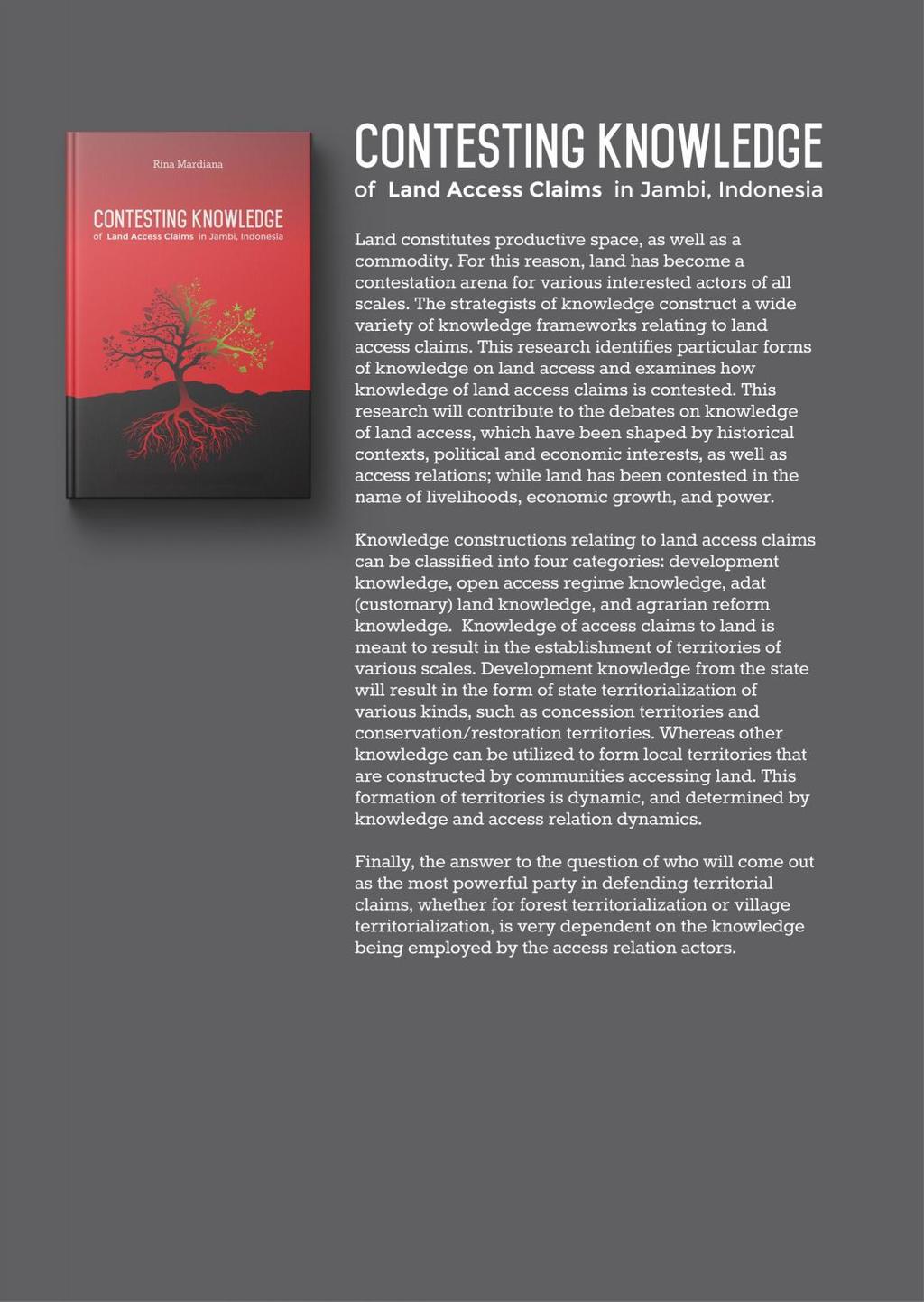
265 S
Master of Arts in Social Science (International Program) Faculty of Social Sciences, Chiang Mai University. Course Descriptions
 Faculty of Social Sciences, Chiang Mai University. Course Descriptions") Master of Arts in Social Science (International Program) Faculty of Social Sciences, Chiang Mai University Course Descriptions Core Courses SS 169701 Social Sciences Theories This course studies how various
Master of Arts in Social Science (International Program) Faculty of Social Sciences, Chiang Mai University Course Descriptions Core Courses SS 169701 Social Sciences Theories This course studies how various
Chapter Ten Concluding Remarks on the Future of Natural Resource Management in Borneo
 Part IV. Conclusion Chapter Ten Concluding Remarks on the Future of Natural Resource Management in Borneo Cristina Eghenter The strength of this volume, as mentioned in the Introduction, is in its comprehensive
Lubuk Jering and PT. RAPP Resolve their Land Conflict
 Tour 1 Lubuk Jering Lubuk Jering and PT. RAPP Resolve their Land Conflict Lubuk Jering is community in Siak district, 125 kilometers to the north of Pekanbaru. A conflict over land developed between Lubuk
PUBLIC POLICY AND PUBLIC ADMINISTRATION (PPPA)
") PUBLIC POLICY AND PUBLIC ADMINISTRATION (PPPA) Explanation of Course Numbers Courses in the 1000s are primarily introductory undergraduate courses Those in the 2000s to 4000s are upper-division undergraduate
PUBLIC POLICY AND PUBLIC ADMINISTRATION (PPPA) Explanation of Course Numbers Courses in the 1000s are primarily introductory undergraduate courses Those in the 2000s to 4000s are upper-division undergraduate
Bottom-up Driven Community Empowerment: the case of African Communities in Australia Kiros Gebre-Yohannes Hiruy DHMP, DipPM, BSc, MEnvMgt
 Bottom-up Driven Community Empowerment: the case of African Communities in Australia Kiros Gebre-Yohannes Hiruy DHMP, DipPM, BSc, MEnvMgt Submitted in fulfilment of the requirements for the Degree of Doctor
The dynamics of financial reporting practice in an Indonesian insurance company: a reflection of Javanese views of an ethical social relationship
 University of Wollongong Research Online University of Wollongong Thesis Collection 1954-2016 University of Wollongong Thesis Collections 2006 The dynamics of financial reporting practice in an Indonesian
Marcelo Lopes de Souza, Richard J. White and Simon Springer (eds)
") Marcelo Lopes de Souza, Richard J. White and Simon Springer (eds), Theories of Resistance: Anarchism, Geography, and the Spirit of Revolt, London: Rowman & Littlefield, 2016. ISBN: 9781783486663 (cloth);
Marcelo Lopes de Souza, Richard J. White and Simon Springer (eds), Theories of Resistance: Anarchism, Geography, and the Spirit of Revolt, London: Rowman & Littlefield, 2016. ISBN: 9781783486663 (cloth);
Social Studies Standard Articulated by Grade Level
 Scope and Sequence of the "Big Ideas" of the History Strands Kindergarten History Strands introduce the concept of exploration as a means of discovery and a way of exchanging ideas, goods, and culture.
Civil society responses to large-scale land acquisitions in Tanzania and Indonesia. E. Mwangi, H. Komarudin, E. Luoga, M. Toxede
 Civil society responses to large-scale land acquisitions in Tanzania and Indonesia E. Mwangi, H. Komarudin, E. Luoga, M. Toxede Partners Research Sokoine University of Ag Sciences, Faculty of Forestry
Dublin City Schools Social Studies Graded Course of Study Modern World History
 K-12 Social Studies Vision Dublin City Schools Social Studies Graded Course of Study The Dublin City Schools K-12 Social Studies Education will provide many learning opportunities that will help students
Changing Role of Civil Society
 30 Asian Review of Public ASIAN Administration, REVIEW OF Vol. PUBLIC XI, No. 1 ADMINISTRATION (January-June 1999) Changing Role of Civil Society HORACIO R. MORALES, JR., Department of Agrarian Reform
Symbolism, rationality and myth in organizational control systems: an ethnographic case study of PBS Jakarta Indonesia
 University of Wollongong Research Online University of Wollongong Thesis Collection 1954-2016 University of Wollongong Thesis Collections 2004 Symbolism, rationality and myth in organizational control
GLOBAL GRASSROOTS STRATEGIES FOR WOMEN S COMMUNITY LEADERSHIP
 Volume 1 Issue 1 May 2005 1 BUILDING GENDER EQUALITY IN URBAN LIFE GLOBAL GRASSROOTS STRATEGIES FOR WOMEN S COMMUNITY LEADERSHIP Monika Jaeckel Background The Grassroots Women s International Academies
A 3D Approach to Security and Development
 A 3D Approach to Security and Development Robbert Gabriëlse Introduction There is an emerging consensus among policy makers and scholars on the need for a more integrated approach to security and development
REPORT ON MONITORING OFAPP S FPIC IMPLEMENTATION IN PT. OKI MILL PULP AND PAPER, SOUTH SUMATRA - INDONESIA
 REPORT ON MONITORING OFAPP S FPIC IMPLEMENTATION IN PT. OKI MILL PULP AND PAPER, SOUTH SUMATRA - INDONESIA Wahana Bumi Hijau (WBH) JPIK South Sumatra Serikat Hijau Indonesia Yayasan Bakau Background December
Thailand s National Health Assembly a means to Health in All Policies
 Health in All Policies Thailand s National Health Assembly a means to Health in All Policies Authors Nanoot Mathurapote A, Tipicha Posayanonda A, Somkiat Pitakkamonporn A, Wanvisa Saengtim A, Khanitta
Making the Bali Declaration Binding
 Making the Bali Declaration Binding Review on Status and Update on Indonesia By Norman Jiwan, TuK INDONESIA Gardenia Resort & Spa Pontianak, 11-12 October 2017 Outline Introduction Status and Update on
Fishing in the Margins. North Sri Lankan Fishers Struggle for Access in Transboundary Waters J. Scholtens
 Fishing in the Margins. North Sri Lankan Fishers Struggle for Access in Transboundary Waters J. Scholtens English summary Introduction Why are transboundary fisheries, and the conflicts that affect them,
An Analysis of the Justice Values to Legal Protection for Traditional People from Coastal Reclamation Threat in Coastal Areas
 An Analysis of the Justice Values to Legal Protection for Traditional People from Coastal Reclamation Threat in Coastal Areas Rina Yulianti 1*, Safi 1, and Murni 1 1 Faculty of Law, University of Trunojoyo
Power: Interpersonal, Organizational, and Global Dimensions Wednesday, 14 September 2005
 Power: Interpersonal, Organizational, and Global Dimensions Wednesday, 14 September 2005 TOPIC: continue elaborating definition of power as capacity to produce intended and foreseen effects on others.
Centre for United States and Asia Policy Studies
 Centre for United States and Asia Policy Studies flinders.edu.au/cusaps 2013 EDITION Contents 01 02 03 04 06 08 10 11 12 13 Introduction Welcome Co-directors message Flinders University Our research Our
Leading glocal security challenges
 Leading glocal security challenges Comparing local leaders addressing security challenges in Europe Dr. Ruth Prins Leiden University The Netherlands r.s.prins@fgga.leidenuniv.nl Contemporary security challenges
ROSE FINE-MEYER, PhD
 ROSE FINE-MEYER, PhD (rose.fine.meyer@utoronto.ca) The materials used in this presentation are for educational purposes only and not for publication. All sources have been cited; content is subject to
The Way Forward: Pathways toward Transformative Change
 CHAPTER 8 We will need to see beyond disciplinary and policy silos to achieve the integrated 2030 Agenda. The Way Forward: Pathways toward Transformative Change The research in this report points to one
unfavourable climatic conditions and the mobilization of local labour which is crucial during the farming seasons. The studies on the pre-colonial
 SUMMARY This study has focused on the historical development of local co-operative credit unions, their organizational structure and management dynamics and the ways in which they assist local development
Justice Needs in Uganda. Legal problems in daily life
 Justice Needs in Uganda 2016 Legal problems in daily life JUSTICE NEEDS IN UGANDA - 2016 3 Introduction This research was supported by the Swedish Embassy in Uganda and The Hague Institute for Global Justice.
PGA for REDD+ pilots: Overview for Indonesia. Funding allocation 2012: USD 300 K
 Indonesia Funding allocation 2012: USD 300 K Implementing partner: UNDP Indonesia (upon request by Head of Presidential REDD+ Task Force/ Head of UKP4) Objectives for 2012: 1. baseline information about
Part 1. Understanding Human Rights
 Part 1 Understanding Human Rights 2 Researching and studying human rights: interdisciplinary insight Damien Short Since 1948, the study of human rights has been dominated by legal scholarship that has
Viktória Babicová 1. mail:
 Sethi, Harsh (ed.): State of Democracy in South Asia. A Report by the CDSA Team. New Delhi: Oxford University Press, 2008, 302 pages, ISBN: 0195689372. Viktória Babicová 1 Presented book has the format
Indonesia: Middle Income Country in Transition
 Indonesia: Middle Income Country in Transition A Special Open Forum and Lunch with Sri Mulyani Indrawati Managing Director, World Bank Former Minister of Finance, Republic of Indonesia February 29, 2012
VERIFICATION REPORT ON GRIEVANCE THROUGH REPORT
 VERIFICATION REPORT ON GRIEVANCE THROUGH REPORT Lessons Learned from the Conflict, Negotiations and Agreement between Senyerang Village and PT Wirakarya Sakti By FPP, Scale Up & Walhi Jambi VERIFICATION
Timothy Ogden (Geneva Global Inc.)
") Ecuador: U.S. Agency for International Development (USAID)/Geneva Global Initiative: The Time is Now, Strategically Mobilizing Anti- Trafficking Organizations in Ecuador Timothy Ogden (Geneva Global Inc.)
Ecuador: U.S. Agency for International Development (USAID)/Geneva Global Initiative: The Time is Now, Strategically Mobilizing Anti- Trafficking Organizations in Ecuador Timothy Ogden (Geneva Global Inc.)
Diversity and Democratization in Bolivia:
 : SOURCES OF INCLUSION IN AN INDIGENOUS MAJORITY SOCIETY May 2017 As in many other Latin American countries, the process of democratization in Bolivia has been accompanied by constitutional reforms that
Human Rights-based Approach & Rural Advisory Services
 Human Rights-based Approach & Rural Advisory Services Rahel Hürzeler, Conflict Transformation & Gender Advisor Marc Zoss, Rural Development Advisor & Desk Officer Philippines Martin Schmid, Head of Thematic
Forum Report. #AfricaEvidence. Written by Kamau Nyokabi. 1
 Forum Report Written by Kamau Nyokabi. 1 #AfricaEvidence 1 Kamau Nyokabi is a research associate at the African Leadership Centre. The preparation of this report would not have been possible without the
PROCEEDINGS - AAG MIDDLE STATES DIVISION - VOL. 21, 1988
 PROCEEDINGS - AAG MIDDLE STATES DIVISION - VOL. 21, 1988 COMPETING CONCEPTIONS OF DEVELOPMENT IN SRI lanka Nalani M. Hennayake Social Science Program Maxwell School Syracuse University Syracuse, NY 13244
USJI Seminar Washington, DC (19 February 2013) Toward a New Paradigm for Resettlement Policy. Mikiyasu Nakayama
 Toward a New Paradigm for Resettlement Policy. Mikiyasu Nakayama") USJI Seminar Washington, DC (19 February 2013) Beyond dland-for-land: L d Toward a New Paradigm for Resettlement Policy Mikiyasu Nakayama International Research Project Implications of resettlement associated
USJI Seminar Washington, DC (19 February 2013) Beyond dland-for-land: L d Toward a New Paradigm for Resettlement Policy Mikiyasu Nakayama International Research Project Implications of resettlement associated
AGRICULTURAL EXTENSION POLICY PROCESS IN UGANDA: IMPLICATIONS ON THE DELIVERY OF AGRICULTURAL EXTENSION SERVICES. By:
 AGRICULTURAL EXTENSION POLICY PROCESS IN UGANDA: IMPLICATIONS ON THE DELIVERY OF AGRICULTURAL EXTENSION SERVICES A Presentation to the IFPRI Organized Workshop on Making Rural Institutions work for the
Synthesis of the Regional Review of Youth Policies in 5 Arab countries
 Synthesis of the Regional Review of Youth Policies in 5 Arab countries 1 The Regional review of youth policies and strategies in the Arab region offers an interesting radioscopy of national policies on
 Workshop 3 synthesis: http://jaga.afrique-gouvernance.net Rebuilding postcolonial State through decentralization and regional integration Context and problem Viewed from its geographical location (in the
Faculty of Political Science Thammasat University
 Faculty of Political Science Thammasat University Combined Bachelor and Master of Political Science Program in Politics and International Relations (English Program) www.polsci.tu.ac.th/bmir E-mail: exchange.bmir@gmail.com,
2018/ /21 SERVICE PLAN
 Ministry of Indigenous Relations and Reconciliation 2018/19 2020/21 SERVICE PLAN February 2018 For more information on the British Columbia Ministry of Indigenous Relations and Reconciliation contact:
Getting strategic: vertically integrated approaches
 JUNE 2016 MANILA LEARNING EVENT BACKGROUND NOTES 1 Getting strategic: vertically integrated approaches JOY ACERON AND FRANCIS ISAAC Authors Joy Aceron is Senior Knowledge Leader at the Ateneo School of
Civil Society Partnership
 CARE Civil Partnership CIVIL ACTION FOR SOCIO-ECONOMIC INCLUSION (CASI) Civil Society Partnership Civil Action for Socio-economic Inclusion(CASI) GOAL: Sustainable improvements in livelihood security for
LONDON, UK APRIL 2018
 INCLUSIVE GOVERNANCE: THE CHALLENGE FOR A CONTEMPORARY COMMONWEALTH Monday 16 April 2018 Day One: Leave No one Behind : Exploring Exclusion in the Commonwealth 0800 1000 1045 1130 1300 Registration Official
FOREWORD LEGAL TRADITIONS. A CRITICAL APPRAISAL
 FOREWORD LEGAL TRADITIONS. A CRITICAL APPRAISAL GIOVANNI MARINI 1 Our goal was to bring together scholars from a number of different legal fields who are working with a methodology which might be defined
The above definition may be amplified at national and/or regional levels.
 International definition of the social work profession The social work profession facilitates social change and development, social cohesion, and the empowerment and liberation of people. Principles of
Revisiting Socio-economic policies to address poverty in all its dimensions in Middle Income Countries
 Revisiting Socio-economic policies to address poverty in all its dimensions in Middle Income Countries 8 10 May 2018, Beirut, Lebanon Concept Note for the capacity building workshop DESA, ESCWA and ECLAC
The United States & Latin America: After The Washington Consensus Dan Restrepo, Director, The Americas Program, Center for American Progress
 The United States & Latin America: After The Washington Consensus Dan Restrepo, Director, The Americas Program, Center for American Progress Presentation at the Annual Progressive Forum, 2007 Meeting,
WOMEN RECLAIM LAND AND PROPERTY RIGHTS: A HOUSING INITIATIVE IN HARARE BY THE ZIMBABWE PARENTS OF HANDICAPPED CHILDREN ASSOCIATION (ZPHCA)
") WOMEN RECLAIM LAND AND PROPERTY RIGHTS: A HOUSING INITIATIVE IN HARARE BY THE ZIMBABWE PARENTS OF HANDICAPPED CHILDREN ASSOCIATION (ZPHCA) Theresa Makwara * Introduction Realizing land and property rights
WOMEN RECLAIM LAND AND PROPERTY RIGHTS: A HOUSING INITIATIVE IN HARARE BY THE ZIMBABWE PARENTS OF HANDICAPPED CHILDREN ASSOCIATION (ZPHCA) Theresa Makwara * Introduction Realizing land and property rights
I n t e r v i e w w i t h A p s a r a C h a p a g a i n C h a i r p e r s o n, F E C O F U N
 I n t e r v i e w w i t h A p s a r a C h a p a g a i n C h a i r p e r s o n, F E C O F U N July 2012 Background The Federation of Community Forestry Users, Nepal (FECOFUN) is a formal network of Community
The Influence of Conflict Research on the Design of the Piloting Community Approaches in Conflict Situation Project
 KM Note 1 The Influence of Conflict Research on the Design of the Piloting Community Approaches in Conflict Situation Project Introduction Secessionist movements in Thailand s southernmost provinces date
Wadi Al-Karak Environmental Advocacy Campaign: Enforcing National Laws Related to Dealing with Wastewater Treatment in Wadi Al-Karak
 Wadi Al-Karak Environmental Advocacy Campaign: Enforcing National Laws Related to Dealing with Wastewater Treatment in Wadi Al-Karak Princess Basma Development Center- Al-Karak Jordanian Hashemite Fund
Navigating through Complex Legal Landscapes
 Navigating through Complex Legal Landscapes A Legal Compass for VPAs Executive Summary Feja Lesniewska and Janet Meissner Pritchard with input from Lynette Omollo and Simon Mutagha Acha ClientEarth is
Peace Palace, the Hague 15 March 2007 Dewan Adat Papua
 Peace and sustainability Sessions: Forces for Sustainability Mining the forests, the Military and the Communities: From Plunder to Protection in Papua Peace Palace, the Hague 15 March 2007 Dewan Adat Papua
Dinda Nuur Annisaa Yura Solidaritas Perempuan, Indonesia
 Conflict of Interest in UNFCCC: Pull Out Polluters from Negotiation Dinda Nuur Annisaa Yura Solidaritas Perempuan, Indonesia Climate negotiations have been happening since 1991, while UN Framework Convention
Available through a partnership with
 The African e-journals Project has digitized full text of articles of eleven social science and humanities journals. This item is from the digital archive maintained by Michigan State University Library.
Department for Economic and Social Affairs (UNDESA) Division for Social Policy and Development
 Division for Social Policy and Development") Department for Economic and Social Affairs (UNDESA) Division for Social Policy and Development Report of the Expert Group Meeting on Promoting People s Empowerment in Achieving Poverty Eradication, Social
Department for Economic and Social Affairs (UNDESA) Division for Social Policy and Development Report of the Expert Group Meeting on Promoting People s Empowerment in Achieving Poverty Eradication, Social
On the New Characteristics and New Trend of Political Education Development in the New Period Chengcheng Ma 1
 2017 2nd International Conference on Education, E-learning and Management Technology (EEMT 2017) ISBN: 978-1-60595-473-8 On the New Characteristics and New Trend of Political Education Development in the
IS - International Studies
 IS - International Studies INTERNATIONAL STUDIES Courses IS 600. Research Methods in International Studies. Lecture 3 hours; 3 credits. Interdisciplinary quantitative techniques applicable to the study
ILO/Japan Managing Cross-Border Movement of Labour in Southeast Asia
 ILO/Japan Managing Cross-Border Movement of Labour in Southeast Asia Quick Facts Countries: Cambodia, Indonesia, Lao PDR, Thailand Final Evaluation: November 2010 Mode of Evaluation: independent Technical
Citizenship Education and Inclusion: A Multidimensional Approach
 Citizenship Education and Inclusion: A Multidimensional Approach David Grossman School of Foundations in Education The Hong Kong Institute of Education My task in this paper is to link my own field of
Marxism and the State
 Marxism and the State Also by Paul Wetherly Marx s Theory of History: The Contemporary Debate (editor, 1992) Marxism and the State An Analytical Approach Paul Wetherly Principal Lecturer in Politics Leeds
UNDERSTANDING AND WORKING WITH POWER. Effective Advising in Statebuilding and Peacebuilding Contexts How 2015, Geneva- Interpeace
 UNDERSTANDING AND WORKING WITH POWER. Effective Advising in Statebuilding and Peacebuilding Contexts How 2015, Geneva- Interpeace 1. WHY IS IT IMPORTANT TO ANALYSE AND UNDERSTAND POWER? Anyone interested
Pluralism and Peace Processes in a Fragmenting World
 Pluralism and Peace Processes in a Fragmenting World SUMMARY ROUNDTABLE REPORT AND RECOMMENDATIONS FOR CANADIAN POLICYMAKERS This report provides an overview of key ideas and recommendations that emerged
UNESCO S CONTRIBUTION TO THE WORK OF THE UNITED NATIONS ON INTERNATIONAL MIGRATION
 UN/POP/MIG-5CM/2006/03 9 November 2006 FIFTH COORDINATION MEETING ON INTERNATIONAL MIGRATION Population Division Department of Economic and Social Affairs United Nations Secretariat New York, 20-21 November
POST-2015: BUSINESS AS USUAL IS NOT AN OPTION Peacebuilding, statebuilding and sustainable development
 POST-2015: BUSINESS AS USUAL IS NOT AN OPTION Peacebuilding, statebuilding and sustainable development Chris Underwood KEY MESSAGES 1. Evidence and experience illustrates that to achieve human progress
CONTENTS 20 YEARS OF ILC 4 OUR MANIFESTO 8 OUR GOAL 16 OUR THEORY OF CHANGE 22 STRATEGIC OBJECTIVE 1: CONNECT 28 STRATEGIC OBJECTIVE 2: MOBILISE 32
 EN 2016 2021 2016 2021 CONTENTS 20 YEARS OF ILC 4 OUR MANIFESTO 8 Our core values 12 Our mission 14 Our vision 15 OUR GOAL 16 The contents of this work may be freely reproduced, translated, and distributed
MA International Relations Module Catalogue (September 2017)
") MA International Relations Module Catalogue (September 2017) This document is meant to give students and potential applicants a better insight into the curriculum of the program. Note that where information
MA International Relations Module Catalogue (September 2017) This document is meant to give students and potential applicants a better insight into the curriculum of the program. Note that where information
Note on measuring the social dimension of sustainable tourism
 Note on measuring the social dimension of sustainable tourism Emanuela Recchini Contribution for the purposes of the 2 nd meeting of the WGE-MST (Madrid, 24-25 October 2018) I would like to make a preliminary
Committee on the Implementation of the Rights of Indigenous Peoples of the International Law Association
 Working plan, November 2014 Committee on the Implementation of the Rights of Indigenous Peoples of the International Law Association The first part (para s 1 to 4) consists of the text approved of by the
THE GIFT ECONOMY AND INDIGENOUS-MATRIARCHAL LEGACY: AN ALTERNATIVE FEMINIST PARADIGM FOR RESOLVING THE PALESTINIAN-ISRAELI CONFLICT
 THE GIFT ECONOMY AND INDIGENOUS-MATRIARCHAL LEGACY: AN ALTERNATIVE FEMINIST PARADIGM FOR RESOLVING THE PALESTINIAN-ISRAELI CONFLICT Erella Shadmi Abstract: All proposals for resolving the Israeli-Palestinian
Globalization and Inequality: A Structuralist Approach
 1 Allison Howells Kim POLS 164 29 April 2016 Globalization and Inequality: A Structuralist Approach Exploitation, Dependency, and Neo-Imperialism in the Global Capitalist System Abstract: Structuralism
Studien zur Neuen Politischen Ökonomie. Herausgegeben von T. Bräuninger, Mannheim, Deutschland G. Schneider, Konstanz, Deutschland
 Studien zur Neuen Politischen Ökonomie Herausgegeben von T. Bräuninger, Mannheim, Deutschland G. Schneider, Konstanz, Deutschland Eva Bernauer Identities in Civil Conflict How Ethnicity, Religion and Ideology
Introduction. - RSPO Standards and FPIC - Cross reference of other criteria - P&C review and FPIC implementation 5/11/2012
 Institutionalisation of Respect for Free, Prior and Informed Consent (Towards RSPO implementation and verification working for forest, lands and livelihoods of indigenous peoples and local communities)
GCPH Seminar Series 12 Seminar Summary Paper
 Geoffrey Pleyers FNRS Researcher & Associate Professor of Sociology, Université de Louvain, Belgium and President of the Research Committee 47 Social Classes & Social Movements of the International Sociological
United Nations Educational, Scientific and Cultural Organization Executive Board
 ex United Nations Educational, Scientific and Cultural Organization Executive Board Item 3.6.6 of the provisional agenda Hundred and sixty-first Session 161 EX/21 PARIS, 10 May 2001 Original: English and
Personal copy of () The Human Right to Equal Access to Health Care
 The Human Right to Equal Access to Health Care") The Human Right to Equal Access to Health Care SCHOOL OF HUMAN RIGHTS SERIES, VOLUME 53 The titles published in this series are listed at the end of this volume. The Human Right to Equal Access to Health
The Human Right to Equal Access to Health Care SCHOOL OF HUMAN RIGHTS SERIES, VOLUME 53 The titles published in this series are listed at the end of this volume. The Human Right to Equal Access to Health
POLI 111: INTRODUCTION TO THE STUDY OF POLITICAL SCIENCE
 POLI 111: INTRODUCTION TO THE STUDY OF POLITICAL SCIENCE SESSION 4 NATURE AND SCOPE OF POLITICAL SCIENCE Lecturer: Dr. Evans Aggrey-Darkoh, Department of Political Science Contact Information: aggreydarkoh@ug.edu.gh
South East European University Tetovo, Republic of Macedonia 2 ND CYCLE PROGRAM IN PUBLIC ADMINISTRATION. Master studies - Academic Diplomacy
 South East European University Tetovo, Republic of Macedonia 2 ND CYCLE PROGRAM IN PUBLIC ADMINISTRATION Master studies - Academic Diplomacy Program of Master studies Academic Diplomacy I. GENERAL DESCRIPTION
Unwinding Colonialism, Lessons from the Front Line
 Unwinding Colonialism, Lessons from the Front Line Guujaaw President of the Haida Nation, 2000-2012 Presented as part of Islands Spirit Rising Reclaiming the Forests of Haida Gwaii Book Launch and Panel
Mehrdad Payandeh, Internationales Gemeinschaftsrecht Summary
 The age of globalization has brought about significant changes in the substance as well as in the structure of public international law changes that cannot adequately be explained by means of traditional
International Research Workshop on Gender and Collective Action, October 2005, Chiang Mai, Thailand
 International Research Workshop on Gender and Collective Action, 17-21 October 2005, Chiang Mai, Thailand Strengthening Women s Participation through Collective Action for Inclusive Decision making Processes:
Constitution and Human Rights Provisions in Indonesia: an Unfinished Task in the Transitional Process
 Constitution and Human Rights Provisions in Indonesia: an Unfinished Task in the Transitional Process Bivitri Susanti Introduction Indonesia is now facing the important moment of constructing a new foundation
Three year plan for the Center on Child Protection
 Three year plan for the Center on Child Protection Introduction The University of Indonesia, supported by Indonesian Ministry of Planning (BAPPENAS) and Columbia University established the Center on Child
Gender Thematic Group (GTG) Meeting
 Meeting") Gender Thematic Group (GTG) Meeting 26-27 May 2014 Tsakhkadzor, Russia Hotel Summary of Discussion Outcomes A. GTG priority context: New Issues, Challenges and Key Players in the Area of Gender Equality
Gender Thematic Group (GTG) Meeting 26-27 May 2014 Tsakhkadzor, Russia Hotel Summary of Discussion Outcomes A. GTG priority context: New Issues, Challenges and Key Players in the Area of Gender Equality
Primary Animal Health Care in the 21 st Century: Advocating For The Missing Link In Our Change Strategy
 Primary Animal Health Care in the 21 st Century: Advocating For The Missing Link In Our Change Strategy Lindiwe Majele Sibanda Regional Programme Manager Centre for Applied Social Sciences, Public Policy
Rethinking Rodriguez: Education as a Fundamental Right
 Rethinking Rodriguez: Education as a Fundamental Right A Call for Paper Proposals Sponsored by The Chief Justice Earl Warren Institute on Race, Ethnicity and Diversity University of California, Berkeley
LOCAL VERSUS EXTERNAL INTERVENTIONS IN RURAL TOURISM DEVELOPMENT. Alenka Verbole Ljubljana, Slovenia
 LOCAL VERSUS EXTERNAL INTERVENTIONS IN RURAL TOURISM DEVELOPMENT Alenka Verbole Ljubljana, Slovenia Abstract. This paper is an attempt to understand the socio-political dynamics taking place within the
Comparative Economics (Sistemi Economici Comparati)
") Prof. Dipak R. Pant (drpant@liuc.it) Università Carlo Cattaneo (LIUC) ITALY Comparative Economics (Sistemi Economici Comparati) Academic Year 2010-2011 (September-December 2010) Objectives 1. To introduce
Prof. Dipak R. Pant (drpant@liuc.it) Università Carlo Cattaneo (LIUC) ITALY Comparative Economics (Sistemi Economici Comparati) Academic Year 2010-2011 (September-December 2010) Objectives 1. To introduce
Cry out as if you have a million voices, for it is silence which kills the world. Catherine of Siena. The Journey to Rio+20
 Dominican Leadership Conference Spring 2012 Dominicans at the UN Cry out as if you have a million voices, for it is silence which kills the world. Catherine of Siena The Journey to Rio+20 What is Rio+20
The status quo of money transfers across ASEAN
 The status quo of money transfers across ASEAN This piece has been written together by TransferTo and The Singapore Fintech Association A region with huge remittance receipts Sending money and making payments
FLOWERS IN THE WALL Truth and Reconciliation in Timor-Leste, Indonesia, and Melanesia by David Webster
 FLOWERS IN THE WALL Truth and Reconciliation in Timor-Leste, Indonesia, and Melanesia by David Webster ISBN 978-1-55238-955-3 THIS BOOK IS AN OPEN ACCESS E-BOOK. It is an electronic version of a book that
Response Statement to the Status Report by Rainforest Action Network ( RAN ) titled Conflict Palm Oil in Practice
 titled Conflict Palm Oil in Practice") 13 January 2016 Statement to the Status Report by Rainforest Action Network ( RAN ) titled Conflict Palm Oil in Practice Kuala Lumpur Kepong Berhad ( KLK ) is responding to RAN s status report with regards
13 January 2016 Statement to the Status Report by Rainforest Action Network ( RAN ) titled Conflict Palm Oil in Practice Kuala Lumpur Kepong Berhad ( KLK ) is responding to RAN s status report with regards
ASSESSING COMMUNITY DEVELOPMENT AGENCY OF VILLAGE FOR PRE- PROSPEROUS COMMUNITY WELFARE IMPROVEMENT
 ASSESSING COMMUNITY DEVELOPMENT AGENCY OF VILLAGE FOR PRE- PROSPEROUS COMMUNITY WELFARE IMPROVEMENT Hadi Karyono,SH., M.Hum Evert Max Tentua,SH., M.Hum ABSTRACT To achieve the state purpose to be prosperous
ENTRENCHMENT. Wealth, Power, and the Constitution of Democratic Societies PAUL STARR. New Haven and London
 ENTRENCHMENT Wealth, Power, and the Constitution of Democratic Societies PAUL STARR New Haven and London Starr.indd iii 17/12/18 12:09 PM Contents Preface and Acknowledgments Introduction: The Stakes of
POLITICAL SCIENCE (POLS)
") Political Science (POLS) 1 POLITICAL SCIENCE (POLS) POLS 102 Introduction to Politics (3 crs) A general introduction to basic concepts and approaches to the study of politics and contemporary political
Political Science (POLS) 1 POLITICAL SCIENCE (POLS) POLS 102 Introduction to Politics (3 crs) A general introduction to basic concepts and approaches to the study of politics and contemporary political
Mass mobilisation in Indonesian politics, : towards a class analysis
 University of Wollongong Research Online University of Wollongong Thesis Collection 1954-2016 University of Wollongong Thesis Collections 2009 Mass mobilisation in Indonesian politics, 1960-2001: towards
The Governance of Large-Scale Farmland Investments in Sub-Saharan Africa:
 The Governance of Large-Scale Farmland Investments in Sub-Saharan Africa: A Comparative Analysis of the Challenges for Sustainability George C. Schoneveld, Ph.D. - Stellenbosch, March 6, 2014 Premise Most
DEMOCRACY, FREE MARKETS AND ETHNIC CONFLICT IN EAST ASIA. Mohamed Jawhar Hassan
 Draft Introduction DEMOCRACY, FREE MARKETS AND ETHNIC CONFLICT IN EAST ASIA Mohamed Jawhar Hassan The nexus between democracy, free markets and ethnic or sectarian conflict has always been a source of